The Trails
Guide
Maps
Miles/Ele
Permits
Resupply
Forum
Current Weather Conditions
Weather Notes
Northern High Sierras
Central High Sierras
Southern High Sierras
Gear
Gear List
Gettin Started
Layering
Discussion
Testing yourself and your gear
Gear Reviews
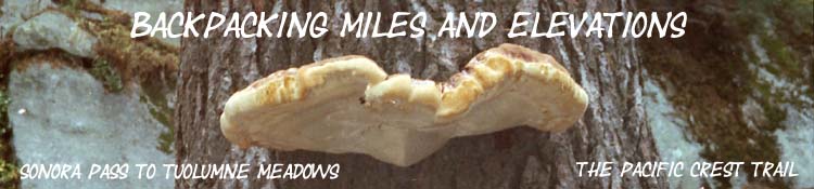
Sonora Pass to Tuolumne Meadows
Miles and Elevations
Backpacking
Emigrant Wilderness
and the
North Yosemite Backcountry
Backpacking
Miles and Elevations
on the
Pacific Crest Trail
through the
High Sierra Nevada Mountains
Languages
Translate
Trail Arts
The art of walking
Physical Preperation
Trail Skills
The trail
Off the trail
Scrambling
Maps
Navigation
Camp skills
Food
Resupply
Food
Other
Photo Catagories
Trail Stories
Trail Culture
News and Science
Links
Groups
Books
MILES PCT |
MILES JMT-PCT |
MILES TYT-PCT |
REGIONAL PCT |
TRAIL TYT-PCT |
TRAIL TYT-PCT |
MAPS PCT |
ALL |
TRAIL |
This website is under construction...
Hard Miles
Sonora Pass
|
||||||||||||||||||||||||||||||||||||||||||||||||||||||||||||||||||||||||||||||||||||||||||||||||||||||||||||||||||||||||||||||||||||||||||||||||||||||||||||||||||||||||||||||||||||||||||||||||||||||||||||||||||||||||||||||||||||||||||||||||||||||||||||||||||||||||||||||||||||||||||||||||||||||||||||||||||||||||||||||||||||||||||||||||||||||||||||||||||||||||||||||||||||||||||||||||||||||||||||||||||||||||||||||||||||||||||||||||||||||||||||||||||||||||||||||||||||||||||||||||||||||||||||||||||||||||||||||||||||||||||||||||||||||||||||||||||||||||||||||||||||||||||||||||||||||||||||||||||||||||||||||||||||||||||||||||||||||||||||||||||||||||||||||||||||||||||||||||||||||||||||||||||||||||||||||||||||||||||||||||||||||||||||||||||||||||||||||||||||||||||||||||||||||||||||||||||||||||||||||||||||||||||||||||||
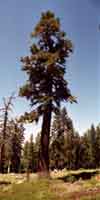
High Sierra Along Southbound Traveler Descending the South flank of Leavitt Peak our Pacific Crest Trail route turns East into Kennedy Canyon and solidly into the Toiyabe National Forest for the remainder of the hike into Yosemite National Park via Dorothy Lake Pass, by detouring around the Sierra Crest. Note that we also have a Southbound Route Option at the Kennedy Canyon trail junction South of Leavitt Peak bringing us over Big Sam and across the High Emigrant Basin into Yosemite via Bond Pass. That route follows the Sierra Crestline. Connecting PCT & TYT over Big Sam Enter the Five Canyons More
Sonora Pass Backpacking Information Northbound PCT
Sonora Pass All distances measured are South from Sonora Pass
Shortcut Route up Leavitt Peak
JULY 2016 SOUTHBOUND PCT ROUTE UPDATE
Shortcut Route Depicted and Marked
SHORTCUT ROUTE DISTANCE xxxxxxxxxxxxxxxxxxxxxxxxxxxxxxxxxxxxxxxxx
If we take the shortcut route, we must subtract 1 mile from all the subsequent mileages listed below for the PCT route South to Tuolumne Meadows. xxxxxxxxxxxxxxxxxxxxxxxxxxxxxxxxxxxxxxxxx The PCT Route up Leavitt Rather than heading straight up the Northwestern ridge arm of the Leavitt massif, as the shortcut route above does, the Pacific Crest Trail takes a more circuitous route up the Leavitt Massif. The PCT turns Southeast from Sonora Pass to cross a relatively flat zone across the base of the North flank of the Leavitt Massif, to where the trail climbs a low ridge arm to gain access to the trail's long East-West traverse of the North flank of the Leavitt Massif. This traverse is along a long well-graded, well-maintained trail between the mountain's Northeastern and Northwestern shoulders. Southbound hikers will climb this traverse from East to West. Check out the Trail Guide for a close look at our hiking options on the North side of Leavitt Peak. At the far Western end of the PCT's traverse up the North flank, the PCT and shortcut trail link up, and the PCT turns directly South to work its way up to and around the Western flank of Peak 10,480, which sits atop the North Flank of the Leavitt Massif. Once we get up there Leavitt Peak itself will finally come into view.
STANDARD ROUTE DISTANCE Distances are measured from Sonora Pass
As we can see, the shortcut South up from Sonora Pass saves us one mile. But we will have to do a small bit of climbing with our packs on. I have taken this shortcut during all four seasons. Crampons and Ice axe are required during Winter, and expert skills are necessary in Summer if you are carrying a very heavy pack.
Below: 2.38 miles South of Sonora Pass we climb towards a gap along a spur of Leavitt's crest-line running East and West. Great views to the North-Northeast and South-Southeast open up from this gap. At our feet to the South we see Latopie Lake nestled in a few hundred yards below the line of the trail. The mileage and elevations below reflect the route down from the unmarked Latopie Lake Junction to Latopie Lake, and then back to the PCT via a cross-country hike South of Latopie Lake. This is marked as the "Latopie Loop" on the 30 minute backpacking map. In the past I preferred the Latopie Loop to the Pacific Crest Trail through here due to the poor trail quality of the PCT as it crossed a massive ridge of very sharp unstable talus above Latopie Lake. And, I've spent many first nights of trips at Latopie Lake. In recent years the Stanislaus National Forest has broken up this old nasty scree-trail section of the Pacific Crest Trail that loops around and above Latopie Lake into a very nicely bedded trail. That's a lot of hard work with sledgehammers, and my thanks go out to the trail crews who did the hard work to break up all of this high altitude skree into a well-packed gravel walkway easing our way through this beautiful, but difficult, landscape. In any case, if we decide to have lunch or camp at Latopie Lake we don't have to backtrack back up to the PCT the same way we came down to it. Continuing a bit down and a bit South a short distance past Latopie Lake brings us to a hanging valley that we can work our way Southwest into for a short cross country route back up to the Pacific Crest Trail. We rejoin the PCT at the top of this hanging valley where the PCT passes onto the South Flank of Leavitt Peak through the gap dividing the Leavitt Lake basin from the Kennedy Lake valley. See the map for specifics on the Latopie Lake Loop. It's a nice little walk. xxxxxxxxxxxxxxxxxxxxxxxxxxxxxxxxxx
Latopie Lake Loop (1.64 miles total from leaving to rejoining the Pacific Crest Trail) Distances are measured from Sonora Pass
xxxxxxxxxxxxxxxxxxxxxxxxxxxxxxxxxx Standard Distance
RECAP We have two trail options for "shortcuts" heading South between Sonora Pass to the Gap overlooking Leavitt Lake's basin to our Northeast, and down at the valley to our Southwest cradling Kennedy Lake. The first shortcut is the "locals" shortcut from Sonora Pass straight up the Mountain's Northwestern ridge-arm reaching down to Sonora Pass. This route shortcuts the Pacific Crest Trail route by 1.01 miles. The second is the Latopie Lake Loop. Comparing the Latopie Lake Loop with the Pacific Crest Trail's track around Latopie Lake indicates that taking the the Latopie Lake loop is shorter than following Pacific Crest Trail route by nearly 1.2 miles. Though shorter than the PCT route, the advantage of the Latopie Loop is that it brings us first to the beauty of Latopie Lake, then through very desolate terrain to reconnect with the PCT. The distance from Sonora Pass to the Gap on the Pacific Crest Trail above Kennedy Lake, with no shortcut or Latopie Lake Loop is 4.49 miles. The distance from Sonora Pass to that same Gap on the Pacific Crest Trail taking both the shortcut and the Latopie Lake Loop is 3.29 miles
Continuing South on the Pacific Crest Trail mileages are measured from Sonora Pass on the Pacific Crest Trail route
The Kennedy Canyon junction offers us the option of backpacking around the Emigrant Basin on the Pacific Crest Trail or cutting through the Emigrant Basin to enter Yosemite at Bond Pass. Bond Pass lays West of Dorothy Lake Pass. See the Sonora Pass to Bensen Lake 30 minute map.
The Tilden Lake Junction is the Last derivation of the Tahoe to Yosemite Trail off of the Pacific Crest Trail route South to Tuolumne Meadows. The Tilden Lake Loop measures
The Pacific Crest Trail route measures 3.55 miles between the Tilden Lake junction in Jack Main Canyon to the Tilden Lake Junction East of Wilmer Lake. Also see the Sonora Pass to Bensen Lake 30 min map for a big view of this route derivation and the
The
Tilden Lake Loop
Miles and Elevations Our Options NORTH
SOUTH
All
Stanislaus National Forest
|
||||||||||||||||||||||||||||||||||||||||||||||||||||||||||||||||||||||||||||||||||||||||||||||||||||||||||||||||||||||||||||||||||||||||||||||||||||||||||||||||||||||||||||||||||||||||||||||||||||||||||||||||||||||||||||||||||||||||||||||||||||||||||||||||||||||||||||||||||||||||||||||||||||||||||||||||||||||||||||||||||||||||||||||||||||||||||||||||||||||||||||||||||||||||||||||||||||||||||||||||||||||||||||||||||||||||||||||||||||||||||||||||||||||||||||||||||||||||||||||||||||||||||||||||||||||||||||||||||||||||||||||||||||||||||||||||||||||||||||||||||||||||||||||||||||||||||||||||||||||||||||||||||||||||||||||||||||||||||||||||||||||||||||||||||||||||||||||||||||||||||||||||||||||||||||||||||||||||||||||||||||||||||||||||||||||||||||||||||||||||||||||||||||||||||||||||||||||||||||||||||||||||||||||||||
North: Ebbetts Pass to Sonora Pass TYT Northwest: Bond Pass to Kennedy Meadows TYT-PCT-JMT South: TM to Reds Meadow
Note:
|
This trail guide, like the High Sierras, divides itself into ups and downs. Your miles are generally done either going up to the top of the mountain, or you are coming down from the mountaintop into the valley that separates you from the next mountaintop. This means that the mileages and elevations between the peaks and the valleys is going to be important in determining how many miles you can reasonably expect to cover that day. This will be instrumental in planning where you are going to camp every night, and ultimately this information will determine how many days it will take you to cover a given distance. This in turn establishes your proper food load. There are 73.8 miles between Sonora Pass and Tuolumne Meadows along the Pacific Crest Trail. The Sonora Pass is 1043 feet higher than the Tuolumne Meadows. But this gross elevation figure does not do justice to the constant ups and downs that virtually all Sierra trails present to their visitors. This segment of the trails between Lake Tahoe and Mount Whitney is certainly no exception. The terrain between Sonora Pass to Tuolumne Meadows offers a fine range classic long distance high altitude travel options. From Sonora Pass you cover the great barren mass of the Leavitt Massif. Coming off the South side of Leavitt, you can either follow the Pacific Crest Trail down East, then South through the forests leading back up to granite-bound lakes below Dorothy Lake Pass, or you can continue hiking South to climb over Big Sam into the pink hued granites of the Emigrant Basin. Humm. Options-Options. Both routes lead to the head of Jack Main Canyon in Yosemite's Northwest backcountry. Once they join again below Bond Pass in Jack Main Canyon the Pacific Crest and Tahoe to Yosemite trails will only part for one more short section before tracking together into Tuolumne Meadows. This exception is where the Tahoe to Yosemite Trail loops around Tilden Lake, while the Pacific Crest Trail traces its route around Wilmer Lake. The Trails rejoin again just Southeast above Wilmer Lake. The terrain between Jack Main Canyon to Tuolumne Meadows is lovingly described as Yosemite's Washboard. The reason for the name comes from the near proximity of high altitude ridge to the next high altitude ridge. When you descend from the top of one 9500 foot ridge you can bounce a rock off the next 9500 foot ridge that you will shortly be climbing. This section contains the closest set of mountain ridges you will be challenged by between Lake Tahoe and Mount Whitney. There is no long walk between mountain passes within this section. This section will have you climbing and descending at the highest frequency of the whole trip, until you reach Virginia Canyon. From Virginia Canyon you have one low rise before you begin the long, mostly gentle, drop down to the unique culture and stunning beauty that characterizes all of Yosemite's High Sierra Camps, and especially Glen Aulin. Remember this important rule: Every descent route holds many mini-ascents, and every ascent has many mini-descents within its route. Your mileage will very rarely just go up, or just go down. You are going endlessly up and down.
|
Backpacker Forums
|
PCT North: Ebbetts Pass to Sonora Pass TYT Northwest: Bond Pass to Kennedy Meadows TYT-PCT-JMT South: TM to Muir Ranch
Trailhead
Contact:
Alex Wierbinski