
The Trails
Guide
Maps
Miles/Ele
Permits
Resupply
Forum
Current Weather Conditions
Weather Notes
Northern High Sierras
Central High Sierras
Southern High Sierras
Gear
Gear List
Gettin Started
Layering
Discussion
Testing yourself and your gear
Gear Reviews
Carson Pass
to
Forestdale Divide
Hiking the
Pacific Crest Trail from Carson Pass to Ebbetts Pass across the Mokelumne Wilderness
Languages
Languages
Trail Arts
The art of walking
Physical Preperation
Trail Skills
The trail
Off the trail
Scrambling
Maps
Navigation
Camp skills
Food
Resupply
Food
Other
Photo Catagories
Trail Stories
Trail Culture
News and Science
Links
Groups
Books
Terms and Conditions of Use
| Trail Guide Index Carson Pass to Ebbetts Pass |
North PCT The Carson Pass |
South PCT Forestdale Divide to Blue Lakes Road |
Topo Map Carson Pass to Lost Lakes |
7.5 Map West Carson Pass Region |
30 min Map Carson Pass to Ebbetts Pass |
Carson Pass |
Map Index Carson Pass to Ebbetts Pass |
National Forests |
Tahoe to Whitney on You Tube |
||
El Dorado National Forest |
Humboldt Toiyabe NF |
||||||||||
South
from
Carson Pass
on the
PCT
End South on the TYT The page below continues our hike South on the Pacific Crest Trail across the 5.1 miles separating Carson Pass from Forestdale Divide, the first waypoint along our 27.88 miles of trail between Carson and Ebbetts Passes. Hiking South from the Carson Gap on the PCT route through Carson Pass is also part of the Tahoe to Yosemite Trail if we turn Southwest on the TYT through the Winnemucca Lake trail junction a mile South of Carson Pass. Arriving at Winnemucca Lake hiking the TYT route we see the trail coming up from Woods Lake joins us for the hike up to Round Top Lake where the Lost Cabin Mine Trail next ties in, covering all the possible routes hiking the Tahoe to Yosemite Trail route up to Round Top from the Carson Gap. This page covers the last possible bit of trail the PCT and TYT share before their routes divide across the Mokelumne, Carson Iceberg, and Emigrant Wilderness to our South. The PCT and TYT next reunify in the Northeast corner of Yosemite National Park. PCT South From the Winnemucca Lake junction we finish the last bit of the moderate climb from Carson Pass to the high point of this segment of trail hiking across the low rounded flat below the steep North face of Elephant Back. Here we enjoy expansive views of the Northeast to Southeast horizon while exiting the Carson Pass Management Area. Looking East from the high point of the trail across Elephant Back we see Forestdale Creek reaching South towards its headwaters within the valley topped by Forestdale Divide. We begin a descending traverse down the Western flank of this valley South to the ponds that spawn Forestdale Creek. These ponds lay below a set of wide switchbacks making up the end of this moderate difficulty hike from Carson Pass to Forestdale Divide. Backpacker's Index
CPMA 15 min Backpacking Map
Carson Pass to Forestdale Divide: 5.1 miles Carson Pass to Ebbetts Pass: 27.88 miles Backpacker Resources
POST UP! All backpackers can post text comments about the following section of trail through the comments links on all the trail guide pages. Registered Members can post up stand alone post about the trail with text, images, maps and videos in the Trails Forum that supplements this section of the Trail Guide. Check out the Tahoe to Whitney .org Backpacking Trails and Topics forums |
||||||||||||||||||||||||||||||
PCT Trailhead
South from Carson Pass
 |
|||
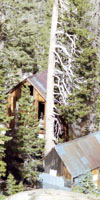
Pacific Crest Trail Trailhead information Southbound out of Carson Pass. The trailhead is located behind the Carson Pass Cabin. The permit box where pre-arranged permits are left for pickup is attached to the Southwest corner of the Carson Pass Cabin.
|
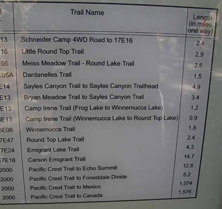 |
Local and long distance trail miles from this Carson Pass Trailhead. Schneider Camp road and the trail to Little Round Top are routes South into the Tahoe Basin located to our Northwest along the North shore of Caples Lake. This map shows the dirt road and Schneider Camp. This larger map shows where the trail from Schneider Camp over Little Round Top into the Lake Tahoe Basin joins with the combined PCT-TYT-TRT routes in the Meiss Country Roadless Area. Carson Pass to Ebbetts Pass The first six trails on this list are to our Northwest, which is funny because this trailhead is pointing us to the Southwest and these first six trails are behind us. No problem. All information is good information. |
Hiking South
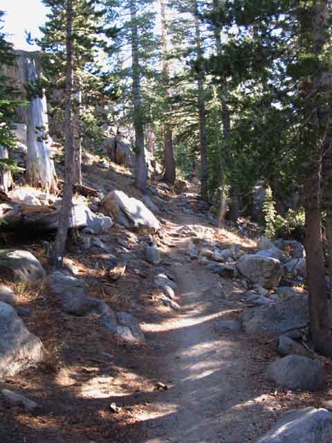
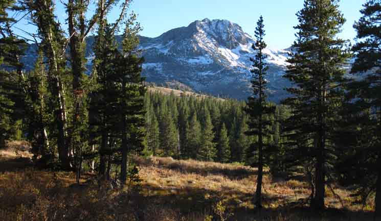
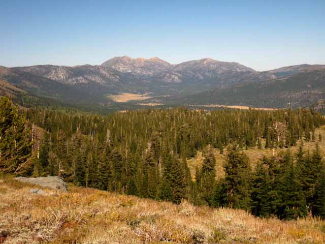
Up to Elephant Back Heading South from Carson Pass on the Pacific Crest Trail finds us making an easy 480 foot ascent over two miles of distance to reach the rounded flat under the distinctive steep Northern Flank of Elephant Back. Below us to the East-Southeast we will see Forestdale Creek in its valley.
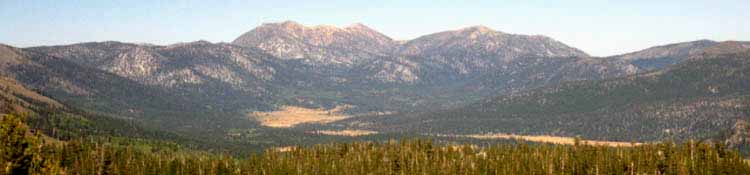
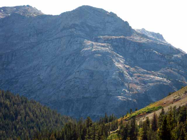
At the high point crossing Elephant Back fine views open up. Forestdale Creek sits in the valley below us. Tallac Peak and its lofty neighbors define our Eastern horizon. Jobs Sister, Jobs Peak, and Mokelumne Peak grab our attention along with Freel Peak. The wide expanse of Hope Valley is laid out in the near distance before us, verdant green for Spring, golden brown during fall, and always reassuring. The Lay of the Land The map lays it out clearly. Reaching the ponds at the head of the Forestdale Creek near the top of the valley marks the point we begin climbing sweeping switchbacks out of the of Forestdale Creek's valley to Forestdale Divide. Well, we've this nice view until we drop off the East flank of Elephant Back into the valley holding Forestdale Creek and lose it dropping below the peaks of the surrounding mountains. We've still got good views, just not as expansive as those from the high point crossing Elephant Back. Local History The earlier Western History is intertwined with that of Kit Carson and John Fremont, which are well recounted across the first dozen pages of the History of the Toiyabe National Forest. Crossing Open Terrain Break out the suntan lotion and the hat. |
South
from the
Carson Pass Trailhead
 |
Video
Approaching Forestdale Divide Southbound from Carson Pass
Duration: 2:57 A short look at the terrain approaching Forestdale Divide.
|
On the Way South from Carson Pass
Round Top and The Sisters We will see Round Top and the Sisters again when we arrive at the top of Forestdale Divide. Forestdale Divide straddles the ridgeline running Southwest from the main bulk of the Round Top-Sisters massif. As we can see the terrain down on the South flank of Round Top, so too can hikers on the TYT down there see us up here on the upcoming segment of the PCT where it crosses the exposed mountainside South of Forestdale Divide. TYT hikers can get a glimpse of a segment of the PCT by looking East out of the top of Summit City Canyon as the route of the TYT traverses down to the Summit City Creek trail junction below Fourth of July Lake. The Deal |
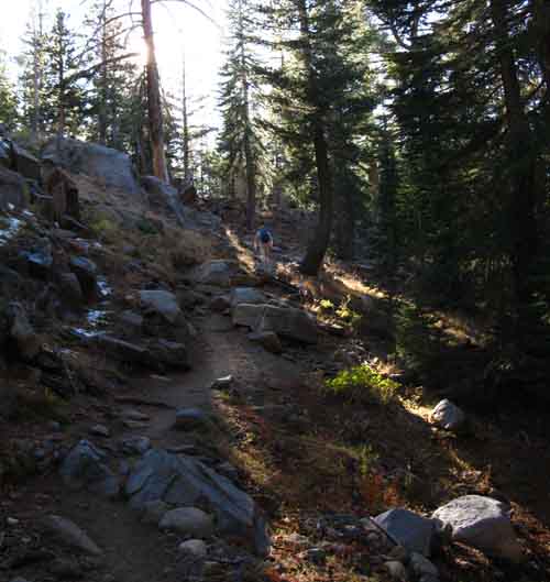
Hiking South from Carson Pass
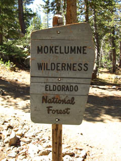
Mokelumne Wilderness Boundary
| .38 of a mile South of Carson Pass we enter the El Dorado NF administered section of the Mokelumne Wilderness. For a minute. |
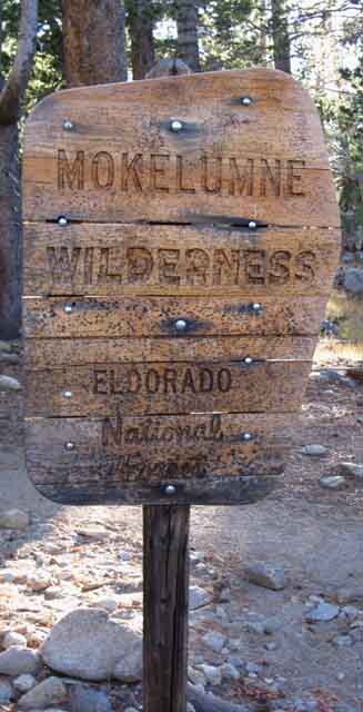 |
The Mokelumne Wilderness boundary is highly gerrymandered between Carson and Ebbetts Passes. Only a small section is in the El Dorado NF. The majority is within the Toiyabe NF. But there are many cut-outs along the tattered Eastern edge of the Mokelumne Wilderness.
|
Views to the Southwest
Open Up
| Round Top sits to the Southwest of Carson Pass. | ||
 |
||
View of Round Top from just South of Carson Pass on the Pacific Crest Trail. Views of Round Top open up as our climbing trail rotates around the lower flanks of Elephant Back rising above Carson Pass, rotating around to the Southwest facing flank as we climb higher. Note the big bird... Carson Pass Region
|
Southeast to Elephant Back
| Turning Southeast and rising out of the forest we get views of Elephant Back through the forest cover. |
 |
Approaching Elephant Back from Carson Pass. |
Southwestern View Now that we've turned fully onto the Southwest flank below Elephant Back we've come around into some fine views of Round Top off to our Southwest. |
 |
Southwest viewing of Round Top. We can see two depressions in the terrain between us and Round Top. The first is in front of us, filled with forest. At the far side of the forest we can see the terrain dropping elevation past a strip of golden meadow. The terrain over there is dropping into the second depression, at the bottom of which the trail up the footbridge route from Woods Lake is tracking South up to Winnemucca Lake. |
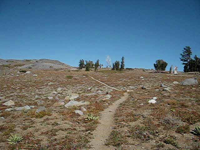
Southeastern View Looking South down the trail we are hiking in a Southeast direction towards Elephant Back, now rising into view above tree cover. A few hundred feet further South we will encounter the unmarked trail leading Left to Frog Lake, and a few hundred feet beyond that the trail junction to our Right, where the Tahoe to Yosemite Trail route breaks off to the Southwest to the Round Top Lake trail junction via Winnemucca Lake. If we're hiking South on the Pacific Crest Trail we will hike past the Winnemucca Lake trail junction to finish our climb up to and around the North side of Elephant Back, its Left side, before following the trail's bend to the Southeast towards Forestdale Divide. We'll pass under the Eastern flank of Elephant Back dropping down into the canyon holding Forestdale Creek. If we are hiking South on the Tahoe to Yosemite Trail we will turn Right at the Winnemucca trail junction on this side, the West side of Elephant back back for the short hike to Winnemucca Lake. |
 |
| Approaching Elephant Back to our Southeast hiking South from Carson Pass along the Pacific Crest Trail route. |
Frog Lake Trail Junction An unmarked trail leads Northeast to Frog Lake. It needs not be marked as we can see Frog Lake from the junction. |
 |
||
Unmarked Frog Lake trail junction.
|
Frog Lake
Elements of High Sierra beauty tie themselves together at Frog Lake. View Northeast across Frog Lake. |
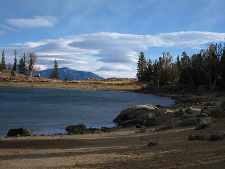 |
Water, Clouds, Forest, Mountains and Me. All the ingredients of deep experience, deep satisfaction. View Northeast across Frog Lake low level of late season. Cold winds blew and snow fell on this late September day. |
On the Trail Between Frog Lake to Elephants Back
 |
View to the Southwest Round Top and The Sisters perfectly frame our trail climbing South from Frog Lake towards the Winnemucca Lake trail junction under the Northwest flank of Elephant Back. Last night's snow flurries left their mark on Round Top and The Sisters. We'll be up there soon if we are turning onto the TYT through the upcoming Winnemucca Lake trail junction. |
Frog Lake and Caples Lake
Northeast and Northwest Views
| A glance to the West at just the right moment reveals Caples Lake fitting nicely into the contours of its surrounding mountains and forests. | |
 |
|
Caples Lake with a breeze blowing across it during a Summer afternoon. Highway 88 hugs the far shoreline. Schneider Camp and the trail over Little Round Top lays off the far Right side of Caples Lake. |
 |
||
A Fall Morning. Caples Lake viewed through morning light looking to the Northwest from under the Northwest side of Elephant Back, Pacific Crest Trail.
|
View Northwest at our Carson Gap exit from the Lake Tahoe Basin
 |
||
Here we see the mountains making up the Southwestern corner of the Lake Tahoe Basin. I'm thinking we're lined up, and looking at Tallac Peak using the Carson Gap as our gunsight. Everything on the far side, the North side of that low gap drains into Lake Tahoe. Everything on this side of the ridge drains into the Silver Fork of the American River. Little Round Top is visible on the far Left side of the image. The Tahoe to Yosemite and Pacific Crest Trail routes pass North and South through the low gap on the Right of the Tahoe Rim Ridgeline. I call this low gap the Carson Gap. Carson Pass is a short ways out of frame to the Right at the high point below the Southern base of this golden ridge arm. The forest is running up to the gap in the terrain between the base of Red Lake Peak to the North and Elephant Back to the South. In the Distance we can see the tip of Pyramid Peak in the Crystal Range in Desolation Wilderness and Mount Tallac in the far distant Right of the image as well. A grand terrain with interesting views in all directions.
|
Winnemucca Lake trail junction
and
Elephant Back
TRAIL GUIDE PAGE Pacific Crest Trail |
 |
||
Post pointing the way for Southbound PCT hikers around the North flank of Elephant Back. The trail to Winnemucca Lake can be seen on the Right side of the sign post.
|
The trail Trail to Round Top Lake Lake Alpine is located about 15 miles West along Highway 4 and 1400 feet lower in elevation than Ebbetts Pass. East and West Sierra Experiences The great drops down to Camp Irene (5280) and Kennedy Meadows (6400) are followed by great hikes back to the Sierra Crest. The PCT and TYT share the same trail through the Lake Tahoe Basin in the North Sierra and rejoin at the Yosemite boundary for the hike through the Yosemite Wilderness in the Central Sierra. Between these areas the TYT covers the Western and the PCT the Eastern flank of the North Sierra Nevada. The junction below is our last chance to decide East or West. |
| South of the Winnemucca Lake Junction we climb up to and pass around the Northern side, the left, of Elephant Back, pictured below. | ||
 |
||
The tree cover is thinning as we climb. We will be without tree cover before reaching Elephant Back's North side. We will not enjoy cover again until we pass South of Forestdale Divide. The next section of trail crosses much open terrain.
|
Winnemucca Lake Trail Junction
| A mile South of Carson Pass we encounter the Winnemucca Trail Junction. |
 |
This is the Southbound Backpacker's last chance to turn West and head up to Round Top, and follow the Tahoe to Yosemite Trail route. Winnemucca Lake trail junction to Winnemucca Lake: 1.26 miles Round Top Lake: 2.14 miles Carson Pass: 1.04 miles |
TRAIL GUIDE PAGE
PCT to WINNEMUCCA LAKE The Winnemucca Lake Trail Junction West to the Tahoe to Yosemite Trail Here at the Winnemucca Lake trail junction with the Pacific Crest Trail we are at the Southernmost cutoff to Round Top which also puts us on the most Eastern of the three possible ways of linking up the Pacific Crest Trail with the Tahoe to Yosemite Trail around Carson Pass, if we are planning on hiking the Tahoe to Yosemite Trail. Three Ways from Carson Gap to Round Top Lake Which one we take depends on how we are coming down the Tahoe to Yosemite Trail. If we are hiking South out of the Tahoe Basin on the TYT I suggest splitting off the PCT route at the Northern trail junction to hike the Western route up to Round Top via the Lost Cabin Mine Trail. I consider all three to be the TYT. The video below depicts the section of the TYT route from the Carson Gap through Carson Pass to the Winnemucca Lake junction along the PCT South of Carson Pass, and then on to Winnemucca and Round Top Lakes. At the Winnemucca Lake trail junction the middle trail coming up from the foot bridge near Woods Lake joins us for the next leg of our hike up to the high point of this trail at Round Top Lake. At Round Top Lake we note the junction where the Lost Cabin Mine trail from Woods Lake intersects with our route. Clicking the red dots on the Carson Pass Region Map below links to the guide page for that position. Clicking the black-dotted route on the Wilderness Map brings that area's detailed map, the red dots also linking to guide information.
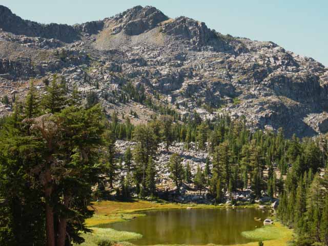
Mokelumne Wilderness From Round Top Lake our Tahoe to Yosemite Trail guide continues South on the next TYT guide page covering the TYT down past Fourth of July Lake to Summit City Creek while this page continues South down the PCT below our brief detour exploring this Eastern route to Round Top Lake, to Forestdale Divide. |
Video
Three ways
from
Carson Gap to Round Top Lake
Three ways from Carson Gap to Round Top Lake. Duration: 13:27 In the video above we hike the PCT route from the Carson Gap through Carson Pass. Turning Right, to the Southwest on the Tahoe to Yosemite Trail route at the Winnemucca Lake trail junction opens up views across the Carson Pass Management Area revealing the terrain the two other potential routes between Carson Gap and Round Top Lake cross. When we arrive at Winnemucca Lake we pass the trail junction where the "middle" route, the trail coming up from Woods Lake arrives at Winnemucca Lake. Arriving at Round Top Lake we take note of the third route up to Round Top Lake, the Lost Cabin Mine trail coming up from the campground near Woods Lake. This is the most Western of the three routes. This video covers the Eastern route from Carson Gap to Round Top Lake through Carson Pass and Winnemucca Lake. This is the most lengthy route between these two points. The Woods Lake trail guide page covers the other two routes, of which the Lost Cabin Mine Trail is the most direct and steepest route, while the "middle" route over the footbridge near Woods Lake up to Winnemucca Lake splits the difference in difficulty and distance between the "Eastern" and "Western" routes. Carson Pass Region Our next move is from Round Top Lake to Fourth of July Lake on our way down to enter the unmaintained section of Tahoe to Yosemite Trail along Summit City Creek. |
Trail to Winnemucca Lake
Continuing South on the Pacific Crest Trail
The Northeastern Side of Elephant BackA very dry almost-flat rocky area sits below the Northeastern steep flank of Elephant Back. Expansive Views to the East begin opening up as we reach this high point of the PCT across Elephant Back. This is a nice "side" destination for day hikers out of Carson Pass, before they double-back to the Winnemucca trail junction for the hike up to Winnemucca Lake. Overlooking Forestdale Creek
|
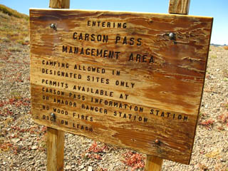
Carson Pass Management Area Boundary and Linda
| Many day hikers enjoy the many miles of trails in the Carson Pass Management Area. | ||||
Exiting the CPMA on the North side of Elephant Back, heading South towards Forestdale Divide. We turned around to face North to read this sign. |
 |
|||
 |
||||
Note the gentle sloping almost-flat terrain here on the North side of Elephant Back. Carson Pass to Blue LakesCPMA 15 min Backpacking Map |
||||
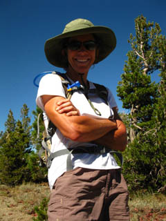
| Info: Carson Pass Management Area | Linda and I had a nice long chat. |
Views and Encounters on the Eastern Flank of Elephant Back
The Social Trail Policy in ActionObserve I make it trail policy to observe, analyze, and greet every thing I meet on the trail. Most backpackers are fit and secure, but I occasionally run into backpackers who are injured, totally trashed, lost or unsure of their position, or running low on food or fuel. Observing a hiker's gait reveals lower body injury, their breathing reveals their level of fatigue, their posture indicates the condition of their back, shoulders and general status, and finally, observing a hiker's face generally reveals their attitude about their overall level of tension and fatigue. And talking to them reveals all. Exchange Trail Information If my fellow backpacker is secure, then I turn my attention towards obtaining fresh information from them about the terrain I am approaching, which they just covered, while providing them with the information about the terrain I have just crossed. I also check their tracks, so I know who and when it was put on the trail I will be hiking, and can follow its degradations. Known tracks becomes a known reference point for other tracks. If backpackers are not secure, I try to fix them up. After the basic evaluations I'm curious about where the person came from, how they came to find these fine trails through the Sierras, and where they are going. The Result At the very least I get to meet another back country traveler. I get to try to understand another hiker's approach to, and experiences in the wilderness. I meet people who show me new things and things I've missed all the time. The Sierra is Huge. Shared experience makes each of us better informed and more knowledgeable and safer because of it. Knowledge is power. The Bottom Line The negative is that this type of social interaction on the trail can really extend how long it takes to cover a given distance. On the North side of Elephant Back I talked to Linda, pictured above, for over a delightful half-hour, and then I spent 10 minutes with the SCA crew pictured below. At a three mile per hour pace, which I can easily hold over this moderate terrain, 40 minutes equals 2 miles. This adds up on a busy trail. Thus you may want to adjust your expected daily mileage in consideration of your social policy on the trail. This should be figured into your overall and daily hiking plans. I figure that my preoccupation with taking pictures of everything, and talking to everyone along the trail takes up two hours a day, costing me the equivalent of 6 miles a day. Yikes! Another way of looking at this is to understand that I spend 2 hours a day standing around wearing a heavy pack doing 0 miles, if not running around in pursuit of something. Every minute in the pack is physically stressful, so I've solved this problem by immediately removing the pack when any predictable trail encounter or photographic goal threatens to exceed 30 seconds. If something pops up I chase it with the pack on. My point is that you've got to give yourself the time in your hiking plan to enjoy the trail culture as well as the terrain and environment. On the other side of the scale we have the very real mileage requirements fundamental to hiking the long trail or the aggressive short trip. There is a balance point between talking with backpackers all day versus hiking relentlessly from Sunrise to Sunset, and it is your own. You have to find your balance point between the time requirements of different aspects of the trail. The good news is that this balance point changes daily over the course of a long trip. Hiking the long trails shows that different situations require different approaches, delivering a wide range of different trail experiences. Enjoy them all. Onward... From the flat area on the North side of Elephant Back we will now be dropping down 200 feet over the next 1.85 miles to the ponds at the head of Forestdale Creek. Forum Section |
This Guide is set up so that you can add your perspective & experiences here to broaden the trail guide's view of the Carson Pass and its backpacking opportunities. Check the Forum linked to every trail guide page for more information or to add yours. My perspective alone is insufficient to describe the terrain or the experience. Thus your perspective adds another dimension to the experience and value of this guide. Questions and comments always welcome. General Backpacking Specific Backpacking Trails & Topics This Location |
The Trail & Private Trail Crew
| Looking South at the PCT making its way down and around Elephant Back's Eastern Flank towards Forestdale Creek, flowing from Right to Left through the valley below. |
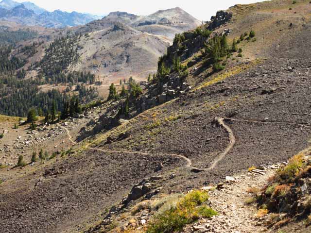 |
Note how deeply the PCT route is cut into the terrain. You can follow this sucker at night. It glows in the dark. This is why I call the Pacific Crest Trail the "Super-Highway" of trails. The trail ahead is working its way Southeast below the East flank of Elephant Back. The Southbound trail from our high point on the North side of Elephant Back traverses down to the canyon floor while hiking up-canyon. We can see the dirt Forestdale Divide road climbing towards the divide on the far side of the canyon. That rock on the far upper-Left of the image looks like The Nipple above Lost Lakes. |
Good Kids on the Trail
| Student Conservation Association Leader's Trail Crew, working the NE side of Elephant Back. |
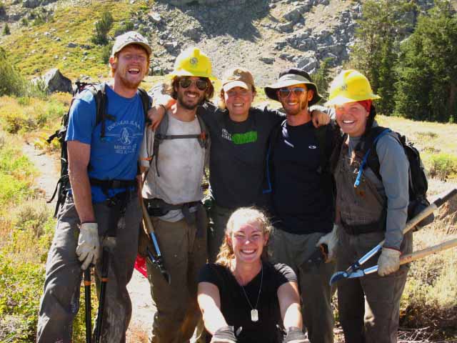 |
This crew was composed of Trail Crew Leaders who will later lead SCA student trail crews. These were real nice kids. A credit to our country. For more on Trail Crews, see the Trail Culture section in the Backpacker's Forum. |
View Northeast
from the
Eastern Flank
of
Elephant Back.
The golden grasses of Hope Valley bend around towards Freel Peak on the furthest Left, Jobs Sister to its Right and Jobs Peak to the furthest Right. This fine scene comes into view as we climb out of Carson Pass during Fall up to the flat on the North side of Elephant Back. |
 |
Highway 88 hits Hope Valley on the section of meadow on the Right, which is also where the Blue Lakes Road intersects with Highway 88. Check out the top blue marker on the road map below the backpacking map. The distant meadow section in Hope Valley is crossed by Highway 89 between Picketts Junction and Luther Pass. |
Towards Forestdale Divide
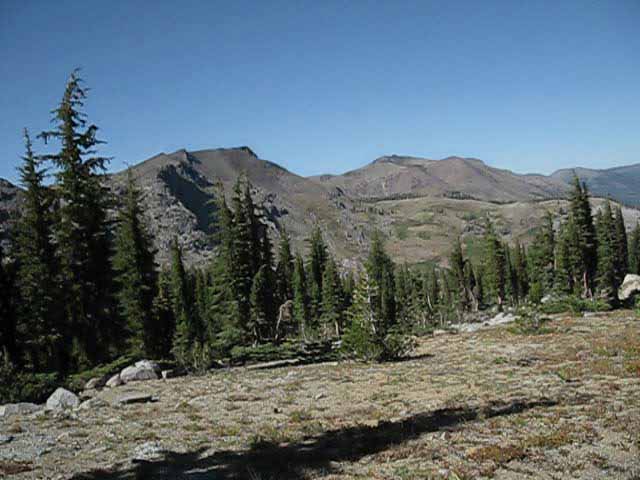
The Sierra Crest West of Forestdale Divide
Hiking South towards Forestdale Divide along the lower East Flank of Elephant Back. Forestdale Divide is out of sight out of the Left side of this image, making up the low point of where the crestline is dropping down. That's Forestdale Divide. That's where we're going. |
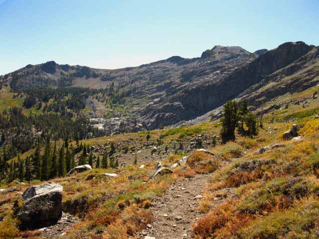 |
This Crestline is the Southeastern extension of the Round Top/Sisters crestline. As I mentioned, the ridgeline along the far Left of the image is running down to Forestdale Divide, and the top of our Southbound trail's switchbacks up to the divide. The West end of each switchback up to Forestdale Divide turns East under/to the Left of the triangular rock jutting up from the Left end of the ridgeline. The sharp crest of the ridgeline ahead moderates into a wide area of flattish terrain across Forestdale Divide. The topo hiking map well depicts this flat. |
Markleeville Peak
View East-Southeast Across Forestdale Creek
| Markleeville Peak viewed while dropping almost directly South down into Forestdale Creek's Canyon approaching the North side of Forestdale Divide. |
 |
Forestdale Creek is running through the meadow in the foreground. Note the location of the pond with the island on the topo hiking map. |
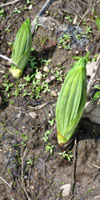
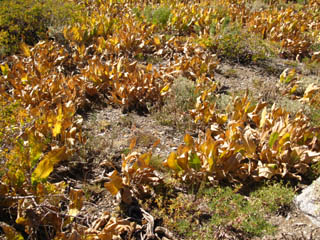
Mule Ears
Fresh Sprouting Wyethia mollis, commonly called Mountain Mule Ears, which I call Paper Plant. |
Why I call them Paper Plants |
|||||
 |
 |
|||||
I call them paper plants because of the sound they make at the end of their annual lifecycle. They look like ears of corn sprouting straight out of the wet Earth during early Spring.
Paper Plant |
When wind blows through these plants during late Summer into Fall its dried leaves rubbing together in the breezes sound like the raspy rustling of thousands of dried-out pieces of loose paper blowing about in Nature's ancient library. Thus I call them "paper plants..." To get even more interesting-weird, I am not as much concerned about what man calls the plants, but what they call themselves...in a manner of "speaking." How we approach nature determines what we see... |
Do you have Experiences from this area to relate? The Backpacker's ForumCarson Pass to Forestdale Divide All pages accept any comments and questions. |
Ponds
at the
Top of Forester Creek
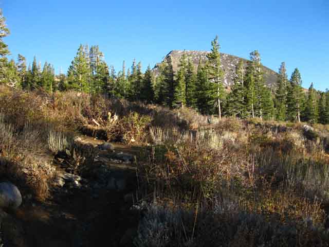
After descending from Elephant Back down to the Ponds at the head of Forestdale Creek, we begin a 1.25 mile hike gaining 250 feet in elevation up a set of wide switchbacks to Forestdale Divide. Forestdale Creek Ponds Mileage 7.64 miles to Tamarack Lake |
Across
the
Forestdale Creek Drainage
Remote Trailhead Access Hiking South to the point the trail crosses Forestdale Canyon we look to our Left while approaching our fording point of Forestdale Creek, over our Left shoulder at the semi-shaded parking in a small stand of trees off the Forestdale Divide Road. This parking offers auto access to a trail leading up here to the PCT and/or down Forestdale Creek's Canyon. Note the Forestdale Road beyond the SUVs, at the base of the mountain on the East side of the canyon. Forestdale Creek Road is a rough unpaved road which leads from Highway 88 to Upper Blue Lake. See the Road Map for information. Well, it does not look too rough, but the drivers of SUVs I've observed crossing its upper section over the years all exhibit great fear climbing the last steep section of road up to Forestdale Divide. It's steep, and I've watched numerous SUV drivers lose confidence approaching the crest, causing them to slow and stop on the steepest upper section of the road. Stopping on the steep section of a dirt road is not a great idea. Knowing how to keep and carry your vehicle's traction and momentum up and over steep sections of marginal traction surfaces is an important driving skill. It is a skill you should posses if you decide to drive Forestdale Road. Drivers can avoid Forestdale Road in favor of the paved Blue Lakes Road which also connects Blue Lakes to Highway 88. But hey, why do you have a fake four-wheeler, an "SUV," if not to drive roads like the Forestdale Divide Road? |
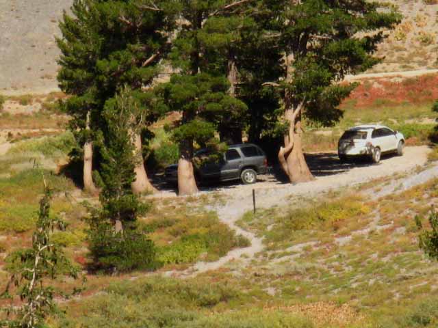 |
Forestdale Creek Road connects Highway 88 at Red Lake with the upper end of Upper Blue Lake while the Blue Lakes Road connects Highway 88 in Hope Valley to East end of Lower Blue Lake. We can see the Forestdale Road beyond the cars. |
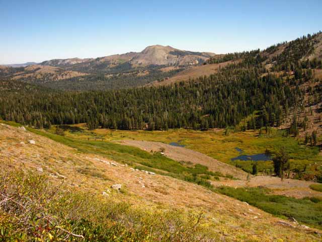
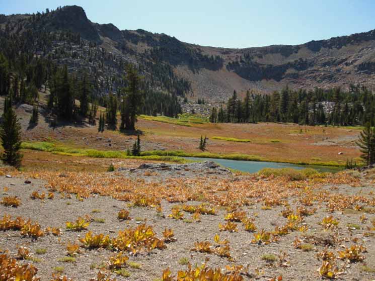
View West
Looking West-Northwest across the headwaters pond of the Forestdale Creek towards Round Top/Sisters Massif. Frkn nice terrain. Stunningly beautiful in a remote and harsh manner. |
 |
We've crossed over to the East side of the very upper section of Forestdale Creek, and are hiking South around the East shore of the pond Forestdale Creek issues from. Carson Pass to Blue Lakes We're positioning ourselves for the switchbacks up to Forestdale Divide. |
Top of Forestdale Creek Canyon
| Looking Southwest across the top of Forestdale Creek's upper pond in the top of the canyon. | ||
 |
||
Looking Southwest across the upper pond after crossing over to the East side of Forestdale Creek at the very top of the Forestdale Creek Headwaters. The Sierra Crestline runs Southeast from Round Top, to the Left, towards Forestdale Divide. It's a pretty scene dressed in Fall colors.
We're beginning the switchbacks up to Forestdale Divide. The West side of each switchback will turn East under that triangular rock jutting up from the Sierra Crestline on the upper Left of the image above. |
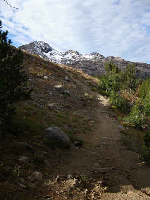
Last Steps South up to Forestdale Divide
 |
Hiking up the great inclined flat known as Forestdale Divide. |
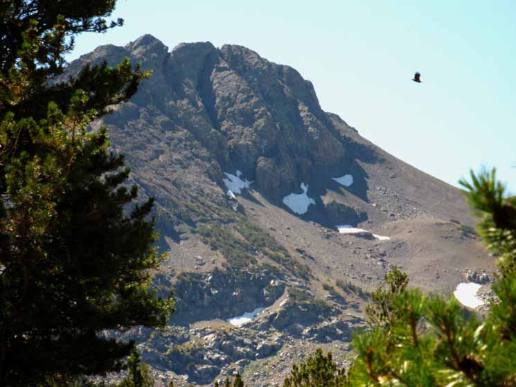
Elephant Back and Red Lake Peak
View North from Forestdale Divide
 |
Looking North at our Route from Elephant Back Carson Pass to Blue Lakes We worked our way to the East on the semi-flat ridgeline extending East from the North side of Elephant Back. That ridge is plainly visible in the image above. From the East end of that ridge we began what was essentially a great traverse South from our position under that steep Eastern flank of Elephant Back, hiking down to Forestdale Creek as we can see that the line of our traverse South brings us to the top of the rising valley Forestdale Creek flows down. We're hiking down to the top of the valley Forestdale Creek flows through. Red Lake Peak is the mountain on the Right of center in the distance. Between us and Red Lake Peak we can see the ridge running East from Elephant Back. Carson Pass The Highs and Lows Carson Pass is also the lowest point for hikers on the Sierra Crestline running North and South. Life is a series of highs and lows, and life on the trail makes this fact especially apparent. |
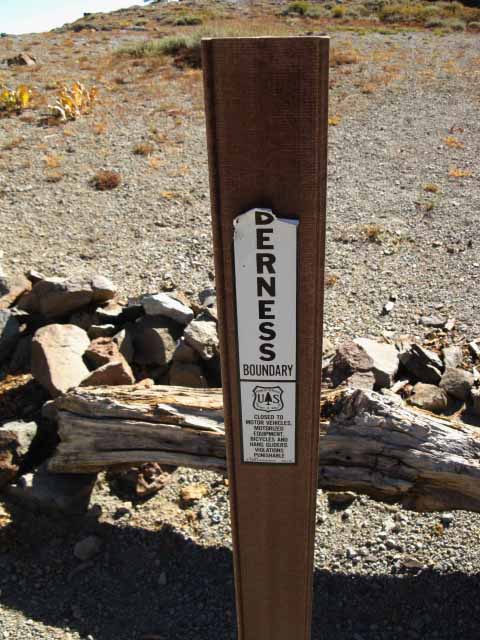
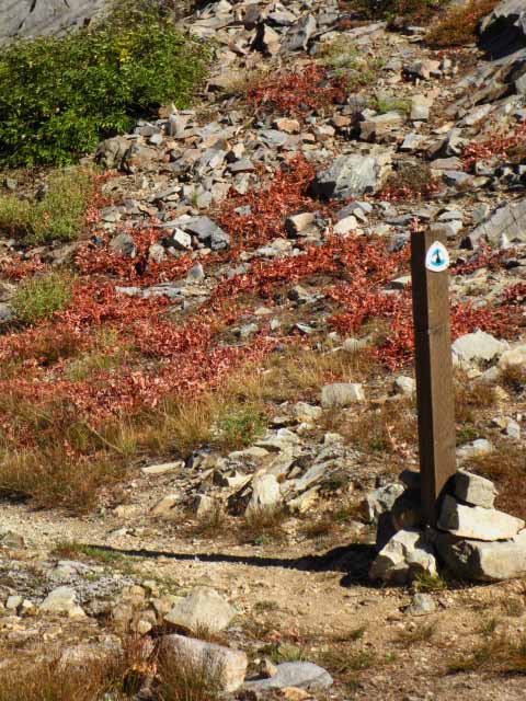
Mokelumne Wilderness Boundary
The Forestdale Divide |
||||
 |
||||
An inspection of the map reveals that the Mokelumne Wilderness is highly gerrymandered through it's whole length along the PCT between Carson and Ebbetts Passes. This is our second Wilderness Boundary so far since departing Carson Pass. We'll see a few more before we arrive at Ebbetts Pass. In the image above we can almost see the line of Forestdale Road crossing the divide at the base of the mountain behind the wilderness boundary marker. The road runs across there, though we can't quite see it clearly. Note the location of the Wilderness Boundary on the map below. |
||||
|
View to the Southeast
 |
Trail It's easier to hike to Upper Blue Lake by continuing South along the PCT down to the Lost Lakes intersection with Forestdale Road, then follow the road down to Upper Blue Lake, than it is to hike the trail above to Upper Blue Lake. But, this is the best trail to enter Summit City Canyon and access Summit City Creek, and Devils Corral, where we can continue our hike South along the Tahoe to Yosemite Trail. Besides the web of connector trails around Carson Pass and Round Top between the Pacific Crest and Tahoe to Yosemite Trails, there are not many/any other trails linking the TYT and PCT together across the length of the Mokelumne Wilderness. Well, there's the one we see above, and our three options to Round Top Lake across the Carson Pass Management Area to our North, and that's it. Once we hike South of the trail from Upper Blue Lake to Summit City Canyon there are no more trails tying the the PCT and TYT trails together across the South end of the Mokelumne Wilderness. This is very unlike the situation across the Carson Iceberg and Emigrant Wilderness Areas to our South. Down there we have many amazing trails that we can use to tie these two routes together into custom local loops and long distance routes across the lengths of both of these upcoming wilderness areas to our South. Not so across the Mokelumne Wilderness, once we get South of Upper Blue Lake. There are no PCT/TYT connector trails across the Southern Mokelumne Wilderness. The trail above is the last connector between the PCT and TYT until we hit Highway 4. This limits local loop backpacking trips around the Mokelumne Wilderness. We can do fairly short loops around the Carson Pass Management Area using the trail above to connect the PCT with the TYT elements of a Carson Pass Management Area loop. And, we could hike an arc from Lake Alpine to Ebbetts Pass using the trail connecting Summit City Canyon with Upper Blue Lake that the trail pictured above intersects. Once we get down to the Carson Iceberg and Emigrant Wilderness Areas we will be able to craft custom long-distance backpacking routes across both, as well as hike loops of various diameters around both wilderness areas. |
South
out of the
Forestdale Divide
| Junction for the Trail to Summit City Canyon | ||
| At the first trail head at top of the Forestdale Divide sits this trail junction and mileage post. It states: Ebbetts Pass 18 miles. The other side says: Carson Pass 4. | PCT in the Background. | |
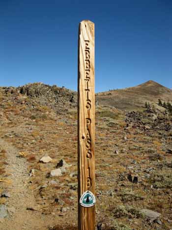 |
 |
|
I have the distance South to Ebbetts at 21.33 miles, and the distance North to Carson Pass at 5.1. See the barren peak rising to the East of Forestdale Divide in the background Right above? Check that peak out from the Tahoe to Yosemite Trail between |
Upper Blue Lake sits behind the forest-covered ridge in the distance. We can see the distinctive shape of the forest wrapping around the Southeast flank of the peak rising to the East of Forestdale Divide.
|
|
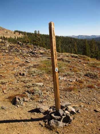
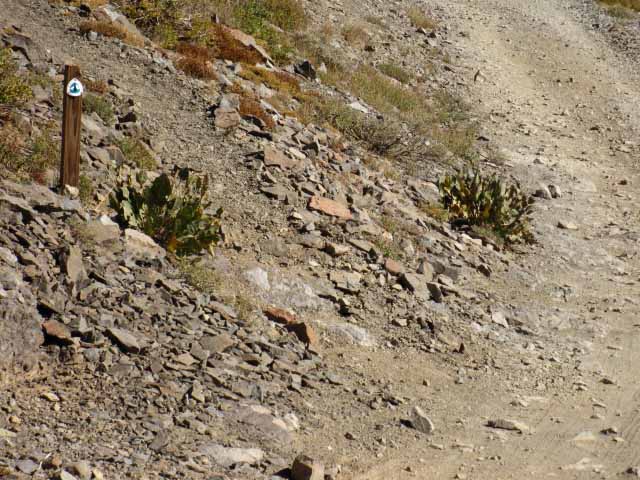
Well Marked Trail
 |
This trail post is informing us of the location of the PCT running South along the South side of Forestdale Divide Road. The PCT runs along the South side of the road for a short distance before crossing. |
Crossing to the East Side of Forestdale Divide Road
| The Pacific Crest Trail is well marked where it crosses Forestdale Divide Road just below the South side of Forestdale Divide. | |
 |
|
Right here we are crossing under the exposed peak visible to TYT hikers on the trail below Fourth of July Lake. |
|
Two Trail Junctions
We encounter two trail junctions teeing off our PCT route to the Southwest as we arrive and cross the Forestdale Divide. The first junction in Forestdale Divide is at the wilderness boundary marker, and the second junction is at the marked trail junction just South of Forestdale Divide. Both trails track Southwest, and both can bring us down to Summit City Creek and the Tahoe to Yosemite Route down Summit City Canyon. The trail from the wilderness boundary is longer and steeper. The trail from the wilderness boundary tracks directly into Summit City Canyon, while the trail from the post connects with the trail between Summit City Canyon and Upper Blue Lake. I don't see the reason for the first trail from the wilderness boundary. The trail from the marked junction crosses a better route across the terrain hiking both directions, be we hiking up or down the terrain. Local hikers circling the CPMA can turn here to begin through either trail to bend their circle route back to Carson Pass to bring them to Fourth of July Lake and the trails over Round Top to Carson Pass. Or, local hikers can start loop trips around the Carson Pass Management Area by hiking West into Summit City Canyon through the trailhead at Upper Blue Lake. |
|||
| Two Trail Junctions | |||
First trail junction in Forestdale Divide Southwest to Summit City |
Second trail junction South of Forestdale Divide Southwest to Summit City |
||
Note that the second trail junction, the Southern junction on Forestdale Divide is a shorter, easier, and more direct route into Summit City's Canyon and Creek.
|
|||
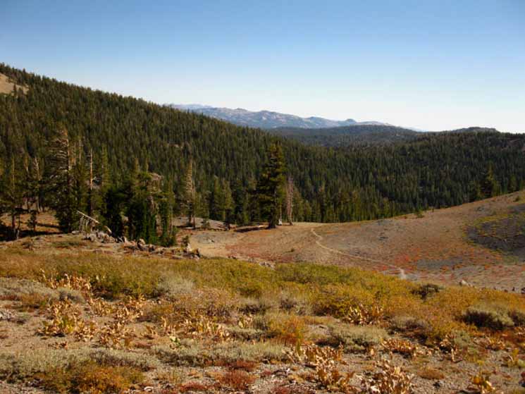
Looking
West-Southwest from Forestdale Divide
Devils Corral
View of Devils Corral and Summit City Creek Headwaters
|
Devils Corral drains from the Left
Summit City Creek flows to the Right
 |
Looking at the East side of the Carson Pass Region Map reveals our position on Forester Divide looking to the Southwest at what the map calls Peak 9626 with Devils Coral located on the Left side of this massive rock. Note on the map the route of the trail from Forestdale Divide down to Summit City Creek and downstream along Summit City Creek to its intersection with the route of the Tahoe to Yosemite Trail below Fourth of July Lake. The trail down from Forestdale Divide intersects with the trail out of the top of Summit City Canyon East to Upper Blue Lake. This is the Southernmost route that connects the PCT with the TYT. Below us a trail works its way over the low rise West of Upper Blue Lake down into Summit City Canyon. Our trail down from Forestdale Divide intersects with this trail about halfway between Summit City Creek and Upper Blue Lake. Continuing South past this short position offering views up Summit City Creek we cross to the East side of Forestdale Road and shortly enter the relief of shaded forest cover dropping down the South flank of Peak 9374. Peak 9374 is the peak we can see at the head of Summit City Creek while hiking on the TYT from Fourth of July Lake down into Summit City Canyon. Once we enter the forest we will be distracted between the old routes of the PCT and the Forestdale Divide Road over to Lost Lakes, and their new routes which stay to the West of the Lost Lakes. I've noted these changes on the maps, and discuss them on the next trail guide page to the South, |
North: The Carson Pass top of page South: Forestdale Divide to Blue Lakes Road
Carson Pass |
Terrain The majority of this section feels like it is downhill, excepting two medium difficulty climbs. But we are actually climbing a few more feet than descending between Carson Pass and Forestdale Divide. The first climb is out of Carson Pass up to the flat below the North Flank of Elephant Back. This is followed by our long descending traverse down to the ponds at the head of Forestdale Creek's canyon. The second climb is up to Forestdale Divide from these ponds at the head of Forestdale Creek. Water The terrain between Carson Pass and Forestdale Divide is quite dry and exposed, though water is available from Frog Lake and at the Ponds at the head of Forestdale Creek, even into late Fall. I am rolling through here with fresher water than that, haven taken water from the top of the South Upper Truckee River in Meiss Meadow. I generally carry enough water for nine miles of hiking, which for me generally works out to 32oz in normal Sierra conditions. I can re-water in one of the fresh streams South of the paved Blue Lakes Road, unless they are dry in late Summer, in which case I will get water at Tamarack Lake, or the small lake to its South. Or Lost Lakes. Lost Lakes is a good spot to have a lunch break and water up for the next segment of trail. If I am hiking efficiently and conditions are cool I will not rewater from the South Upper Truckee until I reach Tamarack Lake 11.49 miles past Carson Pass. This means that I am going to have to stock a bit more than 32 oz at the South Upper Truckee, or stop for a water break at the Forestdale Ponds or Lost Lakes. There is a fine campsite at Tamarack Lake, and I always take a break in this cool shaded site to rehydrate, have a nice snack, and refill my water bottle. Before departing this shaded section of trail to head South towards Raymond Peak, I always stop at the campsite along the creek coming off of the North Side of Raymond Peak to re hydrate and refill my water bottle in anticipation of the upcoming 8+ mile crossing of the very dry exposed terrain between the North side of Raymond Peak to the South side of Reynolds Peak. Let's get back to the Forestdale Divide. From the pond at the head of Forestdale Creek there is no water sitting directly on the trail in late Summer and Fall for 7.64 miles until we reach the small unnamed lake just South of Tamarack Lake. During dry years the many small creeks and tributaries that crisscross the area draining East during Spring dry out quite early in the Summer. There is all-season water just off the trail at two points between Forestdale Divide and Tamarack Lake. Lost Lakes and Tamarack Lake both hold water all Summer, but both lakes are offset from the Pacific Crest Trail. Lost Lakes is about a half-mile East of the PCT where the Lost Lakes dirt road intersects with the PCT and the Forestdale Divide Road. We can see the Northwest Lost Lake from where the trail crosses the dirt road to the lake. Just look East down the dirt road when you cross it and you will see the NW Lost Lake. I've never headed down there, but I'll bet there are loads of really nice campsites set up by car campers. Roads = Car Campers = Campsites. NOTE: The map does not properly depict the trail from Forestdale Divide to Lost Lakes. The trail is no longer routed to Lost Lakes, as depicted on the 7.5 min USGS Topo Map. The trail's loop to Lost Lakes has been straightened out, and the trail now crosses the dirt road to Lost Lakes about a half-mile West of the lakes. Forestdale Divide Road's "loop" over to Lost Lakes has also been straightened out, and both the road and trail intersect about a half-mile West of Lost Lakes. Both the dirt road and the trail have been rerouted to the West of the NW Lost Lake. I did not correct the map. Continuing South on the Pacific Crest Trail 4.5 miles further South of Lost Lakes down the Pacific Crest Trail, sitting about .83 of a mile South of the Blue Lakes Road we will encounter the creek draining Tamarack Lake crossing the trail. Tamarack Lake is found less than an eight-mile SW off the trail following the creek. The 7.5 minute USGS topo map incorrectly depicts the trail coming off of the South Side of The Nipple. In fact it does not show the Pacific Crest Trail coming off the South side of The Nipple to the paved Blue Lakes Road at all. Don't worry, I laid out the rough location of the Pacific Crest Trail route on the map. The PCT continues South from the Blue Lakes Road and intersects with the trail coming up from the Tamarack Trailhead just South of Blue Lakes Road. The USGS map does not show the segment of the PCT coming South from Blue Lakes Road, but only shows the PCT coming out of the Tamarack Trailhead parking lot. This is incorrect. The PCT crosses Blue Lakes Road and does not loop through the Tamarack trail head. South of Blue Lakes Road Look for the large creek draining Eastward from Tamarack Lake .83 of a mile South of Blue Lakes Road, though when I passed by here in late September of 2009 the lake had dropped below the level necessary to feed the creek. The creek bed draining Tamarack Lake is large enough that it's size and location should indicate to you the presence of the lake. 7.5 min USGS hiking topo Map 30 min USGS hiking topo Map Note: Click the Colored Dots on the Maps! |
Backpacking Trail Guide North |
 |
Backpacking Trail Guide South |
Backpacker ForumsHave General Information about Backpacking to relate?Post it on
|
North: The Carson Pass South: Forestdale Divide to Blue Lakes Road
Trailhead
Contact
Alex Wierbinski

Backpacking Lake Tahoe to Mount Whitney
Your guide to the High Sierra Crest, including the Tahoe to Yosemite, Pacific Crest, and John Muir Trails
