
The Trails
Guide
Maps
Miles/Ele
Permits
Resupply
Forum
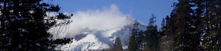
Current Weather Conditions
Weather Notes
Northern High Sierras
Central High Sierras
Southern High Sierras
Gear
Gear List
Gettin Started
Layering
Discussion
Testing yourself and your gear
Gear Reviews
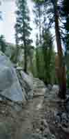
Tahoe to Whitney Trail Guide
Status
Purpose
Resources
Trail Arts
The art of walking
Physical Preperation
Trail Skills
The trail
Off the trail
Scrambling
Maps
Navigation
Camp skills
Food
Resupply
Food
Other
Photo Catagories
Trail Stories
Trail Culture
News and Science
Links
Groups
Books
What's Up? High Altitude High Sierra Trails. Welcome. I'm Al, and I'm writing this generation's High Sierra trail guide, using the modern technology of the internet to offer the most comprehensive guide possible. The lid has been blown off the constraints previous generations of trail guide writers struggled under. On the Web we can present images, videos, and kick-ass maps for a trail guide that gives you clear views of the the trerrain itself to best plan, prep, and execute your very long and very short distance High Sierra Hikes, as well as your long section hikes and short backpacking loops. New
Above are links to the newly-created introductions to the Sierra Crest Trails and the Tahoe to Yosemite Trail, respectively. We've also put up the basic South Sierra Maps anticipating I will soon begin building the South end of the guide. Trail Guide Pages Neither are complete. This is a guide in motion, constantly growing towards its destination at the Mount Whitney Portal describing the terrain, logistics, gear, weather, skills and fitness necessary to hike the length of the High Sierra Nevada Mountain Range South from Lake Tahoe. Thus this guide is aptly named Tahoe to Whitney. Backpacking Trails and Topics Forums This guide is centered and organized along the main trails running the length of the Sierra Crest. The Tahoe to Yosemite and Pacific Crest Trail routes in the North Sierra are mirrored by the John Muir and Pacific Crest Trails along the South Sierra Crest. And how these trails are seen and experienced. All the short and long loops described in this guide, in fact this entire guide and the many trailheads and backpacking trips it describes are all orientated to pointing you towards hiking the Sierra Crest. My goal is to get you out and get you in shape step by step until you are capable of hiking long distances at high altitudes carrying a heavy load, either one section of the High Sierra at a time, or the whole thing all at once. Both, over the years, over and over again... This is what we were designed to do. This guide and forum are building into a comprehensive source of information for hikers on the Tahoe to Yosemite, John Muir, and Pacific Crest Trails down the length of the Sierra Nevada. Well, it will. I've lots of work ahead. Currently this trail guide spans from the start of the Tahoe to Yosemite Trail at Meeks Bay to the point where the Pacific Crest Trail and Tahoe to Yosemite Trail rejoin in Tilden Canyon in the North Yosemite Backcountry. The completed guide now measures out to around 300 miles of North Sierra Nevada Trails online with trail guide pages, maps, mileages, images and videos. I hope you find them helpful. Let me know. We've a lot of trails behind and a long ways ahead. No matter. The long journey down the High Sierra trails is the point of this exercise. Happy Trails, Al. The Hot Topic When Will the High Sierra Trails Open in 2015? This Trail Guide features |
Let's Focus on Some Stunning Areas to Explore in the Sierra Nevada Mountain Range this Upcoming Summer
Thinking about Planning your Summer of 2013 Sierra Nevada Hiking?
Me too. I've worked out some maps of excellent hiking areas listed at right that you might be interested in. I say you should plan on taking the Summer to hike the 400 (+/-) miles and forty days to hike from Lake Tahoe to Mount Whitney. But, my Tahoe to Whitney bias is apparent. These maps to our Right link to the underlying trail guide pages, more detailed maps, and miles and elevations information. Except the North Yosemite Backcountry Maps. I'm currently working on those. Check these maps out for some fine Summer Backpacking trip ideas, free car camping, and great day hikes for you peak baggers. Monitor the snow-watch resources on the All High Sierra Weather Page! Improved Can't find it? |
Killer Maps and Trail Guide Pages click red dots for guide info and click the trail routes for on large maps for underlying detailed maps Mokelumne Wilderness Hiking Map Carson Iceberg Wilderness Hiking Map Emigrant Wilderness Backpacking Backpacking Emigrant Wilderness Backpacking Emigrant Wilderness Trail Guide Pages Backpacking Emigrant Wilderness more maps |
Lake Tahoe to Mount Whitney
Your guide to the Sierra Crest, including the Tahoe to Yosemite Trail, the Pacific Crest Trail and the John Muir Trail