The Trails
Guide
Maps
Miles/Ele
Permits
Resupply
Forum
Current Weather Conditions
Weather Notes
Northern High Sierras
Central High Sierras
Southern High Sierras
Gear
Gear List
Gettin Started
Layering
Discussion
Testing yourself and your gear
Gear Reviews
Backpacking
through the
Carson Gap
Hiking South out of the Tahoe Basin through the Carson Gap on the Tahoe to Yosemite and Pacific Crest Trails
Languages
Languages
Trail Arts
The art of walking
Physical Preperation
Trail Skills
The trail
Off the trail
Scrambling
Maps
Navigation
Camp skills
Food
Resupply
Food
Other
Photo Catagories
Trail Stories
Trail Culture
News and Science
Links
Groups
Books
Terms and Conditions of Use
| Trail Guide INDEX |
North TYT-PCT Carson Gap Winter |
South TYT Trail to Woods Lake |
South PCT Carson Pass |
Topo Map Meiss Country |
Topo Map SOUTH Carson Pass Region Map |
Maps Index |
MILES AND ELEVATIONS |
Miles and Elevations INDEX |
Lake Tahoe Basin Management Unit PERMITS |
Local Weather All Sierra Weather |
Tahoe to Whitney on YouTube |
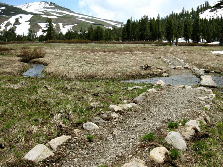
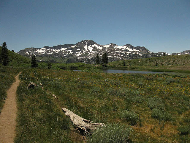
Approaching
Carson Gap from the North crossing Meiss Meadow
departing the
Lake Tahoe Basin
Meiss Meadow Getting Ready to BLOOM
 |
||
View Southeast We're looking down the last bit of trail as we approach our Southbound exit from the Tahoe Basin through the Carson Gap. We're crossing Meiss Meadow with a length of the South Upper Truckee River at our feet. This high stream runs up the gully to the Carson Gap with our trail. We're looking Southeast at the Southernmost point of the Lake Tahoe Basin. Red Lake Peak rises in the Left, out of the frame of this view, but we can see its' subordinate Southwestern peak rising above the East side of the Carson Gap, the gap through which we will exit the Lake Tahoe Basin. The final layers of Spring snow have finally melted into the meadow. The uncovered meadow first reveals the matted dead brown grasses of last year, crushed flat and turned brown under the heavy weight of the cold Winter snow. The water and heat of the Spring Thaw first reveals the meadow, then begins surging subtle waves of muffled green hues through these vast fields of compressed dead grasses and barren brush.
|
South Which Way? We can hike a Tahoe to Yosemite backpacking trip along the Pacific Crest or the Tahoe to Yosemite Trails down to Tuolumne Meadows, depending on our preferences and capabilities. But the TYT route stands alone as a unique hiking experience. Just a few feet South through the Carson Gap we encounter the first and Northernmost of three possible routes to the Southwest up to Round Top Lake to get onto the Tahoe to Yosemite Trail route. We find three trails up to Round Top Lake, but there's only one way down the South side of Round Top along the Tahoe to Yosemite Trail into Summit City Canyon. We discuss the differences between the Tahoe to Yosemite and Pacific Crest trail routes below, and in the Trail Guide Index. Northbound Backpackers Southbound Like Us But, for roughly the next 75 miles the Tahoe to Yosemite and Pacific Crest Trails will take very different routes South down opposite sides of the Sierra Nevada until they do again rejoin entering the North Yosemite Backcountry at the top of Jack Main Canyon. Hooray for the Difference It gets even better. TYT Challenges PCT The Other Route TYT+PCT= Local and Long Distance We can use the route we've explored across each of these subsequent wilderness as the basis of "grand tour" loops around each wilderness area. Once we hike the long trails across the Sierra Nevada this is going to have shown us enough to get us back in for more. Backpacking is addictive, if you approach it carefully. Our long hike down the Sierra Nevada will reveal further routes to explore in each wilderness area, and bring us to so many places that are so beautiful we will be drawn back in for years of additional in-depth explorations. |
| INDEX On this page |
||||||||||||||||||
|
Miles and Elevations North & South: TYT and PCT
Video
Carson Gap Encounters Trail Culture: Pepperoni and Harmony Video
Video
TYT Junctions |
Carson Pass Weather Information
All Weather |
Route South Options & Information
TYT unmaintained trail section
Thoughts on the upcoming Trails
Next Resupply
South of Highway 4 Carson-Iceberg Wilderness
Sierra Nevada Administration and Permits
Short Trips: Carson Pass and Meiss Roadless Area |
||||||||||||||||
| > Forum < | ||||||||||||||||||
POST UP! All backpackers can post text comments about the following segment of trail through the comments links on all the trail guide pages. Registered Members can post up stand alone post about the trail with text, images, maps and videos in the Trails Forum that supplements this section of the Trail Guide. Check out All the Tahoe to Whitney .org |
||||||||||||||||||
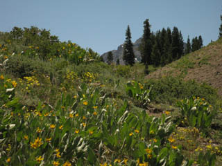
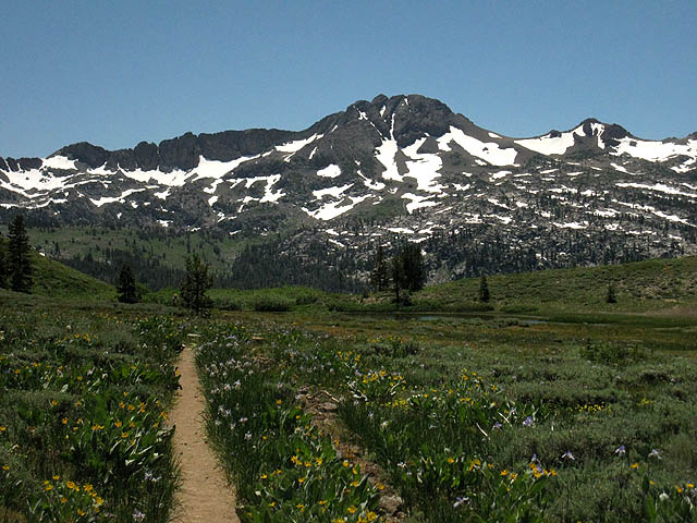
Views East
Hiking South
up to the
Carson Gap
Paper Plant in full bloom heading up the North side of the Carson Gap. Looking at Stevens Peak to the Northeast behind the stand of forest. |
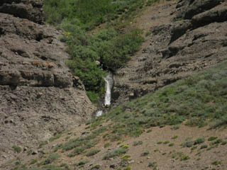
Waterfall draining off the North side of Red Lake Peak in July, which bounds the Eastern Side of the Carson Gap. A high source of the South Upper Truckee River. | |||||
 |
 |
|||||
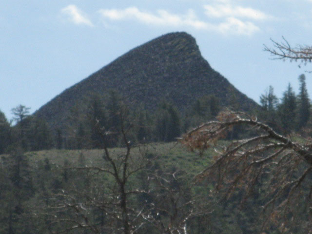
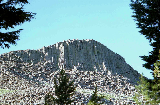
| Otherwise known as Mule Ears. The sound these plants make in Fall breezes sounds like rustling pager in an ancient library. | Much of the Eastern Sierra is draped with, if not completely composed of, reddish-hued volcanic rock. |
The Carson GapThe Carson Gap is the low gap (8800 ft) in the mountains ringing the Southernmost end of the Tahoe Basin. This gap is located at the low point along the Sierra Crestline between the West flank of Red Lake Peak and the ridgeline dropping off the Eastern side of the Little Round Top massif. The Carson Gap is the lowest point between the peaks ringing Meiss Meadow. Meiss Meadow is the bottom of the South Upper Truckee River's headwaters bowl collecting water from the mountains wrapping around the Southern corner of the Tahoe Basin, and these mountains also mark out the Southern extent of the Tahoe Basin. On the South side of the Carson Gap the Eastern Sierra flank and its streams drain into the West Carson River while the Western Flank mountains channel their runoff into the Silver Fork of the American River. Hiking Maps In any case, the Carson Gap marks the Southbound backpackers departure from the Tahoe Basin and the uniquely beautiful variety of terrains that decorated our hike down the High Sierra mountains wrapping around the Western Shore of Lake Tahoe. We will realize just how unique the Tahoe Basin is after we hike through a few more National Forests and Wilderness backpacking South. Though each is unique and beautiful, the Tahoe Basin puts together such a variety of physical and cultural terrains it stands out. Well, each area stands out on its own individual expression of beauty. From the Carson Gap we exit the Tahoe Basin to continue our Southward trek along the Sierra Crest Line. The question is, South along which trail? The TYT or the PCT? We must decide quickly. I hope you have already decided and planned and packed properly for your chosen route. Because a few yards down the South side of Carson Gap we will find the first of three trail junctions where the PCT and TYT routes part company near Carson Pass. PCT vs TYT From the Carson Gap the great Massif of Round Top and the Sisters dominates our Southern view. This piece of rock is also the dominant feature of our route decision. How we pass South of this feature determines our route. PCT The Pacific Crest Trail route turns Southeast hiking around the East side of Round Top to trace its Southbound route along the volcanic dominated Eastern flank of the High Sierra. The Pacific Crest Trail route brings us 27 miles South of our position at the Carson Gap down to Ebbetts Pass on Highway 4. See this topo hiking map which marks the location of the Carson Gap in relation to both the Tahoe to Yosemite and Pacific Crest Trails. Click the Colored dots along each route and be brought to the corresponding trail guide page for that location, where you can examine each location and both routes in detail. TYT Rather than hiking around Round Top the Tahoe to Yosemite Trail hikes up to Round Top Lake sitting nestled in a sweet flat just below The Sisters. Our TYT route rounds the Southwest flank of the Western Sister to set our general line of travel to the Southwest, towards Lake Alpine through the grand granite Western Flank of the Sierras. Lake Alpine is 26.28 trail miles South of our position here at the Carson Gap, situated about 15 road miles West of Ebbetts Pass down Highway 4. Backpackers on the Tahoe to Yosemite route encounter the first of three possible trail junctions to the TY Trail just a few steps to the South of the Carson Gap. (see below) The second junction sits at the bottom of the South flank of the mountain below Carson Gap, (also below) while the third junction to the Tahoe to Yosemite Trail is through the Winnemucca Lake Junction a mile South of Carson Pass on the Pacific Crest Trail. Our first question is which of the three routes to the TYT should we hike? The first two junctions to the TYT are unmarked trail junctions that lead us down well-trod trails to where they meet at the creek. From the creek below Carson Gap these trail join to lead us down to Highway 88 West of Carson Pass at an old trailhead. There are no trail junctions labeled "The Tahoe to Yosemite Trail" in the Carson Pass region, though there are three ways to get to the Western Flank of Round Top and The Sisters to follow the Tahoe to Yosemite route into the great granite valley holding Summit City Creek. |
Exiting |
|
The Carson GapElevation North 1.52 Miles to Meiss Cabin. 3.4 miles to Showers Lake. 10.61 miles to Echo Summit 7.03 miles to South Upper Truckee Trailhead. 6.9 miles to Big Meadow Trailhead. South 1.39 miles to Carson Pass PCT. 29.27 miles to Ebbetts Pass PCT. 3.9 miles to Round Top Lake TYT. 26.34 miles to Lake Alpine TYT. |
|
Mileages NorthCombined
|
Southbound Hikers Southbound backpackers have a choice between continuing South on the Pacific Crest Trail or the Tahoe to Yosemite Trail. These are very different trails providing very different experiences. For information about the differences between your two route options South read the route discussion below, and find more information and links on the Carson Gap Forum Page, where you can also leave comments and questions. Note that below and to the Left we have comparison miles for each trail's distinct route across the Mokelumne, Carson Iceberg, and Emigrant Wilderness Areas. Backpackers who wish to hike the TYT but don't want to hike the segments of unmaintained trail can find side trails where we can get around the unmaintained section in the Southern Carson Iceberg Wilderness. The upcoming unmaintained section through the Mokelumne Wilderness has no side trails around it. Either we take the TYT through the unmaintained section or we take the heavily used PCT route. Mileage South
|
Video
Backpacking through the Carson Gap
looking
South
at our
Tahoe to Yosemite and Pacific Crest Trail options
This video gives us a look at the Carson Gap, where the Southbound backpacker on the Tahoe to Yosemite trail departs the Pacific Crest Trail to hike to Lake Alpine on Highway 4 along the Western flank of the Sierras. The videos, maps, miles and elevations, and all the trail guide information linked to these assets below give us a real good look at the aspects and character of both of these routes down to Highway 4. Video PlaylistNorth Video Playlists
Miles and Elevations to Highway 4
|
Encounters at the Carson Gap
Cowgirls in the High Sierras
Trail CultureEquestrian Pacific Crest TrailerJanice "Pepperoni" Raddatz |
| Half-way up to the Carson Gap I encountered Pepperoni and Harmony coming down. |
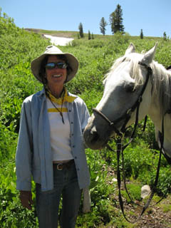 |
| They were both in good Cheer. |
Pepperoni and HarmonyI encountered Pepperoni and Harmony on the North Side of the Carson Gap on July 16, 2009. They were heading North, and I South. This horse carried Pepperoni Northbound across the Sierras during the early Spring when they were full of snow. This was a real accomplishment for both horse and rider. I find that the Sierras are very challenging in Spring Conditions for backpackers, and can only imagine these challenges on horseback. But, horses are amazing mountain climbers. The horse was wearing a few scrapes from hitting submerged objects in the snow, but was looking sharp and lively. A very well tuned creature, by my accounting. Some Young horses' skittishness is perfectly tuned to the environment. I departed the trail through the Whitney Portal on August 28, finally returning home in early September. I looked up Pepperoni and found her to be Janice Raddatz, and checked her website. On her site I found a notice that she had a wreck up North, going over the edge of a trail with Harmony, pictured above, and another mount, and losing both. Hard luck. Harmony was a fine mount with a great character, by my momentary accounting. Though the notice of the accident is no longer on Janice Raddatz's site, the site is up. Nope, that site is off-line as of Sept 2010, but the eques-trek site was still up at that time, and as of May 2014. I don't support or condone organized religion... |
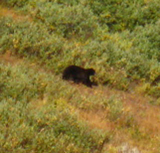
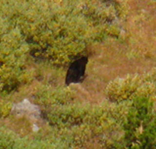
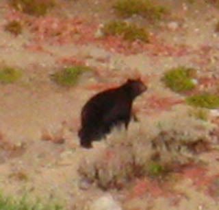
Video and Pictures of Bear Running North through Carson Gap, down to Meiss Meadow
Approaching the Gap on September 20, 2009
Bear running North
|
Running Bear on the North side of the Carson Gap
| Bear in full retreat down from the Carson Gap. | Slowing a bit behind the brush cover. | |
 |
 |
|
| The bear must be doing 25 mph. But keeping a brisk pace away from the intruder. | Bear had no idea I was observing. |
Video of Bear and Comments on Two-legged Trail Denizens
| Bear film shot below the Carson Gap |
The rest was shot at the Carson Gap Pond. The Point Video Playlist |
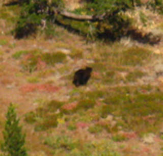
More Bear
| Bear fleeing into Meiss Meadow | This bear would have shocked the shit out of any hikers coming up through Meiss Meadow... | |
 |
 |
|
| Wild Bears run from people. But there was no one coming up behind me. | Likely heading down to the unsecured garbage cans at the houses in Christmas Valley. |
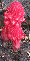
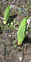
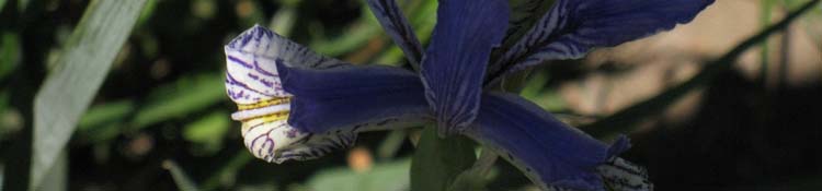
Reaching the Carson Gap
in
Spring and Early Summer
finds the
Iris Pads in full bloom
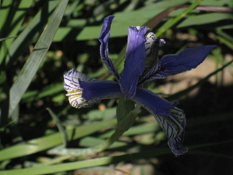
| Another Iris at the Carson Gap | |
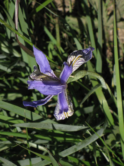 |
|
The Iris in the Gap is always a welcome sight in Spring. |
North: Carson Gap South on the TYT: Trail to Woods Lake. South on the PCT: Carson Pass.
The Carson Gap Pond
backed by
Round Top and The Sisters
| View South of the Round Top Massif through the Carson Gap. |
 |
| Below: Round Top and The Eastern Sister dominates the Vista South of the Carson Gap. |
 |
The Carson Gap's Meadow was in full bloom. |
Video
Three ways
from
Carson Gap to Round Top Lake
Three ways from Carson Gap to Round Top Lake. Duration: 13:27 In the video above we hike from the Carson Gap through Carson Pass. Turning Southwest at the Winnemucca Lake trail junction towards Round Top Lake we observe the trail up from Woods Lake to Winnemucca Lake via the footbridge over Woods Creek, which I call the Center route. The total distance of the Eastern Route from Carson Gap to Round Top Lake via Carson Pass is 4.57 miles, while the Center Route up from the footbridge is 3.90 miles. Arriving at Round Top Lake we take note of the Lost Cabin Mine trail coming up from the campground near Woods Lake. This is the Western, and shortest route up to Round Top Lake. That completes our hike up the Eastern route to Round Top Lake from Carson Pass, except for checking out the wind on the lake. Our next move is from Round Top Lake to Fourth of July Lake on our way down to the unmaintained section of Tahoe to Yosemite Trail along Summit City Creek. Video Playlist |
North TYT-PCT: Carson Gap South TYT: Trail to Woods Lake. South PCT: Carson Pass.
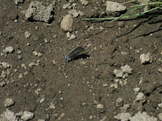
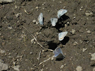
BUTTERFLIES!
Puddling Butterflies sucking salt at the Carson Gap Pond
Butterflies are a regular, sometimes constant joy along our trail South to Mount Whitney. We see them in meadows and forests, as well as high up on barren rocky mountainsides. Every now and again we run into great concentrations of butterfly beauty, sometimes by specific species, and sometimes in great congregations of every type, size and color. I enjoy them all. |
Thanks
to
Professor Arthur Shapiro
for
Identification and Behavior information
We've Got the Blues | Small pale blue butterflies were feeding on the receding wet apron of the pond in the Carson Gap. | They were fluttering on their own, when they were not holding on to keep the gusting breezes from pushing them over. | |
 |
 |
|
So I sat down with the view of Round Top before me, and the fluttering butterflies below. Between the breeze and their fluttering, they were a hard shot. Especially as this was my break! |
Butterfly Forum |
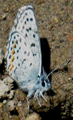 |
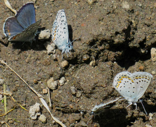
About the image aboveButterflies in the Sierras are beyond my ability to identify. I sought out the expertise of Professor Arthur Shapiro, who is quoted and credited for identifying the species on this page. Professor Shapiro Says"All easy, but you may be slightly discombobulated by the information about the little blue guys--identifying them is a skill that takes lots of practice.""The one in the smaller upper-left picture is undeterminable at this angle." "In the smaller upper-right picture: The 3 at the top are Euphilotes battoides. The one at 3 o'clock is Lycaeides idas anna. The one at 5 o'clock is almost certainly plebejus icarioides." |
Above and Below
Blues
Puddling at the Carson Gap Pond
| Beautiful pale blue with orange and black checkering |
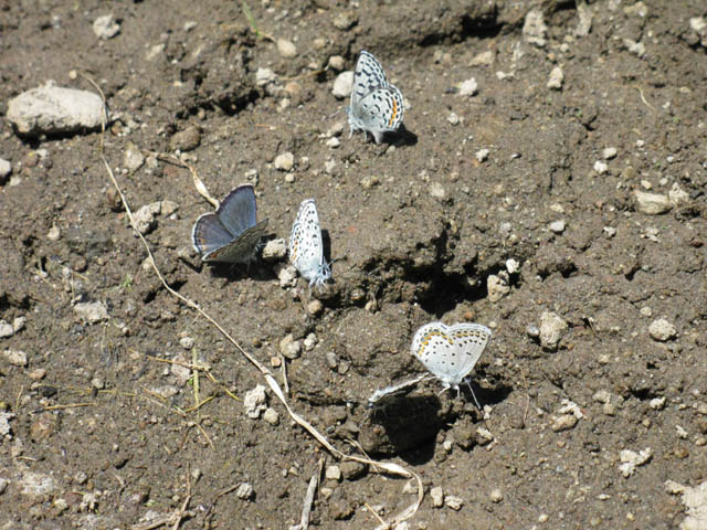 |
| Their fluttering wings were a relaxing sight. |
Professor Shapiro Distinguished Professor at UC Davis Professor Shapiro is a Fellow of the American Association for the Advancement of Science, the California Academy of Sciences, the Royal Entomological Society of London, and the Explorers Club and has received the Academic Senate Distinguished Teaching Award and the Outstanding Adviser Award at Davis and has been a Fellow of the Davis Humanities Institute. |
Professor Shapiro identifies the above group as a mixed-species "puddling" group, with interesting facts that have expanded my knowledge about the behavior of Butterflies. Professor Shapiro Says:"In the big puddling picture: At 9 o'clock, two Plebejus lupini. At 1 o'clock: E. battoides. At 5 o'clock: 2 L.i.anna." "These are all males and all common. Many Blues look very much alike and their males -- only males -- puddle together, but forming single-species clusters when numerous! There are others in the mix too--just not in your pictures; I've seen six different Blues on one puddle." For more on Butterflies, See the Butterfly Section of the Backpacker's Forum |
For more butterflies,
or to
add your own experiences
see the
butterfly section
of the
High Sierra Backpacker's Forum
For an excellent source of Sierra Butterfly information, seeArt Shapiro's Butterfly Siteespecially the Butterfly Listing by Latin Name and the Professor's recent work; Compounded effects of climate change and habitat alteration shift patterns of butterfly diversity. (abstract) To obtain a broad understanding of Sierra Butterflies, see; Status of Butterflies, Arthur M. Shapiro, Center for Population Biology, University of California, Davis. (pdf) On Professor ShapiroProfessor Shapiro has contributed valuable information to our understanding of the repercussions that our alterations to our climate and ecosystem have initiated. My hope is that our society has the wisdom to understand and properly use the information Professor Shapiro has generated to guide our legal, political, and development policies to mitigate, if not restore, our crumbling natural infrastructure. Many thanks to Professor Shapiro not just for identifying the Butterflies pictured above, but for his dedication to understanding the Natural World, as well as his contributions to making us all aware of the importance of our interrelationship with Nature. And he's a really cool dude. |
Carson Gap Pond with snow apron
| Early Spring with the Carson Gap Pond in the background. |
 |
A small ice apron still sits around the perimeter of the pond, as well. |
Two Lake Tahoe to Yosemite Trail Junctions South of the Carson Gap
#1, At the top
| The first unmarked junction is a Right Turn to the Southwest just below the South side of the Carson Gap. This unmarked trail brings us straight down to Highway 88, on our way up to Round Top, in the Background. |
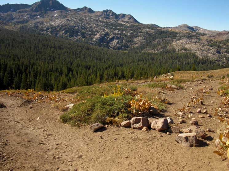 |
Trail to Woods Lake The two lesser peaks to the Right of Round Top are The Sisters. Our TYT route passes around the Right side of the third peak to the Right of Round Top. Following The Pacific Crest Trail South from here keeps us on the main trail (Left) that leads us down to the Carson Pass. South of Carson Pass the PCT route tracks East of Elephant Back dropping down to Forestdale Creek for the climb up to the Forestdale Divide. From the Forestdale Divide we get a glimpse down Summit City Creek and at the South flank of Round Top and The Sisters, to our West, before turning Southeast towards Ebbetts Pass. |
North TYT-PCT: Carson Gap South TYT: Trail to Woods Lake. South PCT: Carson Pass.
#2 Tahoe to Yosemite Trail junction
at the
Base
of the trail up to the
Carson Gap
The second unmarked trail junction is at the base of the Southern descent from the Carson Gap. Here the PCT turns Left, East to traverse Red Lake Peak's lower mountain flanks over to Carson Pass. This unmarked trail Southwest joins up with the TYT trail coming down from Carson Gap at a creek less than a quarter of a mile from the junction below. |
|
 |
|
Trail to Woods Lake We'll follow this dirt track down the mountain to our Southbound Right, down to the paved road leading South to Woods Lake, and also to our two trail options up to Round Top Lake. The unmarked trail junction pictured above is located near the head of the little creek that this unmarked trail follows down to Highway 88. We'll meet the unmarked trail coming down from the Carson Gap where it crosses this creek, which is where these first two trails to the TYT join to roughly follow the course of the creek down to Highway 88. |
North: Carson Gap South on TY: Trail to Woods Lake. South on the PCT: Carson Pass.
Let's |
|
The Tahoe to Yosemite Trail
|
ResupplyHighway 4, Lake Alpine Lodge and Ebbetts Pass The Pacific Crest trail crosses Ebbetts Pass on Highway 4. Lake Alpine, where the Tahoe to Yosemite hits Highway 4, sits about 26 miles to the West of Ebbetts Pass, also on Highway 4. I always pick up my first resupply at the Lake Alpine Lodge, even if I am hiking the Pacific Crest Trail. This necessitates hitching a ride down down mountain from Ebbetts Pass for hikers on the Pacific Crest Trail. Hikers on the Tahoe to Yosemite Trail hit Highway 4 at the East end of Lake Alpine, and will find it a pleasant 3/4 mile walk alone the beautiful shore of Lake Alpine to the Lake Alpine Lodge. After finding my secret camp on the East side of Lake Alpine and stashing our food and gear properly, we will take a leisurely walk along the scenic North Shore of Lake Alpine down to the Lake Alpine Lodge. Food! Beer! Good Company! Highway 108, Saint Mary and Sonora Passes The same basic resupply situation confronts backpackers hitting Highway 108 at the Sonora Pass as it did on Highway 4. Kennedy Meadows Pack Station is 9 miles West down the mountain from the Sonora Pass. I suggest hitching the 8 miles West, down to Kennedy Meadows to resupply. Kennedy Meadows Pack Station Kennedy Meadows is the superior resupply option in every respect. But if you do hit Bridgeport to resupply, check out Rhino's Bar and Grill. Rhino's sports pool tables, a nice cafe with great food, and a bar. US Marines, random special forces, and other military personnel from Pickle Meadow mingle with locals, car campers, hunters, fishermen, and the occasional backpacker misguided enough to head to Bridgeport for resupply. Don't get me wrong, I like Bridgeport a lot, its fine residents, and especially the hot springs just South of town, but Kennedy Meadows is the Superior resupply option for backpackers crossing Highway 108. The 395 Corridor Personally, when I am in the 395 corridor near Highway 108, I always head North to the little town of Walker, which sits 14 miles North of the Highways 108 and 395 junction. Though it has few resources, I have friends there that have always made Walker a fine place to visit. Lake Alpine, Bear Valley, and Arnold Resupply |
Read more about your route options on the Pacific Crest Trail or the Tahoe to Yosemite Trail between the Carson Gap and Highway 4 on the Trail Guide Index, on the Carson Gap Trail Guide page, in the maps section, and on the miles and elevations pages.
Inform Yourself!
Check the maps, mileages and elevations, and the trail guide pages for information on each route's specifics.
The route options through the Northern Sierras are approached from the perspective of resupply on the Echo Lake Chalet Resupply page. Check this page out for resupply information and options as they pertain to both the Tahoe to Yosemite and Pacific Crest Trail routes between Meeks Bay and Sonora Pass.
Also Check out the route discussion comparing the Tahoe to Yosemite and Pacific Crest Trail routes on the
Backpacker's Forum
Comments?
Maps
North
of the
Carson Gap
7.5 minute Topo hiking Map
Echo Summit and South Upper Truckee to Carson Pass
30 min Topo hiking Map
Echo Summit and South Upper Truckee to Carson Gap
South
of the
Carson Gap
Fourth of July Lake to Mount Reba Map
SOUTH PCT miles
Carson Pass to Ebbetts Pass
SOUTH TYT miles
Carson Gap to Lake Alpine
Trail Guide Pages
North: Carson Gap South on TYT: Trail to Woods Lake. South on the PCT: Carson Pass.
Short Trips
|
The Administrative UnitsThe Toiyabe National Forest extends down the Eastern flank of the Sierras from North of Lake Tahoe South down to where it wraps around the Northeastern boundary of the Yosemite National Park. The Toiyabe manages the East flank of the Carson Range around the East shore of Lake Tahoe, then the East flank of the Sierra from Carson Pass down to Highway 120. The Toiyabe National Forest is huge. The Western Flank of the Sierra between Tahoe to Yosemite is administered by a series of National Forests. The Lake Tahoe Basin Management Unit administers the whole Lake Tahoe Basin. South of the Tahoe Basin from Carson Pass to Camp Irene the El Dorado National Forest administers the Western Flank of the Mokelumne Wilderness, while the Eastern side of the Mokelumne Wilderness sits within the Toiyabe NF. The Carson-Iceberg Wilderness spans both flanks of the Sierra Crest South of Highway 4 down to Highway 108. Again, the Eastern Flank is administered by the Toiyabe NF, while its Western Flank is part of the Stanislaus NF. South of Highway 108 both the PCT and TY trails enter the Stanislaus NF Administered sections of the Emigrant Wilderness. The Southbound hiker on the Pacific Crest Trail will enter the Toiyabe NF for the short section from Kennedy Canyon to where they enter Yosemite through Dorothy Lake Pass. The Tahoe to Yosemite Backpacker will be in the Emigrant Wilderness administered by the Stanislaus National Forest from Kennedy Meadows until they enter Yosemite through Bond Pass. Climate and TerrainThe Eastern slope is noticeably drier than the Western flank of the Sierra Neavada Mountains. This is because most of the moisture of the wet Pacific Ocean air currents passing over the Western Slope is drawn out as it climbs up to and over the high altitude Crest of the Sierra Nevada Mountains. Local Thunderstorms Don't get caught out on a high altitude exposed mountainside when one of these storms forms up. I have postponed crossing open meadows and exposed mountainsides during thunderstorm activity. The volcanic terrain along the Sierra's Eastern Flank compliments its dryness. The PCT route along the Eastern Slope is dominated by starkly beautiful volcanic features, until we approach the East Fork of the Carson River, (South of Ebbetts Pass past Wolf Creek Pass, and 5 miles North of Sonora Pass.) which presents a beautiful interface zone between local pink-hued granites and the surrounding volcanic overlays bracketing the granite. We will trace this interface from the East Fork of the Carson through Emigrant Wilderness, until we begin climbing to the Boundary of Yosemite National Park at Dorothy Pass. From there it's all granite, all the way to Tuolumne Meadows. The volcanic/granite terrain interfaces that surround Yosemite, to both the North and South, fall away as we enter Yosemite. Yosemite stands as a great granite island in the vast sea of mixed volcanic and granite terrain that surrounds it. We've got lots of cool things to see, both about and around us. |
Trips North
|
South of Highway 4
|
| Backpacking Trail Guide Pages from Carson Gap | ||
North Pacific Crest & Tahoe to Yosemite Trails |
South Pacific Crest Trail
|
South Tahoe to Yosemite Trail |
Backpacker ForumsHave General Information about Backpacking to relate ?Post 'em on
Become a Member!Post your comments and questions on the relevant Pages in this Forum, or Register to post your own pages about your trips and the trails through the Meiss Country Roadless Area in the Echo Summit to Carson Pass Forum. Forum
|
North TYT-PCT: Carson Gap South TYT: Trail to Woods Lake. South PCT: Carson Pass.
Trailhead
Contact
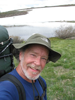
Alex Wierbinski

Backpacking Lake Tahoe to Mount Whitney
Your guide to the High Sierra Crest, including the Tahoe to Yosemite, Pacific Crest, and John Muir Trails
