The Trails
Guide
Maps
Miles/Ele
Permits
Resupply
Forum
Current Weather Conditions
Weather Notes
Northern High Sierras
Central High Sierras
Southern High Sierras
Gear
Gear List
Gettin Started
Layering
Discussion
Testing yourself and your gear
Gear Reviews
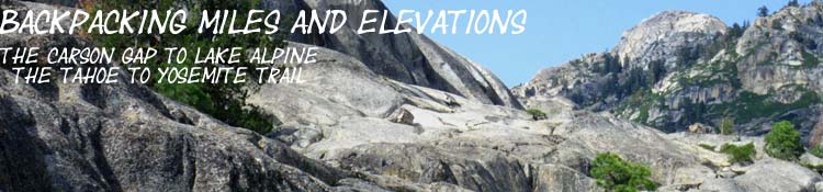
Backpacking Miles and Elevations
Carson Gap to Lake Alpine
The Tahoe to Yosemite Trail
through the
Western Mokelumne Wilderness
Languages
Translate
Trail Arts
The art of walking
Physical Preperation
Trail Skills
The trail
Off the trail
Scrambling
Maps
Navigation
Camp skills
Food
Resupply
Food
Other
Photo Catagories
Trail Stories
Trail Culture
News and Science
Links
Groups
Books
MILES TYT-PCT-TRT |
MILES TYT |
MILES TRT |
MILES PCT-TYT |
REGION TYT |
TRAIL TYT-PCT |
MAPS |
ALL |
ALL |
Miles & ElevationsThe Tahoe to Yosemite TrailCarson Gap to Lake Alpine Campsite |
|||||||||||||||||||||||||||||||||||||||||||||||||||||||||||||||||||||||||||||||||||||||||||||||||||||||||||||||||||||||||||||||||||||||||||||||||||||||||||||||||||||||||||||||||||||||||||||||||||||||||||||||||||||||||||||||||||||||||||||||||||||||||||||||||||||||||||||||||||||||||||||||||||||||||||||||||||||||||||||||||||||||||||||||||||||||||||||||||||||||||||||||
Backpacking Miles Our view South from the Carson Gap, where we exit the Lake Tahoe Basin on the unified PCT-TYT routes, overlooks our upcoming route options South along both trails. Towering to our South is the Round Top - Sisters Massif around which our so-far unified Tahoe to Yosemite and Pacific Crest Trail routes now split into different directions. The Southbound Pacific Crest Trail bends Southeast through Carson Pass to Forestdale Divide passing East of most of the Round Top Massif, while the Tahoe to Yosemite Trail climbs Southwest right over Round Top and the Sisters dropping into Summit City Canyon wrapping around its Southern flank.
The Miles figures below measure our two route options for hiking the Tahoe to Yosemite Trail South from Carson Gap to Round Top Lake that pass by Woods Lake. PROCEEDING SOUTH ON THE TAHOE TO YOSEMITE TRAIL Exiting the Lake Tahoe BasinFirst Cutoff South of Carson Gap to Highway 88
Woods Lake Carson Pass Region The Bottom Line The Footbridge Route
|
|||||||||||||||||||||||||||||||||||||||||||||||||||||||||||||||||||||||||||||||||||||||||||||||||||||||||||||||||||||||||||||||||||||||||||||||||||||||||||||||||||||||||||||||||||||||||||||||||||||||||||||||||||||||||||||||||||||||||||||||||||||||||||||||||||||||||||||||||||||||||||||||||||||||||||||||||||||||||||||||||||||||||||||||||||||||||||||||||||||||||||||||
| Location | Elevation | Mileage | ||
| Woods Lake footbridge/ Woods Lake Campground | 8240 | 1.60 | ||
| +325 | .72 | |||
| End of Forest | 8565 | 2.32 | ||
| +415 | .7 | |||
| Winnemucca Lake Junction | 8980 | 3.02 | ||
| +380 | .88 | |||
| Round Top Lake Junction | 9360 | 3.90 | ||
| Total elevation Gain The Footbridge to Round Top Lake +1120 feet over 2.3 miles |
||||
3.9 miles is the total distance from the Carson Gap to Round Top Lake across the footbridge route via Winnemucca Lake. This puts the distance between the footbridge to Round Top Lake at 2.3 miles. That's half a nice day hike, for those of us who are just visiting for a day...
|
Route 2
to
Round Top Lake
The Lost Cabin Mine Route
to the
Round Lake Junction
The mileages below are measured from the Carson Gap to Round Top following the Lost Cabin Mine trail.
This route heads West through the top of the Car Campground next to Woods Lake to connect with the Lost Cabin Mine Jeep Road, which narrows to a trail, which tracks South up to the top of Round Top.
1.79 miles refers to the distance from the Carson Gap.
El Dorado National Forest PDF map of the trail through the campground to the Lost Cabin Mine trail.
xxxxxxxxxxxxxxxxxxxxxxxxxxxxxxxxxxxxxxxxxxxx
| Location | Elevation | Mileage | ||
| Lost Cabin Mine Trail Jnct | 8320 | 1.79 | ||
| +80 | .31 | |||
| Lost Cabin Mine | 8400 | 2.1 | ||
| +280 | .14 | |||
| Rock Cabin past Old Car and Trap |
8680 | 2.24 | ||
| +680 | 1.16 | |||
| Round Top Lake Junction | 9360 | 3.40 | ||
| Total elevation Gain Lost Cabin Mine Trail to Round Top Lake +1040 feet over 3.40 miles |
||||
3.4 miles is the distance from the Carson Gap to Round Top Lake on the Lost Cabin Mine route. This puts the distance between the Lost Cabin Mine trail junction at the Car Campground to Round Top Lake at 1.61 miles.
Route 3 The third route up to Round Top from Carson Gap is to continue South on the Pacific Crest Trail through Carson Pass to the Winnemucca Lake trail junction. It is 1.26 miles from Carson Pass to the Winnemucca Lake junction on the PCT and 2.14 miles to Round Top from there. This puts the distance to Round Top from Carson Pass at 3.8 miles. Adding 1.39 miles for the hike from the Carson Gap to the Carson Pass, Route 3 totals up to 4.79 miles. See: PCT Miles and Elevations, Carson Pass to Ebbetts Pass
|
xxxxxxxxxxxxxxxxxxxxxxxxxxxxxxxxxxxxxxxxxxxx
Continuing South
from the
Round Lake Junction
on the
Tahoe to Yosemite Trail
Summit City Creek backpacking map
Round Top Lake Junction
is
Our new mileage Zero Point
This guide measures mileage South from our exit from Lake Tahoe Basin at the Carson Gap.
As there are three routes from the Carson Gap up to the trail junction at Round Top Lake, we have either walked 3.9 miles from the Gap to Round Lake via the footbridge route, 3.4 miles via the Lost Cabin Mine route, or 4.57 miles from the Carson Gap to Round Top via Carson Pass and the Winnemucca Lake trail junction.
To simplify measuring trail mileages further South from the Round Top Lake trail junction where these 3 routes all converge is to make the Round Top trail junction the new zero-point for measuring distances South to the end of this TYT section at the Bee Gulch Trailhead on Highway 4 at the East shore of Lake Alpine.
Round Top trail junction to Highway 4
21.15 miles
| Location | Elevation | Mileage | ||
| Round Top Lake Junction | 9360 | 0 | ||
| -1196 | 2.3 | |||
| Fourth of July Lake | 8164 | 2.3 | ||
| -724 | 1.31 | |||
| Summit City Creek Junction | 7440 | 3.61 | ||
| *** | *** | |||
| Boy Scout Camp | *** | *** | ||
| (Summit City Junction to Horse Canyon) |
-560 | 2.43 | ||
| Horse Canyon | 6880 | 6.04 | ||
| -160 | .8 | |||
| Telephone Gulch | 6720 | 6.84 | ||
| *** | *** | |||
| Rock Zone | *** | *** | ||
| (Telephone Gulch to Upper Ford) | -160 | 1.71 | ||
| Upper Ford | 6560 | 8.55 | ||
| -440 | 1.32 | |||
| Water/Granite Flat campsite | 6120 | 9.87 | ||
| -40 | .22 | |||
| End of Canyon Campsite | 6080 | 10.09 | ||
| Water Access | *** | .3 | ||
| Total from Campsite to Lower Ford | -640 | .97 | ||
| Lower Ford Summit City | 5440 | 11.06 | ||
| Climbing to Forest Entrance | +80 | .32 | ||
| Enter Unblazed forest | 5520 | 11.38 | ||
| Across Enchanted Forest to Exit | -40 | .71 | ||
| Forest to Munson Jnct | 5480 | 12.09 | ||
| 200 feet to top of climb | +160 | .47 | ||
| Munson Meadow Junction | 5640 | 12.56 | ||
| -360 | .57 | |||
| Camp Irene | 5280 | 13.13 | ||
| +3440 | 5.24 | |||
| top of Mt Reba | 8720 | 18.37 | ||
| -240 | .87 | |||
| Bee Gulch Junction | 8480 | 19.24 | ||
| -1000 | 1.4 | |||
| Trail Jnct above Lodge | 7480 | 20.64 | ||
| -160 | .51 | |||
| Hwy 4 Bee Gulch Trailhead | 7320 | 21.15 | ||
| +40 | .34 | |||
| Al's hidden Camp | 7360 | 21.49 | ||
| Total elevation Gain Round Top Lake to Lake Alpine + feet over 21.49 miles |
||||
21.49 miles is measured from the Round Top Lake Junction to my campsite behind (East, up Silver Creek) the backpacker's camp on the East Side of Lake Alpine.
Add the distance of the route you chose to hike up to Round Top Lake to determine the total miles you've hiked from Highway 88 to Lake Alpine.
| Carson Pass Region CPMA 15 min Backpacking Map |
Echo Summit to Lake Alpine 30 min Backpacking Map |
Mileage Totals |
| Carson Gap to Lake Alpine on the Lost Cabin Route 24.89 |
Carson Gap to Lake Alpine through Carson Pass up to Round Top Lake 26.28 |
Carson Gap to Lake Alpine |
More
Miles and Elevations
| North TYT & PCT Echo Summit to Carson Gap |
South TYT Lake Alpine to Saint Marys Pass |
Have you comments, questions, or experiences about this section of the trail?
MILES
Northeast
Meyers to Meiss Cabin
Miles North: Echo Summit to Carson Pass Miles South: Lake Alpine to Saint Marys Pass
Note |
This trail guide, like the High Sierras, divides itself into ups and downs. Our miles are generally done either going up to the top of the mountain, or we are coming down from the mountaintop into the valley that separates us from the next mountain. The difficulty of our mileage here will be determined not by how well we climb, but by how easily we can find the best route through the unmaintained segment of trail that lays between our beginning and ending climbs. Remember this important rule: Every descent route holds many mini-ascents, and every ascent has many mini-descents within its route. Our mileage will very rarely just go up, or just go down. We are going endlessly up and down. The great rock roller coaster. |
Backpacker Forums Post it on Above we come to the Front Page of the High Backpacking Trails and Topics Forums. Below we break the forums down into categories:
Anyone can post text comments in the existing forums, but only members can post up new topics, along with images, maps, and formatting. If you have experiences, comments, questions, trip reports, trail conditions updates or pictures and videos of the Tahoe to Yosemite/Pacific Crest Trail from Carson Gap to Lake Alpine, most especially how the unmaintained segment of trail was looking, and how it felt to you. You can post up here as an unknown hiker or as a member: Section |
MILES
Northeast
Meyers to Meiss Cabin
North: Echo Summit to Carson Pass South: Lake Alpine to Saint Marys Pass
Trailhead
Contact
Alex Wierbinski