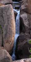
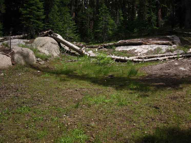
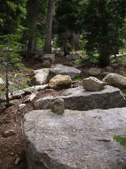
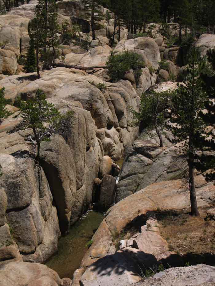
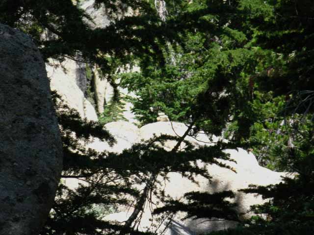
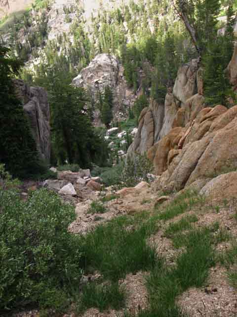
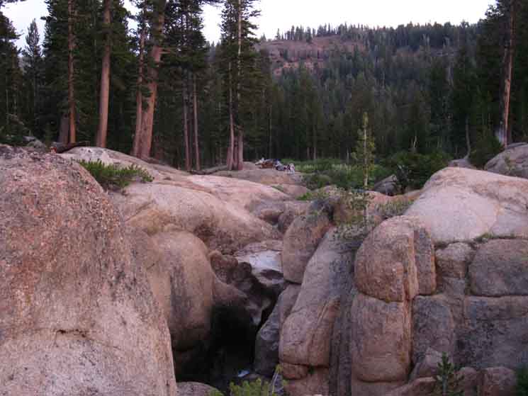
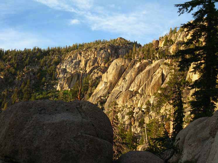
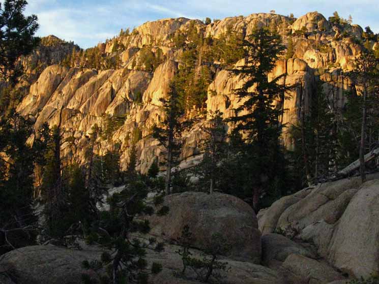
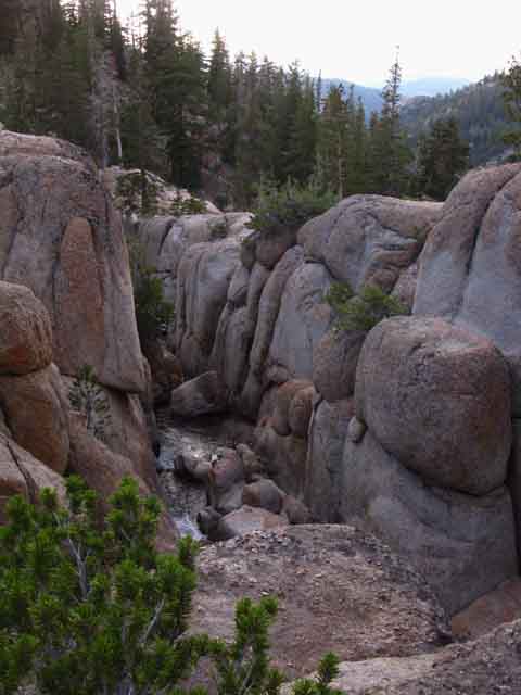
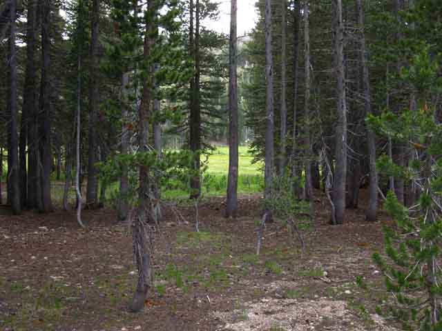
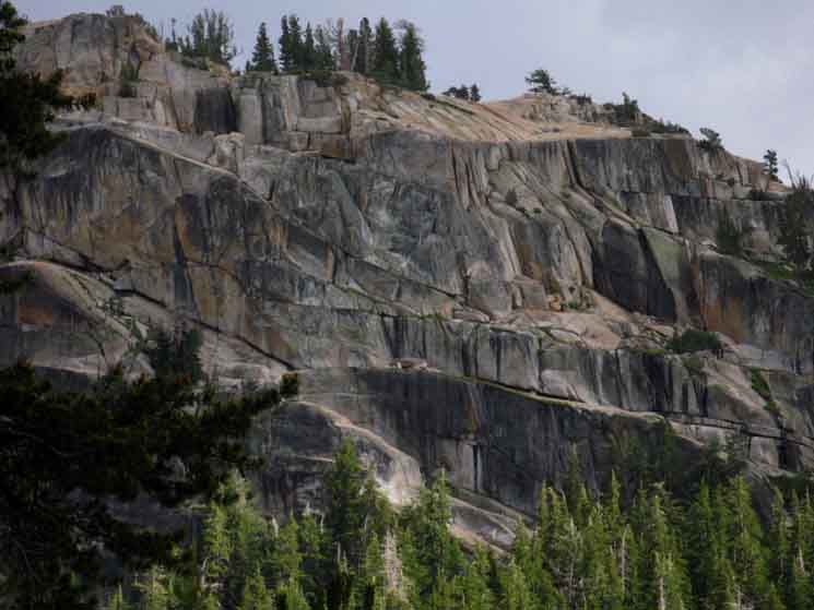
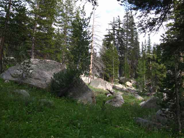
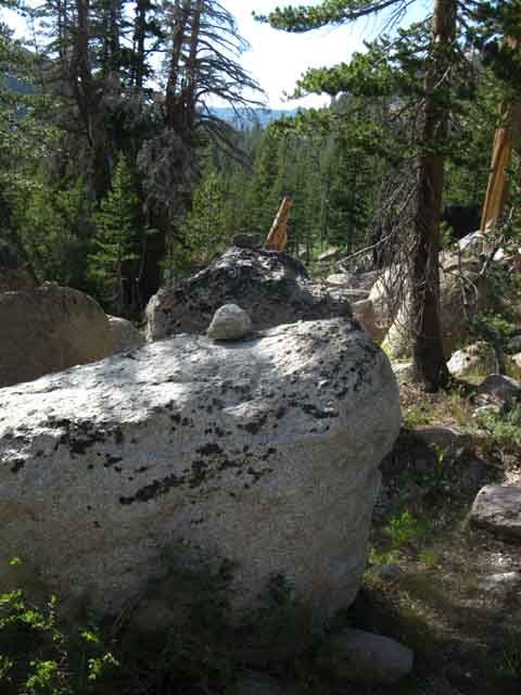
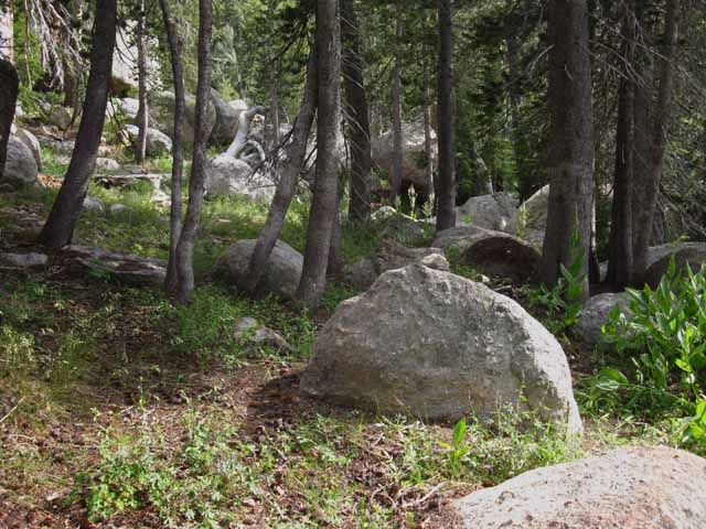
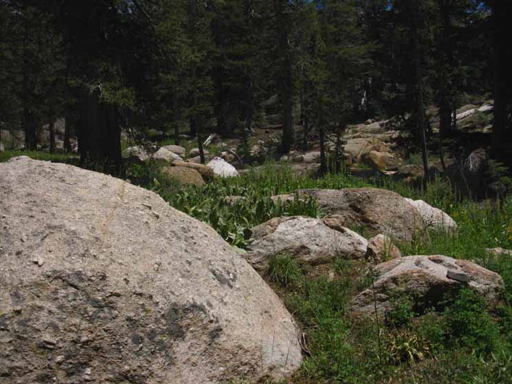
Cliff marking beginning of the sheer South Wall entering Upper Clarks Fork Headwaters Bowl.
The Trails
Guide
Maps
Miles/Ele
Permits
Resupply
Forum
Current Weather Conditions
Weather Notes
Northern High Sierras
Central High Sierras
Southern High Sierras
Gear
Gear List
Gettin Started
Layering
Discussion
Testing yourself and your gear
Gear Reviews
Backpacking
Clarks Fork Lower Ford
SOUTH
through
Clarks Fork Upper Ford
to the
Slot
Exiting the Upper Headwaters Bowl
Hiking
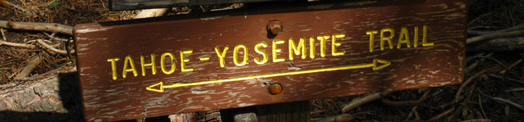
The Tahoe to Yosemite Trail
BACKPACKING SOUTH CARSON ICEBERG WILDERNESS
Backpacking from Lake Alpine to Saint Marys Pass Trailhead
Languages
Languages
Trail Arts
The art of walking
Physical Preperation
Trail Skills
The trail
Off the trail
Scrambling
Maps
Navigation
Camp skills
Food
Resupply
Food
Other
Photo Catagories
Trail Stories
Trail Culture
News and Science
Links
Groups
Books
Terms and Conditions of Use
| TRAIL GUIDE SECTION INDEX PCT-TYT Highway 4 to Highway 108 |
North TYT TRAIL GUIDE to Boulder CREEK |
South |
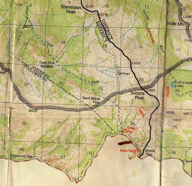
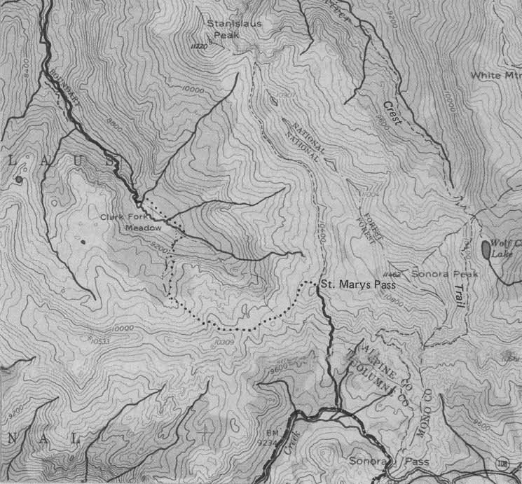
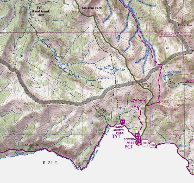
TYT DETAILED TOPO MAP Clarks Meadow & Clarks Fork Headwaters to SAINT MARYS PASS TH |
TYT-PCT REGION MAP Carson Iceberg Wilderness MAP |
TYT TOPO MAPS INDEX Lake Alpine to Saint Marys Pass |
Resupply NORTH SOUTH |
PERMITS |
All |
TYT-PCT |
TYT Lake Alpine to Saint Marys Pass MILES and ELEVATIONS |
|||||||
| East
to PCT TRAIL GUIDE via Boulder LAKE |
||||||||
Through
The Clarks Fork Headwaters Bowl
to the
Saint Marys Pass Trailhead
A Difficult Segment
|
||||||||||||||||||||||||||||||||||
The
This brings up the clear fact that backpacking is dangerous. This type of rough terrain carrying a variable-quality route can be even more dangerous if we are not fit, properly geared, and sufficiently experienced to deal with the range of conditions we could be hiking ourselves into. The route's difficulty increases as we continue hiking South of this lowest of our three fords over the Clarks Fork. The route fades considerably (into nothingness) and significantly steepens (into near climbing). Good Practices Required I like to have some kind of answer to the question, "What will you do, when you lose the trail?," before I lose the trail. I suggest recovering indications of the forward route, use trail, and wild ducks as soon as possible, long before giving up on the route and finding our own self-navigated route through. Some searching is in order. Here's the approach I generally employ following unmaintained and use trails across routes: "If we lose the trail through here, we must think! The first thing I do is carefully observe and explore my forward options. If none prove fruitful, I backtrack to my last know position. This is generally a duck or blaze along a know piece of the old trail-route, but it may not be. My other option is to plan on moving forward to reconnect with the use trail/wild ducks. This is only employed if I am pretty darn sure where the route lays, and that I can pick it back up. The Fundamentals of Success Thus it is our previous backpacking experience that gives us the very good observation, analysis, and decision making skills that will be our best assets hiking through this short and most difficult segment of trail. Three Segments to the End of this Section of Trail Segment 1 Segment 2 Segment 3 Our passage up through the slot in the Southern wall of cliffs surrounding the headwaters bowl of the Clarks Fork brings us to the top of the cliffs. We guide ourselves counter-clockwise around the top of the headwaters bowl to the Northeast to Saint Marys Pass. From Saint Marys Pass we we can observe the maintained trail to our East coming up from the Saint Marys Pass Trailhead, and decide which route we will hike down to Highway 108. I've further subdivided these trail segments in the trail guide following below to better identify and locate key landmarks along our unmaintained and untrailed route South from the Eureka Valley trail junction through the Upper Clarks Fork to where we again pick up maintained trail beyond Saint Marys Pass. Kennedy Meadows Rest and Resupply That's a rather large group of very interesting folks... KM is the #1 backpacker resupply spot in the Sierra Nevada, and its joys will be a well-earned reward for finishing this uber-difficult segment of trail through the upper reaches of the Clarks Fork and its Headwaters Bowl. Kennedy Meadows Pack Station is right along our TYT route South. The next and last section of our Tahoe to Yosemite Trail hikes through Kennedy Meadows Pack Station (map) as part of its route, as a matter of fact. Both of these facts, that we have excellent resources, and that they are located right along our TYT route, are both good news. We are going to need some rest after the challenges and difficulties of this segment of trail, and it's nice not to have to get off the line of our route to get that rest, eat some great food, and pick up our resupply for our final section of trail hiking down to Tuolumne Meadows. Context Check out the Sonora Pass Region Map for an even broader perspective on the relationship between the PCT and TYT both North and South of Highway 108, and our options for tying bits of each trail together into unique routes for our long distance trips or shorter local backpacking loops both North and South of Highway 108. We've really got a lot of backpacking route options across the Carson Iceberg and Emigrant Wilderness Areas. Remember, click the Black Dots on the 30 minute maps for more detailed maps, and the Red Dots on all the maps for the associated trail guide information.
Post up about your hikes in the Carson Iceberg Wilderness: Forum
Updates for this little bit of Complex and Difficult terrain are posted here, in a special forum in the Carson Iceberg Backpacking Forum: |
Vital
Information and Statistics
The
Lower Ford of the Clarks Fork of the Stanislaus River
is
30.00 miles SOUTH of Highway 4 hiking out of Lake Alpine following the Tahoe to Yosemite Trail across the vast majority of the
length of the Carson Iceberg Wilderness.
The
Lower Ford of the Clarks Fork of the Stanislaus River
is
4.57 miles NORTH of the Saint Marys Pass TYT Trailhead on Highway 108. There are not very many miles remaining to the end of this section of the TYT, but they are difficult miles across very difficult terrain!
Pages
North and South, Resources
On this Page:
Backpacker
Resources and Information
| TRAIL INDEX Resources on this page |
||||||||||||||||||
The
THREE PAGES
This is the
Overview
Hiking Options
Character
Supplemental Tropical Hail in July at Saint Marys Pass Snow in July at Saint Marys Pass Both Videos
FIRST PAGE Clarks Fork
Segment I
Segment II
Segment III |
Weather
All
|
THIS PAGE Clarks Fork Segment IV
Segment V Segment VI NEXT PAGE Clarks Fork
Segment VII
Segment VIII |
||||||||||||||||
> Forum < |
||||||||||||||||||
All backpackers can post text comments about this challenging segment of trail from the Boulder Lake trail junction through Saint Marys Pass via the comments links all over this guide page. Agree, disagree, modify, append, correct, or update the trail descriptions. These links are for your comments, questions, updates and hiking reports, for you to add your perspective and experiences on these trails. We're all different and experience things differently. Share your experiences. It informs others who are like you, and those who are different. Contrast is informative. There is the easy way through this segment of trail, and I have taken note of a couple of very difficult ways to get through here. Which you experience on depends on your ability to stay on the unmaintained trail, then stay on the use route and follow wild ducks. We will end up having a harder trip the less use trail we can stay on, until we vary from the route completely and forge one of the more difficult routes through. That would be the hardest way through possible. That generally involves losing the use trail, and following one of the two hard routes out the East or North ends of the Clarks Fork Headwaters Bowl, rather than the route of the TYT out the South side of the bowl. These are much more difficult routes than that of the TYT, but they are do-able by strong and skilled cross-country travelers. They may be necessary for less skilled backpackers who cannot stay on the optimal route of the Tahoe to Yosemite Trail. This can be a hard segment of trail, indeed! Variable Experience Zone This difficult segment along the TYT can be fairly easily by-passed by replacing it with the segment of the PCT South to Sonora Pass. Southbound hikers on either the TYT or PCT hiking through the South end of the Carson Iceberg Wilderness can easily switch over to the other trail by crossing over via the trail through Boulder Lake. Sonora Pass Trailhead bisects the Sierra Crest about three-quarters of a mile East of Saint Marys Pass Trailhead along Highway 108. Though the Southbound routes of the TYT and PCT hiking South to Highway 108 vary greatly, their final destinations on 108 are quite close to each other. Registered Members can post up stand alone posts about this section of the trail with their own custom images, embed google maps and Youtube videos in articles and updates posted up in the Trails Forum for this Lake Alpine to Saint Marys Pass section of the Trail Guide: Unmaintained TYT Trail Reports Instantly add your two-cents worth, and supplemental information through the comments links and read the supplemental information submitted by other backpackers through the forum links as well. Check out the |
||||||||||||||||||
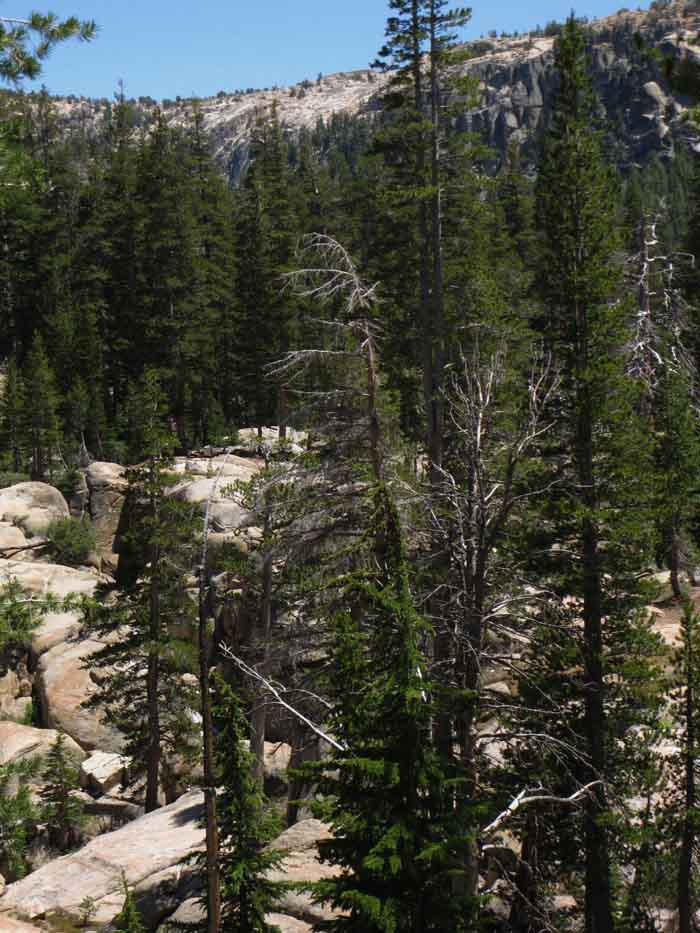
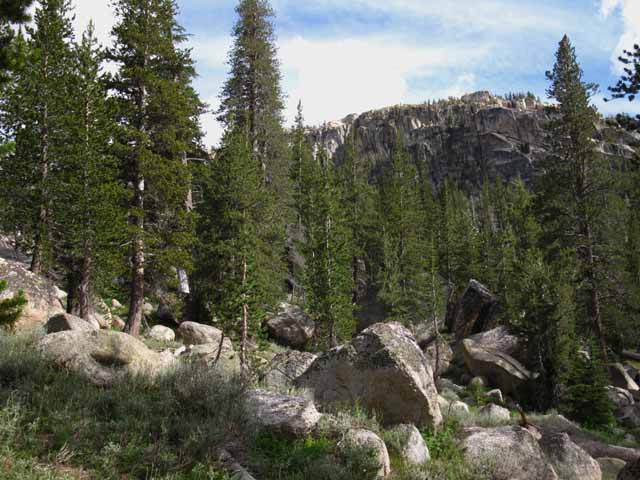
The Tahoe to Yosemite Trail through the Carson-Iceberg Wilderness.
Location and Situation Hiking South from the lowest ford of the TYT above Boulder Creek we are already hiking difficult terrain and entering very difficult backpacking terrain. We have three options from here, at this lowest ford along the unmaintained trail. We can continue South through the increasingly difficult terrain, first up to the North Edge of Clarks Meadow where our second ford along the unmaintained route to Saint Marys Pass Trailhead. We can backtrack to Boulder Creek and hike up to the PCT to bypass this segment by hiking around it to Sonora Pass. We can backtrack all the way North to road access at the Clarks Fork Trailhead.
The above are our Trail Options from the Lowest Ford of the Clarks Fork. Below are the trail guide pages exploring each option.
|
We Have Many route Options
from
Clarks Fork Lower Ford
Three, to be more specific...
|
Southbound Across the Lowest Ford
|
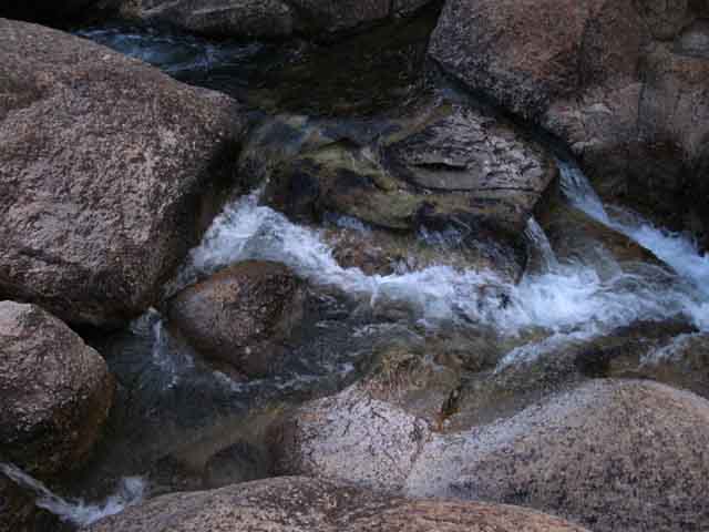
Our arrival at the lowest ford of the Clarks Fork of the Stanislaus River is marked by easy to see ducks on the North and South banks of the now creek-sized river. Note that the power of the Spring thaw may remove existing ducks. |
 |
||||
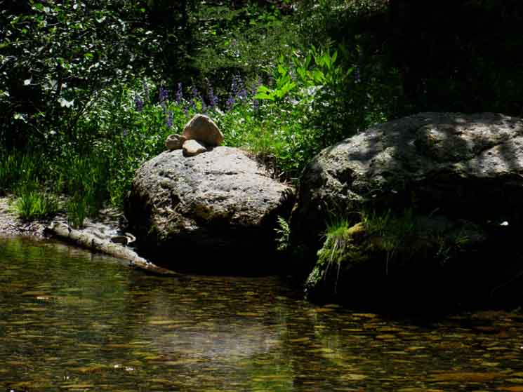
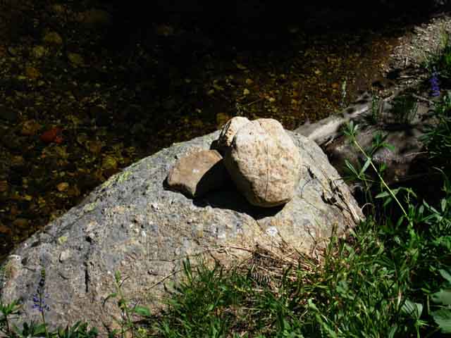
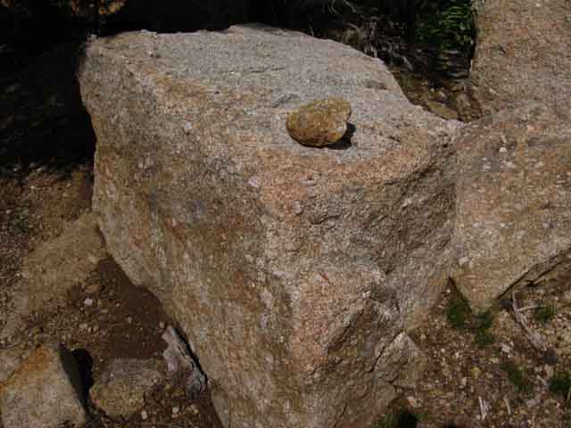
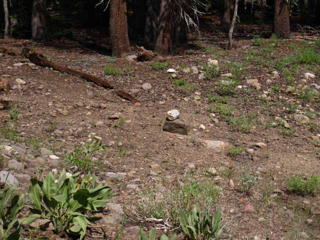
2012 Duck on the South shore of the lowest ford of the three fords across the unmaintained segment of the TYT through the upper Clarks Fork. 2012 above, 2015 below. Add your current or historical observations and experiences into the
 What have you seen here? The main rock will remain until a major Spring Thaw Event.
|
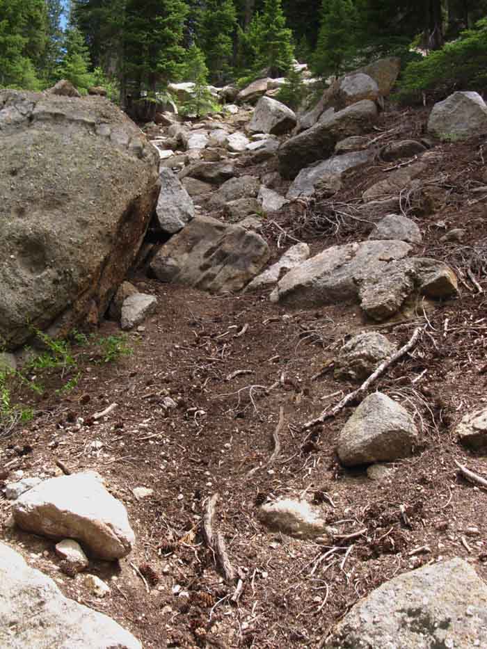
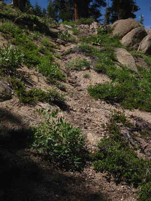
Segment Lowest Ford to the Middle Ford Images and Guide Video Video duration Additional video Video duration route distance 8370 to 8800 feet South of the Lower Ford We've been following varying degrees of degraded unmaintained trail up from the Eureka Valley trail junction, and it deteriorates above, whatever we call it. All the maps, the USGS and Dept Ag Wilderness Maps, both show trail leading from the lower ford to the middle ford. They are incorrect. The density of meadow and the rapidly growing forest above the ford have gobbled up the trail there, and the steepness of the climb above the meadow and nub of forest up to the middle ford has certainly degraded that segment of the trail into route status. We do find elements of "Use Trail" and good "Wild Ducks" hiking beyond the short flat above the lower ford that's rapidly filling up with a dense young fir forest. This use trail leads us into the beginning of our steep, short Hard 1 difficulty climb up to the North edge of Clarks Meadow, where we find the middle ford.
Unmaintained TYT Trail Reports
|
| Clarks Fork Meadow to the Lower Ford of the Clarks Fork River. |
This is a fun segment of trail if you like physical puzzles. 13:21 |
 |
||
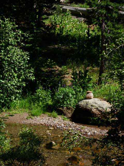
Duck on the South shore of the lowest ford. South of here the trail melts into little more than a route through the terrain. North of here the trail expands, its various pieces connecting up with increasing regularity, and we can begin to dream of soon seeing maintained trails.
|
VIDEO
The Next few Hundred Yards South
of the
Lowest Ford
| film 2015 Trail Update HIKING NORTH through the Forest Thicket South of the Lower Ford to the Lowest Ford of the Clarks Fork of the Stanislaus River |
Southbound Hikers The critical element in this next segment up the steep climb we will be attempting to stay on, or at least stay roughly lined up with the existing bits of use trail along the route while keeping the existing wild ducks in sight, if there are any there. A Northbound Film Fun Stuff! |
 |
Narrow seam of our route through the forest South of the lowest ford. Depend on these seams to close up over the next years, if it ever rains, and then open up as the trees grow. (2015) We saw this same "bushy to open" evolution along parts of the unmaintained Tahoe to Yosemite Trail up North through the Mokelumne Wilderness. We saw rapid young tree growth in the Enchanted Forest and other areas swept of trees and crushed by the massive flood of 1998. After a few years of wild, bushy young tree growth a much smaller number of larger and bushier trees succeeded in reestablishing both a canopy, and a maturing forest floor environment across most of the chaos that swept across the Enchanted Forest in the aftermath of that smashingly powerful flood. The interconnected powers of destruction, recovery, and construction powerfully running through Nature are amazing and profound. These destructive evens should focus our attention on balancing our society safely within the extremes of nature, rather than provoking the extremes of nature through our pursuit of power. |
|
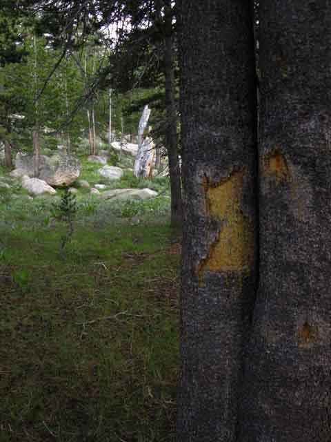
A few hundred yards South of the lower ford, after hiking through a dense thicket of thick forest we encounter a dried out trench, a huge sandy wash left by a persistent Spring-flowing flooding tributary surrounded by blazed trees. It is a great sandy wash where the Tahoe to Yosemite Tail crosses it.
I note this location as the last blaze (or blazes) Southbound hikers will encounter along this section of trail, or the first that Northbound hikers will encounter. It's not. I found another blaze at what appears to be an old line of the stock fence up near the top of our upcoming steep climb, likely no longer used. Maybe it is. Cowboy Steve and his dad and bros still run stock out here. I had an interesting stock encounter in July of 2015: Just a bit South of this point pictured below the trail begins approaching the bottom of the very stiff climb up a jumbled mountainside leading up to the North edge of Clarks Fork Meadow. Difficulty increases dramatically South of this position. This will be the last segment of today's hiking. North of here the unmaintained trail widens, deepens, becomes more apparent, and we experience decreasing obstacles. South of here the unmaintained trail disappears into route. The Future Therefore what we find out here marking the route may/will change from year to year. Changeable conditions show the utility of having a trail guide designed for updates. Backpackers can post up informal comments or write up detailed trail reports to update us on conditions and their experiences on specific pieces of terrain. Unmaintained TYT Trail Reports
Our Southbound route passes to the Left of the blazed tree beyond the sandy wash. |
 |
||
Is this our First blaze below Clarks Meadow?
View South at Tree and Blaze across the dry wash |
 |
Yes! Detail of our first-or last blaze, depending on our direction. "First," blaze below Clarks Meadow, at least the one the vast majority of hikers through here will likely see. The Northbound trail gets considerably easier, taking on more characteristics of an unmaintained trail, while the trail South of here deteriorates into a route. After crossing the lower ford Southbound, passing through the dense maze of fir forest, and crossing the sandy wash we follow a faint trail upstream along the Clarks Fork before we turn uphill to climb the steep wall of the South flank up to Clarks Meadow. |
Faint Use Trail and Wild Ducks
 |
A short length of faint old trail, what I call "use trail" leading us South, helped along by the dark red "wild duck" we can see sitting in the glare on the low granite boulder ahead. We are trying to keep these bits of use trail lined up with the random wild ducks we find as we carefully find our way across the varying lengths of wild terrain separating them. Keen observation is required to stay on the line of our route. |
The Incredible Disappearing Trail
Typical Loss of Trail across a Segment of Meadow
 |
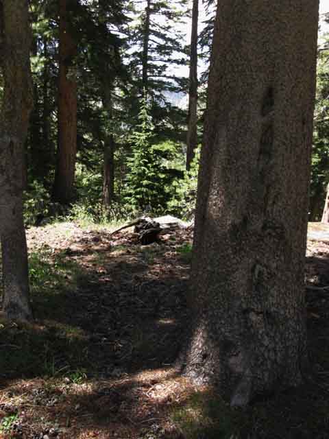
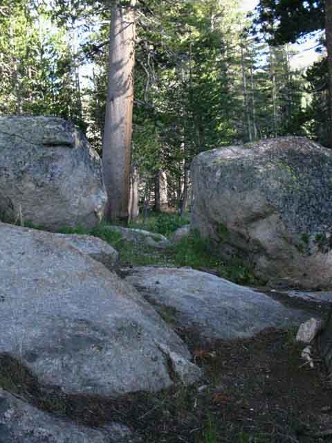
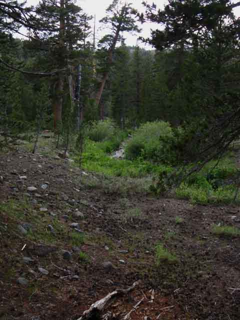
This terribly nondescript typical small High Sierra Meadow wedged between forest and rock may seem unremarkable, but it is quite typical of a common situation we constantly encounter following unmaintained trails and self-selected routes. At our feet above we can plainly see where our trail enters a small meadow and instantly disappears into "route" status. Er, that's "no trail," with the hope of finding the trail's exit point on the far side of the meadow. All sign of trail disappears. This is a consistent condition crossing every meadow large and small. In the case of the meadow above a hiker was kind enough to place a duck square in the middle of the meadow, which leads us to into the dark passage we can make out in the wall of forest beyond the meadow. The duck is a bit hard to see, as it is hidden on the far edge at the center of the thin shadow cast across the meadow above. See it there? That's a classic "Wild Duck." One common characteristic of unmaintained trails is how quickly they disappear across seasonally unstable areas of terrain that absolutely absorbs trails, such as meadows. Many forest floor environments also eat up trail. One powerful Spring Thaw event will soften up and move meadow soils enough to obliterate trail. If that is not enough, then the subsequent power of the Spring Bloom fueled by the water and heat of the thaw quickly overgrows trail across meadows into nothing more than a fond memory. It is common for us to stop at the entrance to each of our meadow crossings to carefully observe the terrain on the other side of the meadow to anticipate just where we think it most likely that our route resumes on the far side of the meadow. Sometimes we are surprised, and have to do a little searching to pick up the route. Other times we have wild ducks and old blazes to clue us in. Most times the lay of the land informs us of the best and most likely location where our route continues. Other times it is an educated guessing game. |
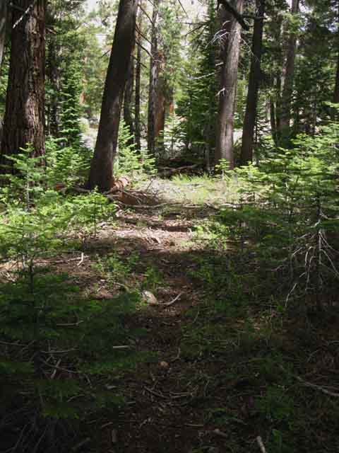 |
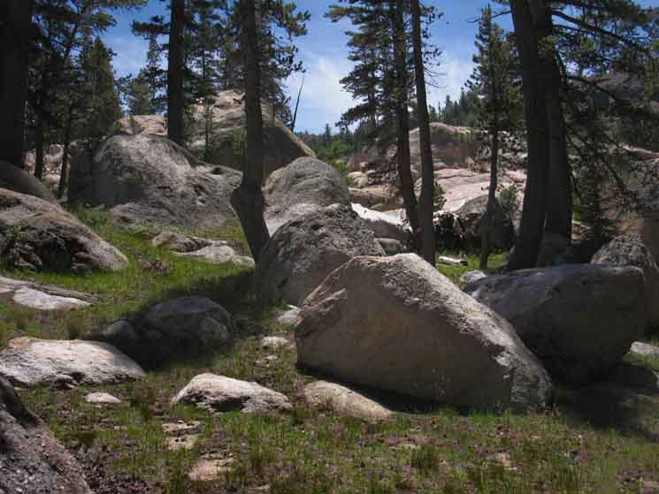
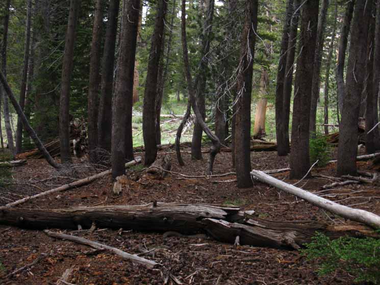
Above we find typical faint indications of our route through forest above the lower ford of the Clarks Fork of the Stanislaus River. We can still make out bits of old trail bed fading in and out of visibility at our feet. The current low level of use and lack of maintenance work to degrade the route's condition. Few feet are kicking sticks off the trail or keeping the grasses at bay. The trail has pretty much disappeared, replaced by a use route who's quality and degree of of access is a direct reflection of its level of use, or the lack of use it gets. This route only stays as clear, visible, and open as its current and recent level of use supports. That is not wide open, as it appears that the majority of traffic on this route is animal, and though the animals make good use of the trails (hell, they originated most of the routes that we use as trails today), they mostly use them in bits and pieces as a means to achieve their local feeding and breeding goals, not keep our long trails clear. The animals are not concerned with our trail's status as part of a grand network of interconnected through-trails spanning the length and width of the High Sierra Crest. The majority of the use on our route through here is certainly by animals, with human use trailing far behind that of the local four-legged residents. |
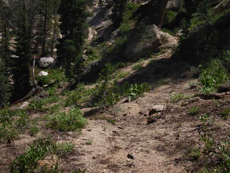
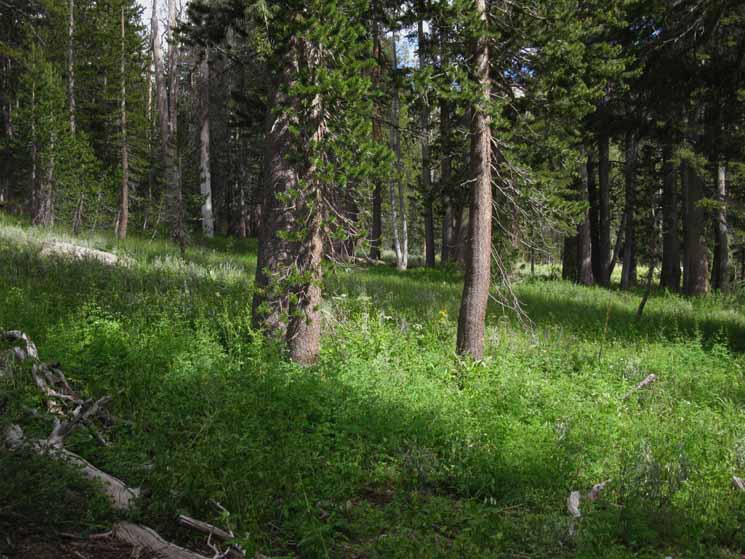
Key Points of Decision How successful we are at this will be the final factor determining just how hard this segment of trail will finally be. This segment will be easier the more we stay on-route, and harder the more we wander off-route. We are now hiking South approaching one of these key points of decision, being where we start climbing up the side of the canyon beyond the forested flat above the lower ford. Our intermediate difficulty hike upstream along the Clarks Fork in the relatively flat predominantly fir-forested riverside terrain where we can see that our route is becoming rockier as it reaches the end of the forest along the river to turn South away from the river to begin climbing. Our unmaintained trail turns South away from the river to begin moving itself under its upcoming climb up the short but steep set of difficult switchbacks up the South canyon wall, up to where we are high enough on the canyon wall we can finally make an easy traverse above the rough fall of the Clarks Fork surging down its wild canyon below, so we can gain access into the North edge of Clarks Fork Meadow. Hiking South from the North edge of Clarks Meadow presents us with our next key decision point, but first we've got to get there. |
|
These two ducks pictured below sit along a seam of granite decorating the bottom of our steep climb up to the edge of Clarks Fork Meadow from the relatively flat terrain we've been hiking up along the river above the lower ford. Note how the ducks were placed on two boulders that the trail route threads through. Thus the term "gateway" ducks... I like that. A fitting marker for the difficulty of the upcoming route South. Though I made the gateway ducks marking the East Carson River Trail along the Pacific Crest Trail I did not construct this gateway, but I totally approve! It is really hard for even the dullest hiker to miss gateway ducks... We can see ample signs the trail, and the drainage down the mountain that it is becoming are our way up, even if the gateway ducks are missing. The use trail is subtly apparent turning up the mountain. From this point South staying on the route becomes somewhat dependant upon our route-finding skills. The bottom part of our Southbound climb up the canyon wall from these gateway ducks is a bit diffuse. This is a product of being at the bottom of the hill during the Spring Thaw and runoff. That's a sloppy and challenging location for unmaintained trail. But don't worry, as there are ample bits of use trail and wild ducks to find, at least from 2012 to 2015. If we have skills of observation, analysis, and good decision-making we will maintain the old route and occasionally encounter the relief of hiking on trail bed. We are on the wrong route if we are not finding bits of trail and the occasional wild duck leading us up the hill every now and again, and confirming our location along the route. So, as of 2015 there is a fairly decent use trail and ample wild ducks to be found switch backing up the South wall of the canyon beyond the Gateway Ducks, once we route-find our way through the confusing terrain at the bottom of the climb above the Gateway Ducks. This status will change year on year, depending on weather and use. Make sure you post your updates in the forum about this If we do not have route finding skills we will wander off the proper route which will make us work considerably harder and lengthen the time and effort it takes to make our way up to the North edge of Clarks Fork Meadow.
|
 |
||||
Ducks at the base of the steep climb up to Clarks Fork Meadow in 2012. Here the steep climb South up to Clarks Fork Meadow begins in earnest.
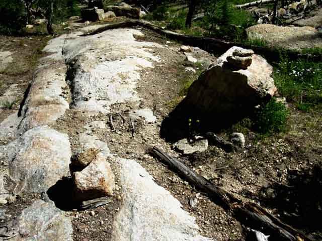
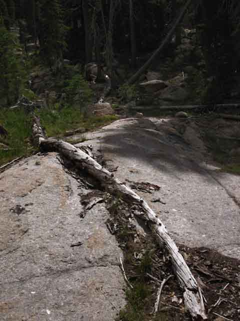
Unmaintained TYT Trail Reports I consider this point where the granite slab and Gateway Rocks are located to be the transition between the relatively moderate riverside climbing we've been doing up to here and the steep little bit of canyon wall climbing we are about to be doing. Granite Slab, 2015 A remnant of the Gateway Ducks
|
Space Ducks-Rough Terrain-Shards of unmaintained trail route 2012 I took the image below after locating this duck as I pondered my next move. Then I put the frkn camera away and made it. UPDATE |
CLIMBING
to
CLARKS MEADOW
 |
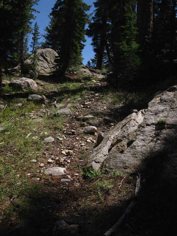
We find ourselves pushing South by Southeast up what is either a current drainage path or the old line of trail. Likely both, now unified. At the bottom of the climb we can see trail and drainage have become one. This offers confusion as we climb, the problem being us splitting off the main route onto a finger of the drainage. The drought of the last four years (as of 2015) has allowed a more observable route to build up and deepen. That's because the lack of Winter Storms and fierce Spring Thaws sweeping away the route each year has allowed it to build up to a limited extent. There have been increasing tropical downpours in 2015 with great potential to do local damage. My point here is that trail conditions are deeply tied to weather trends and conditions, and the last years have allowed unmaintained trails and routes to "recover" up and down the Sierra Crest and its flanks. The next fierce Winter and strong Spring Thaw will seriously rearrange and degrade unmaintained trails and routes. HIGH SIERRA WEATHER REPORTS & FORECASTS ALL DESCRIPTIONS HERE ARE SUBJECT TO CHANGE This next short segment runs us up the steepening base of the canyon wall. |
 |
| We can follow a diffuse line of unreliable ducks where elements of use trail disappear. |
 |
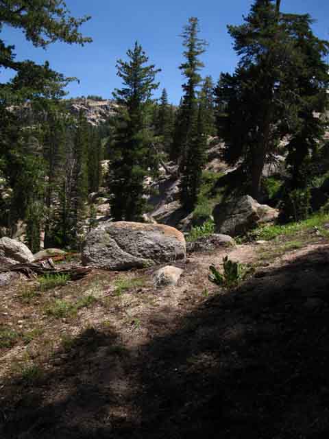
Some wider views of the chaotic surrounding terrain in the narrowing canyon around us opens up as our route steepens its ascent. |
 |
We must pick our way carefully through the terrain obstructions while remaining aware of our position in the overall context of the terrain. I am always projecting where I think the route is going in the terrain, then comparing my observations of the bits of use trail and wild ducks I can see with the lay of the land to suss out where the route actually goes. We have to become self-correcting navigation devices on diffuse routes. No batteries required. |
The Climbing Begins in Earnest
To the Fence line
 |
This was once a trail. |
 |
We pick our way through the boulder-swept route. |
 |
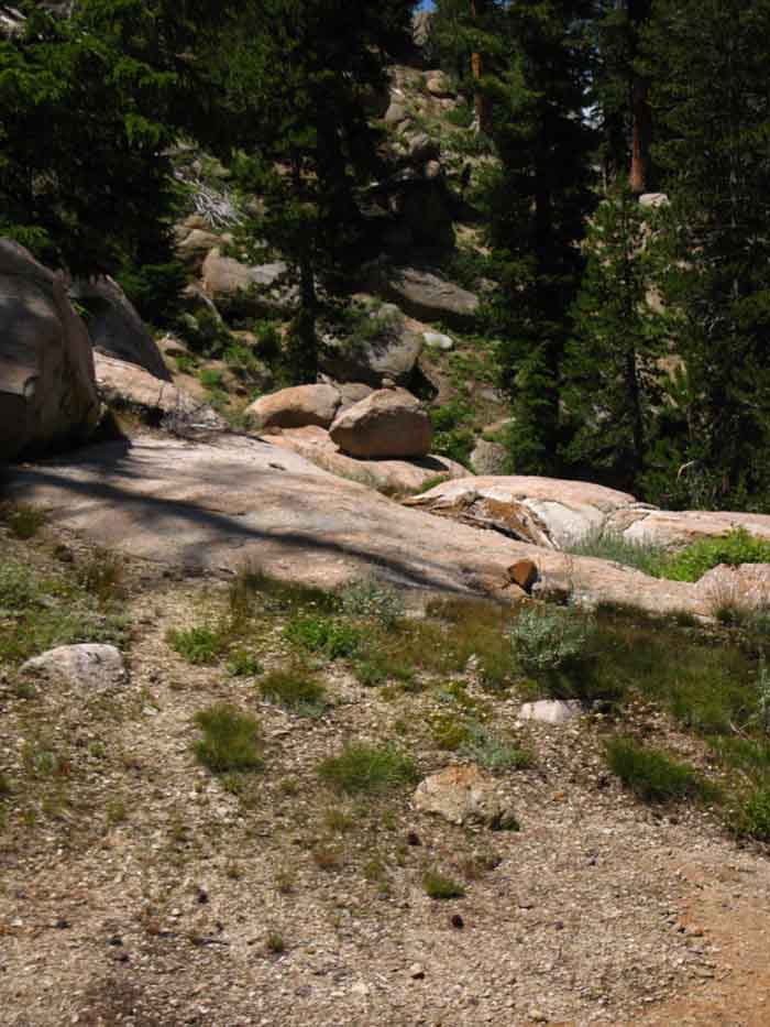
Approaching the ridgeline guarding the North entrance to Clarks Meadow. We see how the canyon funnels-in above the lowest ford, climbing steeply and narrowing up to where our climb moderates crossing the ridgeline above. Past that ridgline we mostly traverse over to the entrance to the North edge of Clarks Fork Meadow. |
Another Last Blaze
 |
Stock fence just below the top of the Northern flank of the ridgeline between lower and middle fords of the Clarks Fork. |
Top Stock Fence
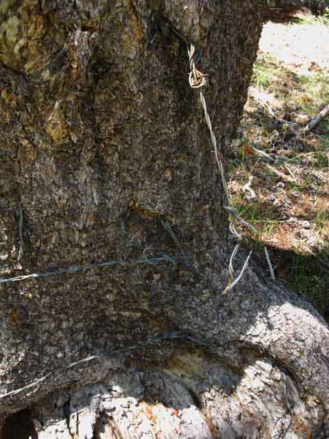 |
Barbed wire at the top end of the grazing in the Clarks Fork of the Stanislaus River. |
Up to the Ridge Arm
 |
||
Final climb to top of ridgeline above Clarks Meadow. Just look at that fine quality use trail! We certainly are on the line of the old Tahoe to Yosemite Trail route through here.
|
Over the Ridge Arm
 |
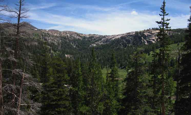
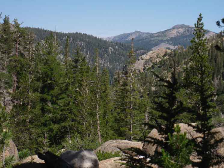
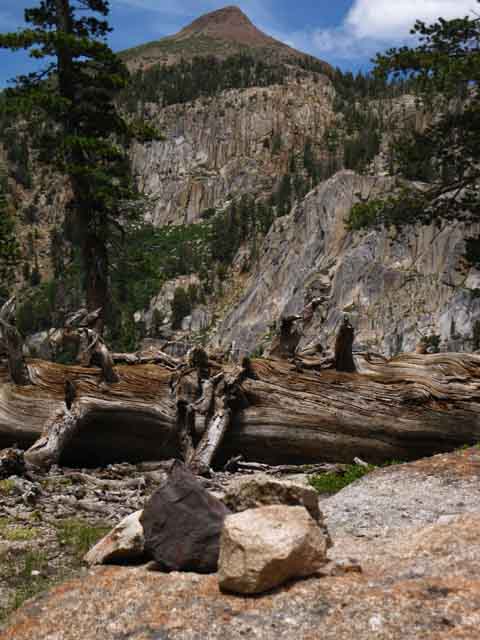
Canyon below North edge of Clarks Meadow. That is the Sierra Crestline in the distance, just a bit North of Stanislaus Peak. Southern Carson Iceberg Wilderness |
Below the North Edge of Clarks Fork Meadow
 |
Granite and Forest along the Clarks Fork of the Stanislaus River just under North edge of Clarks Meadow and below the very uppermost Western Flank of the Sierra Crestline, Stanislaus National Forest. We have the Sierra Cresline dividing our Western Drainage through the Clarks Fork from the Eastern Drainage of the East Carson River on the other side of the crestline. |
 |
||
Crossing the Ridgearm Looking back, North, at the high point of the Tahoe to Yosemite Trail where we just crossed over the ridgearm as we are approaching Clarks Fork Meadow in the Southern end of the Carson Iceberg Wilderness.
|
TRAVERSE
 |
As Southbound hikers descend, and begin the traverse over to the middle ford from crossing the ridge arm, we come upon a subtle trail split. Southbound hikers cut down the trail in the little gully to the Left. |
VIEW NORTH
 |
||
Line of the Route Above we are looking at our route North from the Clarks Fork Meadow. Northbound hikers will begin the steep descent to the lower ford after traversing up to and over the ridgeline in the distance. The middle ford on the North edge of Clarks Fork Meadow is less than a couple hundred yards to our South, behind us.
|
Rock Channel below Clarks Fork Meadow
 |
||
Clarks Fork of the Stanislaus flowing through a rock channel below the North edge of Clarks Fork Meadow. The scene below stretches out into a rocky jumble all the way down to just above the lower ford, explaining why we climbed up the flank of the canyon to get around it. All the terrain visible on the far side of the rock channel is easily accessible from our upcoming campsite on the North edge of Clarks Fork Meadow. Now we turn Right to continue up to the middle ford.
|
Last Steps to Middle Ford
 |
Last wild ducks leading to the middle ford and North edge of Clarks Fork. |
 |
||
Final seam in the terrain up to middle ford of the Clarks Fork on the North end of Clarks Meadow. See the duck up on the great boulder? We are hiking up the seam along the Right edge of the picture.
|
Looking Back
View North from the Seam
 |
Looking North through the last seam in the rocky terrain leading us South to the middle ford of the Clarks Fork. |
Wild Duck to the North
Indicating line of Route to the North
 |
||
Look! A duck! Let's go that way! Well, if we are hiking North... Duck below Clarks Meadow. Dropping through the seam we see the beginning of wild ducks and use trail leading us up and over the ridgearm to the North.
|
Segment North Edge Images and Guide
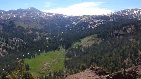
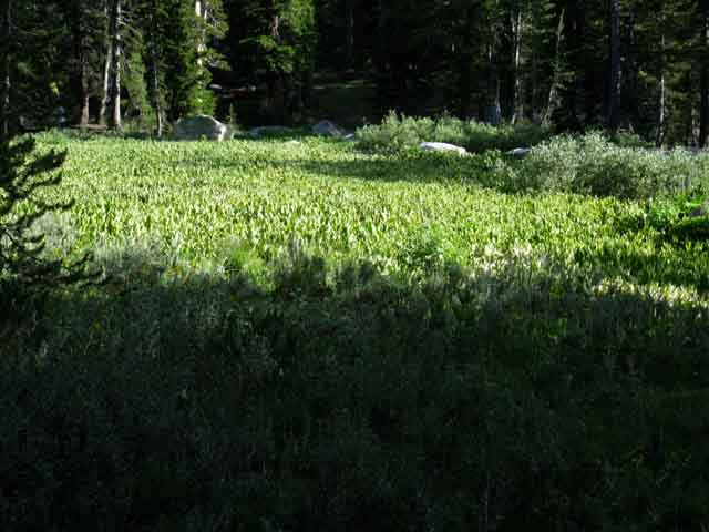
Route Distance It's quite a scene. Especially when lit by fiery sunsets, and sitting under ancient starlight on a jet black night. Though this next segment of trail South to the upper ford is short at .42 of a mile (mileage page), it will be necessary to have some excellent route-finding skills and/or good information to keep our hike between the middle and upper fords on the optimal line of the route and at this optimally short distance. Our next segment of route hiking from the middle to the upper ford finds its way around the three distinct levels of Clarks Fork Meadow. The Mystery Segment Despite our fording over to the North shore at the middle ford there are no wild ducks, use trail, nor blazes leading South from the middle ford on the North Edge of Clarks Fork Meadow to the upper end of the middle meadow. Either we know or can figure out where the optimal route is located to bring us to the irregular resumption of wild ducks on the South end of the middle meadow, or we can't. As I mentioned above, the North edge of Clarks Fork Meadow has two sets of premium campsites. The Northernmost is situated on the very Northern end of the Clarks Fork Meadow on the South Bank just across the ford, and the second set of campsites is about a hundred yards South and a few dozen feet higher in elevation on the very Northern end of what I call the "middle" meadow. Though the overall physical difficulty of the terrain diminishes hiking South through the middle ford towards the upper ford, an increase in route-finding difficulty due to the absence of any route markings makes up for the physical moderation. Clarks Fork Meadow The next segment of our route South stretches from the middle ford of the Clarks Fork at the North end of Clarks Fork Meadow to the final, uppermost ford just above where the last bit of Upper Clarks Fork Meadow disappears in the upper section of the Headwaters Bowl. Below we have the full extent of the middle meadow laid out before us, with the upper headwaters bowl of the Clarks Fork of the Stanislaus River as its backdrop. The campsites on the far North edge of the Clarks Meadow (the "lower" meadow) are just out of view in the lower-Left corner of the image. At the far upper end of the middle meadow, which is the meadow we see laid out below, we find a Wild Duck on a rock pointing the way to a short climb through through a boulder-strewn ascent up to the next successive level of Clarks Meadow, which I designate as the upper meadow. After breaking away from the middle meadow and ascending through the boulder field we will see bits of the upper meadow off to our South, our Right, and again hike South along the North edge of the short stretch of the "upper" meadow guided by few indications of the route other than natural landmarks. We can almost see the "upper" meadow peeking out from its encircling forest, located to the Right of the seventh yellow dot counting down from the top-Right of the picture below. The first uppermost dot is hard to see up there in the glare along the rim of the headwaters bowl, but dot #1 is up there. As we come around the top of the uppermost meadow our good observations and proper route selection should move us towards the Clarks Fork and its uppermost ford. This route described above and below keeps us on line with the existing bits of Use Trail and the irregular series of Wild Ducks leading us up to the upper ford, and finally out of the headwaters bowl as pictured below. The Tahoe to Yosemite Trail Through the Clarks Fork Headwaters Bowl
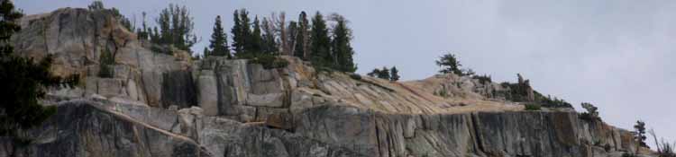
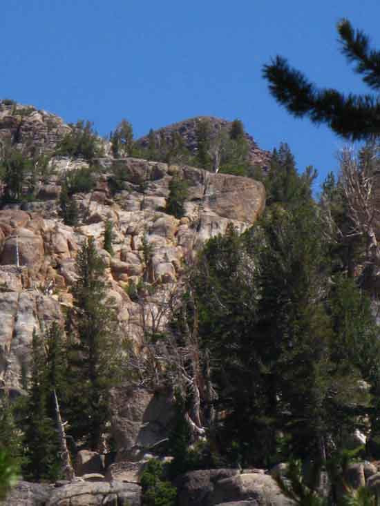
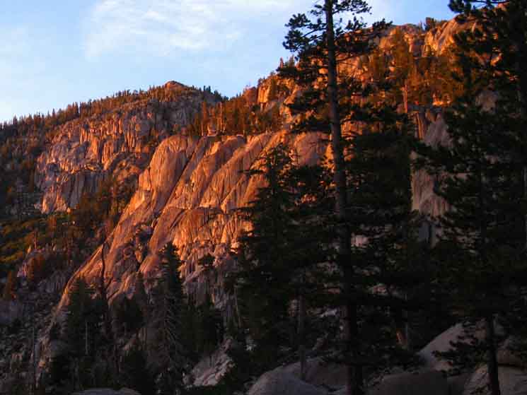
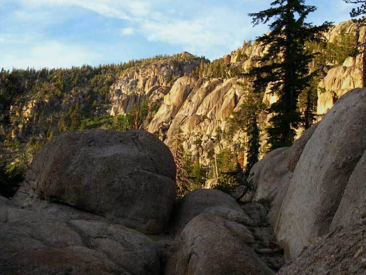
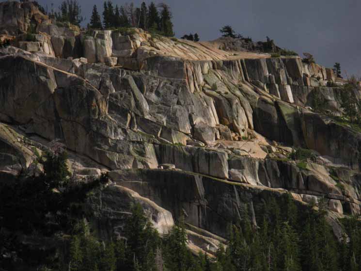
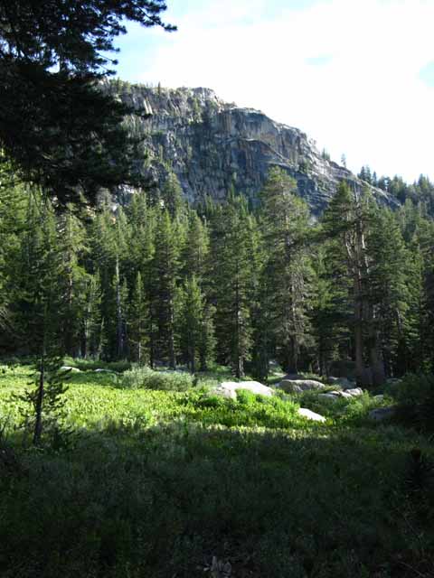
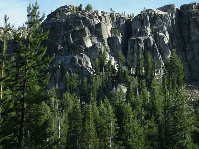
Note the dome, being the great granite citadel rising through the forest along our route in the upper-center Right of the floor of the headwaters bowl, in both images above and below. That my friends, is a critical landmark who's top sticking through the forest locates our exit slot through the South Cliffs of the Headwaters bowl.
Let's take a closer look at the rock dome's position in relation to the Southern Cliffs. Now let's take a look at that citadel rock on the floor of the headwaters bowl as we climb through the slot in the South Cliffs exiting the headwaters bowl: Viola, that's how we locate our exit point from the Clarks Fork Headwaters Bowl. Well, at least along the line of the Tahoe to Yosemite Trail. Other Ways Out I don't suggest or recommend them. I have only hiked one of them many years ago, but I
Tell Us What You Know Experience through here is rare and valuable. All I recommend we make ourselves familiar with the route as described on the this guide, carefully review the experiences backpackers have shared the forum about the standard route of the Tahoe to Yosemite Trail and other, alternative routes that can be found.
|
|||||||||||||||||||||||
|
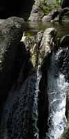
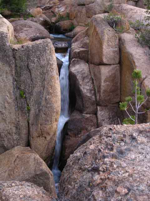
From the middle ford on the Northernmost edge of Clarks Fork Meadow hiking South to our climb out of the headwaters bowl we will be in the section of the USGS map designated as "Clarks Fork Meadow," though we will be hiking through dark forest as well as alongside bright meadow. I say "alongside bright meadow" as we are going to do our best to put as much distance between our route and the mosquito-filled green meadow as possible. We will watch and enjoy it from a distance, rather than engage it. The route South described below is situated on the North side of the meadow as close to the surrounding canyon wall as practical, to provide the greatest distance as possible from the mosquitoes nurtured by the moisture in the quagmire conditions these meadows cultivate. This high-North route also serves to keep us on the line of the use trail and wild ducks, such as they are, until we begin seeing them again on the South end of the middle meadow. Elements of Clarks Fork Meadows Lower Clarks Meadow: The "Middle" Clarks Fork Meadow From the middle ford we can make our way up to the North end of the middle meadow by hiking a couple of hundred yards South, and climbing up to the two upper campsites situated in the forest fringe off the North edge of the middle section of meadow. From there we hike above the North perimeter of the middle meadow upstream to its end. This is crucial for putting ourselves in position to find the upper ford. This middle section of meadow is large. It will take us a little while to hike through the trail-less and trackless forest floor across its Northern edge. We will cross three creeks before arriving at the top end of the middle meadow, where the meadow turns away from us and we begin climbing a nifty boulder field. South to the Upper Meadow It's only about a half-mile South of the middle ford on North nose of Clarks Fork Meadow to our uppermost and final ford of the Clarks Fork. Well, it's likely more, depending on the course of our specific self-selected route. END of MEADOW: At the waterfall we again find a series of ducks leading us first up to the top of the granite block composing the unusual surface this waterfall flows over, then up and around the South side of this unique rock feature to continue hiking upstream above the South bank of the Clarks Fork until we come to a substantial tributary running from our Right to Left, out of the cliffs and into the Clarks Fork. That tributary is our ticket out of here. Good wild ducks turn us 90 degrees to our Right, South, leading us up along the West bank of this tributary to a great lone wild duck at the bottom of a great slot in the cliffs on the South wall of the Clarks Fork Headwaters Bowl. This slot in the cliff face takes us on a wild ride off the floor of the headwaters bowl up to the top of this horseshoe-shaped ring of granite cliffs. The bottom segment of the slot is pretty freeking steep, but it moderates after climbing over the "sand berm." CONCLUSION OKAY, Here's the Plan: There's an old wild duck at the base of the route up the slot in the cliff, but we can't depend on it being there. The tilted stripped granite block overhanging the lower end of the slot is the sure landmark.
|
VIDEO
Headwaters Bowl to Clarks Fork Meadow
Hiking down from the rim of the Headwaters Bowl to the Clarks Fork, finding the upper ford and making my way down to the fine campsite overlooking the descending canyon of the Clarks Fork from the North edge of the Clarks Fork Meadow. 14 minutes and 32 seconds of cross country hiking in the Carson Iceberg Wilderness. |
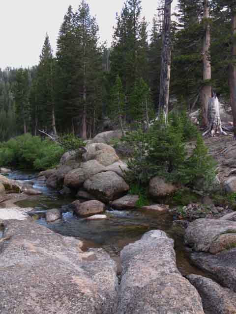
Scenes We cannot mistake our arriving or departing the North edge of the Clarks Fork Meadow. Here the trail transitions radically through this narrow pinching of the neck of the canyon that marks the Northwestern limit of Clarks Fork Meadow. Climbing Southbound up out of our struggle up the short section of steep rocky mountainside below the meadow presents us with an inviting scene: a beautiful nub of green meadow flat sits behind a beautiful rock channel containing a mini-waterfall flowing into a beautiful mini-pool which flows through a mini-granite "pocket" gorge, all surrounded by inviting shady forests of lodgepole pine. A fine ancient campsite sits under the edge of the forest to our Left, across the ford. I'll bet the Natives kicked it here for a thousand years of Summers, then the Westerners afterward, and now us. The scene in the mini-gorge at our feet is reminiscent of the granite formations at Carson Falls along the East Carson River, but in a miniaturized form. It is kind of like a scale-model, except that it is real. The Middle Ford This North edge of the Clarks Fork Meadow also locates the middle ford of our journey up the Clarks Fork. A few steps above the mini-fall a series of granite rock stepping-stones makes this an easy ford during low water flows. Though the lower ford's location does not set off mental alarms, this middle ford does. The lower ford is in a location that would allow the river to widen rather than deepen during high water flows while this middle ford sparks my unease: This middle ford would be downright dangerous during high water flows. Its narrow granite channel would deepen dangerously and focus this deeper flow into a powerful current that could easily sweep backpackers over the mini-waterfall below, which would be generating terrifying power during high water flows of the Spring Thaw. Not a pretty picture. This middle ford at the North end of the Clarks Fork Meadow should be a serious consideration and concern for hikers planning a trip through here during times of potential high water flows. Possibly hikers could ford further to the South where the river's flow could potentially spread out across the meadow sufficiently to lessen fording dangers. Maybe not. Remember, of all the things that can kill you in the Sierra Nevada fording and lightening are the most successful at dealing death to backpackers. Don't make stupid decisions. Always carry sufficient food and preserve sufficient energy to turn around and/or reroute when facing obstacles potentially threatening death. Overall Impression We veer Left of the North edge of the meadow to find the route down the mountain if we are hiking North. To the South behind the granite-inset waterfall we see the inviting green of the almost-flatness of Clarks Fork Meadow bending away to our right, Southwest, before bending Left with the turn in the river to the upper meadow. From the North edge of Clarks Fork Meadow our route South is mostly made difficult by the route-finding challenge as much as the physical difficulty. We will find segments of this shrinking meadow running Southeast like pearls along the string-line of the narrowing Clarks Fork River. The Clarks Fork Meadow has already been segmented by forest intrusions, squeezed down into a series of smallish bright green shelves of glowing meadow separated and surrounded by the slopes of the boulder field and the deepening shadows of the encroaching lodgepole forest. Our best route South pushes up into the forest around the North edge of this series of meadows. being the nose, and the middle and upper meadows. It appears that the Clarks Fork Meadow was larger in the past, before expanding tendrils of forest broke it into smaller segments and subsequently began shrinking each segment down within closing circles of trees. My impression is of a short series of small almost-flat meadows descending like a series of green steps, separated by forest, down from the upper canyon under the headwaters bowl. It appears that they don't run cows up here to graze anymore, which is allowing these meadows to fill in. I'd say the route up has deteriorated enough to even keep the grazing stock out. Not much cow dookie up here, and none fresh. Each step down to a lower, or up to an higher meadow section is separated and surrounded by dense lodgepole forest making this a hike through alternating sections of dark shadows and vibrant light. NO TRAIL SOUTH OF MIDDLE FORD Hiking South from this point to where we jump on the trail coming up from Saint Marys Pass we are on relying on our own route finding skills, bits of "use trail," and a few "wild ducks." A deep feeling of isolation is imparted by this short segment of our hike by the combined factors of natural quiet, the lack of trails, and resulting lack of people and signs of humans. It's a nice old feeling this planet needs more of. Go get yourself some. |
of the
CLARKS FORK OF THE STANISLAUS RIVER
 |
Our middle ford of the Clarks Fork is located on the North edge of Clarks Meadow. We are on the North bank looking Southbound across the ford. |
View North off North Edge of Clarks Fork Meadow
 |
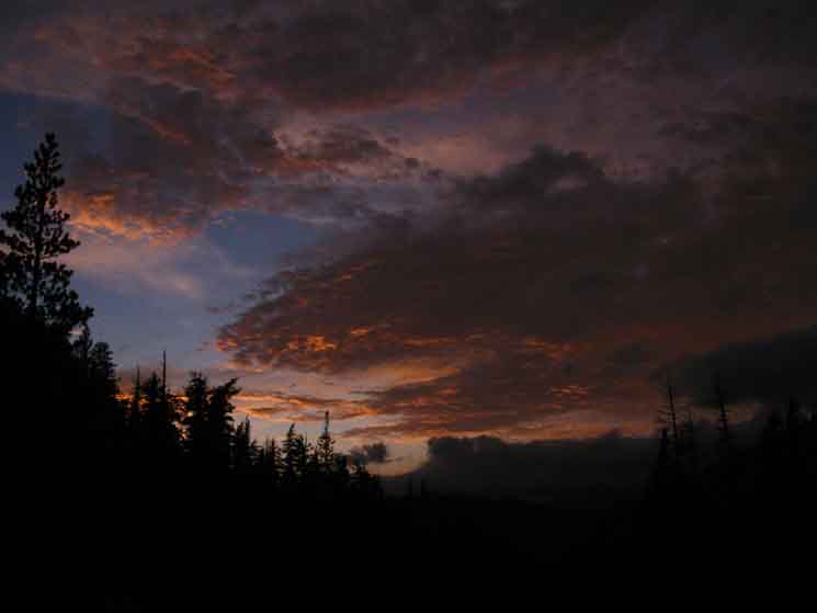
Looking out at the river valley of the Clarks Fork below the North edge of Clarks Meadow. Arnot Peak is the most distant mountain along the Sierra Crestline visible to our North, Disaster Peak is the closest. The same view decorated by a sweet tropical sunset: Below we can see the red sunset lighting up the North end of Clarks Meadow. |
 |
||
Above we are looking South across the granite gorge the Clarks Fork is flowing through, looking into Clarks Fork Meadow across the river and the middle ford. The Middle Ford of the Clarks below.
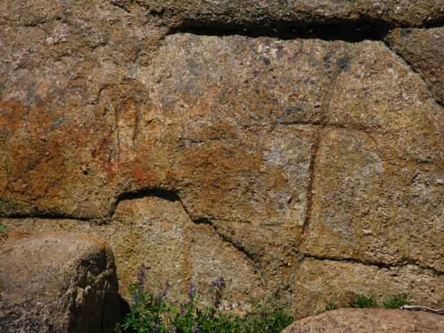
We can see petrographs carved into the rock face on the North shore of the ford
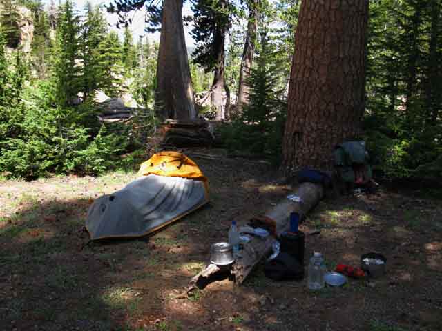
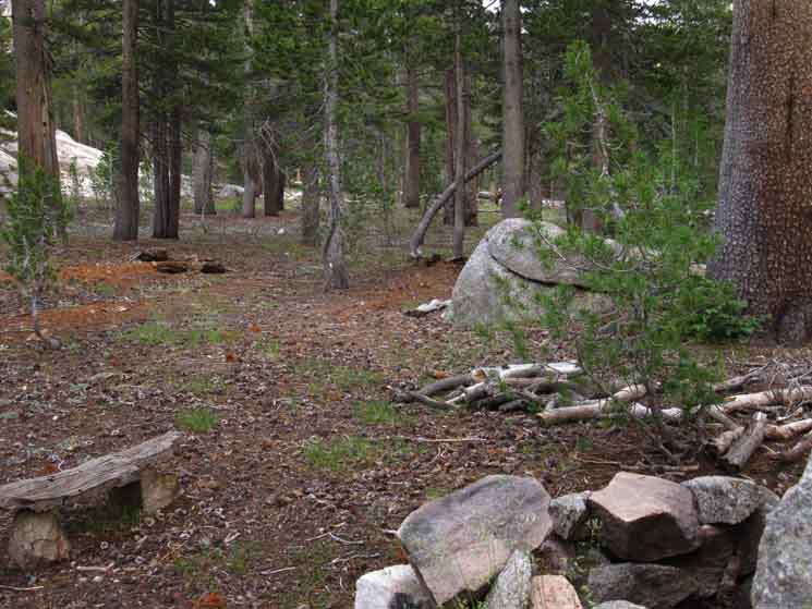
Our campsite is located by the near trees on the Left side of the ford in the fourth image above. |
Sweet View
North-Northwest
of
Upper Clarks Fork Canyon below
North Lip
of
Clarks Fork Meadow
 |
||||
The approaching sunset's horizontal lighting brightens up the canyon wall below Clarks Fork Meadow along the Tahoe to Yosemite Trail route. We can see the very top of Stanislaus Peak peeking over the top of the crestline. Stanislaus Peak lies hidden behind the top of those rock formations in the pictures above and below, capping the top of the Sierra Crestline running North and South above the North Edge of Clarks Fork Meadow. Below Stanislaus Peak is peeking out from behind the top of the granite formations above the North side of Clarks Meadow: Climbing up a bit above the South flank of our campsite on the North edge of Clarks Fork Meadow reveals the vast volcanic bulk of Stanislaus Peak sitting behind the great granite faces climbing the North wall of our canyon. Stanislaus Peak Our Southbound route came up here via the steep flank to our Left, out of view of this image. Detail of Rock Wall rising above the North Edge of Clarks Fork Meadow
Unmaintained TYT Trail Reports
|
 |
||
Sunset colors deepen view from Clarks Meadow in the Carson Iceberg Wilderness.
|
 |
||||
View North from the Northwest end of Clarks Fork Meadow. There are lots of nice places to sit in the granite features, drink a hot chocolate, watch the evening shadows lengthen while listening to the melody of the river tumbling through its rocky channel with the breeze blowing through the trees. The deep peace that ensues after such hard work validates all aspects of the experience.
|
 |
||||
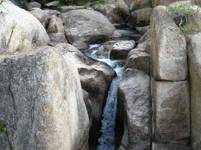
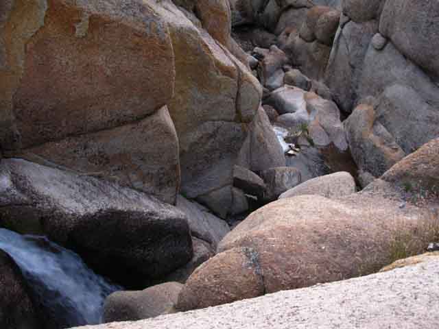
Top of the waterfall at the ford at the end of Clarks Meadow. At the North Edge of Clarks Fork Meadow the river, now flowing at the volume of a creek way up here, flows through a hard rock channel before tumbling down into the "mini gorge" on its way into the jumbled granite canyon below Clarks Fork Meadow.
This rock channel starts with a nice little waterfall, pooling up below the waterfall, before flowing through a "mini-gorge" to begin its trip down the chaotic canyon below the
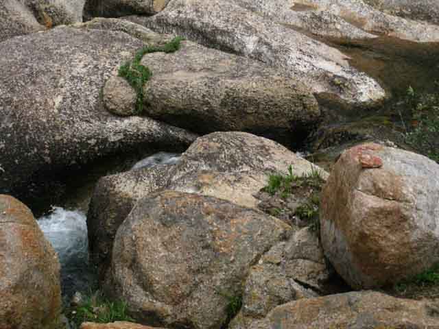
In the third image above we can see the rocks we used as stepping stones where we Southbound hikers crossed over from the Northwest to the Southeast shore of the Clarks Fork. Look closely at that third image above, and we can see the cross carved into the granite on the Right, North side of the middle ford. We ford where we Southbound hikers enter the North edge of the Clarks Fork Meadow. Below we see the view turning around to take a look to our South from the North edge of the meadow to locate the faint route continuing South from the middle ford along the Tahoe to Yosemite Trail.
|
Continuing Hiking South Hiking South from the middle ford of the Clarks Fork of the Stanislaus River on the North shore of the North end of Clarks Fork Meadow we pass between these two great boulders just feet beyond the custom campsite on the North side of the ford. The campsite is about thirty feet behind us, a bit off to the Left. I made a short video about this crucial segment of our route. After passing between these boulders and walking about thirty yards across a bit of thin, but dark forest, we emerge at the base of the great low rock formation pictured below. We are going to hike up around the far Left side of this feature pictured below. We can see a dark outline of use trail making its way up the slope on the Left side of the image below. That's our optimal route South, both up to the upper campsites, and to continue hiking South on the Tahoe to Yosemite Trail. |
 |
||
We are going to push to our Left climbing maybe another hundred yards further South along the TYT (we are looking East-Southeast by the compass), from our current position towards the two "upper" campsites. Middle Ford Campsites Comparison The campsite behind us on the far North edge of the Clarks Fork Meadow is in proximity to the snub of the "nose" of Clarks Fork Meadow, what I call the "lower" meadow. Winner-Winner Backpacker Dinner Beauties Far I would classify the terrain above as the beginning of the headwaters bowl of the Clarks Fork of the Stanislaus River and the terrain below as the jumbled gorge the river first flows down after exiting the headwaters bowl. High Sierra Crestline Though we can plainly see that many of the valley walls along both flanks of the Sierra Crest under these volcanic peaks are composed of magnificant sheer granite, the overwhelmingly vast majority of the North Sierra Crestline is capped by volcanic material. We get to thinking hard about the evolution of terrain when we hike the PCT along the East Carson River, over on the East flank draining the Eastern flank of Stanislaus Peak over on the other side of the Sierra Crestline. It is obvious that a long time ago a new, freshly glacial-cut granite range was first flooded by, then drowned under a long series of eruptions ranging from the cataclysmic to the irrelevant, the net effect to bury a great percentage of the range under thousands of feet of various grades of volcanic debris. I've found a fantastic series of student-geologist articles summarizing the recent rapid rate of change and amazing evoltuon of our understanding of the Geological History of the Sierra Nevada Mountain Range. Saying "what goes up must come down' may be fatally oversimplifying the complexity of the geological conditions influencing the "life cycle" of the Sierra Nevada Range, but a look around the world at its mountains proves that anything geology can put up meteorology can take down, while physics sits watching with a paranoid, insecure look on its face... The steady, relentless power of our once bountiful weather pattern steadily pushing powerful rains and thick annual snow up onto the Sierra Crest and its flanks has driven thousands of years erosion since the last of the all-consuming eruptions. Since the last cataclysmic eruptions we can see the force of erosion has partially excavated granite mountains from their volcanic tombs, recut ancient river courses, and reexposed the flanks of granite mountains once covered under thousands of feet of soft volcanic material for thousands and thousands of years. Yet the changing weather pattern could stop this ancient process, and a lot of other ancient things in their tracks. Perspective, Priority, and Personality Looked at from a longer perspective, Stanislaus Peak's 11233 feet of elevation is the second highest peak along this stretch of the Sierra Crestline across the Carson Iceberg Wilderness from Ebbetts to Sonora Passes along the route of the Pacific Crest Trail. This puts Stanislaus Peak second in heigth behind the 11459 feet of Sonora Peak, but Stanislaus Peak is by far the dominant peak in terms of personality. We Southbound hikers along the Tahoe to Yosemite Trail have not been hiking along the Sierra Crestline for the last 30 miles across the Carson Iceberg Wilderness. We turned Southwest off the Sierra Crestline where we exited the Lake Tahoe Basin and pointed ourselves Southwest over Round Top and the Sisters to hike South along the West flank of the Sierra. We are only just now climbing up along the Clarks Fork of the Stanislaus River back to the Sierra Crestline approaching the South end of the Carson Iceberg Wilderness. Our TYT route across the Carson Iceberg Wildeness has followed a line I figure is averaging between 12 to 15 miles to the West of the line of the PCT along the East flank of the Sierra Crest. Now the line of our TYT route has brought us up under the West flank of Stanislaus Peak as we approach the Sierra Nevada Crestline. The Great Triangular Blob We need a new environmentalism, which to be effective requires the end of defining rationality as the gratification of the desire for wealth and power by any means necessary. The age of cheaters must be ended to even have a snowball's chance in hell of saving the tattered remnants of our Natural World. Under "standard" precipitation conditions of a "normal" Winter and Spring Thaw erosion will very quickly melt the trail across the weak compositon of unconsolidated volcanic debris making up the South flank of Sonora Peak to the angle of repose. Stanislaus Peak's unique shape may be due to it being constructed of a harder grade of volcanic material as well as some possible structural advantages imparted by the shape of the hidden granite crestline Stanislaus Peak is covering. Beauties Near As we are sitting on the North edge of the Clarks Fork Meadow the terrain to our North, downriver, drops abrupty into an amazing maze of jumbled granite that has been carved, shattered, polished, weathered, and cut by every form of water into every form, shape, and texture its materials, colors, and form can possibly produce. Shadow Pic This gives us an almost unlimited scope for scrambling around. We have the fantastic feature of the middle ford and its inset waterfall, pool, and gorge to explore from the perspective of the North shore. Then we have the amenities, which I touched on above. Besides seating, shade, a nice flat, easy water and wind shelter this is an excellent spot to take care of business, and do some laundry. Here's the drier: The Drier I would backpack to this position just to stay in this site, which gives it the premium designation of,
|
At the top of the left side of the formation pictured above we pass through a narrow, nondescript channel between forest and rock to the two-plus upper campsites situated under an apron of forest wrapping around the very Northern end of the middle meadow. Here we find two well-developed campsites nestled into the low granite formations marking the end of the North end of the expansive "middle" Clarks Meadow. The width of the middle meadow spreads out to our South and its length stretches East towards the narrowing uppermost canyon up under the narrowing canyon walls of the headwaters bowl. The real obstacle dividing the North nose of the Clarks Fork Meadow from its middle meadow is a ninety-degree turn the river makes around the rock formation pictured above. The river bending around rocky terrain effectively separates the middle meadow from the nose of the meadow. That's why we are not following the course of the river, but are hiking Left here on the North edge of the Clarks Fork Meadow to shortcut the bend that divides the middle from lower portions of the Clarks Fork Meadow. Staying on the best route will keep the difficulty level down through this most difficult segment of trail. Following along the river through the meadow segments will increase difficulty. From these two upper campsites we will stay up and away from the meadow, continuing South high up paralleling the middle meadow under the thinning edge of the forest along its Northern fringe under the canyon wall. We will proceed along this line for a few hundred yards crossing three vibrant little streams feeding the Clarks Fork. The Movie This is our best route South from the middle ford for picking up the bits of use trail, wild ducks, and landmarks that will ultimately lead us to the uppermost ford of the Clarks Fork. Hiking to the upper campsites on the North edge of the upper meadow puts us in the best position to stay on the historic line of the Tahoe to Yosemite Trail hiking South exiting the Headwaters Bowl. But that's not the only way out. As Winnett says, "Hikers have found or invented dozens of routes into (Northbound) or out of (Southbound) Clarks Fork Meadow, and the one I describe is not the only safe one, but I believe it is the easiest to follow, and the easiest to hike." My recent investigations put me in full agreement. What Winnett fails to mention is even his "easiest to hike" route is very difficult. I consider this whole segment from Boulder Creek South to be Hard 1+ trail due to its combination of climbing and route finding. Alternative Routes 1> The route listed on the 1987 and earlier editions of the Carson Iceberg Wilderness Map, below, depicts the now abandoned route straight up the center of the headwaters bowl. This route is omitted on the current 2009 version of the map (downloadable pdf). I link to the current 2009 map below which also omits the old "up the center" route. 2> The route up the North wall of the headwaters bowl, described by Johnny, which I related in my 2015 update below. I will have Johnny's account up soon! I don't even include the route from Stanislaus Peak to the North edge of the Clarks Fork Meadow on the 1987 map below. I am convinced that there is a route along the old line of the trail, but I am also certain that there are some real hairy segments along that old route finding its way down via a slot in the massive rock face above the North Edge of Clarks Fork Meadow. Post up your experiences scrambling alternative routes or along the Tahoe to Yosemite Trail out of the Clarks Fork headwaters bowl. I've dug out the maps I've used over the years hiking through here: The 1987 Department of Agriculture |
 |
Straight Up the Middle Route They must be approached with great respect and caution. On the 1987 map above we see the route of the Tahoe to Yosemite Trail is depicted continuing East-Southeast above Clarks Fork Meadow running Southeast straight out the center of the headwaters bowl. The route of the TYT is not even depicted. Also note the trail, once it reaches the top of the cliffs it passes through Saint Marys Pass continuing straight across the ravine below the gap. The current junction (2015) connecting the TYT to the trail coming up from the Saint Mary Pass Trailhead intersects at the top of the gap, as depicted on Winnett's map below, and omitted from the 2009 map below that. The route through and out the upper Clarks Fork Headwaters on the old 1987 Wilderness Map above is not "unmaintained," but abandoned, meaning I've scouted around up there and found no sign of trail or even any discernable route. It did appear do-able, with some determination and effort well matched with fitness and route-finding skills. Not easy, but do-able. It also looks like terrain where we could put ourselves into some bad positions, if we don't watch out. OK, the old 1987 Wilderness Map shows the old trail connecting with the currently maintained trail East of Saint Marys Pass. Winnett's books describe the route of the TYT running up the second seasonal creek on the South wall of the headwaters bowl, as we can see below. The latest map, from 2009, depicts no trails above the North edge of Clarks Fork Meadow, and unmaintained trail from up to the North Edge of Clarks Fork Meadow. Winnett, Tahoe to Yosemite Trail, 1989 edition, Thomas Winnett's works are standard trail guide classics on my backpacking bookshelf. Interesting history of the Tahoe to Yosemite Trail in Wikipedia. The current route of the TYT fords to the South shore of the Clarks Fork well below where it and the tributary climb out of the headwaters bowl. We currently (2015) have several hundred yards of route along the South shore above the upper ford before we turn South to climb off the floor of the headwaters bowl with the tributary creek through the slot. The route shown on the 1987 Wilderness Map running from the North edge of Clarks Fork Meadow straight up along the Clarks Fork, and then climbing out the center of its headwaters bowl is no longer depicted on any of the current maps. But, it is important to understand that none of the previously described routes through here are maintained above, nor even below, the North edge of Clarks Fork Meadow. Maintained Trail Or, we can rotate counter-clockwise around the top of the headwaters bowl from the top of our slot passage across Saint Marys Pass to find the maintained trail coming up through the gap on the Norhteast corner of the Clarks Fork Headwaters Bowl. That's exactly the route depicted on Winnett's map above, though he misplaced the label for Saint Marys Pass. I rate the difference between the two routes we can hike from the top of the headwaters bowl over to maintained trail as almost a toss-up in terms of difficulty. I am not real fond of unecessary climbing. Back Down to the North Edge of Clarks Fork Meadow Winnett's '89 version of his Tahoe to Yosemite Trail map only shows his route through the upper headwaters bowl. We both know that I will compare differences between the maps in different editions as possible. I tend to believe that Winnett's text and maps were fairly consistent from first through their last editions. We will see, given enough time The '87 wilderness map above shows both the trail from the North edge of Clarks Fork Meadow up to Stanislaus Peak and trail above the North edge of Clarks Fork Meadow. The USGS Sonora Pass map published in 1979 that I modify and update to use for the trail guide to depict this segment of this route originally shows no trails above the North edge of Clarks Fork Meadow, nor the trail connecting the North edge of Clarks Fork Meadow to Stanislaus Peak. What is interesting is that all these maps show maintained trail below (North of) Clarks Fork Meadow that is today unmaintained down to the Eureka Valley trail junction. Alternative Routes I also included a third, the route described by Johnny out the North Wall of the Headwaters Bowl. Imaginary Lines Kind of like this route along the TYT, but only more so. Thanks to the Dept of Ag, Forest Service, Thomas Winnett, and the USGS for producing these excellent maps. |
VIDEO SOUTH on the TAHOE to YOSEMITE TRAIL There is no use trail, nor are there ducks or blazes until we hit the far upper end of the Middle Meadow. There we begin to pick up a few wild ducks and bits of use trail pointing us to begin the climb up and away from the middle meadow through the boulder field to the upper meadow and finally, the uppermost ford. Or we may not. Conditions change over time on unmaintained trails and along informal routes. There may or may not be a whole lot of ducks or use trail along the route. In any case we going to be more or less depending on our own merits, our excellent observation, analysis, and decision making to find our way through. |
Upper Campsite
at the
North End of the "Middle" Clarks Fork Meadow
 |
Looking South down the line of the route of the TYT over the main campsite on the North edge of the middle meadow. That's our route South. |
Three Creeks then we Climb
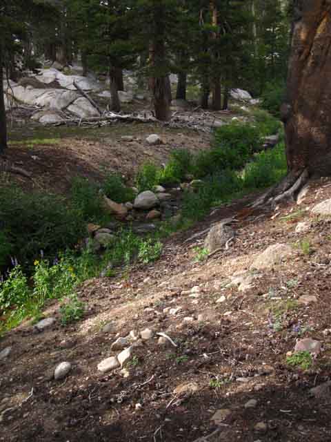
As we are hiking South along the North edge of the forest fringe around the North perimeter of the middle segment of the Clarks Fork Meadow we cross three little tributary creeks before coming to the South end of the middle section of the meadow. The "middle" meadow ends where the Clarks Fork River bends South, and looks like it falls into the far side of the middle meadow through a real boulder-strew jumble. Here we climb to the Southeast, rather than follow the edge of the meadow or the Clarks Fork to the South. Below we see the first tributary creek South of the upper campsites. Northern Stream |
 |
Off to our Right, the South, is the expansive middle Clarks Fork Meadow. We continue to our South, to the Left from the perspective of the image above. |
No Visible Trail or Use Trail
Continuing South along the North Side of the Meadow
 |
Continuing South along the untrailed, unmarked, unblazed and unducked forest fringe we come to the middle creek running down across the meadow into the Clarks Fork. |
Middle Creek along the North Side of the Middle of Clarks Fork Meadow
 |
| The middle, or second of three creeks we pass hiking by the middle of the Clarks Fork Meadow. |
View East
 |
We still have an expansive area of open sage along the edge of the forest above the North side of the middle of Clarks Fork Meadow, which is still off to our South, our Right, from the perspective above. The route of the Southbound TYT, which we are facing above, is roughly East-Southeast. |
The South Rim of the Canyon
Our View South by the Compass
 |
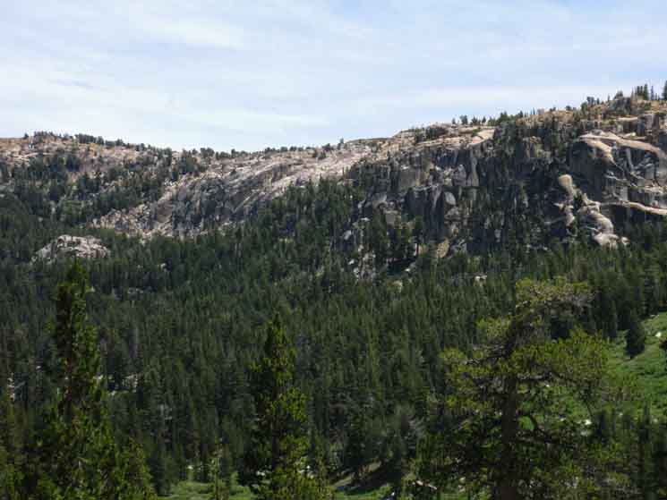
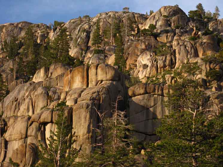
The walls of the Clarks Fork Canyon leading up to the headwaters bowl are closing in on us as we continue hiking Southeast on the TYT along the North edge of Clarks Fork Meadow. As we hike higher the great granite wall making up the South side of the headwaters bowl comes into view rising beyond the far Southeast side of the middle meadow. What a fine piece of uniquely shattered, cracked, carved, and polished granite. A more detailed view. |
Looking South
The Southernmost Tributary
 |
We now come to the last of three tributary creeks feeding the middle segment of Clarks Fork Meadow as we hike South on the TYT, which means we are coming to the end of our hike along the fringe of forest on the North side of Clarks Fork Meadow. We've crossed the three tributaries hiking along the North edge of the middle bit of meadow. Shortly the meadow terminates and we begin encountering wild ducks and use trail climbing through a boulder field up to the last, little, upper level of the Clarks Fork Meadow preceding our crossing the uppermost ford over to the South bank of the Clarks Fork. |
End of the Flat Walk Along Middle Meadow
 |
| We encounter a random blaze roughly marking where we begin climbing through boulders rather than along the flatter terrain of meadow-side forest. |
Southbound Climbing away from the Middle Meadow
 |
The climb soon increases a bit. I found bits of use trail and random wild ducks through here during 2015. |
Looking Back at the Middle Meadow to our Southwest
 |
Looking Southwest into the East end of the middle portion of Clarks Fork Meadow (hiking South on the TYT) as we begin climbing (to our Left) out of the meadow. I could see wild ducks marking the divergence of the route from the end of the meadow. |
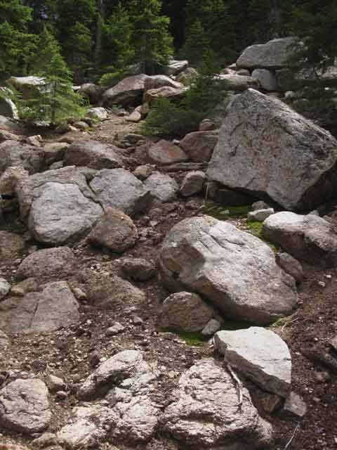
Climbing South up the Boulder Field
 |
| Great Boulder leading the way South. |
Looking Northwest at the South end of Middle Clarks Fork Meadow
 |
Looking back, North, at the middle meadow and towards the far Northern edge of the Clarks Fork Meadow where the ridge arm reaches the river. That's where the middle ford is located. |
In the images above and below we've turned around to look Northwest back down at the route we've taken hiking South from the very North edge of the Clarks Fork Meadow around the North perimeter of the middle meadow up to the slope climbing us up to the upper bits of meadow. In both the images the gap in the mountains pinching to a V in the middle distance leads to the gap making up the very Northern edge of Clarks Fork Meadow. That's where the middle ford is located, where the North edge of Clarks Fork Meadow overlooks the canyon. I had chosen a high route above the top of the middle meadow and was rewarded with the reassuring sight of a few "wild ducks" and little bits of use trail informing we're on-route. If we keep our eyes open and stay on route we will see a rough line of wild ducks pointing us up into and through the boulder field after skirting around the North edge of the middle Clarks Fork Meadow. |
 |
||
Duck pointing way North from our perspective above overlooking the tapering end of the "middle" Clarks Fork Meadow segment of our route below our position. The ford and campsite are located between the closing jaws of the tapering valley in the middle distant to the Northwest, the direction of the view above. Unmaintained TYT Trail Reports
|
Looking Southeast
 |
A view of the South Wall of the Headwaters Bowl to our Southeast. Climbing through the boulder field is funneling us into the narrowing upper canyon. Around us we can see great granite cliffs rising out of a sea of volcanic terrain. Above we are looking at where the cliffs making up the Southern wall of the cliffs surrounding the upper headwaters begin. We are finding our way up towards our Left, to the East-Southeast by the compass, along the cleanest line we can find moving us up into the highest part of the headwaters bowl. |
LANDMARK TREES
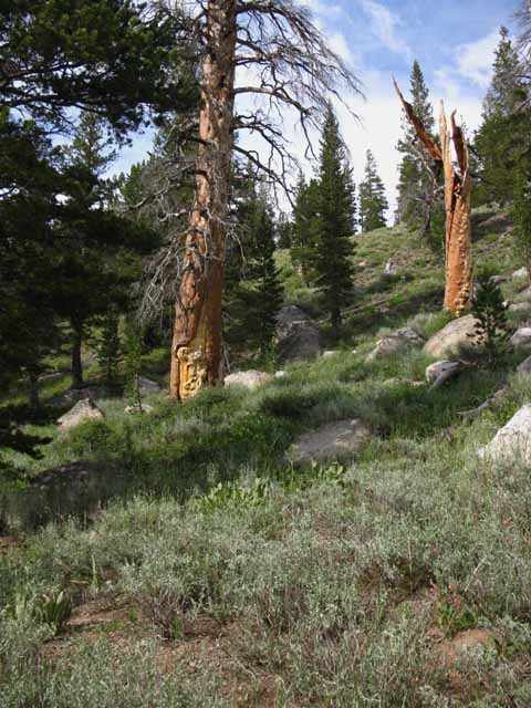 |
Landmark trees along our gradual climb. Our line from the Northeastern edge of the middle meadow to the upper ford passes just below these identifiable landmark trees. Besides the reddish coloration, one of these snags has recognizable bark damage and the other a series of mini-burls, or bumps. |
Looking into the Uppermost Canyon
Along the line of our Route South
 |
That's the line of our rocky route up. I found some wild ducks and bits of use trail in August of 2015. What have you seen up here? |
 |
We have been finding regular wild ducks and bits and pieces of readable use trail. We have been finding our own route between recognizable bits of use trail and wild ducks, such as the ones above and below. That's a good sign that we are on-route. |
 |
More wild ducks and bits and pieces of readable use trail leading us up to the upper ford. |
 |
Above we have four wild ducks lead the way up through the boulder field between the middle meadow and the upper ford. At a certain point our angle of climb moderates, the density of boulders moderates and that of the forest thickens. The image can be magnified to find the ducks. |
View North
 |
REACHING THE NEXT LEVEL |
Continuing South
 |
Looking to our South we see we are once again hiking along in the forest along the North fringe of the Clarks Fork Meadow, but now way up above the middle and lower levels of the meadows. I call this highest and last bit of distinct meadow wedged in up here the upper meadow. Now we've got to get around the top of the upper meadow without getting suckered into following an arm of meadow up a tributary feeding into the Clarks Fork near the top of the upper meadow. |
Landmark to North of East
 |
I spy a fallen red trunk in the terrain. The landmark becomes more distinct as we approach. |
Landmark Tree and Rock
 |
We can see the fallen tree behind a landmark rock, which we will pass by on its South side, its Right-hand face. As we approach the rock face we will deflect our route slightly towards our right, starting to move back down to the Clarks Fork around the top of the upper meadow for our final very short hike up along the Clarks Fork to the upper ford. |
Narrowing Path
 |
Looking towards the Right from the Landmark Rock towards where we are going to make our final approach to the top of the uppermost Clarks Meadow, which is off to our Right, where we will begin to move closer to the Clarks Fork River and its upper ford. There are no ducks, bits of use trail, or blazes through here. |
A Wild Duck
 |
Hiking through the thin forest closer to the top of the meadow we find a wild duck leading us into a dark dense patch of forest off to the Left of the top of the narrowing upper meadow. Now here is where things can get a bit confusing. There is an inviting-looking "annex" of meadow running off to our Left, following a tributary feeding the Clarks Fork coming down from our Northeast, which may appear to be an inviting route option to that through the dark forest. It is not. Following the tributary & meadow to the Southbound hiker's Left off the Clarks Fork is an error. Our route going around the top of the uppermost meadow goes through the dark bit of dense young forest on its way over to the Clarks Fork. We will see the Clarks Fork again for the first time since departing the middle ford. We've still a ways before we reach and make our final ford of the Clarks Fork, so don't turn away and go off-route here! |
 |
The top of the upper meadow. We pass around the North edge of the upper meadow under moderate forest cover. Going around the top of the meadow, to our Left in the above image, is where we enter a short length of dense forest. |
View Southwest Entered the Uppermost Headwaters Bowl |
 |
||
Looking Southwest across the upper section of Clarks Fork Meadow. The opening in the forest cover around the upper meadow gives us a good opportunity to take a look at how the canyon is narrowing and steepening above us. Well, at least to our Southwest across this small island of open meadow. It's been hard to see far from under the forest cover. We begin to feel a subtle pressure as the canyon narrows under the steepening walls. I don't think it's actually a physical pressure in the conventional sense that we feel, but more a perceptive pressure, the feeling imparted by intensive competition for limited living space. And possibly the pressure of our awareness we are following a nebulous, faint, route we could lose at any time. This feeling is well-illustrated, if not multiplied by the almost claustrophobic narrowing of the upper canyon. The high walls of the upper canyon shorten the length of days for the forest and meadow inside, seemingly increasing the pressure of their competition for the diminished energy able to hit the floor of the uppermost canyon. This quiet, subtle, almost invisible pressure builds as space diminishes between the converging canyon walls. This "pressure" leaks into our minds as an increasingly pressing need to understand exactly where we are and the necessity to find the easiest way out of here moves to the forefront of our thoughts. All of these degrees, these aspects of "pressures" we pick up in the web of life as it fits itself into the changing patterns of terrain sharpens our physical perceptions and mental analysis. Our navigational imperatives play out across terrain formed by the changing requirements of plant survival, across this battleground between forest and meadow. We pick our way carefully across this battleground. Constant "warfare" between forest and meadow have scoured the terrain of all signs of trail and most of the route through here, forcing us to search carefully for the bits of wild ducks, use trail, and the rare blaze keeping us hiking on the optimal route out, which right here involves moving towards the upper ford. We understand this is going to entail a significant climb as we hike higher up between these sheer granite walls that, I repeat, are growing much higher and closing in around us as we move deeper into the headwaters bowl. It is downright cozy in here. Besides the forest, meadow, and rising walls all around us, we are picking our route through a scattering of massive boulders that have broken off the surrounding walls. It's a very interesting place. Unmaintained TYT Trail Reports
|
| View Southeast Great Granite Walls rise on both Sides |
 |
||
Granite wall on the South flank of the headwaters bowl approaching the very upper reaches of the Clarks Fork, Tahoe to Yosemite Trail route. The upper headwaters bowl is shaped like a "U," or a "long" horseshoe shape that is aligned almost exactly from the open Northwestern end to the tight arc of the headwaters cliffs around the Southeast end of the headwaters bowl. A line drawn along our route through the upper Clarks Fork River through the center of the upper headwaters bowl runs Northwest to Southeast.
|
| At Our Feet Old Bear Pie |
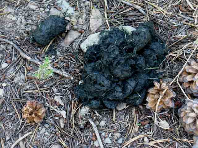 |
Bear crap, old. No moisture. It's light as a feather and crisp as a potato chip. The point is this area is bear patrolled, part of an area considered property of the dominant male of this area, who will regularly visit it. Thus I strongly recommend use of a bear proof canister during Summertime here. Backpacking Skills |
| Light and Shadow Thin Forest below the Uppermost Ford |
 |
Into the thicket. This is the dense thicket of young lodgepoles above the Northeast edge of the upper meadow. We have turned around and are looking back to the North, towards the upper meadow. We can make out the upper meadow beyond the base of the most distant tree in the center of the shot. |
Same Perspective, Different Year, Different Lighting
 |
||
The Sierra Nevada Mountains is a study in contrasts. Transition zone between Dark Forest along bright upper reaches of Clarks Meadow. We hike Southbound though the forest above the upper meadow until we sight the great boulder below, atop a low rise on the end of this dense little thicket of forest.
|
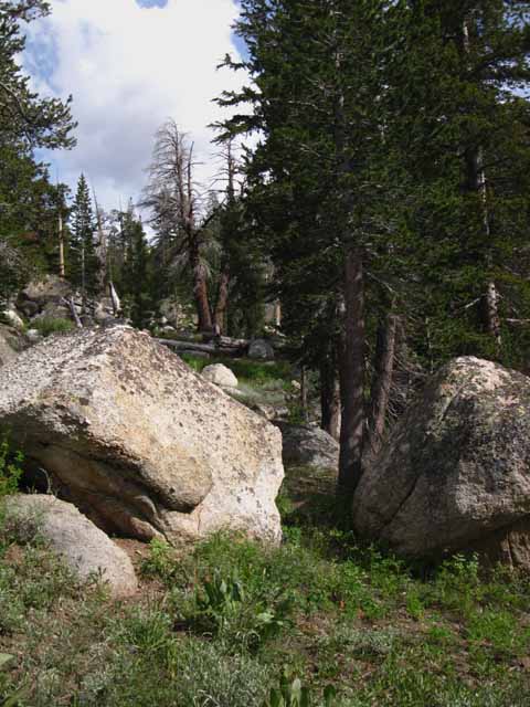
Landmark Rock
 |
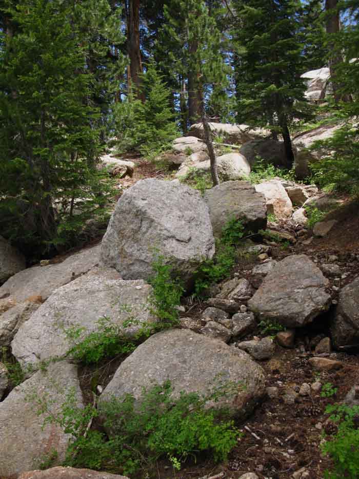
Hiking South into the forest above the North edge of the upper meadow we find this very distinctive landmark rock. We pass around the Right side of this boulder to find the Clarks Fork of the Stanislaus River. |
Stroll Along the Upper Clarks Fork
 |
| Bending Right around the landmark boulder at the top of the rise in the thicket-forest we bend Right, South, to see we are coming down to stroll along the North bank of the Clarks Fork, just feet over to our Right but out of sight in the image above, along a subtle segment of use trail with a few wild ducks leading us upstream. We are correct if we sense we are approaching the upper ford. We are now walking alongside the North bank of the Clarks Fork, maybe forty yards downstream |
| The Upper Ford Distinctive Blaze |
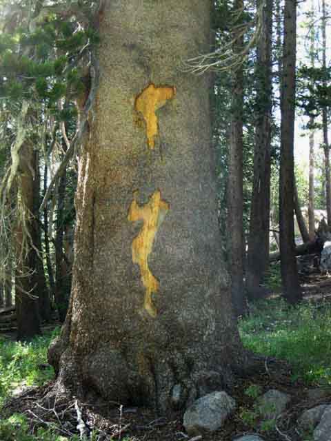 |
||||
Blaze at the upper ford. The location of this blaze makes it not very visible for Southbound hikers along the TYT. It is perfectly positioned to be observed by Northbound hikers. Southbound hikers must pass the tree and turn around to see the blaze from the perspective above. It's a good thing that there's a great boulder alongside the North bank of the Clarks Fork with a rock on it also showing us the location of the ford before we see the carving on the tree above. There are also a couple of easily visible ducks on the South bank too, if we cannot find the blaze pictured above and the ducks pictured below making the location of the North bank of the ford.
Unmaintained TYT Trail Reports
|
The Way North
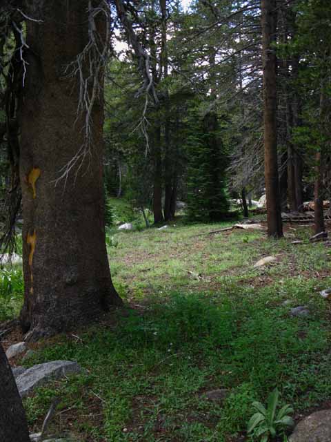 |
Looking North at the route of the Northbound TYT past the carved tree marking the North shore of the uppermost fording point. This is the way Southbound hikers approached the upper ford and how the Northbound depart. |
The Upper Ford
&
Above the Ford
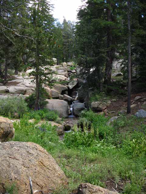 |
Location of the Uppermost Ford That's where the ford is. Skip down to Continuing Below Then we hike it. |
Great Boulders on the North Shore of the Upper Ford
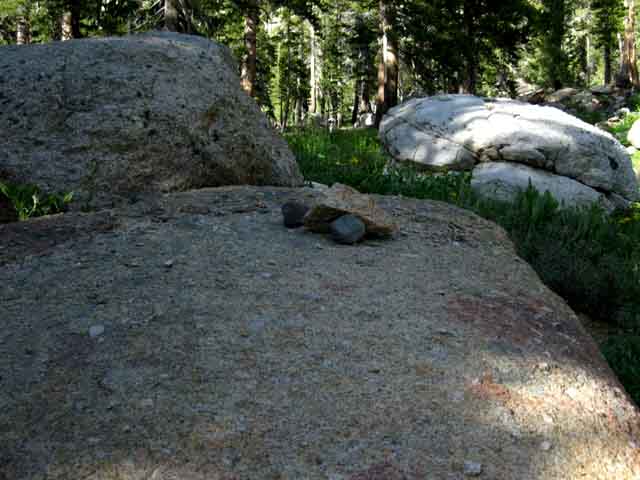 |
Duck on the North Shore of the upper ford of the Clarks Fork fork of the Stanislaus River. These great boulders appear to have tumbled off the surrounding cliffs. |
The Way South
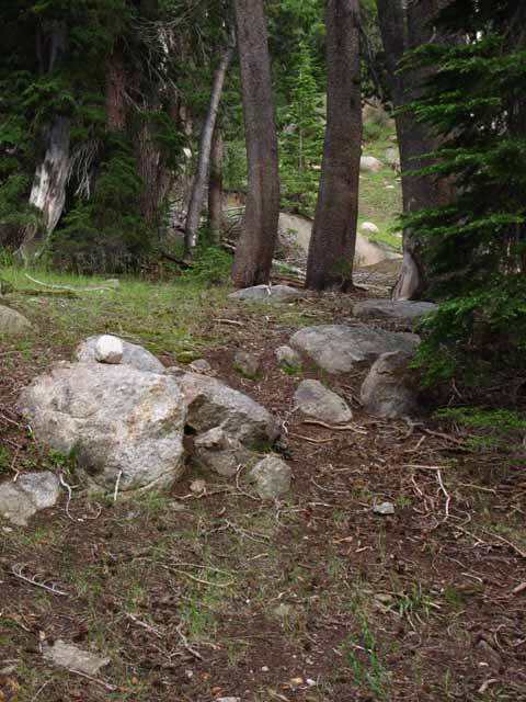 |
Looking across the Clarks Fork at an upper duck a bit above the South Bank. Now we are going to turn and walk directly away from the upper ford, to the top of the rise about thirty yards North on a perpendicular line from the location of the upper ford. |
Not the Way South
View from top of the rise to the North of the Upper Ford
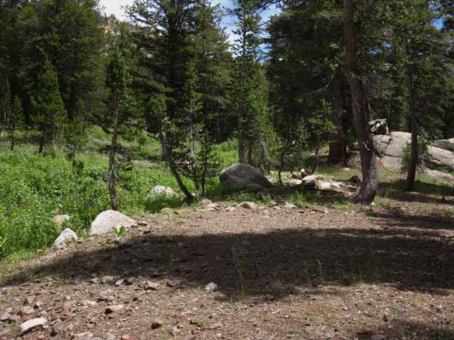 |
The Wrong Way! As we hiked up to the top of the third and uppermost meadow we may have noticed a tributary stream coming down from our Left, out of the Northeast. That tributary is surrounded by and feeding an annex of meadow that runs roughly Northeast up along this tributary's course. It may appear to be an inviting route to some, but it is the wrong way. We avoided it coming around the top of the upper meadow, but we can see above this meadow is in near proximity to our upper fording point. In the picture above we have walked up to the top of the flat above the North shore of the ford, to check it out for excellent campsites. When we approached the ford we saw this forested flat on a rise thirty yards to our North (Southbound hiker's Left) that looks like it has the potential to sponsor some nice campsites. It does not. We found none. But we did find the upper part of that tributary stream and its associated meadow that we passed when we hiked around the top of the upper meadow. We're looking at that creek and its meadow over on the far North side of the rise above the upper ford, which is pictured above. Up here at the upper ford we see that this tributary stream roughly parallels the Clarks Fork above the upper ford. We are looking East-Northeast in the picture above. The upper ford along the TYT is off about thirty yards to our Right, which is to our South by the compass. We can turn Right here to find the upper ford along the route of the TYT if we are hiking up through this messy meadow along this wrong-way tributary. The upper ford of the Clarks Fork, and our route continuing up along its South Shore to our route out of the headwaters bowl are just about thirty yards to our Right, which is off the South edge of the image above. Following this subordinate strip of meadow on the Left of the image is the wrong way if we are attempting to follow the modern route of the Tahoe to Yosemite Trail, which is to the Right. Alternative Route I personally believe the trail depicted on the 1987 Carson Iceberg Wilderness Map no longer exists in on-the-ground reality. I believe that the closest thing we have to a viable, even occasionally-used route through here is the route of the TYT, and the route of the TYT fords the Clarks Fork to the South of our position in the image above to make its way to our TYT exit through the slot. But, the validity of a route is in the eye, and especially in the capacity, of the beholder. It's a route if you can do it. The problem here is that the 1987 map is depicting something that does not exist on the ground, which tends to mislead hikers into following the river upstream beyond the ford and beyond the proven TYT exit from the floor of the headwaters bowl through the slot. See the maps above. |
Segment The Upper Ford Images and Guide Video video duration route distance 9040 to 10400 feet of elevation
Above the Upper Ford Crossing over to the South shore of the upper ford we first find ourselves hiking up to the Right side of the base of a great granite block-feature to even begin to see our route South (Which is really Southeast by the compass). Our goal, the route continuing South beyond this feature is wedged between the Left side of the uppermost part of the rock feature along its interface with the forest, a ways above the South shore of the Clarks Fork of the Stanislaus River. We hike about a 25 degree line to the Southeast hiking upstream from the South shore of the ford over to the Right side of the base of the granite rise. Our position on the Right side of the base of the rock allows us to get up onto the rock and begin traversing up and to our Left using thin slots and cracks in the rock bringing us up and over to a flat on the Left side of the feature allowing us to get up to, and find the route continuing South. Great Flat Waterfall The mechanics of the flat fall are simple beauty in action. The river flows down onto the flat upper surface of this great granite block. During low flows the river's whole capacity can flow through the narrow channel carved into the top of the block by ancient ice. Once the flow exceeds the capacity of this thin channel it spreads itself evenly and thinly across the ample width of the flat top of the block. The whole Clarks Fork flows as a thin sheet across the top of the block down to its wide lip. The lip must be thirty or forty feet wide. Along this nifty but short segment of our hike up the South shore the Clarks Fork of the Stanislaus River quickly spreads itself for display and inspection, then pulls itself all back into its narrow channel just as quickly. This little segment of the river expands and contracts just like a custom-made little accordion. Delightfully, we find another small waterfall feeding the river onto the top of this great granite block when we scramble up to explore the top of the block. South of the Great Flat Waterfall Once we've assured ourselves we are on the correct route we turn South to follow this tributary up to the base of the slot it flowed through down the cliff face. Here we begin our final climb out of the Headwaters Bowl of the Clarks Fork of the Stanislaus River up through a steep slot in the surrounding wall of sheer cliff faces. This is typically a breathless moment, for the beauty, for the work, for the breathless tension route-finding inspires. Headwaters Passage I had a hell of a time getting down the lower segment last time through. I was having Right foot and ankle post-injury problems (frostbite and bad-broke lower leg, respectively), and my old shattered L knee was giving out under the down-mountain loading. I still made it down lowering myself mostly using my upper body. It was slow and a drag, but was do-able. Oh, and I was wearing a freeking heart meter to assure I was keeping my Beats Per Minute within the "live" zone, which required I stop all the time to cool off the old heart. I cannot wait to get through this last series of injuries! Yeah, I consider my heart as an "injury" as its dysfunction was triggered by drugs prescribed to kill the pain in my L knee. Don't trust drug companies. Always check your prescription medications in the PDR or a reliable source of information on side effects, and who is susceptible to them. We can hike through Saint Marys Pass to cut across the ravine draining below the gap, which puts us on a self-selected route scrambling Eastbound over to the maintained trail we can spot over on the other, Eastern side of the drainage ravine below the gap and East of Saint Marys Pass. In any case, we find roughly a 1.14 mile length of well-maintained trail leading South down to the Saint Marys Pass Trailhead on Highway 108 from the Northeastern edge of the top of the headwaters bowl, where the maintained trail comes through the gap linking up with our unmaintained route. Rest and Resupply Ahead That's an ideal Summer. Match that up with active Fall, Winter, and Spring snow seasons, and we've an ideal year. Continuing Challenges, but Different Challenges Both of these facts, that we have excellent resources, and that they are located right along our TYT route, are both good news. We are going to need some rest after the challenges and difficulties of these unmaintained and untrailed segment of trail before beginning this next long, difficult section. It's nice not to have to get off the line of our route South to get some rest, eat some great food, and pick up our resupply for our final section of the Tahoe to Yosemite Trail hiking down to Tuolumne Meadows. I get excited doing it, and am excited even thinking and writing about making the transition from the Carson Iceberg Wilderness into the Emigrant on the way to Yosemite through Kennedy Meadows Pack Station. We are going to start seeing folks along the trail again, as we have not through the unmaintained segments of trail through the Clarks Fork Headwaters and Summit City Canyon. We may end up encountering a whole lot of Northbound PCT hikers where the PCT and TYT routes unify at the top of Jack Main Canyon in the very Northwestern corner of Yosemite National Park, depending on the time of year we are hiking South, and the trajectory of the melting snow pack that year. The "main body" of hikers typically begins coming through the North Sierra in mid-July, depending on exactly when the trails clear of snow. We will encounter PCT hikers every 10 or 15 minutes hiking South through the "main body" of Northbound PCT hikers. I call this "taking a sample" of each year's crop of PCT hikers. Check out a couple of years of sampling.
There's also a lot of PCT and other local and long distance backpackers spread across the pages of the guide. Alternative Long, and many Local Routes The experience this place possesses are far more valuable than the time and effort expended to access it. The problem is that it's size, and the overall scale of the Sierra Nevada Crestline itself requires we take a reasoned approach to exploring the variety of unique realities, terrain, and experiences over time. A methodical approach. Time and a variety of route options for long and short trips reveal, and gives us a shot at exploring some small part of the astounding range of the vast scale of High Sierra experience. Check out the Sonora Pass Region Map for an even broader perspective on the relationship between the PCT and TYT both North and South of Highway 108. This map was laid out with an emphasis on our options for tying bits of these classic trails together into unique routes along our long distance backpacking trips or custom routes for our shorter local loops and trailhead to trailhead trips. Remember, click the Black Dots on the 30 minute maps for more detailed maps, and the Red Dots on all the maps for the associated trail guide information.
Unmaintained TYT Trail Reports
|
VIDEO
Down The Slot
These videos were shot finding my way down the slot, hiking Northbound, during 2012. 12:14 |
|
Likely a Satyr Anglewing, if my identification is correct. |
 |
||||
Butterfly, upper Clarks Fork of the Stanislaus River. Post your butterfly shots in the forum, learn more from Doc Shapiro.
I go as far as saying that life is an inherent part of, and interwoven in the basic physical structure of reality itself. This leads us to the conclusion that it is discreet consciousness where the problems lay. Which puts each individual's study and understanding of life at the center of importance. This approach puts understanding the contradictions that drive life at the center of the physical, as well as biological realities we experience. Observing Nature clearly from your own unique perspective is the first step to understanding yourself.
|
The Clarks Fork of the Stanislaus River UPPERMOST FORD |
Crossing the Upper Ford
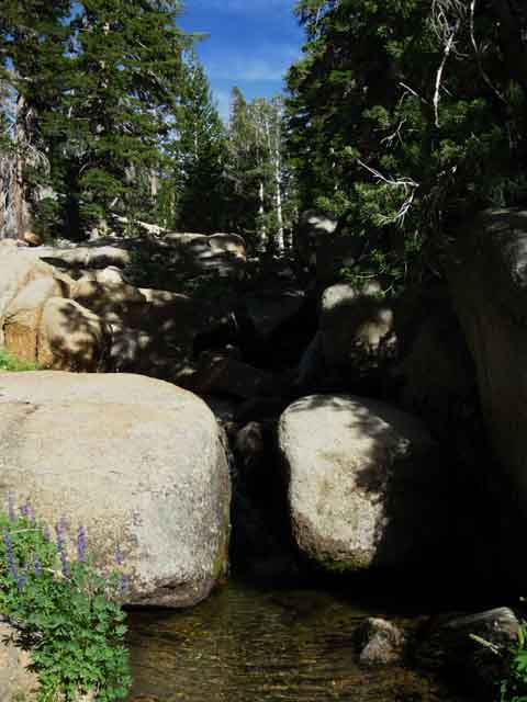 |
||||
Looking upstream while crossing the upper ford. Tranquil creek-scale Summer flow of Clarks Fork of the Stanislaus River We're looking a bit South of East up the last bit of the Clarks Fork in its headwaters bowl as we cross the upper ford. Let's take a step back, and look at the terrain above the ford;
Unmaintained TYT Trail Reports
|
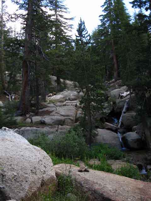
Northbound View
Lining up the Ducks across the Upper Ford
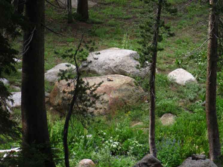 |
We're looking North across the upper ford lining up the visible ducks on both banks. We can see the ducks on the near South bank in the lower Right corner of the image, and the duck on the North shore in the distant center of the image. The South-bank chipmunk in the image below is standing on the pointy rock visible to the left of the lower ducks in the image above. Though we are looking across the river in both the images above and below, the Clarks Fork of the Stanislaus is out of sight below the bottom edges of both images. |
View South
Three Ducks and a Chipmunk on the South Bank
Ducks at the Uppermost Ford
 |
Looking South across the Clarks Fork at three ducks on the Left, and a chipmunk on the Right, both on the South bank. A closer look at the Chipmunk: Don't mess with the small mammals Standing |
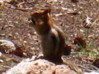
Duck higher up above the ford on the South Shore
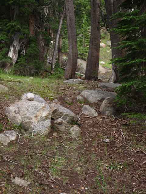 |
SOUTH SHORE DUCK We have to get around this feature to find the line of wild ducks and bits of use trail continuing upstream. We are moving away from the ford behind us at a 45 degree angle looking beyond the duck for the path leading us up around the granite feature. |
Climb South of the Upper Ford
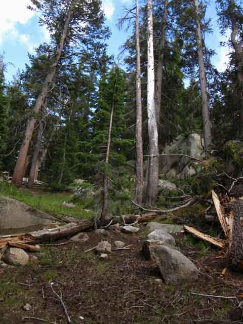 |
We find our way to the interface between rock and forest on the Left edge of this formation where we hit the gap to continue South along a nice traversing route above the South bank of the Clarks Fork. |
Making our way Upstream
| Hitting the gap pictured above brings us to a fairly gentle traverse along and above the South bank of the now creek-sized Clarks Fork of the Stanislaus River. Except during the surge of the Spring Thaw. Then this baby is roaring and rolling! |
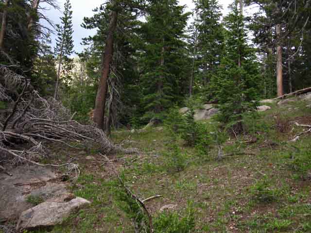 |
The force of water during the Spring Thaw actually roars and rolls large boulders downstream. Anyway, we are going to follow a subtle line of route upstream, and sometimes a not so subtle line of wild ducks up to our next landmark, The Waterfall.
We may be able to line one wild duck up with the next If we keep our eyes wide open. The actual level of wild ducks and the status of use trail will change from year to year and season to season. |
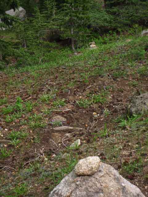
Looking Down Stream
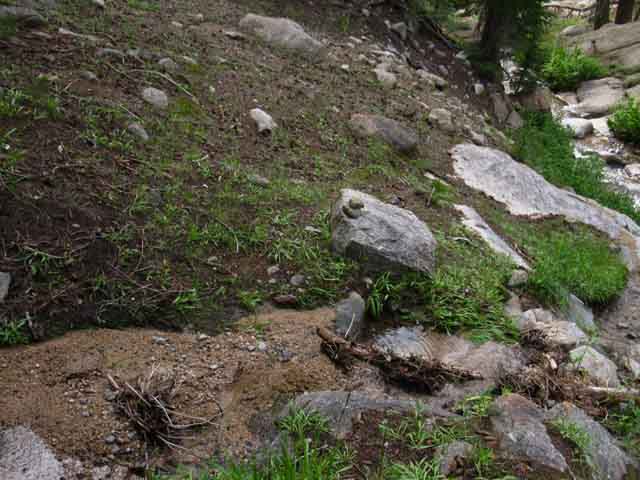 |
We find a wild duck on a little wash recently charged with a sandy flow by intense tropical downpours during July of 2015. This is not the tributary up out of the headwaters bowl, which lays above the waterfall. |
The Waterfall Our next landmark is The Upper Waterfall. This is more of a water slide than a waterfall. The different definitions are demanded by the less extreme angle of the drop from the top to the bottom of this water slide. This configuration adds to this feature's unique beauty. |
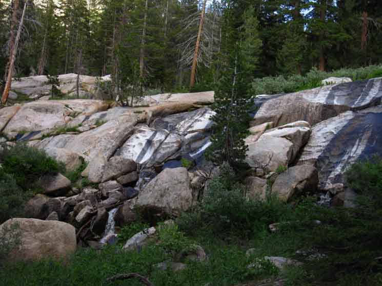 |
| Upper waterfall along the Tahoe to Yosemite Trail in the Clarks Fork Headwaters Bowl. |
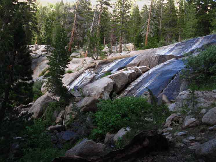 |
| We're moving to our Right to find the route up to the deck the waterfall is sliding off. |
A couple of Ducks to the top of the Waterfall
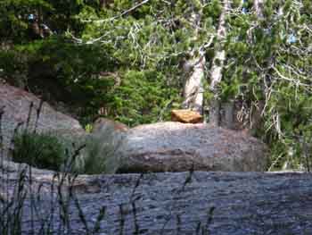 |
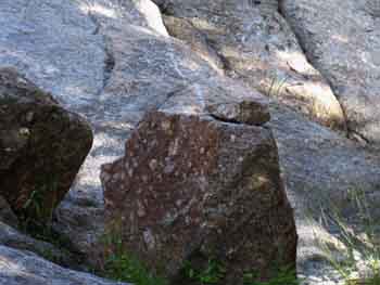 |
|
We find a couple of ducks off to our Southbound Right leading us up to the top of the waterfall. |
||
South Beyond the Waterfall
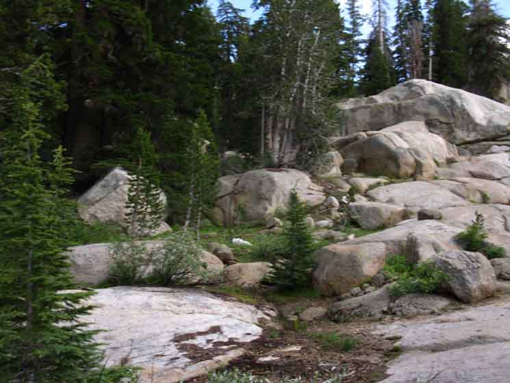 |
| Reaching the top of the waterfall draws our eye to our Right towards the route continuing South before we stop to check out the unique terrain atop the waterfall. |
Upper Waterfall above the Upper Waterfall
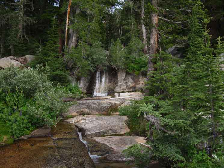 |
Surprise! The water slide is not the upper waterfall! We find another waterfall after making our way onto the nifty flat deck atop the water slide. See the "low water" slot? |
Man, this is cool.
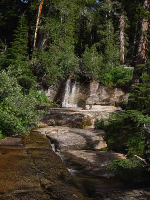 |
| Waterfall onto the upper deck of the "water slide" waterfall. |
Lip of the Upper Waterfall
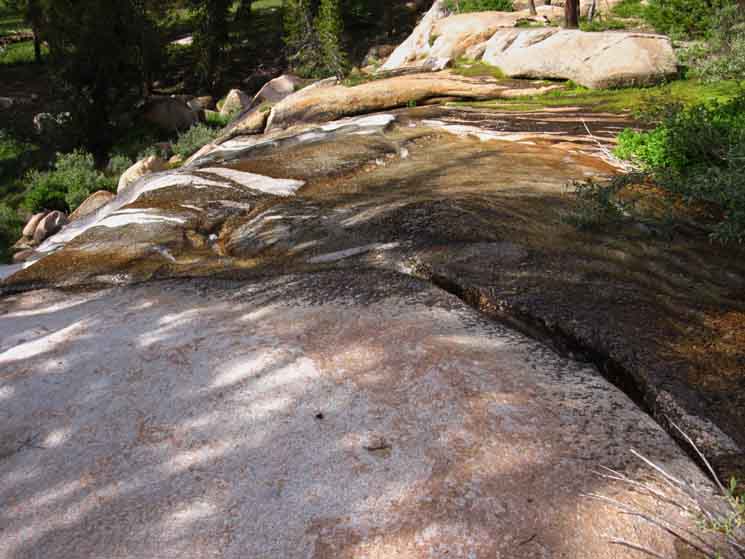 |
| Looking off the lip of the upper waterfall. |
Trail Continuing South
Above & Past
the
Waterfall
|
We backtrack off the deck of the waterfall to review our route South, which we see above into the forest to the Left of the granite above. Wild Ducks continue to inform our route selections. |
Looking Back at the Waterfall from Above
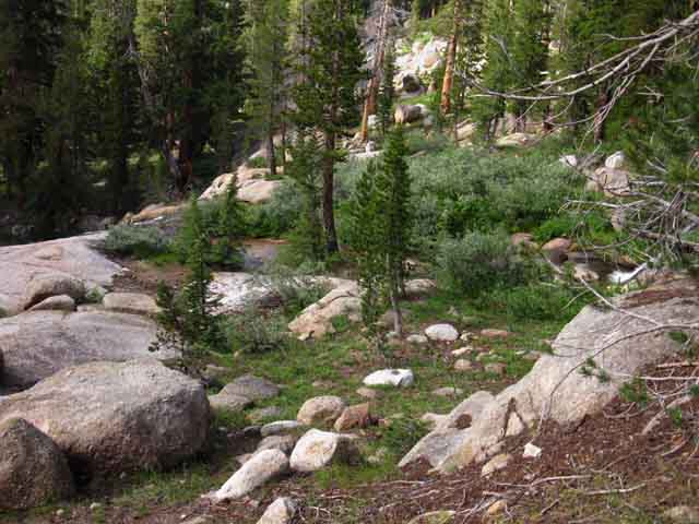 |
| Looking back down at the upper waterfall as we climb away. |
 |
Good wild ducks lead us up from the waterfall, still moving upriver, until we turn South up a well ducked tributary. |
Climbing Upriver from the Waterfall up to the Tributary
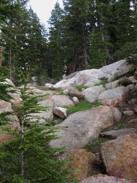 |
| Channel brings us up to tributary, which I neglected to photograph! |
Cliffs to the East of our Passage Out
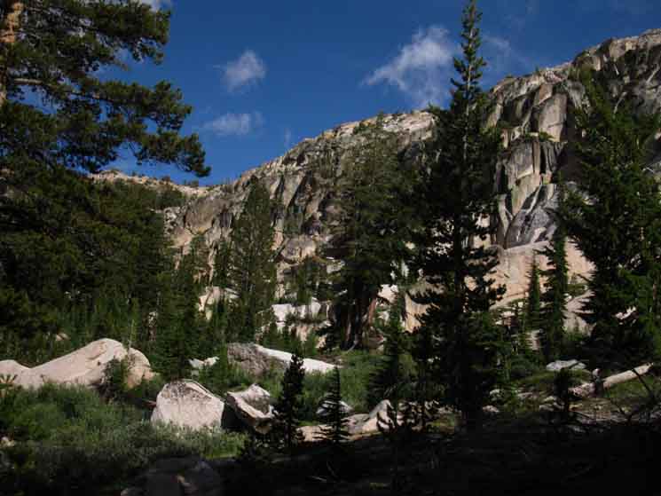 |
The South Wall of the Clarks Fork Headwaters Bowl The tributary has bent off a little to our East, and we to the West. The flow of the tributary creek runs down through the East side of the slot we climb out of, while we will climb up through the West side of the slot. Our route and the route of the creek come together about halfway up the slot. |
Detail of Eastern Cliffs
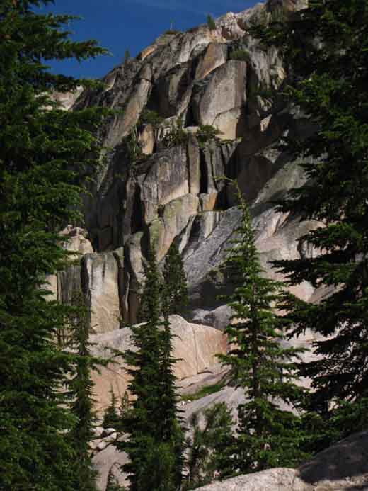 |
Impressive cliffs rising to the East of our position. The Slot we climb through is out of the Right edge of this image. |
Looking West
Approaching the Base of the Cliffs
The rocky cliffs to the Right (West) of the channel out of the Headwaters Bowl.
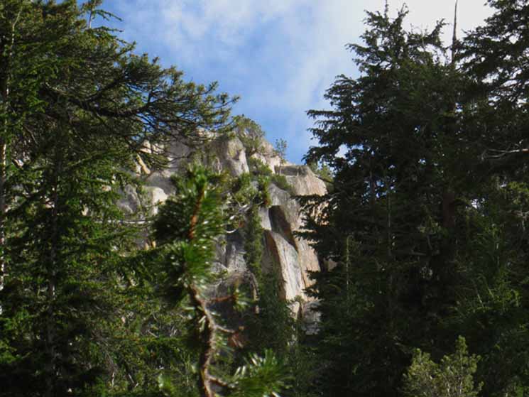 |
Approaching the base of the cliffs along the South wall of the headwaters bowl we begin to see the wall of cliffs to the West of rock channel, the slot, we will be climbing through off the floor of the headwaters bowl up to the rim. The slot through the cliffs is out of the Left edge of the images above and below. |
Detail of Cliff Walls West of Slot
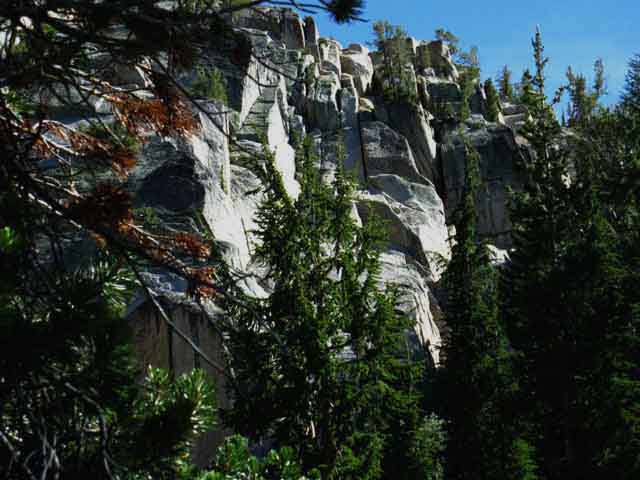 |
||
Getting closer to the base of the cliffs brings us out from under the dense forest to reveal the sheer but still shattered nature of the cliffs running West of the slot. The Terrain of the South wall of the headwaters bowl is ultra sheer cliffs on both sides of the slot we climb through to the top of the headwaters bowl. Very impressive terrain.
Now let's take another look at the walls of the headwaters bowl to our East. |
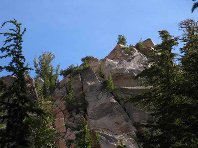
Wall of the Clarks Fork Headwaters Bowl
East of the Slot
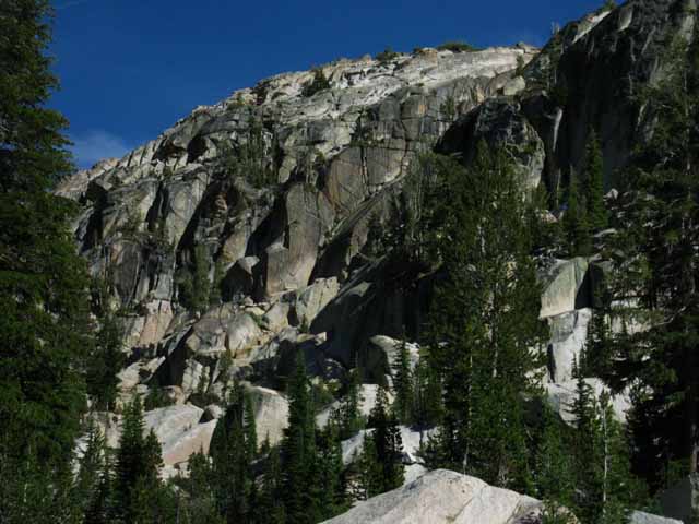 |
||
Majestic granite lining the South wall of the Clarks Fork headwaters bowl to the East of our channel climbing to the top of the cliffs. This view to the East-Southeast is while approaching the lower reaches of the rocky channel up to the top.
|
The Depending on Direction The Last The First A Pivotal Wild Duck |
 |
||
Wild Duck This is the top and last duck for Southbound hikers below the rocky channel, the slot in the cliffs climbing out of the base of the Clarks Fork of the Stanislaus River up to the top of its headwaters bowl. Northbound hikers will find this duck is the first is a series of wild ducks leading down first to the Clarks Fork of the Stanislaus, then the waterfall, and finally down to the uppermost ford on our way down to the North end of Clarks Fork Meadow. All Right! On the next page we will climb the slot to the top of the headwaters bowl, hike around the headwaters bowl across or through Saint Marys Pass, depending on how we want to hook up with the maintained trail coming up from the Saint Marys Pass Trailhead on Highway 108. This next segment of trail is our last bit of unmaintained trail along our Tahoe to Yosemite Trail down to Tuolumne Meadows. Headwaters Bowl
|
North: Boulder Lake junction South: Headwaters Bowl to Saint Marys Pass Trailhead
Backpacker Forums Have a great Sierra Nevada trip or story to relate? A fine piece of gear? Or gear that failed?Post it on If you have specific experiences, comments, questions, or pictures and videos of the Pacific Crest Trail between Lake Alpine and Saint Marys Pass, Post up here:Forum Section
|
North: Boulder Lake junction South: Headwaters Bowl to Saint Marys Pass Trailhead
The Tahoe to Whitney Trail Guide and Forum have been built, funded, and supported by my individual efforts, with help from my friends and Sister. THANKS! If you feel these efforts are valuable to you, This is the first full and free classic trail guide of and on the web. A True "Digital Book" |
Trailhead
Contact
Alex Wierbinski

Backpacking Lake Tahoe to Mount Whitney
Your Guide to the High Sierra Crest, including the Tahoe to Yosemite, Pacific Crest, and John Muir Trails
