The Trails
Guide
Maps
Miles/Ele
Permits
Resupply
Forum
Current Weather Conditions
Weather Notes
Northern High Sierras
Central High Sierras
Southern High Sierras
Gear
Gear List
Gettin Started
Layering
Discussion
Testing yourself and your gear
Gear Reviews
Hiking
Jenkins Canyon to Boulder Creek
Backpacking
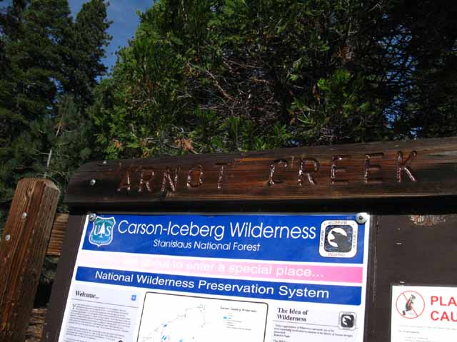
Carson-Iceberg Wilderness
Hiking
The Tahoe to Yosemite Trail between Lake Alpine to Saint Marys Pass
Languages
Languages
Trail Arts
The art of walking
Physical Preperation
Trail Skills
The trail
Off the trail
Scrambling
Maps
Navigation
Camp skills
Food
Resupply
Food
Other
Photo Catagories
Trail Stories
Trail Culture
News and Science
Links
Groups
Books
Terms and Conditions of Use
| Trail Guide Index Highway 4 to Highway 108 |
GUIDE NORTH TYT Rock Lake to Jenkins Canyon |
TYT or PCT? 15 minute TOPO MAP Jenkins Canyon Trail Junction |
GUIDE |
South on TYT Arnot Creek Disaster Creek Boulder Lake |
Topo Maps
all |
Resupply Resupply |
National Forest Stanislaus |
|
| GUIDE SOUTH TYT Boulder Creek to Saint Marys Pass |
TYT Lake Alpine to Saint Marys Pass MILES AND ELEVATIONS |
PCT Ebbetts Pass to Sonora Pass MILES AND ELEVATIONS |
30 min Topo Map |
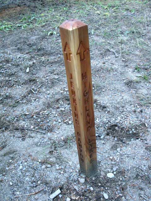
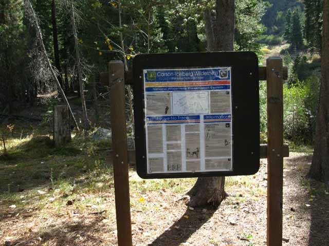
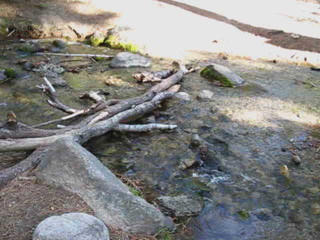
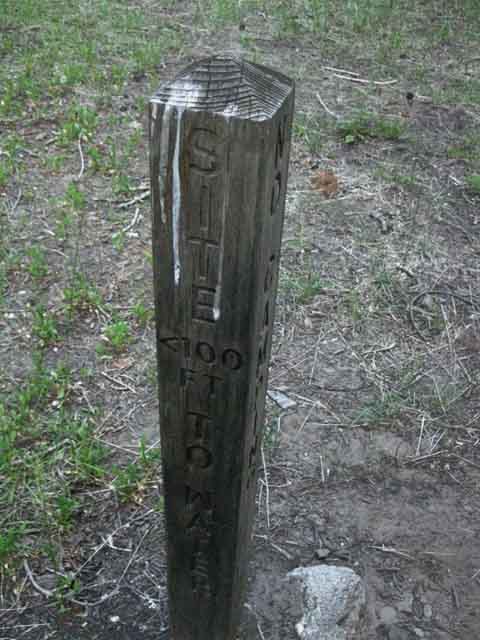
The Jenkins Canyon Trail Junction
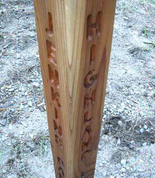
Highland Creek
 |
||||||
Place and Options Options
Opening Moves Alternative Long Distance Route Local Loops Or, Jenkins Canyon is our next waypoint on our grand hike down the classic Tahoe to Yosemite Trail. It's up to you! Watersheds TYT to the Sierra Crest Next Interestingly enough, we will still be on the Western flank of the Sierra crossing over Saint Marys Pass. Saint Marys Pass is a low gap between Western watersheds, not a division between the Eastern and Western flanks of the Sierra Crest. The runoff from both sides of Saint Marys Pass flows down to the same endpoint, which is where the Clarks Fork merges into the Middle Fork of the Stanislaus at the intersection of Clarks Fork Road and Highway 108. Maps
|
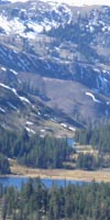
Backpacker's IndexArriving at the Jenkins Canyon trail junction we've hiked 11.58 miles South on the TYT from the Silver Valley Trailhead located on the East Shore of Lake Alpine. Let's get some context on our position with the maps and mileages.
Lake Alpine to Saint Marys Pass Jenkins Canyon Trail Junction
Southbound Tahoe to Yosemite Trail We're 8.13 miles from stepping onto the paved Clarks Fork Road, where we begin a 3.61 mile hike up to the end of the road past a couple of big car campgrounds and church retreats before passing through the Clarks Fork Traihead at the end of the road, where we reenter wilderness. The Way Forward and the Way Around Local Color and Character Ahead I'd say each of these divergent populations could all "unpucker" by a few degrees, to find the common roots drawing us all to this beauty. This is therefore the mutual basis of an ethical equality, for each group to see the other as unique perspectives, each being aspects and reflections of the multi-faceted face of reality, rather than as competing perspectives, with each vying to monopolize the definition of reality and impose it on the others. We are not "it" from one particular perspective, but can only get a glimpse of "its" grandeur through the combination of all of our perspectives. That's just the way it is. Our ability to understand the reach of our perspective measures either our understanding or our ignorance. The scale goes both ways. The zealots, be they Consumers or Christians or both, could all use some long distance backpacking to cure what ails them. I'd send them all on a forty day Tahoe to Whitney backpacking trip to bring them all into better balance with themselves and each other. Ironically, this weird bit of "civilization" we encounter along our otherwise remote Tahoe to Yosemite Trail along Clarks Fork Road precedes us hiking into the very remote section of unmaintained trail over Saint Marys Pass. We can loop around this segment of road and civilization by hiking up to the Pacific Crest Trail by turning up to the PCT via Highland Lakes through this Jenkins Canyon trail junction at the top of this guide page, or through the Boulder Lake trail at the bottom. The configuration of trails across the Carson Iceberg Wilderness has something for every backpacker. We discuss these hiking options below. Jenkins Canyon
|
||||||||||||||||||||||||||||||||||||||||||||||
| INDEX On this Page |
||||||||||||||||||
Start: Jenkins Canyon trail junction. Discussion of Route Options Long and Short.
Video
Passing South of the Dardanelles
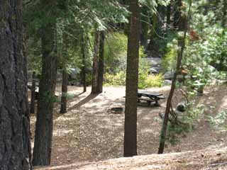
Jenkins Canyon Meadows: Nice primitive campsites.
Miles
Road Map |
Weather
All Weather and Fire Information All High Sierra Weather Resources Comprehensive High Sierra Fire and Smoke Information
|
Video
Sand Flat Campground with Backpacker Resources
Sand Flat to the End of the Clarks Fork Road
End of the Clarks Fork Road: Disaster Creek and Clarks Fork Trailheads.
Miles
Video
Miles |
||||||||||||||||
| > Forum < | ||||||||||||||||||
All backpackers can post text comments about this segment of trail from Jenkins Canyon to Boulder Lake trail junction through the comments links all over this guide page. These links are for your comments, questions, updates and hiking reports, for you to add your perspective and experiences on these trails. We're all different and experience things differently. Share your experiences. It informs others who think like you as well as those who don't. Registered Members can post up stand alone posts about this section of the trail with images, maps and videos in the Trails Forum for this Lake Alpine to Saint Marys Pass section of the Trail Guide. Add information through the comments links and read this supplemental information through the forum links. Check out the Tahoe to Whitney .org Backpacking Trails and Topics forums
|
||||||||||||||||||
| Basic Quick Facts | ||
| Miles | Maps | |
Jenkins Canyon trail junction Arnot Creek Trailhead Sand Flat Campground Disaster Creek and Clarks Fork trailheads, end of Clarks Fork Road Saint Marys Pass |
Topo Hiking Maps
Carson Iceberg Map Indexes |
|
| click the red dots on the maps for that trail location. | ||
Jenkins Canyon trail junction
along the
Tahoe to Yosemite Trail
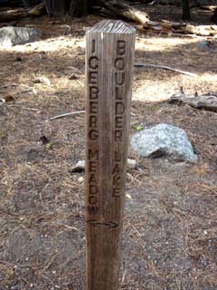
Jenkins Canyon trail junction Both Long and Short distance backpackers have lots of options Long Distance Tahoe to Yosemite Trail Hikers Long distance backpackers Southbound on the Tahoe to Yosemite Trail turn Right to continue South through Jenkins Canyon. If you are not interested in the following discussion about hiking loops around the Carson Iceberg Wilderness or the alternative long-distance route options up to the Pacific Crest Trail from the Jenkins Canyon trail junction, skip to the trail guide's continuing description of the Southbound Tahoe to Yosemite Trail up Jenkins Canyon, below. Medium and Long distance Local backpackers hiking local loops or trail segments out of the Silver Valley Trailhead at Lake Alpine can continue straight through the Jenkins Canyon trail junction up Highland Creek to Highland Lakes. The well-maintained dirt Highland Lakes Road accesses the Highland Lakes from Highway 4 near Ebbetts Pass. Highland Lakes can be the end-point of point to point backpacking trips from the Silver Valley Trail head. Or it can open up a series of backpacking loops for local backpackers and alternative routes South for long distance backpackers. Our exceptional opportunities to craft backpacking loops around the Carson Iceberg Wilderness are dependent on the four trails that connect the PCT and TYT across its length. These are the Highland, Arnot, Disaster, and Boulder Creek Trails. The backpacking loops described below are expanded by using the furthest connector trails at the North and South ends of the Carson Iceberg, and contracted by using the nearest connector trails to our selected trailhead, independent of where we begin, independent of which trailhead we use to jump onto this grand hamster wheel for backpackers. The two maps below lay out all four of the trails linking the TYT to the PCT across the Carson Iceberg Wilderness.
Silver Valley Trailhead to Highland Lakes and Wolf Creek Pass The Northern ends of the Arnot and Disaster Creek trails coming up from the Clarks Fork Road link up with each other before terminating into the trail running from the Gardner Meadow Trailhead to the Pacific Crest Trail at Wolf Creek Pass. These two trails are ideal for local loops. They allow us to bend nice backpacking loops out of Silver Valley Trailhead through Highland Lakes, and back to Silver Valley through either Arnot or Disaster Creeks, depending on how big of a loop we want to hike. Let's examine our basic backpacking loop options hiking South out of the Silver Valley Trailhead at Lake Alpine. Arnot Creek back to Silver Valley Trailhead Disaster Creek back to Silver Valley Trailhead Arnot and Disaster Creeks offer us two trail examples of expanding backpacking loops out of the Silver Valley Trailhead. We can expand these loops by a couple of more degrees. Carson Iceberg Wilderness
Boulder Lake back to Silver Valley Trailhead Hiking 10.69 miles South on the PCT from Wolf Creek Pass we encounter the 2.74 mile trail down to the TYT through Boulder Lake. From Boulder Lake trail junction on the TYT we have 25.88 miles North returning to our starting trailhead at Silver Valley. The Full Loop We can put together the backpacking loop that suits our needs, abilities, or conforms to our constraints around the Carson Iceberg Wilderness. We can put together short backpacking loops for those of us who are time or mileage constrained, and big loops encompassing most of the Carson Iceberg Wilderness for those who have time and energy. This guide contains the information necessary for us to plan and execute these backpacking loops, section hike the PCT or TYT across the Carson Iceberg Wilderness, hike the length of the Sierra Nevada between Lake Tahoe and Mount Whitney, or just plan and execute a simple in-and-out hike to a sweet lake. I urge you to do it all, one sweet step at a time.
Highway 108 We can craft these grand backpacking loops around the Carson Iceberg starting from any of the circle of trailheads around the wilderness adjacent to the PCT and TYT. I use Silver Valley Trailhead as an example because it is the trailhead we entered the Carson Iceberg Wilderness along our Southbound TYT route. We can begin our big Carson Iceberg backpacking loops anywhere around the perimeter of the wilderness. We can start out of the Highway 4 trailheads or those trailheads along the Clarks Fork Road and Highway 108 to put together basically the same medium and long distance backpacking loops out of, and back to their respective trailheads as described above. We just need to modify our route a bit to suite the particular starting trailhead we've chosen. The Carson Iceberg is covered by a web of trails. Once we get onto this web of trails we can move all around it, across it, and to its peripheral anchor points. Check out the links to the maps and miles pages to find a suitable loop of the best distance, the proper level of difficulty, and most convenient starting trailhead for you.
Carson Iceberg Wilderness
Getting Started Big Hiking Loops Use either the PCT or the TYT to hike out from your selected trailhead, then use the other to return. Deciding which connector trails you use to tie the in-and-out trails together determines the length of your backpacking loop around the Carson-Iceberg Wilderness. Choose wisely! How Many Loops? When I get the chance I'm going to find a mathematician to figure out the number of loops we can craft out of the 8 trailheads, two main trails, and four connector trails that characterize the Tahoe to Yosemite and Pacific Crest Trail routes across the Carson Iceberg Wilderness. I live next to UC Berkeley, and have had a few math whiz kids as pals over the decades I've been here. The next gets to work this one out. If you can set up and work out this equation, shoot me an email. Many fine loops from all compass points Independent of where we start our backpacking trip, from either the Highway 4 or 108 corridors (or even out of 395), we have a lot of excellent hiking loop options in the Carson-Iceberg Wilderness. Check out this Trip Report of a fifty-mile Carson Iceberg Loop. Another way into this maze of trails that I have not mentioned is from the East, through the remote Corral Valley Trailhead situated on historic Rodriguez Flat at 8000 feet wedged into the East Sierra flank at the end of a dirt road twisting off of Highway 395. Access is just North of the town of Walker, about 17 miles North of the junction between Highways 108 and 395. There are backpacking loops around the Carson Iceberg Wilderness to suit a wide range of fitness and experience levels, or one person's evolution through time and space. Start yourself off with little trips, grow into big backpacking loops, and begin to explore the art of cross country travel remaining within the Carson Iceberg Wilderness. Let's Review The Arnot-Disaster Creek loop's 18.3 miles includes 4.17 miles of hiking along the paved Clarks Fork Road between the Arnot and Disaster Creek Trailheads, so we could reduce this loop down to 14.13 miles by leaving cars at both our Clarks Fork Trailheads, if possible. Check out our route options on the
|
Where We Are TYT South to Saint Marys Pass
Our interaction with the Clarks Ford Road is limited to our 4.17 miles hike upstream on the TYT along the Clarks Fork Road from trailhead to trailhead. Though it's 4.17 miles from our emergence out of the Arnot Creek Trailhead to the Clarks Fork Trailhead at end of the road, only 3.61 miles of this are up the paved road. The remaining .56 mile is our hike down the dirt road from the trailhead to Clarks Fork Road. We re-enter wilderness through the Clarks Fork Trailhead at the end of the Clarks Fork Road for the short 2.56 mile hike South to the Southernmost of the 4 trails connecting the TYT with the PCT across the Carson Iceberg Wilderness, the Boulder Lake trail junction. Backpacking Route Options We've got range and imagination... a dangerous combination. This guide shows us both how to go over and around the rough route over Saint Marys Pass, to suit our plans. Local Trailheads I've spent some fruitful time here, and I suggest you do too. Passing Connector Trails and Trailhead Hiking South on the TYT
Join the discussion of our Route Options further South down the TYT at the Boulder Lake trail junction. Road Map
|
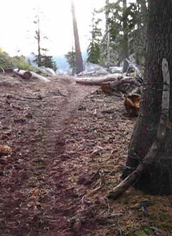
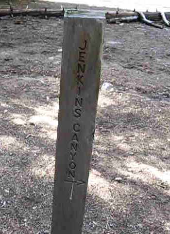
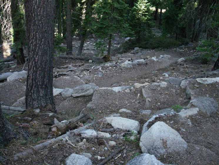
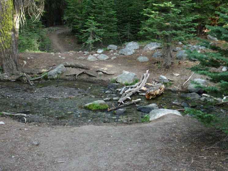
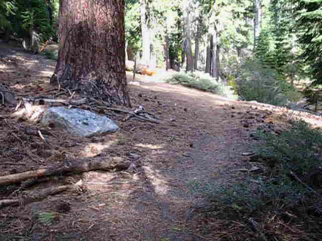
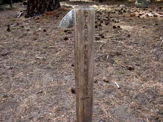
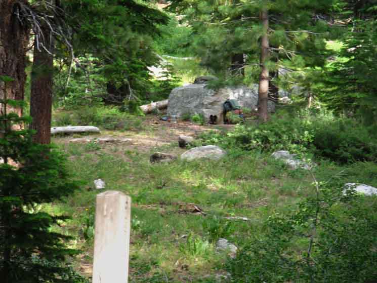
Jenkins Canyon Trail Junction
Let's step back a little... The Jenkins Canyon Trail Junction |
||
 |
||
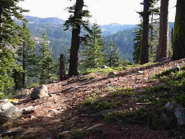
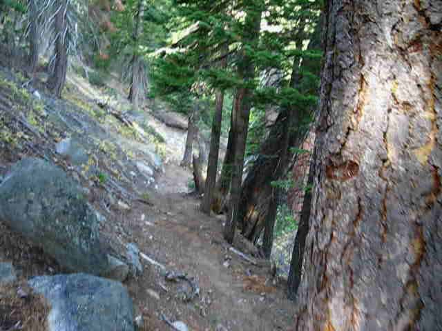
Above: Southbound Backpacker's View of the Jenkins Canyon trail junction. TYT North and South From Jenkins Canyon we continue our Southbound route along the Tahoe to Yosemite Trail to our Right. To the PCT The Northern ends of the the Arnot and Disaster Creek Trails up from their Clarks Fork Road Trailheads intersect with our trail from Highland Lakes to Wolf Creek Pass. Highland Lakes Backpacking Map These trails and junctions all offer amazing backpacking loops...
|
Southbound
on the
Tahoe to Yosemite Trail
Jenkins Canyon
|
| Jenkins Canyon to Arnot Creek Trailhead |
||
The Tahoe to Yosemite Trail across the middle of the Carson Iceberg Wilderness Video Duration: 11:04.
|
Turning up Jenkins Canyon on the Southbound TYT presents up with a 2.27 mile climb up 1262 feet from the trail junction to the narrow gap through forest at the top of the canyon leading to the top of Wood Gulch descending the other side of this mountain ridge.
Lake Alpine to Saint Marys Pass
Backpacking Miles and Elevations
The lower half of the trail up Jenkins Canyon is steeper than the upper. The upper section of the trail flattens a bit climbing up a high meadow, before we encounter the steepest last section up to the gap over to Woods Gulch.
Jenkins Canyon to Clarks Fork Road
15 minute backpacking map
We're following a creek up Jenkins Canyon, and we find a nice campsite off to our Right at the top of an open meadow about halfway up to the top of the canyon.
Jenkins Canyon to the Top of the Canyon
Jenkins Canyon trail junction to gap in the ridge dividing Jenkins Canyon from Wood Gulch, 1262 feet of elevation over 2.27 miles. |
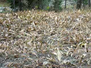
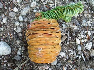
| Fall: Dying Mule Ears in Jenkins Canyon. | Red Fir Cone. | |||||
 |
 |
|||||
| Soon their dried leaves will make the sound of rustling paper on every breeze. | Comments on the Tree Forum. |
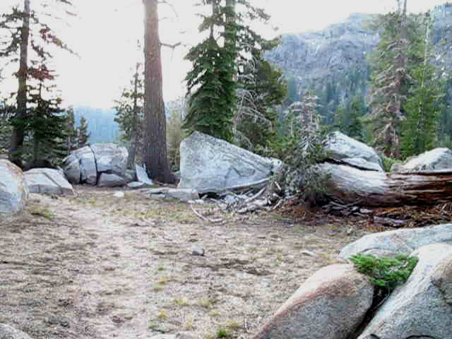
Passing South around the Dardanelles
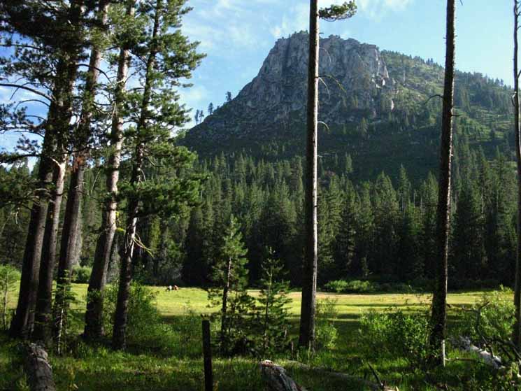
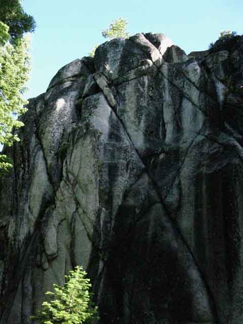
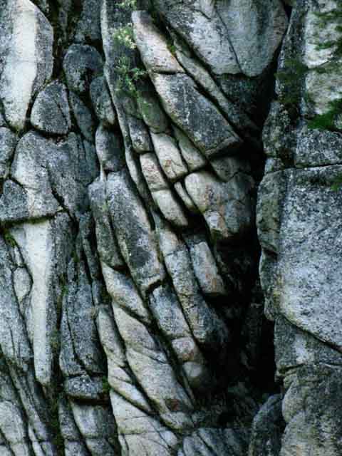
| The Dardanelles is the Southwest wall of Jenkins Canyon, which we are looking at below as we hike South, to our Left, up into Jenkins Canyon. | ||
 |
||
We're looking at the gnarly Northeastern shoulder of The Dardanelles. Note how our Tahoe to Yosemite Trail passes South over/around the East shoulder of the Dardanelles. Spicer Meadow Reservoir to
Clarks Fork Road
|
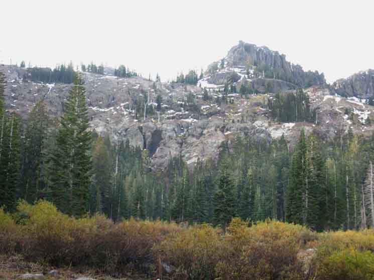
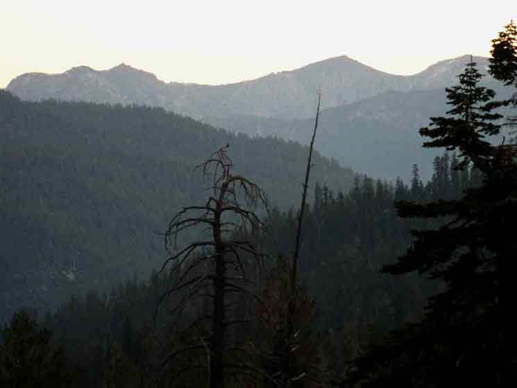
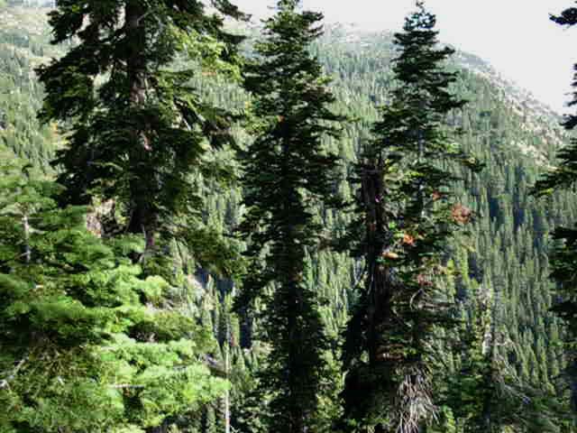
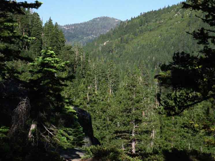
Hiker's Note Some Context On the East side of this ridge Arnot and Disaster Creeks roughly mirror each other on wrapping around the opposite flanks of Lightening Mountain, with Disaster Creek running along the Western flank of the Sierra Crest. Looking Northeast up Highland Creek we can see Hiram Peak at the top of the line of peaks, followed by Airola and Iceberg Peaks from Left to Right on the ridgline descending down towards our position entering Jenkins Canyon. To our East-Southeast we can get a couple of glimpses of the main line of the Sierra Crest beyond, capped by Stanislaus Peak, before hiking deeper into Jenkins Canyon eliminates long views of the surrounding terrain. Other Side of the Mountain These two great trails, the TYT and PCT are moving towards a near convergence at Sonora Pass. The Southbound route of our Tahoe to Yosemite Trail emerges onto Highway 108 through the Saint Marys Pass Trailhead about a mile West of Sonora Pass, where the PCT crosses Highway 108. The Pacific Crest Trail passes under the East flank of Stanislaus Peak before wrapping around the East and South flanks of Sonora Peak to arrive at Sonora Pass. The TYT wraps around the West and South flanks of Stanislaus Peak before it climbs over the ridgeline descending off the Southwestern shoulder of Sonora Pass, which makes up a substantial amount of the headwaters bowl of the Clarks Fork of the Stanislaus River. We have to climb out of the headwaters bowl through Saint Marys Pass to reach the Saint Marys Pass Trailhead on Highway 108. Southern Carson Iceberg Wilderness We're observing this surrounding terrain on the Tahoe to Yosemite Trail climbing South up into Jenkins Canyon. That's why I want to walk these trails multiple times. We're going to see new things and gain new perspectives each time. |
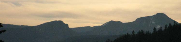
Viewing the Sierra Crestline Looking East across the Southeastern Carson Iceberg Wilderness. Stanislaus Peak on the Sierra Crestline |
||
 |
||
That's the Sierra Crest in the Glowing Twilight, capped by Stanislaus Peak. Hiking up into Jenkins Canyon we get brief points of view to the Northeast and the East at the Sierra Crestline featuring Stanislaus Peak. Sonora Peak, marking the location of Sonora and Saint Marys Passes for the purpose of orienting ourselves, is out of the frame of this image just a bit further South on that same section of the Sierra Crest. The Southernmost connector trail linking the Pacific Crest to Tahoe to Yosemite Trail via Boulder Lake climbs to the crestline on the far Left side of the visible crestline in the image above, where we can see the crest dropping down a bit. In the image above we're hiking up into Jenkins Canyon, which is located to our Right, and we've bent our head 90 degrees to our Left for the view.
|
Stanislaus Peak
Sierra Crestline to our East-Southeast topped by Stanislaus Peak. Detail of Southeastern Carson Iceberg Wilderness from 7200 feet of elevation in Jenkins Canyon. Looking East-Southeast at the Sierra Crestline rising between the East fork of the Carson River on its far Eastern flank from our position on TYT route moving toward the Clarks Fork of the Stanislaus River's twisting canyon for the hike up to the Western flank of Stanislaus Peak, and Saint Marys Pass. |
||
 |
||
The peak on the far Right is tracing out the distinctive outline of Stanislaus Peak, visible from all directions. To put this area into a broader context check out various views of Stanislaus Peak from surrounding terrain. We can see Stanislaus Peak looking South from the top of the PCT crossing Tyron Peak South of Ebbetts Pass (it's Left of Ari's Head), from the North side of Murray Canyon on the PCT, from the East out of the unmaintained trail along the East Carson River, and from Saint Marys Pass. From that high point on Tyron Peak along the Pacific Crest Trail we also overlook the the terrain where Disaster, Arnot, and Highland Creeks cut down-mountain to their intersection points with the Tahoe to Yosemite Trail. The TYT approaches the Sierra Crest hiking alongside the Clarks Fork of the Stanislaus flowing down from its headwaters bowl under the South Flank of Stanislaus Peak. We are currently climbing South out of Highland Creek's valley on our way over to the Clarks Fork of the Stanislaus River. We'll drop into the lower section of Arnot Creek and follow it a short ways down to where it enters the Clarks Fork. From there we'll follow the Clarks Fork upriver, first on paved road, then back to wilderness trail, and eventually unmaintained trail as the Clarks Fork turns under the base of Stanislaus Peak's West Flank to bend around under its Southern flank into its untrailed headwaters bowl. The Carson Iceberg Wilderness map lays out how the shape of this section of the Sierra Crest determines the route of our Tahoe to Yosemite Trail. The unique terrain here is the key to how the route of the TYT is divided from, and linked to, the Pacific Crest Trail across the length of the Carson Iceberg Wilderness. Carson Iceberg Wilderness
|
Climbing out of Highland Creek
Looking Northeast
Looking North of East at Hiram Peak, Airola Peak, and Iceberg Peak, from Left to Right along the ridgeline dividing Highland Creek on this side of the ridgeline above Highland Creek in its canyon running up to Highland Lakes, from Arnot Creek running along its far flank Eastern flank. We're looking back over our Left shoulder climbing South up Jenkins Canyon. |
||
 |
||
The peak on the far Left, Hiram Peak, sits above the Highland Lakes. Highland Lakes are 6.46 miles up Highland Creek from the Jenkins Canyon trail junction below us, down to the Left, out of sight beyond the lower Left corner of the image above. We can see how Highland Creek's Canyon bends to the Northeast climbing to Highland Lakes, and our Northernmost access to the PCT, had we chosen to hike up Highland Creek.
|
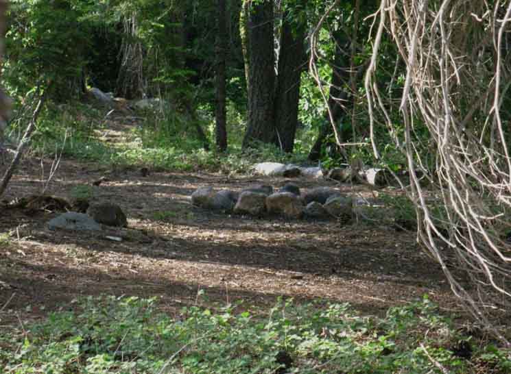
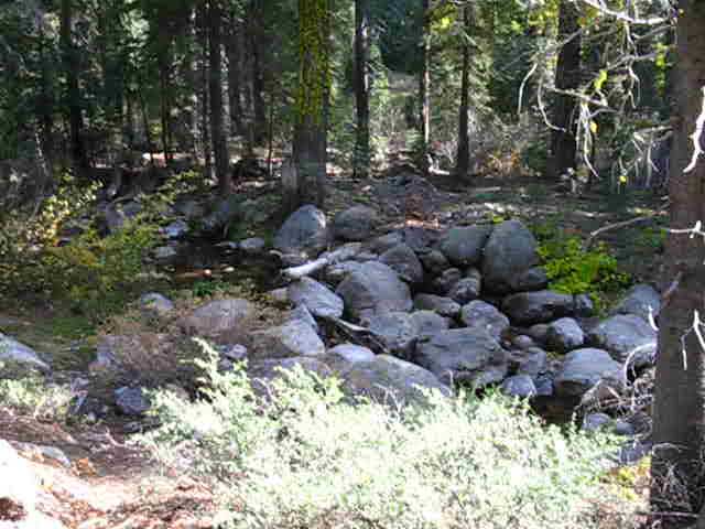
Campsites
in
Jenkins Canyon
| Jenkins Canyon Meadow. |
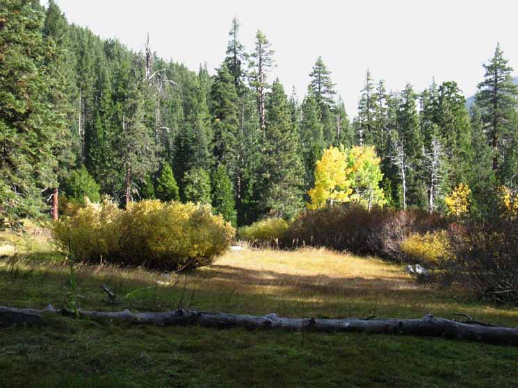 |
After the steeper section of trail up from the trail junction in Highland Canyon the terrain moderates into a steady incline, until we come to another steeper section of trail. At the top of this second steep section the incline again moderates, this time into gentle enough of a plane to support a series of meadows running up to where the terrain again steepens for a third time for the final climb through the gap in atop of Jenkins Canyon over into the top of Woods Gulch. There are three steeper climbing segments of trail along the average rate of climb up Jenkins Canyon. Above is the view waking up in the morning at the head of this small section of meadow, next to my little fire ring, with a babbling creek a few steps to our East, to our Right from this perspective. |
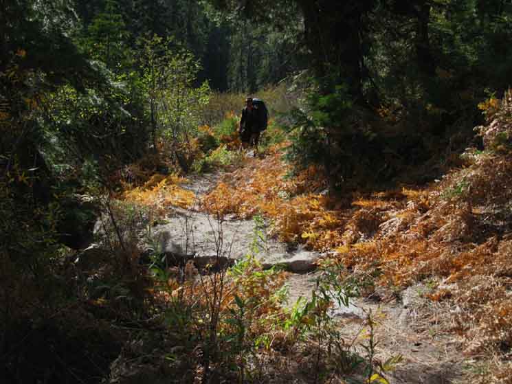
Racing the Clock, Racing the Terrain As Darkness fell we continued up, and then off, the trail up Jenkins Canyon. No problem. I follow the lay of the land and the logic of trail location. The trail will come back to me, if not I to it. I began looking for flat areas, for an ideal forest-covered flat with a campsite along the edge of the meadow as I continued to lead us up the mountain following the creek. The location of the creek told me the trail was off to our right, but I waited to cut right until I spied the upper section of the meadow above. We hiked over to what looked like the most likely spot to camp at the top of the meadow in almost total darkness, and found a nice little campsite there waiting for us. The edges of the meadows along the creek are littered with little camping possibilities. "Infrequently Maintained" It is not too hard to stay on-trail in daylight, but parts of the trail quickly fade into the surrounding terrain as twilight deepens into night. Faint trails are alright with a bit of light but disappear from sight as twilight slips into night. I suspect that the current route of the trail has been altered from the route depicted on the USGS topo map at the top of Jenkins Canyon. I will study this next time through. If you have noticed any difference between the USGS map and the trail on the ground post up your thoughts on the Jenkins Canyon to Boulder Lake page through the comments link.
The image above is looking North and down-mountain from our little campsite at the head of the lower segment of meadow. The creek runs about 40 feet to our Right. |
| Fire ring at the top of the meadow. | Jenkins Canyon's Creek runs to the East of the meadow sections, where we find little campsites and good primitive flat throw-down spots.. | |||||
 |
 |
|||||
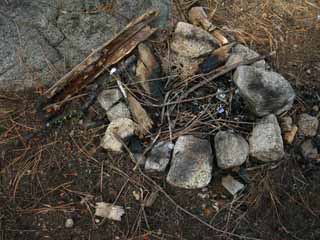
| We make no fires, except for social occasions. |
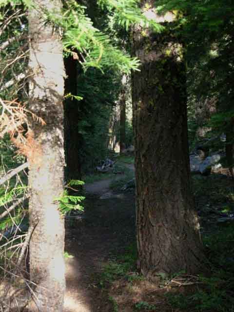
Over the Top of Jenkins Canyon into Woods Gulch
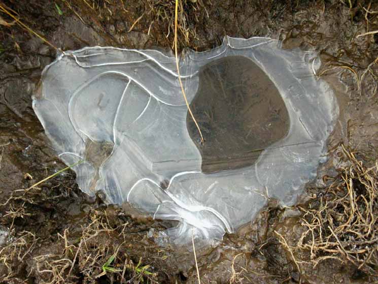
I want to kick myself. As we were climbing the last bit of the trail South up to the top of Jenkins Canyon I passed by a fresh bear track in soft mud that was beautifully framed by a delicate outline of frost. I was tired, chugging up the last steep segment of trail approaching an even steeper length of trail. Don't let fatigue-or-fear deter us from enjoying and even recording special circumstances. I was tired, and though I paused to enjoy its delicate beauty, I kept straining up the grade to our crossing into Woods Gulch without taking its picture. |
| Meadow muddy flowing wetness squeezed into clear ice by low overnight temps. | ||
 |
||
Clear Ice emerges from meadow muck over a cold October night. Though this image was taken in late October, it represents the regular below-freezing temps that we experience during High Sierra evenings all Summer long.
|
South
through the
Gap
out of
Jenkins Canyon into Woods Gulch
Into the Rising Sun
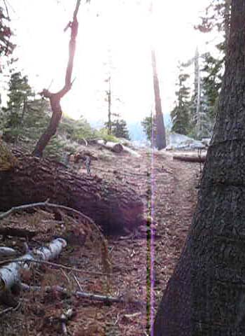
| Last steps South out of Jenkins Canyon | Departing the Forest for a moment. | |||||
 |
 |
|||||
Hiking into the rising sun. |
The trail South into Woods Gulch.
|
Looking South
into the top of
Woods Gulch
| First view South into Woods Gulch from the gap to Jenkins Canyon. |
 |
A nice soft flat area always gives the feet a break from the rigors of up and down hiking. Hard volcanic terrain of the Dardanelles is visible on right of image. |
Looking North
at the
Forested Gap
emerging from
Jenkins Canyon
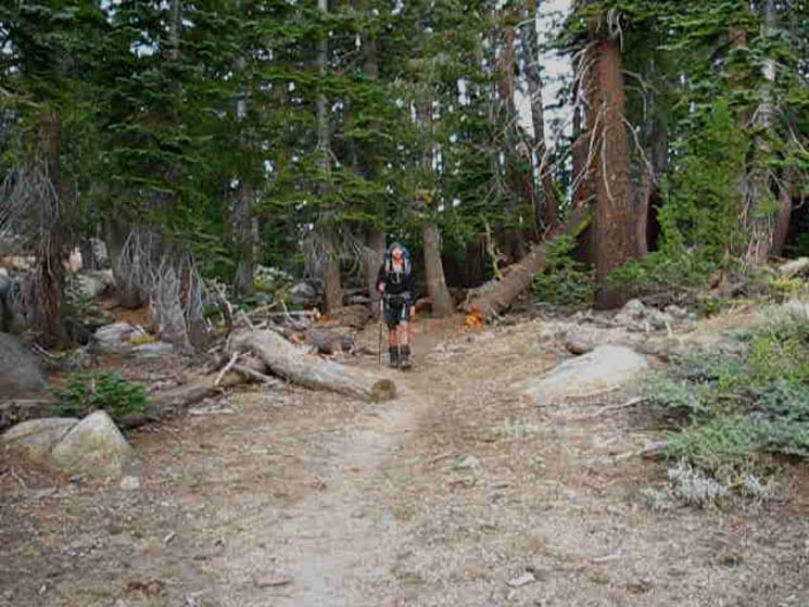
| Southbound Ari emerges from the forest into the gap filled with a soft sandy flat separating Jenkins Canyon from Woods Gulch. | ||||
 |
||||
An easy 3.65 mile hike (downhill in soft terrain) 1742 feet South down to the Arnot Creek trail junction starts here. Note the granite boulders strewn about in the picture above, and especially how the red rock of the Dardanelles lays beyond the granite boulders in the second image above. The granite terrain wraps around the Dardanelles. The Dardanelles appear to be much older than the typical volcanic areas we've crossed or skirted along, which can be measured in thousands of years. The Dardanelles can be measured in millions of years, if my perceptions are true.
Top of Jenkins Canyon 8142 feet Location along the TYT 13.85 miles South of Silver Valley Trailhead at Lake Alpine 20.72 miles North of Saint Marys Pass Trailhead on Highway 108
|
Terrain
and
Trail
hiking down
Woods Gulch
| High up Woods Gulch looking Northeast. |
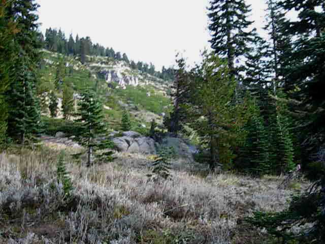 |
View Left (North-Northeast) At the Eastern base of this ridge below us (to the Right out of the frame of the image above), Arnot Creek and its trail run South along the base of this ridge from Half Moon Lake to the Clarks Fork. Behind us, over on the other side of this ridge, Highland Creek runs down from Highland Lakes. Looking South of our position here (behind us) while dropping down to the East through Woods Gulch we can see that we are still in the shadow of The Dardanelles, still skirting around the Northeastern flank of this massive volcanic hulk. Looking Northeast, as in the image above, we can see that the mountaintops along the ridge running Northeast to Highland Lakes are all capped by volcanic peaks. We've been hiking down Woods Gulch through granite terrain, and we can see volcanic to our North and South. Woods Gulch is a granite anomaly in this sea of volcanic terrain. Woods Gulch is a low spot between the volcanic ridgeline tracking Southwest and The Dardanelles. It is quite obvious that the ridge and The Dardanelles are the products of very different volcanic events, are not at all the same material, and not the same age. The Dardanelles feature is quite different from the surrounding volcanic terrain. And we are hiking down an interesting granite cut between these two very different volcanic terrains. The Dardanelles is a landmark who's position we have noted since it first came into view crossing South over Mount Reba. We are hiking South around The Dardanelles Northeast shoulder through Jenkins Canyon over into Woods Gulch. To our East-Northeast in the faint distance we can see the Sierra Crest line bending itself across our visible horizon. That's where we're going. The compass of our Southbound Tahoe to Yosemite Trail route is pointed Southeast from Woods Gulch towards Saint Marys Pass, though the trail itself will swing around the compass a bit before we get there. Cool. |
Arnot Creek
| Approaching the bottom of Woods Gulch looking Northeast up Arnot Creek. | ||||
 |
||||
We're about to drop over the edge into a steep short-switchbacked descent to Arnot Creek. Arnot Creek lays runs down bottom of the forested valley below. I mean short length switchbacks. The hulking rounded mass rising out of the far-distant center-Right is Lightening Mountain. The ridgeline we see descending along the horizon out of the upper Left edge of the image is the sheer ridgeline dividing Wolf Creek at the base the side facing us from Bull Canyon on its far side. That's the Sierra Crestline behind Highland Lakes. That ridge is running to the Northwest out of the Left frame of the image to the gap where the PCT crosses over from Noble Lake, and Tyron Peak rises up to be the high point along that ridgeline just West of the gap where the PCT crosses over to the West flank of the Sierra for a short distance. The map below Left shows the PCT coming over the gap on the Tyron Peak ridgeline from Noble Lake onto the Western flank of the Sierra. The peak at the end of the ridgeline on the upper-Left side of the image above is Peak 9578 down the ridgeline from the Tyron Peak Gap on the map below Left.
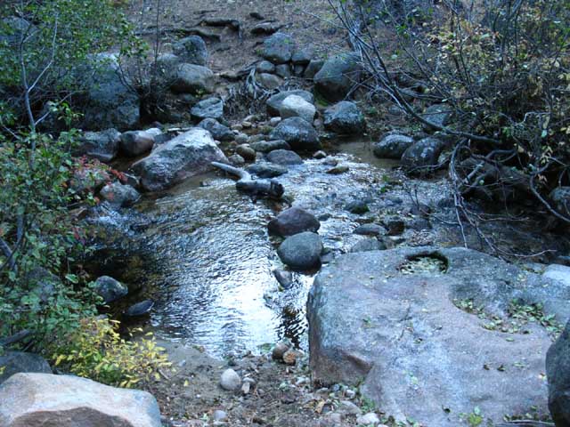
We could turn Left, upstream on the Arnot Creek Trail which Tees-out into the trail from the Gardner Meadow Trailhead (Highland Lakes Road access) to the PCT at Wolf Creek Pass. I've got the distance from our upcoming junction with Arnot Creek upstream to the PCT at Wolf Creek Pass at 7.34 miles. It's 1.65 miles downstream to the Arnot Creek Trailhead and another .56 of a mile further down a dirt road to the paved Clark Fork Road.
|
Mountainside North to the Sierra Crest
| Forest on steep ridge side looking North, to our Left, as we drop down Woods Gulch. Arnot Creek runs North and South along the base of this mountain ridge. | ||
 |
||
This is the Eastern Flank of the massif hosting the series of Peaks dividing the Highland Creek drainage running down from Highland Lake along its opposite flank from Arnot Creek on this side. We're looking North up the West side of the valley holding Arnot Creek. In any case, this is really beautiful terrain. The series of peaks capping this ridgeline running Northeastward towards Gardner Meadow are Iceberg, Airola, and Hiram Peaks. Highland Lakes, Arnot and Disaster Creeks Map
|
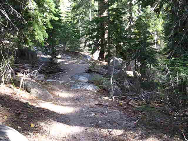
Hiking South Down Woods Gulch
| Fine trail work hiking down Woods Gulch. |
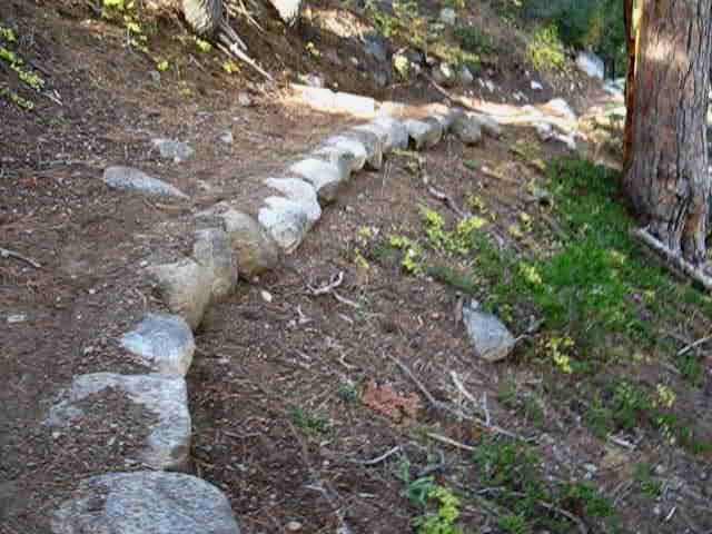 |
Stable, well-designed and soft trail... Look at the size of those boulders the trail crew located, freed, and herded into place a long time ago. Those trail crew kids work hard. Generations of those trail crew folks have worked hard to keep our trails open. Thanks Y'all! |
More Views to the North
| Forested flank of this ridge line running Northeast from Woods Gulch. | ||
 |
||
The Sierra ridge line running North of Woods Gulch. We are looking North towards the rough location of the lower Eastern Flanks of Iceberg Peak. We're also looking at serious volcanic terrain from our granite slash. Highland Lakes, Arnot and Disaster Creeks Map
|
I'll Kiss the Stanislaus National Forest Trail Crew.
You Kids are GREAT!
| Short Length Switchbacks down to Arnot Creek. Fine soft trail is easy on the feet. |
 |
What a Nifty Trail Placement. I'd normally fear the incline will creep into the trailbed, but the surface of the incline is remarkably stable looking, with lots of embedded boulders. This piece of trail running up into Woods Gulch from Arnot Creek will be here for a long time. |
The Woods Gulch
&
Arnot Creek Trail Junction
at the
Base of Wood Gulch
The Tahoe to Yosemite Trail down from Jenkins Canyon meets Arnot Creek at this junction. This junction is 1.65 miles North of the Arnot Creek Trailhead, which is .56 of a mile up a dirt road from the old pavement of Clarks Fork Road. We are 7.34 miles South of the Pacific Crest Trail at Wolf Creek Pass, if we hike upstream to the top of the Arnot Creek Trail and across Lower Gardner Meadow to the PCT. Southbound hikers on the Tahoe to Yosemite Trail turn Right here, downstream to the Arnot Creek Trailhead and the Clarks Fork Road.
Lake Alpine to Saint Marys Pass
|
| North Up Arnot Creek South TYT Down Arnot Creek We find a trail junction pointing North and South along Arnot Creek coming South on the TYT from Jenkins Canyon. |
North on the TYT The trail pointing North to Jenkins Canyon on the TYT is actually pointing West by the Compass from the Arnot Creek trail junction. |
|||||
 |
 |
|||||
Hiking North the Arnot Creek Trail first hikes through Upper Gardner Meadow, then intersects with the trail running from the Gardner Meadow Trailhead to Lower Gardner Meadow, then the PCT at Wolf Creek Pass. The trail coming up from Disaster Creek links up with the Arnot Creek Trail just South of where their unified paths T-out into the trail linking the Gardner Meadow Trailhead to the PCT at Wolf Creek Pass. The Gardner Meadow Trailhead is located off of the dirt road out to Highland Lakes from Highway 4. We would approach the PCT at Wolf Creek Pass through the Gardner Meadow Trailhead if we had hiked up Highland Creek from the Jenkins Canyon junction, instead of hiking over to Arnot Creek.
|
Jenkins Canyon is behind us Southbound TYT hikers. Carson Iceberg Wilderness We'll hike South-Southeast down a gentle meadow and forest trail through what is obviously a flood/washout zone alongside Arnot Creek down through its trailhead to the Clarks Fork Road. We'll follow the Clarks Fork a bit North of East through the end of the road where trail resumes and we finally turn South to run under Stanislaus Peak's West, then its Southern flanks approaching Saint Marys Pass. Click the RED DOTS on the maps for more info... |
Arnot Creek Trail Miles The distance from Arnot Creek Trailhead to its Northern junction with the trail between Gardner Meadow to Wolf Creek Pass is 7.96 miles, and 8.99 to the PCT at Wolf Creek Pass. From our current position 1.65 miles North of the Arnot Creek Trailhead the distance North to the end of the Arnot Creek Trail is 6.31 miles, and 7.34 miles to the PCT at Wolf Creek Pass. Arnot Creek Trailhead Arnot Creek 0
Arnot Jenkins Junction 1.65 2.89 First two fords 4.54 .86 Third ford 5.5 .38 Fourth ford 5.78 .82 Lower trail split 6.6 .33 Upper trail split 6.93 .18 Junction with Disaster Creek Trail / Upper Gardner Meadow 7.11 .85 Junction with Gardner Meadow Trail 7.96 1.03 Wolf Creek Pass, PCT 8.99 Related Trail Mileages
Central Carson Iceberg Wilderness Map Clarks Fork to Highland Lakes
|
Forestry
along
Arnot Creek
| Somebody is cutting down trees along Arnot Creek. | Yeah, sure. | |||
 |
 |
|||
Call me skeptical. I am good with dragging out the dangerous forest floor litter, and have a controlled burn. Cutting down the forest growing into mature canopy seems unnecessarily greedy.
|
||||
| It appears to be a lame attempt to make money through "thinning" the forest. |
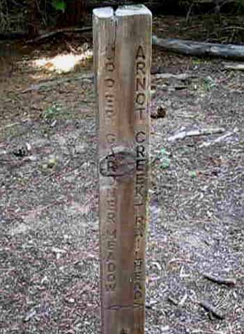
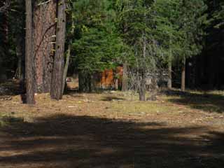
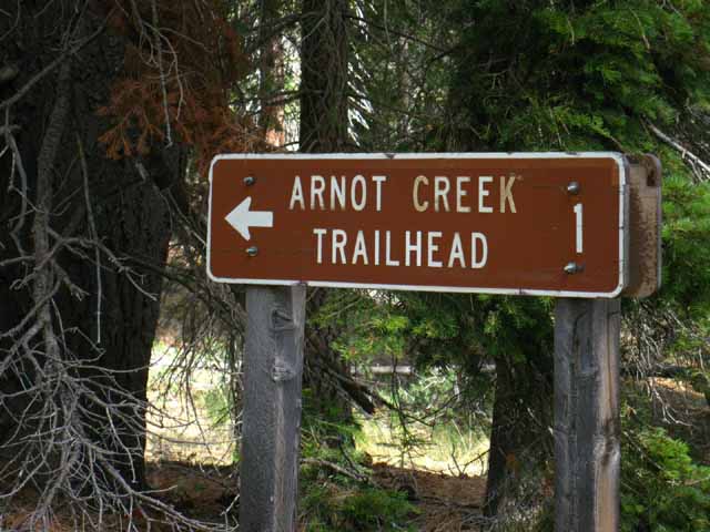
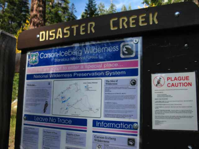
The Arnot Creek Trailhead
The Arnot Creek Trailhead is located at the end of a short well-maintained and well-marked dirt road off the Clarks Fork Road. The Arnot Creek trail runs North out of this trailhead up Arnot Creek to Half Moon Lake. From our position here on the TYT the Arnot Creek trail can link us to Highland Lakes and the PCT to our North. Arnot Creek Trailhead has the potential to be Southern starting point for loops around the central Carson Iceberg Wilderness. The North end of the Arnot Creek trail gives us access to the top of Highland Creek. The map below shows the relationship between the Arnot and Disaster Creek trails and how they merge between Highland Lakes and Wolf Creek Pass. |
|||||||||
 |
|||||||||
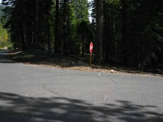
Southbound Hikers on the Tahoe to Yosemite Trail exit the Arnot Trail through this trailhead and follow the dirt road down to the paved Clarks Fork Road. The sign on the Right says "Plague Caution" because the fleas on the mammals, especially the small mammals, can carry bubonic plague. So don't play with the squirrels or chipmunks. WHO
Lake Alpine to Saint Marys Pass
|
Arnot Creek Trail head
up to the
Clarks Fork Trail head
along the
Clarks Fork Road
The old Paved Section along the old Clarks Fork Road Sonora-Mono, Clarks Fork Road History Historical Monuments History Forum Highways Road Map for auto access to the Southern Carson-Iceberg Wilderness through Highway 108 trailheads and the Clarks Fork Road. The Northern access points to the railheads along Highway 4 at Lake Alpine, Highland Lakes, and Ebbetts Pass are also marked.
(The trail guide continues South on the TYT below this essay.) Driving Driving East up the Western Sierra Foothills
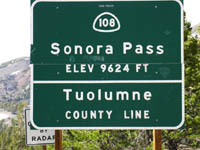
Driving East up Highway 108 we could get the impression that Highway 108 is an almost endless road. Just getting to 108 can be daunting. After struggling to get out of the traffic congesting the main population centers along the West coast of California, crossing The Valley, and meandering up long twisting foothill roads into deep and steep forests, and finally, finally pushing our straining car climbing up the steep roads into the fine melody of granite and volcanic formations of the High Sierra sub-Alpine Zone, to finally make it to the Sierra Crest at Sonora Pass. Whew! Highway 108 is a great scenic and historic drive, and driving it is an adventure in itself. Sonora-Mono, Clarks Fork Road History Independent of the specific route we take approaching Highway 108, which we can plan out on the road map above, we will pass through a series of zones on our way up to Sonora Pass. These zones are much the same independent of which of the five trans-Sierra highways is our goal, if it is not Sonora Pass topping Highway 108. Trans Sierra Highway Highway 108's 9624 feet of elevation across Sonora Pass is the second highest mountain pass in the Sierra Nevada to Tioga Pass's 9943 feet. Continuing North the elevation of the passes declines. Ebbetts Pass's 8732 feet of elevation drops to 8600 feet over Carson Pass, and Highway 50's entrance into the Tahoe Basin across Echo Summit's 7377 feet is the lowest elevation Trans Sierra Highway we cross between Lake Tahoe and Mount Whitney. Though I approach the Sierras as a single Tahoe to Whitney backpacking trip, these Sierra roads divide the long trails along the length of the Sierra into smaller sections. Fine wilderness areas sit North and South of each Trans-Sierra Highway's mountain pass, and all the Trans Sierra Highways offer rest and resupply resources, except Carson Pass on Highway 88.
Trans-High Sierra Roads: Getting There After getting out of the city we are faced with crossing The Valley. The San Joaquin Valley is not just wide, hot, and flat, it is also a very difficult place to catch a ride. Crossing The Valley entails many-many miles of hot flatness before we finally begin to feel the low rises in the terrain signaling the first beginnings of the foothills. From the smallest seeds grow the mightiest trees... Once we begin to encounter low rises on the Eastern side of The Valley, these rises grow rapidly into deep rolling undulations, telling us that Highway 49 is not located too far to our East, and we will soon be exiting the relentless plain of The Valley. Transportation Methods
Highway 49 Highway 49 begins, for our purposes, at the point where it turns South along the Western Sierra Foothills after its East & West crossing over the low-altitude Sierra North of Highway 80 (Donner Pass). Highway 49 begins on the Eastern flank of the Sierra near the town of Portola. Utility of Highway 49 Highway 49 is perfect tourist country. The relics and remnants of the Gold Rush are preserved, celebrated, and are the current cultural and economic foundations for many of the towns up and down Highway 49. There's also lots of interesting folks up and down Highway 49. The Southern End of Highway 49 Mariposa is the town where Highway 140, the troublesome central entrance to Yosemite, begins. Avalanches and undercutting of Highway 140 have kept it closed more than open during the latter half of this new century's first decade. Oakhurst, where Highway 49 ends, is where Highway 41, the Southern access road into the Yosemite Valley, begins.
Highway 395 The Eastern and Western Flanks of the Sierra Nevada Highway 395 and the East Sierra Escarpment Great dry mountain ranges sit just East of the sheer escarpment of the Eastern Sierra Nevada, with Highway 395 running though the narrow strip of high desert separating them. Mountain Ranges East of the Sierra Nevada Life in the Valleys Highway 395 is very different than Highway 49. Rather than the Highway 49 experience of following foothill ridges' undulations further East and West for every mile we make North or South, long sections of Highway 395 run in straight lines North and South along the base of the sheer Eastern escarpment of the Sierra. The rolling foothills of the Western flank pull Highway 49 in and out of the ridges descending from the crest. Highway 395 runs along the base of a precipitous escarpment. I can't think of anywhere we can see the Sierra Crestline from Highway 49 South of Hwy 80.
A Range of Choices To the Clarks Fork! Our trip up Highway 108 to the Clarks Fork road is typical of driving East up any of the mountain roads across the Sierra Crest between Lake Tahoe and Highway 120. Each road is worth the drive not just to see the beauties of each of the trans-Sierra highways, which is worthwhile in itself, but the real payoff is gaining access to each road's local high altitude trailheads approaching, along the Sierra Crest line that give us access to the long distance routes of the Tahoe to Yosemite and the Pacific Crest Trails. Out of the Valley-Into the Foothills Approaching Oakdale and the Stanislaus River New intersections, stop lights, and road signs in Oakdale as of 2009 (or around 2009...) make the junction between Highways 108 & 120 fairly painless. Highway 108-120 Split Highway 120 The Tioga Road is also the Southernmost of all of the trans-High Sierra Highways, until we get down to Lake Isabella at the far Southern end of the Sierra. Continuing our drive East up Highway 108 past the Highway 120 split we will pass through a series of quaint communities of diminishing size and services, starting with Jamestown, after which the road steepens and narrows. The 108-120 split is where the hitch hiking gets good. West of this point it sucks. Approaching the Stanislaus River A bit to the East of Jamestown we come to Sonora, which a new bypass brings Highway 108 around, which must have just killed the businesses in downtown Sonora that were dependent on the Highway. The big new mall did not do local business any favors, either. East of Sonora Highway 108 begins climbing out of the foothills and onto the West flank of the Sierra. We pass through a number of cute little mountain communities as we follow the corkscrew and ribbon route of Highway 108 out of the foothills onto the Western flank of the Sierra Nevada. Corkscrew for the twists and turns, ribbon for the great stretches of gently turning and climbing road. The percentage of corkscrewing road segments grows the higher we climb. We navigate twisting roads through dense forest passing through the tiny mountain communities of Mi-Wok Village, Long Barn, and Cold Springs on our way to the Sierra Crest. Climbing to Long Barn we can begin to see we are driving up a great ridge descending off the Sierra that divides two great watersheds. Off to our Right, we have the Cherry Creek drainage system dropping down to the Tuolumne River and Lake Don Pedro, destined for drinking glasses in the Bay Area. To our Left we have the great canyon cut by and holding the Middle fork of the Stanislaus River, on its way down to New Melones. East of Cold Springs we come to a great descent, near the bottom of which is the Pinecrest Lake turnoff and the massive Pinecrest Ranger Station. This is the bottom of the Emigrant Wilderness, from where we can begin hikes up into the Heart of the Emigrant Wilderness on our way to the Sierra Crest. We'll continue driving, and start our trips on, or much closer to the Sierra Crest... Continuing our climb out of Strawberry we pass by the Winter snow gates and we see the massive gorge of the Middle Stanislaus dropping off to our Left. We note that we are driving along the top of a massive ridge line reaching East up towards the Sierra Crest between two great drainages. The Middle Fork of the Stanislaus to our Left, and now the drainage feeding the South Fork is off to our Right. After leaving the Donnell Lake turnoff behind to our Left we lose sight of the massive canyon to our Right as the road drops onto the South Flank of the great gorge on our Left, the Middle Fork of the Stanislaus River. Observing carefully we begin to understand that Donnell lake Dams up the great drainage below that we are paralleling up here traversing up the mountainside on Highway 108. Above Donnell Lake all the surrounding terrain drains through the Middle Stanislaus. We have passed through grasslands (yeah-sure) of The Valley, the grass and oak zone at the edges of The Valley stretching up low Foothills, and are now climbing higher into the cool depths of the rich pine and fir forests clinging to the steep flanks of the Sierra. As we parallel the Middle Stanislaus River past Donnell Lake we can begin to see ahead that this steep and deep drainage valley to our Left continues up to and cuts deeply into the Sierra Crest Line towering in the East. We can see that this great valley actually cuts a great gash twisting Southeast and up into the mountains towards the Sierra Crest through the curtain of mountains ahead. The valley we are looking at ahead is the Clarks Fork of the Stanislaus River cutting through the Western flank of the Sierra up to its headwaters just a bit Northwest of Sonora Pass. It looks like, and is a natural route up to the Sierra Crest. The first time driving East across Highway 108 you will naturally believe that this valley holds the route of Highway 108 across the Sierra Crest. And it did, a long time ago. The valley holding the Clarks Fork was also an early route of the wagon roads across the Sierra. Today the Clarks Fork Road is a segment of the Tahoe to Yosemite Trail through the Carson-Iceberg Wilderness, and an old paved road supporting busy car campgrounds, religious retreats, and a set of trailheads. History of the Sonora Mono Toll Road As we drive East to the point where observations of the vast valley of the Clarks Fork convinces us that Highway 108 does indeed proceed East up the valley, we get to the point where can see another valley cutting in from the Southeast, from our Right, becoming visible as Highway 108 descends towards river level from its position high up the side of the valley. Rather than continuing up the great Clarks Fork valley that we have been observing, Highway 108 drops downmountain and veers Right, Southeast, to enter this medium-sized canyon that holds what looks like a significant tributary to the great Middle Stanislaus River. This valley does not hold a tributary, but it is the Middle Stanislaus River itself which turns up this side canyon, while the larger Clarks Fork canyon continues East up mountain in its massive canyon. Highway 108 drops down off its valley-side route and turns Southeast into the gentle flat along the bottom of the idyllic canyon holding this almost-flat upper section of the Middle Fork of the Stanislaus River above where it merges with the Clarks Fork. This stunningly beautiful flat along the flat section of the Middle Stanislaus between the Clarks Fork and Deadman Creek also holds a series of incredibly popular Stanislaus National Forest car campgrounds. The stunning beauty of this High Sierra flat is composed of alternating sections of meadow, forest, and riverine terrain within this narrow and sheer high altitude granite canyon. The beauty of this terrain assures that these car camping sites are packed full every Summer. Highway 108 turns out of the Middle Stanislaus at the end of this fine flat to begin steeply climbing up a narrow track above the narrow gorge of Deadman Creek to Sonora Pass. Highway 108 follows this steep route rather than the gentle course of the Clarks Fork up to Saint Marys Pass. The Saint Marys Pass Trailhead sits just a mile West of Sonora Pass along Highway 108. Why?
Clarks Fork Road Turnoff Kennedy Meadow Pack Station Especially the cowboys that offer long-distance backpackers full services and full hospitality along the High Sierra Trails. It's the least we can do. After the beer, have a Chile-Cheese burger if you are in-time for lunch, or the dinner special if you are running real late. Tell the waitresses hello, and be nice to the cowboys and tourists. If you need to spend a night indoors, ask about the bunk house, or a cabin if you have bucks and it's not mid-Summer. Good luck in mid-Summer. KM's cabins are booked mid-Summer for years in advance. If neither of these options suit you, there are likely nice places nearby to throw down you bag for an early start after breakfast. Free Car Camping Both of these very popular car camping areas areas strictly enforce their no camping except in designated spots in the designated National Forest Campgrounds policy. The Carson Iceberg Topo Map shows six car campgrounds in this small area. Both the Clarks Fork and Middle Stanislaus areas up here are very popular car camping areas.
The National Forest Car Campgrounds are not the only game in town. Free Car Camping on Highway 108 Free long-established car camping spots in the National Forest along Highway 108 are concentrated on the West side of West of Sonora Pass along the perimeter of thin forest circling around the high altitude meadow to the West of Sonora Pass itself. Starting at about 4 miles West of Sonora Pass along the road East to the pass we see a series of nice dirt tracks leading off to well-established car campsites off the North edge of Highway 108. Great resources for driving Highway 108 All of the Trans-Sierra Roads bring us through many miles of beautiful terrain zones that are worth seeing, at least according to the Euros. Every year I meet German and French tourists up at Sonora Pass checking out the terrain, history, and current culture. Who would think that the remoteness and history of Sonora Pass is know in Europe? If the Euros think it's worth seeing, it's worth taking a drive up to check it out for yourself. |
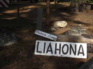
LIHONA
Mormon Treatment Retreat
| Past the trail head parking lot we see buildings off to our Right, to the Southwest. | After a little more investigation, I found these two definitions of LIAHONA: Wikipedia & Translated Correctly. | |||||
 |
 |
|||||
I know that Liahona is a Mormon treatment program for youth. My treatment is mountain trails...
|
This place has a strange look and feel. It is listed as a "Youth Guidance Center School" out of San Francisco.
|
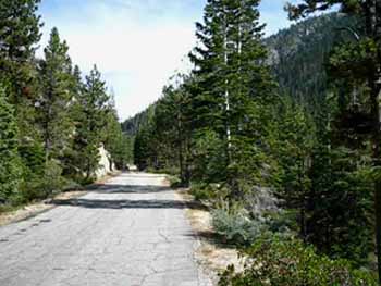
The paved Clarks Fork Road
up to the
Clarks Fork Trailhead
Arnot Creek Trailhead to the Clarks Fork Trailhead Between the Arnot Creek Trailhead and the Clarks Fork Trailhead we have a 4.17 mile hike of which 3.61 miles are along the old paved Clarks Fork wagon road to its end-point at the Clarks Fork Trailhead. |
| Road Sign Pointing the way from the Clarks Fork Road. | ||||
 |
||||
A short .56 of a mile well-maintained dirt road connects the Clarks Fork Road to the Arnot Creek Trail head. The 7.5 minute Topo Hiking Map also omits the old dirt road up Arnot Creek past the trailhead. The USDA Forest Service Map of the Carson Iceberg Wilderness shows the dirt road loop at the Arnot Trailhead, and the old roadbed continuing up Arnot Creek, though it is no longer open for vehicles.
Backpacking Miles and Elevations
|
| Reaching the old paved road after exiting the trail out of the Arnot Creek Trailhead we take a Left, hiking East and upstream along the Clarks Fork of the Stanislaus River to continue hiking South along the Tahoe to Yosemite Trail. |
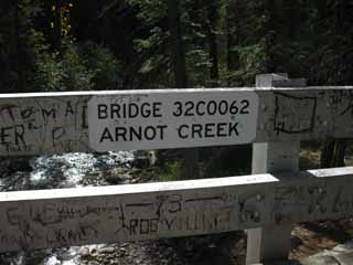
The Arnot Creek Bridge
along
Clarks Fork Road
| Road to Arnot Creek Trailhead from Clarks Fork Road. | The 1960 Arnot Creek Bridge on the Clarks Fork Road heading East over Arnot Creek to Disaster Creek and the Clarks Fork Trailheads. | |||||
 |
 |
|||||
There is no alternative or shortcut to the dirt road as it takes us West, the wrong way, before meeting-up with the paved Clarks Fork Road. |
Another fine old bridge in the area is the old 1933 Dardanelle Bridge across the Middle Stanislaus River on Highway 108 just East of the Dardanelles Store.
|
Reaching the Clarks Fork Road gives us another option for re-supply. Out to Highway 108 I continue a couple of miles beyond the Dardanelles Store to the turnoff for Kennedy Meadows Pack Station.
Kennedy Meadows Pack Station has a better store, a better restaurant, and full laundry and shower facilities perfect for long distance backpackers. And a Bar! It's not too hard to get a ride to Highway 108 out of the Clarks Fork Road and on to Kennedy Meadows Pack Station during the Summertime when car campers throng to this area. |
Arnot Creek Bridge looking East up the Clarks Fork Road off of Highway 108. That's where we're going! |
||
 |
||
Although the nearby Dardanelles Bridge is listed on BridgeHunter, this Arnot Creek Bridge is listed on UglyBridges.
|
Clarks Fork of the Stanislaus River
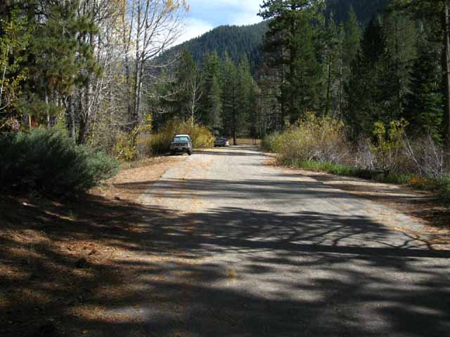
Sand Flat Campground, Backpacker Resources
| Hiking past the Sand Flat Car Campground on the Clarks Fork Road. | ||||
 |
||||
Hiking a bit over a mile up the Clarks Fork Road brings us to the Sand Flat Car Campground. Closed and Empty during late October. This place is FULL during peak Summer vacation periods.
On the North side of the Clarks Fork Road across from the Sand Flat Campground are private residences and group retreats for various organizations, such as "Church of the Brethren." They were not going to give me a ride and were almost too shy to ask for directions. They took off as suddenly as they appeared, before I could explain the way to the Clarks Fork Road. It was a rather strange meeting. If you see folks up here who look like they came from the little house on the prairie, it's because the local cowboys and ranchers are having some kind of Western Celebration, or you're seeing the archaic ways of "The Brethren." On another side note, the wreck of a cabin where they actually filmed some part of the little house on the prairie television series sits about a mile West of Kennedy Lake in the Emigrant Wilderness to our South.
|
Backpacker Resources
at the
South End
of the
Sand Flat Campground
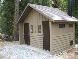
| Sand Flat is a rather large car campground. Their basic infrastructure, being water, garbage, and waste is good for passing backpackers. | I consider the chance of getting rid of garbage, tapping some clean water, and using a toilet seat a real resource along the long trails. | |||||
 |
 |
|||||
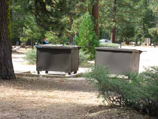
At the far South end of Sand Flat we encounter dumpsters and bathrooms next to our route up Clarks Fork Road. I use them all.
|
Call me Luxury. |
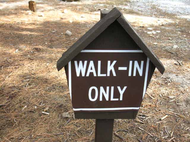
Walk In Campsites Behind the Bathroom I believe that there are 15 walk-in sites and 53 drive in sites at Sand Flat. The Stanislaus National Forest Sand Flat page indicates that fees are $17 dollars per night. (2012) $19 bucks in 2014.
|
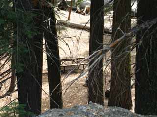
Though my hiking plans never call for a night along the Clarks Fork Road I stop to use any empty picnic tables I encounter near a fresh water spigot while hiking past the South end of the Sand Flat campground to re-hydrate and have lunch or a major break. My favorite sites hiking between the end of the Clarks Fork Road and Saint Marys Pass are at the North edge of Clarks Fork Meadow and the Boulder Creek trail junction, the campsite located at the bottom of this guide page. |
||
 |
||
Use the fancy bathrooms, sit and cook up lunch at a table, water-up from the clean-water faucets, get rid of all my garbage, and maybe talk to some car campers.
|
Looking Down at the Walk-In Sites The walk-in sites are located on a little flat along shore of Clarks Fork of the Stanislaus River past the South end of the Sand Flat Campground. |
| View of the walk in campground from the Clarks Fork Road on the South side of Sand Flat Campground. | A quiet shaded flat along the river below the noise of the Clarks Fork Road and busy campground. | |||||
 |
 |
|||||
I've never stayed here, but it is a pretty little set of campsites. |
Another view that shows the Clarks Fork of the Stanislaus running beyond the walk-in camp. |
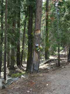
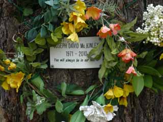
Memorial
| Memorials dot the Sierra terrain. | These mountains are full of hard engagements with nature. | ||||||
 |
 |
||||||
Every year people visiting the mountains are injured and killed. Locals driving the highways, backpackers in the mountains, tourists into rivers and over waterfalls. Death happens all the time. Be Careful. Observe Carefully. Analyze Well. Decide Wisely. |
|||||||
From Gold Rush graves to peaks named after disasters and relief expeditions, the Sierra past and present are formed by hard experiences.
|
Sand Flat
to the
End of the Clarks Fork Road
2.51 miles of steady climbing
| One of many fine rock walls that line the uphill side of the Clarks Fork Road. | A long view East reveals bends in the river and therefore the road. | |||||
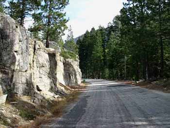 |
 |
|||||
Hiking up the Clarks Fork Road. We can see the river and canyon bending Northeast, and it will soon bend around to the Southeast
|
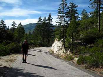
The Southbound TYT heads East along the Clarks Fork Road for 2.51 miles of steady climbing from Sand Flat to the end of the road. |
Road Work
| Looking back down the Clarks Fork Road to the Southwest. | Our hike up the Clarks Fork Road is mostly along a shelf cut above the North bank of the river. | |||||
 |
 |
|||||
I generally can get a ride from the beginning of the paved road up to its end during Summertime. I generally stay on the outside of the bends in the road so oncoming vehicles can see me from the greatest distance. There was almost no one out here in late October when I shot these images.
|
As we climb higher the road and the river come closer together as the canyon narrows. Knowing how catastrophic Spring Thaws are a regular part of the seasonal cycle, and heavy thaws normal in the Sierra Nevada Mountains, one begins to wonder about the utility of the Clarks Fork as a route over the Sierra, despite its relatively gentle ascent to the Sierra Crest. The narrowing of the canyon combined with the power of the Spring Thaw rushing through it each year would make this a hard route to maintain a road through. Yet this was the route over the Sierra Crest here from 1855 to 1864, when the present route was opened. |
Sonora Pass - Mono Road, Clarks Fork Road Beyond the Sand Flat campground we have a 2.51 mile hike up 240 feet to the end of the gradually rising Clarks Fork Road. |
| Detail of another fine rock wall along the Clarks Fork Road. | ||
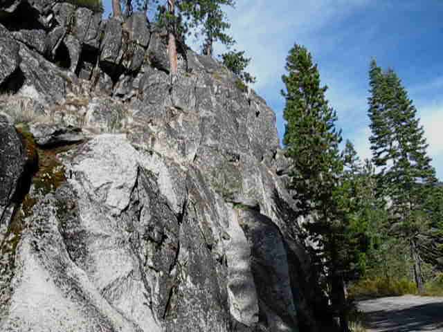 |
||
The terrain hiking up the Clarks Fork Road, and along the Clarks Fork of the Stanislaus River past the road, is by far the smoothest, best-graded route up to Sonora Pass.
|
The End of the Road
Disaster Creek and the Clarks Fork
Trailheads
The Disaster Creek Trailhead sits a few yards North of the Clarks Fork Trailhead, just before the end of the Clarks Fork Road. The Northbound route of the Disaster Creek Trail links our position here off of Highway 108 with Highland Lakes off Highway 4, or can bring us up to the PCT at Wolf Creek Pass. |
|||||||||
 |
|||||||||
The Disaster Creek Trail heads North to link up with the Arnot Creek Trail before reaching Upper Gardner Meadow.
About half-way up the Disaster Creek Trail North towards Gardner Meadow a junction breaks off the trail to your right, East, to link the Disaster Creek trail to the Pacific Crest Trail at Golden Canyon through Paradise Valley.
|
Paradise Valley I would assume this trail is an unmaintained faint route, and that the second trail up Paradise Valley is in marginally better condition than that. I do know that the ranchers ride both these trails every Fall rounding up their grazing stock.
|
The End
of the
Clarks Fork Road
Hiking past the Disaster Creek Trailhead we can see Iceberg Meadow beyond the end of the Clarks Fork Road. We'll continue South through the Clarks Fork Trailhead following the Tahoe to Yosemite Trail around the Right perimeter of Iceberg Meadow. |
||||
 |
||||
Approaching Iceberg Meadow beyond the Clarks Fork Trailhead, who's brown grasses of fall we see beyond the end of the road.
Carson Iceberg Wilderness
|
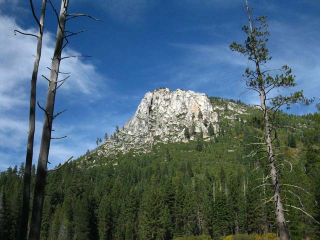
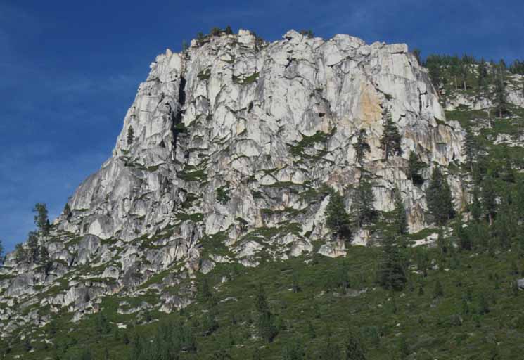
The Iceberg
| We notice the top of The Iceberg poking over the forest approaching the end of Clarks Fork Road. | ||
 |
||
A few steps South of the Disaster Creek Trailhead The Iceberg dominates the terrain through Clarks Fork Trailhead and across Iceberg Meadow until our trail climbs into the narrowing canyon, leaving The Iceberg behind.
|
Clarks Fork Trailhead
| The End of the Clarks Fork Road Tahoe to Yosemite Trail South through the Clarks Fork of the Stanislaus Trailhead. |
||||
 |
||||
Off the hard but stable pavement of the Clarks Fork Road back onto soft natural surfaces. What's good for the knee is good for me.
Carson Iceberg Wilderness Unconventional Segments of the TYT I don't have a problem walking this one down the Clarks Fork Road, but I won't walk down Highway 108 from the crest to Kennedy Meadows. I don't want to play "dodge the car." Highway 108 is a twisting narrow track on a steep grade, and we are a lot better off hitch-hiking down to Kennedy Meadows. Well, that's what I do.
|
Clarks Fork Trailhead
to the
Boulder Lake Trail Junction
Clarks Fork Trailhead Boulder Lake trail junction: An Interesting Loop Option NORTH Pacific Crest Trail from Clarks Fork Trailhead via Boulder Lake and Creek: We could wrap a loop up to the PCT via Boulder Lake, North on the PCT to Paradise Valley (rough trail) down to Disaster Creek trail to Disaster Creek Trailhead. Central Carson Iceberg Wilderness Tahoe to Yosemite Trail Clarks Fork Trailhead to Saint Marys Pass at Highway 108 past Boulder Creek trail junction along Tahoe to Yosemite Trail: Lake Alpine to Saint Marys Pass |
The End of the Clarks Fork Road The Clarks Fork Trailhead
Hiking from the End of the Clarks Fork Road to the Boulder Creek trail junction.
Lake Alpine to Saint Marys Pass |
The Iceberg beyond Iceberg Meadow
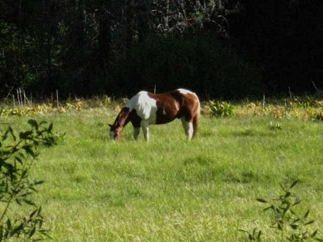
Passing South through the Clarks Fork Trailhead we wrap around the South edge of Iceberg Meadow Nice looking horses pastured there last time I hiked through. Off to our Right, we see a big campsite. We enter a zone of dense forest and cold quiet rock Sweet granite formations rise out of the shadow and light of the forest. We climb tight switchbacks up out of the forest and rock onto a low exposed shelf above the North shore of the Clarks fork. Central Carson Iceberg Wilderness
|
Views
South and North
hiking up the
Clarks Fork of the Stanislaus River
Passing South through the Clarks Fork Trailhead we wrap around the South edge of Iceberg Meadow through dense forest for a short distance until we climb up onto an exposed low shelf to get above and around a sheer section of the North shore of the Clarks fork of the Stanislaus River. This looks like a reroute, a difference from the USGS map.
|
| Hiking over a rise and up around a sheer section of the Clarks Fork River puts us in position to get a view South, back the way we came. | North up the Clarks Fork of the Stanislaus River. | |||||
 |
 |
|||||
Looking South down the Canyon of the Clarks Fork of the Stanislaus. |
Looking North up the Canyon of the Clarks Fork of the Stanislaus. |
Fall Colors, late October
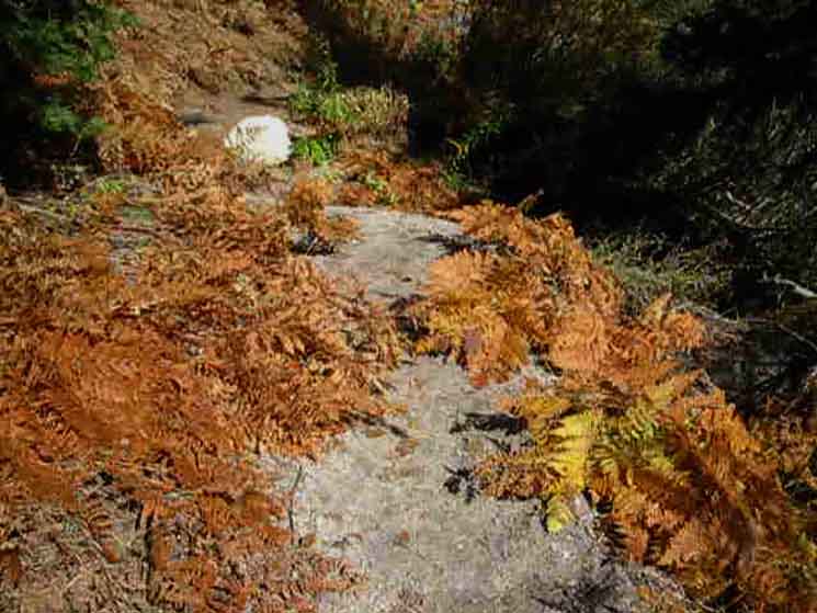 |
A thicket of Sword Ferns have called it a season. The Sword Ferns have abandoned their bright green Summer shades for brilliant golden Fall colors. |
Vibrant Ferns Earlier in the Season
 |
| Nature's color wheel spins with the changing seasons in the Sierra. |
Ari hiking South on the Tahoe to Yosemite Trail
 |
||
Ari enters this golden channel.
|
View South
Back down to Clarks Fork
 |
Our view above is almost directly East. After clearing the climb around a sheer section above the shoreline of the Clarks Fork we drop back down into the dense forest along the river. We determine where we are before we drop back under the forest cover. In the distance ahead we can see where the Clarks Fork Canyon bends South, to the Right, at the point where the creek and trail down from Boulder Lake, off to the Left in the image above, intersect with the Clarks Fork. That's where we're going, and where this page ends. We are just that far from the Boulder Lake trail junction with the TYT, which is also where the quality of our Southbound Tahoe to Yosemite Trail begins degrading. |
Site Restoration
 |
Getting back down to river level brings us to a series of campsites and potential campsites. The first large site we encounter is marked off as a restoration zone. |
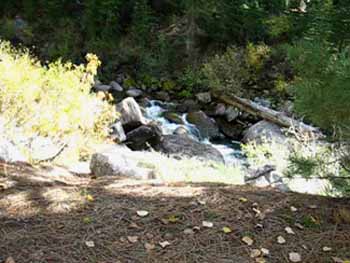
Clarks Fork Tributaries
| A couple of little streams lay between the Clarks Fork Trailhead and the upcoming Boulder Lake trail junction. | ||||
 |
||||
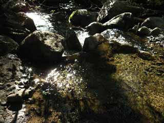
The time of year determines the flow rate of creeks and rivers. The intensity of Springtime flows are determined by temp and the status of the snowpack. Independent of the ferocity of Spring, or the lack of it, Summer brings diminished flows, tapering to a trickle during Fall. Therefore "easy" fords are a matter of timing. The character of the annual movement of water is determined by the specifics of each season. Summer hikers are well informed of the conditions they can expect to encounter by tracking the evolution of conditions throughout the year, especially the transition of Winter into Spring. This transition will determine when the trail open and when the creeks and rivers recede from raging torrents to placid flows. The status of the Winter snow pack against the profile of rising Spring temps determines both the potential intensity of the Spring Thaw, as well as how long and how much water will be running during late Summer. The interlocking natures of the Winter snows and the Spring Thaw determines the trajectory of each Summer's moisture conditions. These factors are all tied together by hemispheric weather patterns that we can track. My observations, over the last 40 years? We're Screwed. Check out the These grand global forces "set the table" for the local conditions we will experience on the ground during each season of every year. Tracking the hemispheric weather engines that annually determine the nature of each year's water cycle gives us the outlines of "the big picture." The High Sierra Weather Page also provides resources for us to focus in on the specific conditions on the ground across the length and breadth of the Sierra Nevada through its links to a wide range of ground reporting stations. These reporting stations allow us to get real-time glimpses of temp and snow conditions on the ground.
|
Looking North back across Unnamed Creek
 |
| Looking back at the first ford South of Clarks Fork Trailhead before we continue North to the next fording point, which will be Boulder Creek at the trail junction up to Boulder Lake. |
| The second tributary cutting a pocket across the trail. |
 |
Ever changing conditions. These small tributaries are no problem except during the high flows of the Spring Thaw, when they can be surging up to dangerous levels. |
California White Pine Forest
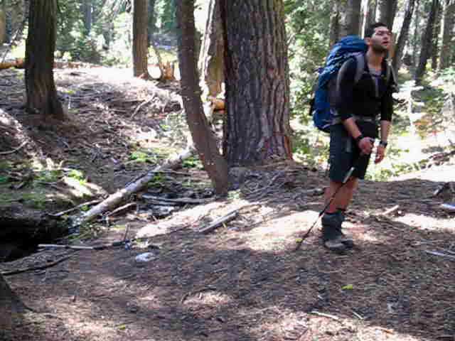
| Ari observing forest. | ||
 |
||
Always keep your eyes open. Ari is quietly scanning the terrain while relaxing for a moment.
|
Camping Restrictions
 |
We find camping restrictions at a couple of prime location between the Clarks Fork Trailhead to the Boulder Creek trail junction. This is due to the relatively heavy use that easy access through the paved Clarks Fork Road gives this nice little hike. Even during Summer this place gets a fraction of the attention that Desolation Wilderness and Yosemite National Parks attract. |
Clarks Fork thinning with Elevation
| Clarks Fork of the Stanislaus River high up. | ||||
 |
||||
Great boulders roll down the rivers during great Spring Thaws. When a raging Spring Thaw is thundering down mountain one of the scariest sounds a river can make are the sounds of great boulders rolling, smashing, and grinding against each other as they surge down river hidden under the raging flow. That sound always makes the hair on the back of my neck stand up. All of those boulders above are on a journey we can't see. But we will hear them the next time they move.
|
Southbound Tahoe to Yosemite Trail
| Tahoe to Yosemite Trail through rich forests along Clarks Fork of the Stanislaus River. |
 |
Quiet, cool, soft, and serene trails. |
| View of rock formation along the Pacific Crest Trail South of Boulder Peak. See it peaking out through the trees on the Left of the image? | ||
 |
||
The trail up to the Pacific Crest Trail from Boulder Lake sits below the Left side, the North side of the peak barely visible through the trees. Boulder Lake sits below and Left of that part of the Sierra Crest line in this view. Central Carson Iceberg Wilderness
|
Boulder Lake Trail Junction
| Hiking South into the Boulder Lake trail junction along the Tahoe to Yosemite Trail. | ||||||
 |
||||||
The trail junction post can be seen just Right of the big tree. The trail up to Boulder Lake continues straight/veers Left through this junction along Boulder Creek. The Tahoe to Yosemite Trail turns Right fording Boulder Creek to continue following the Clarks Fork of the Stanislaus River up to Saint Marys Pass.
|
Boulder Lake Trail Junction
| Iceberg Meadow is 2.56 miles to our North at the Clarks Fork Trailhead. | South down the TYT towards Clarks Fork Meadow. | |||||
 |
 |
|||||
| Clarks Fork Meadow is 4.96 miles South on the Tahoe to Yosemite Trail, and is the beginning of the headwaters of the Clarks Fork of the Stanislaus River. | ||||||
Boulder Lake is 1.39 miles Northeast up this trail. Heading 1.35 miles East past Boulder Lake a good unmaintained trail brings us up to the Pacific Crest Trail. |
Route options discussion. TYT to PCT via Boulder Creek
|
Boulder Lake Trail Junction The Boulder Lake trail up to the Pacific Crest Trail from the Clarks Fork of the Stanislaus is the Southernmost of the 4 trails connecting the PCT and TYT routes across the Carson Iceberg Wilderness. Trail Guide Pages Hike the Boulder Lake trail up to Boulder Lake and on to the Boulder Lake trail junction on the Pacific Crest Trail. TYT to PCT via Boulder Creek Miles and Elevations Boulder Lake East from the TYT to the PCT Boulder Lake trail junction 6960 feet elevation 0 miles +1200 feet Boulder Lake 8160 feet 1.39 +490 feet +1.35 PCT @ Boulder Lake trail junction 8650 feet 2.74 The total distance between the Boulder Lake Junction on the Tahoe to Yosemite Trail to the Boulder Lake Junction on the Pacific Crest Trail is 2.74 miles. The elevation difference is 1690 feet. This is the shortest of all 4 trails linking the Tahoe to Yosemite Trail with the Pacific Crest Trail through the Carson Iceberg Wilderness. TYT to PCT via Boulder Creek South on the Tahoe to Yosemite Trail |
Boulder Creek
junction with the
Clarks Fork of the Stanislaus River
| The Boulder Creek ford just past the Boulder Lake trail junction. | ||
 |
||
Trail crews are responsible for creating most of the lines of stepping stones that look so perfectly crafted for Summertime backpackers.
|
Looking across Boulder Creek South down the TYT
Campsites at the Boulder Lake Trail Junction
 |
| Boulder Creek campsite looking to the Southeast from the trail junction across Boulder Creek. |
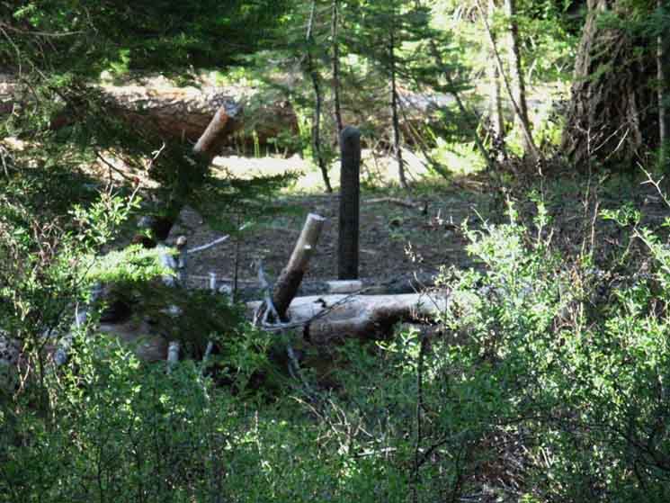
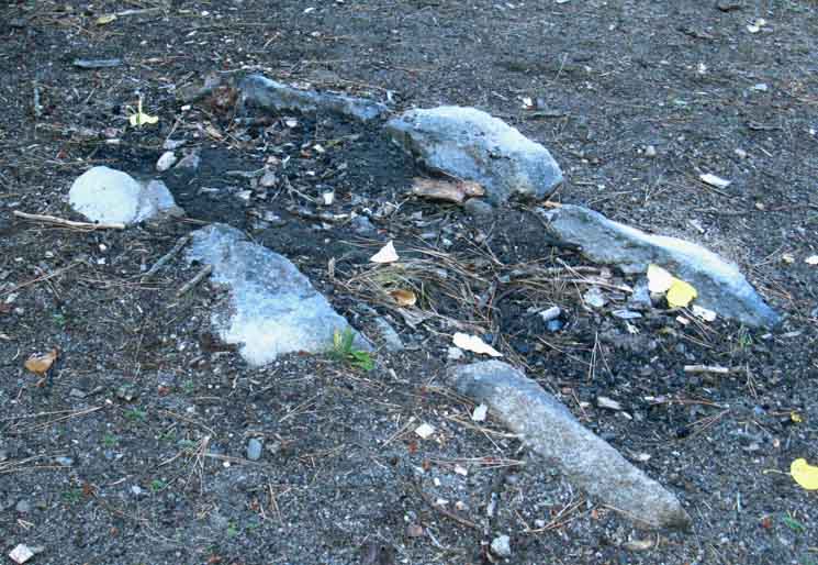
Old Keyway Fire Slot
| On the South side of Boulder Creek there are a series of nice campsites. This is an old remnant of a National Forest Trail Crew "keyway" fire slot. | ||||
 |
||||
These fire slots mark the location of old and current Trail Crew camps. The keyway is cut facing the prevailing wind, and lined with suitable rocks. The keyway creates a venturi that feeds the fire. If trail crew sets up a camp here in the future they will dig it out for use. Update: Keyway fire pit removed. Trail crew dug it out and scattered the rocks.
Backpacking Miles and Elevations
|
North: Rock Lake to Jenkins Canyon East: Boulder Creek to the PCT South: Boulder Creek to Saint Marys Pass
The Tahoe Yosemite Trail |
Lake Alpine to Saint Marys Pass Arriving at the Boulder Lake trail junction puts us 25.88 miles South of our Silver Valley starting point for this section of The Tahoe to Yosemite Trail, and 8.69 from its end through the Saint Marys Pass Trailhead onto Highway 108. These next 8.69 miles are the most difficult of this section of trail, both physically and mentally. The trail is unmaintained above the unmarked Eureka Valley trail junction, and degrades into route finding above the lower ford. All trail ends when we reach the North edge of Clarks Fork Meadow, and we'll be route finding the rest of the way to Saint Marys Pass. This last segment of the Tahoe to Yosemite Trail from the Jenkins Canyon trail junction along Highland Creek brings us across an extensive length of "civilization," as well as the challenging unmaintained segment of trail. Thankfully this segment of trail also offers us ample alternative routes around both the civilization and the unmaintained lengths of trail, depending on what we are trying to avoid. We can do it all or avoid it all. These alternative routes for the long distance backpacker create endless medium and long distance backpacking loop opportunities remaining within the Carson Iceberg Wilderness for the local backpacker. 7.5 topo hiking Map 30 min topo backpacking Map |
Backpacking Trail Guide North |
|
TRAILS 1> Jenkins Canyon 3> Boulder Lake |
Backpacking Trail Guide South |
Backpacker ForumsHave a great Sierra Nevada trip or story to relate? A fine piece of gear? Or gear that failed? Backpacking news or events? We don't just have forums about High Sierra Backpacking Trails.We've backpacking forums about all topics important to backpackers! Post it on
|
North: Rock Lake to Jenkins Canyon East: Boulder Creek to the PCT South: Boulder Creek to Saint Marys Pass
Trailhead
Contact
Alex Wierbinski

Backpacking Lake Tahoe to Mount Whitney
Your Guide to the High Sierra Crest, including the Tahoe to Yosemite, Pacific Crest, and John Muir Trails
