Late July to Early August 2010 High Sierra Trail Culture Report |
||
Sampler
|
The Trails
Guide
Maps
Miles/Ele
Permits
Resupply
Forum
Current Weather Conditions
Weather Notes
Northern High Sierras
Central High Sierras
Southern High Sierras
Gear
Gear List
Gettin Started
Layering
Discussion
Testing yourself and your gear
Gear Reviews
top of page
Languages
Languages
Trail Arts
The art of walking
Physical Preperation
Trail Skills
The trail
Off the trail
Scrambling
Maps
Navigation
Camp skills
Food
Resupply
Food
Other
Photo Catagories
Trail Stories
Trail Culture
News and Science
Links
Groups
Books
Terms and Conditions of Use
top of page
Summer |
Index of High Sierra Trail Encounters |
||||
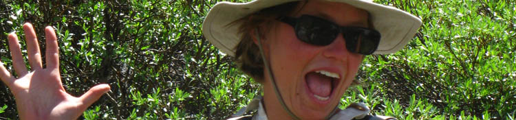
Trail Culture in the High SierrasWriting this trail guide made it impossible to complete a Tahoe to Whitney backpacking trip this Summer. To compensate, I just returned from a 100 mile Southbound backpacking trip along the Sierra Crest between July 21 and August 1st, 2010. See The Trip Plan The timing of this trip allowed me to encounter and talk to a large number of Pacific Crest Trail hikers. PCTers are a key component of High Sierra Trail Culture during the early Summer. In 2010 I was able to meet many PCTers in mid and late Summer. The reason was the extreme late Spring snow fall that held the PCTers out of the Sierras until July, which is very late in the hiking season for PCTers hoping to reach Canada before snows again cover the trail. Hey, I was there. I did trips along the Crest in March and June of 2010. The snow in mid June was deep and plentiful from 7500 feet on North facing slopes, and about 8500 on South facing slopes. All the Sierra passes were choked with snow until deep into the hiking season. So I met a lot of PCTers as I headed South on the PCT between Bond Pass and Tuolumen Meadows in July and August. I also met other representatives of trail culture. Horsemen, Scientists, Trail workers, Boy Scouts, as well as many many long distance backpackers decorated the trails. Add to this the great staffs of the two resupply points I crossed, first at Kennedy Meadows Pack Station (Hwy 108) and then at Tuolumne Meadows, (Hwy 120) where this too-short trip ended. Resupply points are centers of Trail Culture. This section will give you a glimpse into the variety of travelers on, and the people along, the High Sierra trails in 2010. You should be one of them! |
Wendsday,
Thurs,
Friday, Solitude off the Pacific Crest Trail: Mill Canyon/Golden Gate Mine Road
Sat, Man-up, Gouda, lady leave no Trace, and unidentified Turbo, Stanimal, Wide Angle, Big Foot
Sat, July 24:
Sunday, Jesse Mestrovic no pic |
Kennedy Meadows Saloon Dance Floor
Monday
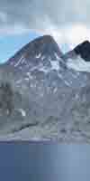
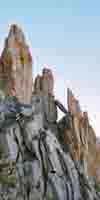
Tuesday National Forest Scientists frog counting team California Conservation Corps Crew: Dimes, Heather, and Zack Dimes, Heather, and Zack's Trail Work CCC: A big chunck of the Stanislaus Backcountry Crew CCC Trail Workers moving up mountain with tools CCC: Steven, Stephine, and Morgan Big Granite Formation with a flash of red on it Red Flowers on Big Granite Formation Part of the Granite Dome Massif The Granite/Volcanic interface leading to Brown Bear Pass |
July 28 Brains No Pic
July 29
July 30 PCTer: Stick Reckless no pic Pro from Dover no pic Hawkeye no pic Lone Ginger no pic Hawkeye no pic |
July 31 Trail Worker Kids no pic
Do you have questions or comments about trail culture?
Are you featured in this section, and want to add biolographical or trip information? Do you want to leave a message for another hiker? Then get your ass to the
High Sierra Trail Culture 2010 Backpacker's Open Thread, Bulliten/Message Board, Information Exchange See each page to post other comments or questions.
Maps
Miles and Elevations |
|
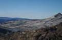
Index By PageTrail Culture Index Corral Valley to PCT at East Carson River The E Carson Headwaters to the Sonora Pass Hiking towards Brown Bear Pass Brown Bear Pass to Stubblefield Canyon |
|||||
NoteTo all of you who I have met on the trails last year, and during previous years, your pictures will be incorporated into the main Trail Guide pages as they are constructed. I have not forgotten any of you. It is just so time-consuming to build a trail guide. |
|||||
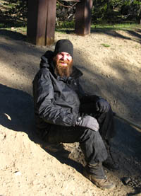
Stroker I ran into Stroker on Thursday, July 22, 2010 at the Sonora Pass. Stroker is a Pacific Crest Trail Hiker who has, like the rest of his fellow PCTers, completed 1000 miles on the trail North from Mexico to reach Sonora Pass. When I walked over to the Sonora Pass the next morning, Stroker was sitting where I was going to hitch. No problem for the Stroker, so we hitch hiked together East on Hwy 108from the Sonora Pass. Stroker was heading to Bridgeport to resupply, which I do not recommend. I highly suggest that you resupply at Kennedy Meadows Pack Station . But other than missing the Kennedy Meadows Pack Station experience, Stroker is doing the Pacific Crest Trail right: Though Stroker covers big miles on the trail, he never neglects to take the time necessary to take in all the sights and experiences. At least the ones he knows about! Stroker detoured to climb Mt. Whitney, exited to Bishop to resupply and hang out, explored Mammoth Lakes, and also detoured off the PCT to head down to Yosemite Valley to check it out, and climb Half Dome. |
The Stroker and I caught a great ride from a retired teacher/Marine/backpacker from the town of Sonora down to Hwy 395. |
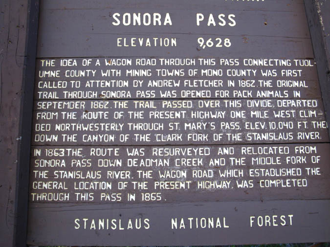
Sonora Pass Historical Monuments
National Forest Monument
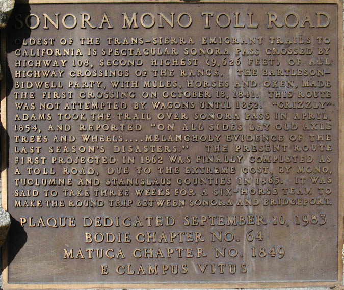
Sonora Pass Historical Monuments
Clamper Monument
Next Page
Highway 395 to Corral Valley
Contact
Alex Wierbinski
Lake Tahoe to Mount Whitney: your backpacking guide to the Sierra Crest, including the Tahoe to Yosemite, the Pacific Crest, and the John Muir Trails