High Sierra Trail Culture Report IV: Late July to Early August 2010 |
The Trails
Guide
Maps
Miles/Ele
Permits
Resupply
Forum
Current Weather Conditions
Weather Notes
Northern High Sierras
Central High Sierras
Southern High Sierras
Gear
Gear List
Gettin Started
Layering
Discussion
Testing yourself and your gear
Gear Reviews
Across the East Carson Headwaters, past Wolf Creek Lake and on to Sonora Pass
Saturday, July 24Northbound over the Headwaters Bowl of East Fork of the Carson River, past Wolf Creek Lake, and on to the Sonora Pass After meeting a bunch of Pacific Crest Trailers down low in the East Carson River, I did not run into anyone for an hour or so, until I climbed above the forest line, into the sparce cover of the Whitebark Pines. Then I hit the damn Jackpot! A Cool Chick Solo PCT hiker! And... A Squared-Away Boy Scout Troop hiking from Sonora Pass to Echo Summit! |
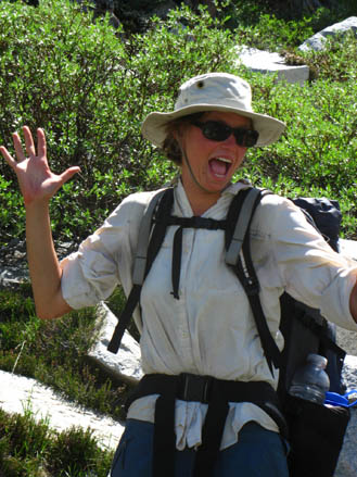
Climbing up the last bit of the headwaters of the East Carson River, I spied this lady carefully making her way down. She was examining the ground carefully, and appeared deep in thought. I coughed gently, so I would not scare the shit out of her. We both laughed, then sat and talked for awhile. This is Dinosaur. She is out of North Carolina, doing the Pacific Crest Trail, and was a delight to encounter on the trail, as you can see. |
|
||
and... Two Damn Sharp long distance backpackers from Oregon, who were walking home! and finally, I got a ride down to Kennedy Meadows in a fancy silver Mercedes two-door sports car... Any ride in a Mercedes, especially a new two-door sports car, would be really amazing for a dirty backpacker with a huge pack, except that the two dayhikers, a fit early-sixties couple whom I passed on the way down to Sonora Pass, who were also packing heat, were also parking a fast car at Sonora Pass. And 'cause they liked me, they insisted that me and my pack would fit in their car. And we did. I was truly amazed that my huge-assed backpack fit in the trunk of |
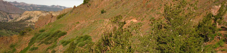
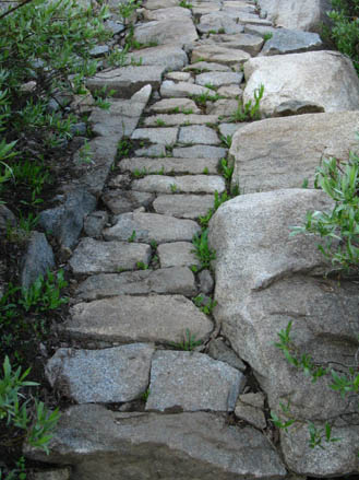
The Fine Trail work going up the headwaters bowl of the East Carson River is just beautiful. Without the tireless and dedicated work of Generations of Hard Workers on Trail Crews, these mountains would be very difficult for backpackers to penetrate. leave more information about the people or places on this page. |
 |
||
that two door sports car. But the Germs are pretty damn ingenious... Index By PageCorral Valley to PCT at East Carson River The E Carson Headwaters to Sonora Pass |
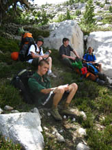
Troop 13 out of Newcastle, California. These kids were squared-away, though I know a few of them will come to rue the heavy things they packed. But you have to love the |
 |
 |
|
|
Hiking towards Brown Bear Pass Brown Bear Pass to Stubblefield Canyon |
enthusiam of youth, especially as it was directed towards their Sonora Pass to Echo Lake backpacking trip. I have that at 67.15 miles. That's Scoutmaster Ken Brown. |
 |
 |
|
|
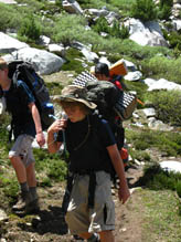
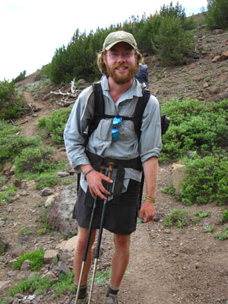
Swazie, heading North on the Pacific Crest Trail on the Eastern Flank of Sonora Peak near Wolf Creek Lake. Now you should understand that the Pacific Crest Trail hikers are at the 1000 mile mark at this point on the trail. Swazie and Dino were hiking together for sections, and solo for sections. I think Swazie is from North Carolina too, but my notes fail to inform. |
 |
|||
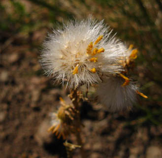
The flowers growing on the flanks of Sonora Peak are stunning every year, from when they first bloom, to when they pull in their flowers and go to seed. This one was growing near the Sonora Gap, the Gap in the ridge that brings you from Sonora Peak's East to its South Flank. |
 |
|||
| Comments? |
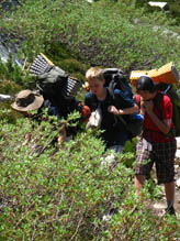
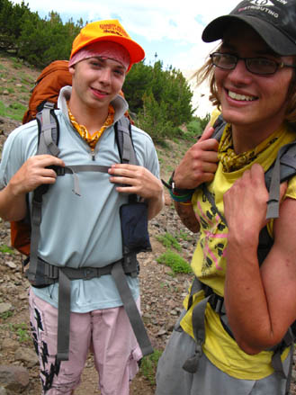
This is Ted and Henry. They are from Southern Oregon. Ted and Henry have walked 75 miles to this point, which is just North of the Sonora Gap, and Just South of Wolf Creek Lake, from Tuolumne Meadows. They are on their way back home to Oregon, walking to Hood River. Nice guys. Wish I had more time to kick it, but the thunderclouds were forming up, and we were at about 10, 400 feet here. |
 |
||
|
|
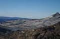
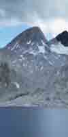
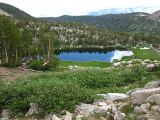
Wolf Creek Lake sits just South of the East Carson Headwaters bowl, and just North of the Sonora Gap.
|
 |
||
|
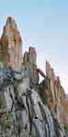
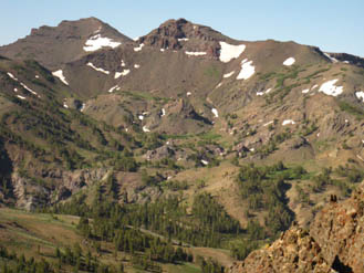
The Leavitt Massif From the Sonora Gap. The peak in the foreground is part of the massif, and the peak in the background is Leavitt Peak. Sonora Pass sits beyond the low hills between Leavitt and the Sonora Gap. |
 |
||
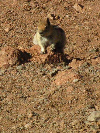
| Lodgepole Squirrel |
July 2009: This little guy was living at the hole in the Sonora Gap. At the gap between the East and South flanks of Sonora Peak (just North of Sonora Pass) there is a gap that the PCT passes through. In that gap there is a hole in the ground. I took a break there this year, but the little dude did not show.
|
 |
||
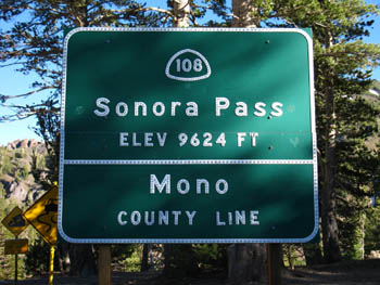
Sonora Pass on Highway 108
| A couple of miles hiking down from the Sonora Gap brings you down to the Sonora Pass. From here I hitch down to Kennedy Meadows, both to resupply, and to follow the section of the Tahoe to Yosemite Trail that connects Kennedy Meadows to the Jack Main Canyon. | |
 |
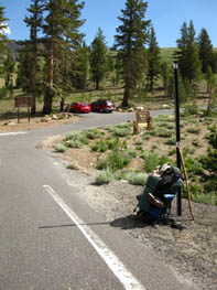 |
| The historic Sonora Pass. | Hitching West on 108 from Sonora Pass, down to Kennedy Meadows Pack Station Resupply Page . |
Next Page South: Kennedy Meadows Pack Station: next trail culture page
Last Page North: East Carson River
Contact: Alex Wierbinski
Languages
Languages
Trail Arts
The art of walking
Physical Preperation
Trail Skills
The trail
Off the trail
Scrambling
Maps
Navigation
Camp skills
Food
Resupply
Food
Other
Photo Catagories
Trail Stories
Trail Culture
News and Science
Links
Groups
Books
Terms and Conditions of Use
Lake Tahoe to Mount Whitney: your backpacking guide to the Sierra Crest, including the Tahoe to Yosemite, the Pacific Crest, and the John Muir Trails