
The Trails
Guide
Maps
Miles/Ele
Permits
Resupply
Forum
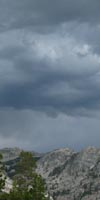
Current Weather Conditions
Weather Notes
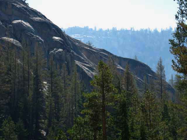
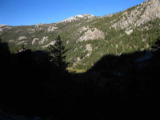
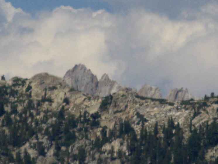
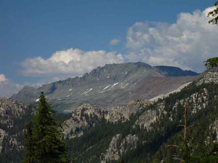
Northern High Sierras
Central High Sierras
Southern High Sierras
Gear
Gear List
Gettin Started
Layering
Discussion
Testing yourself and your gear
Gear Reviews
Hiking
Smedberg Lake to Miller Lake
via
Bensen Pass and Matterhorn Canyon
Backpacking
NORTH YOSEMITE BACKCOUNTRY
Yosemite National Park
Hiking
The Pacific Crest and Tahoe to Yosemite Trail routes between Sonora Pass to Tuolumne Meadows
Languages
Languages
Trail Arts
The art of walking
Physical Preperation
Trail Skills
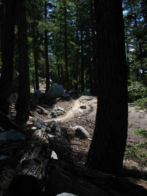
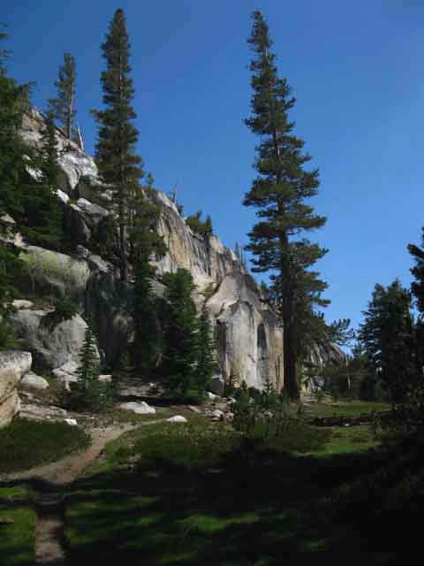
The trail
Off the trail
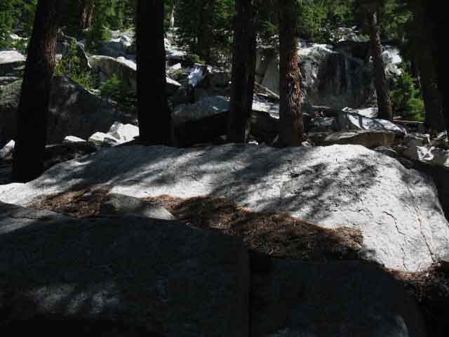
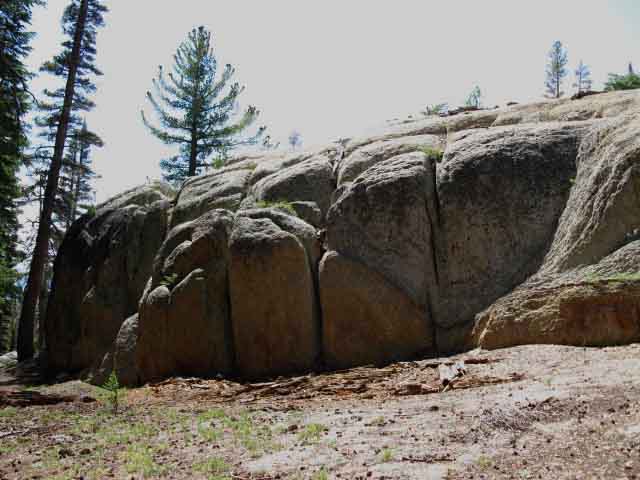
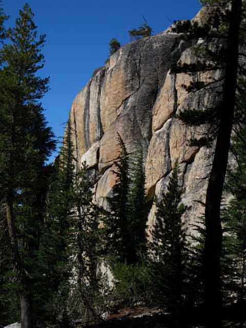
Scrambling
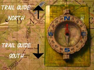
Maps
Navigation
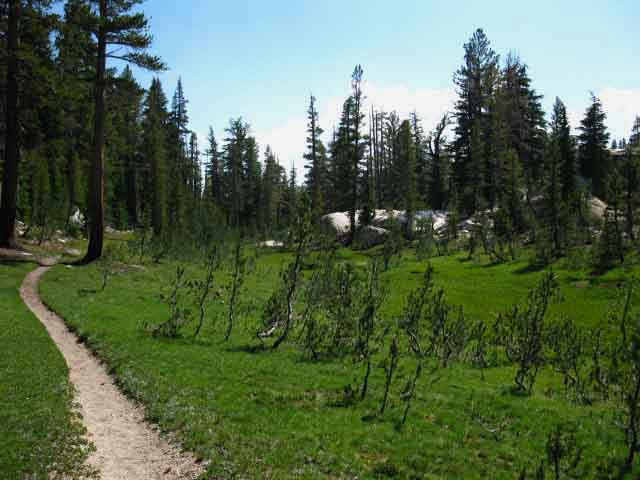
Camp skills
Food
Resupply
Food
Other
Photo Catagories
Trail Stories
Trail Culture
News and Science
Links
Groups
Books
Terms and Conditions of Use
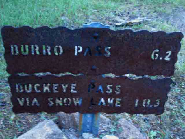
| Trail Guide INDEX Highway 108 to Highway 120 |
North PCT-TYT Seavy Pass to Smedberg Lake via Bensen Lake |
South PCT-TYT Miller Lake to Glen Aulin |
7.5 Topo Map Bensen Lake to Miller Lake |
30 min Map Bensen Lake to Virginia Canyon |
Sonora Pass |
TOPO MAP INDEX SONORA PASS to TUOLUMNE MEADOWS |
Resupply North Kennedy Meadows South Tuolumne Meadows |
National Forest-Park PERMITS Toiyabe NF (Hoover) & Stanislaus NF (Emigrant) & Yosemite NP |
all maps index |
Yosemite National Park
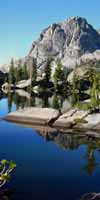
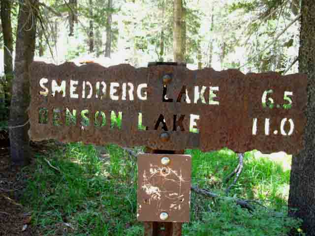
Smedberg Lake
|
|||||||||||||||||||||||||||||||||||||||||
| Bensen Lake to Miller Lake 15 min Topo Backpacking Map |
North Yosemite Miles and Elevations |
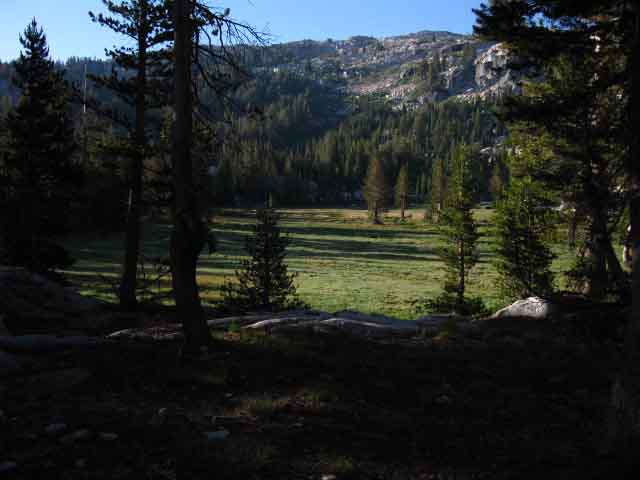
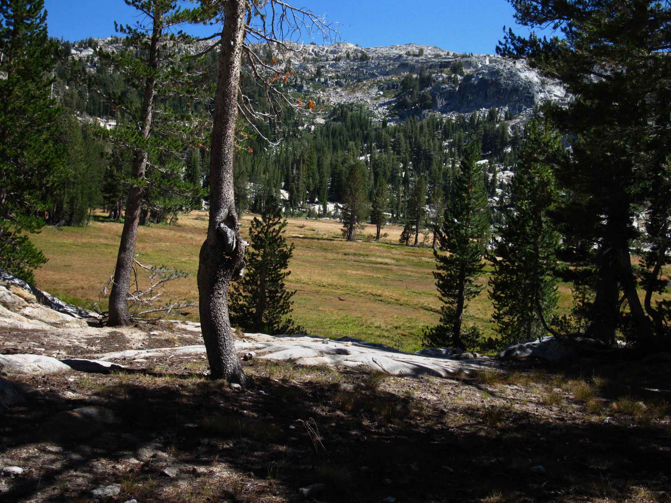
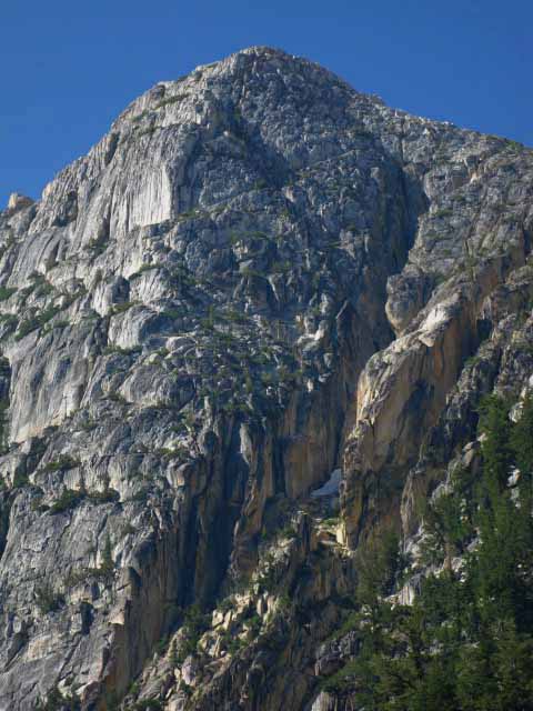
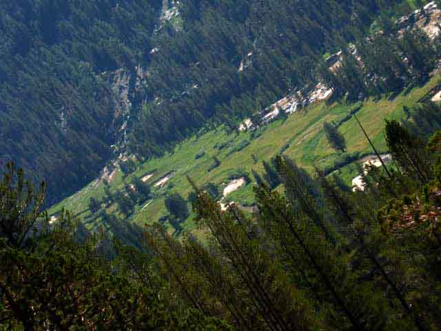
Looking to our Right across the wide gap making up our Southbound entrance into this upper meadow we see the great granite dome that marks the end of the ring of rock ridge wrapping around this high altitude meadow. We can make out where a nice little campsite is located under the Western flank of the dome.
There was an old fire ring there, but there is a nice flat and comfortable shaded site, if not a fire ring. Golden Sand Creek is its water source, and we have a great view of Volunteer Peak. The 7.5 map well depicts the topography of these features, if not the feeling they impart.
Looking to the South down our trail we see that the Golden Sand Creek turns Southwest (to our Southbound Right) crossing the length of this last little upper meadow where we continue Northeast across the North edge of the meadow to where we hike into a narrow climbing gorge to begin our last bit of climbing to Bensen Pass.
From the Northeast corner of the upper meadow we hike into a narrow channel through hard rock terrain that leads us up and around a button-hook route to the soft golden soils under Bensen Pass. The last forty yards of trail across the golden berm into Bensen Pass may be at or near the angle of repose if the the soft golden terrain up to Bensen Pass has not been dug out in the last couple of years.
A couple of heavy Spring Thaw flows are sufficient to seriously degrade the last bit of the trail up the North flank of Bensen Pass.
Rather than being composed of granite, Bensen Pass looks like a slice of soft unconsolidated mineral terrain wedged into a little gap along the length of the granite ridgeline. Approaching Bensen Pass I get the feeling as if I am climbing to the source of the golden sands that run down the Golden Sand Creek into Smedberg Lake, and from there down to Bensen Lake. It's like we've found the main source of the golden sands draining out from their ancient role of filling in the gaps between the vast granite blocks making up the surrounding ridgeline.
Dry Drop to Matterhorn Canyon
After taking an enjoyable break sitting on the Bensen Pass Rock we begin the dry plunge down towards Wilson Creek and its three fords.
We immediately noticed the change in the nature of the terrain when we cross from the Southwest facing terrain on the North side (by trail direction) of Bensen Pass over to its South flank, again by the direction of the trail.
In terms of compass readings, we have passed from the Southwest side of Bensen Pass over to its Northeast facing aspect for the hike down to Matterhorn Canyon via Wilson Creek. If it's not wet on the Southwest side, it's at least green. By comparison the Northeast flank below Bensen Pass is dry. This change in the aspect of the terrain explains the shift of the character of the terrain from (kind-of) moist on the Southwest side of the pass approaching from Smedberg Lake, to a very dry feeling when we cross over to the Northeast side of Bensen Pass.
It's more than a feeling. It's the aspect of the terrain. We are made to feel and reflect the changing character of nature.
It's not that there is any shortage of water between Bensen Pass and Matterhorn Canyon. There is not. There are three fords of Wilson Creek between us and the bottom of Matterhorn Canyon. What is striking is the shift to a drier character of overall terrain.
The nature of the trail itself changes as well. We've been hiking on an alternating trailbed composed of solid rock or soft rich meadow soils since entering Yosemite. From the 3rd uppermost meadow approaching Bensen Pass we were able to see the unique berm of golden soil composing Bensen Pass, and we observed the Golden Sand Creek just South of Smedberg Lake.
From Bensen Pass South to the point we enter Matterhorn Canyon we will hike through dry soils and barren forests reminiscent of "Pine Barrens," treading on a very interesting dry granular dull golden or white mineral surfaces. Of course we will cross bits of meadow soils generated along Wilson Creek, and through meadows and forests, but this segment of trail from Bensen Pass down to our entry into Matterhorn Canyon, high up on its canyon wall, is mostly composed of this noteworthy mineral surface through dry terrain.
Combined with the drier aspect on the Northeast facing side of Bensen Pass, the changes across the pass are pleasing. Basic joy lays in the observing the balance point of the diversity of life and environment change across a very few feet of space.
Other than that, this section of trail from Bensen Pass to Matterhorn Canyon is like dropping a bomb. It's all down to the floor of Matterhorn Canyon from Bensen Pass. Ka-boom. Time to roll.
My speed down to Matterhorn Canyon is only limited by the condition of my knee (and associated human hardware), my fitness level, and how many folks and critters I meet, and the time I need to spend observing and situating myself in the terrain.
Other than those physical and cultural limiting factors, we now go down like a bomb dropping. That's me whistling... Ka-boom.
Northbound backpackers, on the other side of the coin, will find a relentless climb out of Matterhorn Canyon up the switchbacks climbing out, relieved by a nice moderate stretch up Wilson Creek, which is just setting you up for the final brutal set of switchbacks which are putting you in position for the final hard1 climb to Bensen Pass.
Then you Northbound hikers are dropping like a bomb down to and past Smedberg Lake onto much steeper trail terminating at Benson Lake in the bottom of the canyon far below.
Matterhorn Canyon
Our position hiking South down the high switchbacks turning us out of Wilson Creek's high hanging canyon into Matterhorn Canyon, which is where we get a few pretty good views into and up and down Matterhorn Canyon, when we can take our eyes off the complex terrain at our feet. The trail switchbacking the final stretch of trail down to the floor of Matterhorn requires a good deal of our attention if we are moving quickly and want to remain vertical.
We have once again hiked down into granite and brown soils turning into Matterhorn Canyon departing from the "pine barrens" and golden-and-mineral soils we encountered coming down Wilson Creek from Bensen Pass.
The floor of Matterhorn Canyon has a fairly gentle incline rising towards the Sierra Crestline, though it undulates over and around various obstacles.
There's a great (as in large) campground near the great rock formations in the center of the meadow near where our Southbound trail hits the floor of Matterhorn Canyon. We'll see it when we get our first views of the floor of Matterhorn Canyon observing carefully as we descend the final switchbacks down before we get buried under forest cover. I've seen horseparties out there, with their mounts grazing the meadow. I've never camped out there.
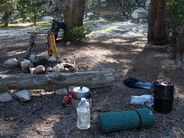
My preferred campsite in Matterhorn Canyon (as a long distance Southbound hiker) is on the South side of the Matterhorn Creek ford, by trail direction, a couple of miles South up Matterhorn Canyon from where our trail first touches the floor of the canyon.
There are a series of campsites along the trail between our touchdown point on the Matterhorn Canyon floor and the campsite at the ford. I prefer to camp at the ford, to better put myself under the big climb up to Miller Lake as early in the morning as possible. Tomorrow we have the huge run down to Glen Aulin after passing Miller Lake. I like to get a very early start and climb out of Matterhorn Canyon during the cool morning hours.
We generally hike the the whole distance from our last campsite (be it at the Matterhorn Ford, Miller Lake, or Spiller Creek) down to Glen Aulin in one shot. Position yourself well to suit your remaining food, fitness, and endurance capacities as you approach your next resupply spot.
If you are holding extra, you can slow down. If you are short, you must push forward. It's counter-intuitive. As we get closer to resupply food gets tighter and tighter if we properly planned our trip.
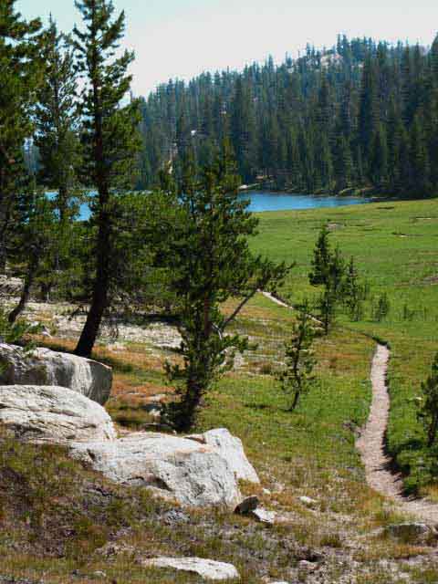
A short distance past the Matterhorn Canyon ford our trail turns South for the substantial hike up and out of Matterhorn Canyon to Miller Lake.
Local hikers on the Bensen Lake Loop will continue up Matterhorn Canyon past this trail junction to exit the top of Matterhorn Canyon through Burro Pass, and eventually pass through Mule Pass, on their way to the end and beginning point of their Bensen Lake Loop at Twin Lakes.
Matterhorn Canyon to Miller Lake
A big climb. Old stock gate finally falling apart (2012). Switchbacks up to the grand view of Matterhorn Canyon. False Summit! More amazing views of the majesty and wonder of Matterhorn and its feeder canyons just below where we turn Southwest to pass through the Great Gap and down to the expansive meadow flat hosting Miller Lake.
Stories: Meeting the backcountry rangers at Matterhorn Creek ford campsite who built the stock gate on the way up the trail to Miller Lake. The one related how the first evening, after they had rode in, they made camp and had dinner before calling it a night.
Late that night a bear ran through their camp, doing what I call a "drive by," trying to snatch food on the run through. Bears do this when they ID a potential target in an active camp, which then forces them to wait until late to do their dash and grab. The Rangers had not left any food out, but they eat good, which had fooled the bear, who got no food. Nonetheless, the ranger's horses freaked out and broke off line, one running all 25 miles back to its stable in Tuolumne Meadows. This required that horse's Ranger to walk all the way back to the stables, retrieve his mount, ride it back to Matterhorn Canyon, then build the stock gate they came out to build.
The Rangers all laugh when they tell the story. Horsemen all laugh when telling about one of their own having to walk. Hell, they laugh at me for walking. I think they just like to laugh. The Backcountry and Wilderness Rangers are generally good dudes, especially the walking ones...
Stories: Reaching the overlook of Matterhorn and its feeder canyons during an incredibly active series of daily thunderstorms gave me the perspective of looking down at the terrain to the Northwest around upper end of Matterhorn Canyon and along the Sierra Crestline to the North watching thunderheads moving rapidly and actively down all the hanging canyons draining into Matterhorn, as well as active lightening storms in Matterhorn and along the Sierra Crestline, each throwing lightening and resounding with thunder! From a very safe position! Amazing! Whooo-Hoooo. Many sad backpackers like soggy doggies in rain... cheer up kids, this is special, A unique position to observe this amazing show. Up through the Great Gap. Down to Miller Lake. Miller Lake Campsites.
West Shore of Smedberg Lake 941 feet |
Bensen Pass -1680 feet |
|
Matterhorn Canyon Ford 966 feet |
Totals Smedberg Lake to Miller Lake Here's a question for you: Are you hiking from high point to high point to camp, or low point to low point? That's the question, and the answer defines the nature of your campsites. Lower elevation campsites along the canyon bottom creeks, or higher elevations camping at high elevation lakes? That is the question. Two Climbs One Descent Note: These miles and elevation rises and fall are almost exactly split between the two ascents and the single descent across this segment of the Pacific Crest and Tahoe to Yosemite Trails. The two ascents add up to +300 feet of elevation more than our single descent. Pretty closely split! A symmetry somehow describing the terrain? The middle of North Yosemite "Washboard?" Yes. Look at the maps! |
Backpacker's Index
| Bensen Lake to Miller Lake 15 min Topo Backpacking Map |
North Yosemite Miles and Elevations |
Bensen Lake to Virginia Canyon
N Yosemite 30 minute Backpacking Map
Backpacker Resources and Hiker Information
| Backpacking Trails and Topics Forums |
Backpacking Trail Information Smedberg Lake to Miller Lake Linear Index |
||||||||||||||||||||||
Off Southeast shore of Smedberg Lake
Video: Smedberg Lake to Bensen Pass
Upper Meadow below Bensen Pass
View of Bensen Pass from Upper Meadow
Video: Bensen Pass to Matterhorn Canyon
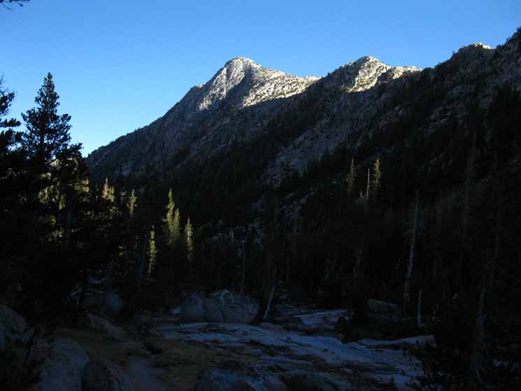
Volunteer and "Double" Peaks from Bensen Pass
View South across Bensen Pass (by Trail Direction, NE by Compass)
To the Upper Ford of Wilson Creek
|
North Weather
Below find the closest Ground Stations, Point and Regional Forecasts from Matterhorn Canyon to Tuolumne Meadows. Satellite and Radar Imagery Real-Time Ground Reporting Stations
All |
View into Matterhorn Canyon Below
Switchbacks down to Floor of Matterhorn Canyon
First look up and down Matterhorn Canyon
Onto the floor of Matterhorn Canyon
Campsites in Matterhorn Canyon
Campsite on North shore of Matterhorn Creek Ford
Matterhorn Canyon Creek Ford trail junction
Video: Matterhorn Canyon to Miller Lake
Now We Climb: Matterhorn Canyon to Miller Lake
View: Wilson Creek and Canyon
Whorl Mountain and Matterhorn Peak
Sierra Nevada Crestline across Top of Matterhorn Canyon
Miller Lake West Shore Campsites
|
||||||||||||||||||||
| > Forum < | ||||||||||||||||||||||
All backpackers can post text comments, questions, or add information and share their experiences on this segment of trail from Bensen Lake to Bensen Pass through the comments links on this page.
Every comment link on every trail guide page goes into the forum for that segment of trail.
Your experiences become part of the guide.
Registered Members can post text, images, maps and videos on their own pages in the Trails Forum to supplement this section of the Trail Guide.
Check out the Tahoe to Whitney .org Backpacking Trails and Topics forums.
The Trails Forums cover the main High Sierra Trails from Lake Tahoe to Mount Whitney paralleling trail guide construction.
The Backpacking Topics Forum covers about every topical issue any long distance backpacker would face in high elevation mountains. The Topics Forum is also being constructed in conjunction with the trail guide.
As I slowly move South completing the trail guide so too the Trails and Topics Forums evolve. I hope to complete all three simultaneously. Make sure to post up your bits of wisdom and experience in this compendium of High Sierra Backpacker information, knowledge and experiences.
Joy, Pain, Wisdom and informative experience eminate from experts and rookies alike. Your experiences across this terrain, as well as you questions, are part of its great tapestry of experience.
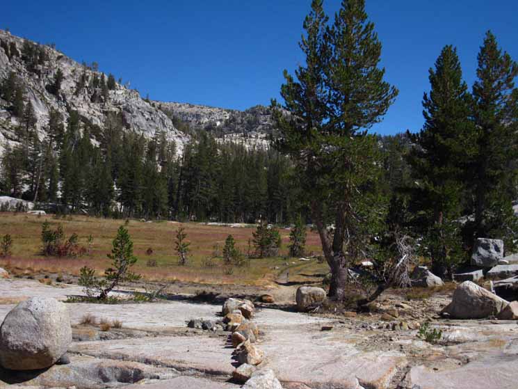
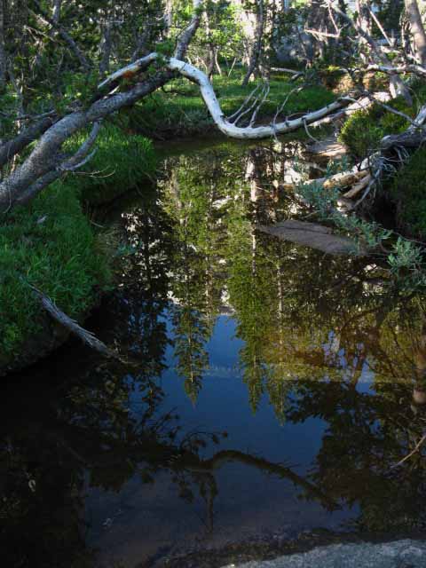
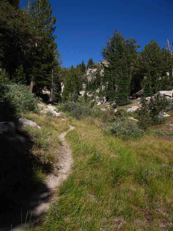
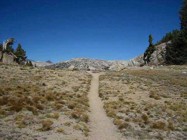
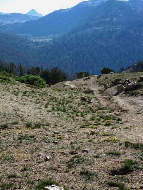
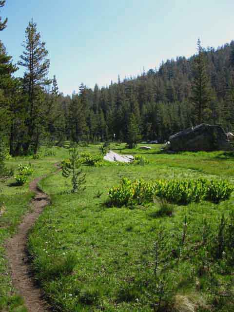
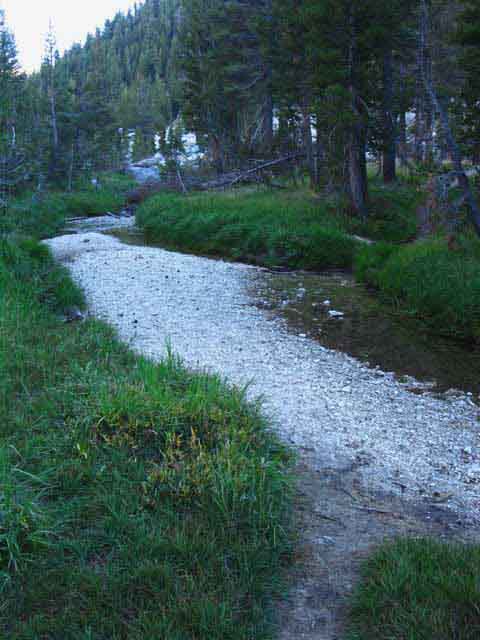
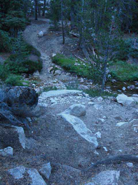
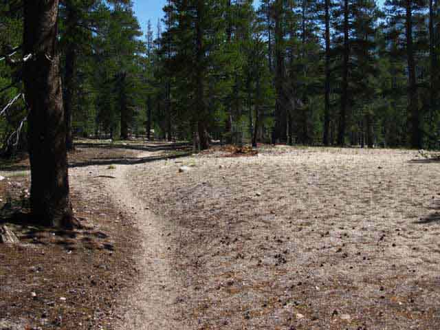
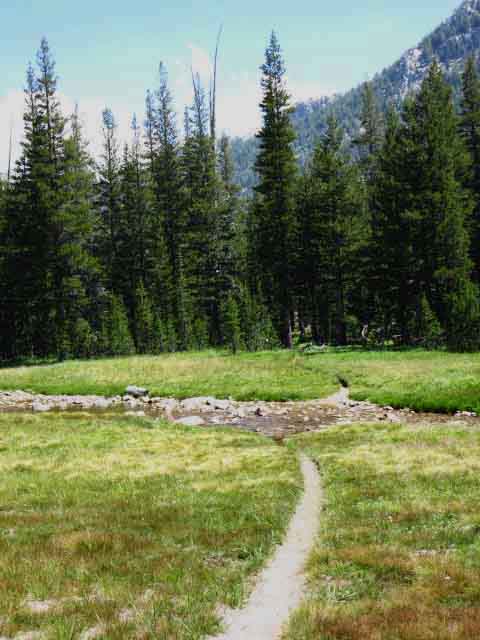
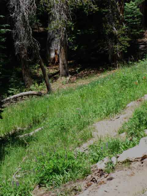
Southbound from Smedberg Lake Hiking East along the South Shore of Smedberg Lake the trail soon turns Southeast hiking up the meadow off the Southeast shore of Smedberg Lake. Below we turn back to take a last look North across East half of Smedberg Lake as we hike South up the meadow away from the lake, behind us. |
 |
Turning Left to take a last look at the marshy Southeast shore of Smedberg Lake as we hike to our Right, to the Southeast, away from the lake. We are hiking South on the unified Pacific Crest and Tahoe to Yosemite Trails towards Bensen Pass. Let's turn to take a look at the trail South up this meadow. |
View South at our Upcoming Trail
 |
||
Hiking Southeast past the wet meadow apron around Southeast side of Smedberg Lake. The wet meadow around the lake stretches out into a dry meadow as we hike South down the trail. Note the vibrant, yet subtle, colors of the blooming and dying dry meadow. From here we can see the next segment of our route South. Beyond the trees our trail cuts Left, bending around to hike almost directly Northeast by the compass, up through the V-gap in the terrain towards Bensen Pass.
|
Video
West Shore of Smedberg Lake South to Bensen Pass
11:55 We are beginning a 2.2 mile Southbound hike up 941 feet of elevation from the Southeast Shore of Smedberg Lake to Bond Pass. Hiking South away from Smedberg Lake we first cross the dry upper meadow Southeast to the beautiful Golden Sand Stream. An easy climb reveals the upper annex of the Dry Smedberg Meadow, an upper shelf of meadow hidden below the rocky recesses of grand granite surrounding this high flat. A stiff climb Southeast from this nifty kind-of-hidden upper annex meadow brings us to the upper meadow below the North flank of Bensen Pass. I've always found water and a good campsite here below the great rock horn guarding our entrance to this meadow. A final difficult moderate climb brings us up to Bensen Pass and some inspiring views back at Volunteer and Double Peaks around Smedberg Lake.
|
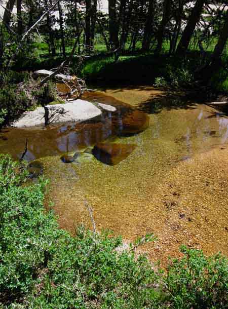
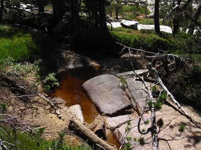
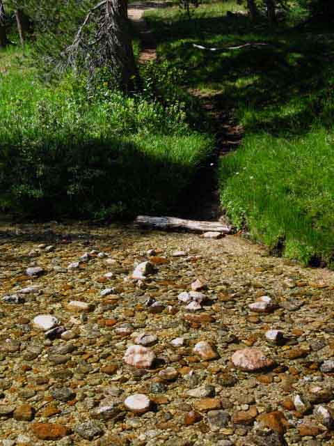
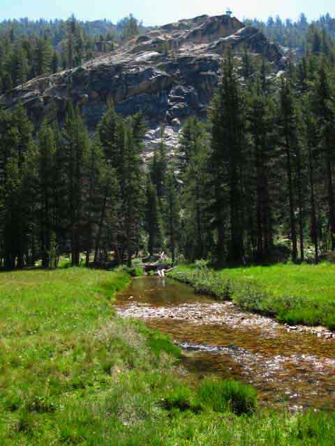
Golden Sand Creek
 |
||
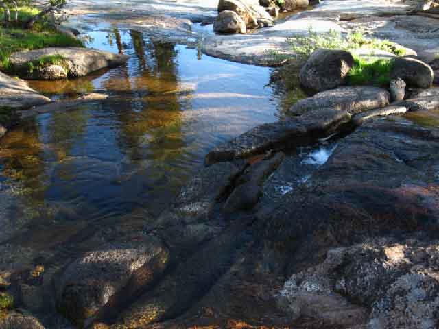
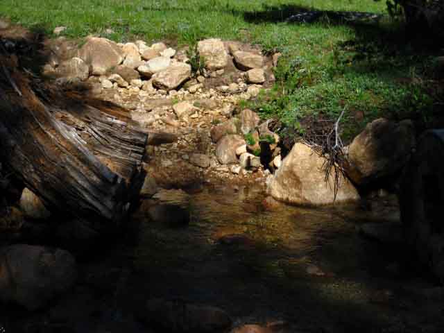
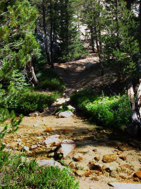
A low easy climb brings us to the beautiful Golden Sand Stream and our fording point across a wide flat rock. The air seems to thicken into a dense silence as we enter the woods approaching the Golden Sands Stream. Over the course of a hiking season the stream starts powerfully, gradually declining into series of golden sand pools chained together by the translucent string of burbling stream, until just a series of golden pools remain at the end of the season.
|
Golden Sand Creek
 |
August 26 2010. |
Golden Sand Creek
 |
| Above and three images below: August 2, 2009. |
Golden Sand Creek
 |
Golden Sand Creek
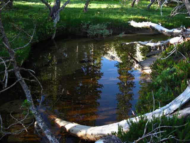 |
A very peaceful place. Walking downstream a bit we come to the slabs of granite serving as the fording point for the golden sand creek. |
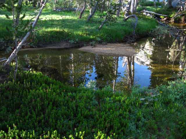
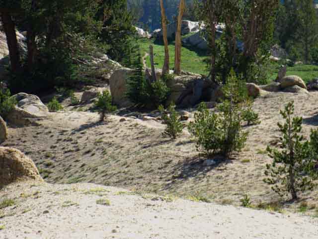
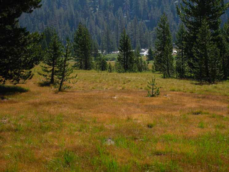
Upper "Annex" Moist Meadow
 |
2009 |
Upper "Annex" Meadow Dry
 |
||
2012 Now we face a stiff 480 foot climb up .64 of a mile to the upper meadow.
|
Climb South to Upper Meadow
 |
Steady Hard Climb. |
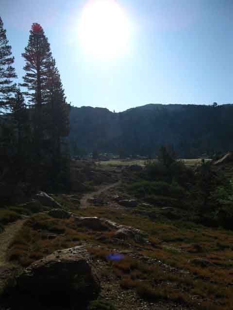
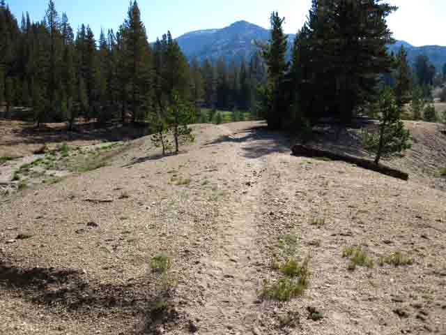
Entering the Uppermost Meadow
Hiking into the Morning Sun
 |
||
Into the Scathing Bright Morning Light. Hiking South from the shaded switchbacks into the glare of the rising sun across the uppermost meadow under Bensen Pass. Hiking the very steep terrain South up from our Bensen Lake campsite during the early morning cool air and shadow saves lots of energy. Well, at least this very difficult first climb of the day is in cool conditions... Now we will have to contend with the intensity of sun exposure and physically dissipating heat as we climb. Blowing off heat, protecting ourselves from the heat of climbing can take as much energy as the climb itself. Early climbs save lots of energy compared to late afternoon climbs. Heat, coolness, and heat dissapation should be an itergral part of planning out our daily hiking plan. The Daily Hiking Plan In the image above I was hiking the 9.6 miles from Smedberg Lake to Miller Lake over a half-day, to give myself time to explore the terrain around Miler Lake's West shore campsites. Recognizing this, I planned a trip to fill in that particular gap in my recent hiking plans by shifting my campsites through this segment of trail. So I offset my camping plan to break out of this hiking pattern I was falling into, and spend a night Miller Lake before making my way South to Glen Aulin the next day. I was especially focusing on shifting my campsite pattern after deciding to write the guide. Before I was doing it for fun. Shifting Backpacking Patterns This place pulls us outward while sucking us in at the same time. The fact is that where we camp, where we "stage up," for the next day's hiking determines the timing for each of the subsequent places where we camp and explore. The only way to get a reasonable perspective on the North Yosemite Backcountry is by varying the location of campsites and the times of day each time through the terrain. This alters the time of season and the time of day we pass through each location over a period of years, giving us a wide perspective on the range of characters each place shows as the seasons progress. This is just delightful. BIG Today, in terms of the image above, we'll get over this climb out of the "Bensen Hole" in cool morning air and make our next climb out of Matterhorn Canyon up to "today's" destination at Miller Lake before the day really heats up, which is good. Standard Approach Shifting the Hiking Pattern
This Complex Segment of Trail All right, that's what I know, unless you push me. My actual email sits at the bottom of every page. Want to "see more?" Well, I've a list of trails, routes and trips that I will not live long enough to explore. I'll fricking send you there. |
Want to do some "scouting?" First, explore the trail routes through your favorite area throughly. Get to know the surrounding terrain and the trails. Develop physical and psychological comfort and "flexibility" on the trail, being the ability to bring and use an extra day's food to explore. Begin to apply these skills by taking a half-day off and exploring the regions around your campsites. Once you get these fundamental backpacking skills under control I'll send experienced backpackers ideas for exploration, at your own risk. Explore Exploring New Terrain Thus I warn that Backpacking is Dangerous before we choose between backpacking the Pacific Crest Trail's Superhighway of Trails South from the Lake Tahoe Basin or the diffuse and sometimes non-existant trail of the Tahoe to Yosemite "Trail" South from the Tahoe Basin. "Exploring New Terrain" is what I call it when I get lost. I'm not lost if I am exploreing new terrain. It took me about three years before I started pushing past the boundaries of Summertime scrambling and cross country unmaintained routes, first exploring into the snows of late Spring conditions, backpacking earlier and earlier into the receeding warm snows of Springtime, and later into the much more challenging deepening cold of Fall snows. I figure it is much better to begin probing the Art of Snow Camping during the warming snows and weakening storms of Spring than the deepening cold and stregthening storms of Fall. Late season storms during Spring and early Winter Storms during Fall bring exciting trips! Or disaster, depending on what you expect and are ready for. Proceed Carefully! After mastering what Spring and Fall could throw down I finally ventured into Mid-Winter conditions along the High Sierra Crestline. Once I broke the Winter Barrier my backpacking schedule was year-round. I was lucky enough to get in a six year run of extensive four-season backpacking that kept me on or very close to the Sierra Crest for a minimum of six months out of each year. A series of old and new injuries has since knocked me out of Winter and off the trail. My goal is to spend the Winter Solstice/New Year somewhere on the Sierra Crest. Generally performing a Leavitt Peak Loop from the Marine Base, a Sonora Pass to Marine Base trip from Rodriquez Flat, or a Showers Lake/Round Top loop out of the Tahoe Basin. Each would happen between the snows of Fall and the advent of the Spring Thaw. One of these trips would happen across the Winter Solstice and New Year. Each step of evolving fittness and experience will draw you naturally to the next step evolving both. There is no "desire" that allows us to safely progress without experiencing the pleasure, pain, fear and work that brings us up through each subsequent step of our skills progression. Our motivation for reaching for the next step of Wintertime development must be tempered by the serious dangers Winter travel presents. The logical end of this process is merely the top of the Sierra Crestline. No need to go anywhere else. All we need is right here, in the Sierra Nevada. Each and every day of the year. The exact same progression is what first brought me onto and then off of the High Sierra Trails onto cross-country and scrambling routes, then into the snow covered mountains. Not just to "do" it and run away, but to intergrate my life more deeply into the High Sierra Seasons. High Sierra Backpacking Bug These are difficult trails to hike on the trail. Adding the extra work and risk of exploring off-trail and into Winter adds to the already significant risks of High Sierra Backpacking. It may be for you or not. Backpacking is Dangerous Forum Here's the deal: Each of us must honestly measure our capacities against our motivations and desires, and put a practical plan in place. Hey, it may take years to get your fat ass out on the high trails. But it will be so worth it that you will shit yourself. Every backpacking trip is a step you guided yourself through the unknown, even on trails. It is unknown to you! Each step brings you closer to yourself. You've just got to properly evolve your inherent capacities. They are in there if you want to find them. Your life will be reorganized by your preperations for the trip, let alone the efforts necessary to plan and execute the series of trips required to properly prepare ourselves for, and to consolidate the skills and fitness necessary to hike from Highway 108 to Tuolumne Meadows. Between mastering Summer backpacking and evolving-transitioning our Summer skills to Winter compentency on the continium of High Sierra backpacker's skills lays cross-country travel.
Navigation Forum A Logical Progression You can do anything you put your mind to following a good plan one step a time executed with great care. First, go long in Summertime. Second, go deep. Explore off trail during Summertime. Third, plan trips earlier into Spring and later into Fall snows. Finally, execute mid Winter High Sierra backpacking trips. Fill the circle of life with your reflection of it through each of its seasons. This full-circle seasonal evolution will expand your gear and evolve your training and fitness as you learn to comfortabley situate yourself across a very wide range of the beauty this Earth can throw at you. You'll be amazed at what you find both within and around yourself, and what you find out about that living point of conscious choice in-between your physical body and the outside world called, that elusive thing called, "you." There are very old things within the "you" sitting between what exists within and without. I'd guess that there are more things inside and outside of yourself than you are currently aware. Long distance backpacking will bring them out. Get out to bring it out! |
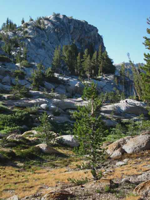
Horn Guarding Southbound Entrance to Upper Meadow
 |
||
There's a nice campsite over there. Up in those trees under the West side of this rock horn. We're hiking South into the Upper Meadow laying off to our Left, and we are looking to our Right (SE by compass) across the trickle of the Golden Sand Creek to observe this nifty horn of rock. There is a nice campsite located over there, as we enter the upper meadow below the North side of Bensen Pass. This feature is easily identifiable on the 15 minute map below:
Each time I hiked past here I looked over and said to myself, "I'll bet there is a nice campsite over there." During one trip I said, "what the hell," and hiked over there to camp and see if I was correct. I was. There's a nice campsite in the trees nestled in below the rock formation. We have to hike back to the pool pictured below to retrieve water, so I always fill up my jug when I hike out there to camp. One less trip! |
Golden Sand Creek
Running
out of the
Upper Meadow
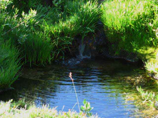 |
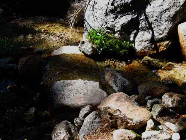
Water source at low point exiting upper meadow below North flank of Bensen Pass. August second 2009. I've never seen this pool dry, even when the stream feeding it does not reach the meadow above. There appears to be a nearby buried spring, and/or the underground flow of the creek continues after the surface flow has stopped, only to reemerge here. The USGS map cites the stream through here as a seasonal stream, but I've never seen this pool completely dry. I'd say that this status may not continue if either the sustained drought and/or the new weather pattern that is emerging continues evolving past 2014. We'll see! |
Bensen Pass
looking across
Upper Meadow
 |
||
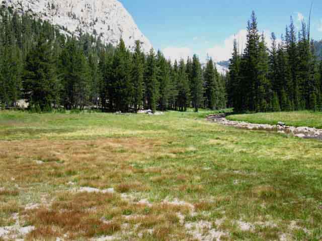
Bensen Pass The picture below puts the light slash of soil that composes Bensen Pass into a broader context with the meadow below its North side and along the granite ridgline its is located that wraps around our upper meadow.
Bensen Lake to Virginia Canyon |
Bensen Pass beyond Dried Out Upper Meadow
 |
Bensen Pass across and above the uppermost meadow Our combined Southbound Tahoe to Yosemite and PCT trails are pointing us at Bensen Pass. The upper meadow below South flank of Bensen Pass completely dried out on September 4 2010. Bensen Pass is visible as the bright slash between the trees making up the low point along the Left side of the ridgeline. Subtle Fall colors glow as the now crunchy meadow readies itself for Winter. |
View South across Upper Meadow
 |
||
High Altitude Meadow below Bensen Pass Turning our gaze to our Right, South, looking across the same meadow pictured above, but earlier in the year, on August the second, and a year earlier, during 2009. A sweet high altitude meadow sitting at 9760 feet of elevation. It's still green.
|
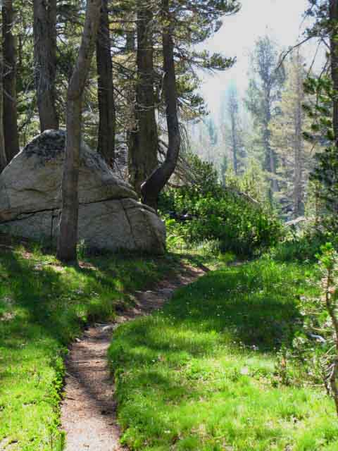
Trail to Bensen Pass
 |
Up the Gorge to Bensen Pass South of the meadow we begin our final approach to Bensen Pass entering a narrow defile in the terrain which we will follow up to Bensen Pass. It's a nifty piece of terrain. |
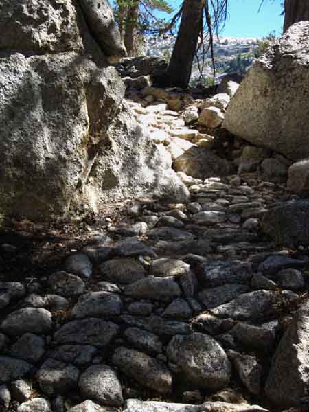
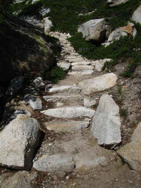
Yosemite Trail Work
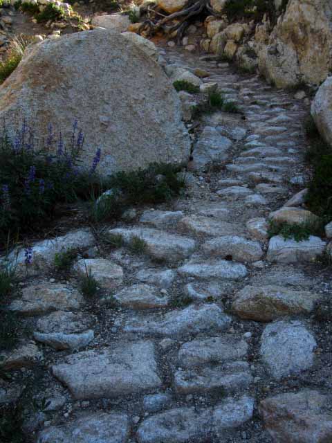 |
Deeply and Firmly bedded stones preserves trail through Spring Thaw conditions. |
Final Approach to North Side of Bensen Pass
 |
That's Bensen Pass When I refer to the North and South flanks of Bensen Pass I refer to the directions of the Pacific Crest and Tahoe to Yosemite Trails across it. Bensen Pass's flanks are actually situated Southwest and Northeast by the compass. |
Last Steps
up the
North Flank of Bensen Pass
 |
Last steps up the North side of Bensen Pass. |
Bensen Pass
 |
||||||||||
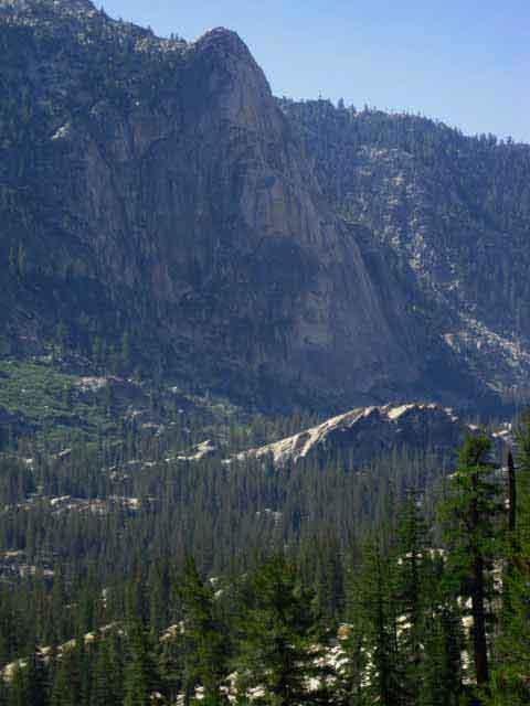
Hiking South across Bensen Pass in the North Yosemite Backcountry. Crossing Bensen Pass we begin the descent through Wilson Creek's hanging canyon onto the switchback on the West wall of Matterhorn Canyon. We can see the black pointy peak of Virginia Peak poking up over the tops of the ridges running up to the Sierra Crest. The ridges we can see divide Wilson Creek's near canyon from Matterhorn Canyon in the distance and Virginia Peak beyond. Virginia Peak is located high up near the Sierra Crest near the top of the ridge making up the West wall of Virginia Canyon and the East wall of the Spiller Creek canyon. The Spiller Creek canyon is slashed out of the top of the massive ridge running up to the Sierra Crestline that divides Matterhorn from Virginia Canyons. We will hike down Spiller Creek's hanging canyon onto the switchbacks and great traverse down West wall of Virginia Canyon after hiking South from Matterhorn Canyon. Bensen Pass
The unified Northbound routes of the Tahoe to Yosemite and Pacific Crest Trails split for their respective trailheads to our North along Highway 108 at the top of Jack Main Canyon. The TYT and PCT remain unified for the twenty-four and a quarter remaining miles of their shared routes South to Tuolumne Meadows.
|
||||||||||
VIDEO
Bensen Pass to Matterhorn Canyon Creek
Ford and Campsite
6:33 This video takes us Southbound over the top of Bensen Pass hiking into the Wilson Creek Drainage down through its hanging canyon onto the side of Matterhorn Canyon. We switchback down the West wall of Matterhorn Canyon and then hike up the the floor of the canyon to the Campsite on the North shore of the Matterhorn Creek Ford. The top of the vast granite ridge running up to the Sierra Crest dividing the upper section of Matterhorn Canyon from the upper section of Virginia Canyon to its East is shaped like a great "wishbone," cradling a great cut in the top of the ridge dividing the tops of Matterhorn and Virginia Canyons. There is a hidden middle canyon between Matterhorn and Virginia Canyons cut into the upper section of the vast ridge that divides them. Virginia Peak sits atop the Eastern prong of that wishbone ridge, also making up part of the crestline above the West wall of upper Virginia Canyon. Twin Peaks sits to the North of Virginia Peak marking the line of the Sierra Crest across the top of Virginia Canyon. All of that complexity is at the top of these canyons to our Northeast. Our route continues roughly East across this series of ridges, but a bit to the South of the line of the Sierra Crestline. Closer to home, our hike South from Bensen Pass descends 10160 feet of elevation down to 8480 feet at the campsite on the North shore of the Matterhorn Canyon ford. Our total descent is 1680 feet over the 4.8 miles to this camp or fine break site.
|
Bensen Pass Rock
 |
Bensen Pass Rock. A nice place to sit and consider our situation. |
View North
 |
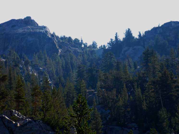
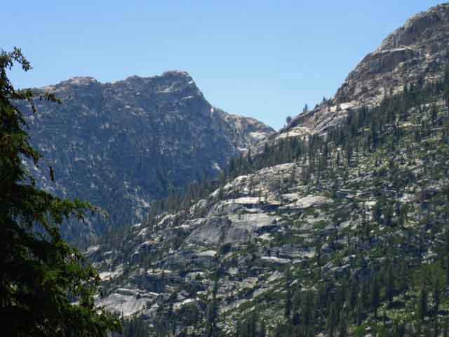
Volunteer and Double Peaks View down Northbound Pacific Crest and Tahoe to Yosemite Trails from Bensen Pass. Volunteer Peak jutting up on Left, "Double Peak" on Right. We're looking a little South of West by the compass. Check our view of these same mountains from the North when we were hiking |
View South
 |
||
Hiking South through Bensen Pass. The dark and pointy Virginia Peak is sticking up over three canyons running down the West flank of the Sierra containing Wilson, Matterhorn, and Spiller Creeks respectively. The dark mass of Twin Peaks rising to the Left of pointy Virginia Peak marks out part of the line of the Sierra Crestline at the top of Virginia Canyon. Twin Peaks is almost directly South of Twin Lakes. Twin Peaks is the dominant Peak along the Sierra Crestline between Matterhorn Peak and Camiaca Peak. I'm pretty sure that white mass on the far Left side of the Sierra Crestline is Matterhorn Peak and Whorl Mountain. From Bensen Pass we have a 4.8 mile hike down 1680 feet of elevation through Wilson Creek to the campsite at the ford of Matterhorn Creek in Matterhorn Canyon.
|
Down the South Side of Bensen Pass
 |
Into the Wilson Creek Canyon. View South dropping down the South flank of Bensen Pass. Virginia Peak in the distance beyond the top of the upper section of Wilson Creek's canyon and across upper Matterhorn Canyon. |
Dropping into Dry Eroded Areas
 |
Hiking over to the North side of Bensen Pass brings us into a series of seasonal washes remnant from the annual power of the Spring Thaw flowing down across the steepness of the terrain. Though dry up here from the end of the Thaw, we will find the season creek reaching as high up towards Bond Pass as the particulars of this season allow. During wet years the creek will reach high up late in the season, during dry years it will quickly recede. |
High and Dry
 |
Exposed terrain below South flank of Bensen Pass, by trail direction. We are hiking Northeast by the compass. The upper section of trail below the South flank of Bensen Pass is across exposed terrain composed of broken down sandy soils. It is a steep drop down broken up by nice little flats of dry and green meadow spaces. Note that although we are hiking South along the PCT-TYT route we are hiking North by the compass down the North flank below Bensen Pass. |
Into the Forest Switchbacks
 |
Dropping Steeply to Wilson Creek Forested sections of trail also lay below Bensen Pass's South flank, again by the direction of our trail. By the compass we are descending to the Northeast to Wilson Peak. On the map we are hiking South down the PCT TYT. |
Eric the Destroyer
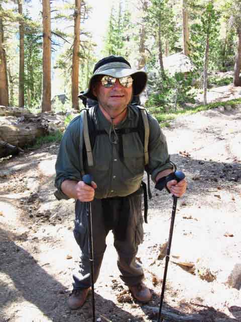 |
Eric the destroyer climbing to Bensen Pass, 2009. Eric was approaching the end of the significant climb out of Matterhorn Canyon to Bensen Pass. The key to successfully climbing this rapid series of High Sierra ridges is keeping your pace at a rate you can sustain, and not over-extending yourself. This series of ridges will put an extended strain on your strength and endurance, so our physical output must be maintained within the limits of daily stress that we can can recover from every night. Here is where we must note the overall effect of our daily hiking on our overall fitness and endurance. If we are declining in strength and endurance we must slow our pace, and might consider taking a half-day, or even a full day off. |
Circling around into a lightly forested area brings the creek into sight off our Right Shoulder
 |
Very low flow during August 2 2009.
|
Creek up High
 |
Tiny creek below Bensen Pass still has a bit of water late in Summer season. |
Bensen Pass crossed this Range
 |
South wall of Wilson Creek's canyon. High peak along this crestline marked as Peak 10462. We are still hiking Northeast by compass, to our Left, as our route currently points up the canyon to access the bottom of the canyon, then we will turn down canyon after crossing the top ford of Wilson Creek. |
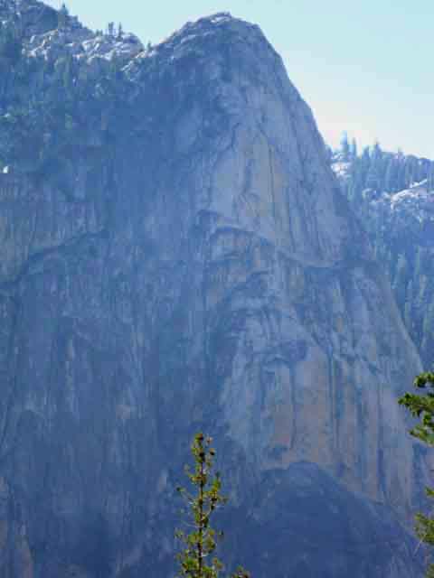
Fine Granite Peak
 |
Detail of Peak 10462 on the South wall of the canyon above Wilson Creek. |
Last Steps to the Northeast
 |
||
Dropping down the switchbacks puts us onto the edge of forest along a thin meadow running upstream along Wilson Creek. Reaching the bottom of the canyon holding Wilson Creek leaves us with a short hike upsteam to the Northeast until we reach the ford at the edge of the forest. At the upper Wilson Creek ford we cross Wilson Creek to turn downstream resuming our descent into Matterhorn Canyon following Wilson Creek to the Southeast.
|
Wilson Creek Upper Ford
 |
Wilson Creek's upper ford. We have just crossed Wilson Creek hiking South, and have turned back as an afterthought. We note the narrow width of the creek up here so high. |
Along Wilson Creek
 |
||
Trail along Wilson Creek below upper ford, hiking to Matterhorn Canyon. We are facing and hiking Southeast along the North bank of Wilson Creek.
|
Great Lineup of Peaks
above
South Bank of Wilson Creek
 |
Last light of day screaming across the top of the South canyon wall above Wilson Creek. It's getting late! Time to get rolling! |
Middle Ford of Wilson Creek
 |
||
Approaching the middle ford of Wilson Creek.
|
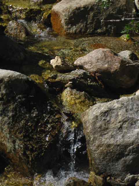
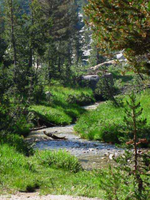
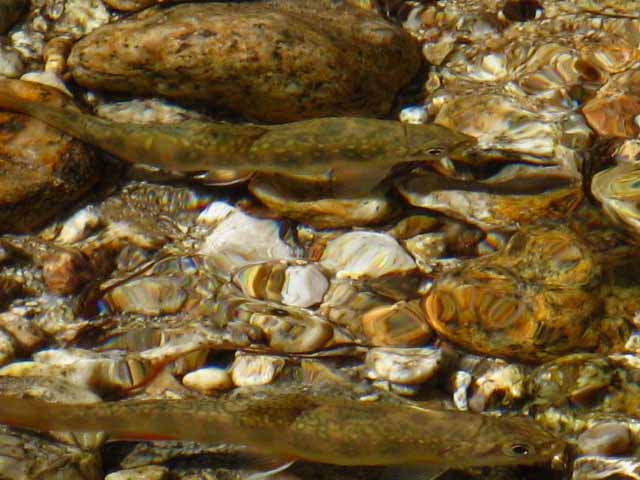
Trout Fry in Wilson Creek
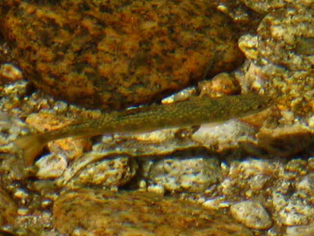 |
I always lighten up my steps when I approach water. Why? Because the fish listen carefully, and if they hear you they hide. Do Fish Have Ears? They feel and see quite well. |
 |
A little dude checking me out while his pal checks him out. |
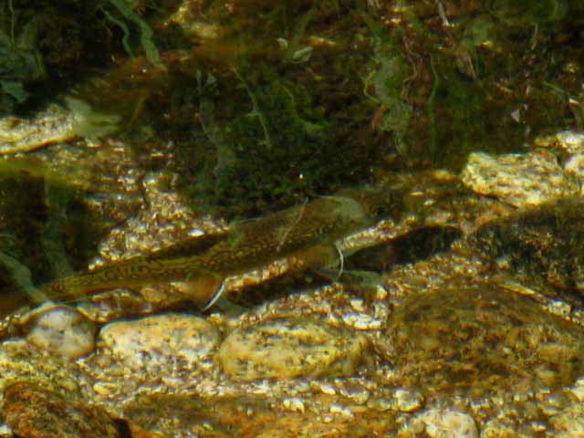 |
Tough little fish moving around the pool looking for goodies. The shimmering reflections dancing across the surface of the water that divides our two very different worlds. August 2, 2009. |
Trail South from Middle Wilson Creek Ford
 |
Wilson Creek almost dried out late in the hiking season. August 26, 2012. |
Hiking South from Middle Ford of Wilson Creek
 |
Wilson Creek middle ford trail continuing South. |
Backpacking
Down Wilson Creek Canyon
 |
Hiking South to lowest ford of Wilson Creek on the way to Matterhorn Canyon. |
Into Matterhorn Canyon
 |
Glimpse of Matterhorn Canyon below Wilson Creek's hangin canyon. We'll come out the mouth of Wilson Creek's canyon down a steep section of trail onto wide switchbacks down to the floor of Matterhorn Canyon. We'll be climbing over that distant ridge out of Matterhorn Canyon a very short distance after steeply dropping into Matterhorn Canyon. This is indeed a roller-coaster ride of a high altitude trail. |
Lower Wilson Creek Ford
 |
||
The last and lowest ford of Wilson Creek for Southbound backpackers, the first for Northbound hikers.
|
Lower Wilson Creek Ford
 |
The widest and potentially strongest of our three fords of Wilson Creek. The further down we go the greater the area the creek has drained. |
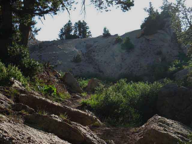
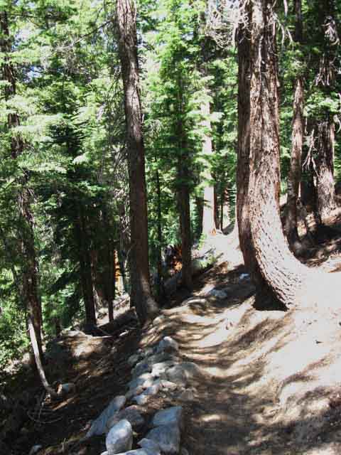
Granite Trail Work entering Matterhorn Canyon
 |
||
Turning around to take a look at a representative of the long steep switchbacks we have been hiking down to floor of Matterhorn Canyon.
|
Trail and Terrain
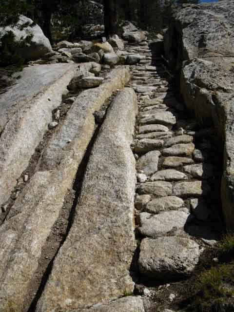 |
Trail Crew fits the trail into natural strong positions that will long resist the forces of erosion. A pretty little puzzle. |
Looking Up Matterhorn Canyon
 |
||
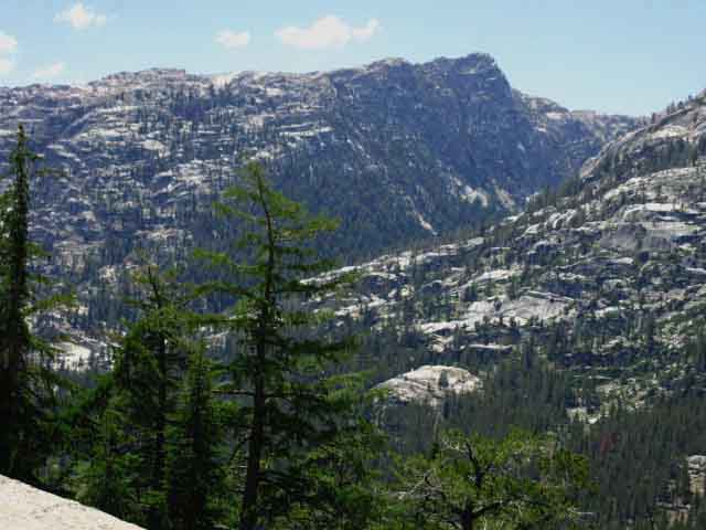
Our first view looking up Matterhorn Canyon while racing the falling Sun down to camp in Matterhorn Canyon.
Bensen Lake to Virginia Canyon |
Looking Down Matterhorn Canyon
 |
View South down Matterhorn Canyon. We can see great granite fins emerging from the canyon floor. |
 |
||
Matterhorn Canyon rock shrouded in smoke from Wildcat Fire of 2009.
|
Meadows on the Floor of Matterhorn Canyon
 |
A break in the dense forest cover as we descend approaching the floor of Matterhorn Canyon gives us a momentairy glimpse of Matterhorn Creek's serpentine course down-mountain through wide meadowlands. We're getting closer yet to the canyon floor descending lots of long granite switchbacks down towards the bottom of Matterhorn Canyon. If we look to the far Right side of the image above we see that the canyon-floor meadow terminates, meeting a rocky island rising from the middle of the meadow. This pushes Matterhorn Creek East towards the far canyon wall to get by. The Unseen Our route brings us down into and then upriver along Matterhorn Canyon's delightfully meadowed floor from the position pictured above to the trail junction pointing us East. We hike East over the Eastern Wall of Matterhorn Canyon into Virginia Canyon. We drop into Virginia Canyon to cross Return Creek, quickly climbing out of Virginia Canyon far above where it intersects with Matterhorn Canyon at the hub of great canyons. This hub of canyons is where the vast canyons bringing Regulation, Matterhorn, and Return Creeks all merge. Our Southbound PCT-TYT route hikes around this hub of canyons to its North and East. I've been contemplating how to get safely into and out of the hub of canyons to take a look at it. I'll bet it is splendid. The creeks emerge from their individual canyons into the hub of canyons to join Return Creek flowing down the huge granite canyon draining out the bottom of the hub of canyons down into the Grand Canyon of the Tuolumne River. This vast canyon brings Return Creek into the Tuolumne River about three miles West of Glen Aulin. Back to the Southbound PCT-TYT The horsecamp is located out towards the center of the meadow from where our trail switchbacks down into the Western edge of the floor of Matterhorn Canyon. The trail out to this campsite/horsecamp breaks off to our East just a few feet South of where our trail finally touches down on the canyon floor. Our first steps on the floor of Matterhorn Canyon and the trail to the campsite/horsecamp along the edge of the meadow are both located on the far lower-Right of the image above. I continue up river to the campsite near the ford if I am to stay in Matterhorn Canyon. Our trail South moves upstream along the Western edge of the wide meadow that Matternhorn Creek makes its twisting course through. This means that our trail along the edge of the meadow occassionally overlooks the Western bends of Matterhorn Creek's serpentine route downstream through the meadow as it turns to and then bends away from our track along the Western edge of the meadow. |
Hitting the Floor of Matterhorn Canyon
 |
||
The last switchback down to the floor of Matterhorn Canyon. We'll see paths East to the horsecamp/campsite here and about fifty yards further South down the PCT-TYT.
|
Matterhorn Canyon Campsites
 |
Old trail and National Park Service Crews campsite in Matterhorn Canyon. This one is about three-quarters of a mile upstream from where we hit the floor of Matterhorn Canyon. |
 |
Another campsite on downstream end of Matterhorn Canyon. We've found three campsites before hiking upstream to the sandy wash. The first was the unseen horsecamp, the second was the old trail crew site, and now this nice little individual site. |
Sandy Wash in Matterhorn Canyon
 |
Trail South through dry forest and sandy wash within Matterhorn Canyon. We get a dry "Pine Barrens" type of feel in here. Red Ants and Black Birds. |
Meadow in Matterhorn Canyon
 |
Matterhorn Canyon meadow along Pacific Crest and Tahoe to Yosemite's unified trail route. |
Beautiful Matterhorn Canyon
 |
Matterhorn Creek flows through meadow meandering down Matterhorn Canyon. |
Ford of Matterhorn Creek in Matterhorn Canyon
 |
Approaching Matterhorn Creek ford and Campsite off to our Left. |
Matterhorn Creek Ford in Matterhorn Canyon
 |
||
Matterhorn Creek ford hiking the Pacific Crest Trail across Yosemite National Park.
|
Deer at the Matterhorn Creek Ford
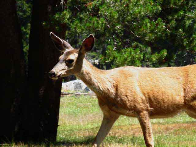 |
Pain in the ass tame deer haunts the ford campsite. Do not feed this deer. Do not increase its tameness, discourage it. This deer showed up in 2009 and I encountered it in 2012 as well. Post up if you've seen it, especially post-2012. |
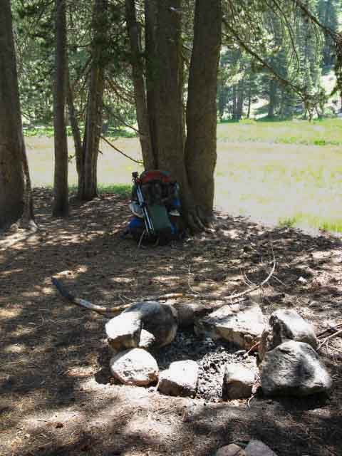
Campsite on North Bank of Matterhorn Creek Ford
 |
||
Matterhorn Creek ford campsite.
|
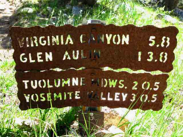
Matterhorn Creek Ford Trail Junction
Southbound
Pacific Crest Trail & Tahoe to Yosemite Trail
 |
||
PCT-TYT SOUTH Matterhorn Canyon trail junction South (by trail direction) to Virginia Canyon via Miller Lake along the PCT & TYT routes. Continuing North up Matterhorn Canyon points towards Burro Pass at the top of the canyon, which leads to Rock Island Pass into upper Kerrick Canyon in close proximity to the Twin Lakes Trailhead in the Hoover Wilderness. This trail junction would be the point that backpackers on the Bensen Lake Loop break off from the TYT-PCT turning their loop back towards their Twin Lakes Trailhead.
|
Up Matterhorn Canyon towards the Sierra Crest
 |
||
Trail sign marking the way Northeast up Matterhorn Canyon towards Burro Pass. The 30 minute map to the Right below lays out the route of the Bensen Lake Loop around the North Yosemite Backcountry.
|
North
on the
PCT-TYT
Back the Way we Came
 |
||
Trail sign showing the way North on the combined Pacific Crest - Tahoe to Yosemite Trail route back the way we came hiking South over Bensen Pass.
|
Video
South out of Matterhorn Canyon to Miller Lake
Let's take a look at the terrain climbing out of Matterhorn Canyon to Miller Lake.
|
Now We Climb
2.6 miles up 966 feet
Matterhorn Canyon Trail Junction to Miller Lake.
 |
Beginning the switchbacks out of Matterhorn Canyon to Miller Lake. A serious climb. |
Forested South Flank of Matterhorn Canyon
 |
South out of Matterhorn Canyon along the Tahoe to Yosemite Trail. |
2009
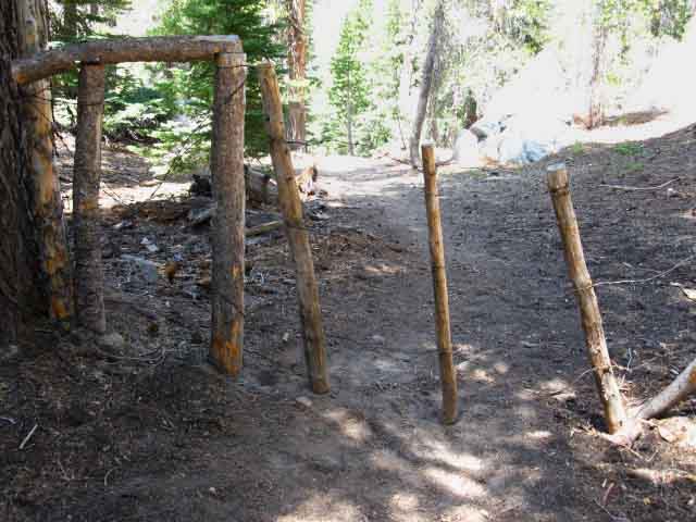 |
This image was taken in 1999 after kicking it with Backcountry Ranger Medford at the Matterhorn Canyon campsite with his buddy the previous evening. That's when Medford's pal told me about their visit from a local bear, which chased Ranger Medford's horse off the line, whereupon it ran all the way back to its home stable in Tuolumne Meadows. Ranger Medford had to hustle down to the stables, hiking in cowboy boots, to get his horse and ride back to Matterhorn Canyon. Medford's buddy could not stop laughing when he told the story. Ranger Medford and his buddy had ridden out there to build the stock gate above, which they had pretty much completed the day I hiked through, which was the day after the bear came through and ran off Ranger Medford's horse. The stock gate is very tight. Bet Ranger Medford wished they had it up before the bear ran through! Over the years it has held together well, despite taking some damage, likely by both animals and snow. It appears backcountry trail crew tightens it up every year. |
2010
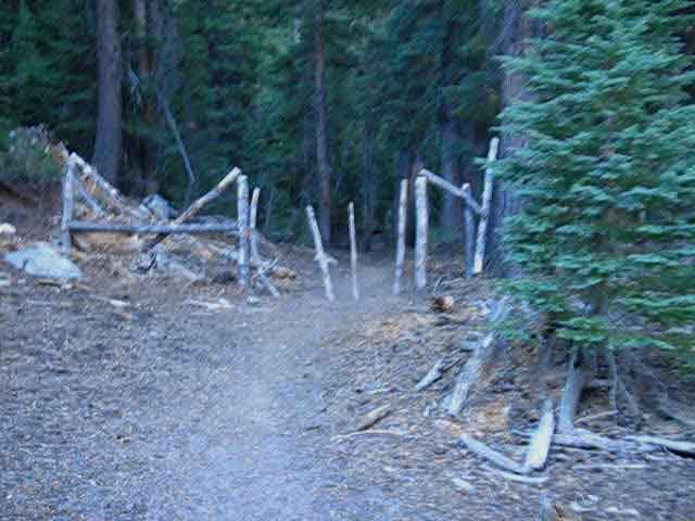 |
In 2010 the fence was broken in one place and dislodged in another, but still an effective stock gate. |
2012
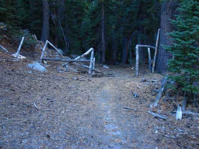 |
In 2012 the North upper rail was still broken, but the dislodged rail had been nailed back into place. In 2011 I was recovering from frostbite, and did not hit the trail until October, and that was with some issues. 2013 has been forestalled by heart and orthopedic issues. Is one half-dead or half-alive? I guess it depends on where you are standing. |
After hiking South on the PCT TYT route through the stock gate we see that the terrain on the South/Eastern flank hiking out of Matterhorn Canyon is very complex. Great mounds of granite punch through dense surrounded forests, making room for short bits of flattish terrain holding tiny meadows offering brief intermediate elevation glimpses of the surrounding grandeur through thin spots in the dense forest cover as we climb higher. This is amazing terrain... this is a huge ridge with a diverse range of terrain decorating its massive flank. A world unto itself, this massive flank making up the East wall of Matterhorn Canyon. Past the gate we swing through some diverse terrain on the flank of Matterhorn Canyon before we catch some long views up and down Matterhorn Canyon. |
 |
As we hike around arms of terrain descending off the upper flank into the canyon below we find a wide variety of terrains and views. This delightful section marks the interface between meadow and forest, though the strip of meadow is thin, and both meadow and forest contort themselves around the requirements of this steep flank. Yet the dimensions of this canyon wall are so profound that areas of flat meadow and forest exist in their own miniature zones wedged-in along this otherwise steep terrain. |
 |
A narrow strip of forest and grass interface on flank of Matterhorn Canyon. |
View Southwest at Wilson Creek's Massive Granite Canyon
 |
||
As we climb higher we get a view through the forest of the granite valley that Wilson Creek flows through into Matterhorn Canyon. That would be Peak 10462, which we observed dropping into Wilson Canyon through Bensen Pass. Our Southbound trail down that canyon from Bensen Pass bent around the interceding ridgeline to drop into Matterhorn Canyon, with the trail finally hitting the floor of the canyon about a mile to our Right, up the canyon.
|
Wilson Creek Canyon cuts into Matterhorn Canyon
 |
The top of the distant ridge runs Northwest, to the Right, to dip down into a low point forming Bensen Pass, where hikers on the Northbound Pacific Crest and Tahoe to Yosemite Trail routes finally climb out of Wilson Creek's Canyon. |
View Northeast at the Sierra Crest Line
 |
||
Looking North up Matterhorn Canyon we see Whorl Mountain dividing the tops of Matterhorn Canyon and Spiller Creek, with Matterhorn Peak in the background topping this section of the Sierra Crest.
|
Directly North: Sawtooth Ridge of the Sierra Crest Line
 |
We've now climbed high enough that an opening in the forest cover gives us a view North up across the head of Matterhorn Canyon looking over the ridge Burro Pass crosses to escape Matterhorn Canyon, with the jagged profile of the Sawtooth Ridge beyond. Matterhorn Peak rises to the Right of Sawtooth Ridge. Though we are getting good views from here, about halfway up, we will get better views from the top of the ridge. Bensen Lake to Virginia Canyon |
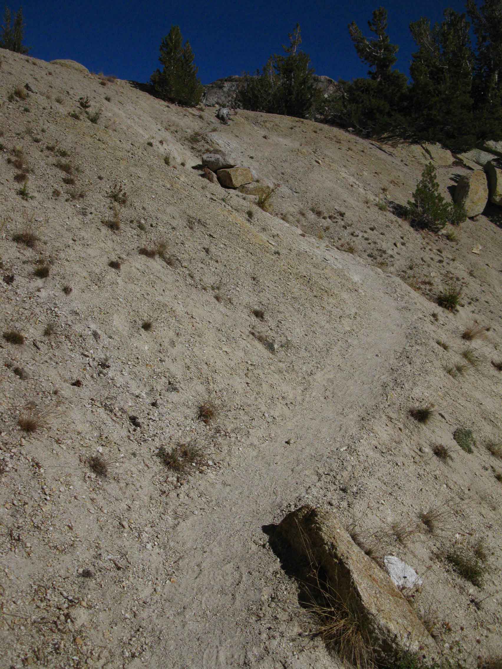
Terrain on the South Flank of Matterhorn Canyon
 |
Trail up Matterhorn Canyon winds through a very welcome flat section along its relentless climb to Miller Lake. It's hard to understand how so many different environments and terrains are fit onto the flank of a mighty Sierra ridge. |
Terrain on the South Flank of Matterhorn Canyon
 |
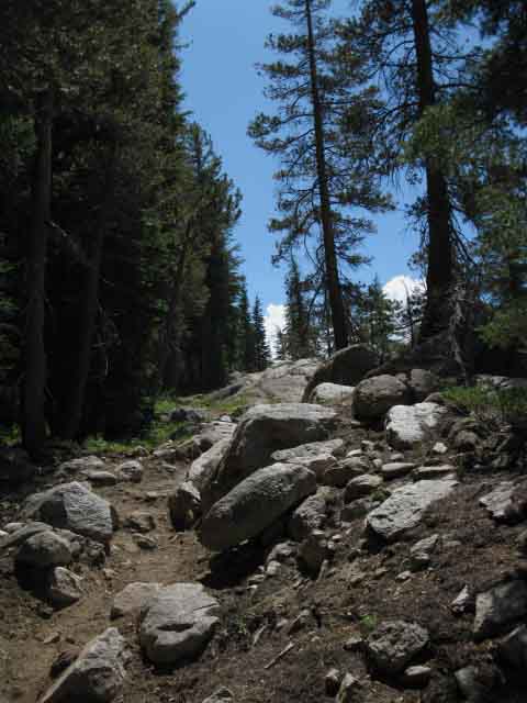
A great field of huge shattered granite boulders interspersed with growing forest creating a jumble of deep darkness and bright reflected light. We are hiking through gaps dividing different sections of the ridge. Switchbacks and then more switchbacks. There's a lot of terrain, an infinity of different terrain in this small space along this short climb between Matterhorn Creek and Miller Lake. The density of detail is profound. |
Terrain on the South Flank of Matterhorn Canyon
 |
Though there are nice flats and great views there is little water up here. There is no shortage of water overall, as there are good sources close together along the trail here, but there is no water source climbing this flank from Matterhorn Creek to Miller Lake. This means a lunch spot would have to be supplied by carried water. |
View of North Flank of Matterhorn Canyon
 |
||
Crack in the Forest Cover Glimpse Northwestward of West wall of Matterhorn Canyon through dense forest. We can see an expansive ridge arm extending out in the foreground. There's lots of nifty terrain to explore on this vast mountainside.
|
Big View North
Matterhorn Canyon reaching to the Sierra Nevada Crestline
 |
||
View up Matterhorn Canyon as we approach the high point of our climb South up the ridge. Observe the representation of this terrain on the 30 minute map:
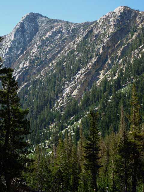
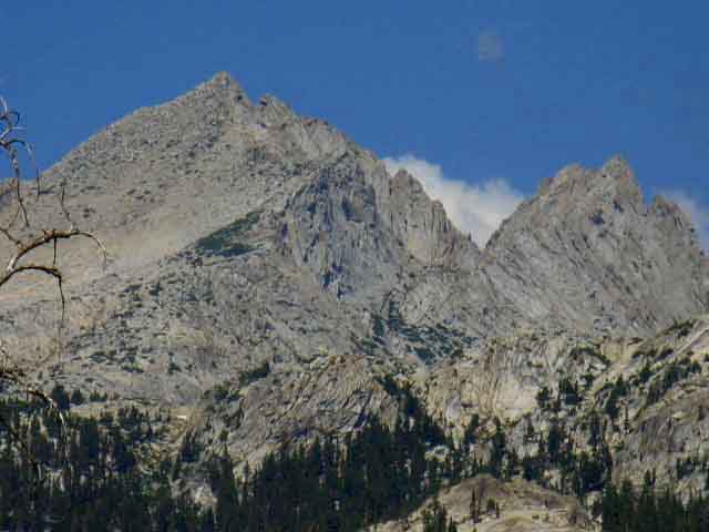
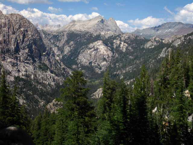
Matterhorn Canyon twists up to the Left, the crest of the ridgline reaching up through Whorl Mountain to Matterhorn Peak sits in the center of the image. The canyon feeding Spiller Creek sits below the Right flank of Matterhorn-Whorl, and the low red structure on the far Right of the image is the West flank of Twin Peaks at the top of Virginia Canyon. The big map above-Right lays out the Sierra Crest Line, and how Matterhorn Peak and Whorl Mountain fit into this complex terrain. From our position we are looking over the Western ridges descending off the Sierra Crestline as well as at the Sierra Crest Line itself. Now lets take this view apart by inspecting each part of the crestline here through the series of images below. |
Center of the Image
Matterhorn Peak and Whorl Mountain
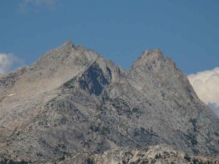 |
In the center-Left background we have the 12,000 foot Matterhorn Peak rising above the slightly lower but still 12000 foot height double pointed peaks of Whorl Mountain in the foreground Right. The sharp crest rising in the foreground middle is the sharp crest of the the massive West flank ridgeline running up to Matterhorn Peak dividing Matterhorn Canyon off its Left side (West by compass) from the vast ridgetop canyon holding the Spiller Creek watershed below its Right flank. Whorl Mountain is situated South of Matterhorn Peak a short ways down this West flank ridgeline dividing Matterhorn Canyon from the canyon holding Spiller Creek. We'll hike down into the hanging canyon holding Spiller Creek and follow it down to where it puts our trail onto the Western wall of Virginia Canyon. |
Left Side of the Image
Sawtooth Ridge
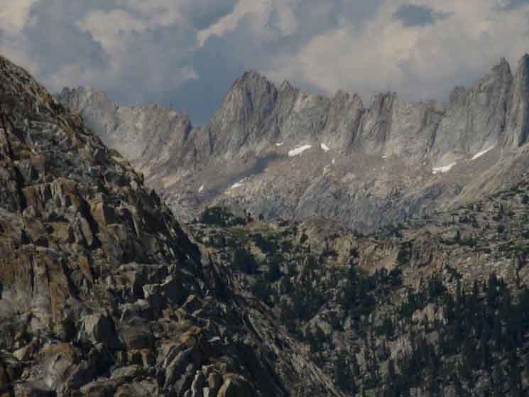 |
North of Matterhorn Peak along the Sierra Crest To the Northwest of the mass of Matterhorn Peak along the Sierra Crest above Whorl Mountain, to the Left from our perspective looking up from the West flank of the Sierra, we see the sharp rocky teeth that give the Sawtooth Ridge its name while dividing the East and West flanks of the Sierra. The Sawtooths kind of remind be of the Palisades down South in Kings Canyon. Now that we've climbed almost up to the top of the East flank of Matterhorn (South on the PCT/TYT) we can see over the massive bulk of the interceding ridgelines where Burro Pass crosses out of the head of Matterhorn Canyon into the very top of the headwaters of Piute Creek feeding Bensen Lake, to get a better view of Sawtooth Ridge beyond. The complexity of this remarkably beautiful and multi-facted terrain demands study. Lots of study. |
Right Side of the Image
Twin Peaks Massif descending over to the East Flank of the Sierra Nevada
 |
||
Twin Peaks at the top of Spiller Creek's canyon and Virginia Canyon The crestline divides the jurisdiction of Yosemite National Park down the West flank from that of the Hoover Wilderness down the short but steep East flank of the Sierra. These four images above are the main features along the Sierra Crestline around Matterhorn Peak at the head of Matterhorn Canyon. Now we turn around to follow the trail East through a gap across the top of this massive ridge to find Miller Lake nestled in along the fantastic world of granite formations carved across its massive crest. This is such a wonderland, on such a vast scale.
|
Over the Top
Reaching the high point of our trail South along the Tahoe to Yosemite and Pacific Crest Trail route out of Matterhorn Canyon brings us through a channel between fine granite formations marking our high point across the massive nose of Matterhorn Canyon. The fun has just begun! |
South through the Channel at the Top of the Ridge
 |
||
Gap South on the trail off the East flank of Matterhorn Canyon. End of the Climb up the East flank of Matterhorn Canyon. Though this is the 9640 foot high point of our hike over this massive High Sierra ridge, we still have a couple of climbs a bit South of Miller Lake before we begin our long descent down to follow the granite slab delights of Spiller Creek down its canyon into Virginia Canyon and the Return Creek Ford.
Bensen Lake to Virginia Canyon |
Fine Granite tops the South Flank of Matterhorn Canyon
 |
We pass under and between great granite features hiking over the top of Matterhorn Canyon. Beautiful form, color and texture. |
Meadow Atop Matterhorn Canyon's South Flank
 |
Passing by narrow section of meadow sprouting a swath of quick-growing lodgepoles. The top of the East ridge of Matterhorn Canyon is graced with expansive gently-graded meadows and forests. |
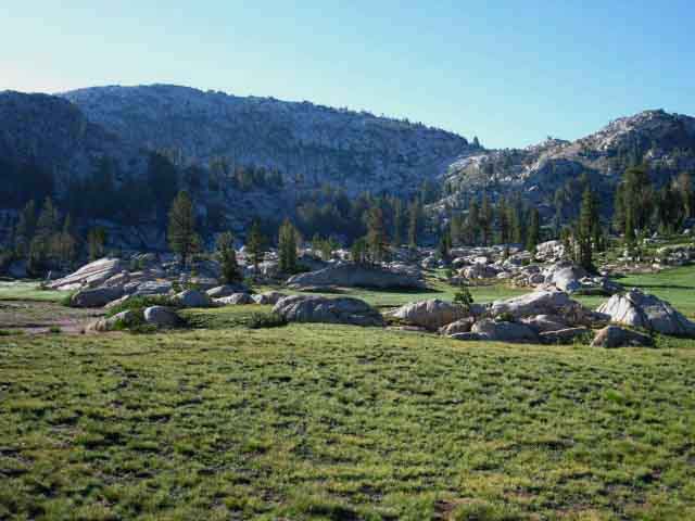
Miller Lake
 |
||
Dropping down from rocky trail through dense forests we find a great flat atop the ridge filled with an expansive meadow and stunning crystal blue Lake. A trail branches off Right at Miller Lake across the meadow to the campsites in the forest on the West Shore of Miller Lake.
|
Miller Lake
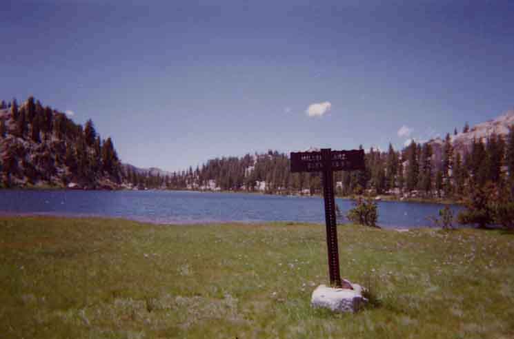 |
The Miller Lake trail sign was removed in 2002? |
Miller Lake West Shore Campsites
 |
Campsite on the West shore of Miller Lake on the Pacific Crest Trail across North Yosemite. |
First Light from Miller Lake
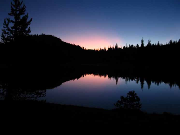 |
Miller Lake Sunrise over the North Yosemite Backcountry. |
North: Seavy Pass to Smedberg Lake via Bensen Lake South: Miller Lake to Glen Aulin
Smedberg Lake |
Bensen Pass to Miller Lake The main features of this segment of our hike across the North Yosemite Backcountry are Bensen Pass and Miller Lake. Bensen Pass and Miller Lake represent two high points between extensive and difficult climbs approaching on the long distance high altitude trails, the TYT and PCT, from either the North or the South. Approaching from the South The facts and figures 1526 feet over 11.9 miles This may not seem like much, but it is. These 11.9 miles will suck the life out of you. The opposite is true from North to South. Me, as a dedicated North to South backpacker, am thrilled. We are bombing down from Miller Lake to Glen Aulin at the speed our structure and metabolism can absorb. Our lengthy but rapid Southbound descent from Miller Lake down to Glen Aulin, despite the mile long climb from the Virginia Canyon ford to the McCabe Lake junction, is a huge descent, and Miller Lake marks its start. More or Less... It's just like any other piece of complex terrain. Though the overall character of the terrain points "down," our trail South from Miller Lake to Glen Aulin has many "ups" along the way down. And so too our trail climbing North has many sweet little descents along the way, thank god. In other words we are going to be climbing and descending more than the overall "gross" change in elevations indicates, and even more than that, depending on where you actually are in terms of fitness and preparation. This segment of trail tells no lies, and it will make your body and mind tell the truth too... For instance, as we hike South down the East flank of the East ridge making up Matterhorn Canyon below Miller Lake into the canyon holding Spiller Creek we have an extensive length of trail where we first make two climbs through two gaps as we essentially traverse Northbound up the East flank of the Matterhorn Canyon ridge towards the Sierra Crest and upriver in context of Spiller Creek before we finally drop down a big set of brutal switchbacks to the Spiller Creek Canyon fording point. The good thing is that the soils are fairly soft, and the granite footing solid. Descending from South of the second gap South of Miller Lake. Such is the nature of this very complex terrain. We will make a couple of nice climbs on our way down! This is the trail of truth, who's overall difficulty will reveal, hell, it will strip bare your physical capacity as well as your psychological context. Call it how much and how well you can suffer. Is work "pain?" Are great amounts of work and impacts "pain?" Yes and No. The segment of the trail North from Glen Aulin to Miller Lake is a brutal piece of work. I can honestly say that you will really appreciate the breaks in the climb the terrain provides. The same is exactly true for Southbound backpackers, but the breaks are from the impact stresses of descending, versus the sweating stresses of climbing. Most are getting old enough their muscles are stronger than their bones. Impacts resound through our whole skeletal structure. Different directions of stress are relatively relaxing. A nice down section during an ascent and a nice flat break from impact during a steep descent can feel equally good, if your fitness is balanced. Your management of these forces reaveals much. This must be considered in training. We must thicken our muscles to hold strength during ascents and our bones to absorb impact during descents, as well as keeping our external friction points (call it feet and butts for everyone, and add thighs for chicks) from getting blistered during these periods of heavy heavy stress during extensive sessions of climbing and descending. The one follows the other like night follows day. An evolving series of climbs thicken muscles and bring us to steeper descents that thicken bones while all of this walking up and down mountains puts layers of skin on the feet and on the butt that makes crossing over, and sitting on High Sierra granite ridges delightful. Got thick skin? If not, you better thicken it before you get here. Before you venture out on this grand adventure backpacking across the North Yosemite Backcountry make sure your well-thickened feet sit atop muscles that are thick enough tied to bones strong enough to bring you through this section of trail before you cross the trailhead. Do this section of trail between Highways 108 and 120, and you are ready to measure out the PCT, the TYT, the JMT, or the Tahoe to Whitney backpacking trips. I would suggest that you attempt none of these classic trails until the contectual capacity of your body equals the sincerity and depth of your movation. I am telling fit track and field runners and other trained atheletes that their inherent physical capacity must be complimented by the fundamental backpacking skills necessary to set up and maintain a secure personal infrastructure to maintain the workload over many days in hostile terrains. Carrying and using the proper clothes, food, water, shelter, first aid, emergency and comfort over the extended length of this section of trail is just as important has having the basic physical capacity to complete it. The one supports the other, and both are necessary to complete this segment of trail from Highways 108 to 120. 7.5 Map 30 min Map |
Backpacking Trail Guide PCT & TYT North Seavy Pass |
 |
Backpacking Trail Guide PCT & TYT South |
Backpacker ForumsHave a great Sierra Nevada trip or story to relate? A fine piece of gear? Or gear that failed?Post it on Above we come to the top of the High Backpacking Trails and Topics Forums. Below we break the forums down into categories:
Anyone can post text comments in the existing forums, but only members can post up new topics, along with images, maps, and formatting. If you have experiences, comments, questions, or pictures and videos of the Pacific Crest Trail between Sonora Pass and Tuolumne Meadows, post up here as an unknown hiker or as a member: Forum Section
|
Trailhead
Contact
Alex Wierbinski

Backpacking Lake Tahoe to Mount Whitney
Your Guide to the High Sierra Crest, including the Tahoe to Yosemite, Pacific Crest, and John Muir Trails
