

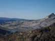
North Yosemite Backcountry
Backpacking Map
The Combined Pacific Crest and Tahoe to Yosemite Trails
Southbound
Jack Main Canyon to Stubblefield Canyon via Tilden Lake or Wilmer Lake
4 USGS 7.5 minute Topographic Hiking Maps
Maps |
Maps |
Map |
Trail Guide |
PCT |
TYT |
Trail Guide |
30 min |
|
Click RED DOTS for links to Trail Guide Page |
LOCAL |
Resupply |
Permits
|
Upper
Jack Main Canyon
to the
TYT Route around Tilden Lake
and the
PCT Route around Wilmer Lake
PCT |
TYT |
|
ROUTES of the PCT-TYT |
Lower Click Red Dots |
Map |
|
PCT |
TYT |
Click Red Dots Lower |
Map |
Location |
||||
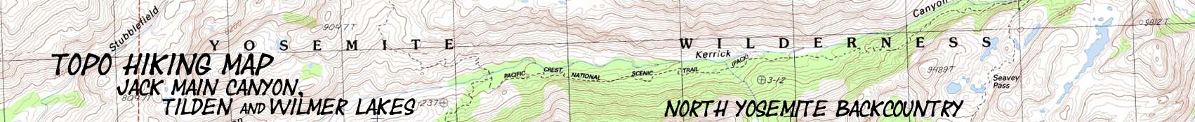
Main Features of Note Note that the Map is wrong: It is called Wilmer Lake. I was told the story by rangers and trail crew, but it eludes me at this late hour, constructing the basics of this map. After a bit of research I've come up with a story and a history:
Another note of interest.
Note that we can see the trail junction below Horse Meadow in the upper Left corner of the map. Or we can hike South into Yosemite and extend our backpacking trip down to Tuolumne Meadows. Long distance backpackers have a lot of route options across Emigrant Wilderness approaching Yosemite. |
Mapology |
||||
MAP NOTE What's important for our general reference purpose is that each side of a square is 1000 meters, or a Kilometer. From my point of view that is 1093.6 yards or .62 of a mile. Diagonal: 1414.22 meters, if my trig is correct. That converts the diagonal distance into 4,639.8 feet or .88 of a mile.
|
Mapping, Mileage, and National Park Permit Information |
|
Yosemite Permits I have not yet written the Yosemite National Parks permit page. But I will offer some advice. UPDATE (The advice below is still good...) Walk into Yosemite. Don't even mess with getting permits there if you don't have reservations by the advent of Summer. Want to hike the JMT? Start at Sonora Pass. Drop down to the Valley backwards on the JMT once you arrive at Tuolumne Meadows, then reaccquire the JMT in Lyell Canyon via Voglesang. Yosemite Permit Problems Solved.
Yes, I know that may not solve your permit problem. But it is a start. |
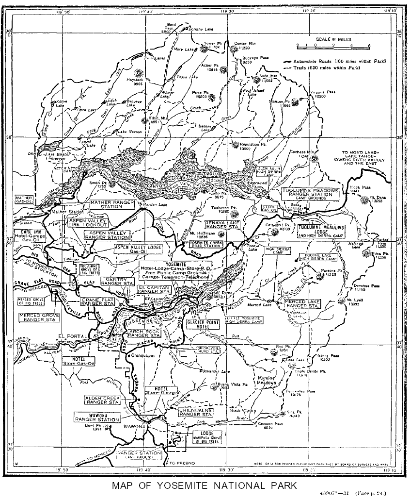
Topographic Map Information Northwest Map Northeast Map Southwest Map Southeast Map
Compass Offset Declination is 15 degrees for the East maps.
scale Contours
Backpacking permitting authority National Park Wilderness Area: Yosemite Physical location: South of Highway 108, North of Highway 120. |
topo hiking map North: topo hiking map South:
| Elevations | More Information | ||
Dorothy Lake Pass Tilden Lake Junction Wilmer Lake Junction Top of Macomb Ridge Stubblefield Ford and Camps |
Trail Guide Trail FORUM, Section Trail FORUM, Segments |
||
Map Credit: |
||
U.S. Geological Survey, Department of the Interior Big Government? Small Government? WHO CARES? I demand a government sufficient to achieve the purposes expounded by the US Constitution. The USGS serves the General Welfare of our Citizens exceptionally well, and I am proud of them. The products of the USGS are our products, and in the public domain. This includes the USGS topographic map series that are the backpacker's bible of terrain. Locate and download USGS maps here: Move the Map to the Sierras. Select size of Maps you wish to locate. Click "Mark Point" on map to see the USGS map grid of the selected map scale.
|