High Sierra
Backpacking
Trail Guide
Forums
Sierra
Weather
WeatherNotes Northern
Sierra Weather
Gear
Backpacking
the
Tahoe to Yosemite Trail
Hiking the West Flank of the Northern High Sierra Nevada Mountain Range
Languages
Trail Skills
Mountain
Safety
Food
Planning
Trail Arts
More
Information
Social
| Traill Guide Section Index | Find Meeks Bay Trailhead |
Meeks Bay Resources | Meeks Bay Trailhead MAP |
Mileages and Elevations |
Tahoe Basin Permits |
All Sierra Permits |
Trail Guide INDEX | all pages | MAPS Index |
The Tahoe to Yosemite Trail
INDEX
Trail Guide Introductions
|
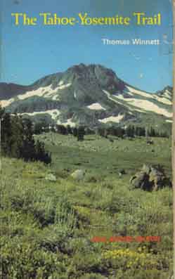 |
Thomas Winnett First published in 1970, The Tahoe to Yosemite Trail is one of the earlier publications in a long series of classic High Sierra trail guides pioneered by Thomas Winnett and his hiking and writing associates. From the late 1960s through the late '80s Winnett and his crew were not only the masters of High Sierra trail guide writing, but the creators of the modern art of trail guide writing. These masterworks were published through the 1990s by Winnett's own Wilderness Press. Winnett's book is the rock that the Tahoe to Yosemite Trail is built upon. High Sierra Library Changing Times What is not gone are the standards of trail guide scholarship established by Winnett. Sadly, these high standards have not transitioned into the digital era. I did not know it then, while I was referencing Winnett to find interesting ways into the High Sierra, that I was actually absorbing an approach to writing trail guides as well as an approach to the trails. New Era Trail Guide Marshalling digital power behind a classic literary approach to trail guide writing opens up the trail and terrain for planning and pleasure like never before. The modern digital trail guide is not only a window to the most remote sections of trail, but is also an interactive forum where hikers can update and correct as well as be informed about the range of backpacking conditions possibly encountered on the Tahoe to Yosemite Trail. The forum is where you can update or confirm trail conditions, report on changes, add your perspective to the mix, or ask questions about the route. All perspectives are additions to our understanding. That's the difference between this web trail guide and forum, and the old book guides. This digital trail guide gives info, the digital forum absorbes info, while the old guides were static. Today you can observe, contribute, or question. The modern Tahoe to Yosemite Trail Guide also answers questions. Yesterday this required a stamp, a letter, some licking, and good luck. Today all it takes are are some clicking and an email. And luck... haha. One Perspective The Trails Forums allows you to update the guide. This is important as the TYT contains two sections of unmaintained trail where conditions can change radically over the years and over the course of a season.
UNMAINTAINED TRAIL SECTION UPDATES
Though describing a great route through the Sierras, the real gift of Winnett's fine book is that it, and his long list of High Sierra guides are still stimulating backpackers to explore every trail in the Sierra as well as the TYT's nifty alternative to the Pacific Crest Trail route through the North Sierra Nevada. Be careful: The Tahoe to Yosemite Trail is a gateway drug to even greater High Sierra engagement and experiences. |
Publication Information UC Berkeley Library Description: The Tahoe-Yosemite Trail: a comprehensive guide to the 180 miles of trail between Meeks Bay at Lake... (Wilderness Press, Berkeley Ca, 1970.) Other Works by Thomas Winnett RIP, Backpacker Dude
Corporate Buyout Look and you will see it. What's left...
Tahoe to Yosemite Trail
Distances
GUIDE
|
The Tahoe to Yosemite Trail
TYT The Meeks Bay trail head is the start point for the classic 181 mile Tahoe to Yosemite Trail backpacking route described in Thomas Winnett's classic 1970 book, The Tahoe-Yosemite Trail. Tuolumne Meadows is the end point. Between these two points the Tahoe to Yosemite Trail offers a very interesting and much more challenging alternative route to the more popular and much more heavily traveled Pacific Crest Trail between Lake Tahoe and Tuolumne Meadows. How and Why, you ask? Well, the Tahoe to Yosemite Trail route offers an excellent Western alternative to the PCT across the Mokelumne Wilderness, the Carson Iceberg Wilderness, and the Emigrant Wilderness.
The route of the Tahoe to Yosemite Trail through these wilderness areas is completely different than that of the Pacific Crest Trail. ALL TRAIL INFORMATION These are the trail guide indexes for each section of the Tahoe to Yosemite and Pacific Crest Trail routes from the Meeks Bay Trailhead on the West Shore of Lake Tahoe to Tuolumne Meadows in Yosemite:
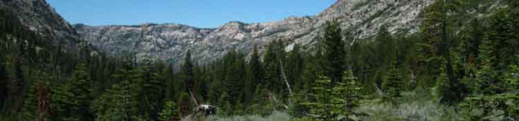
Great Differences The main difference between these two trails across the five wilderness and one roadless area named above are characterized by the Tahoe to Yosemite Trail's great swings down in elevation along the Western flank of the Sierra Nevada. Down elevation across the Mokelumne Wilderness, up through the South end of the Carson Iceberg Wilderness, and up again across the Emigrant Wilderness. TYT Makes Grand Western Swings The different geology of the terrains we experience hiking the Eastern and Western flanks of the Sierra are accentated by substantial environmental differences between the flanks of the Sierra. These geological and environmental differences are linked through the past, into the present, and determine the future. This long techtonic tilt, the force of gravity, and tens of thousands of years account for the long granite valleys we find carved down the Western flank of the Sierra Nevada.
The long deep canyons carved down the gradual descent of the Western flank are a result of ancient geological processes still operating today. The moisture that carved these great canyons either sits on land as ice, in the seas as water, or is somewhere in-between. Each time it passes through the stations of its cycle it wears the Sierra down a bit more. The Machine of Change Dry from the Sierra Crest and Eastward... The geological differential between the East and West flanks drives the climate differences we experience today. Layers of Lava served up on a Granite Foundation We will observe where the flows of hot volcanic debris froze in place while engulfing terrain. We will see hard granites being "born again," where they are re-emerging from their soft volcanic tombs as the timeless forces of erosion are slowly but surely unburying them. This wide range of geological, geographic, and environmental conditions differentiating the PCT and TYT are pretty profound, and very cool. You can decide which set of experiences fit your skills and tastes, and hike that route. Then you should hike the other route. These radical differences between the trails make both the TYT and PCT required hiking to get to know the amazing range of terrain, trail conditions and environments that compose the Sierra Nevada Mountains between Lake Tahoe and Tuolumne Meadows. One route is not inherently better than the other. That is a judgment dependent upon personal preferences. Both are part of a bigger picture. Each is a different expression of its particular role in the long geological and biological history of the Sierra Nevada. My favorite route hiking between Tahoe and Yosemite involves segments of both trails. Read up on the Natural History of the Sierra Nevada Great Similarities The Tahoe to Yosemite Trail's route also shares a significant distance of the trail South to Tuolumne Meadows with the Pacific Crest Trail route. These two routes share a significant amount of trail and have significant differences. Their very different routes across the Carson Iceberg and Emigrant Wilderness are deeply interlinked. In fact I would say that the TYT and PCT are part of the webs of trails covering both these wilderness areas. Alternative Routes and Local Backpacking Loops The Tahoe to Yosemite and Pacific Crest Trail routes can be tied together by the web of connector trails linking them up across both the Carson Iceberg and Emigrant Wilderness Areas to craft grand hiking loops exploring the majority of each of these wilderness areas' terrain. These great loop routes measure out to about 90 miles to circle either of these wilderness areas. Series of smaller loops from 20 to 50 miles tying together lengths of the TYT and PCT can be designed in either wilderness area. A view of how these trails cross and tie together these wilderness areas opens up many amazing hiking opportunities. Carson Iceberg and Emigrant Wilderness Area Loops The North Yosemite Backcountry The Bensen Lake Loop, the Grand Canyon of the Tuolumne running down to Hetch Hetchy draining the series of great granite canyons crossed higher up by our TYT/PCT route offer a huge number of local long-distance loops around the North Yosemite Backcountry. Section Hike the TYT We can section-hike the TYT by hiking loops around each section! If our hikes across the Tahoe to Yosemite and/or the Pacific Crest trails brings understanding of the broader nature of the terrain we are hiking through we will see a lifetime of amazing hiking opportunities laid out at our feet. Check out the differences and shared portions of the routes of the TYT and PCT on the maps below covering each or both of these routes. |
| Tahoe to Yosemite Trail Hiking MAPS |
||||
Shared
North Yosemite Backcountry (draft) |
Different Emigrant Wilderness |
|||
Distances
|
||||
High Sierra Nevada Trail Reports
|
Click the Black Dotted Trail Route on 30 minute maps for Detailed Maps
Click the Red Dots on all maps for Trail Guide Information
The Tahoe to Yosemite Trail
Goals
The goal of these efforts The goal of this section of the Tahoe to Whitney Trail Guide is to bring you the whole Tahoe to Yosemite Trail in images, videos, maps, miles, elevations and words. This guide allows us to click from the marked black dotted routes on the large scale 30 minute maps to the detailed underlying 7.5 minute maps of any segment of trail, to click the red dots on any of these maps to view that specific location's images, videos, and trail guide information.
The goal is to allow us to quickly click ourselves North and South up and down the trails with ease. Much Information a Mouse Click Away Once you figure out my system, and once I get it perfected and smoothed out, you will be able to get a look at any part of the trail at various degrees of resolution, from the grand overview of a wilderness area on a regional map down to on the spot pictures, film, and trail guide information for specific locations up and down the Tahoe to Yosemite Trail. And the Pacific Crest Trail. And the John Muir Trail. Soon we will cover all the main routes between Lake Tahoe to Mount Whitney. The Tahoe to Yosemite Trail is the tip of an iceberg. A huge iceberg. The results are designed to give you the most comprehensive view possible of the Tahoe to Yosemite Trail and the requirements necessary to hike it, then continue South from Tuolumne Meadows to finish hiking the length of the Sierra Crest along the routes of your choice down to Mount Whitney. The power of the internet and contemporary digital technology has finally allowed us to present an enhanced version of classic paper trail guides with the modern addition of a massive number of quality maps, images, and videos that was impossible for previous generations of paper trail guide writers. Trail Guide chocolate has run into mapping, miles, and video peanut butter, making our generation the lucky recipients of the fruits of the expansion of technology into the art of trail guide writing. Right when the ancient beauty of our planet has all but dissappeared... how ironic. Finally a good use of this damn technology. Add to these presentation advances the capacity of all Sierra Hikers to add their experiences to the guide via the Forums, and we have the potential to store and share a vast amount of trail information. That's adding up to a pretty deep view of the trails and terrain. |
The Tahoe to Yosemite Trail
Guide Progress
|
Current progress As of November 2014 I have all types of information completed from Meeks Bay along the West Shore of Lake Tahoe South down to Tuolumne Meadows, covering the 181 total miles of the Tahoe to Yosemite Trail. So too is the Pacific Crest Trail complete to Tuolumne Meadows. With all the side trips and connector trails this guide now covers about 400 miles of Sierra trails. The large and small map series are complete down to Tuolumne Meadows. In addition, you can likely see that this guide also covers the Pacific Crest Trail and the potential connector trails that tie these two routes together across the Carson Iceberg and Emigrant Wilderness Areas. One of my goals is to give you a clear understanding of just what you're getting yourself into before you jump from the frying pan of High Sierra backpacking into the fire of High Sierra cross country travel across the unmaintained sections of the Tahoe to Yosemite Trail. That's why we give ourselves the chance to plot our route around these untrailed segments of trail. Or through them. It's up to you. And then you have me. If you have questions, if the guide does not quite tell you all of what you need to know, or you just want someone to bounce your ideas and plans off of, you can always hit me up and I will give you my best answer. This is the only trail guide that has legs. I mean really has legs. Mine. I've walked all the routes depicted in the guide more times than I can count. I've walked them slow, I've walked them fast, I've walked them in rain, heat, and some of them in snow. I've walked them early in Spring and late in Fall, I've walked them all. And now it could and should be walked by your legs too. I can't cover everything. I don't see eveything, despite my best efforts. (seriously!) Therefore we have the resources of the membership. It looks like we Backpackers of The Tahoe to Whitney have thousands of years of High Sierra and general backpacking experience among us. The trails I have not walked have likely been hiked by one of the members, or you. We've hundreds of legs that are walking now and have walked centuries of miles on and off the trails. When I confront an issue I cannot unwind myself I call upon the collective experience of the members. So give me a call if you believe as I do, that between all of us we can know it all. Call it the Endless Quest. Join Me as you Solo Hike the TYT... Contact |
The Tahoe to Yosemite Trail
Never Done
|
This guide is under construction and in Draft form. Construction of this massive project happens in layers. This page will be finished in conjunction with finishing the Tahoe to Yosemite Trail section of the Guide, which should be happening (in late 2013) someday... |
The Tahoe to Yosemite Trail
Hard Fun
Down or Around The Lake Tahoe to Yosemite Trail may be more challenging today than when the book of the same name was written in 1970. The reason is that the Tahoe-Yosemite trail looks like it has not been maintained between its junction along Summit City Creek below Fourth of July Lake South down to Camp Irene on the Mokleumne River, since 1970. The other "umaintained" section of trail on the North side of Saint Marys Pas is not really an unmaintained trail because there has not been an official trail through there as long as I've hiked it and consulted maps. Few hikers venture the whole Tahoe to Yosemite Trail every year, and these two unmaintained sections of the trail are actually remote and degraded. Though some backpackers may find this troubling, others find these obstacles and conditions challenging, and find the isolation of finding and following routes, rather than hiking "trails" along the unmaintained sections are the most rewarding backpacking of all, next to actually route-finding on cross country and snow trips. I take it like I find it. With trail or without, with people or without. Rain, snow, sleet, and Sun, it's all fun. If you find the possibility of challenging trails degrading into difficult routes (there is a route if not a trail) within your capabilities and within your definition of fun, the Tahoe to Yosemite Trail is the trail for you. The section along Summit City Creek and the North Fork of the Mokelumne involves 9.52 miles of route-finding across the Western Mokelumne Wilderness. These are both very special segments of trail that maintain primitive conditions. Want to get a taste of what the original inhabitants and the first Western explorers experienced? Here we find two small slices of primitive conditions. For less aggressive, less fit, or less skilled backpackers, these two unmaintained sections are not an obstacle for us to complete the Tahoe to Yosemite Trail, with the addition of a few route modifications. Instead of hiking the untrailed sections, we will find a differents routes around them, while following most of the Tahoe to Yosemite Trail route. We are nothing if not flexible. Up North we will just go around Summit City Creek by taking the PCT route through the Eastern Mokelumne Wilderness hiking to Ebbetts Pass, rather than the Tahoe to Yosemite Trail across the Western Mokelumne to Lake Alpine. Problem solved. From Ebbetts Pass we will hitch-hike down to the Lake Alpine Lodge to pick up our free resupply, then resume our hike South on the Tahoe to Yosemite Trail from its Southbound trailhead on the East side of Lake Alpine through the Silver Trailhead. Though the Tahoe to Yosemite and Pacific Crest Trail's routes differ significantly, by fifteen miles, where they enter the Carson Iceberg Wilderness on its North end, their routes draw together over the length of the wilderness. Their respective trailheads where they exit the Southern end of the Carson Iceberg Wilderness, on Highway 108, are less than a mile apart. Dropping down into Sonora Pass along the Pacific Crest Trail does not preclude continuing South along the Tahoe to Yosemite Trail. All Tahoe to Yosemite Trail hikers are required to hitch-hike West down Highway 108 from their Saint Marys Pass trailhead to resume their Southbound route into the Emigrant Wilderness through Kennedy Meadows Pack Station. This Guide is Under Construction...more coming... This trail trail guide now covers the complete Tahoe to Yosemite Trail, the Pacific Crest Trail between Lake Tahoe and Tuolumne Meadows, and will soon cover the PCT and John Muir Trail and their variations South of Tuolumne Meadows down to Mount Whitney. Stay Tuned! On this date, November 21, 2014, this Tahoe to Whitney trail guide is complete (in draft form) from Lake Tahoe to Tuolumne Meadows in the North Yosemite Backcountry, covering both the Tahoe to Yosemite and Pacific Crest Trail routes. Happy Trails ! |
Tahoe to Yosemite TrailStatus Report & Notes on what you should expect...2013High Sierra Nevada Trail ReportsUNMAINTAINED TRAIL SECTION UPDATES July 2012Did a quick run through of the unmaintained section of trail between Eureka Valley trail junction and Saint Marys Pass trailhead located in the Southernmost section of the Carson Iceberg Wilderness. This update is incorporated into that section of the trail guide. Quick recap: There is no trail from the Northwest edge of the Clarks Fork Meadow to Saint Marys Pass. From the pass a decent trail runs you over to the trail from the Saint Marys Pass Trailhead to Stanislaus Peak, or you can cross country it over to that trail rather than taking the long way around... July 2009As of my passage through the Tahoe to Yosemite trail section between Round Top Lake and Lake Alpine in July of 2009, there is only one section of the Lake Tahoe to Yosemite through here that is problamatic. This section begins when you drop down from 4th of July Lake into the great granite valley that bounds Summit City Creek. When you reach the bottom of the valley below 4th of July Lake you encounter a trail junction and turn right. From this point to Camp Irene the Tahoe to Yosemite Trail is not maintained. Important Note: Although much of the old trail bed is discernable, or findable for experienced backpackers of intermediate to expert skill levels between 4th of July Lake and Camp Irene, the section following the 2nd ford of Summit City Creek has a section that is very difficult in terms of both navigation and physical obstacles. The important long term difference is that the unmaintained trail section has expanded up to the Summit City Junction from where it previously began at Telephone Gulch. The good news is that the cross-country route is expanding. The bad news is that unmaintained trails are expanding everywhere. Have you recent info on The Tahoe Yosemite Trail? Have you ever backpacked this route? Insights, experiences, or comments to share? Post your experiences, question, or comments on As the trail guide covers the TYT minutely with maps, miles, elevations, trail guide text, images, and videos I'm just going to hit the high and hard parts of the TYT route that are important for backpackers below. For specific details read the trail guide. |
Summit City Creek
|
|
The Tahoe to Yosemite Trail Some basic facts The interesting and difficult unmaintained sections of The Tahoe to Yosemite trail should not disqualify Meeks Bay as the start point for your backpacking trip to Mount Whitney. You can easily bypass the difficult section further down the trail by hiking through Carson Pass down to Ebbetts Pass along the PCT route, hitch down to Lake Alpine on Highway 4, and resume your Southbound hike on the Tahoe to Yosemite Trail. You can hike your own custom route sections tying together sections of both the PCT and TYT South to Toulumne Meadows. You can hike the TYT route independent of if you swing through the unmaintained sections of the Tahoe-Yosemite Trail, or go around them via Pacific Crest Trail detours. We have one way to get around Summit City Creek's unmaintained section and many options to detour around the unmaintained/route section over Saint Marys Pass. My point is to encourage you to craft your own unique route across the Northern Sierras to Yosemite that suits you, your fitness, your gear, and your experience. Read on, then drop me an email, and I'll consult. Feel free to drop me an email on me, or address any issues that concern you on TahoetoWhitney.Org, the backpacker's forum that backs up the trail guide. The guide, forum, and I are all here to share information, experience, and the pleasure of hiking the High Sierras by providing this place to share information and experience about this little bit of heaven and hell, AKA as the trails between Tahoe and Whitney. We can really live here, but it can also kill us. Meeks Bay There are two distinct advantages to starting your backpacking trip at Meeks Bay that are striking. First, it offers a gently rising entry into High Sierra backpacking through a short, gentle rise in elevation to the first set of lakes, and the subsequent passes are a moderate introduction and transition to the continuous difficult high altitude backpacking we will be experiencing on our way South to Yosemite. This gentle entry reduces the shock put on our body from a heavy backpack, from unaccoustomed altitude, and from hiking uphill for the first few days of our trip. Plus, you have been jogging and working out to get ready for this trip, right?. The Second Advantage to Meeks Bay is that it starts your trip in the Desolation Wilderness, a most beauitiful place as you will see on the next few pages, despite its heavy over use. The Different Characters of the Tahoe to Yosemite and Pacific Crest Trails When the TYT and PCT exit the Tahoe Basin together, about 44 miles South of Meeks Bay, they only then reveal the basis of their very different characters. The PCT swings onto the volcanic Eastern Flank of the Sierra and follows the Eastern flank along the Sierra Crest most of the way down to Yosemite. The TYT, on the other hand, swings West after exiting the Tahoe Basin and stays rather low on the Western Flank of the Sierra pretty much all the way down to Yosemite. The TYT only actually reaches the Sierra Crest at two points between Tahoe and Yosemite when it is not co-habitating the route with the PCT. First at Saint Marys Pass and subsequently in the High Emigrant Basin after passing through Brown Bear Pass. The Rough Section & Hiking your own route between Tahoe and Yosemite I far prefer the rough sections of unmaintained trail along the TYT route from Carson Pass to Lake Alpine than the PCT route between Carson Pass to Ebbetts Pass. South of Lake Alpine I like to hike an alternative route off of the TYT to the PCT and then down to Sonora Pass. In recent years I have again begun to route through Saint Marys Pass. My "problem" is that I really really like the East Carson River, which is the along PCT "alternative" route to Sonora Pass over on the East Flank of the Sierra from the TYT's route over Saint Marys Pass via the Clarks Fork of the Stanislaus. This vast map of the Highway 108 corridor depicts the relationship between the PCT and TYT across the South Carson Iceberg Wilderness:
The PCT and TYT take very different routes from Highway 108 to their reunification in Jack Main Canyon. Both routes travel through exceptional terrain roughly equal in beauty. From Highway 108 across the Emigrant Wilderness to the Yosemite National Park boundary we have three potential routes. The two standard routes are the classic PCT South from Sonora Pass and the TYT South out of Kennedy Meadows. The third route follows the PCT South from Sonora Pass and splits off the PCT at the top of Kennedy Canyon to hike over Big Sam to intercept the TYT near Grizley Peak Lake. Our third option draws on both trails to cross the Emigrant Wilderness to Yosemite. The Real Deal Both the Tahoe to Yosemite and the Pacific Crest Trail routes between Lake Tahoe to Tuolumne Meadows in Yosemite are each worth hiking on their own merits. Ok, let's get started... Guide: Finding Meeks Bay Trailhead 7.5 Big Map: Meeks Bay to Dicks Lake Map: Lake Genevieve to Phipps Pass |
|
This guide is under construction and in Draft form. Construction of this massive project happens in layers. This page is being edited up in conjunction with finishing the Tahoe to Yosemite Trail section of the Guide, which should finally be happening in late 2013 or early 2014. |
Last page: finding meeks bay trail head Next page: meeks bay trailhead resources
Backpacker ForumsThe Tahoe to Yosemite TrailAdd your experiences, comments, and/or questions about the Tahoe to Yosemite Trail through the Forums below: |
Trailhead
Contact
Alex Wierbinski

Backpacking Lake Tahoe to Mount Whitney
Your guide to the High Sierra Crest, including the Tahoe to Yosemite, Pacific Crest, and John Muir Trails