High Sierra
Backpacking
Trail Guide
Forums
Sierra
Weather
WeatherNotes Northern
Sierra Weather
Gear
Backpacking
Susie Lake to Heather Lake
Hiking
Pacific Crest Trail and Tahoe to Yosemite Trail through Desolation Wilderness
Languages
Trail Skills
Mountain
Safety
Food
Planning
Trail Arts
More
Information
Social
Video
Susie Lake backpacking
past the
North Shore of Heather Lake
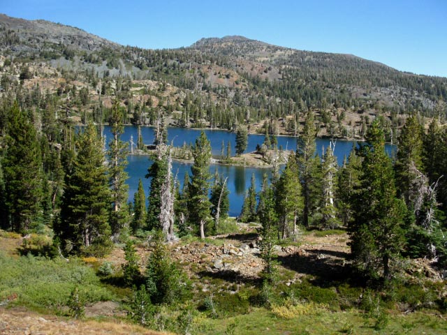
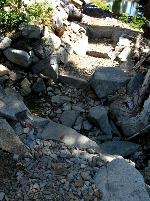
Susie LakeA third of a mile South of our last Glen Alpine trail junction the trail comes to the East shore of Susie Lake. A nice shady pool has formed on the backside of Susie Lake's check dam.
Meeks Bay to Echo Summit
After the 1590 foot drop in elevation over the 2.93 mile descent from Dicks Pass, I looked to this pool for more than its quiet beauty. |
Refreshing Soak in the Pool below the Check Dam at Susie Lake
| Backpacking Susie and Heather Lakes in the Desolation Wilderness |
North: 3 Trail Junctions South: Aloha Lake
| Susie and Heather Lakes Desolation Wilderness |
Desolation WildernessMeeks Bay
|
Backpacking around the South Side of Susie Lake to Heather Lake
Suzie LakeThe trail winds around to the West along the Southern shore of Susie Lake, then follows an easy channel up to Heather Lake between massive mountain shoulders descending off of Jacks Peak and Cracked Crag. Check out the topo map for details |
 |
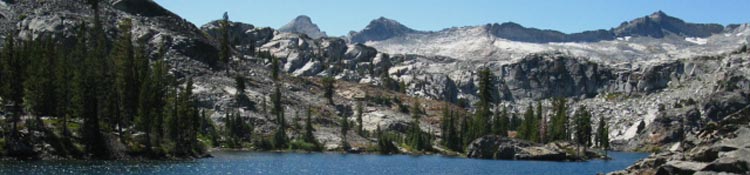
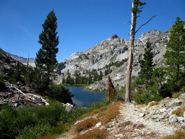
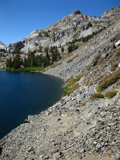
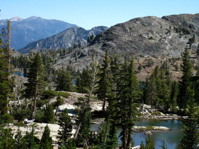
Southwest Side of Susie Lake, looking North, Desolation Wilderness. Dicks Peak is the high point of the red mountain with a low shoulder in the distant middle-Left, just off the center of the above image. Dicks Pass is near the low point to the Right of the low dark ridgetop in the distant center-Right of the image. We observed the other side of that low dark ridge as we hiked South past Fontanillis and Dicks Lake. The red peak closest to us on the near extreme Left of the image is a subordinate peak to the Southeast of Jacks Peak on the same ridgeline holding Jacks and Dicks Peaks. Phipps Pass to Heather Lake |
View North-Northeast Across Susie Lake
Mount Tallac
 |
Southwest Side of Susie Lake, climbing South towards Heather Lake, looking back to the N-NE across Susie Lake at Mount Tallac. Lake Tahoe is on the other side of the mountain. |
Heather Lake Bending around the Southern shore of Susie Lake we hike a short ways Northwest up around Susie Lake's Western Shore until the trail bends hard Left, to the West through an incredibly cool cut in the terrain between the massive mountains shoulders descending off of Jacks Peak to our North and Cracked Crag to our South up to Heather Lake. Check out the topo map for details |
 |
| First Peek climbing through the gap to Heather Lake, Desolation Wilderness. |
Heather Lake
Desolation Wilderness
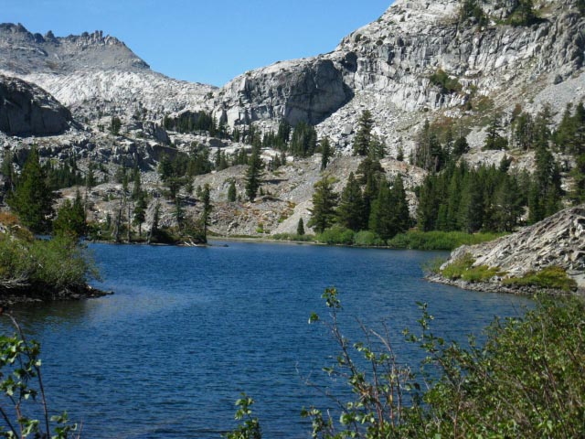 |
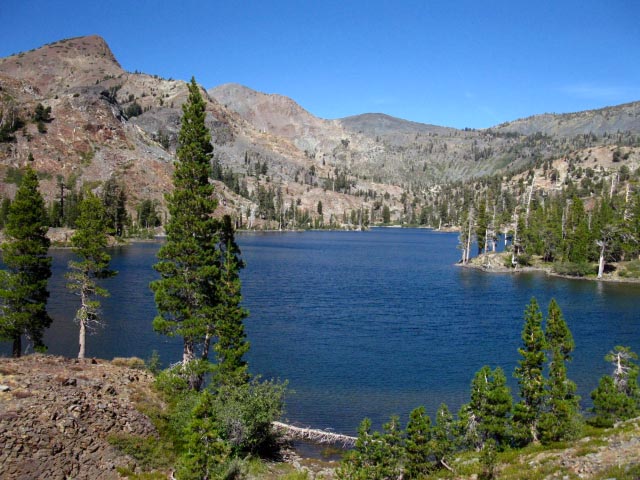
| Heather Lake, Desolation Wilderness. |
Heather Lake and Crystal Range
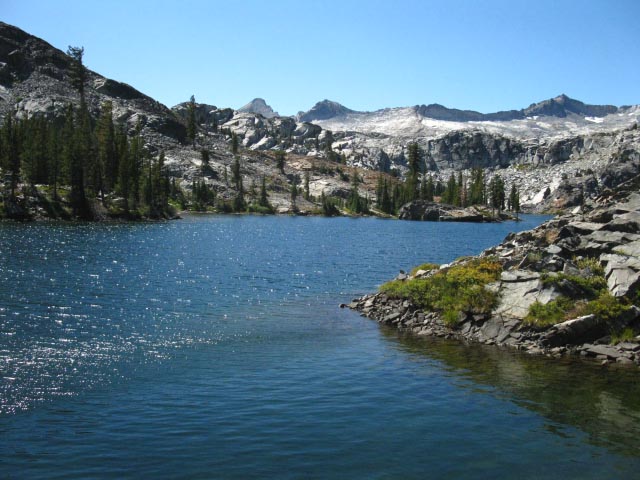 |
| The Western expanse of Heather Lake. |
North: 3 Trail Junctions South: Aloha Lake
Passing around the North Shore of Heather Lake
 |
| Hiking the thin trail along the North Shore of Heather Lake. |
Climbing West away from Heather Lake
 |
| Passing out of Heather Lake's little basin between the mountains. |
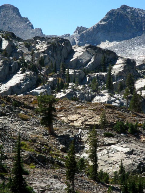 |
Rounding the formation in the foreground brings to the final little climb before reaching Lake Aloha. The precipitous Pyramid Peak of the Crystal Range decorates the background. This section of trail is breathtakingly beautiful. |
Above, and South of Heather Lake
 |
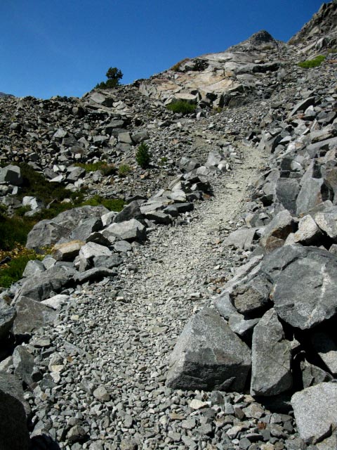
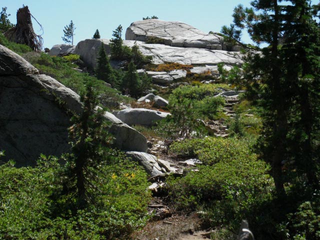
| Great Trail work winding through the ponds West of Heather Lake. |
 |
| Heather Lake in background, pond in foreground, Looking NE from our brief climb South of Heather Lake towards Lake Aloha, Desolation Wilderness. |
Our last steps up to the North shore of Lake Aloha
 |
|
| The last steps of our small climb up to Lake Aloha from Heather Lake. The great granite vault of the Desolation Valley will open up before us at the top of this rise. |
North: 3 Trail Junctions South: North Lake Aloha
Backpacking Desolation Wilderness past Susie lake and Heather Lake |
|||
After giving my aching feet and knees a nice soak in the cold water pool below Susie Lake's check dam, I quickly passed by and around Susie and Heather Lakes. Though this looked like an awesome place to set up camp, my high-mileage plan required that I push to exit the Desolation Wilderness this day and camp near Echo Summit. That would require that I add another 11.35 miles to the 5.23 miles I had already hiked. As this was my first time carrying a camera through here to shoot the trail guide, I figured this would be a tough objective. So I saddled up and hit the trail.
Topo Hiking Map
Topo Hiking Map
Next page |
Backpacking North Trail Guide
|
 |
Backpacking South Trail Guide
|
Backpacker Forum
|
North: 3 Trail Junctions South: Aloha Lake
Trailhead
Contact
Alex Wierbinski

Backpacking Lake Tahoe to Mount Whitney
Your guide to the High Sierra Crest, including the Tahoe to Yosemite, Pacific Crest, and John Muir Trails
