The Trails
Guide
Maps
Miles/Ele
Permits
Resupply
Forum
Current Weather Conditions
Weather Notes
Northern High Sierras
Central High Sierras
Southern High Sierras
Gear
Gear List
Gettin Started
Layering
Discussion
Testing yourself and your gear
Gear Reviews
Backpacking Carson Gap
during
Winter, Spring, and Fall
Carson Gap is the Southern Exit from the Lake Tahoe Basin
Languages
Languages
Trail Arts
The art of walking
Physical Preperation
Trail Skills
The trail
Off the trail
Scrambling
Maps
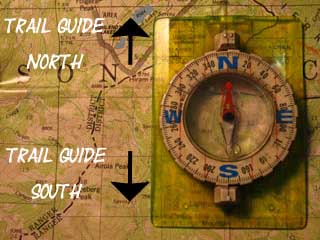
Navigation
Camp skills
Food
Resupply
Food
Other
Photo Catagories
Trail Stories
Trail Culture
News and Science
Links
Groups
Books
Terms and Conditions of Use
Southbound
up to the
Carson Gap departing the Lake Tahoe Basin
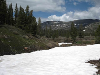
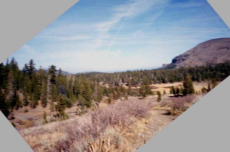
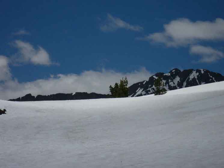
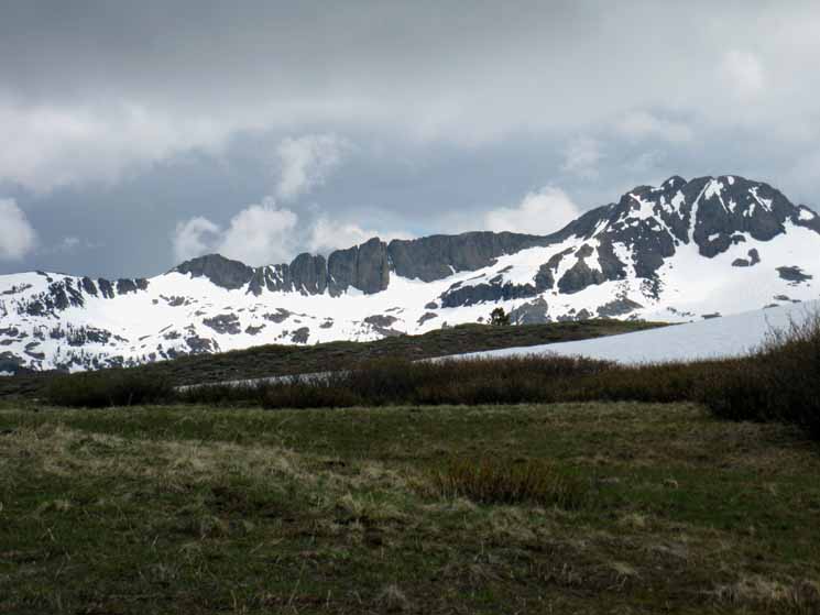
South Out of the Lake Tahoe Basin Looking South at the Carson Gap in early Spring from the South end of Meiss Meadow. |
|||
 |
|||
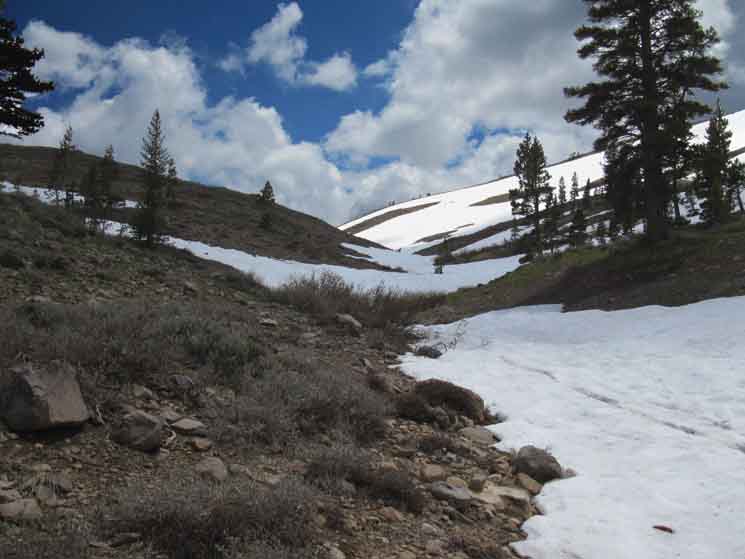
The actual location of the PCT-TYT route is wrapping around the base of the tree line along the bottom right of the image. There is also a Summer campsite located under the edge of that same forest where the trail route passes along the bottom right of the gully on its way up to the Carson Gap.
Our perspective above is from the far Northeastern corner of Meiss Meadow, by the compass, taken after emerging from route-finding the "Eastern" route up from Round Lake to Meiss Meadow.
|
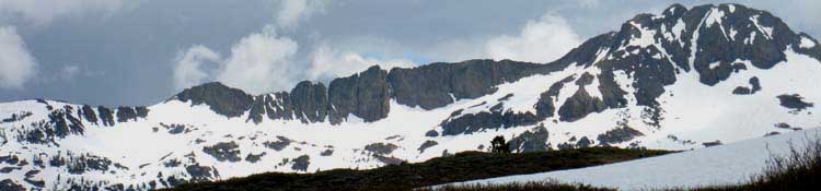
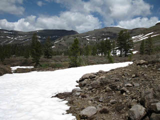
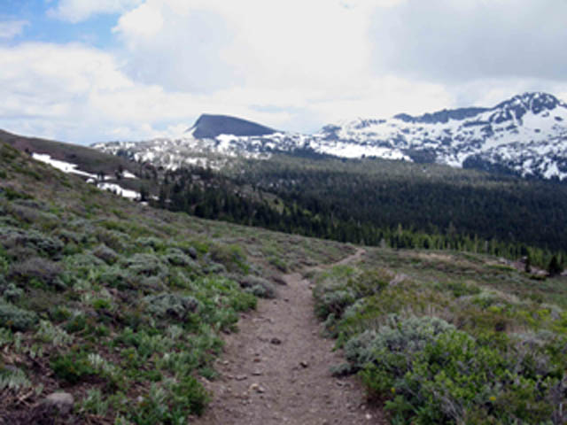
The image above shows our upcoming last steps South out of the Lake Tahoe Basin. The crest of that low gap marks the extent of the Tahoe Basin. In fact, these mountains wrapping around the end of Meiss Meadow represent the Southernmost extent of the Lake Tahoe Basin. From here our backpacking trip either ends at Highway 88, which runs along the Southern base of this ridge, it's far side, or we cross Highway 88 for the hike South into the Mokelumne Wilderness. Below we find trails information for our current position in Meiss Meadow, for the Carson Pass Management Area and Mokelumne Wilderness Area to our South, and the Desolation Wilderness Area located North of Meiss Country Roadless Area. |
Local
|
||||||||||||||||
UP
up to the
Carson Gap
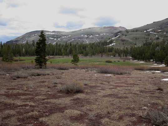
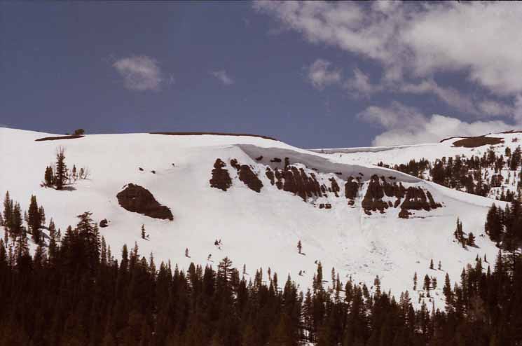
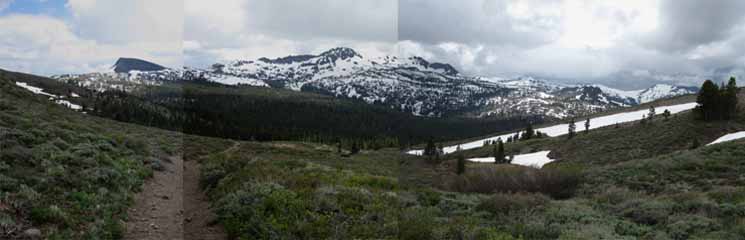
| Below the Carson Gap in Spring. | Looking North across South Meiss Meadow from just above the Meadow while beginning the short climb South up to the Carson Gap. | |||||
 |
||||||
Topo Hiking Map |
||||||
Ready to Go on Rock and Snow. |
Maps, Miles and Elevations
Information
Exiting
|
Custom
USGS Topo Hiking Maps
LINKED MAPS The trail routes on the 30 minute maps that are marked with black dots link to detailed maps of that trail. The labels pointing to maps North and South of each map link to those maps. Check the link bar along the tops of the maps pages for additional information about backpacking miles and elevations, permits, and resupply. SOUTHMokelumne Wilderness Hiking Map
CURRENT POSITION
NORTH
Download your own free sets |
View North
looking into the top of Meiss Meadow
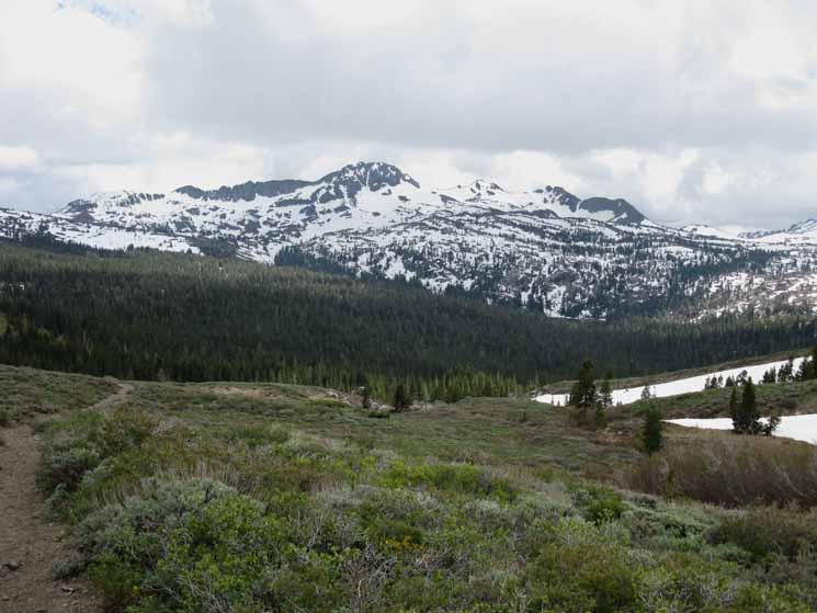
Looking North across Meiss Meadow at the mountains ringing the Southern extent of Tahoe Basin around the perimeter of Meiss Meadow. On the far left we have the mountain face above Round Lake, barely visible through the trees on Left. Stevens Peak rises to its rounded head on the far Right side of that same ridge, while the flank on the far Right of the image climbs towards the out of frame Red Lake Peak. |
|||||||
 |
 |
||||||
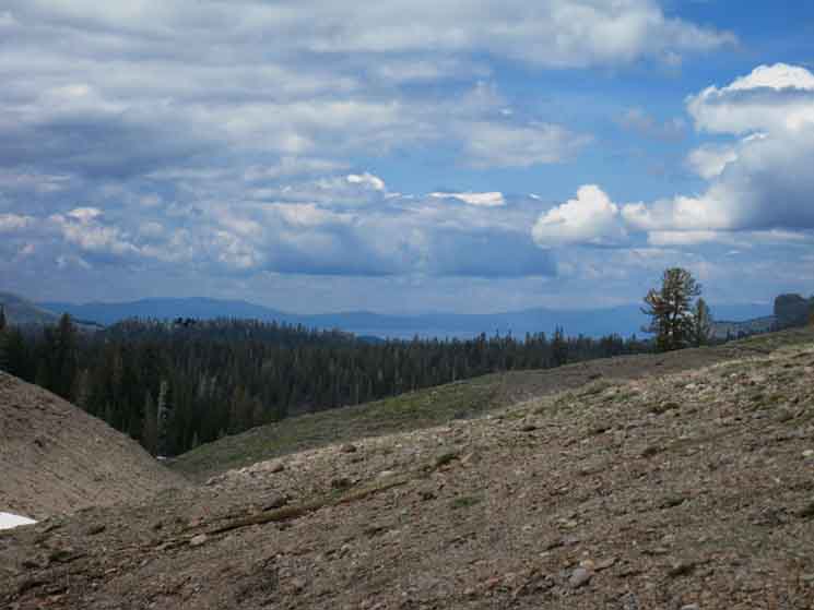
Above: An "almost" panorama of the Carson Range mountains wrapping around the Southern perimeter of Meiss Meadow. Note how all these mountains wrapping around this most Southern end of the Tahoe Basin concentrate their runoff flows into Meiss Meadow. It's this terrain-driven concentration of runoff that super-saturates the soils in the terrain below Meiss Meadow during periods of very heavy Spring Thaw. Below: A view turning around to look North across the South end of Meiss Meadow
as we enter the The most Southern end of Meiss Meadow sits between us and the distant ridge.
|
|||||||
Hiking
up to the
Carson Gap
Views North and West
 |
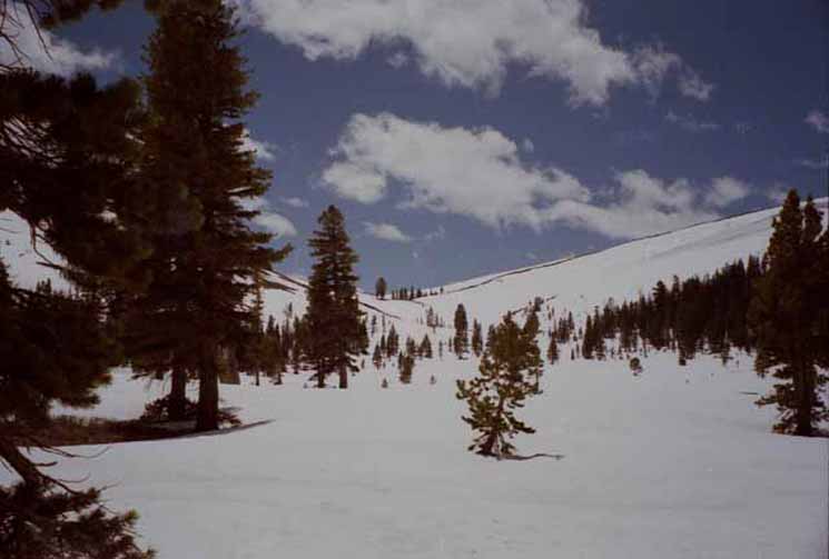
We've crossed the last ford of the South Upper Truckee River and are beginning to climb South up the East side of the gully the South Upper Truckee flows through on its way down from the Carson Gap to Meiss Meadow. We can see the bottom of that gully off to our Left, the West, when we turn around to look North. In front of us to the North we see the volcanic pinnacle above Round Lake looking North across Meiss Meadow. |
LOOKING WEST Big overhanging cornice hanging off the Tahoe Rim mountain ridge rising West of the gully of the South Upper Truckee River we're following up to the Carson Gap. This is our view over our Right shoulder as we hike South. |
 |
This is the view West while hiking South (to our Left in the image above) up to the Carson Gap from Meiss Meadow during early Spring. That cornice is going to fall! |
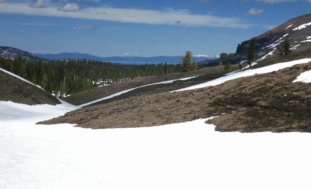
North: Meiss Meadow South: Carson Gap in Summer
Last Chance
for the
Easy Way up to the Carson Gap
We are looking Northwest and back down towards Meiss Meadow. The low point of the Carson Gap exit from the Tahoe Basin is to our back, at the top of this gully. We are actually standing on the course of the South Upper Truckee River. We've turned around for a moment to look North towards Lake Tahoe while hiking South up to the Carson Gap on the snow route. Our view North gets obscured by bends in the gully of the South Upper Truckee River. The snow remaining in the drainage is easier to climb than the trail up to the Carson Gap. The trail is now exposed, melted out from under the snow up on the Eastern side, the Right side, of the drainage above us from this perspective. |
||
 |
||
The actual route of the trail from Meiss Meadow South to the Carson Gap switches from the Winter route up the center of this drainage when the snow finally melts out, and hikers switch routes up to the trail route laid out on the higher ground across the barren terrain above the East side of this drainage, on our Right side above us from the perspective above. Soon the headwaters stream of the South Upper Truckee River will reemerge from under its thin snow cover, the ground will become even more saturated, and the Winter shortcut right up the center of this drainage will close up for the Summer Season, driving us back onto the regular trail route. That point has not quite arrived yet, when the images above and below were taken on Sunday June 7 of 2009.
|
View South
Higher Up towards the Carson Gap
| Clouds Blowing Up, looking South into the top of the Carson Gap. |
 |
The snow filling the drainage up to the Carson Gap makes this gully the best way up when it's filled with snow. The trail is located up to our Left, our East, above this snow filled fold in the mountain. The actual route of the trail takes a bunch of unnecessary ups and downs, and swings wide around this gully up towards the top, as it approaches the Carson Pass Pond. Not so this snow route, which takes the most direct route possible. No wasted calories... The reason the trail is up there to our East is that this most direct route up, the route we are taking up the center of the gully of the South Upper Truckee River to the Carson Gap will soon become a wet quagmire surrounding the River when the Spring Thaw fully takes hold. The trails are always routed to stay above and go around the wet quagmires of Spring, when at all possible. When not possible the trails are built up and trimmed with protective rocks. Spring quagmires that trails are routed around become the easiest route through the terrain when covered by deep snows of Winter. |
Views
South and North
from
Higher Positions
on North side of the
Carson Gap
 |
An easy channel still leads us up to the Carson Gap during this Spring Backpacking Trip. The route up the snow-filled gully is still easier than the already-exposed trail above the gully. |
Looking Northwest at Lake Tahoe
 |
Turning around to take in the last views of Tahoe Basin to our North while we are climbing to South Upper Truckee headwaters. The rock chimney on the Right side of the image is the Round Lake Pinnacle. |
Fine View of Round Lake Pinnacle
 |
||
View North of Lake Tahoe across Meiss Meadow hidden below us while hiking South to exit the Tahoe Basin through the Carson Gap on the TYT and PCT routes. South of this position we lose the Northern view, not to regain a good view North until we're climbing to the top of Round Top and The Sisters. From certain parts of the trail up to Round Top we will get great views into the Tahoe Basin.
The rock chimney on the Right side of the image is the Round Lake Pinnacle. Look, we can see the regular trail route coming over the low hill on the middle-Left of the picture.
|
To the Top of the Carson Gap
 |
Round Top and its associated sheer ridge reaching East visible peeking over the top of the Carson Gap. We're almost to the top! |
North: Meiss Meadow South: Carson Gap in Summer
Video
Backpacking Spring Snow
Day 3
Meiss Meadow through Carson Gap
| Meiss Meadow is a Winter Wonderland, and occasionally a crystallized miracle, when it gets really cold. Walk with me out of Meiss Meadow Southbound towards Round Top Lake on what would be the Tahoe to Yosemite route if it was Summertime... |
||
Check out the series of videos from this trip Video Playlists Tahoe to Yosemite Trail from Carson Gap to Lake Alpine Summertime
|
North: Meiss Meadow South: Carson Gap in Summer
South Side
of the
Tahoe Rim
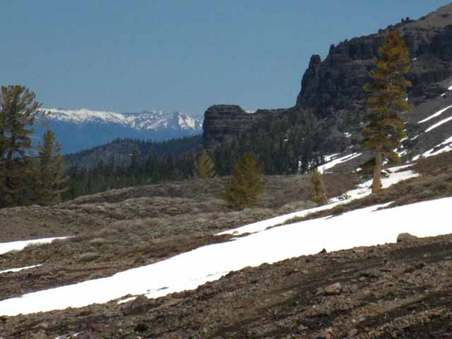
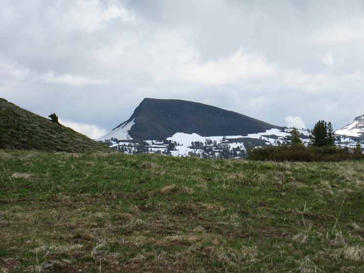
Elephant Back The bare back of Elephant back East of the snow veiled Round Top, viewed from the trail passing through the Carson Gap. |
|
 |
|
The Pacific Crest Trail crosses the almost flat apron below the Northeast face of Elephant Back, the sheer face on its Left side. |
Elephant Back
 |
About a mile South of Carson Pass the Southbound PCT runs across the flat in front of the the Northeast steep flank of Elephant Back. That would be to the Left of the sheer face on the Left side of Elephant Back from our position. We can't see the majority of that flat, as our view of it is blocked by the intervening flank of Red Lake Peak in the middle-distant Left of the image. The Southbound PCT is on its way over the flat below Elephant Back's sheer face for the traverse down into the canyon holding the upper reaches of Forestdale Creek, which lay of the far side of Elephant Back. The Southbound PCT traverses down into the canyon to cross Forestdale Creek on its way to the switchbacks up to the Forestdale Divide at the head of that canyon. Hiking the PCT South from Carson Pass we pass the Frog Lake junction and quickly come to the Winnemucca Lake trail T-junction in the shadow of the Northwest face of Elephant Back, the flank facing us in the picture above. The trail to Winnemucca Lake Tees-out to the Right, the Southwest, to hike along the base of Elephant Back from Left to Right, to the Southeast to Winnemucca Lake. At Winnemucca Lake we encounter a trail junction where the trail up from Woods Lake intersects with the course of our trail tying Carson Pass to Round Top Lake. The total distance from Carson Gap to Round Top Lake via Carson Pass is 4.57 miles. From Winnemucca Lake it's a mile up to Round Top Lake, or two miles down to the footbridge over Woods Creek below Woods Lake. The total distance from Carson Gap to Round Top Lake via the footbridge is 3.90 miles. Hiking West from Winnemucca Lake to Round Top Lake we find the trail junction marking the end of the Lost Cabin Mine Trail up from the Woods Lake Federal Car Campground. That would be our third and final junction for trails accessing the Tahoe to Yosemite Trail route coming South over the Carson Gap out of the Lake Tahoe Basin. The total distance from Carson Gap to Round Top Lake via the Lost Cabin Trail is 3.40 miles. All three of our possible ways to break off to the Southwest for the Tahoe to Yosemite Trail meet up at the trail junction at Round Top Lake. The Lost Cabin Mine Trail is the shortest route, the middle footbridge route as a bit longer, and the Eastern Route through Carson Pass via Winnemucca Lake is the longest. That's also my order of preference. |
Round Top
 |
||||
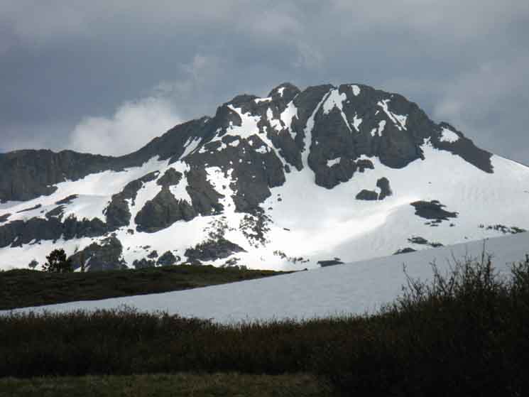
Round Top's Striking form fully reveals itself, and also dramatically frames itself in the Carson Gap, as we backpack South into the gap. Southbound hikers on the Tahoe to Yosemite Trail will hike one of the three routes up to Round Top Lake we discussed above, and pointed out in the video below, on our way over the Round Top and the Sisters Massif to find our way past Fourth of July Lake into Summit City Canyon. The maps below take us through the transition from the Meiss Country Roadless Area into the Carson Pass Management Area and onto our selected route South to Highway 4 across the Mokelumne Wilderness. Maps
Maps South
|
Round Top and its Eastern Ridge
 |
Hiking into the Carson Gap we can clearly see that the East Ridge off Round Top is a beautiful thing. |
Views South
from the
Carson Gap
 |
||||
This is pretty much the view we get hiking South through the Carson Gap during mid-to-late Spring. Along with Eastern route to Elephant Back up to Round Top Lake via Carson Pass, we have a central route hiking up past the East shore of Woods Lake, and the Lost Cabin Mine route up to around the West shore of Woods Lake. That's three routes to Round Top Lake. We'll deal with the details in the video below, and the subquent trail guide pages which continues South down both the Pacific Crest and Tahoe to Yosemite Trail routes to Highway 88 and on down to Highway 4 from our position here at the Carson Gap. We've got solid information for both routes, and you can add updates via the forums after you hike it. Here's information dealing with the first part of our next section of trail South from Highway 88 to Highway 4, laying out the trails and miles for both the TYT and PCT routes down to Highway 4. Maps
Miles and Elevations
|
North: Meiss Meadow South: Carson Gap in Summer
Video
Three ways from Carson Gap to Round Top Lake
Three ways from Carson Gap to Round Top Lake. Duration: 13:27 We hike South from the Carson Gap through Carson Pass. A mile South of Carson Pass we turn Southwest at the Winnemucca Lake trail junction. At Winnemucca Lake we observe the footbridge trail up from Woods Lake to Winnemucca Lake, being the Center route up to Round Top Lake. Arriving at Round Top Lake we take note of the Lost Cabin Mine trail coming up from the campground near Woods Lake. This would be the West route up to Round Top Lake. We've observed all three routes up to Round Top Lake from Carson Gap, including our Eastern route to Round Top Lake from Carson Pass. The total distance of the Eastern Route from Carson Gap to Round Top Lake via Carson Pass is 4.57 miles. Our next move South from Round Top Lake is past Fourth of July Lake on our way down to follow the unmaintained section of Tahoe to Yosemite Trail along Summit City Creek within the granite grandeur of Summit City Canyon. Video Playlist |
The View Hiking South out of the Carson Gap
Round Top and The Sisters from the Carson Gap. Round Top is the Big Round Peak at the center of the massif. The Sisters are the two mountain peaks to the West, to the Right side of Round Top. Only the first two of the three lesser peaks to the West of Round Top as designated as "Sisters." |
||
 |
||
The Tahoe to Yosemite Trail route passes to the West, the right, of the bare shoulder of the third peak to the Right of Round Top. The Pacific Crest Trail passes around the steep Northeast face of Elephant Back, which is just out of sight on the far left of this image. The image above depicts the route of the PCT crossing the flat to the Left of Elephant Back. Check out the Map of the Carson Pass Area to find the exact trail locations of the PCT and TYT.
|
Close-up of Woods Lake, Nestled in at the Base of the Round Top Massif, from the Carson Gap
Woods Lake is nestled in at the base of the rock mass that makes up Round Top and The Sisters where rock rises almost straight out of the forest. If I had one chance to stop while crossing Highway 88, it'd be at Woods Lake rather than Carson Pass. |
||
 |
||
Woods Lake is just past the Lost Cabin Mine turnoff for backpackers following the Tahoe Yosemite Route up to Round Top Lake. Check out the Map to find the exact location of Woods Lake in relation to our potential Center and Western routes up to Round Top Lake, where all three of the possible routes of the Tahoe to Yosemite Trail route into Summit City Creek hook up. The Western route is the Lost Cabin Mine Trail's run up the ridge on the West side of Woods Lake, while the Footbridge's Central route finds its way up to Round Top Lake via Winnemucca Lake by hiking South up the ridge on the East side of Woods Lake. Our third possible route up to Round Top Lake and onto the Tahoe to Yosemite Trail is through Carson Pass on a trail swinging a wide arc up to Winnemucca on its way up to Round Top Lakes via Elephant Back, which is about as far away from Woods Lake and the most direct routes possible, while still being within the Carson Pass Management Area. The 4.57 miles of the Eastern route to Round Top Lake via Carson Pass from Carson Gap is also the longest way up to Round Top Lake, with the 3.90 miles along the central footbridge route the second longest, while the 3.40 miles via the Lost Cabin Mine Trail is the shortest and steepest of the three routes up to the trail junction at Round Top Lake. At the Round Top Lake trail junction only one trail continues South into Summit City Canyon, where an unmaintained 9.54 mile length of the Tahoe to Yosemite Trail route begins. Carson Pass Management Areaand the Tahoe to Yosemite Trail miles to Lake Alpine
|
| The Carson Gap Pond. | |
 |
|
| top of page |
This Guideis set up so that you can add your perspective & experiences here to broaden the trail guide's view of the Carson Gap exit from the Lake Tahoe Basin, and our subsequent hiking options South across the Carson Pass Management Area and on down to Highway 4. Check the Forum linked to from every trail guide page for more information. Add your experience and insight. Questions and comments always welcome. General Topics This Location |
North: Meiss Meadow South: Carson Gap in Summer
The Carson Gap |
The Carson Gap is our Southern doorway into and out of the Lake Tahoe Basin. Permitting Authorities North of the Carson Gap we are exiting the Meiss Country Roadless Area of the Lake Tahoe Basin Management Unit. Meiss Country Roadless Area requires no permits for overnight backpacking. But they do require fire permits, even for using camp stoves. To the South of the Carson Gap we enter the Carson Pass Management Area of the El Dorado National Forest. The Carson Pass Management Area is exactly the opposite of Meiss Country, strictly requiring that permits for backpacking in the CPMA can only be obtained from the Carson Pass Cabin. Southbound Options Continue South to the next page of this trail guide looking at the Carson Gap where we discuss the the differences between the Pacific Crest and Tahoe to Yosemite Trails from the Carson Gap to Tuolumne Meadows. Information 7.5 min USGS hiking topo Map 30 min USGS hiking topo Map South |
Backpacking Trail Guide North |
 |
Backpacking Trail Guide South |
Backpacker ForumsHave General Information about Backpacking to relate ?Post 'em on
On the Trails Forums you can browse trail locations and add your experiences, comments, questions (or pictures and videos) about hiking South out of the Echo Summit Trail Head. About the Meiss Country Roadless Area. The Topics Forums deal with everything else backpacking. Post your comments and questions on the relevant Pages in this Forum, or Register to post your own pages about your trips and the trails through the Meiss Country Roadless Area in the Echo Summit to Carson Pass Forum. Forum
|
North: Meiss Meadow South: Carson Gap in Summer
Trailhead
Contact
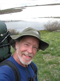
Alex Wierbinski

Backpacking Lake Tahoe to Mount Whitney
Your guide to the High Sierra Crest, including the Tahoe to Yosemite, Pacific Crest, and John Muir Trails
