Tahoe to Whitney
High Sierra Trail Guide
Supplement
Backpacking
Emigrant Wilderness
Images and Information:
ALTERNATIVE ROUTE
from
Mosquito Pass Junction to Snow Lake
for
Backpacker Magazine
A Supplement to the Backpacking Routes of the TYT-PCT through Emigrant Wilderness depicted on the Trail Guide
Backpacking Emigrant Wilderness
Backpacker Magazine BLURB
| Emigrant Wilderness RESUPPLY |
Emigrant Wilderness PERMITS |
Trail Guide INDEX |
Sonora Pass TYT-PCT TRAILHEADS |
Emigrant Wilderness Trail Maps INDEX |
Emigrant Wilderness Trail Miles INDEX |
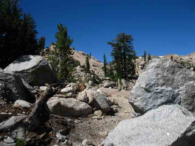
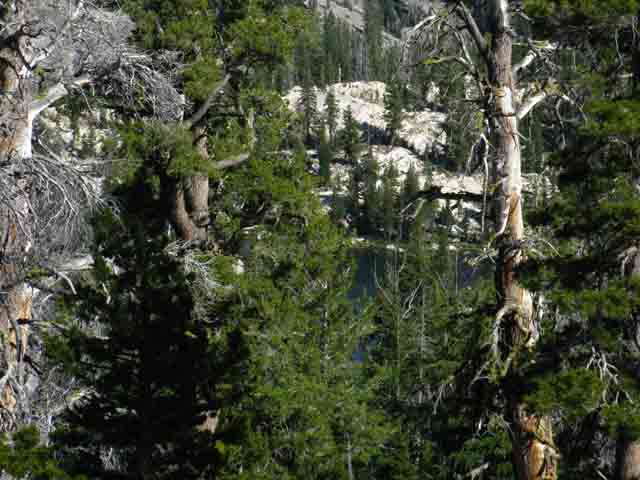
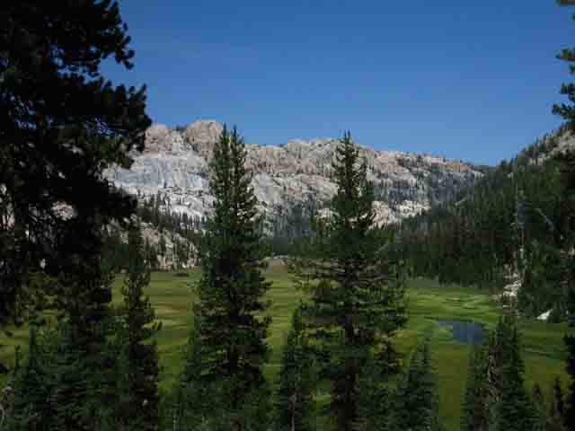
Backpacking Emigrant Wilderness Depicting The segments of trail depicted below have not been incorporated into formal trail guide pages. Yet the information here is valuable for hikers putting together awesome backpacking routes and loops through the High Emigrant Wilderness over into the Northwest corner of Yosemite, and maybe even taking in the PCT's swing through Toiyabe National Forest lands wedged in on the East side of the High Sierra Crest between Emigrant Wilderness, Hoover Wilderness, and Yosemite. This map covers this terrain: This page approaches Mosquito Pass and the line of lakes and ridges to the Southeast from Kennedy Meadows Pack Station. This page gives us basic information about the route South from Mosquito Pass to the bottom of Horse Meadow, where we have two choices to intercept the Tahoe to Yosemite Trail. We can hike up Horse Meadow and its steep canyon beyon, or we can swing by Twin Lakes on our way past Black Bear and Bigelow Lakes to the TYT at Summit Meadow via Snow Lake. This page is set up to support those backpacking efforts, as well as exploring alternative routes across the Emigrant Wilderness for Tahoe to Yosemite Trail hikers. We've got a good collection of resources below. It also offers alternate routes across Emigrant Wilderness for hikers on the Pacific Crest Trail. The Pacific Crest Trail pretty much goes around the East edge of Emigrant Wilderness. The routes described below hike straight through the high elevation heart of Emigrant. From the trail at the bottom of Horse Meadow we can either hike up to the Tahoe to Yosemite Trail through Horse Meadow or select one of two unmaintained trails over to Snow Lake via Bigelow and Black Bear Lakes. Snow Lake is situated about 3/4ths of a mile of easy hiking from the Tahoe to Yosemite Trail just below our climb out of Emigrant Wilderness into Yosemite through Bond Pass. We can turn back towards Kennedy Meadows Pack Station through any of these junctions, or continue to expand the length of our hike down to the next junction before turning back. These trails add to those already covered on the guide, which opens up a wide range of long and short backpacking loops around the high elevation section of the Emigrant Wilderness and adjacent wilderness areas. Emigrant Wilderness Backpacking FeaturesOn This Page Trails and Lakes opened up backpacking South over Mosquito Pass
Backpacking Emigrant Wilderness
This page below covers the route from the Mosquito Pass trail junction along the TYT above Lunch Meadow over Mosquito Pass, past Emigrant, Blackbird and Maxwell Lake to the base of Horse Meadow. From the bottom of Horse Meadow we have three potential routes to Summit Meadow along the Tahoe to Yosemite Trail. Which one we take is likely a reflection of the character of our trip. Two routes are cross country routes to Snow Lake via Black and Bigelow Lakes. The third climbs up Horse Meadow to turn Right where the trail splits between tracking to Grizzly Peak or Snow Meadow. My goal in putting this page up is to give you an idea about the amazing medium and long distance backpacking trips you can come up with in the High Elevation areas of the High Emigrant Wilderness. |
|
15 Minute Backpacking Maps Brown Bear Pass through Bond Pass takes us into NW corner of Yosemite National Park. This map covers the TYT above and to the North of the series of lakes we pass from Mosquito Pass to Snow Lake. 30 Minute Backpacking Maps The Big Sonora Pass hiking map covers both the TYT and PCT trails coming closer together approaching Highway 108 from the North, and again as they approach their respective entrances into Yosemite from the North. The Sonora Pass to Bensen Lake backpacking map gives us a better overall view of the relationships between the TYT and PCT along the Sierra Crest South of Highway 108 through Emigrant Wilderness into the North Yosemite Wilderness. Map Index List Note that my maps focus on the Tahoe to Yosemite and Pacific Crest Trail routes across (and around) the high elevation areas of Emigrant Wilderness. I have plans to add the web of trails covering the next level of trails paralleling and connecting with the TYT through here after I finish the main body of the TYT, PCT, and JMT between Tahoe and Whitney... Miles and Elevations |
Mosquito Pass junction near the top of Summit Creek
 |
The trail junction South over Mosquito Pass from the Tahoe to Yosemite Trail above Lunch Meadow. Relief Reservoir to Brown Bear Pass 15 min Map Mosquito Pass trail junction on the Tahoe to Yosemite Trail. |
Hiking to Mosquito Pass
Moderate climb South to Mosquito Pass
 |
It is an easy degree of moderate difficulty trail that brings us up to Mosquito Pass. BIG Sonora Pass Area Map: TYT & PCT |
Unique granite coloration-decoration here.
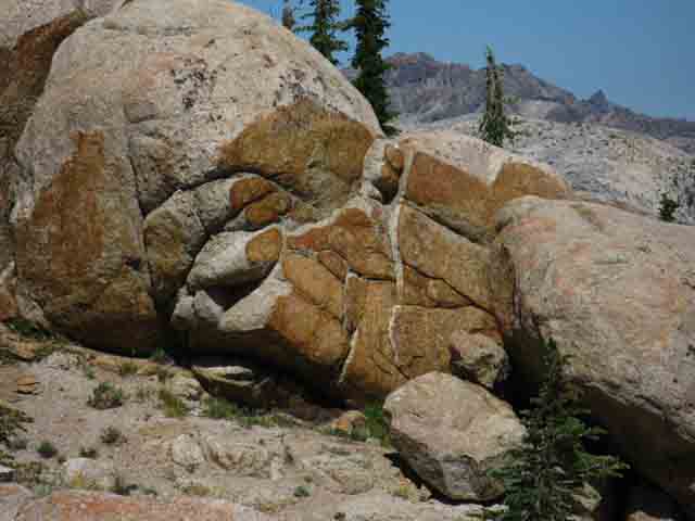 |
Fantastic juxtiposition of the amazing pink and gold granite hues that characterize this wonderful place. |
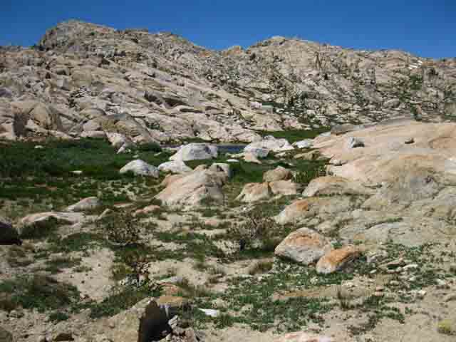
Ponds just below N side of Mosquito Pass
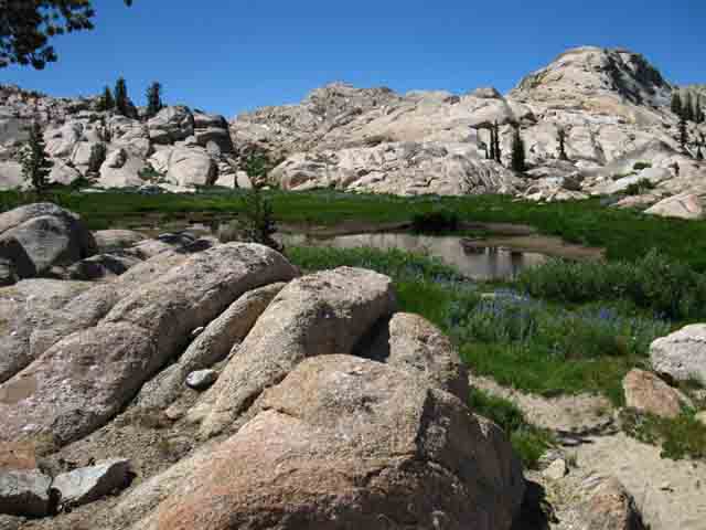 |
Set of saturated meadows just below the North side of Mosquito Pass. |
Final Trail up to Mosquito Pass
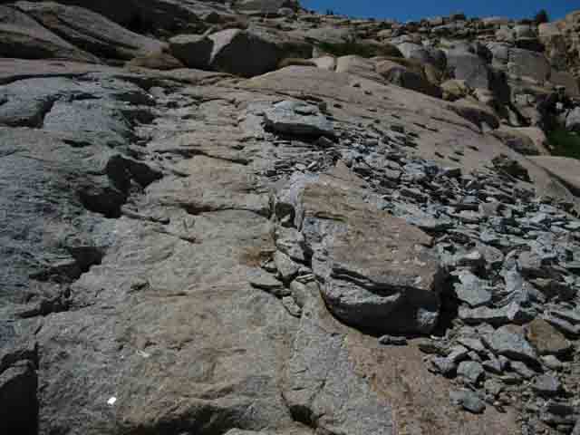 |
Can't miss the trail up to Mosquito Pass. |
View North from Mosq Pass approach
Relief Peak dominating N side of our hike from KM to Mosq Pass junction along Summit Creek.
Below this volcanic cap granite terrain is eroding out...
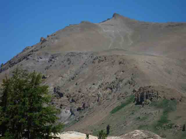 |
Climbing up to Mosquito Pass opens great views to the North of Relief Peak, which tops the Northern, the volcanic side of the valley we've hiked up since passing South of Relief Reservoir. Map showing Relief Peak: |
Pond at Mosquito Pass
 |
Why they called it "Mosquito Pass." |
Valley down South side descent from Mosq Pass
 |
Looking Southeast down valley off the South side of Mosquito Pass. BIG Sonora Pass Area Map: TYT & PCT |
North Fork Cherry Creek feeds N shore of Emi Lake
 |
Tranquil flow of North Cherry Creek through delightful meadow-marsh into the North shore of Emigrant Lake. |
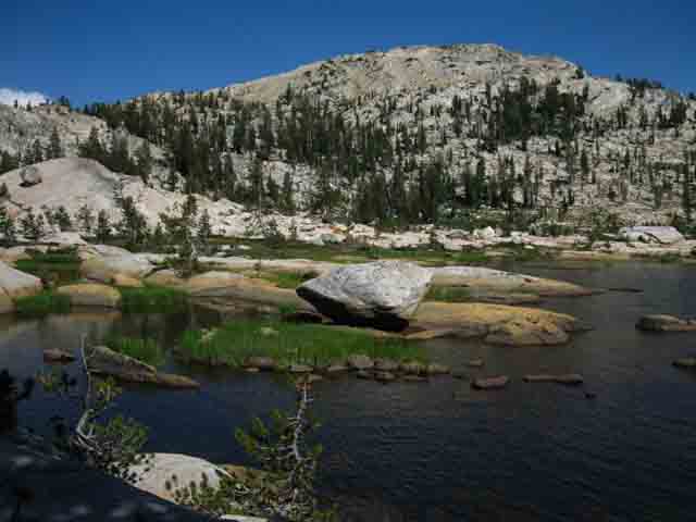
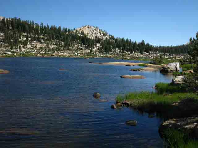
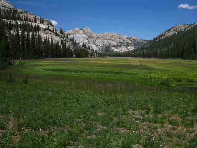
Emigrant Lake
 |
Emigrant Lake. The trail over Mosquito Pass drops down to the North of Emigrant Lake, seperated from the lake by a great grassy or marshy apron, depending on the season. Sonora Pass to Bensen Lake 30 min Map BIG Sonora Pass Area Map: TYT & PCT |
Emigrant Lake
 |
Dropping down to Emigrant Lake from Mosquito Pass. |
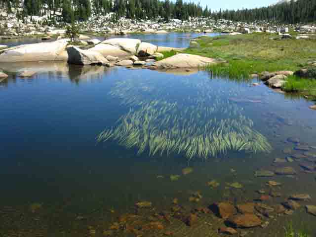
Great Fishing in N Cherry above Emigrant Lake
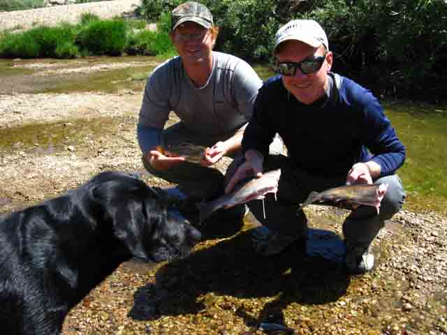 |
Braided streams of the North fork of Cherry Creek provide dinner for Paul and Mark. The dudes were out here from Florida, doing the annual backpacking trips that keep these childhood buddies together. Paul is going to Medical School and Mark is becoming a journeyman electrician. The dog is keeping a close eye on what's going on in the marshy terrain around us... Now we're climbing to our BIG Sonora Pass Area Map: TYT & PCT |
Blackbird Lake
 |
Fantastic other worldly terrain. A trail junction tee break off the trail up to Middle and Emigrant Meadow Lake. This trail tees-out at the junction with the Tahoe to Yosemite Trail on the Northeast shore of Emigrant Meadow Lake. BIG Sonora Pass Area Map: TYT & PCT |
Blackbird Lake
 |
View hiking Southeast past Blackbird Lake on our way to Maxwell Lake. |
Blackbird Lake
 |
More of a pond than a lake as we continue Southeast over a low gap to the descent to Maxwell Lake. |
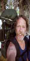
Trail buddies approach
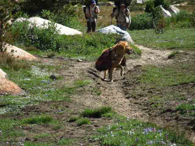 |
I noted two good dogs approaching. They were happy to see me, yet were totally engaged with the rest of the environment as well. This guy was coming down to meet me when something off our flank caught his attention. Hiking past Blackbird Lake brought a cool encounter with a family backpacking team, the Rileys, including both two and four legged team members. The Rileys had been out for 12 days, hiking around the high elevation portions of the Emigrant Wilderness. They had been resupplied by Kennedy Meadows Pack Station. A horsepacker brought them out many pounds of food and kibble... |
Trail Buddies
 |
Meeting some good old boys packed for the trail. |
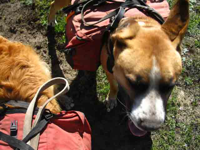
The Rileys Backpacking Emigrant Wilderness
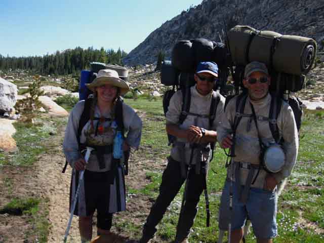 |
Bailey, Branden and Bobby Riley on a long backpacking trip all around Emigrant Wilderness. Talking to Bobby I found that having horsepacker haul out a major resupply on mule-back runs around 340 bucks for four fully packed mules. That makes for an amazing base camp, and provides supplies for endless backpacking in the Emigrant Wilderness Backcountry. Sunday July 15 2012. BIG Sonora Pass Area Map: TYT & PCT |
Hiking down to Maxwell Lake
 |
Hiking down to Maxwell Lake from Bluebird Lake. BIG Sonora Pass Area Map: TYT & PCT Sonora Pass to Bensen Lake 30 min Map |
Maxwell Lake
 |
Looking South down Maxwell Lake with the great rising mass of the Sachsc Monument on the Left side of the image. |
Maxwell Lake
 |
Maxwell Lake. BIG Sonora Pass Area Map: TYT & PCT |
Hiking down to Horse Meadow
 |
||||
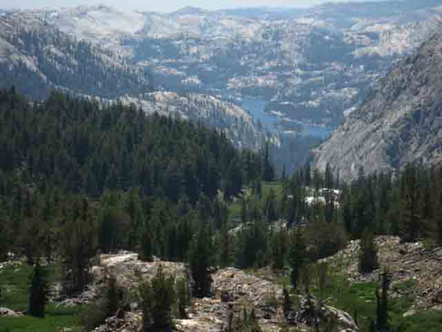
Hiking down to Horse Meadow from Maxwell Lake. The trail up Horse Meadow Ys out at the top of the canyon. The trail to the Left climbs to the unmarked trail junction along the Tahoe to Yosemite Trail a few yards from the Grizzly Peak and Emigrant Pass trail junctions. The trail to the Right climbs up to link up with the TYT just a bit to the South along the North edge of Summit Meadow. Passing by the trail up Horse Meadow we hike Southeast to Twin Lakes, from where we can hike the trail past Black Bear and Bigelow Lakes onto the unmaintained route over the gap in the mountains to Snow Lake. The BIG Sonora Pass and Jack Main Canyon maps below give us the best view of this fun route.
|
Horse Meadow
 |
Looking up Horse Meadow towards the Tahoe to Yosemite Trail running along the Sierra Crest. At the top of the meadow the trail climbs hard to a trail tee: The trail Left hikes up to an unmarked trail junction just West of Grizzly Peak while the trail Right terminates on the North end of Summit Meadow. Clearing the upper section of the trail This is the bottom of the Tungsten Road brancing off from the trail junction on the North end of Summit Meadow down to the Cherry Creek Mine. The Cherry Creek Mine claims reached from Horse Meadow down East Cherry Creek to the Southwest as far as a line drawn from the North shore of the Western Twin Lake above Cherry Creek. |
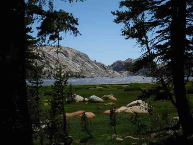
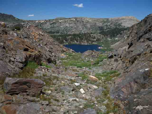
Summit Meadow
Snow Lake is located in trees to the Right of low valley
 |
||
Enterning Summit Meadow, which means that we're now hiking South on the Tahoe to Yosemite Trail. We've come up the canyon above Horse Meadow along the old Tungsten Road to where it links up with the branch of the Tungsten Road South to Snow Lake and North towards Leavitt Lake and Highway 108. Snow Lake sits between the forest and the ridge ahead of us. The Horse Meadow trail junction lays behind us to our Right...
|
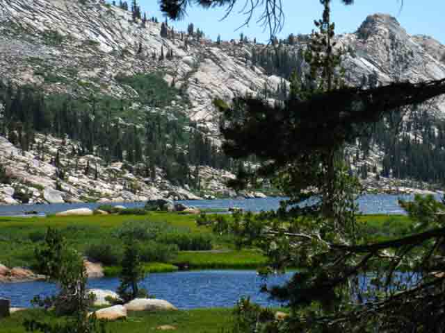
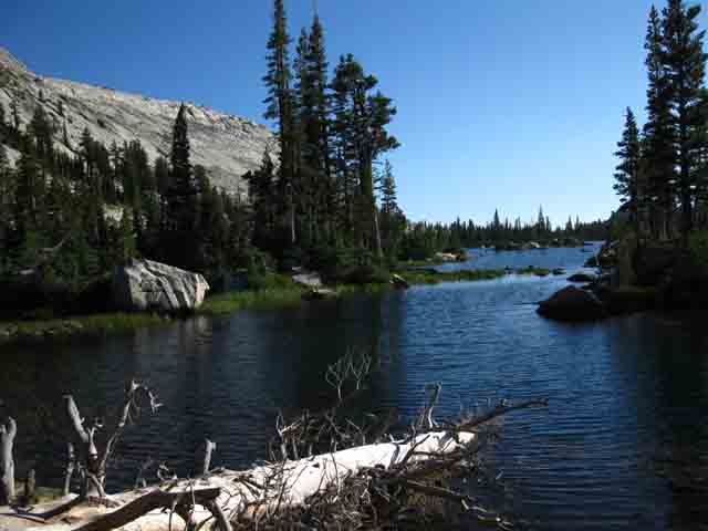
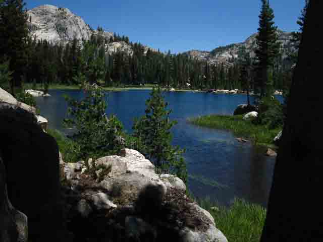
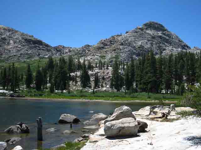
Snow Lake. Bigelow and Black Bear lake on other side of rock
 |
||
Approaching Snow Lake from Summit Meadow on the Tungsten Road. Viewing The Horn looking Southeast across Snow Lake.
|
Unique Snow Lake designation...
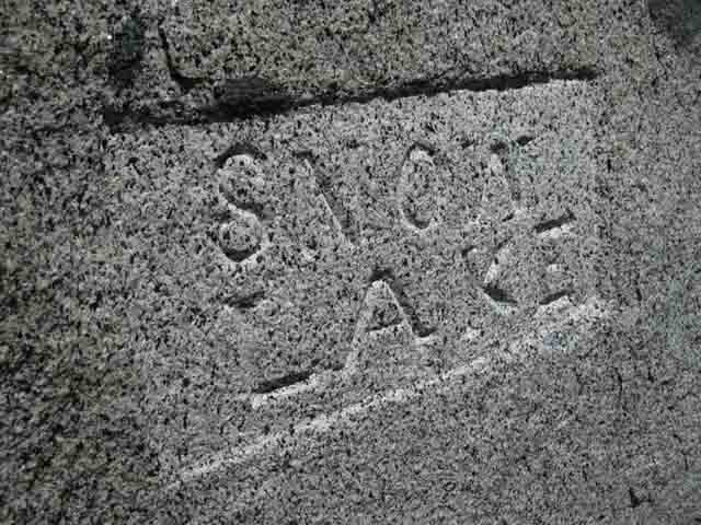 |
Snow Lake's designation carved into a huge boulder on the North Shore of Snow Lake. |
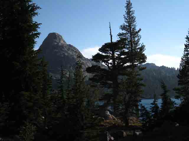
The gap over to Bigelow, Black Bear and eventually, Huckleberry Lake.
 |
||
Looking across West shore of Snow Lake at Gap over to Bigelow and Black Bear Lakes sitting to the Left of the Horn of Rock. That's where we're going to find our way over to look at Bigelow Lake. We could also see this Horn and Gap while backpacking South of Grizzly Peak along the Tahoe to Yosemite Trail.
|
Relief Peak to Northwest |
 |
Relief Peak in the distance marks the location of the TYT hiking up from Kennedy Meadows, and where we came East through Mosquito Pass. Map showing Relief Peak: Terrain we are looking across |
Flowers proliferate in gap, as do dozens of hummingbirds...
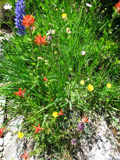 |
Climbing to the Gap during late Spring we encounter a garden of color and form. The best part are the dozens, if not hundreds of crazy hummingbirds zipping all about. They seem quite social. I froze for a while, as my entering their hillside kind of got them even more excited than hummingbirds normally are. Then I started making "friendly" clicks, and sweet talking them. My calming strategy appeared to work, as the hummingbirds all came out and began socializing again, little disturbed by my happy presence. |
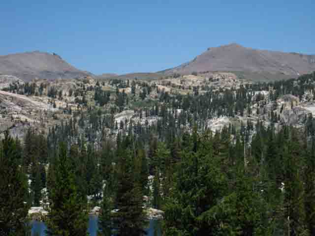
From the S side of the gap we see Huckleberry Lake far below |
 |
||
View Southwest from the Gap above Snow Lake at Huckleberry Lake far below. Bigelow and Black Bear Lakes are hidden by tree and terrain on the Left side of slope below us. An unmaintained trail breaks to the Right, to the North out of the scope of the picture above to climb over the rocky ridge into Horse Meadow, which lay on the other side of the ridge.
|
Turning back to the North we see Snow Lake
 |
Standing in the gap dividing Snow Lake from Bigelow and Black Bear Lakes, looking Northeast across Snow Lake below. |
Snow Lake Camp: Many Many Marmots
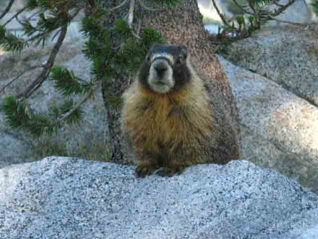 |
Campsites at Snow Lake must be Marrmot proof. |
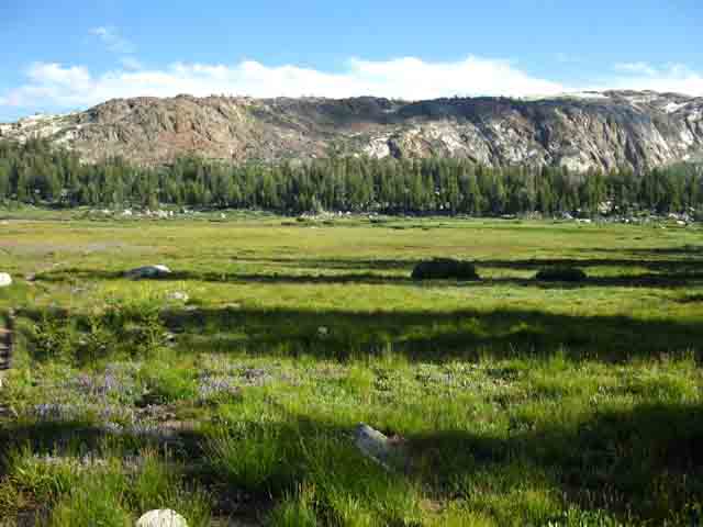
Summit Meadow on a fine morning
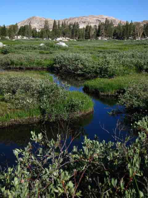 |
View Northwest across Summit Meadow. We are hiking back to the TYT from Snow Lake. The channels of water reaching into Summit Meadow are the upper fingers of the East fork of Cherry Creek branching out as they rise higer up the Western Sierra Crest. East Cherry Creek drains Summit Meadow and the surrounding mountain flanks. East Cherry Creek runs through Horse Meadow. BIG Sonora Pass Area Map: TYT & PCT |
Summit Meadow
flowers hiking South towards Griz Peak and meadow on our way back to KM
 |
||
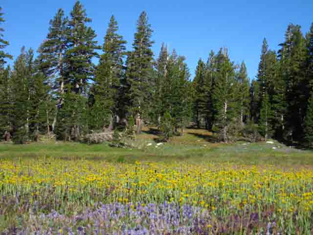
Summit Meadow is delightful to the eye during Spring, though the densitiy of mosquitoes and flowers is roughly equal... We're looking roughly North, over at where the Tahoe to Yosemite Trail comes South from Grizzly Peak. Over there is where the trail down to Horse Meadow is located.
|
|
Hiking Options Standing at the Summit Meadow trail junction between the Tahoe to Yosemite Trail and the trail to Snow Lake we have a number of route options. Which one we take depends on how we got here. First, we have the trail to Snow Lake. Southwest of Snow Lake an unmaintained trail can bring us over the gap past Bigelow and Black Bear lake to the trail between Twin Lakes and the bottom of Horse Meadow. We can hike North Past Horse Meadow to Emigrant Lake on our way over Mosquito Pass to the Tahoe to Yosemite Trail just above Lunch Meadow. Second, we can hike South over Bond Pass to the top of Jack Main Canyon in Yosemite. Here we can continue South to Tuolumne Meadows via the combined TYT/PCT routes, or continue down Jack Main Canyon to the Hetch Hetchy trail head. If we backpack North on the Pacific Crest Trail from the top of Jack Main Canyon we shortly exit the Northwest corner of Yosemite into the Toiyabe National Forest. From here we can continue Northeast to exit on the Eastern Flank of the Sierra through the Leavitt Meadow Trailhead. To the North we can follow the PCT all the way up to the Sonora Pass Trailhead. At the top of Kennedy Canyon we have the option of hiking West down to the Tahoe to Yosemite Trail about 2.5 miles to the South of Kennedy Meadows Pack Station. Third, we can hike North past the Horse Meadow trail junction to the junction under the West flank of Grizzly Peak. From here we can hike Northeast over the low rise of Emigrant Pass down towards Leavitt Meadow via the West West Walker River. We can hike North over Big Sam from Grizzly Peak to the top of Kennedy Canyon. We can hike Northwest from Grizzly Peak along the Tahoe to Yosemite Trail back down to Kennedy Meadows Pack Station. All of these routes are covered on the following topo backpacking map: Sonora Pass Area: TYT & PCT Click the red dots on the map for trail guide information and the black dots for more detailed topo trail maps. |
BLURB PUBLISHED IN BACKPACKER MAGAZINE (Loads very slowly - 4th Article from top of page) [The Next Best Thing] Split the difference between Tahoe and Yosemite to get both of their charms but none of their crowds. The Spot: Kennedy Meadows, Emigrant Wilderness, CA Old-growth trees, crystalline streams, and granite domes dot the western Sierra, and when I walk through the area I experience the full breadth of its fluid stillness—if I can be alone for a sec. So I’m learning to look north, past Yosemite, to the quiet paths of the Emigrant Wilderness for my own tract of unspoiled heaven. A four-night, 40-mile loop leads southeast from Kennedy Meadows, past Relief Reservoir, over 9,400-foot Mosquito Pass, and to Emigrant Lake (mile 16), where the combination of skyward granite, alpine pool, and rainbow trout make for the most picturesque fishing imaginable. Or so says Alex Wierbinski—and he’d know: He’s been tracking these trails and visiting these pools for two decades. The trail continues over the 9,800-foot Brown Bear Pass for a vantage overlooking the surrounding meadows pooling with clear water and protected by jagged Sierra peaks. Here, ancient lava flows cover slabs of granite, creating intricate layers of rock Wierbniski calls “ice cream sandwiches.” His tips: Take it slow—camp at Sheep Camp (mile 9), Emigrant Lake (mile 16), Snow Lake (mile 23), and Sheep Camp again (mile 31)—study the geology, and most of all, let your pace match the forest’s natural calm. –JAMES LUCAS Permit Free, no quota; at Stanislaus NF ranger stations |