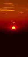
Last Spring Snow Trips?
Once the Spring Thaw gets going the rivers and creeks will rage, making fording very dangerous.
REPORT
Spring Gear
Time to begin stashing the full Winter Gear. We can start lightening up the gear depending on weather.
PCT-TYT-JMT
HIKERS
Time to Carefully Monitor
Travel & Fording
Conditions
SPRING THAW
RIVER INFORMATION
RESERVOIRS
HAZARDS
Tracking
SPRING THAW 2019
All Snow Information
|
28
LAST MONTH
NEXT WEEK
TOP
Hiking the PCT
in
2020?
From the Trail Guide
The
Earliest, Latest, and Average Start Dates
How Will This Year Stack-Up?
ON THE CALENDAR
Earliest
Start Date
Winter of 2015
Driest in History
Average
Start Date
Winter of 2016
An Average-Dry Year
Latest
Start Date
Winter of 2017
Wettest in History
When are the trails along the Sierra Crest going to be passable this year?
Upcoming
Weather
Probabilities
These three years highlighted above offer the potential range of Weather Conditions within which this year's PCTer,
"Start Date," the date you can reasonably expect to encounter fairly snow-free trails with post-deadly fording conditions, will be determined within. These are the historic limits of wet and dry, with a perfectly average year thrown in-between, for good measure.
This date, of course, depends upon your ability to navigate snow at high altitude, along with your ability to cross the various stages of the dangerous thaw waters draining off it.
And your fitness, of course. You are training, are you not?
You can get through before and after the period of high-flow runoff, but not during this phase.
How the conditions of the Winter to Spring
Transition we track this year measures-up to the classic trajectories of these three years cited above will inform potential PCT hikers about the snow/trail conditions along the High Sierra Crest they may reasonably expect to encounter during May, June, and July of this year measure-up against those of the Driest year in history against an Average Year, against the wettest Year in History...
This year of 2020 will fit somewhere between these historic parameters of the record Wettest and record Driest years that happened between
2015 and 2017.
As our seasonal start date for open access to trails along the High Sierra Crest will be adjusted according to the character and trajectory of this year's Winter to Spring Transition, we will watch it carefully.
Advice for
Rookie Hikers wishing to hike the TYT-JMT-PCT
More
2018
Weather Notes
TWISTED SEASONS
Hottest & Driest, then Wettest Year Ever, over Three Years
Compare Years
|
29
Beautiful Day
Sun & Warmth
HOT
This Week in 2018
Snow & Temps
This Week in 2017
Snow & Temps
|
30
Beautiful Day
Sun & Warmth
HOT
Overnight Temps
Warming...
Approaching
Transition
to
Spring Gear
SPRING THAW
---DANGERS---
--WARNINGS--
BEGAN
(April 24...)
LAST MONTH
NEXT WEEK
TOP
LAST MONTH
NEXT WEEK
TOP
This Week
TOP
This Week
TOP |
1
Beautiful Day
Sun & Warmth
Cooler-Warm
2020
May1
Ca Snow
37%
Of May 1 Average
Last Reading
April 22
Next Reading
May 7
MAY DAY
May 2015
Driest Year in History
May 2016
An Average-Dry Year
May 2017
Wettest Year in History
May 2018
Very Dry Year
2019
Current Snowpack:
Percent of Average for
May 1.
N Sierra: 144%
=0% in 2 days
Cen. Sierra: 147%
+2% in 2 days
S Sierra: 139%
-1% in 2 days
Ca State: 143%
=0% in 2 days
2019
2018
Snowpack
Percent of Average for
May 1
+/- change since
April 29
Ca State: 27%
(-10%)
2018
Carson Pass, 5-8-18 = 19"
2016 Snow Depth
Carson Pass
49 & 23 degrees, 75"
Ebbetts Pass
48 & 23 degrees, 75"
Sonora Pass
33 & 28 degrees, 69"
Tuolumne Meadows
17 & 50 degrees, 34.5"
2016 April
Snow Depths & Temps
2015 Snotel Station Reports Snow Depth
Carson Pass 0 inches
Ebbetts Pass 0 inches
Sonora Pass 0 inches
Tuolumne Meadows 0 inches
2015 May
Snow Depths & Temps
Station Reports
The
SIXTH
--SPRING--
Temp-Snow
Check
May 1
2020
8 pm
Evening
Below: Watershed Snow Water Content Charts followed by individual reporting station's Snow Depth and 24 hour high-low temps.
Last Report:
April 22
Next Report:
May 7
Red Snow = Near Clear
Tahoe Basin
Watershed
Southwest Tahoe
Trail Map with Stations
PCT-TYT-TRT
Rubicon
27.0 −13.00
(22.60) + 0.1
7618 feet
Trail Map
54 & 38 +/=
PCT-TYT-TRT
Echo Peak
18.0 −26
(33.50) −0.2
Echo Lake Resupply
Lake Tahoe Resupply
7652 feet
Stations Map
53 & 39 =/+
American-Yuba Watersheds
PCT-TYT
Carson Pass
36.0 −17.0
(27.40) =0.00
8388 feet
Trail Map
Stations Map
52 & 31 −/=
Carson-Walker
Watersheds
PCT-TYT
Ebbetts Pass
26.00 −23
(33.90) +0.10
Lake Alpine Resupply
8660 feet
Trail Map
52 & 37 −/+
West of PCT
Highlands Meadow
00.00 −10.65
(28.95) +0.69
8360 feet
Trail Map
49 & 27 −/−
Top of List
EAST FLANK
Leavitt Lake
75.00 −29
(29.40) −0.10
9602 feet, East Flank
Trail Map
48 & 36 −/+
EAST FLANK
Marine Base
Cold Weather Training
6748 feet East Flank
Trail Map Above
FULL REPORT
VIS-CHIL-WEA-MB-
WIND
69 &48 +/+
Mokelumne-Stanislaus Watersheds
PCT-TYT
Sonora Pass
Kennedy Meadows
RESUPPLY
Deadman Creek
18.46 −15.21
9250 feet,West Flank,
Trail Map
57 & -19 +/− ??
Tuolumne-Merced
Watersheds
SW of TYT
Horse Meadow
5.40 x0.0
8602 feet
Trail Map
52 & 26 −/+
Bensen Lake Loop
Slide Canyon
38 −17
(25.14) −0.98
9200 feet, NW Yos
Trail Map--Location
49 & 26 +/+
Report
(Typically one of the coldest stations)
Top of List
Tenaya Lake
19.11 −23.64
(10.05) +0.00
8163 feet, West Flank
Trail Map
53 & 26 −/+
JMT-PCT-TYT
Tuolumne Meadows
0.43 −8.43
(8.32) =0.00
8600 feet, West Flank
Trail Map
55 & 26 =/+
Tioga Pass/Dana
ERROR +ERROR
(4.59) =0.00 ??
9798 feet
Trail Map
48 & 26 −/+
Mammoth Mountain
Mono Lake-Owens Basin
East of PCT-JMT
Above Gem Lake
Gem Pass (New)
(error)
Report
10750 feet
Trail Map
temps bad
Old
JMT-PCT Junction
Devils Postpile
0.26 +0.04
(16.55) +0.98
8004 feet
Trail Map Above
57 & 30 +/+
NE of JMT-PCT
Mammoth Pass
48.80 −25.39
(17.44) +0.12
9500 feet
Trail Map
53 & 31 −/+
Top of List
JMT-PCT
E of Bear Ridge
Volcanic Knob
34.30 −19.4
(0.00) = ??
10100 feet
Trail Map
54 & 28 −/+
East Flank
South Lake Cabin
no snow sensor
(30.60) =0.0
9580 feet, East Flank
Trail Map
56 & 36 −/+
East Flank
Big Pine Sawmill
11.10 −13.3
10200 feet, East Flank
Trail Map Above
46 & 35 −/+
Kings River
Just East JMT-PCT
Bishop Pass (bad)
(0.0) =
11972 feet
Trail Map Above
-- & -- −/− (earlier)
Just West JMT-PCT
Charlotte Lake
PREVIOUS READING
(no current data)
8.34 −6.3
(80.92) +1.18
10398 feet, West Flank
Trail Map
48 & 22 +/+
(Typically the coldest station)
Kern Watershed
JMT-PCT
Upr Tyndall Creek
38.07 −12.39
11441 feet
Trail Map
51 & 32 +/+
JMT
Crabtree Meadow
1.76 −38.04
(40.02) +0.22
10,700 feet
Trail Map
53 & 28 +/+
? = questionable data
All High Sierra
Reporting Stations
More Stations, by Watersheds
Top of List
|
2
Beautiful Day
Sun & Warmth
Cooler-Warm
Informative
"Normal" Vs. Now
Forcasts & Reality
vs.
Averages
TRENDS
Week-Month- 3 Months
HIGH SIERRA
SNOW INFO
All Snow Info
SNOW STATUS
&
FORECASTS
THE SNOWPACK
GRAPHICS
Date-Adjustable
High Sierra Snowpack Status
MAY 1
NOAA-NOHRSC
The High Sierra
5-1-20
LAST MONTH
NEXT WEEK
TOP
2017
Current Snowpack:
Percent of Average for
May 2.
N Sierra: 198%
Cen. Sierra: 201%
S Sierra: 178%
Ca State: 194%
2017
Snow Depths & Temps
This Week
TOP
LAST MONTH
NEXT WEEK
TOP
LAST MONTH
NEXT WEEK
TOP |
3
Beautiful Day
Sun & Warmth
Cooler-Warm
LAST WEEK
NEXT WEEK
TOP
This Week in 2018: Dry
Snow & Temps
This Week in 2017: Wet
Snow & Temps
Very Early Openings
2018
Highway 108
Open
May 3, 12:00 Noon |
4
Beautiful Day
Sun & Warmth
Cooler-Warming Up
2018
Highway 4
Open
May 4, 12:00 Noon |
5
Beautiful Day
Sun & Warmth
WARM-WARMING
LAST WEEK
NEXT WEEK
TOP
LAST WEEK
NEXT WEEK
TOP |
6
Beautiful Day
Sun & Warmth
WARM-WARMING
2019
Current Snowpack:
Percent of Average for
May 6.
N Sierra: 143%
−1% in 6 days
Cen. Sierra: 143%
−4% in 6 days
S Sierra: 129%
−10% in 6 days
Ca State: 138%
−5% in 6 days
2019
------2016------
RAINY DAY IN SIERRA
TEMPS & SNOW DEPTH
MESOWEST stations
Carson Pass
49 & 33 degrees, 51"
Ebbetts Pass
43 & 31 degrees, 46"
Sonora Pass
47 & 32 degrees, 43"
Tuolumne Meadows
29 & 48 degrees, 0"
HUGE SNOW LOSS DAY
2016
This Week
TOP |
7
Beautiful Day
Sun & Warmth
HOT
Annual
Seasonal Averages
2020
Snowpack:
Percent of Average for
May 7
N Sierra: 16%
−35% in 15 days
Cen. Sierra: 29%
−34% in 15 days
S Sierra: 25%
−34% in 15 days
Ca State: 25%
−33% in 15 days
Last Reading
May 1
Next Reading
May 11
Statewide Summary of Snow Water Content PDF
2018
Snowpack
Percent of Average for
May 7
+/- change since
May 1
N Sierra: 21%
(-9%)
Cen. Sierra: 29%
(-15%)
S Sierra: 21%
(-10%)
Ca State: 25%
(-12%)
2018
Station Reports
The
SEVENTH
--SPRING--
Temp-Snow
Check
May 7
2020
4 pm
Afternoon
Below: Watershed Snow Water Content Charts followed by individual reporting station's Snow Depth and 24 hour high-low temps.
Last Report:
May 1
Next Report:
May 11
Red Snow = Near Clear
Tahoe Basin
Watershed
Southwest Tahoe
Trail Map with Stations
PCT-TYT-TRT
Rubicon
15.00 −12.00
(22.50) −0.1
7618 feet
Trail Map
56 & 38 +/=
PCT-TYT-TRT
Echo Peak
00.0 −18
(33.60) +0.1
Echo Lake Resupply
Lake Tahoe Resupply
7652 feet
Stations Map
61 & 39 +/=
American-Yuba Watersheds
PCT-TYT
Carson Pass
22.0 −14.0
(27.40) =0.00
8388 feet
Trail Map
Stations Map
58 & 35 +/+
Carson-Walker
Watersheds
PCT-TYT
Ebbetts Pass
11.00 −15
(33.90) =0.00
Lake Alpine Resupply
8660 feet
Trail Map
58 & 34 +/−
West of PCT
Highlands Meadow
00.00 −10.65
(29.16) +0.21
8360 feet
Trail Map
59 & 37 +/+
Top of List
EAST FLANK
Leavitt Lake
65.00 −10
(29.50) +0.10
9602 feet, East Flank
Trail Map
59 & 36 +/=
EAST FLANK
Marine Base
Cold Weather Training
6748 feet East Flank
Trail Map Above
FULL REPORT
VIS-CHIL-WEA-MB-
WIND
73 & 37 +/−
Mokelumne-Stanislaus Watersheds
PCT-TYT
Sonora Pass
Kennedy Meadows
RESUPPLY
Deadman Creek
11.82 −6.64
9250 feet,West Flank,
Trail Map
63 & -15 +/− ERROR? 31 is likely low
Tuolumne-Merced
Watersheds
SW of TYT
Horse Meadow
16.30 +10.9
8602 feet
Trail Map
64 & 30 +/+
Bensen Lake Loop
Slide Canyon
27 −11
(12.09) −13.05
9200 feet, NW Yos
Trail Map--Location
61 & 28 +/+
Report
(Typically one of the coldest stations)
Top of List
Tenaya Lake
2.86 −16.25
(10.05) =0.00
8163 feet, West Flank
Trail Map
65 & 28 +/+
JMT-PCT-TYT
Tuolumne Meadows
0.76 +0.33
(8.32) =0.00
8600 feet, West Flank
Trail Map
65 & 27 +/+
Tioga Pass/Dana
ERROR +ERROR
(1.16) −3.43 ??
9798 feet
Trail Map
59 & 28 +/+
Mammoth Mountain
Mono Lake-Owens Basin
East of PCT-JMT
Above Gem Lake
Gem Pass (New)
(error)
Report
10750 feet
Trail Map
temps bad
Old
JMT-PCT Junction
Devils Postpile
0.48 +0.22
(16.55) = 0.00
8004 feet
Trail Map Above
70 & 43 +/+
NE of JMT-PCT
Mammoth Pass
34.40 −14.4
(17.44) =0.00
9500 feet
Trail Map
63 & 32 +/+
Top of List
JMT-PCT
E of Bear Ridge
Volcanic Knob
21.70 −12.6
(0.00) = ??
10100 feet
Trail Map
64 & 31 +/+
East Flank
South Lake Cabin
no snow sensor
(30.60) =0.0
9580 feet, East Flank
Trail Map
65 & 32 +/−
East Flank
Big Pine Sawmill
2.30 −11.8
10200 feet, East Flank
Trail Map Above
58 & 31 +/−
Kings River
Just East JMT-PCT
Bishop Pass (bad)
(0.0) =
11972 feet
Trail Map Above
-- & -- −/− (earlier)
Just West JMT-PCT
Charlotte Lake
PREVIOUS READING
(no current data: 4/22)
8.34 −6.3
(80.92) +1.18
10398 feet, West Flank
Trail Map
48 & 22 +/+
(Typically the coldest station)
Kern Watershed
JMT-PCT
Upr Tyndall Creek
12.64 −25.43
11441 feet
Trail Map
58 & 36 +/+
JMT
Crabtree Meadow
PREVIOUS READING
(no current data: 5/1)
1.76 −38.04
(40.02) +0.22
10,700 feet
Trail Map
53 & 28 +/+
? = questionable data
All High Sierra
Reporting Stations
More Stations, by Watersheds
Top of List |
8
Beautiful Day
Sun & Warmth
HOT-COOLER
BEWARE THE THAW
Selected
RIVER LEVELS
ALL
Weather Monitoring
DROUGHT REPORTING
&
THAW-
RIVERS
Review
May of 2017: Endless snow
This Week
TOP
This Week
TOP |
9
Beautiful Day
Sun & Warmth
WARM-COOLER
Informative
"Normal" Vs. Now
Forcasts & Reality
vs.
Averages
TRENDS
Week-Month- 3 Months
HIGH SIERRA
SNOW INFO
All Snow Info
SNOW STATUS
&
FORECASTS
THE SNOWPACK
GRAPHICS
Date-Adjustable
High Sierra Snowpack Status
MAY 7
NOAA-NOHRSC
The High Sierra
5-7-20
---2015---
Snotel Station Reports Snow Depth
MESOWEST stations
Carson Pass 0 inches
Ebbetts Pass 5 inches
Sonora Pass 7 inches
Tuolumne Meadows .3 inches
2015 May
Snow Depths & Temps
LAST WEEK
NEXT WEEK
TOP
LAST WEEK
NEXT WEEK
TOP
LAST WEEK
NEXT WEEK
TOP |
10
COOLED-CLOUDS
Still Warm
Tropical Moisture
Blowing out of SW
MOTHER'S DAY
Warnings
NWS RENO
E SIERRA WIND ADV
Monday
NWS SACTO
NADA
Sat-Mon
NWS HANFORD
NADA
Sat-Mon
LAST WEEK
NEXT WEEK
TOP
2018:
Very Early Openings
Report from
Kennedy Meadows
Alex
We’re open fully and fish have been stocked.
First pct hiker was here yesterday.
Lots of snow up high.
Expect snow and high runoff until mid July at higher elevations.
Highway should be open over pass by memorial weekend.
We’re stocked and ready for hikers.
Thanks, Matt
BIG NEWS
2017:
Summer "Opening" of Trails "Put-Off" until it happens.
Late July?
I mean clear trails across the High Passes. On the Crest Trails.
Maybe not at all this Summer.
|
11
COOLER-CLOUDS
Still Warm
Tropical Moisture
Blowing out of SW
Light Storm Anticipated
LIGHT RAIN
ACROSS
SIERRA CREST
2020
Snowpack:
Percent of Average for
May 11
N Sierra: 13%
−3% in 4 days
Cen. Sierra: 17%
−12% in 4 days
S Sierra: 15%
−10% in 4 days
Ca State: 16%
−9% in 4 days
Last Reading
May 7
Statewide Summary of Snow Water Content PDF
PRE-STORM
STATIONS
REPORT:
Station Reports
The
EIGHTH
--SPRING--
Temp-Snow
Check
May 11
2020
11 AM
Pre Mini-Storm
Below: Watershed Snow Water Content Charts followed by individual reporting station's Snow Depth and 24 hour high-low temps.
Last Report:
May 7
Next Report:
May 16
Red Snow = Near Clear
Tahoe Basin
Watershed
Southwest Tahoe
Trail Map with Stations
PCT-TYT-TRT
Rubicon
8.00 −7.00
(22.50) = 0.0
7618 feet
Trail Map
62 & 44 +/+
PCT-TYT-TRT
Echo Peak
00.0 −0
(33.60) =0.0
Echo Lake Resupply
Lake Tahoe Resupply
7652 feet
Stations Map
60 & 43 −/+
American-Yuba Watersheds
PCT-TYT
Carson Pass
14.0 −8.0
(27.30)−0.10
8388 feet
Trail Map
Stations Map
59 & 40 +/+
Carson-Walker
Watersheds
PCT-TYT
Ebbetts Pass
5.00 −6
(33.90) =0.00
Lake Alpine Resupply
8660 feet
Trail Map
57 & 38 −/+
West of PCT
Highlands Meadow
00.01 +0.01
(28.70) −0.46
8360 feet
Trail Map
56& 36 −/−
Top of List
EAST FLANK
Leavitt Lake
60.00 −5
(29.50) =0.00
9602 feet, East Flank
Trail Map
53 & 37 −/+
EAST FLANK
Marine Base
Cold Weather Training
6748 feet East Flank
Trail Map Above
FULL REPORT
VIS-CHIL-WEA-MB-
WIND
74 & 34 +/−
Mokelumne-Stanislaus Watersheds
PCT-TYT
Sonora Pass
Kennedy Meadows
RESUPPLY
Deadman Creek
3.76 −8.06
9250 feet,West Flank,
Trail Map
68 & 38 +/+
Tuolumne-Merced
Watersheds
SW of TYT
Horse Meadow
5.30 −11
8602 feet
Trail Map
57 & 33 −/+
Bensen Lake Loop
Slide Canyon
17 −10
(???) 00.00
9200 feet, NW Yos
Trail Map--Location
56 & 30 −/−
Report
(Typically one of the coldest stations)
Top of List
Tenaya Lake
0.27 −2.59
(10.05) =0.00
8163 feet, West Flank
Trail Map
62 & 31 −/+
JMT-PCT-TYT
Tuolumne Meadows
1.06 +0.30
(8.32) =0.00
8600 feet, West Flank
Trail Map
62 & 28 +/−
Tioga Pass/Dana
ERROR +ERROR
(ERROR) −X.XX ??
9798 feet
Trail Map
54 & 29 −/+
Mammoth Mountain
Mono Lake-Owens Basin
East of PCT-JMT
Above Gem Lake
Gem Pass (New)
(error)
Report
10750 feet
Trail Map
temps bad
Old
JMT-PCT Junction
Devils Postpile
0.41 −0.07
(16.55) = 0.00
8004 feet
Trail Map Above
65 & 32 −/−
NE of JMT-PCT
Mammoth Pass
25.58 −8.82
(17.44) =0.00
9500 feet
Trail Map
56 & 35 −/+
Top of List
JMT-PCT
E of Bear Ridge
Volcanic Knob
13.00 −8.7
(0.00) = ??
10100 feet
Trail Map
58 & 27 −/−
East Flank
South Lake Cabin
no snow sensor
(30.60) =0.0
9580 feet, East Flank
Trail Map
58 & 38 −/+
East Flank
Big Pine Sawmill
2.90 +0.6
10200 feet, East Flank
Trail Map Above
52 & 33 −/+
Kings River
Just East JMT-PCT
Bishop Pass (bad)
(0.0) =
11972 feet
Trail Map Above
-- & -- −/− (earlier)
Just West JMT-PCT
Charlotte Lake
PREVIOUS READING
(no current data: 4/22)
8.34 −6.3
(80.92) +1.18
10398 feet, West Flank
Trail Map
48 & 22 +/+
(Typically the coldest station)
Kern Watershed
JMT-PCT
Upr Tyndall Creek
23.99 (??) +11.35
11441 feet
Trail Map
53 & 33 −/−
JMT
Crabtree Meadow
PREVIOUS READING
(no current data: 5/1)
0.00 −1.76
(39.67) −0.35
10,700 feet
Trail Map
54 & 43 +/+
? = questionable data
All High Sierra
Reporting Stations
More Stations, by Watersheds
Top of List
2015
Snotel Station Reports Snow Depth
MESOWEST stations
Carson Pass 0 inches
Ebbetts Pass 0 inches
Sonora Pass 0 inches
Tuolumne Meadows .80 inches 2015 |
12
LIGHT SHOWERS
Clearing into Afternoon
Snow & Temp History
This Week in 2019
Snow & Temps
This Week in 2018
Snow & Temps
This Week in 2017
Snow & Temps
Past News
Review
the
May 2019
Trail News Forum
Review
the
May 2017
Trail News Forum
May 2015
Driest Year in History
May 2016
A Dry Year
May 2017
Wettest Year in History
May 2018
A Very Dry Year
THIS YEAR
Our Selected
REALTIME
High Sierra Crestline
Reporting Stations
REPORTING
The
SPRING
of
2020
Compare Today
with
Snow
&
Temperatures
on
May 7
May 1
April 22
April 14
April 6
March 31
March 25
WINTER
2020
March 17
March 8 & 13
March 2
Feb 27
Feb 20
Feb 10
Feb 3
Jan 28
Jan 23
Jan 13 & 17
Jan 8
Jan 2
Dec 30
Dec 24
Setting the Table
for
WINTER
2020
Fall to Winter
2019
Reports
|
13
LIGHT SHOWERS
Weak-Scattered, Warm
Warnings
NWS RENO
E SIERRA SPECIAL STMT
Into Next Week
BEWARE THE THAW
2020
Snowpack:
Percent of Average for
May 13
N Sierra: 12%
−1% in 2 days
Cen. Sierra: 16%
−1% in 2 days
S Sierra: 13%
−2% in 2 days
Ca State: 13%
−3% in 2 days
Last Reading
<--- May 11
Statewide Summary of Snow Water Content PDF
HIGH SIERRA
SNOW INFO
All Snow Info
SNOW STATUS
&
FORECASTS
MODIS SIERRA SATELLITE VIEW
THE SNOWPACK
GRAPHICS
Date-Adjustable
High Sierra Snowpack Status
MAY 11
NOAA-NOHRSC
The High Sierra
5-11-20
All California Webcams
Cams: Layers, Select.
2019
Current Snowpack:
Percent of Average for
May 13.
N Sierra: 130%
−12% in 7 days
Cen. Sierra: 133%
−10% in 7 days
S Sierra: 120%
−9% in 7 days
Ca State: 127%
−11% in 7 days
2019
2016
Trans-Sierra Highways
OPEN
(Weather Permitting)
VVR Guide Information
Vermilion Valley Resort Website
2015
VVR
Reported first JMT hiker
on
May 14 2015
2015 Opening
Early!
This Week
TOP
This Week
TOP |
14
LIGHT SHOWERS
Diminishing, Warm
BEST
FORECASTS
ALL
HAZARDS
Precipitation
General
Quantitative Precipitation Forecasts:
ALL
RAIN FORECASTS
&
MODELS
Direct to
Seven Day Precip
Animation
Precipitation
Geographic
All High Sierra
ZONE & POINT
FORECASTS
All High Sierra
ZONE
FORECASTS
Now
RADAR
SATELLITES
Direct
to
GRAPHICAL INTERFACE
Forecast
Winds? Weather?
NorCal Graphics
Region, SW US
Forecast
Temperatures
Model
Five Day Mean
Low Temps
Click Green "Latest" Model,
observe using step button
All Temps
Let's look at the
Big Picture
Surface Map
The Pacific Ocean
US Weather Map
All Maps
2018
Snowpack
Percent of Average for
May 14
+/- change since
May 7
N Sierra: 16%
(-5%)
Cen. Sierra: 20%
(-9%)
S Sierra: 16%
(-5%)
Ca State: 17%
(-8%)
2018
2016:
Carson Pass
44 & 31 degrees, 64"
Ebbetts Pass
41 & 29 degrees, 59"
Sonora Pass
44 & 33 degrees, 50"
Tuolumne Meadows
44 & 25 degrees, 14"
2016
|
15
CLEARING
Warming
Warnings
NWS RENO
E SIERRA SPECIAL STMT
Sat through Tuesday
NWS SACTO
NADA
Sat-Mon
NWS HANFORD
NADA
Sat-Mon
BEWARE THE THAW
2020
Snowpack:
Percent of Average for
May 15
N Sierra: 15%
+3% in 2 days
Cen. Sierra: 15%
−1% in 2 days
S Sierra: 12%
−1% in 2 days
Ca State: 14%
+1% in 2 days
Last Reading
<--- May 13
Next Reading
May 14
Statewide Summary of Snow Water Content PDF
Point
Forecasts
Lake Tahoe Forecast
Walker Forecast
Sonora Pass Forecast
Cherry Lake Forecast
Lee Vining Forecast
Tuolumne Meadows
Mammoth Pass
Lake Thomas Edison
Mount Whitney-Lone Pine
Lake Isabella Forecast
Move the Map Dot
to
Customize Forecast Point
Trail Maps
LAST WEEK
NEXT WEEK
TOP
2017
Current Snowpack
VAST
Percent of Average for
May 15.
Ca State: 181%
% of April 1: 140%
Compare against previous years.
2017
LAST WEEK
NEXT WEEK
TOP
LAST WEEK
NEXT WEEK
TOP
|
16
CLEAR
Warm
Tropical Moisture
Approaches
Track It
Warnings
NWS RENO
WIND ADVISORY
Sat through Sunday
NWS SACTO
WINTER STORM WATCH
Sun-Mon
NWS HANFORD
WINTER STORM WARN
Sun-Tues
BEWARE THE THAW
Selected
RIVER LEVELS
ALL
Weather Monitoring
DROUGHT REPORTING
&
THAW-
RIVERS
Informative
"Normal" Vs. Now
Forcasts & Reality
vs.
Averages
TRENDS
Week-Month- 3 Months
Seven Day
Freezing Temperatures
Probability Model
Station Reports
The
NINTH
--SPRING--
Temp-Snow
Check
May 16
2020
1 PM
Pre-Storm
Below: Watershed Snow Water Content Charts followed by individual reporting station's Snow Depth and 24 hour high-low temps.
Last Report:
May 11
Next Report:
May 17
Red Snow = Near Clear
Tahoe Basin
Watershed
Southwest Tahoe
Trail Map with Stations
PCT-TYT-TRT
Rubicon
0.00 −8.00
(22.70) + 0.2
7618 feet
Trail Map
56 & 42 −/−
PCT-TYT-TRT
Echo Peak
00.0 −0
(34.00) +0.4
Echo Lake Resupply
Lake Tahoe Resupply
7652 feet
Stations Map
53 & 42 −/−
American-Yuba Watersheds
PCT-TYT
Carson Pass
5.0 −9.0
(27.50) +0.20
8388 feet
Trail Map
Stations Map
53 & 36 −/−
Carson-Walker
Watersheds
PCT-TYT
Ebbetts Pass
0.00 −5
(33.90) =0.00
Lake Alpine Resupply
8660 feet
Trail Map
53 & 39 −/+
West of PCT
Highlands Meadow
00.05 +0.04
(29.07) +0.37
8360 feet
Trail Map
51 & 32 −/−
Top of List
EAST FLANK
Leavitt Lake
57.00 −3
(29.40)−0.10
9602 feet, East Flank
Trail Map
51 & 40 −/+
EAST FLANK
Marine Base
Cold Weather Training
6748 feet East Flank
Trail Map Above
FULL REPORT
VIS-CHIL-WEA-MB-
WIND
69 & 32 −/−
Mokelumne-Stanislaus Watersheds
PCT-TYT
Sonora Pass
Kennedy Meadows
RESUPPLY
Deadman Creek
2.5 −1.26
9250 feet,West Flank,
Trail Map
54 & 29 −/−
Tuolumne-Merced
Watersheds
SW of TYT
Horse Meadow
5.40 +0.1
8602 feet
Trail Map
53 & 29 −/−
Bensen Lake Loop
Slide Canyon
8 −9
(???) 00.00
9200 feet, NW Yos
Trail Map--Location
53 & 32 −/+
Report
(Typically one of the coldest stations)
Top of List
Tenaya Lake
0.31 +0.4
(10.08) +0.03
8163 feet, West Flank
Trail Map
58 & 30 −/−
JMT-PCT-TYT
Tuolumne Meadows
0.90 −0.16
(8.32) =0.00
8600 feet, West Flank
Trail Map
63 & 29 +/+
Tioga Pass/Dana
ERROR +ERROR
(ERROR) −X.XX ??
9798 feet
Trail Map
54 & 30 =/+
Mammoth Mountain
Mono Lake-Owens Basin
East of PCT-JMT
Above Gem Lake
Gem Pass (New)
(error)
Report
10750 feet
Trail Map
temps bad
Old
JMT-PCT Junction
Devils Postpile
0.20 −0.21
(16.55) = 0.00
8004 feet
Trail Map Above
63 & 30 −/−
NE of JMT-PCT
Mammoth Pass
14.22 −11.36
(17.44) =0.00
9500 feet
Trail Map
55 & 37 −/+
Top of List
JMT-PCT
E of Bear Ridge
Volcanic Knob
3.10 −9.9
(0.00) = ??
10100 feet
Trail Map
58 & 30 −/+
East Flank
South Lake Cabin
no snow sensor
(30.60) =0.0
9580 feet, East Flank
Trail Map
63 & 38 +/=
East Flank
Big Pine Sawmill
2.50 −0.4
10200 feet, East Flank
Trail Map Above
56 & 32 +/−
Kings River
Just East JMT-PCT
Bishop Pass (bad)
(0.0) =
11972 feet
Trail Map Above
-- & -- −/− (earlier)
Just West JMT-PCT
Charlotte Lake
PREVIOUS READING
(no current data: 4/22)
8.34 −6.3
(80.92) +1.18
10398 feet, West Flank
Trail Map
48 & 22 +/+
(Typically the coldest station)
Kern Watershed
JMT-PCT
Upr Tyndall Creek
14.95 −9.04
11441 feet
Trail Map
54 & 36 +/+
JMT
Crabtree Meadow
PREVIOUS READING
(no current data: 5/1)
0.00 −1.76
(39.67) −0.35
10,700 feet
Trail Map
54 & 43 +/+
? = questionable data
All High Sierra
Reporting Stations
More Stations, by Watersheds
Top of List
|
17
AM SHOWERS
Tropical, Warm, Clearing
Afternoon
Track It
Storm Activity Expected
Through
Late Tuesday
Warnings
NWS RENO
WIND ADVISORY
Through Sunday
NWS SACTO
WINTER STORM WARN
To 5 pm Tuesday
NWS HANFORD
WINTER STORM ADVISE
To 4 pm Tuesday
BEWARE THE THAW
Selected
RIVER LEVELS
ALL
Weather Monitoring
DROUGHT REPORTING
&
THAW-
RIVERS
LAST WEEK
NEXT WEEK
TOP
Station Reports
The
TENTH
--SPRING--
Temp-Snow
Check
May 17
2020
NOON
Post-Storm Front
Below: Watershed Snow Water Content Charts followed by individual reporting station's Snow Depth and 24 hour high-low temps.
Last Report:
May 16
Next Report:
May 17
Red Snow = Near Clear
Tahoe Basin
Watershed
Southwest Tahoe
Trail Map with Stations
PCT-TYT-TRT
Rubicon
0.00 = 0.00
(22.80) + 0.1
7618 feet
Trail Map
57 & 42 +/=
PCT-TYT-TRT
Echo Peak
1.0 +1
(34.10) +0.1
Echo Lake Resupply
Lake Tahoe Resupply
7652 feet
Stations Map
57 & 40 +/−
American-Yuba Watersheds
PCT-TYT
Carson Pass
6.0 +1.0
(27.70) +0.20
8388 feet
Trail Map
Stations Map
55 & 38 +/+
Carson-Walker
Watersheds
PCT-TYT
Ebbetts Pass
0.00 =0
(34.10) +0.20
Lake Alpine Resupply
8660 feet
Trail Map
53 & 38 =/−
West of PCT
Highlands Meadow
00.00 −0.05
(28.78) −0.29
8360 feet
Trail Map
52 & 38 +/+
Top of List
EAST FLANK
Leavitt Lake
53.00 −4
(29.30) −0.10
9602 feet, East Flank
Trail Map
49 & 37 −/−
EAST FLANK
Marine Base
Cold Weather Training
6748 feet East Flank
Trail Map Above
FULL REPORT
VIS-CHIL-WEA-MB-
WIND
71 & 31 +/−
Mokelumne-Stanislaus Watersheds
PCT-TYT
Sonora Pass
Kennedy Meadows
RESUPPLY
Deadman Creek
2.3 −0.2
9250 feet,West Flank,
Trail Map
54 & 29 =/=
Tuolumne-Merced
Watersheds
SW of TYT
Horse Meadow
5.40 ERROR +0.1
8602 feet
Trail Map
53 & 39 −/+
Bensen Lake Loop
Slide Canyon
6 −2
(???) 00.00
9200 feet, NW Yos
Trail Map--Location
53 & 37 =/+
Report
(Typically one of the coldest stations)
Top of List
Tenaya Lake
0.40 +0.09
(10.08) =0.00
8163 feet, West Flank
Trail Map
58 & 38 =/+
JMT-PCT-TYT
Tuolumne Meadows
1.67 +0.77
(8.32) =0.00
8600 feet, West Flank
Trail Map
64 & 33 +/+
Tioga Pass/Dana
ERROR +ERROR
(ERROR) −X.XX ??
9798 feet
Trail Map
54 & 35 =/+
Mammoth Mountain
Mono Lake-Owens Basin
East of PCT-JMT
Above Gem Lake
Gem Pass (New)
(error)
Report
10750 feet
Trail Map
temps bad
Old
JMT-PCT Junction
Devils Postpile
0.24 +0.04
(16.55) = 0.00
8004 feet
Trail Map Above
63 & 42 =/+
NE of JMT-PCT
Mammoth Pass
12.51 −1.71
(17.44) =0.00
9500 feet
Trail Map
56 & 35 +/−
Top of List
JMT-PCT
E of Bear Ridge
Volcanic Knob
1.30 −1.8
(0.00) = ??
10100 feet
Trail Map
58 & 30 =/=
East Flank
South Lake Cabin
no snow sensor
(30.60) =0.0
9580 feet, East Flank
Trail Map
60 & 43 −/+
East Flank
Big Pine Sawmill
3.10 +0.6
10200 feet, East Flank
Trail Map Above
54 & 39 −/+
Kings River
Just East JMT-PCT
Bishop Pass (bad)
(0.0) =
11972 feet
Trail Map Above
-- & -- −/− (earlier)
Just West JMT-PCT
Charlotte Lake
PREVIOUS READING
(no current data: 4/22)
8.34 −6.3
(80.92) +1.18
10398 feet, West Flank
Trail Map
48 & 22 +/+
(Typically the coldest station)
Kern Watershed
JMT-PCT
Upr Tyndall Creek
10.23 −4.72
11441 feet
Trail Map
57 & 36 +/=
JMT
Crabtree Meadow
PREVIOUS READING
(no current data: 5/1)
0.00 −1.76
(39.67) −0.35
10,700 feet
Trail Map
54 & 43 +/+
? = questionable data
All High Sierra
Reporting Stations
More Stations, by Watersheds
Top of List
2019
Current Snowpack:
Percent of Average for
May 17.
N Sierra: 133%
+6% in 1 day
Cen. Sierra: 135%
+6% in 1 day
S Sierra: 121%
+4% in 1 day
Ca State: 129%
+6% in 1 day
2019
Ebbetts and Sonora Passes
2015:
Closing for weak
Snow Storm:
Carson Pass 0 inches Ebbetts Pass 0 inches Sonora Pass 0 inches
See 2015 Report
|
18
AM SHOWERS
Stronger
Tropical, Warm, Clearing
into Afternoon
Valley T-Storms
Continious Weak
MOUNTAIN
Storm Activity
LIGHT RAINS
ACROSS
SIERRA CREST
BEWARE THE THAW
Warnings
NWS RENO
NADA
NWS SACTO
T-STORM SPECIAL STMT
&
WINTER STORM
DOUBLE WARNINGS
To 5 pm Tuesday
NWS HANFORD
WINTER STORM WARN
To 5pm Tuesday
2020
Snowpack:
Percent of Average for
May 18
N Sierra: 16%
+1% in 3 days
Cen. Sierra: 13%
−2% in 3 days
S Sierra: 9%
−3% in 3 days
Ca State: 12%
−2% in 3 days
Last Reading
May 15
Statewide Summary of Snow Water Content PDF
2018
Tioga Pass to Open
May 21, 9am.
Hwys 108 & 4
Open 1st Week of May
2015
Bloom reported PCT hikers hiking down closed Hwy 108 for resupply on the 19th.
(KM PACK STATION)
Station Reports
The
ELEVENTH
--SPRING--
Temp-Snow
Check
May 18
2020
5-7 PM
Post-Storm Front
Below: Watershed Snow Water Content Charts followed by individual reporting station's Snow Depth and 24 hour high-low temps.
Last Report:
May 17
Next Report:
May x
Red Snow = Near Clear
Tahoe Basin
Watershed
Southwest Tahoe
Trail Map with Stations
PCT-TYT-TRT
Rubicon
0.00 = 0.00
(24.40) +1.6
7618 feet
Trail Map
43 &3 1 −/−
PCT-TYT-TRT
Echo Peak
6.0 +5
(36.70) +2.6
Echo Lake Resupply
Lake Tahoe Resupply
7652 feet
Stations Map
43 & 31 −/−
American-Yuba Watersheds
PCT-TYT
Carson Pass
10.0 +4.0
(29.80) 2.1
8388 feet
Trail Map
Stations Map
55 & 38 +/+
Carson-Walker
Watersheds
PCT-TYT
Ebbetts Pass
10.00 +10
(36.10) +2.00
Lake Alpine Resupply
8660 feet
Trail Map
39 & 30 −/−
West of PCT
Highlands Meadow
2.50 +2.5
(29.91) +1.13
8360 feet
Trail Map
37 & 26 −/−
Top of List
EAST FLANK
Leavitt Lake
65.00 +12
(29.30) +1.70
9602 feet, East Flank
Trail Map
38 & 28 −/−
EAST FLANK
Marine Base
Cold Weather Training
6748 feet East Flank
Trail Map Above
FULL REPORT
VIS-CHIL-WEA-MB-
WIND
63 & 43 −/+
Mokelumne-Stanislaus Watersheds
PCT-TYT
Sonora Pass
Kennedy Meadows
RESUPPLY
Deadman Creek
10.65 +8.35
9250 feet,West Flank,
Trail Map
54 & 29 =/=
Tuolumne-Merced
Watersheds
SW of TYT
Horse Meadow
0.40 ERROR? −5.0
8602 feet
Trail Map
39 & 26 −/−
Bensen Lake Loop
Slide Canyon
10 +4
(???) 00.00
9200 feet, NW Yos
Trail Map--Location
37 & 28 −/−
Report
(Typically one of the coldest stations)
Top of List
Tenaya Lake
1.95 +1.55
(11.63) +1.55
8163 feet, West Flank
Trail Map
43 & 29 −/−
JMT-PCT-TYT
Tuolumne Meadows
0.71 −0.96
(9.09) +0.77
8600 feet, West Flank
Trail Map
44 & 31 −/−
Tioga Pass/Dana
ERROR +ERROR
(ERROR) −X.XX ??
9798 feet
Trail Map
38 & 26 −/−
Mammoth Mountain
Mono Lake-Owens Basin
East of PCT-JMT
Above Gem Lake
Gem Pass (New)
(error)
Report
10750 feet
Trail Map
temps bad
Old
JMT-PCT Junction
Devils Postpile
0.32 +0.08
(17.62) +1.07
8004 feet
Trail Map Above
45 & 32 −/−
NE of JMT-PCT
Mammoth Pass
12.51 −1.71 BAD
(17.44) =0.00
9500 feet
Trail Map
36 & 26 −/−
Top of List
JMT-PCT
E of Bear Ridge
Volcanic Knob
2.00 +0.7
(0.00) = ??
10100 feet
Trail Map
38 & 26 −/−
East Flank
South Lake Cabin
no snow sensor
(30.70) +0.1
9580 feet, East Flank
Trail Map
43 & 30 −/−
East Flank
Big Pine Sawmill
0.40 −2.7
10200 feet, East Flank
Trail Map Above
39 & 27 −/−
Kings River
Just East JMT-PCT
Bishop Pass (bad)
(0.0) =
11972 feet
Trail Map Above
-- & -- −/− (earlier)
Just West JMT-PCT
Charlotte Lake
PREVIOUS READING
(no current data: 4/22)
8.34 −6.3
(80.92) +1.18
10398 feet, West Flank
Trail Map
48 & 22 +/+
(Typically the coldest station)
Kern Watershed
JMT-PCT
Upr Tyndall Creek
9.07 −1.16
11441 feet
Trail Map
39 & 23 −/−
JMT
Crabtree Meadow
PREVIOUS READING
(no current data: 5/1)
0.00 −1.76
(39.67) −0.35
10,700 feet
Trail Map
54 & 43 +/+
? = questionable data
All High Sierra
Reporting Stations
More Stations, by Watersheds
Top of List |
19
AM SHOWERS
Lighter
Tropical, Warm, Clearing
into Afternoon
Valley T-Storms
HIGH SIERRA
SNOW INFO
All Snow Info
SNOW STATUS
&
FORECASTS
FIVE DAY SNOW
MODIS SIERRA SATELLITE VIEW
THE SNOWPACK
GRAPHICS
Date-Adjustable
High Sierra Snowpack Status
MAY 17
NOAA-NOHRSC
The High Sierra
5-17-20
All California Webcams
Cams: Layers, Select.
---2016---
Carson Pass
61 & 36 degrees, 22"
Ebbetts Pass
61 & 39 degrees, 14"
Sonora Pass
60 & 33 degrees, 17"
Tuolumne Meadows
62 & 33 degrees, 0"
2016
2015
Ebbetts and Sonora Passes
Closing for weak
Snow Storm
Carson Pass 0 inches
Ebbetts Pass 0 inches
Sonora Pass 0 inches
2015
This Week
TOP
This Week
TOP
This Week
TOP
This Week
TOP |
20
CLEARING
Cooler
Big High Building In
WARMING TREND
BEWARE THE THAW
Warnings
NWS RENO
LAKE WIND
To 8 pm Tuesday
NWS SACTO
NADA
NWS HANFORD
NADA
LAST WEEK
NEXT WEEK
TOP
2020
Snowpack:
Percent of Average for
May 18
N Sierra: 17%
+1% in 2 days
Cen. Sierra: 12%
−1% in 2 days
S Sierra: 11%
+2% in 2 days
Ca State: 12%
0% in 2 days
Last Reading
May 15
Next Reading
May 26
Statewide Summary of Snow Water Content PDF
2017
Snowpack & Temps
|
21
CLEAR
Warming
Big High Building In
WARMING TREND
BEWARE THE THAW
BEST
FORECASTS
ALL
HAZARDS
Precipitation
General
Quantitative Precipitation Forecasts:
ALL
RAIN FORECASTS
&
MODELS
Direct to
Seven Day Precip
Animation
Precipitation
Geographic
All High Sierra
ZONE & POINT
FORECASTS
All High Sierra
ZONE
FORECASTS
Now
RADAR
SATELLITES
Direct
to
GRAPHICAL INTERFACE
7-Day Forecast
Winds? Weather?
NorCal Graphics
Region, SW US
Forecast
Temperatures
Model
Five Day Mean
Low Temps
Click Green "Latest" Model,
observe using step button
All Temps
Let's look at the
Big Picture
Surface Map
The Pacific Ocean
US Weather Map
All Maps
|
22
CLEAR
Warm-Warming
Big High Building In
WARMING TREND
BEWARE THE THAW
Point
Forecasts
Lake Tahoe Forecast
Walker Forecast
Sonora Pass Forecast
Cherry Lake Forecast
Lee Vining Forecast
Tuolumne Meadows
Mammoth Pass
Lake Thomas Edison
Mount Whitney-Lone Pine
Lake Isabella Forecast
Move the Map Dot
to
Customize Forecast Point
Trail Maps
This Week
TOP
|
23
CLEAR
Warm-Warming
Big High Building In
WARMING TREND
BEWARE THE THAW
LAST WEEK
NEXT WEEK
TOP
Forecast
Temperatures
Model
Five Day Mean
Low Temps
Click Green "Latest" Model,
observe using step button
All Temps
2019
Current Snowpack:
Percent of Average for
May 23.
N Sierra: 172%
+7% in 1 day
Cen. Sierra: 174%
+5% in 1 day
S Sierra: 150%
+4% in 1 day
Ca State: 164%
+5% in 1 day 2019
2018
TWISTED SEASONS
Hottest & Driest, then Wettest Year Ever, over Three Years
Compare Years
2018
LAST WEEK
NEXT WEEK
TOP
LAST WEEK
NEXT WEEK
TOP
LAST WEEK
NEXT WEEK
TOP
LAST WEEK
NEXT WEEK
TOP
|
24
CLEAR
Warming-Hot
Big High Building In
WARMING TREND
BEWARE THE THAW
LAST WEEK
NEXT WEEK
TOP
2018
Snowpack
Percent of Average for
May 24
+/- change since
May 14
N Sierra: 12%
(-4%)
Cen. Sierra: 15%
(-5%)
S Sierra: 8%
(-8%)
Ca State: 12%
(-5%)
Last
May 14
2018
|
25
MEMORIAL DAY
CLEAR
-HOT-
Big High Building In
TREND PEAKING
HOT
BEWARE THE THAW
Selected
RIVER LEVELS
ALL
Weather Monitoring
DROUGHT REPORTING
&
THAW-
RIVERS
Review
the
May 2019
Trail News Forum
2015
Memorial Day
Echo Lake Chalet
and
Lake Alpine Lodge
OPEN
Depending on Weather
2015 |
26
CLEAR
-HOT-
Big High Building In
TREND PEAKED
BEWARE THE THAW
Warnings
HEAT
NWS RENO
HEATWAVE-THNDSTRMS
N East Sierra, "This Week"
NWS SACTO
HEAT WARN
W Foothills, to Thursday
NWS HANFORD
HEAT WARN
SW Foothills, To Thursday
2020
Snowpack:
Percent of Average for
May 18
N Sierra: 16%
−1% in 8 days
Cen. Sierra: 10%
−2% in 8 days
S Sierra: 7%
−4% in 8 days
Ca State: 10%
−2% in 8 days
Last Reading
May 18
Statewide Summary of Snow Water Content PDF
This Week in 2017
Snow & Temp
2016-17
High Sierra
Season Review
-Cloudy--Driz--
--2016--
--Clearing Sky-Warming
Carson Pass
49 & 30 degrees, 18"
Ebbetts Pass
51 & 31 degrees, 7"
Sonora Pass E Flank
46 & 32 degrees, 10"
Deadman Creek
upper meadow
54 & 31 degrees, 33"
Tioga Pass
xx & xx degrees, 26? 2016 |
27
HIGH SIERRA
SNOW INFO
All Snow Info
SNOW STATUS
&
FORECASTS
FIVE DAY SNOW
MODIS SIERRA SATELLITE VIEW
THE SNOWPACK
GRAPHICS
Date-Adjustable
High Sierra Snowpack Status
MAY 26
NOAA-NOHRSC
The High Sierra
5-26-20
All California Webcams
Cams: Layers, Select.
BEST
FORECASTS
ALL
HAZARDS
Precipitation
General
Quantitative Precipitation Forecasts:
ALL
RAIN FORECASTS
&
MODELS
Direct to
Seven Day Precip
Animation
Precipitation
Geographic
All High Sierra
ZONE & POINT
FORECASTS
All High Sierra
ZONE
FORECASTS
Now
RADAR
SATELLITES
Direct
to
GRAPHICAL INTERFACE
7-Day Forecast
Winds? Weather?
NorCal Graphics
Region, SW US
Forecast
Temperatures
Model
Five Day Mean
Low Temps
Click Green "Latest" Model,
observe using step button
All Temps
Let's look at the
Big Picture
Surface Map
The Pacific Ocean
US Weather Map
All Maps
|
28
2019
Current Snowpack:
Percent of Average for
May 28.
N Sierra: 203%
+31% in 5 days
Cen. Sierra: 203%
+29% in 5 days
S Sierra: 173%
+23% in 5 days
Ca State: 191%
+37% in 5 days
2019
Deep Snow
This Week
TOP |
29
Point
Forecasts
Lake Tahoe Forecast
Walker Forecast
Sonora Pass Forecast
Cherry Lake Forecast
Lee Vining Forecast
Tuolumne Meadows
Mammoth Pass
Lake Thomas Edison
Mount Whitney-Lone Pine
Lake Isabella Forecast
Move the Map Dot
to
Customize Forecast Point
Trail Maps
2018
Snowpack
Percent of Average for
May 29
+/- change since
May 24
N Sierra: 11%
(-1%)
Cen. Sierra: 11%
(-4%)
S Sierra: 5%
(-3%)
Ca State: 9%
(-3%)
Last
May 24
2017
Snowpack & Temps
2016
Ebbetts Pass
Clear of Snow
Elev: 8765 ft
2016
This Week
TOP |
30
LAST WEEK
NEXT WEEK
TOP
Sno-Park Permits
End of permit restrictions for use of Sno-Park parking lots.
2019
Current Snowpack:
Percent of Average for
May 30.
N Sierra: 212%
+9% in 2 days
Cen. Sierra: 211%
+8% in 2 days
S Sierra: 178%
+5% in 2 days
Ca State: 196%
+5% in 2 days
2016
Sonora Pass
Clear of Snow
(East Flank Station)
8827 ft
--2016--
--Clear Sky-Hot
24 hr High & Low+Snow:
Carson Pass
60 & 35 degrees, 8"
Ebbetts Pass
60 & 41 degrees, 0"
Sonora Pass E Flank
60 & 34 degrees, 0"
Deadman Creek
upper meadow
54 & 31 degrees, 26"
Tioga Pass DM
?? & ?? degrees, 23" ??
LAST WEEK
NEXT WEEK
TOP
|