LAST MONTH
NEXT WEEK
TOP
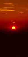
Last Spring Snow Trips?
Once the Spring Thaw gets going the rivers and creeks will rage, making fording very dangerous.
REPORT
Spring Gear
Time to begin stashing the full Winter Gear. We can start lightening up the gear depending on weather.
PCT-TYT-JMT
HIKERS
Time to Carefully Monitor
Travel & Fording
Conditions
SPRING THAW
RIVER INFORMATION
RESERVOIRS
HAZARDS
Tracking
SPRING THAW 2019
All Snow Information
|
30 APRIL
Clear, Warm
Bit Breezy, Nice
Transition
Spring Gear Kit
Lightening Hazard
Predictions & Forecasts
LAST MONTH
NEXT WEEK
TOP
Seven Day
Freezing Temperature Probability
SPRING THAW
RIVER INFORMATION
RESERVOIRS
HAZARDS
2018
ROAD NEWS
June Lake Loop Closed
This Week in 2017
Snow & Temps
LAST MONTH
NEXT WEEK |
1
Clear, Warm
Bit Breezy, Nice
May Day
May Day Note
2019
Current Snowpack:
Percent of Average for
May 1.
N Sierra: 144%
=0% in 2 days
Cen. Sierra: 147%
+2% in 2 days
S Sierra: 139%
-1% in 2 days
Ca State: 143%
=0% in 2 days
Last Reading
April 29
Next Reading
May 6
Statewide Summary of Snow Water Content PDF
Cal Coop Snow Survey
2017 Readings
April 1
April 20
May 2
2018
Snowpack
Percent of Average for
May 1
+/- change since
April 29
Ca State: 27%
(-10%)
2019
MAY 1
HIGH SIERRA
11th
--Spring--
Temp-Snow Check
Last Report:
April 28, 2019
Next Report:
May 7, 2019
Let's check our reporting station snow & temp readings after the last 2 nice, warm, & breezy days but still cooler days. under the persistent High that's built in.
Click the stations below for their latest reports.
Below: Watershed Snow Water Content Charts followed by individual reporting station's Snow Depth and
24 hour high-low temps.
A NEW WATER YEAR:
LAST YEAR
Total Precipitation
58 % of Average
A NEW WATER YEAR: Reservoirs
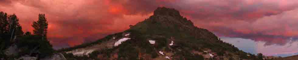
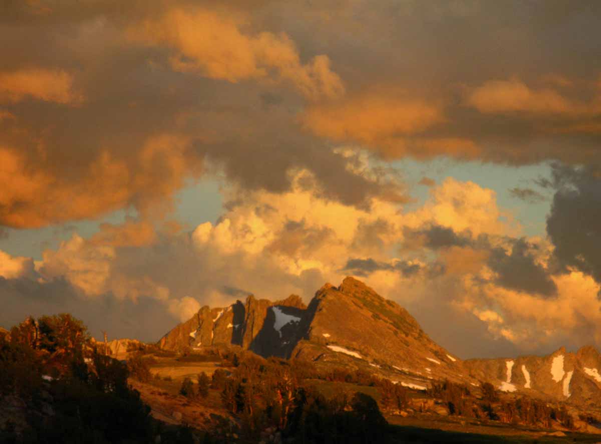
The Thaw: It's Coming
N Sierra Reporting Stations On a Map
Scroll over stations for snow & temps. Click for
full report.
South Sierra Stations
"+/- & ="
below are changes since last reading.
Tahoe Basin
Watershed
Southwest Tahoe
Trail Map with Stations
PCT-TYT-TRT
Rubicon
73" -4
7618 feet
Trail Map
(45.80 H2O) =0.0
45 & 29 −/−
PCT-TYT-TRT
Echo Peak
85" -6"
7652 feet
Stations Map
(63.30 H2O) +0.2
45 & 28 −/−
American-Yuba Watersheds
PCT-TYT
Carson Pass 74" -5
8388 feet
Trail Map
Stations Map
(44.90" H2O) =0.0
47 & 25 −/−
Carson-Walker
Watersheds
PCT-TYT
Ebbetts Pass
88" -6
8660 feet
Trail Map
(60.30 H2O) =0.0
46 & 21 −/−
EAST FLANK
Leavitt Lake
171" -4
9602 feet, East Flank
Trail Map
(63.60 H20) =0.0
41
& 20 −/−
EAST FLANK
Marine Base
Cold Weather Training
6748 feet East Flank
Trail Map Above
FULL REPORT
VIS-CHIL-WEA-MB-
WIND
68 & 38 −/+
Mokelumne-Stanislaus Watersheds
PCT-TYT
Sonora Pass
Kennedy Meadows
RESUPPLY
Deadman Creek
31.76" −1.8
9250 feet,West Flank,
Trail Map
(27.19" H20) -0.06"
43 & 19 −/−
Tuolumne-Merced
Watersheds
Tenaya Lake
68.60 −6.04"
8163 feet, West Flank
Trail Map
(18.26") H20 =0.0"
48
& 20 −/−
JMT-PCT-TYT
Tuolumne Meadows
42.28" −5.39"
8600 feet, West Flank
Trail Map
(6.47") H20 =0.00"
47
& 17 −/−
Tioga Pass/Dana
61.07" −3.68
9798 feet
Trail Map
13.53 H20 =0.00
43
& 15 −/−
Mammoth Mountain
Mono Lake-Owens Basin
East of PCT-JMT
Above Gem Lake
Gem Pass
151.00" −0.0 ERROR?
10750 feet
Trail Map
(00.00 H2O) −32.52 ??
temps bad
JMT-PCT Junction
Devils Postpile
47.80" −7.5
8004 feet
Trail Map Above
(0.0) =
48 & 27 −/−
NE of JMT-PCT
Mammoth Pass
121.15" Sno −5.5
9500 feet
Trail Map
38.72" H2O +2.72 ??
46 & 23 −/−
JMT-PCT
E of Bear Ridge
Volcanic Knob
75.20" −2.8"
10100 feet
Trail Map
(0.00)
47 & 12 −/−
East Flank
South Lake Cabin
(Snow removed ")
9580 feet, East Flank
Trail Map
(26.00 H2O) =0.00
50 & 18 −/−
East Flank
Big Pine Sawmill
41.80" Snow −3.6
10200 feet, East Flank
Trail Map Above
42 & 14 −/−
Kings River
Just East JMT-PCT
Bishop Pass
--.--
11972 feet
Trail Map Above
BAD- BAD
Just West JMT-PCT
Charlotte Lake
78.13" Snow −2.92
10398 feet, West Flank
Trail Map
54.10 H2O +0.57
39 & 14 −/−
(Typically the coldest station)
Kern Watershed
JMT-PCT
Upr Tyndall Creek
81.28" −0.89"
11441 feet
Trail Map
(x.xx" H2O +x.xx")
41 & 24 −/−
JMT
Crabtree Meadow
33.62" Snow −1"
10,700 feet
Trail Map
(22.43 H2O) +0.14
42
& 17 −/−
All High Sierra
Reporting Stations
More Stations, by Watersheds
|
2
Clear, Warm
Bit Breezy, Nice
THE
CURRENT SNOWPACK
Current Conditions
All Snow Information
GRAPHICS
Date-Adjustable Multi-Aspect
High Sierra
Snowpack Status
THE 1ST
NOAA-NOHRSC
SNOWPACK
The High Sierra
5-1-19
OBSERVATIONS
All
High Sierra
Reporting Stations
Temp & Snow Tables
by Watershed and Highway Corridor
2017
Current Snowpack
VAST
Percent of Average for
May 2.
N Sierra: 198%
Cen. Sierra: 201%
S Sierra: 178%
Ca State: 194%
Compare against previous years.
May 2019
Trail News |
3
Clear, Warm
Bit Breezy, Nice
Informative
"Normal" Vs. Now
Forcasts & Reality
vs.
Averages
Winds? Weather?
NorCal Graphics
SoCal & SW US
Precipitation
Quantitative Precipitation Forecasts:
RAIN FORECASTS
Let's look at the
Big Picture
The Pacific Ocean
Set this for 14 days
&
Display Loop Below
US Weather Map
All Maps
All
High Sierra Weather
And the factors creating it
2018
Highway 108
Open
May 3, 12:00 Noon
|
4
Clear, Warm
Bit Breezy, Nice
CHANGING
SMOKE OBSERVATION, INFORMATION, & RESOURCES
LAST MONTH
NEXT WEEK
TOP
2018
Highway 4
Open
May 4, 12:00 Noon
LAST MONTH
NEXT WEEK
TOP
LAST MONTH
NEXT WEEK
TOP
LAST MONTH
NEXT WEEK
TOP |
5
Rising Bluster
Bit Breezy, Cooling,
Weak Low Passing
LAST WEEK
NEXT WEEK
TOP
This Week in 2017
Snow & Temps
|
6
Blustery
Bit Breezy, Cool, Weak Low, Weak Showers
Showers Across Crest
2019
Current Snowpack:
Percent of Average for
May 6.
N Sierra: 143%
−1% in 6 days
Cen. Sierra: 143%
−4% in 6 days
S Sierra: 129%
−10% in 6 days
Ca State: 138%
−5% in 6 days
Last Reading
May 1
Next Reading
May 13
Statewide Summary of Snow Water Content PDF
Cal Coop Snow Survey
2017 Readings
April 1
April 20
May 2
May, 2017 Averages
May 15
June 15
BEST
FORECASTS
Precipitation
General
Quantitative Precipitation Forecasts:
ALL
RAIN FORECASTS
&
MODELS
Seven Day Precip
Animation
Precipitation
Geographic
All High Sierra
ZONE & POINT
FORECASTS
All High Sierra
ZONE
FORECASTS
GRAPHICAL INTERFACE
Forecast
Winds? Weather?
NorCal Graphics
Region, SW US
Forecast
Temperatures
Model
Five Day Mean
Low Temps
Click Green "Latest" Model,
observe using step button
All Temps
Let's look at the
Big Picture
Surface Map
The Pacific Ocean
US Weather Map
All Maps |
7
Clearing
Calm, Warming, Weak Low passed East.
2019
MAY 7
HIGH SIERRA
12th
--Spring--
Temp-Snow Check
Last Report:
May 1, 2019
Next Report:
May 11, 2019
Let's check our reporting station snow & temp readings after the last 2 cooler & breezy days with a weak Low passing by.
Click the stations below for their latest reports.
Below: Watershed Snow Water Content Charts followed by individual reporting station's Snow Depth and
24 hour high-low temps, and the change in snow depths since our last readings.
A NEW WATER YEAR:
LAST YEAR
Total Precipitation
58 % of Average
A NEW WATER YEAR: Reservoirs
The Thaw: It's Coming
N Sierra Reporting Stations On a Map
Scroll over stations for snow & temps. Click for
full report.
South Sierra Stations
"+/- & ="
below are changes since last reading.
Tahoe Basin
Watershed
Southwest Tahoe
Trail Map with Stations
PCT-TYT-TRT
Rubicon
65" -8
7618 feet
Trail Map
(46.10 H2O) +0.3
59 & 41 +/+
PCT-TYT-TRT
Echo Peak
71" -14"
7652 feet
Stations Map
(63.40 H2O) +0.1
57 & 40 +/+
American-Yuba Watersheds
PCT-TYT
Carson Pass 63" -11
8388 feet
Trail Map
Stations Map
(44.90" H2O) =0.0
55 & 33 +/+
Carson-Walker
Watersheds
PCT-TYT
Ebbetts Pass
78" -10
8660 feet
Trail Map
(60.30 H2O) =0.0
56 & 37 +/+
EAST FLANK
Leavitt Lake
158" −13
9602 feet, East Flank
Trail Map
(63.70 H20) +0.1
50
& 34 +/+
EAST FLANK
Marine Base
Cold Weather Training
6748 feet East Flank
Trail Map Above
FULL REPORT
VIS-CHIL-WEA-MB-
WIND
79 & 35 +/−
Mokelumne-Stanislaus Watersheds
PCT-TYT
Sonora Pass
Kennedy Meadows
RESUPPLY
Deadman Creek
25.19" −6.57
9250 feet,West Flank,
Trail Map
(27.19" H20) +0.11"
50 & 28 +/+
Tuolumne-Merced
Watersheds
Tenaya Lake
52.05 −16.55"
8163 feet, West Flank
Trail Map
(18.26") H20 +0.04"
56
& 30 +/+
JMT-PCT-TYT
Tuolumne Meadows
30.26" −12.02"
8600 feet, West Flank
Trail Map
(6.47") H20 =0.00"
53
& 27 +/+
Tioga Pass/Dana
51.93" −9.14
9798 feet
Trail Map
13.53 H20 =0.00
50
& 26 +/+
Mammoth Mountain
Mono Lake-Owens Basin
East of PCT-JMT
Above Gem Lake
Gem Pass
151.00" −0.0 ERROR?
10750 feet
Trail Map
(00.00 H2O) −32.52 ??
temps bad
JMT-PCT Junction
Devils Postpile
34.36" −13.44
8004 feet
Trail Map Above
(0.0) =
56 & 29 +/+
NE of JMT-PCT
Mammoth Pass
110.40" Sno −10.75
9500 feet
Trail Map
47.32" H2O +8.6 ??
56 & 31 +/+
JMT-PCT
E of Bear Ridge
Volcanic Knob
67.20" −8"
10100 feet
Trail Map
(0.00)
53 & 26 +/+
East Flank
South Lake Cabin
(Snow removed ")
9580 feet, East Flank
Trail Map
(26.00 H2O) =0.00
55 & 29 +/+
East Flank
Big Pine Sawmill
36.10" Snow −5.7
10200 feet, East Flank
Trail Map Above
48 & 25 +/+
Kings River
Just East JMT-PCT
Bishop Pass
--.--
11972 feet
Trail Map Above
BAD- BAD
Just West JMT-PCT
Charlotte Lake
68.64" Snow −9.49
10398 feet, West Flank
Trail Map
54.17 H2O +0.07
45 & 26 +/+
(Typically the coldest station)
Kern Watershed
JMT-PCT
Upr Tyndall Creek
74.55" −6.73"
11441 feet
Trail Map
(x.xx" H2O +x.xx")
47 & 28 +/+
JMT
Crabtree Meadow
28.66" Snow −4.96"
10,700 feet
Trail Map
(22.59 H2O) +0.16
44
& 26 +/+
All High Sierra
Reporting Stations
More Stations, by Watersheds
May 7, 2018
Snow Report
|
8
Calm Day
Calm, Weak Low off Coast
LAST WEEK
NEXT WEEK
THE
CURRENT SNOWPACK
Current Conditions
All Snow Information
GRAPHICS
Date-Adjustable Multi-Aspect
High Sierra
Snowpack Status
THE 7th
NOAA-NOHRSC
SNOWPACK
The High Sierra
5-7-19
OBSERVATIONS
All
High Sierra
Reporting Stations
Temp & Snow Tables
by Watershed and Highway Corridor
|
9
Weak Low
Approaching,
Crossing Today
Late Showers
Expected
Biased to S Sierra
May 2019
Trail News
SPRING THAW
RIVER INFORMATION
RESERVOIRS
HAZARDS
LAST WEEK
NEXT WEEK
TOP
BEST
FORECASTS
Precipitation
General
Quantitative Precipitation Forecasts:
ALL
RAIN FORECASTS
&
MODELS
Seven Day Precip
Animation
Precipitation
Geographic
All High Sierra
ZONE & POINT
FORECASTS
All High Sierra
ZONE
FORECASTS
GRAPHICAL INTERFACE
Forecast
Winds? Weather?
NorCal Graphics
Region, SW US
Forecast
Temperatures
Model
Five Day Mean
Low Temps
Click Green "Latest" Model,
observe using step button
All Temps
Let's look at the
Big Picture
Surface Map
The Pacific Ocean
US Weather Map
All Maps
LAST WEEK
NEXT WEEK
TOP |
10
Weak Low
Weak
Instability has returned, after an extended period of calm, warming weather.
Glacier Point Road
Opening, with Status of Higways 4, 108, & 120
Advisories
Lake Wind
Tahoe-Lake Wind
Reno NWS
Winter
South Sierra
SJ Valley NWS, Hanford
All
Sierra
Forecast Zones
KM OPEN
Report from
Kennedy Meadows
Alex
We’re open fully and fish have been stocked.
First pct hiker was here yesterday.
Lots of snow up high.
Expect snow and high runoff until mid July at higher elevations.
Highway should be open over pass by memorial weekend.
We’re stocked and ready for hikers.
Thanks, Matt
BIG NEWS
2017:
Summer "Opening" of Trails "Put-Off" until it happens.
Late July?
I mean clear trails across the High Passes. On the Crest Trails.
Maybe not at all this Summer.
|
11
Weak Low
Calm, Weak Low,
Weak precip
Showers
Anticipated
Biased to S Sierra
2019
MAY 11
HIGH SIERRA
13th
--Spring--
Temp-Snow Check
Last Report:
May 7, 2019
Next Report:
May 14, 2019
Let's check our reporting station snow & temp readings after the last 2 cooler & breezy days with a weak Low passing by.
Click the stations below for their latest reports.
Below: Watershed Snow Water Content Charts followed by individual reporting station's Snow Depth and
24 hour high-low temps, and the change in snow depths since our last readings.
A NEW WATER YEAR:
LAST YEAR
Total Precipitation
58 % of Average
A NEW WATER YEAR: Reservoirs
The Thaw: It's Coming
N Sierra Reporting Stations On a Map
Scroll over stations for snow & temps. Click for
full report.
South Sierra Stations
"+/- & ="
below are changes since last reading.
Tahoe Basin
Watershed
Southwest Tahoe
Trail Map with Stations
PCT-TYT-TRT
Rubicon
59" -6
7618 feet
Trail Map
(46.10 H2O) =0.0
58 & 41 -/=
PCT-TYT-TRT
Echo Peak
62" -9"
7652 feet
Stations Map
(63.20 H2O) −0.2
58 & 40 +/=
American-Yuba Watersheds
PCT-TYT
Carson Pass 56" -7
8388 feet
Trail Map
Stations Map
(44.90" H2O) =0.0
56 & 34 +/+
Carson-Walker
Watersheds
PCT-TYT
Ebbetts Pass
72" -6
8660 feet
Trail Map
(60.40 H2O) +0.1
56 & 35 =/−
EAST FLANK
Leavitt Lake
153" −5
9602 feet, East Flank
Trail Map
(63.70 H20) =0.0
50
& 35 =/+
EAST FLANK
Marine Base
Cold Weather Training
6748 feet East Flank
Trail Map Above
FULL REPORT
VIS-CHIL-WEA-MB-
WIND
70 & 39 −/+
Mokelumne-Stanislaus Watersheds
PCT-TYT
Sonora Pass
Kennedy Meadows
RESUPPLY
Deadman Creek
20.26" −4.93
9250 feet,West Flank,
Trail Map
(27.46" H20) +0.27"
51 & 32 +/+
Tuolumne-Merced
Watersheds
Tenaya Lake
43.56 −8.49"
8163 feet, West Flank
Trail Map
(18.61") H20 +0.35"
59
& 29 +/−
JMT-PCT-TYT
Tuolumne Meadows
21.44" −8.82"
8600 feet, West Flank
Trail Map
(6.59") H20 +0.12"
55
& 25 +/−
Tioga Pass/Dana
47.45" −4.48
9798 feet
Trail Map
13.89 H20 +0.36
48
& 27 −/+
Mammoth Mountain
Mono Lake-Owens Basin
East of PCT-JMT
Above Gem Lake
Gem Pass
151.00" −0.0 ERROR?
10750 feet
Trail Map
(31.43 H2O) +31.43 ??
temps bad
JMT-PCT Junction
Devils Postpile
27.79" −6.57
8004 feet
Trail Map Above
(0.0) =
60 & 27 +/−
NE of JMT-PCT
Mammoth Pass
105.17" Sno −5.23
9500 feet
Trail Map
52.44" H2O +5.12 ??
57 & 29 +/−
JMT-PCT
E of Bear Ridge
Volcanic Knob
62.50" −4.7"
10100 feet
Trail Map
(0.00)
51 & 23 −/−
East Flank
South Lake Cabin
(Snow removed ")
9580 feet, East Flank
Trail Map
(26.50 H2O) +0.50
60 & 28 +/−
East Flank
Big Pine Sawmill
44.80" Snow +8.7 ??
10200 feet, East Flank
Trail Map Above
46 & 26 −/+
Kings River
Just East JMT-PCT
Bishop Pass
--.--
11972 feet
Trail Map Above
BAD- BAD
Just West JMT-PCT
Charlotte Lake
69.53" Snow +0.89
10398 feet, West Flank
Trail Map
55.59 H2O +1.42 ???
43 & 29 −/+
(Typically the coldest station)
Kern Watershed
JMT-PCT
Upr Tyndall Creek
81.55" +7"
11441 feet
Trail Map
(x.xx" H2O +x.xx")
41 & 28 −/=
JMT
Crabtree Meadow
27.49" Snow −1.17"
10,700 feet
Trail Map
(23.20 H2O) +0.61
41
& 31 −/+
All High Sierra
Reporting Stations
More Stations, by Watersheds
|
12
Nice Day
Instability Cleared Early
Where are We At?
January to March 2019
National Temperature & Precipitation Rankings, 1895 to 2019.
NOAA Climate Monitoring.
LAST WEEK
NEXT WEEK
TOP
Past Snow & Temps
This Week in 2018
Snow & Temps
This Week in 2017
Snow & Temps
Past News
Review
the
May 2019
Trail News Forum
Review
the
May 2017
Trail News Forum |
13
Nice Day
2019
Current Snowpack:
Percent of Average for
May 13.
N Sierra: 130%
−12% in 7 days
Cen. Sierra: 133%
−10% in 7 days
S Sierra: 120%
−9% in 7 days
Ca State: 127%
−11% in 7 days
Last Reading
May 6
Statewide Summary of Snow Water Content PDF
Cal Coop Snow Survey
2017 Readings
April 1
April 20
May 2
May, 2017 Averages
May 15
June 15
|
14
Cloudy Day
Gulf Alaska Low dragging
Front along Ca Coast.
Weather West Analysis
WINTER STORM
WARNINGS
NORTH SIERRA
WARNING
247 PM PDT
Tue May 14 2019
"A strong, late season storm will bring significant snowfall accumulations to the higher elevations of the northern Sierra Nevada and Mt. Lassen area later this week. Expect travel delays
and possible chain controls if going through the higher passes of the northern Sierra Nevada. Once this storm exits the region late
Friday morning, another system is forecast to impact the mountains
over the weekend."
NWS SACTO
Carson Pass
Seven Day Forecast
SOUTH SIERRA
WARNING
NWS Hanford WARNING
Seven Day Forecast
Mono Hot Springs
What Up?
Informative
"Normal" Vs. Now
Forcasts & Reality
vs.
Averages
Weather Trends
2019
MAY 14
HIGH SIERRA
14th
--Spring--
Temp-Snow Check
Last Report:
May 11, 2019
Next Report:
May 17, 2019
Let's check our reporting station snow & temp readings after the last 3 days of mild instability, with the Front trailing the Low in Gulf Alaska due to cross the Sierra tomorrow.
Click the stations below for their latest reports.
Below: Watershed Snow Water Content Charts followed by individual reporting station's Snow Depth and
24 hour high-low temps, and the change in snow depths since our last readings.
A NEW WATER YEAR:
LAST YEAR
Total Precipitation
58 % of Average
A NEW WATER YEAR: Reservoirs
The Thaw: It's Coming
N Sierra Reporting Stations On a Map
Scroll over stations for snow & temps. Click for
full report.
South Sierra Stations
"+/- & ="
below are changes since last reading.
Tahoe Basin
Watershed
Southwest Tahoe
Trail Map with Stations
PCT-TYT-TRT
Rubicon
54" -5
7618 feet
Trail Map
(46.10 H2O) =0.0
57 & 42 −/+
PCT-TYT-TRT
Echo Peak
53" -9"
7652 feet
Stations Map
(63.30 H2O) +0.1
55 & 44 −/+
American-Yuba Watersheds
PCT-TYT
Carson Pass
49" -7
8388 feet
Trail Map
Stations Map
(44.90" H2O) =0.0
54 & 38 −/+
Carson-Walker
Watersheds
PCT-TYT
Ebbetts Pass
64" −8
8660 feet
Trail Map
(60.40 H2O) =0.0
52 & 39 −/+
EAST FLANK
Leavitt Lake
147" −6
9602 feet, East Flank
Trail Map
(63.70 H20) =0.0
48
& 39 −/+
EAST FLANK
Marine Base
Cold Weather Training
6748 feet East Flank
Trail Map Above
FULL REPORT
VIS-CHIL-WEA-MB-
WIND
86 & 40 +/+
Mokelumne-Stanislaus Watersheds
PCT-TYT
Sonora Pass
Kennedy Meadows
RESUPPLY
Deadman Creek
14.58" −5.68
9250 feet,West Flank,
Trail Map
(27.46" H20) −0.05"
50 & 32 −/=
Tuolumne-Merced
Watersheds
Tenaya Lake
35.40 −8.16"
8163 feet, West Flank
Trail Map
(18.61") H20 =0.00"
57
& 27 −/−
JMT-PCT-TYT
Tuolumne Meadows
12.95" −8.49"
8600 feet, West Flank
Trail Map
(6.59") H20 =0.00"
54
& 26 −/+
Tioga Pass/Dana
41.98" −5.47
9798 feet
Trail Map
13.89 H20 =0.00
51
& 26 +/−
Mammoth Mountain
Mono Lake-Owens Basin
East of PCT-JMT
Above Gem Lake
Gem Pass
151.00" −0.0 ERROR?
10750 feet
Trail Map
(00.00 H2O) -31.43 ??
temps bad
JMT-PCT Junction
Devils Postpile
18.71" −9.08
8004 feet
Trail Map Above
(0.0) =
58 & 28 −/+
NE of JMT-PCT
Mammoth Pass
99.08" Sno −6.09
9500 feet
Trail Map
52.44" H2O =0.00 ??
52 & 31 −/+
JMT-PCT
E of Bear Ridge
Volcanic Knob
58.70" −3.8"
10100 feet
Trail Map
(0.00)
54 & 27 +/+
East Flank
South Lake Cabin
(Snow removed ")
9580 feet, East Flank
Trail Map
(26.50 H2O) =0.00
60 & 32 =/+
East Flank
Big Pine Sawmill
36.70" Snow −8.1
10200 feet, East Flank
Trail Map Above
52 & 30 +/+
Kings River
Just East JMT-PCT
Bishop Pass
--.--
11972 feet
Trail Map Above
BAD- BAD
Just West JMT-PCT
Charlotte Lake
61.01" Snow −8.52
10398 feet, West Flank
Trail Map
55.79 H2O −0.20 ???
49 & 27 +/−
(Typically the coldest station)
Kern Watershed
JMT-PCT
Upr Tyndall Creek
76.26" −5.29"
11441 feet
Trail Map
(x.xx" H2O +x.xx")
50 & 31 +/+
JMT
Crabtree Meadow
24.17" Snow −3.32"
10,700 feet
Trail Map
(23.43 H2O) +0.23
51
& 28 +/−
All High Sierra
Reporting Stations
More Stations, by Watersheds
|
15
Stormy Day
Light to Moderate Precip
RADAR
Status
Sierra Highways
SPRING THAW
RIVER INFORMATION
RESERVOIRS
HAZARDS
HIGH SIERRA
Mosquito News
2017
Current Snowpack
VAST
Percent of Average for
May 1.
Ca State: 181%
% of April 1: 140%
Compare against previous years.
THE
CURRENT SNOWPACK
Current Conditions
All Snow Information
GRAPHICS
Date-Adjustable Multi-Aspect
High Sierra
Snowpack Status
THE 14th
NOAA-NOHRSC
SNOWPACK
The High Sierra
5-14-19
OBSERVATIONS
All
High Sierra
Reporting Stations
Temp & Snow Tables
by Watershed and Highway Corridor
|
16
Stormy Day
Light to Moderate Precip
High Temps on Crest
Non-Snow Precipitation
Maybe 2 inches snow since Yesterday
2019
Current Snowpack:
Percent of Average for
May 16.
N Sierra: 127%
−3% in 3 days
Cen. Sierra: 129%
−4% in 3 days
S Sierra: 117%
−3% in 3 days
Ca State: 123%
−4% in 3 days
Last Reading
May 13
Statewide Summary of Snow Water Content PDF
Cal Coop Snow Survey
Modis Satellite
Views
(Compare 2017, 18, & 19)
LAST WEEK
NEXT WEEK
TOP
|
17
Clearing Day
Snow Accumulated
Last Night
COLD
Hazard
WINTER STORM
WATCHES
Sacto-----Hanford
2019
Current Snowpack:
Percent of Average for
May 17.
N Sierra: 133%
+6% in 1 day
Cen. Sierra: 135%
+6% in 1 day
S Sierra: 121%
+4% in 1 day
Ca State: 129%
+6% in 1 day
Last Reading
May 16
Next Reading
May 20
2019
MAY 17
HIGH SIERRA
15th
--Spring--
Temp-Snow Check
Last Report:
May 14, 2019
Next Report:
May 19, 2019
Let's check our reporting station snow & temp readings after the last 2 days of light to moderate precip, clearing today, with a series of lows and fronts anticipated tomorrow, and through next week.
Click the stations below for their latest reports.
Below: Watershed Snow Water Content Charts followed by individual reporting station's Snow Depth and
24 hour high-low temps, noting the change in snow depths and temps since our last readings.
A NEW WATER YEAR:
LAST YEAR
Total Precipitation
58 % of Average
A NEW WATER YEAR: Reservoirs
The Thaw: It's Coming
N Sierra Reporting Stations On a Map
Scroll over stations for snow & temps. Click for
full report.
South Sierra Stations
"+/- & ="
below are changes since last reading.
Tahoe Basin
Watershed
Southwest Tahoe
Trail Map with Stations
PCT-TYT-TRT
Rubicon
54" =0
7618 feet
Trail Map
(47.10 H2O) +1.0
42 & 29 −/−
PCT-TYT-TRT
Echo Peak
55" +2"
7652 feet
Stations Map
(63.60 H2O) +0.3
37 & 27 −/−
American-Yuba Watersheds
PCT-TYT
Carson Pass
50"+1
8388 feet
Trail Map
Stations Map
(46.00" H2O) +1.1
41 & 26 −/−
Carson-Walker
Watersheds
PCT-TYT
Ebbetts Pass
68" +4
8660 feet
Trail Map
(62.10 H2O) +1.7
41 & 24 −/−
EAST FLANK
Leavitt Lake
160" +13
9602 feet, East Flank
Trail Map
(65.30 H20) +1.6
37
& 22 −/−
EAST FLANK
Marine Base
Cold Weather Training
6748 feet East Flank
Trail Map Above
FULL REPORT
VIS-CHIL-WEA-MB-
WIND
62 & 38 −/−
Mokelumne-Stanislaus Watersheds
PCT-TYT
Sonora Pass
Kennedy Meadows
RESUPPLY
Deadman Creek
15.03" +0.45
9250 feet,West Flank,
Trail Map
(28.17" H20) +0.71"
33 & 21 −/−
Tuolumne-Merced
Watersheds
Tenaya Lake
39.57 +4.17"
8163 feet, West Flank
Trail Map
(20.10") H20 +1.49 "
43
& 25 −/−
JMT-PCT-TYT
Tuolumne Meadows
13.06" +0.11"
8600 feet, West Flank
Trail Map
(7.52") H20 +0.93"
42
& 22 −/−
Tioga Pass/Dana
45.73" +3.75
9798 feet
Trail Map
13.95 H20 =0.06 ??
35
& 18 −/−
Mammoth Mountain
Mono Lake-Owens Basin
East of PCT-JMT
Above Gem Lake
Gem Pass
151.00" −0.0 ERROR?
10750 feet
Trail Map
(00.00 H2O) -31.43 ??
temps bad
JMT-PCT Junction
Devils Postpile
19.11" +0.4
8004 feet
Trail Map Above
(0.0) =
42 & 27 −/−
NE of JMT-PCT
Mammoth Pass
106.30" Sno +7.22
9500 feet
Trail Map
55.16" H2O +2.72 ??
41 & 21 −/−
JMT-PCT
E of Bear Ridge
Volcanic Knob
66.20" +7.5"
10100 feet
Trail Map
(0.00)
42 & 20 −/−
East Flank
South Lake Cabin
(Snow removed ")
9580 feet, East Flank
Trail Map
(26.70 H2O) +0.20
49 & 23 −/−
East Flank
Big Pine Sawmill
37.10" Snow +0.4
10200 feet, East Flank
Trail Map Above
38 & 20 −/−
Kings River
Just East JMT-PCT
Bishop Pass
--.--
11972 feet
Trail Map Above
BAD- BAD
Just West JMT-PCT
Charlotte Lake
64.01" Snow +3
10398 feet, West Flank
Trail Map
56.99 H2O +1.20
32 & 18 −/−
(Typically the coldest station)
Kern Watershed
JMT-PCT
Upr Tyndall Creek
79.04" +2.78"
11441 feet
Trail Map
(x.xx" H2O +x.xx")
30 & 15 −/−
JMT
Crabtree Meadow
24.91" Snow +0.74"
10,700 feet
Trail Map
(23.43 H2O) +0.38
37
& 13 −/−
All High Sierra
Reporting Stations
More Stations, by Watersheds
|
18
Stormy Day
Light to Moderate Precip
Late Evening Precip
FINALLY
Snowfall that's, "sticking,"
&
Accumulating
The Weather Page
NWS
High Sierra Hazard
WARNINGS
&
National Hazard Map
LAST WEEK
NEXT WEEK
TOP
Seven Day
Freezing Temperature Probability
Watch It!
California Web Cams
BEST
FORECASTS
Precipitation
General
Quantitative Precipitation Forecasts:
ALL
RAIN FORECASTS
&
MODELS
Direct to
Seven Day Precip
Animation
Precipitation
Geographic
All High Sierra
ZONE & POINT
FORECASTS
All High Sierra
ZONE
FORECASTS
Now
RADAR
GRAPHICAL INTERFACE
Forecast
Winds? Weather?
NorCal Graphics
Region, SW US
Forecast
Temperatures
Model
Five Day Mean
Low Temps
Click Green "Latest" Model,
observe using step button
All Temps
Let's look at the
Big Picture
Surface Map
The Pacific Ocean
US Weather Map
All Maps
LAST WEEK
NEXT WEEK
TOP
LAST WEEK
NEXT WEEK
TOP
|
19
Showers
Weak Low crossing N. Ca. Coast, its Forming Front
("Frontogenesis")
Along & Crossing Sierra,
Light to Moderate Precip
MAP
COLD
Hazard
WINTER STORM
WARNINGS
Sacto-----Hanford
North Sierra
Sacto Warning
"...Late Season Mountain Snow Today..."
South Sierra
Hanford Warning
"...Winter weather continues over the higher elevations of the
Sierra today..."
High & Low
FORECASTS
High Elevation
8600 Ft
Carson Pass Forecast
7 Days of Snow
Low Elevation
4000 Ft
Yosemite Valley Forecast
7 Days of Rain
2019
MAY 19
HIGH SIERRA
16th
--Spring--
Temp-Snow Check
Last Report:
May 17, 2019
Next Report:
May 23, 2019
Let's check our reporting station snow & temp readings after the last day of light to moderate precip, breaking up later today, with a series of lows and fronts anticipated through next week.
Click the stations below for their latest reports.
Below: Watershed Snow Water Content Charts followed by individual reporting station's Snow Depth and
24 hour high-low temps, noting the change in snow depths and temps since our last readings.
A NEW WATER YEAR:
LAST YEAR
Total Precipitation
58 % of Average
A NEW WATER YEAR: Reservoirs
The Thaw: It's Coming
N Sierra Reporting Stations On a Map
Scroll over stations for snow & temps. Click for
full report.
South Sierra Stations
"+/- & ="
below are changes since last reading.
Tahoe Basin
Watershed
Southwest Tahoe
Trail Map with Stations
PCT-TYT-TRT
Rubicon
53" -1
7618 feet
Trail Map
(47.50 H2O) +0.4
35 & 30 −/+
PCT-TYT-TRT
Echo Peak
59" +4"
7652 feet
Stations Map
(63.00 H2O) -0.6
34 & 29 −/+
American-Yuba Watersheds
PCT-TYT
Carson Pass
54"+4
8388 feet
Trail Map
Stations Map
(46.70" H2O) +0.7
35 & 27 −/+
Carson-Walker
Watersheds
PCT-TYT
Ebbetts Pass
74" +6
8660 feet
Trail Map
(62.80 H2O) +0.7
31 & 22 −/−
West of PCT
Highlands Meadow
14.2"
8360 feet
Trail Map
(47.52)
30 & 23
EAST FLANK
Leavitt Lake
173" +13
9602 feet, East Flank
Trail Map
(66.30 H20) +1.0
29
& 23 −/+
EAST FLANK
Marine Base
Cold Weather Training
6748 feet East Flank
Trail Map Above
FULL REPORT
VIS-CHIL-WEA-MB-
WIND
76 & 29 +/−
Mokelumne-Stanislaus Watersheds
PCT-TYT
Sonora Pass
Kennedy Meadows
RESUPPLY
Deadman Creek
19.04" +4.01
9250 feet,West Flank,
Trail Map
(28.50" H20) +0.33"
31 & 21 −/=
Tuolumne-Merced
Watersheds
SW of TYT
Horse Meadow
106"
8602 feet
Trail Map
(No H2O)
33 & 24
Tenaya Lake
45.60 +6.03"
8163 feet, West Flank
Trail Map
(20.40") H20 +0.30"
31
& 19 −/−
JMT-PCT-TYT
Tuolumne Meadows
12.49" −0.57"
8600 feet, West Flank
Trail Map
(7.83") H20 +0.31"
32
& 18 −/−
Tioga Pass/Dana
50.41" +4.68
9798 feet
Trail Map
14.00 H20 +0.05
27
& 13 −/−
Mammoth Mountain
Mono Lake-Owens Basin
East of PCT-JMT
Above Gem Lake
Gem Pass
151.00" −0.0 ERROR?
10750 feet
Trail Map
(00.00 H2O) =0.00 ??
temps bad
JMT-PCT Junction
Devils Postpile
26.39" +7.28
8004 feet
Trail Map Above
(0.0) =
32 & 26 −/−
NE of JMT-PCT
Mammoth Pass
119.01" Sno +12.71
9500 feet
Trail Map
56.48" H2O +1.32
30 & 20 −/−
JMT-PCT
E of Bear Ridge
Volcanic Knob
78.90" +12.7"
10100 feet
Trail Map
(0.00)
33 & 18 −/−
East Flank
South Lake Cabin
(Snow removed ")
9580 feet, East Flank
Trail Map
(26.10 H2O) +0.10
31 & 17 −/−
East Flank
Big Pine Sawmill
42.80" Snow +5.7
10200 feet, East Flank
Trail Map Above
27 & 16 −/−
Kings River
Just East JMT-PCT
Bishop Pass
--.--
11972 feet
Trail Map Above
BAD- BAD
Just West JMT-PCT
Charlotte Lake
74.45" Snow +10.44
10398 feet, West Flank
Trail Map
56.99 H2O +0.92
25 & 13 −/−
(Typically the coldest station)
Kern Watershed
JMT-PCT
Upr Tyndall Creek
84.57" +5.53"
11441 feet
Trail Map
(x.xx" H2O +x.xx")
25 & 11 −/−
JMT
Crabtree Meadow
29.30" Snow +4.39"
10,700 feet
Trail Map
(23.43 H2O) +0.44
27
& 9 −/−
All High Sierra
Reporting Stations
More Stations, by Watersheds |
20
Clear Spots
Sucker Hole between Lows & Their Fronts
2019
Current Snowpack:
Percent of Average for
May 20.
N Sierra: 149%
+16% in 3 days
Cen. Sierra: 155%
+20% in 3 days
S Sierra: 136%
+15% in 3 days
Ca State: 147%
+18% in 3 days
Last Reading
May 17
Statewide Summary of Snow Water Content PDF
Cal Coop Snow Survey
This Week in 2018
Snow & Temps
This Week in 2017
Snow & Temps
|
21
Stormy Day
Light to Moderate
Scattered
Precip
RADAR
Status
Sierra Highways
LAST WEEK
NEXT WEEK
TOP
SPRING THAW
RIVER INFORMATION
RESERVOIRS
HAZARDS
LAST WEEK
NEXT WEEK
TOP
|
22
Clearing
Big High building in
on West Coast
Low Over S Nevada
Light
Snow & Precip
Across Crest
thru
MONDAY
ALL
FORECAST ZONES
2019
Current Snowpack:
Percent of Average for
May 22.
N Sierra: 165%
+16% in 2 days
Cen. Sierra: 169%
+14% in 2 days
S Sierra: 146%
+10% in 2 days
Ca State: 159%
+12% in 2 days
Last Reading
May 20
Statewide Summary of Snow Water Content PDF
THE
CURRENT SNOWPACK
Current Conditions
All Snow Information
GRAPHICS
Date-Adjustable Multi-Aspect
High Sierra
Snowpack Status
THE 20th
NOAA-NOHRSC
SNOWPACK
The High Sierra
5-20-19
OBSERVATIONS
All
High Sierra
Reporting Stations
Temp & Snow Tables
by Watershed and Highway Corridor
|
23
Clearing Ca
Big High building in
on West Coast
Low Over NE Nevada
Light
Snow & Precip
Across Crest
thru
MEMORIAL DAY
2019
Current Snowpack:
Percent of Average for
May 23.
N Sierra: 172%
+7% in 1 day
Cen. Sierra: 174%
+5% in 1 day
S Sierra: 150%
+4% in 1 day
Ca State: 164%
+5% in 1 day
Last Reading
May 22
Next Reading
May 28
Statewide Summary of Snow Water Content PDF
2019
MAY 23
HIGH SIERRA
17th
--Spring--
Temp-Snow Check
Last Report:
May 19, 2019
Next Report:
May 27, 2019
Let's check our reporting station snow & temp readings after the last 3 days of light to moderate precip pushed Southwest across the Sierra from Lows, first on the point of S Nevada, and today, from a Low in the NE corner of Nevada
Click the stations below for their latest reports.
Below: Watershed Snow Water Content Charts followed by individual reporting station's Snow Depth and
24 hour high-low temps, noting the change in snow depths and temps since our last readings.
A NEW WATER YEAR:
LAST YEAR
Total Precipitation
58 % of Average
A NEW WATER YEAR: Reservoirs
The Thaw: It's Coming
N Sierra Reporting Stations On a Map
Scroll over stations for snow & temps. Click for
full report.
South Sierra Stations
"+/- & ="
below are changes since last reading.
Tahoe Basin
Watershed
Southwest Tahoe
Trail Map with Stations
PCT-TYT-TRT
Rubicon
56" +3
7618 feet
Trail Map
(48.30 H2O) +0.8
43 & 35 +/+
PCT-TYT-TRT
Echo Peak
57" −2"
7652 feet
Stations Map
(67.40 H2O) +4.4 ??
44 & 34 +/+
American-Yuba Watersheds
PCT-TYT
Carson Pass
53" −1
8388 feet
Trail Map
Stations Map
(47.70" H2O) +1.0
41 & 33 +/+
Carson-Walker
Watersheds
PCT-TYT
Ebbetts Pass
75" +1
8660 feet
Trail Map
(64.40 H2O) +1.6 ??
40 & 32 +/+
West of PCT
Highlands Meadow
19.36" +5.16
8360 feet
Trail Map
(48.52) +1.0
40 & 31 +/+
EAST FLANK
Leavitt Lake
168" −5
9602 feet, East Flank
Trail Map
(67.30 H20) +1.0
41
& 29 +/+
EAST FLANK
Marine Base
Cold Weather Training
6748 feet East Flank
Trail Map Above
FULL REPORT
VIS-CHIL-WEA-MB-
WIND
64 & 35 −/+
Mokelumne-Stanislaus Watersheds
PCT-TYT
Sonora Pass
Kennedy Meadows
RESUPPLY
Deadman Creek
18.70" −0.34
9250 feet,West Flank,
Trail Map
(29.70" H20) +1.20"
40 & 30 +/+
Tuolumne-Merced
Watersheds
SW of TYT
Horse Meadow
105.4" −.6
8602 feet
Trail Map
(No H2O)
41 & 28 +/+
Tenaya Lake
42.64 −2.96"
8163 feet, West Flank
Trail Map
(21.57") H20 +1.17"
42
& 32 +/+
JMT-PCT-TYT
Tuolumne Meadows
9.57" −2.92"
8600 feet, West Flank
Trail Map
(8.14") H20 +0.31"
42
& 30 +/+
Tioga Pass/Dana
48.83" −1.58
9798 feet
Trail Map
14.37 H20 +0.37
37
& 26 +/+
Mammoth Mountain
Mono Lake-Owens Basin
East of PCT-JMT
Above Gem Lake
Gem Pass
151.00" −0.0 ERROR?
10750 feet
Trail Map
(00.00 H2O) =0.00 ??
temps bad
JMT-PCT Junction
Devils Postpile
17.93" −8.46
8004 feet
Trail Map Above
(0.0) =
39 & 32 +/+
NE of JMT-PCT
Mammoth Pass
118.70" Sno −0.31
9500 feet
Trail Map
57.76" H2O +1.28
37 & 28 +/+
JMT-PCT
E of Bear Ridge
Volcanic Knob
80.60" +1.7"
10100 feet
Trail Map
(0.00)
38 & 25 +/+
East Flank
South Lake Cabin
(Snow removed ")
9580 feet, East Flank
Trail Map
(27.10 H2O) +1.00
45 & 26 +/+
East Flank
Big Pine Sawmill
43.70" Snow +0.9
10200 feet, East Flank
Trail Map Above
36 & 24 +/+
Kings River
Just East JMT-PCT
Bishop Pass
--.--
11972 feet
Trail Map Above
BAD- BAD
Just West JMT-PCT
Charlotte Lake
58.82" Snow −15.6"
10398 feet, West Flank
Trail Map
58.82 H2O +0.92
34 & 21 +/+
(Typically the coldest station)
Kern Watershed
JMT-PCT
Upr Tyndall Creek
82.84" −1.73"
11441 feet
Trail Map
(x.xx" H2O +x.xx")
37 & 19 +/+
JMT
Crabtree Meadow
25.40" Snow −3.9"
10,700 feet
Trail Map
(24.45 H2O) +1.02
37
& 17+/+
All High Sierra
Reporting Stations
More Stations, by Watersheds
|
24
Clear Sierra Early
Precip approaching N Sierra, persistant Weak
S Nevada Low
Weak
Snow & Precip
Across Crest
thru
MEMORIAL DAY
May 24 Report
TYT
Problems
Donnell Fire Aftermath
Stanislaus National Forest,
Carson Iceberg Wilderness
Closures
Resupply
Lake Alpine Opening
BEST
FORECASTS
Precipitation
General
Quantitative Precipitation Forecasts:
ALL
RAIN FORECASTS
&
MODELS
Direct to
Seven Day Precip
Animation
Precipitation
Geographic
All High Sierra
ZONE & POINT
FORECASTS
All High Sierra
ZONE
FORECASTS
Now
RADAR
Direct
to
GRAPHICAL INTERFACE
Forecast
Winds? Weather?
NorCal Graphics
Region, SW US
Forecast
Temperatures
Model
Five Day Mean
Low Temps
Click Green "Latest" Model,
observe using step button
All Temps
Let's look at the
Big Picture
Surface Map
The Pacific Ocean
US Weather Map
All Maps
|
25
Light Showers
WINTER WEATHER
ADVISORIES
Sacto-----Reno
Hanford
"Winter-like conditions despite
the late spring calendar date.
5 AM SUN TO 5 AM MON"
HAIL-LIGHTENING
FORECAST
ALL
FORECAST ZONES
LAST WEEK
NEXT WEEK
TOP
Review
the
May 2019
Trail News Forum
Review
the
May 2017
Trail News Forum
LAST WEEK
NEXT WEEK
TOP
LAST WEEK
NEXT WEEK
TOP |
26
Unstable
Light to Moderate
Scattered
Precip, Cool,
out of N & NE
LAST WEEK
NEXT MONTH
TOP
This Week in 2017
Snow & Temp
National Hazard Map
2016-17
High Sierra
Season Review |
27
MEMORIAL DAY
Unstable
Light to Moderate
Scattered
Precip, Cool,
out of N & NE
Persistant
Low Over S Nevada
ALL
FORECAST ZONES
COLD
Hazard
LOWER LOWS
2019
MAY 27
HIGH SIERRA
18th
--Spring--
Temp-Snow Check
Last Report:
May 23, 2019
Next Report:
May 30, 2019
Let's check our reporting station snow & temp readings after the last 4 days of light to moderate unstable weather-snow-mixed-precip.
Click the stations below for their latest reports.
Below: Watershed Snow Water Content Charts followed by individual reporting station's Snow Depth and
24 hour high-low temps, noting the change in snow depths and temps since our last readings.
A NEW WATER YEAR:
LAST YEAR
Total Precipitation
58 % of Average
A NEW WATER YEAR: Reservoirs
The Thaw: It's Coming
N Sierra Reporting Stations On a Map
Scroll over stations for snow & temps. Click for
full report.
South Sierra Stations
"+/- & ="
below are changes since last reading.
Tahoe Basin
Watershed
Southwest Tahoe
Trail Map with Stations
PCT-TYT-TRT
Rubicon
56" −5
7618 feet
Trail Map
(48.80 H2O) +0.5
44 & 30 +/−
PCT-TYT-TRT
Echo Peak
55" −2"
7652 feet
Stations Map
(67.90 H2O) +0.5
47 & 27 +/−
American-Yuba Watersheds
PCT-TYT
Carson Pass
52" −1
8388 feet
Trail Map
Stations Map
(48.40" H2O) +0.7
45 & 26 +/−
Carson-Walker
Watersheds
PCT-TYT
Ebbetts Pass
71" −4
8660 feet
Trail Map
(65.00 H2O) +0.6
44 & 25 +/−
West of PCT
Highlands Meadow
13.45" −5.91
8360 feet
Trail Map
(48.82) +0.3
41 & 18 +/−
EAST FLANK
Leavitt Lake
164" −4
9602 feet, East Flank
Trail Map
(67.70 H20) +0.4
42
& 23 +/−
EAST FLANK
Marine Base
Cold Weather Training
6748 feet East Flank
Trail Map Above
FULL REPORT
VIS-CHIL-WEA-MB-
WIND
61 & 36 −/+
Mokelumne-Stanislaus Watersheds
PCT-TYT
Sonora Pass
Kennedy Meadows
RESUPPLY
Deadman Creek
15.49" −3.21
9250 feet,West Flank,
Trail Map
(30.08" H20) +0.38"
43 & 16 +/−
Tuolumne-Merced
Watersheds
SW of TYT
Horse Meadow
109.10" +3.7
8602 feet
Trail Map
(No H2O)
49 & 15 +/+
Tenaya Lake
37.35 −5.29"
8163 feet, West Flank
Trail Map
(22.37") H20 +0.80"
44
& 19 +/−
JMT-PCT-TYT
Tuolumne Meadows
8.23" −1.34"
8600 feet, West Flank
Trail Map
(8.49") H20 +0.35"
45
& 17 +/−
Tioga Pass/Dana
45.64" −3.19
9798 feet
Trail Map
14.37 H20 +1.03 ??
42
& 12 +/−
Mammoth Mountain
Mono Lake-Owens Basin
East of PCT-JMT
Above Gem Lake
Gem Pass
151.00" −0.0 ERROR?
10750 feet
Trail Map
(00.00 H2O) =0.00 ??
temps bad
JMT-PCT Junction
Devils Postpile
16.01" −1.92
8004 feet
Trail Map Above
(0.0) =
44 & 23 +/−
NE of JMT-PCT
Mammoth Pass
112.64" Sno −6.06
9500 feet
Trail Map
58.80" H2O +1.04 ?
46 & 16 +/−
JMT-PCT
E of Bear Ridge
Volcanic Knob
72.40" −8.2"
10100 feet
Trail Map
(0.00)
46 & 12 +/−
East Flank
South Lake Cabin
(Snow removed ")
9580 feet, East Flank
Trail Map
(27.10 H2O) =0.00
52 & 20 +/−
East Flank
Big Pine Sawmill
37.60" Snow −6.1
10200 feet, East Flank
Trail Map Above
40 & 16 +/−
Kings River
Just East JMT-PCT
Bishop Pass
--.--
11972 feet
Trail Map Above
BAD- BAD
Just West JMT-PCT
Charlotte Lake
65.11" Snow +6.29
10398 feet, West Flank
Trail Map
59.26 H2O +0.44
38 & 12 +/−
(Typically the coldest station)
Kern Watershed
JMT-PCT
Upr Tyndall Creek
80.82" −2.02"
11441 feet
Trail Map
(x.xx" H2O +x.xx")
39 & 16 +/−
JMT
Crabtree Meadow
22.43" Snow −2.97"
10,700 feet
Trail Map
(24.50 H2O) +0.05
40
& 16+/−
All High Sierra
Reporting Stations
More Stations, by Watersheds
|
28
Unstable-Clearing
Lighter to Moderate
Scattered
Precip & Clear
out of N & NE
Persistant
Low Over S Nevada
May 28 Report
2019
Current Snowpack:
Percent of Average for
May 28.
N Sierra: 203%
+31% in 5 days
Cen. Sierra: 203%
+29% in 5 days
S Sierra: 173%
+23% in 5 days
Ca State: 191%
+37% in 5 days
Last Reading
May 23
Statewide Summary of Snow Water Content PDF
THE
CURRENT SNOWPACK
Current Conditions
All Snow Information
GRAPHICS
Date-Adjustable Multi-Aspect
High Sierra
Snowpack Status
THE 27th
NOAA-NOHRSC
SNOWPACK
The High Sierra
5-27-19
OBSERVATIONS
All
High Sierra
Reporting Stations
Temp & Snow Tables
by Watershed and Highway Corridor
LAST WEEK
NEXT MONTH
TOP
|
29
Unstable-Clearing
WARMING
Lighter to Moderate
Scattered
Precip & Clear
out of N & NE
Persistant
Low Over S Nevada
High Sierra
Weather Page
SPRING THAW
RIVER INFORMATION
RESERVOIRS
HAZARDS
What Up?
Informative
"Normal" Vs. Now
Forcasts & Reality
vs.
Averages
|
30
Unstable-Clearing
WARMING
Lighter to Moderate
Scattered
Precip & Clear
out of N & NE
Persistant
Low Over S Nevada
Rapid Thaw Underway
2019
Current Snowpack:
Percent of Average for
May 30.
N Sierra: 212%
+9% in 2 days
Cen. Sierra: 211%
+8% in 2 days
S Sierra: 178%
+5% in 2 days
Ca State: 196%
+5% in 2 days
Last Reading
May 28
Next Reading
June 3
Statewide Summary of Snow Water Content PDF
2019
MAY 30
HIGH SIERRA
19th
--Spring--
Temp-Snow Check
Last Report:
May 27, 2019
Next Report:
June 2, 2019
Let's check our reporting station snow & temp readings after the last 2 days of light, unstable weather-snow-mixed-precip.
Click the stations below for their latest reports.
Below: Watershed Snow Water Content Charts followed by individual reporting station's Snow Depth and
24 hour high-low temps, noting the change in snow depths and temps since our last readings.
A NEW WATER YEAR:
LAST YEAR
Total Precipitation
58 % of Average
A NEW WATER YEAR: Reservoirs
The Thaw: It's Coming
N Sierra Reporting Stations On a Map
Scroll over stations for snow & temps. Click for
full report.
South Sierra Stations
"+/- & ="
below are changes since last reading.
Tahoe Basin
Watershed
Southwest Tahoe
Trail Map with Stations
PCT-TYT-TRT
Rubicon
44" −12
7618 feet
Trail Map
(48.90 H2O) +0.1
54 & 39 +/+
PCT-TYT-TRT
Echo Peak
47" −8"
7652 feet
Stations Map
(68.30 H2O) +0.4
55 & 40 +/+
American-Yuba Watersheds
PCT-TYT
Carson Pass
46" −6
8388 feet
Trail Map
Stations Map
(48.70" H2O) +0.3
55 & 33 +/+
Carson-Walker
Watersheds
PCT-TYT
Ebbetts Pass
66" −5
8660 feet
Trail Map
(65.20 H2O) +0.2
52 & 37 +/+
West of PCT
Highlands Meadow
6.46" −6.99
8360 feet
Trail Map
(49.34) +0.52
48 & 31 +/+
EAST FLANK
Leavitt Lake
157" −7
9602 feet, East Flank
Trail Map
(67.70 H20) +0.4
52
& 37 +/+
EAST FLANK
Marine Base
Cold Weather Training
6748 feet East Flank
Trail Map Above
FULL REPORT
VIS-CHIL-WEA-MB-
WIND
82 & 37+/+
Mokelumne-Stanislaus Watersheds
PCT-TYT
Sonora Pass
Kennedy Meadows
RESUPPLY
Deadman Creek
10.75" −4.74
9250 feet,West Flank,
Trail Map
(30.25" H20) +0.17"
52 & 28 +/+
Tuolumne-Merced
Watersheds
SW of TYT
Horse Meadow
114.40" +5.3
8602 feet
Trail Map
(No H2O)
52 & 25 +/+
Tenaya Lake
29.52 −7.83"
8163 feet, West Flank
Trail Map
(22.37") H20 =0.00"
55
& 28 +/+
JMT-PCT-TYT
Tuolumne Meadows
0.11" −8.12"
8600 feet, West Flank
Trail Map
(8.49") H20 =0.00"
56
& 26 +/+
Tioga Pass/Dana
40.23" −5.41
9798 feet
Trail Map
15.41 H20 +1.04 ??
49
& 25 +/+
Mammoth Mountain
Mono Lake-Owens Basin
East of PCT-JMT
Above Gem Lake
Gem Pass
151.00" −0.0 ERROR?
10750 feet
Trail Map
(00.00 H2O) =0.00 ??
temps bad
JMT-PCT Junction
Devils Postpile
7.07" −8.94
8004 feet
Trail Map Above
(0.0) =
56 & 29 +/+
NE of JMT-PCT
Mammoth Pass
105.98" Sno −6.66
9500 feet
Trail Map
58.84" H2O +0.04
53 & 31 +/+
JMT-PCT
E of Bear Ridge
Volcanic Knob
67.20" −5.2"
10100 feet
Trail Map
(0.00)
54 & 24 +/+
East Flank
South Lake Cabin
(Snow removed ")
9580 feet, East Flank
Trail Map
(27.10 H2O) =0.00
56 & 29 +/+
East Flank
Big Pine Sawmill
35.10" Snow −2.5
10200 feet, East Flank
Trail Map Above
47 & 27 +/+
Kings River
Just East JMT-PCT
Bishop Pass
--.--
11972 feet
Trail Map Above
BAD- BAD
Just West JMT-PCT
Charlotte Lake
61.35" Snow −3.76
10398 feet, West Flank
Trail Map
59.63 H2O +0.37
48 & 24 +/+
(Typically the coldest station)
Kern Watershed
JMT-PCT
Upr Tyndall Creek
78.57" −2.25"
11441 feet
Trail Map
(x.xx" H2O +x.xx")
49 & 27 +/+
JMT
Crabtree Meadow
19.71" Snow −2.72"
10,700 feet
Trail Map
(24.73 H2O) +0.23
48
& 26 +/+
All High Sierra
Reporting Stations
More Stations, by Watersheds
|
31
Unstable-Clearing
WARMING
Light to Moderate
Scattered
Precip & Clear
out of NE & E
Persistant
Low Over S Nevada
Thunderstorms
Rapid Thaw Underway
Mosquito News
Mosquito Defense
BEST
FORECASTS
Precipitation
General
Quantitative Precipitation Forecasts:
ALL
RAIN FORECASTS
&
MODELS
Direct to
Seven Day Precip
Animation
Precipitation
Geographic
All High Sierra
ZONE & POINT
FORECASTS
All High Sierra
ZONE
FORECASTS
Now
RADAR
Direct
to
GRAPHICAL INTERFACE
Forecast
Winds? Weather?
NorCal Graphics
Region, SW US
Forecast
Temperatures
Model
Five Day Mean
Low Temps
Click Green "Latest" Model,
observe using step button
All Temps
Let's look at the
Big Picture
Surface Map
The Pacific Ocean
US Weather Map
All Maps
|
1 JUNE
Unstable-Clearing
WARMING-SHOWERS
Light
Scattered
Precip & Clear
out of NE & E
Persistant
Low Over S Nevada
Thunderstorms
Rapid Thaw Underway
LAST WEEK
NEXT MONTH
TOP
LAST WEEK
NEXT MONTH
TOP
LAST WEEK
NEXT MONTH
TOP
|