
Backpacking
Ebbetts Pass to Sonora Pass
on the
Pacific Crest Trail
Hiking
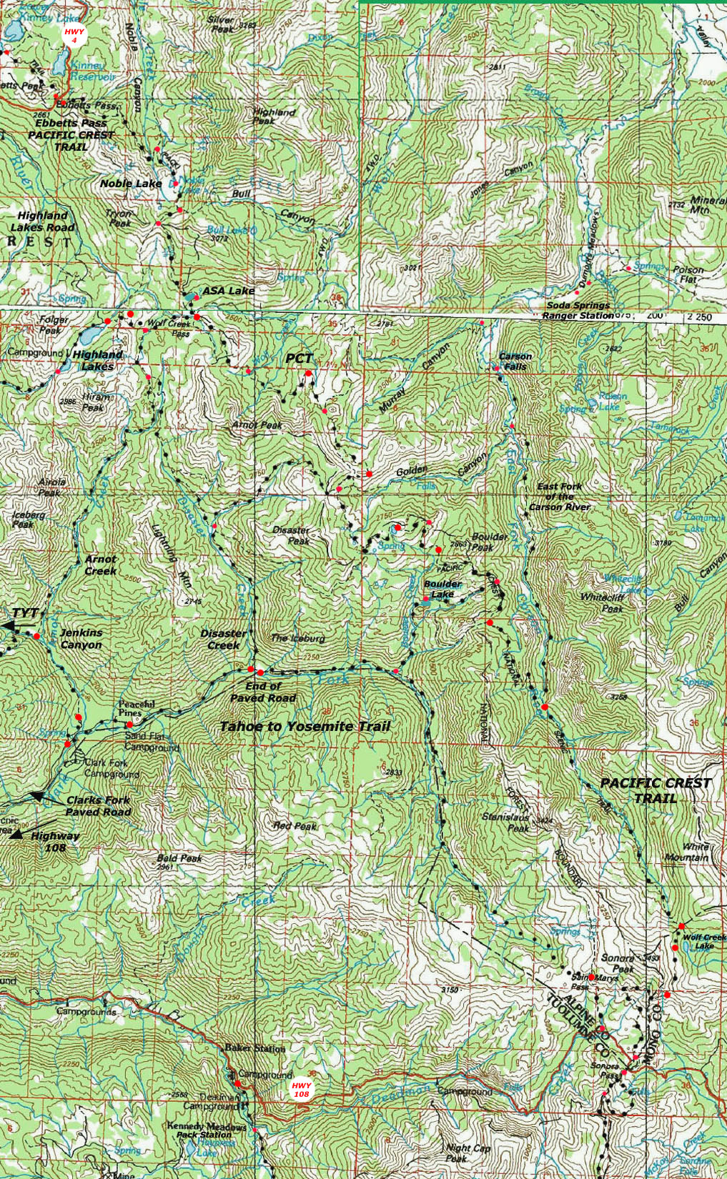
The Pacific Crest Trail showing Regional Context with the Tahoe to Yosemite Trail
30 minute USGS Backpacking Map
| PCT Maps and Mileages |
Trail Guide | Tahoe to Whitney Indexes | More Miles and Elevations |
7.5 Map Series | Weather, Map Data | |||||||||||||||||||
Map |
Miles and Elevations Ebbetts Pass to Sonora Pass |
NORTH |
SOUTH 30 min map Sonora Pass to Bensen Lake |
Carson Iceberg Region Map | Carson Pass to Yosemite Region Map |
Section Index Ebbetts Pass to Sonora Pass |
Page Ebbetts Pass |
Trail Guide Index Tahoe to Whitney |
All Miles Tahoe to Whitney |
Maps Hwy 4 to Hwy 108 |
All Maps Tahoe to Whitney |
PCT North Carson Pass to Ebbetts Pass |
Ebbetts Pass to Sonora Pass |
PCT South Sonora Pass to Tuolumne Meadows |
The Highland Creek Trail | Toiyabe National Forest | Resupply Points: Lake Alpine -&- Kennedy Meadows |
|||||||
Backpacking topo map
29.44 miles
on the
Pacific Crest Trail
through the
Carson-Iceberg Wilderness
between
Ebbetts and Sonora Passes
West of this Topo map:
PCT to the TYT
via
Highland Lakes
NEW
Carson Iceberg Wilderness Regional Hiking Map
North PCT: Carson Pass to Ebbetts Pass Toiyabe and Stanislaus National Forests Click RED & BLACK DOTS South PCT: Sonora Pass to Bensen Lake
|
Pacific Crest Trail topo hiking map North: Carson Pass to Ebbetts Pass Pacific Crest Trail topo hiking map South: Sonora Pass to Bensen Lake
Western Edge of the Carson-Iceberg Wilderness showing the Highland Creek connector to the Tahoe to Yosemite Trail to Lake Alpine
Ebbetts Pass |
|
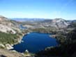
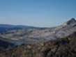
Main Features Over the years I've come to weave together my favorite parts of the PCT and TYT. Summit City Creek South of Carson Pass is one favorite section on the Tahoe to Yosemite Trail. The upper section of the East Fork of the Carson River on the Pacific Crest Trail is another of my favorite sections. The Highland Creek Trail allows me to connect these two sections together, so I can walk through both during one Tahoe to Yosemite or Tahoe to Whitney backpacking trip. More fun than time... The Pacific Crest and Tahoe to Yosemite routes are also linked together by Arnot Creek, Disaster Creek, and Boulder Creek between Highway 4 and Highway 108. Check out my report on a Fall Trip making a loop of through the Carson-Iceberg Wilderness. These connecting trails allowed us to use elements of the Tahoe to Yosemite heading South from Lake Alpine, then cut up to the Pacific Crest Trail to follow it's route North to end the backpacking trip at Ebbetts Pass. Though the Pacific Crest and Tahoe to Yosemite trails are taking quite different routes South from Highway 4 down to Highway 108, their routes virtually converge on Highway 108. Starting 15 miles distant from each other on Highway 4, the TYT trailhead at Saint Marys Pass and PCT trailhead at Sonora Pass are less than a mile apart on Highway 108. The fact that these trails convergence as they head South is complimented by the series of trails connecting them with each other. This allows you to craft a whole series of custom medium to long distance trips within the Carson Iceberg Wilderness sewing together sections of the classic Tahoe to Yosemite and Pacific Crest Trail routes. Click the red dots on the Pacific Crest Trail route to see the trail guide page for that location.
MAP NOTE What's important for our general reference purpose is that each side of a square is 1000 meters, or a Kilometer. |
HIGHWAY 108 CORRIDOR ROAD MAP Sonora Pass (PCT) and Clarks Fork Road and Saint Marys Pass (TYT) This is a road map for highway access to the trailheads on the South end of the trail map above. Centered On
|
Mapping, Mileage, and National Forest Permit Information |
|
Miles and ElevationsEbbetts Pass to Sonora Pass Ebbetts Pass to Sonora Pass
Meeks Bay to Sonora PassMeeks Bay to Echo Summit Carson Pass to Ebbetts Pass Ebbetts Pass to Sonora Pass Total, Meeks Bay to Sonora Pass
Ebbetts Pass to Sonora Pass Backpacking permits Federal Websites Toiyabe National Forest websiteHome Page Toiyabe National Forest Wilderness Area: Carson Iceberg Permits: Carson Ranger District Physical location: On the East side of the Sierra Crest between Highway 4 and Highway 108 Stanislaus National Forest website Home Page Stanislaus National Forest Wilderness Area: Carson-Iceberg Permits: Calavaras Ranger District... You're better off calling the office...(209) 795-1381 for permits. They are great people up there, so just press the option to speak to a real person and they will hook you up. Physical location: On the West side of the Sierra Crest between Highway 4 and Highway 108 |
MapsMap Names Bridgeport Calif-Nev, 1985, 30x60 minute Topographic Compass Offset scale Contours
Backpacking permitsThe Carson Ranger District of the Toiyabe National Forest administers the Pacific Crest Trail between Ebbetts Pass and Sonora Pass. The Carson Ranger District administers the whole Eastern section of the Carson-Iceberg Wilderness. The Western section of the Carson-Iceberg is administered by the Stanislaus National Forest. The Western Carson-Iceberg mainly concerns Tahoe to Yosemite Trail hikers. The Northwest and Southwest sections of the Carson-Iceberg Wilderness are split between two Stanislaus NF Ranger Districts, the Calavaras and Summit Ranger Districts, respectively. Tahoe to Whitney Trail Guide Eastern Sierra Nevada All Eastern Carson-Iceberg
Western Sierra Nevada Contact Information Northwest Carson-Iceberg Southwest Carson-Iceberg |
Next topo map South: Sonora Pass to Bensen Lake Next topo map North: Ebbetts Pass to Carson Pass
| Elevations | More Information | ||
Ebbetts Pass
Sonora Pass |
Trail Guide Trail Guide Google Maps |
||
Map Credit |
U.S. Geological Survey, Department of the Interior Move the Map to the Sierras. Select size of Maps you wish to locate. Click "Mark Point" on map to see the USGS map grid of the selected map scale. USGS Topographic |