High Sierra
Backpacking
Trail Guide
Guide Index
Forums
Sierra
Weather
Northern
Sierra Weather
Gear
Languages
Trail Skills
Mountain
Safety
Food
Planning
Trail Arts
More
Information
Social
Lake Tahoe to Mount Whitney
High Sierra Trail Guide
| Tahoe to Yosemite Trail North Sierra |
Pacific Crest Trail Tahoe to Whitney |
John Muir Trail Central & South Sierra |
Lake Tahoe Basin
TYT & PCT
Lake Tahoe Basin Management Unit
North Sierra TYT & PCT Two Distinct Routes Unmaintained TYT
North Sierra TYT & PCT Two Distinct Routes Unmaintained TYT
|
Emigrant Wilderness
&
The
North
Yosemite Backcountry
TYT & PCT
Stanislaus
TYT & PCT |
|
Center
of the
Sierra Nevada?
Hub OF Trails
TYT-PCT-JMT
|
Central
Sierra Nevada
JMT
| The Golden Triangle Exploring the Heart of Yosemite
|
South Sierra
JMT-PCT
South on the Classic Trails
South Sierra
South Sierra JMT-PCT
|
June 2017 This trail guide is under construction. Trail guide content has been completed from the Lake Tahoe Basin to Tuolumne Meadows in FINAL DRAFT status. The Indexes and Maps have been extended South to the Whitney Portal This North Sierra draft guide, indexes, and topics are being edited up to finish form before beginning the South Sierra content of the trail guide. Except for the South Sierra Maps. I've laid out the draft Recent Work Completed before resuming Guide Construction: High Sierra News See the |
Index
| Trail Guide of the Desolation Wilderness |
|||||||||||||||||||
The
|
|||||||||||||||||||
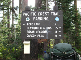
| TRAILS INDEX Meeks Bay Trailhead to the Carson Gap The PCT & TYT around the Tahoe Basin |
TAHOE BASIN TRAILHEAD OPTIONS 3 Representative Lake Tahoe Trailhead Options |
Hiking the Tahoe to Whitney Trails
INTRODUCTION
Getting Started
Tahoe Basin Trailheads
on the
Guide
The Tahoe to Yosemite Trail Trailhead at Meeks Bay, the Echo Summit Trailhead on Highway 50, and the Meiss Country Trailheads described in the Lake Tahoe Basin only represent a small number of the wide variety of trailheads we can use to launch our Tahoe to Whitney backpacking trip out of the Lake Tahoe Basin.
We can start anywhere along the Tahoe Rim Trail (TRT org map) and hook up with the Southbound Pacific Crest and Tahoe to Yosemite Trails. The North end of our trail guide's coverage begins here in the North end of the Desolation Wilderness (guide map) continuing South to wrap around the Meiss Country Roadless Area (guide map) on our way to the Whitney Portal.
Hiking out the South end of the Tahoe Basin ends this first stage of our hike in and around the highly developed and well-trafficked Tahoe Basin Trails. Things quiet down significantly once we cross Highway 88 and hike South of Carson Pass.
Map Use
Click the red and black dots on the large-scale trail guide maps for guide pages and detailed maps, respectively. The red dots on all Tahoe to Whitney trail guide maps link to the guide page for that location.
Tahoe to Whitney Trails
| North Sierra PCT-TYT |
South Sierra PCT-JMT |
Section Hiking Tahoe to Whitney |
The Point of All This
Our goal is to get you out to explore the length of, and become familiar with the Sierra Nevada Mountain Range by hiking the Sierra Crest trails from Lake Tahoe to Mount Whitney. Preferably in one shot, after getting your fitness, gear, and skills up to speed.
Evolving our fitness, gear, and skills will take a series of prep trips for beginners and returning backpackers, to work out fitness and gear issues, and begin developing the skills, experience, and durability necessary.
South from Tahoe
I consider Lake Tahoe and Mount Whitney to be the high altitude "bookends" of the Sierra Nevada Mountain Range. North of Tahoe the geology of the Sierra changes and the altitude recedes. The Sierra is much older North of the Tahoe Basin.
This guide begins hiking South through the Meeks Bay Trailhead of the Tahoe to Yosemite Trail.
The Whitney Portal
Far to our South Mount Whitney is the tallest mountain in the continental United States, it marks the end of the John Muir Trail, and it is the point where I traditionally turn East out of the South Sierra. The Mount Whitney Portal is the end point of this Tahoe to Whitney trail guide.
The Holy Grail
is the
The Crestline Trail
Independent of where we begin or end our backpacking trip, "Tahoe to Whitney" is a hiking ideal representing the goal of hiking the entirety of the Sierra Nevada Crestline. The specific start and end points of can be modified to suit your own notions of the "ideal" High Sierra adventure.
This thing is big, and your route through it will be unique.
Take a Hike
Come walk with me across the following pages exploring the high altitude trails South along the High Sierra Crestline from Tahoe to Whitney. I'm going to tell you everything I know and show you what I see. We're going to check out the main high altitude trails down the Sierra Crestline, the trails that connect them together, and the trails that connect our high trails to key Eastern and Western flank trailhead access.
Scope & Scale
To better understand and conceptualize the trails and terrain between Lake Tahoe and Mount Whitney we've generated this trail guide, created comprehensive sets of maps at large and small scales, calculated the mileages between key points down the trails, cited the elevations and elevation changes, and taken thousands of images and videos depicting these amazing trails and the surrounding terrain.
Backpacking Background
In addition to this fundamental trail guide information
we're also exploring all the backpacking topics necessary to get and keep us on the trail. These topics cover vital issues such as fitness, gear, health, diet, weather, trail skills, resupply, navigation and map reading, among other necessary backpacking (life) skills.
Beyond these necessary topics we investigate all the history, geology, biology, trail culture, artistic expressions and scientific investigations we can find.
We are not just looking for all the practical and technical information necessary to build a successful backpacking trip, but we are also looking for all the human skills and experiences we need to find or develop in ourselves to properly use this information.
The final piece of information in this backpacking puzzle is gaining some understanding of and engagement with the web of life around us.
We're looking for all the reflections of High Sierra experience we can find in man and nature.
Quick Facts The Tahoe Basin |
||
Lake Tahoe Basin Backpacking
Desolation Wilderness Hiking Map
Meiss Country Roadless Area Map
Lake Tahoe to Highway 4
|
Planning Our Backpacking Trip Tahoe to Yosemite Trail Information
Tahoe to Whitney
South Lake Tahoe Side Trips/Short Loops Everywhere! |
|
| Car Camping the High Sierra | ||
Introduction to Tahoe to Whitney
The Basic Outline and Options
Route Options
The TYT and PCT in the North Sierra
This trail guide begins our long backpacking trip South by locating, then stepping through the Tahoe to Yosemite Trail's Meeks Bay Trailhead. This is the Northernmost point of this trail guide.
11.5 miles Southwest of the Meeks Bay Trailhead our TYT route intersects with the Southbound Pacific Crest and Tahoe Rim Trails in the Northern Desolation Wilderness. This is our Northernmost coverage of the PCT-TRT.
The logistical part of this guide begins with figuring out our hiking plan and the resupply strategy necessary to support it.
The Classics
The TYT and PCT are two classic long distance backpacking trails that give us two distinctly different backpacking experiences hiking South across the North Sierra to Tuolumne Meadows. Well, they will be distinctly different experiences once we get beyond their shared route around the Southwestern corner of the Lake Tahoe Basin.
The PCT and TYT draw together again shortly after each enters the Northern Yosemite Backcountry, for their final fifty miles South to Tuolumne Meadows, after their distinct routes across the Mokelumne, Carson Iceberg, and Emigrant Wilderness Areas.
We will investigate both of the convergence of the TYT & PCT routes around the Lake Tahoe Basin, their divergence across the Mokelumne, Carson Iceberg, and Emigrant Wilderness Areas, and their reunion for the hike South across the North Yosemite Backcountry to Tuolumne Meadows.
Though the TYT and PCT are distinctly different routes, they begin and end their North Sierra adventures together. Well, they share the trail through the Tahoe Basin after the TYT's initial 11.5 miles hiking out from to the PCT from its Meeks Bay Trailhead.
South of the TYT-PCT-TRT junction the TYT and PCT share the route across the remaining 29.82 miles of our hike around the Southwest Tahoe Basin through Desolation Wilderness and the Meiss Country Roadless Area.
After sharing their route around the Tahoe Basin the PCT and TYT split East and West at their point of departure from the South end of the Tahoe Basin
through the Carson Gap.
South of the Carson Gap the TRT and PCT follow very different routes South across the Mokelumne, Carson Iceberg, and Emigrant Wilderness before finally rejoining in the very Northwestern corner of Yosemite National Park.
The TYT and PCT cover distinctly different routes with very different characters and conditions between their separation point on the South end of the Tahoe Basin and their reunion point in the North Yosemite Backcountry, as we will see.
The PCT and JMT
in the
South Sierra
Though the Tahoe to Yosemite Trail ends with our arrival at Tuolumne Meadows, it is replaced as an associated-alternative route to the PCT across the South Sierra by the John Muir Trail. The JMT accompanies the Southbound PCT from Tuolumne Meadows down the South Sierra Nevada Crestline to where our JMT route distinguishes itself by turning East to climb Mount Whitney.
Sole Divergence
The only place the JMT & PCT diverge is the run from Thousand Island Lake to Reds Meadow (JMT) or Agnew Meadow (PCT). I strongly suggest all hikers select the JMT option through here. The JMT visits a series of beautiful lakes in granite gorges and pockets on the West side of the canyon, while the PCT traverses the exposed, fairly boring Eastern side.
Nonetheless, we have a nice series of alternative routes and side-trip scrambles to explore along the combined route of the JMT-PCT through the South Sierra.
Tuolumne Meadows
Us Tahoe to Yosemite and Tahoe to Whitney hikers encounter the John Muir Trail where it has climbed up to the Sierra Crestline to join the PCT at Tuolumne Meadows from its Happy Isles Trailhead in Yosemite Valley.
South of Tuolumne Meadows the JMT and PCT run together for the vast majority of our hike South to Mount Whitney, where this trail guide ends with the JMT through the Whitney Portal.
Unlike the very different characters and divergent routes of the PCT and TYT across the North Sierra, the PCT and JMT share the vast majority of the trail South from Tuolumne Meadows down to Crabtree Meadow.
Crabtree Meadow is where the JMT turns East from the PCT for the climb over Mount Whitney.
The nine mile hike from the Southeastern shore of Thousand Island Lake down to Reds Meadow is the only notable divergence of the PCT and JMT from Tuolumne Meadows to Crabtree Meadow. The PCT and JMT are the same trail down the South Sierra Crestline, other than this one divergence approaching Agnew and Reds Meadows.
JMT Variety
Not to worry. With a little imagination, some good observation and map analysis, and a little research we will find some very interesting alternative route options to the standard route of the PCT-JMT. At the very least we will find bunches of exciting scrambles and local peaks to bag both off of, and along the standard JMT-PCT route South from Tuolumne Meadows to the Whitney Portal.
I'd walked the standard route of the JMT once before I began to explore the alternatives.
Hiking Across Yosemite National Park
The Golden Triangle at the Center of the Sierra
The "standard" route of the Tahoe to Whitney backpacker enters Yosemite along the TYT-PCT down to Tuolumne Meadows, then picks up and follows the JMT South out of Yosemite over Donohue Pass from Tuolumne Meadows.
We also have the option of hiking through Yosemite Valley as part of our Tahoe to Whitney backpacking trip, an addition I call adding, "The Golden Triangle."
We can hike the "complete" JMT as we hike from Tahoe to Whitney by adding in the "Golden Triangle," by following the John Muir Trail "backwards," down into Yosemite Valley from Tuolumne Meadows. We will return to the JMT from Yosemite Valley by starting back out the same way we entered Yosemite Valley, by re-entering through Happy Isles, and hiking back up to Little Yosemite Valley.
But from there we are not going to simply retrace the route of the JMT back up to Tuolumne Meadows when we have an excellent and different alternative route across the heart of the Central Yosemite Wilderness that can either bring us back to Tuolumne Meadows, or deposit us onto the JMT in Lyell Canyon six miles South of Tuolumne Meadows, depending on how we turn through the last trail junction at Voglesang High Sierra Camp.
From Little Yosemite we depart the JMT by hiking up the Merced River to Merced Lake. From Merced Lake we hike over Voglesang Pass to the Voglesang High Sierra Camp.
Just North of Voglesang HSC
we can turn to rejoin the Southbound John Muir Trail in Lyell Canyon South of Tuolumne Meadows via Evelyn Lake or return to the JMT in Tuolumne Meadows via Tuolumne Pass.
The Golden Triangle is a great addition to our Tahoe to Whitney hike, and a fine hike on its own. This is a great hike for folks who want to get a feel for Yosemite, especially if we start from Sonora Pass and hike to Reds Meadow. Yosemite is a great section along our long trail, and we should explore it as fully as possible as we hike from Tahoe to Whitney.
The Long and the Short of It
THE SIERRA CREST
The Terrain of the Sierra Crest is this Guide's Real Index
We've gotta start and organize our approach to High Sierra Trails and Terrain somewhere. I approach the High Sierras not by national forests or as a bunch of wilderness areas or even by trails or trailheads, although each of these identifiers is important, helpful, and is treated by this trail guide.
This guide is organized within a linear framework following and determined by the layout of the Sierra Crest Itself, its surrounding terrain, and its watersheds and finally, its trails. Everything is organized by where we, and everything else, are located in relation to the the Sierra Crest trails.
The spine of the Sierra Crestline is itself the basis of this guide's organization, and we are just going to follow and describe it and the trails and terrain that bracket it as we hike from its North to South ends.
The boundary lines of national forests, parks, wilderness, and roads are all helpful, but the real basis of their organization is the layout of Sierra Crestline and the watersheds decorating its flanks. We keep our eyes on the prize.
Why Start at Meeks Bay?
Meeks Bay is a classic starting point for our backpacking trip South into the High Sierra, independent of which trail, or combination of trails we ultimately follow South to Tuolumne Meadows, and down to the Whitney Portal.
Our grand adventure begins hiking through the Tahoe to Yosemite Trailhead at Meeks Bay into the North Desolation Wilderness for a number of smaller reasons, but really, for one big reason.
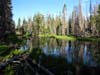
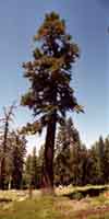
Meeks Bay is our trailhead because it starts our Tahoe to Whitney Backpacking Trip into one of the most beautiful spots in the world, Desolation Wilderness. Meeks Bay leads us directly into the granite grandure of Desolation Wilderness wrapping around the deep blue waters of Lake Tahoe, a truly a world-class spot of backpacking beauty.
Backpacking life does not start better than this.Deeper Destinations
Our basic goal to hike the length of the Sierra Nevada is a cover for our real mission, which is to get some understanding of the fundamental logic, operation, and status of both the Sierra Nevada and overselves. We have various approaches to this, and they all start whith shorter backpacking trips and end with longer backpacking trips.
Necessary Evolution
Our first backpacking trips should not be in the Sierra, if we are an inexperienced backpacker in poor physical conditioning. If we are inexperienced and out of shape we've got to contend with a whole series of physical fitness, gear, and skills issues before we will be ready to hit the High Sierra Trails.
We've got a basic physical training schedule and plan a series of increasingly strenous backpacking trips to gradually gain the fitness, gear, and skills that will be demanded to successfully hike the Tahoe to Whitney as a single backpacking trip.
The Goal
I love to hike the Sierra as one great Tahoe to Whitney backpacking trip, and have so far executed it five times. This has led to a variety of starting points and routes, but starting out of Meeks Bay through the Desolation Wilderness is a classic.
You can start your TW hike anywhere you like. We can begin up in Granite Chief Wilderness, from Highway 80, or out of one of the trailheads described here on the guide, or your favorite trailhead anywhere around the Tahoe Rim Trail in the Lake Tahoe Basin.
Find IT
This real goal of this guide is to put you in a position to find yourself. More precisely, for you to find and develop your physical, psychological, and spiritual assets, identify your weaknesses and strengths, and evolve your observation, analysis, and decision making skills in the difficult, demanding, and always somewhat dangerous natural context of the High Sierra Mountain Range.
After that, we will keep our skills tuned up, operational, and as engaged as possible through the travails of this life. We've got to keep our eye on IT, after we find IT.
"Short Tours"
We don't have to hike all the way South to Mount Whitney, or even hike the whole Tahoe to Yosemite Trail across the North Sierra all at once. We can keep our backpacking trips within Desolation Wilderness and the Tahoe Basin, if we so desire.
The information on this Tahoe to Whitney trail guide is designed to help us plan and execute our shorter Desolation Wilderness backpacking trips, as well as shorter backpacking trips and loops around the forests and wilderness areas from Desolation Wilderness South to Yosemite and on down to the Whitney Portal.
This "section" approach may be wise. Not everyone, well, practically no one is ready to jump onto long distance High Sierra trails without some training, proper gear, and practical experience putting them all together on the trail. Short preparatory trips bringing our fitness, gear selection and use, and our skills up to speed one step at a time is a wise path to safely develop our long distance high altitude backpacking capacities.
Backpacking the High Sierra is a difficult and potentially dangerous activity. Let's not bite off more than we can comfortably chew.
I am serious about the difficulties and dangers of High Sierra backpacking. Read the disclaimer, and note my warnings about dangers and safety up and down the trail guide. Backpacking the High Sierra can break you like a twig. It can seriously injure or kill you.
It can also restore your humanity, balance, and understanding of the human role in life's grand web.
It can give it all, it can take it all.
How the particular balance of pain and pleasure on our trip works out depends on how well prepaired we are. Our level of prepartation determines if backpacking the whole thing or sections is the wise course of action.
Part of a Greater Plan
The beauty of Desolation Wilderness and the Meiss Country Roadless Area in the Tahoe Basin make them delightful places to backpack on their own account, as well as logical locations to start our long distance backpacking trips South.
This is also equally true of the wilderness, forests, and parks to our South. Each is delightful on its own, and this guide explores the local as well as long distance backpacking opportunities in each. Each of our short trips can be elements in a greater plan of exploration. Let's check out some of the various approaches we can take.
One Shot or Many
Thorough Hiking, Section Hiking, or Grand Loops
Just because I like to hike from Tahoe to Whitney in one shot does not mean you have that same desire, fitness, or can dedicate the time and energy necessary for such an extensive trip. But you can achieve the same end result. Good thing we have other options.
We can section hike the High Sierra Trails from Lake Tahoe to Tuolumne Meadows, and on down to Mount Whitney.
We can break the Tahoe to Whitney hike into bite-sized chunks, starting with the Desolation Wilderness and Meiss Country Roadless Area in the Tahoe Basin, and work our way South as possible. The Desolation and Meiss Country backpacking trip can be our first "section" of a Tahoe to Whitney backpacking trip spread out over a number of Summers.
OMG
Better yet, we can section hike the North Sierra by hiking loops around each Wilderness Area"section" using the PCT in one direction and the TYT in the other, as we proceed South. This means that we can "section" hike the TYT and PCT simultaneously across much of the North Sierra!
Well, we can hike TYT-PCT loops around the wilderness areas that have sufficient trails! Although the webs of trails across the Carson Iceberg and Emigrant Wilderness make these PCT-TYT loops possible, the "wishbone" shape of our main TYT and PCT trails diverging as they move South across the Mokelumne Wilderness make TYT-PCT loops there difficult, if not impossible.
To better use these interconnected PCT-TYT routes to craft grand "sectional loops," let's take a look at how the length of the Sierra Crest is divided into sections by the Trans-Sierra Highways.
The Trans-Sierra Highways and their Mountain Passes
Section Hiking the North Sierra
PCT
Hiking South out of the Tahoe Basin on the PCT we find the succession of the Carson, Ebbetts, and Sonora Pass Trailheads on the PCT route down the Sierra Crestline to Tuolumne Meadows.
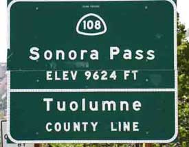
Carson Pass on Highway 88 roughly differentiates the Tahoe Basin to its North from the Mokelumne Wilderness to its South. Ebbetts Pass on Highway 4 distinguishes the Mokelumne Wilderness to its North from Carson Iceberg Wilderness to its South, while the Sonora Pass Road, Highway 108, separates the Carson Iceberg to its North from the Emigrant and Yosemite Wilderness Areas to its South.
Each of these mountain passes sit at the top of a of trans-Sierra Highway with parking and trails running North and South into the wilderness areas flanking it. These highway divisions of the North Sierra Crest are perfect for those of us wishing to "section hike" the TYT and PCT routes across, or even looping around, each section of trail between the Trans-Sierra Highways.
If that describes some version of your plans, this guide will be perfect for you!
Section Hiking the North Sierra
TYT
The Tahoe to Yosemite Trail has a similar set of trailheads along the Trans-Sierra Highways that we can use to break the TYT into "sections." But the TYT sections, and its route are a bit more complex than the relative simplicity of the PCT's trail and trailheads following the Sierra Crestline across the tops of the Trans-Sierra Highways.
The TYT Trailheads on the Trans-Sierra Highways are split between being located further down the Western flank of the Sierra than the PCT Trailheads along the Sierra Crest, and being located on or near the Sierra Crest.
Three of our TYT Trailheads on the Trans-Sierra Highways are located on the Sierra Crestline, three are located down the Western flank.
TYT
On the Crestline
Carson Pass on Highway 88
and
Saint Marys Pass on Highway 108
We can access trailheads onto the TYT along the Sierra Crest at Carson Pass on Highway 88. Hikers on the TYT can pass South through Carson Pass after exiting the Tahoe Basin, though the most direct routes to the TYT over Round Top bypass Carson Pass. The same is not true of the single TYT Trailhead at Saint Marys Pass on Highway 108.
| Highway 88 Carson Pass Area Backpacking Map |
Highway 108 Highway 108 Trails and Trailheads Map |
I say "trailhead" in the singular because there is only one direction of the TYT, coming out of the North, through the Saint Marys Pass Trailhead onto Highway 108.
Trail Guide Index
Highway 108 Trailheads
The Saint Marys Trailhead is located very close to the Sierra Crestline. It is located less than a mile west of the PCT trailheads at Sonora Pass on the Sierra Crestline at the top of Highway 108.
Hiking South on the TYT through the Saint Marys Pass Trailhead onto Highway 108 presents one big problem for Southbound TYT hikers: there is no Southbound TYT Trailhead on other side of Highway 108 from Saint Marys Pass!
This makes it difficult to continue South on the TYT after hiking through Saint Marys Pass Trailhead onto Highway 108.
The TYT continues South into the heart of the Emigrant Wilderness through the Kennedy Meadows Pack Station nine miles to the West of Saint Marys Pass down Highway 108. I suggest hitch-hiking rather than backpacking down this dangerous narrow and twisting road.
On the Flank
TYT Trailheads on Lake Alpine on Highway 4
It is a lot easier to continue South on the TYT across Highway 4 at Lake Alpine than the offset trailheads across Highway 108 for us Southbound TYT backpackers.
The Lake Alpine TYT Trailheads aalong Highway 4 are 15 miles West of Ebbetts Pass down Highway 4, and virtually right across the Highway 4 from each other.
TYT hikers just cross Highway 4 on the East Shore of Lake Alpine to easily continue South on the TYT, while Southbound TYT hikers at Saint Marys Pass face a nine-mile hitch-hike West down Highway 108 to continue South.
The Sections
Thiry Miles Average Length
The bottom line is that the series of PCT trailheads on the Sierra Crestline at the tops of the Trans-Sierra Highways combined with the TYT Trailheads a bit further down the Western Flank of the Sierra gives us the ability to break up the 180 miles of hiking between Tahoe to Tuolumne Meadows into manageable lengths of thirty miles or less between resupply points.
The Long One
The only exception is that the last and the longest sections of both the TYT and PCT are across seventy-five miles of hard 1 trail through the Emigrant Wilderness South from Highway 108 and across the North Yosemite Backcountry to Highway 120 in Tuolumne Meadows.
Trail Treats
These "sections" of trail between the Trans-Sierra Highways break our PCT and TYT routes down into natural bite-sized lengths of trail that are perfect for section hikers. Let's evolve section hiking the North Sierra one more step...
Let's Get Loopy
We can easily turn some of our "section hikes" into grand backpacking loops around the Carson Iceberg or Emigrant Wilderness by tying the PCT and TYT routes together into fantastic backpacking loops around both the Carson Iceberg and Emigrant Wilderness area.
Rather than hiking the PCT or TYT by "sections" down the length of the Sierra Nevada one by one in simple linear "sections," we can easily transform each "section" through either of these wilderness areas into frigging fantastic fifty to eighty mile loops that extensively explore and experience the very different characters of the East and West Flank aspects of the PCT and TYT along one big loop.
I call this "Master Loop" section hiking, when our "section" incorporates and completes both the PCT & TYT "sections" of that particular wilderness along our looping route.
We can section hike the PCT and TYT simultaneously!
We can adjust our route to hike loops of various lengths using elements of both the TYT and PCT around the Carson Iceberg and Emigrant Wilderness Areas because each trail is extensively interconnected with the other by webs of amazing trails across both wilderness. These are really fun places to backpack.
This high degree of interconnection between the PCT and TYT also opens up many interesting alternative routes to the standard linear routes of either the PCT or TYT.
We can tie the PCT and TYT together across the Carson Iceberg and Emigrant Wilderness into a number of unique and interesting routes to suite our own capabilities, interests, or constraints. We really can do it our own way, and craft our own unique backpacking routes while hiking either the Pacific Crest or Tahoe to Yosemite Trails across the Carson Iceberg and Emigrant Wilderness Areas.
I've personally hiked as wide a variety of hybrid routes from Tahoe to Yosemite, and on down to Mount Whitney incorporating and mixing as many options as I possibly could, over the years.
Loops to Chains
This thought, of hiking each section of trail between the Trans-Sierra Highways as a loop tying the PCT and TYT together creates a visual image in my mind each of each North Sierra trail sections being one ring in a chain of trails forged by hiking circles around the North Sierra Wilderness Areas.
Reality Check: This is what I call, "fun," beating myself with the chain of trails!
The South Sierra is Different
We don't have the same parallel trail construction between the PCT and JMT in the South Sierra as with the PCT-TYT in the North. But we can put together a series of impressive South Sierra loops. I'm thinking of Fish Valley to the South of Reds Meadow, the classic North-South loop through Bishop and Piute Passes, and the Rae Lakes Loop.
These are classic South Sierra Backpacking Loops.
North-South
Though we can effectively section hike two trails at once down the North Sierra by stringing together a series of TYT-PCT hiking loops, the layout of the South Sierra terrain and trails prevents this. Though the South Sierra is full of classic backpacking loops and alternative routes, these loops do not interlink as they do in the North Sierra.
The alternative routes through Fish Valley South of Reds Meadow and the Bear Creek trail South of Vermilion Valley Resort, the North-South Lakes Loop, and the Rae Lakes Loops are all distinct loops and alternative routes we can hike along the JMT-PCT, but they do not overlap, and leave great gaps between the end of one loop and the beginning of the next.
Sadly, we cannot put together a series of backpacking loops around each of the wilderness areas for the whole length of the Sierra Crestline between Lake Tahoe to Mount Whitney.
Section Hiker's Dream
We can section hike the PCT or the TYT routes from trailhead to trailhead from Lake Tahoe to Tuolumne Meadows, or we can section hike both the PCT and the TYT in grand loop routes around the wilderness areas between Tahoe and Yosemite.
We don't even have to leave the Tahoe Basin
It's nice backpacking around the Desolation Wilderness and Meiss Country Roadless Area in the Tahoe Basin. We could spend a lifetime exploring this single wilderness. But I like to push South from the North end of the High Sierra down to its South end to exit the Sierra through the Whitney Portal, so that's what we are going to do.
But you don't have to.
Backpackers wishing to remain in the Tahoe Basin can turn a big loop around Desolation Wilderness, or turn an even bigger loop around the whole Lake Tahoe Basin on the Tahoe Rim Trail.
Infinity of Detail
The fact is that there's an infinity of detail surrounding each step in the Sierra. We can speed our pace and lengthen our trip to blur detail, or we can slow the pace, decrease the length of our trip, and greatly increase the precision with which we observe, and the number of environmental "details" we can engage.
Wisdom is knowing which approach is best for us at each time and place along the length of our trip, and having the fitness and skills to apply it.
Adjusted for You
Hikers unwilling to bite off the whole TYT or PCT across the North Sierra can break its length down into greater or lesser "section hikes" across or around each of the wilderness areas between the Trans-Sierra Highways, either hiking them as section or loop, depending on which best fits your situation.
3 Representative Trailheads
Or Pick Your Own!
Meeks Bay Trailhead
Trail Guide
Desolation Wilderness Area
|
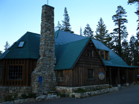
Echo Summit Trailhead 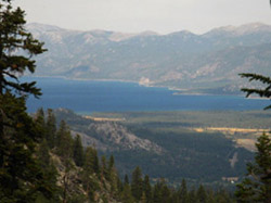 Lake Tahoe from South of Echo Summit on the Pacific Crest & Tahoe to Yosemite Trails
Trail Guide
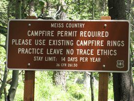
Meiss Country Roadless Area
|
Meyers Trailhead 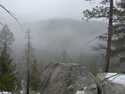 Christmas Valley in fog, above the South Upper Truckee Trail head in Meyers.
Trail Guide
Meiss Country Roadless Area
|
SOUTH of the TAHOE BASIN
TWO + ROUTE OPTIONS
Besides these three trailhead options out of Lake Tahoe we also have two major route options to choose from hiking South through the Northern Sierras from Lake Tahoe to Tuolumne Meadows. We explore them both.
TYT & PCT
This trail guide covers both the Tahoe to Yosemite and the Pacific Crest Trail routes from the Lake Tahoe Basin to Tuolumne Meadows in Yosemite. I discuss the differences between the PCT and TYT on the Tahoe to Yosemite Trail Guide Page.
Infinite Loops
We also cover the trails connecting the TYT and PCT between Tahoe and Yosemite. These trails connecting the PCT and TYT offer backpackers a wide range of alternative long distance routes across the Carson Iceberg and Emigrant Wilderness, as well as open up a wide range of local loops remaining within these wilderness areas.
Read, or add your own hiker's comments about
Trail Section #1 and the Trail Segments it contains
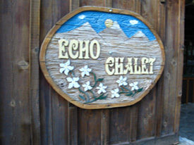
Echo Chalet Backpacker Resupply
|
|
Resupply Point #1 No longer offers resupply services Echo Lake Chalet is located at the South end of Lower Echo Lake just past where the Southbound TYT hiker exits the Southernmost Desolation Wilderness Trailhead. If we chose to begin our journey South through the Meeks Bay Trailhead along the Classic Tahoe to Yosemite Trail, we will pass the Echo Lake Chalet. Echo Chalet is not a vital resupply point for Southbound Tahoe to Whitney or Tahoe to Yosemite Backpackers. The reason is that the Chalet is only 28.71 miles South of the Meeks Bay Trail Head on the Tahoe to Yosemite Trail. And, the Echo Lake Chalet sits North of our Echo Summit and South Upper Truckee trailheads This makes Echo Summit irrelevant for Southbound packers out of those two trailheads. As my standard food load is five days, and I carry up to 11 days of food, I prefer to carry the food necessary to cover the 68 mile distance between Meeks Bay and the Lake Alpine Lodge, so I don't rely on Echo Chalet for resupply. The 68 miles separating the Meeks Bay Trailhead from the Lake Alpine Lodge on Highway 4 makes the Lake Alpine Lodge my first resupply point South of Meeks Bay. I rely on Echo Lake for a boost of good fresh food and milkshake power. But resupplying at Echo Lake will serve to keep the initial weight of our food supply, and backpack weight lower than if we don't resupply there, so can be useful for saving us some pain. Though not a vital resource for Southbound TYT hikers, it is convenient. The Echo Lake Chalet is a vital resource for Northbound backpackers on the Pacific Crest Trail. Their previous resupply point, typically, was 75 miles South at Sonora Pass. Check out this discussion of our Read more about the differences between our Southbound route options between the Pacific Crest Trail and the Tahoe to Yosemite Trail on the Trail Guide Index, on the Carson Gap Trail Guide page, in the maps section, and in the miles and elevations pages. |
|
Lake Tahoe Basin Best Backpacker's Resource in the |
|
 |
|
| Top of Page | |
| Meiss Country Roadless Area | ||||
Section 1B Alternative to the Meeks Bay Trailhead Backpackers using the Echo Summit or the South Upper Truckee trailheads will find much quieter backpacking in the Meiss Country Roadless Area than they would have experienced hiking the Desolation Wilderness from Meeks Bay. Desolation Wilderness is always among the the busiest wilderness in America. These trailheads also respectively knock 31 and 34 miles off the 185 miles between Meeks Bay and Tuolumne Meadows on the TYT. This section of the trail guide explores the triangular shape of the Meiss Country Roadless Area wedged into the Southwestern corner of the Tahoe Basin. The long side of this triangle stretches from Echo Summit down to the Carson Gap, with the two shorter sides of this rough triangle narrowing down to the South Upper Truckee Road trail head in Meyers. This nice little wedge of terrain in the South-Southwest corner of the Tahoe Basin is the total extent of the tiny little Meiss Country Roadless area. Echo Summit and the South Upper Truckee Trailheads are both excellent trailheads to begin short and maybe medium distance backpacking trips around this fine little corner of the Lake Tahoe Basin, if not beginning a longer trek to points South, hopefully all the way down to Tuolumne Meadows and on to Mount Whitney.
|
||||
| Mokelumne Wilderness | |||||||
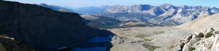
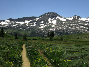
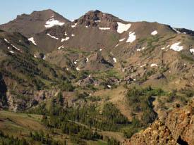
The The Carson Gap is the point where Southbound backpackers on the TYT and PCT exit the Lake Tahoe Basin. It is also where the Southbound Pacific Crest and Tahoe to Yosemite Trails first part, and from here we will follow our selected route South across the Mokelumne Wilderness to Highway 4. If we're following the Pacific Crest Trail our route brings us Southeast through Carson Pass and subsequently down the Eastern flank and the Sierra Crest to Ebbetts Pass on Highway 4. If we are following the Tahoe to Yosemite Trail our route brings us around the Southwest flank of Round Top and The Sisters, to hike the Western Flank of the Sierras to Lake Alpine on Highway 4. In short, we will be heading to either the Southeast or Southwest of Round Top, the mountain pictured below on the upper Left, on our way to Highway 4. This section contains a route discussion comparing the terrain, mileage, elevations, and the different characteristics of these two trails to help us decide which route is best for us, followed by trail guide accounts of each. Excellent Video describing our PCT-TY trail choice. Trailheads on the North and South Ends of the Mokelumne Wilderness
|
|||||||
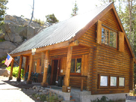
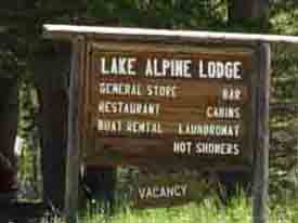
| Lake Alpine Lodge | ||||
|
||||
| Carson Iceberg Wilderness | |||||
Section Three
|
|||||
| The Tahoe to Yosemite Trail Trail Guide Page Lake Alpine Backpacker |
The Pacific Crest Trail Trail Guide Page Ebbetts Pass Backpacker |
Carson Iceberg Wilderness Hiking Map
Click the RED DOTS on the maps for Trail Guide Pages, the Black DOTS for DETAILED MAPS.
Carson Iceberg Wilderness Maps
| TYT Topo Hiking Map Lake Alpine to Saint Marys Pass |
PCT Topo Hiking Map Ebbetts Pass to Sonora Pass |
Click the RED DOTS on the maps for Trail Guide Pages, the Black DOTS for DETAILED MAPS.
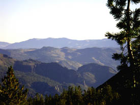
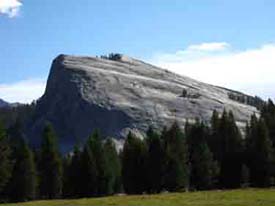
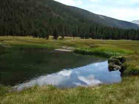
Leavitt Peak from the Sonora Gap
Leavitt Peak (it's not visible behind the mountaintop in back) from the Sonora Gap, Pacific Crest Trail, looking South towards the Sonora Pass on Hwy 108. The Sonora Pass is situated beyond the low hill in foreground and the mountains in the background.
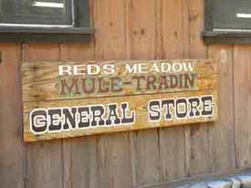
| Kennedy Meadows Pack Station | |
Resupply Point #3Highway 108I love this place! Don't miss Kennedy Meadows on your trip along the Sierra Crest! Euros and other visitors who wish to experience the Modern West should reserve a cabin and hang out! The E Sierra towns of Walker and Bridgeport (Hwy 395) |
|
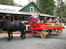
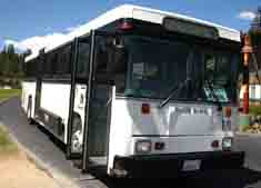
| Kennedy Meadows Pack Station, with the Stueve Family's Milk Wagon. | |
| Emigrant Wilderness | |||||
Section Four
|
|||||
| Information | |
Elevations & Mileages |
|
Read, or add your own hiker's comments about Trail Section #3 and the Trail Segments it contains
| Tuolumne Meadows | |
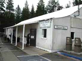
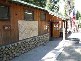
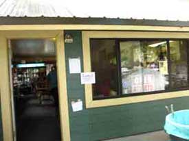
Resupply Point #4Tuolumne Meadows, Yosemite A top quality long-time staff is complimented, and challenged by, everything the world can throw at them, including urban idiots and outdoor specialists from all around our country and all over the world. Tuolumne Meadows Grill, Post Office, and Store |
|
| Tuolumne Meadow Cafe, Post Office, and Store | |
| Tuolumne Meadows to Yosemite Valley The "Backwards" John Muir Trail into the The Golden Triangle |
|
Section Five
The "standard" route for Southbound hikers on the Tahoe to Whitney Trails is to pick up the Southbound John Muir Trail in Tuolumne Meadows where the Tahoe to Yosemite Trail ends, and continue South along the Sierra Crestline towards Mount Whitney on the JMT. An exceptional alternative route and expansive addition to our standard crestline route is to follow the JMT "backwards" down to Yosemite Valley. After a refreshing stay in Yosemite Valley we will return to the JMT along the Sierra Crestline just a few miles South of Tuolumne Meadows in Lyell Canyon. I call this alternative route off the Sierra Crestline via the JMT to the Valley and back up to the JMT via Voglesang Pass "The Golden Triangle." This will be a unique addition to our Tahoe to Whitney hike, if we choose to include it. Highway 120 to Yosemite ValleyQuick FactsMapsMiles & ElevationsResupply Point
|
|
| Ls | |
| Rnt | |
| Yosemite Valley Backpacker Resupply | |
Resupply Point #Highway 108
Don't miss! The E Sierra towns of (Hwy 395) |
|
| K. | |
Trail Guide Construction Note I have not yet completed any of the trail guide elements for the trails between Tuolumne Meadows and Mount Whitney. I hope to have at least the Maps and Mileages info up before the upcoming Summer backpacking season begins in earnest. |
| Yosemite Valley to Lyell Canyon Alternative Route back to the The John Muir Trail |
|
Section Five This is our return route to pick up the JMT just a bit South of Tuolumne Meadows in Lyell Canyon. We hike this route from Yosemite Valley back to the JMT rather than retracing the route of the JMT back up to Tuolumne Meadows. We already did that hiking down to The Valley. We will find a different way back to the JMT. After some R & R in Yosemite Valley we follow the JMT hiking through Happy Isles up to Little Yosemite, but at Little Yos we turn off the JMT by hiking up the Merced River to Merced Lake. This alternative route brings us back to the JMT close to where we turned off the Sierra Crest to follow it down to The Valley. Top-Down Perspective Dropping down to Yosemite Valley from Tuolumne Meadows puts us into fantastic overviews of the beauties that drove the creation of the US Park System itself, of what stirred modern man to preserve this, and other ancient untouched places from total destruction. As we drop down into Yosemite Valley we can see, and even feel the historic competition between the different demands the different aspects of human nature have put on Nature. Bottom-Up Perspective The famous Yosemite Valley and the upper elements of the Merced River Drainage that created it. Hiking across Yosemite along the Sierra Crestline on the combined TYT through the North and the JMT across South Yosemite is nothing short of a world-class backpacking trip. But it can be made better by the Golden Triangle. Adding the Golden Triangle into Yosemite Valley and back to the JMT puts our Tahoe to Whitney hike into a class of its own. The Golden Triangle is an exceptional stand-alone backpacking trip (without having to hike from Tahoe to Whitney) starting and ending in Tuolumne Meadows.
Yosemite Valley to Lyell Canyon
Quick Facts
MapsMiles & ElevationsYosemite Valley Resources/TransportationResupply Points:Side Trips/Short LoopsCar CampingRead, or add your own hiker's comments about Trail Section #4 and the Trail Segments it contains |
|
| Ls | |
| Rnt | |
| Tuolumne Meadows to Reds Meadow TYT to JMT The Standard Sierra Crestline Route |
|
Section Five
|
|
| Lyell Canyon, just a bit South of Tuolumne Meadows, on our way to climb out the South end of Yosemite through Donohue Pass. | |
 |
|
| Red's Meadow store, our "on the trail" resupply point. We can take the shuttle into Mammoth Lakes to access extensive resources there. | |
Reds Meadow |
||||
|
||||
Reds Meadow John Muir Trail |
|
Section Six
|
|
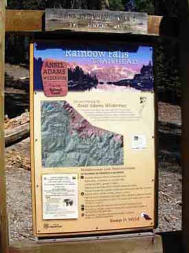
| To Rainbow Falls off the Southbound JMT in Ansel Adams Wilderness. | |
 |
|
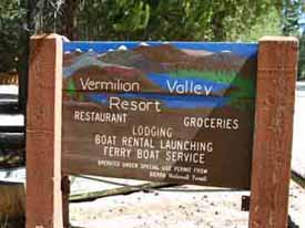
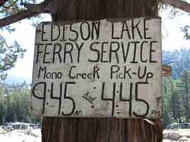
| Vermilion Valley Resort's Sign, Lake Thomas Edison. Only seen by walk-ins. Most hikers take the ferry in from the John Muir Trail. | |
Reds Meadow |
|
Alternative RouteMammoth Lakes to Lake Thomas Edison
|
|
| B. | |
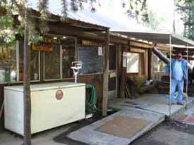
| Vermilion Valley Resort | |
Resupply Point #6Vermilion Valley Resort
|
|
 |
|
| Backpacker Disneyland: Vermillion Valley Resort. Great people, Great food, and a heck of a lot of fun. | |
| VERMILLION VALLEY to MUIR RANCH |
|
Section Seven:
|
|
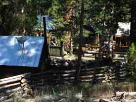
| Vermillion's backpacker pick up point on the East side of Lake Thomas Edison. | |
 |
|
| Hiking down to the very private Muir Trail Ranch | |
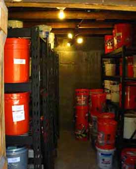
| Muir Ranch | |
Resupply #7No Road Access Muir Ranch
|
|
| Muir Ranch's fancy new food storage system | |
| MUIR RANCH to MOUNT WHITNEY |
|
Section Eight
|
|
| Muir Ranch Backpacker Gate, food storage building | |
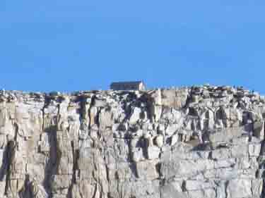 |
|
| Approaching peak of Mount Whitney Shelter visible. | |
| Mount Whitney Portal | |
The End of the LineMount Whitney Portal, Lone Pine Portal Road to Hwy 395, Lone PineDoug's Portal Burgers! And New Backpacker's Hostel, I hear... Lone Pine: Grocery, Cafes, Motels |
|
| A Doug's Burger at the Whitney Portal is the way to end the trip | |
DEDICATIONS
This Whole Trail Guide is Dedicated to my Sister,
Suzanne Wierbinski.
This guide & forums would have been impossible
without her
encouragement and support. I never carried a
camera,
until
she insisted. Helped more ways than I can count.
Thanks, Boo!
None ot this would be possible without the endless help of my pal,
Alex Gomez
&
Family
Alex has provided every kind of support, tech, infrastructure, personal, medical, financial, and moral, for longer than anyone but sis....
The Yosemite Section of this Trail Guide is Dedicated to,
Erin Anders.
Erin's life represented the Good Will and Spirit of generations
of amazing folks
who've
dedicated
their life's work
to
serving
and protecting
Nature while
using it to bring out
the best in people.
The real dedication of this trail guide
is to the
Spirit
of the
High Sierra Mountain Range
and the
People who Love and Reflect its Spirit
YOU?
You All Know Who You Are...
If you can get into the High Sierra or Not...
Lake Tahoe to Mount Whitney
Your guide to backpacking the Sierra Crest, including the Tahoe to Yosemite, the Pacific Crest, and the John Muir Trails