

North Yosemite Backcountry
Backpacking Topo Map
The Combined Pacific Crest and Tahoe to Yosemite Trails
Topo Hiking Map covering
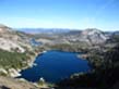
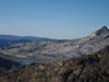
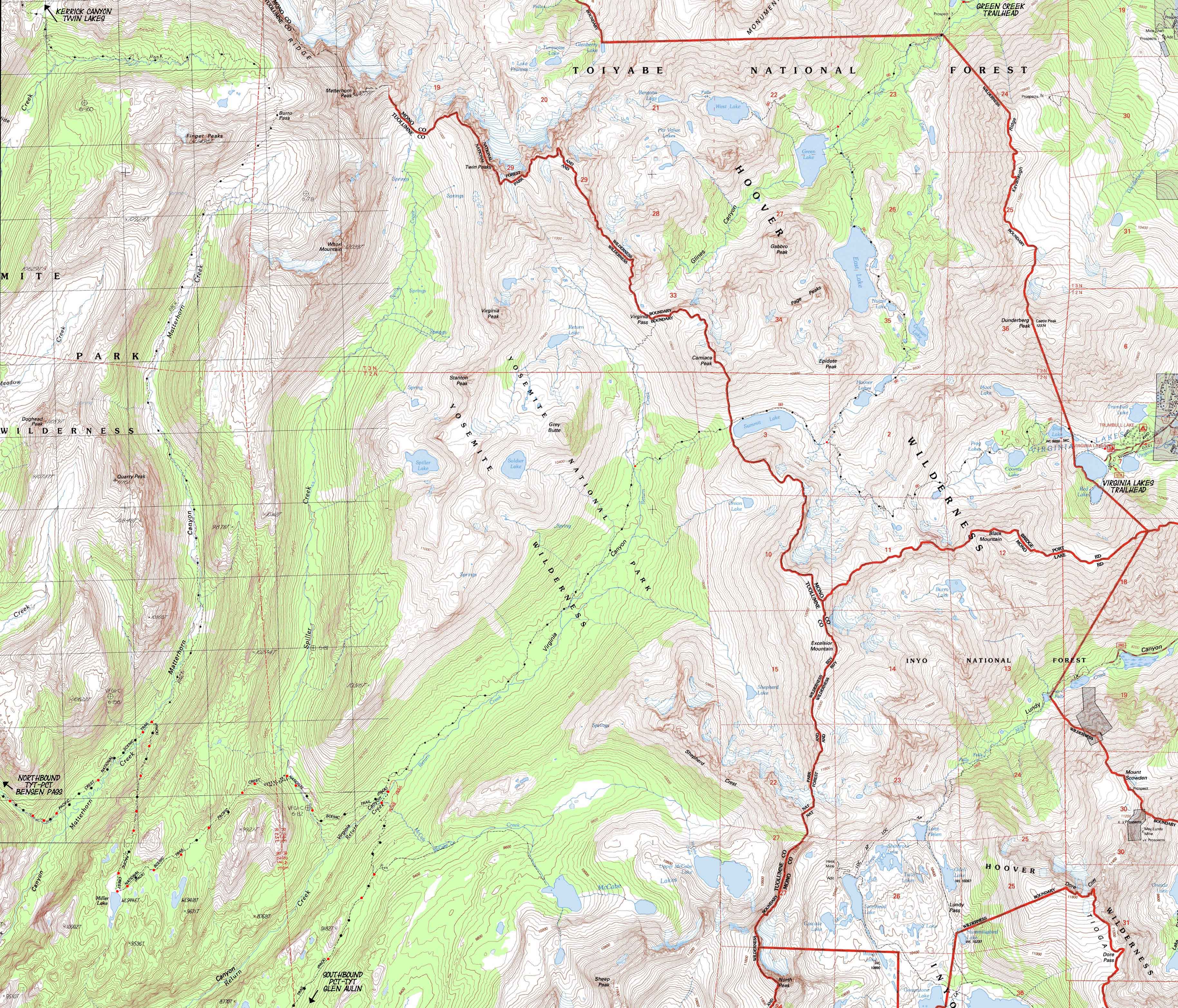
Matterhorn Canyon, Miller Lake, and Virginia Canyon on our way South to the McCabe Lake trail junction
Four
7.5 minute USGS Topographic Backpacking Maps
Topo Maps |
|
Backpacking PCT-TYT |
Backpacking PCT-TYT |
PCT |
TYT |
Trail Guide |
Trail Guide |
30 min |
|
Click RED dots for Trail Guide Pages |
LOCAL |
|
Backpacking the Pacific Crest and Tahoe to Yosemite Trail routes
approaching the
South End of the Five Canyons
North: Bensen Lake to Miller Lake Click Red Dots South: Cold Canyon to Glen Aulin
|
North: Bensen Lake to Miller Lake Click Red Dots South: Cold Canyon to Glen Aulin
Road Map |
Highway 108 Corridor Scroll East, to the Right, to reveal Bridgeport on Highway 395. South of Twin Lakes we can see the Green Creek and Virginia Lakes
A Nice Drive |
Mapology |
||||
MAP NOTE What's important for our general reference purpose is that each side of a square is 1000 meters, or a Kilometer. From my point of view that is 1093.6 yards or .62 of a mile. Diagonal: 1414.22 meters, if my trig is correct. That converts the diagonal distance into 4,639.8 feet or .88 of a mile.
|
Mapping, Mileage, |
|
I have not yet written the Yosemite National Parks permit page. But I will offer some advice. Correction: see the link above... but the advice is still good. Walk into Yosemite. Don't even mess with getting permits there. Want to hike the JMT? Start at Sonora Pass. Drop down to the Valley backwards on the JMT once you arrive at Tuolumne Meadows, then reacquire the JMT in Lyell Canyon via the Merced River up to Voglesang. Or start into Rancheria Creek down Kerrick Canyon from Twin Lakes on Highway 395 a few miles West of Bridgeport. Yosemite Permit Problems Solved. Yes, I know that may not solve your permit problem. But it is a start. Tuolumne Meadows Backpacker Resupply
Backpacking permitting authority National Park Wilderness Area Physical location |
USGS Northwest Map Northeast Map Southwest Map Southeast Map Scale Contours
Compass Offset West map's Magnetic North East map's Magnetic North |
| Elevations | Trail Forums | More Trail Guide Information | |||
Miller Lake Return Creek Ford McCabe Lake Junction Glen Aulin |
Trail Forum Trail Forum |
Trail Guide Trail Guide |
|||
Map Credit |
||
U.S. Geological Survey, Department of the Interior I love the USGS. For our "General Welfare" we have set up geographic organizations to provide reliable data for us all. Also included are the National Weather Service. Do that with "small" government. We'd be better off with a small corporate nobility, and a government sufficient to force them back under democratic constitutional control. There is absolutely no reason to buy maps, if you can swing an inkjet printer, some cool waterproof paper, an internet connection and a computer. Download USGS Maps: Move the US Map to the Sierras. Focus in on the area of your trip or trip planning. Click "Mark Point" in controls to see the USGS map grid of the range of USGS map scales available. Select scale of Maps you wish to download. Select your 15 and 30 minute maps to download. Download the suckers! Open these free USGS maps in the free Adobe Reader. "Take a snapshot" of the map segments you need and paste them into the free "MS Paint" program that came with your "Windows" operating system to make adjustments to the map and add your own custom route indicators, then print that sucker up. You might have to screw around getting the scale and adjustments down. Make some test prints before you use your good paper!! Once you get it all set up you will be able to print out a series of custom maps for each of your High Sierra Backpacking trips...
|