

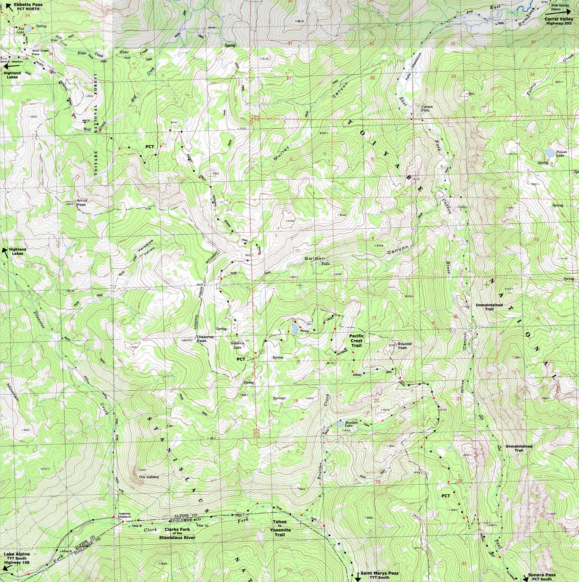
Backpacking Topo Map
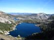
Asa Lake
to
The
East Fork of the Carson River
Carson Iceberg Wilderness
Topo Hiking Maps for
The Pacific Crest Trail between Ebbetts Pass and Sonora Pass
Topo Maps INDEX |
North |
South |
TYT-PCT |
Ebbetts Pass to Sonora Pass |
30 min |
Click RED DOTS for links to Trail Guide Pages |
Trail Guide East Carson |
Northwest High Sierra Weather Forecast ALL SIERRA WEATHER Poison Flat Weather Station |
All miles and elevations |
14.09 miles Hiking from Asa Lake to the East Carson River Trail Junction
Check out the
Wolf Creek Pass (PCT) to Lake Alpine (TYT)
routes
| North PCT Ebbetts Pass to Wolf Creek |
Northern PCT link to TYT Highland Lake to Wolf Creek Pass |
Detail South PCT Two Sharkfins-Murray & Golden Canyons |
South PCT link to TYT Boulder Lake to Clarks Fork |
Detail South PCT South Sharkfin to Boulder Lake |
South PCT Boulder Lake to Sonora Pass |
|
| North PCT Ebbetts Pass to Wolf Creek |
Northern PCT link to TYT Highland Lake to Wolf Creek Pass |
Detail South PCT Two Sharkfins-Murray & Golden Canyons |
South PCT link to TYT Boulder Lake to Clarks Fork |
Detail South PCT South Sharkfin to Boulder Lake |
South PCT Boulder Lake to Sonora Pass |
Mapology |
||||
MAP NOTE What's important for our general reference purpose is that each side of a square is 1000 meters, or a Kilometer. From my point of view that is 1093.6 yards or .62 of a mile. Diagonal: 1414.22 meters, if my trig is correct. That converts the diagonal distance into 4,639.8 feet or .88 of a mile.
|
Road Map
Map, Miles, and Elevation Information |
|
Miles and Elevations Tyron Peak High Point 9320 4.92
Ebbetts to Sonora Pass Topo maps Ebbetts Pass Tyron Peak
MAP NOTE What's important for our general reference purpose is that each side of a square is 1000 meters, or a Kilometer. |
Map Names SW: Dardanelles Cone, (1979) Calif., USGS 7.5 minute Topographic NE: Wolf Creek, (1979) Calif., USGS 7.5 minute Topographic SE: Disaster Peak, (1979) Calif., USGS 7.5 minute Topographic Compass Offset scale Contours Lower Map Permits Backpacking permitting authority Wilderness Area Physical location |
Topo Hiking Map North: Ebbetts Pass to Tyron Peak PCT link to TYT: Highland Lake to Wolf Creek Pass Topo Hiking Map South: Wolf Creek to Swampy Lake
| Elevations | More Information | ||
Tyron Peak Wolf Creek Pass Wolf Creek |
Trail Guide, Section Trail Guide, trailhead Trail Guide, trailhead Google Map |
||
| MAP CREDIT | ||
U.S. Geological Survey, Department of the Interior The
|
||
Trailhead
Comments-Questions-Experiences?
Forum Section
Ebbetts Pass to Sonora Pass