The Trails
Guide
Maps
Miles/Ele
Permits
Resupply
Forum
Current Weather Conditions
Weather Notes
Northern High Sierras
Central High Sierras
Southern High Sierras
Gear
Gear List
Gettin Started
Layering
Discussion
Testing yourself and your gear
Gear Reviews
Backpacking
South
to
Round Lake
through
Christmas Valley
Meiss Country Roadless Area
Languages
Languages
Trail Arts
The art of walking
Physical Preperation
Trail Skills
The trail
Off the trail
Scrambling
Maps
Navigation
Camp skills
Food
Resupply
Food
Other
Photo Catagories
Trail Stories
Trail Culture
News and Science
Links
Groups
Books
Terms and Conditions of Use
First,
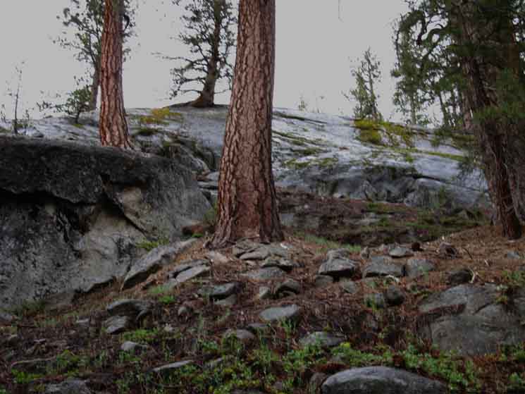
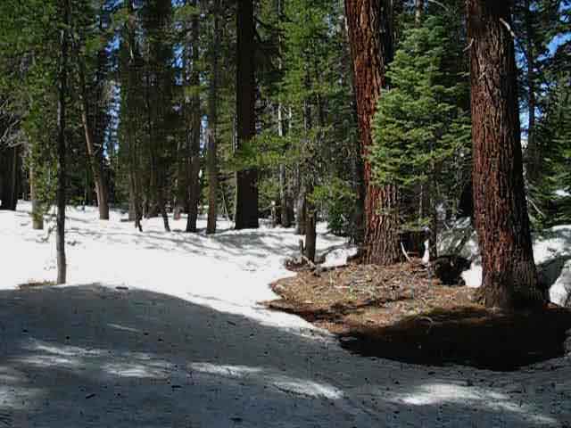
A Couple of Low Ridges lay between the Big Meadow Junction and Round Lake
Jeffery Pines in Granite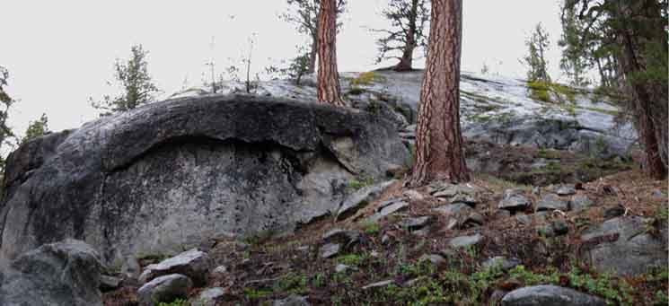 |
||||
Climbing a low ridge South of the Big Meadow trail junction we see fine granite slabs making up the ridgetop to our West. To our West the geology and terrain is Granite, to our East it is Volcanic. We are sitting astride this wandering interface.
Information Map, Miles, and Elevations
Miles and Elevations
Trails Forums
|
South of Big Meadow Trail Junction Over the short .58 of a mile separating the Big Meadow trail junction from Round Lake we climb and drop over a couple of low ridge arms composed of granite to our Right (West) and volcanic terrain to our East. The exact position of this interface can be obscured by the deep soils and thick forest filling this narrow little valley, though it is apparent volcanic terrain thickens to the East and the granite to the West. We make our final ascent to the top of the last rise and begin the short descent to Round Lake before we get our first views of Round Lake through the trees, and realize we are finally descending to our destination for tonight's campsite. The thick forest wrapping around the Northeast corner of Round Lake, where the trail coming South from both the South Upper Truckee and Big Meadow trailheads approach obscures views of the lake until we are almost on it. Look to your Right descending to Round Lake. First, we will see a campsite. It's kind of hidden from the trail, but we can see it across a fallen tree between two low rises in the terrain. Next, we will see a trail branching off to the West, our Right, when we reach lake level. This trail leads along the North Shore of Round Lake to the check dam past campsites along the ridge rising above the North shore of Round Lake, and this trail also leads to the rather large improved campsite we observed while hiking down the last bit of trail approaching Round Lake. Though the steepest part of the trail coming up from the South Upper Truckee is now behind us, and the steepness and difficulty had already moderated by a degree when we hiked South of the Dardanelles Lake trail junction, we are still getting worked hiking up to Round Lake, though just not as hard as when backpacking up the lower section of the trail. Though the total elevation rise between the Big Meadow trail junction and Round Lake is only 160 feet, we hike up this distance of elevation a couple of times as we climb up and down the low ridges between the Big Meadow junction and Round Lake. The steady climb of the trail up from the South Upper Truckee Trailhead moderated into a rolling-rising terrain, even opening up a bit more after the Big Meadow trail junction. Here at Round Lake the surface of lake itself has forced the dense forest to open up enough allowing us get fine views of the lake, the towering volcanic features rising above the East shore of the lake, and the low granite wrapping around the South and West shores of this pretty little lake. To our South we can see the South end of the Tahoe Rim rising above what we know is Meiss Meadow. Contribute comments, questions, and bits of your experience hiking through here on the Trails Forum for this segment of the trail through the Dardanelles Lake and Big Meadow trail junctions, and its Comments Feature. |
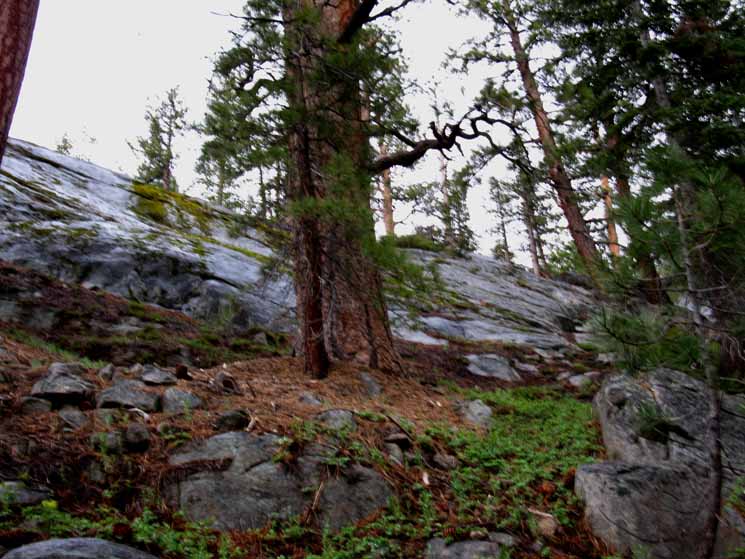
Granite Ridgetop tracking West
 |
||
Sweet granite sheet composing the ridge descending Westward. Our route South moves to the Left, South towards Round Lake, crossing the top of the ridge.
|
North: Big Meadow Trail Junction South: More Round Lake
Everything is painted with life's brush. |
||
 |
||
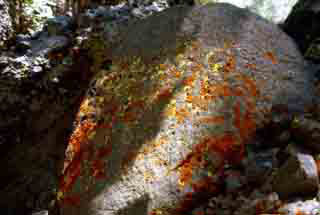
| Everywhere life can support itself, it does. Both the Granite and Andistic terrain wear bright Lichen. |
| Alongside the Volcanic, is the Granite. Our trail up from the South Upper Truckee Trailhead almost follows this geological divide, cut by this tributary of the South Upper Truckee, up the valley. | ||
|
||
The harsh Red Rock of the volcanic remnants is beautifully contrasted by the sensual contours of the steel gray granite as we begin hiking along the boundary between these two very different terrains. The Sierra can be a study of contrasts. Though the terrain is "opening up" a bit, it is still a bit claustrophobic in here. Our route following the tributary up the mountain has been shaded under dense forests squeezed into the narrow space between the tightly-spaced ridges rising bracketing the banks of the creek. We've been stressed by the steepness of traversing up their flanks, while being essentially kept on track by the narrowness of the valley, at least during Winter. Arriving at Round Lake we can finally see the ridgeline making up the Southern extent of the Tahoe Basin rising in the Southern distance above the forests surrounding Round Lake. Our knowledge that Meiss Meadow wraps around the base of the Southernmost corner of the Tahoe Rim above us gives us an excellent understanding of how much further we have to hike to get to Meiss Meadow, and how much higher that hike will bring us on our way over the gap in the Tahoe Rim to get out of the Lake Tahoe Basin. We'll cross that gap when we get to it. In the meantime, Round Lake has given us our first good vantage point looking South since starting out of the South Upper Truckee Trailhead. This view gives us some context on our upcoming trails. Looking South from Round Lake reveals the high point we will be climbing over to exit the Tahoe Basin, as well as giving us a pretty good idea about the much shallower angle of our upcoming climb will be compared to our freeking steep hike up here from the South Upper Truckee Trailhead. View of our position here at Round Lake from above and to the West
Check out this Winter video of the final leg of Navigation up to Round Lake from the South Upper Truckee Trailhead. |
Composite Boulder Gardens Above and below If we follow the seasonal creek, which cuts off to our Right, to the Southwest just before the point pictured above, we will end up at Round Lake's check dam. I've hiked that way up to Round Lake during Winter, after first making sure there was no avalanche danger off the big ridge making up the South side of the gully twisting its way up to the check dam. This is not a great way in when devoid of snow. The snow of Winter covers the brush filling the gully during Summer, making it passable. Not just passable, but a real sweet route decorated with features you can only see during Winter. Otherwise it'd be a real nightmare to pass. This is very a very rough environment for Summertime cross country travel that opens up during Winter. |
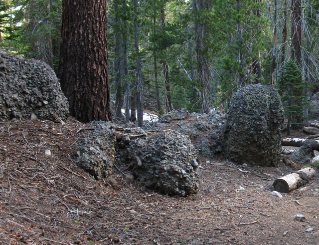
Composite rocks, likely remnants of ancient lahars that flowed over a rather large section of the Northeast Sierras. |
||
 |
||
These particular composite boulders are interesting because they are typical of the composite boulders here. They are mostly composed of fine small stones held together by a weak cement-like material. This differs considerably from the dense composite boulder we encounter on the East shore of Round Lake. The very different densities of the volcanic material holding these composite boulders together, and the very different types of rocks swept up by the formation of these two examples of local composite boulders, make them almost exact opposites. The weak-cement consolidated boulders are composed of thousands of small and medium size rocks, apparently swept up by the violent power when these great volcanic lahars that originally formed them roared down Christmas Valley. These two very different types of volcanic composite boulders are located in very close proximity to each other, and to the granite terrain to our West. This configuration challenges imagination and intelligence. The evidence indicates that a series of lahars of very different characters, and likely different heat and density levels, flowed through this ancient canyon during the series of violent volcanic events that marked the end of the last ice age. It is likely that this valley, who's present configuration we now call "Christmas Valley," was completely filled by a series of massive volcanic lahars flooding through here over time. The different characters of the composite boulders tumbling off the stratified-layers of "composite" cliffs rising above Round Lake indicates that the flows through here had a wide range of characters caused by both different densities of flowing materials at different temperatures over a significant period of time. What a pretty puzzle this Earth is. Differences in the composite boulders we see show that different flows sometimes deposited layers of completely different characters and compositions. This is apparent as composite boulders with different types of cement holding differing content break off the volcanic cliffs towering above, and roll through the forests below. We should consider this threat the same way we consider the threat from falling snags, as we select our Round Lake campsite. Once we get to Round Lake we will be able to make out some of the details of the layers making up the volcanic features towering above the East shore of Round Lake. Some flows were of dense "classic" volcanic lava, though it appears these dense flows were heated to a level of plasticity cooler than "classic" liquid lava, as indicated by the whole rocks still visible in the composite boulder on the East shore of Round Lake. The large rocks it picked up were not melted into the flow, but picked up whole and embedded into the dense material basically undamaged. We can easily imagine that the lahars which created the less-dense granular cement-like composite boulders flowing down Christmas Valley as great surging rivers of hot volcanic debris with the consistency of a weak, watery cement. I picture these events as being akin to the liquid-like lahars we saw after Mount Saint Helens exploded. The great red volcanic features slowly rose on the East flank of Christmas Valley as the forces of erosion cut through and cleared the center of the valley of its volcanic filling. All the composite boulders we are seeing have subsequently tumbled off the crumbling volcanic features rising above the East flank of Christmas Valley. The volcanic terrain that originally filled Christmas Valley up to the the height of the tops of the volcanic cliffs towering above us was long ago cut and swept away by the inextricable forces of erosion and life, which are continuing this process today. We are just one perspective, at one point in time, looking a constantly changing trail that our observations indicate has had a very long trajectory. We try to get our best insights into its past and future by studying the dynamics of its current status as closely as possible. Isn't that why we are here? To reflect the beauty of the reality around us, at least? The more common and widely distributed granular cement composite boulders indicate watery-cement lahars were much more common than the classic "lava-style" flows which produced the much less-widely distributed hard rock composite boulders. I have an enduring mental image of great volcanic activity percolating under the massive ice cap of the last glacial age topping the Sierra. Imagine the mess when a series of volcanic eruptions under this massive ice cap blew. The lahar flows must have been monumental, judging by the remnants we observe. The present shape and composition of Christmas Valley, the beauty we are experiencing here, had first been cut by these ice age glaciers, which was then refilled by these ancient floods of volcanic material, and again re-cut by water, this time by the long term geological force of erosion. The composite rock gardens we are backpacking through have all fallen off the crumbling volcanic formations rising precipitously over the Eastern wall of Upper Christmas Valley above us. I imagine the top of these formations was once the floor of the valley here, after the last series of widespread eruptions ended, before the timeless forces of erosion began to wash away all the soft volcanic materials in its path. Great pieces of the remaining volcanic material still break off the towering volcanic cliffs and spires above us on a regular basis as the forces of erosion continue to undermine them. These composite boulders tumble down onto our trail, as seen above and below, and into the campsites around the East shore of Round Lake like geological time bombs-capsules crashing down to remind us that the ancient and enduring violence continually carving beauty onto the face of the Earth are still operating. That's why I rarely camp on the East shore of Round Lake. Today we watch as the weak cement material holding together the vast majority of the composite boulders sitting in the valley rapidly melts away. As the weak cement holding together these vast boulders composed of thousands of tiny stones and pebbles wears away the final dissolution of the cement binding them together releases great piles of tiny stones and pebbles into the terrain. Each composite boulder falling off the towering cliff above eventually delivers a truckload of gravel and small rocks into Christmas Valley. Rocks in Our Head Seeing that composite boulder's birthplace informs us that our current position would, at one time, have put us at the bottom of an ancient flood of volcanic debris hundreds of feet deep flowing down Christmas Valley. We are standing at the bottom of an ancient line of "volcanic flooding" that covered, destroyed, and created miles and miles of Sierra Crest terrain. The Sierra Nevada is a pretty puzzle. Backpacking brings us to moments of experiencing, observing, and participating in the timeless dynamic relationship between the forces of nature that engendered our minds, bodies, and the environment we inter-operate within. Backpacking puts the fundamental mental skills we are endowed by nature with, our observation, analysis, and decision making back into engagement with the natural environment that created them. Likewise our bodies. Both mind and body were made by nature to engage nature. When successful, we are a reflection of the physical aspects, as well as reflecting the grand beauty and spirit of life in nature. The only church I go to requires a backpack to enter. Our current position observing the natural process that created the beauty of this densely forested Sierra valley are but as a series of points looking down the path of the ever evolving forces that created, destroyed, and finally recreated this valley. It is our understanding that organizes and gives meaning to, or removes the meaning from, this grand mechanism of life and beauty in active operation around us. The real point of backpacking is to draw out our fundamental abilities to observe, reflect, and engage this force of life and beauty without getting knocked-off by its destructive aspects. It's a generator of physical, mental, and spiritual context. We each decide where we put ourselves within this context, with or without our backpack. My campsite selections here are conditioned, contexted, by my knowledge of the slow motion avalanche that's under way as the volcanic features above us slowly break down over geological time scales. This is the practical application of the knowledge that the presence of these composite boulder gardens reveal. I camp on the North shore of Round Lake. Backpacking through nature is better than any movie or play. It offers long, amazing pieces of time-lapse photography that only play on the screen of our mind's eye. The limits of your backpacking trip are the limits of your perception. Terrain Forum comments-questions-experiences? Reference |
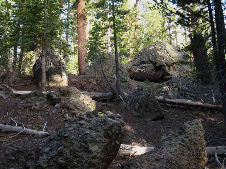
Composite Boulders
around
Round Lake
 |
||
Making our way South through a field of composite boulders that are slowly melting into great piles of rock and gravel as the weak cement binding them together erodes away. The rocks making up the boulders are not going anywhere soon. The cement holding them into boulders is rapidly wearing away.
|
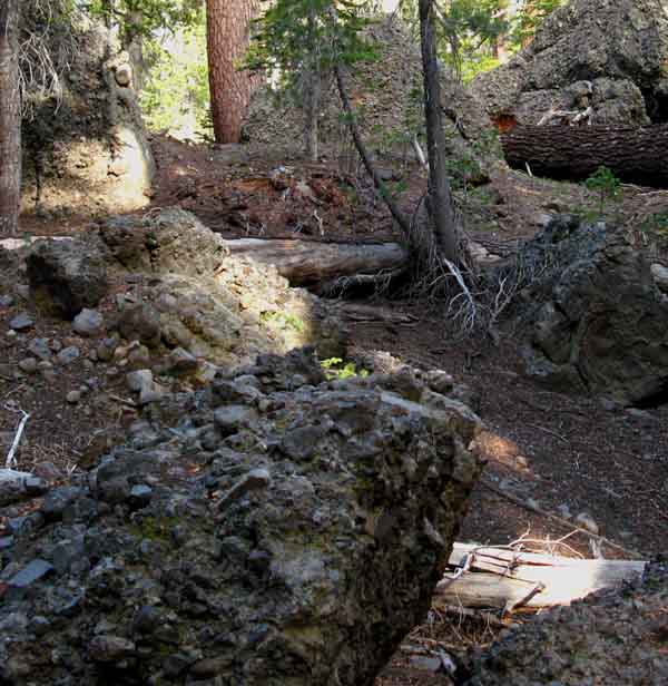
Let's get a closer look at those composite boulders scattered along the seam between volcanic and granite terrain that runs up the center of Christmas Valley
Detail Composite boulders, composed of a variety of small stones and rocks held together in a kind of weak cement, are scattered about the seam between the Volcanic and Granite terrain dividing Christmas Valley. |
||
 |
||
Note the piles and scatterings of loose stones remaining after the cement holding together the composite boulders has weathered away. All of these composite boulders are in the process of melting into piles of stones. The weak cement holding the stones together is weathering away. Imagine volcanic eruptions up and down the Eastern Sierra Flank and Crest big enough to produce lahars capable of burying great granite Sierra peaks while filling the valleys between them. All flows subsequently hardened and erosion and weathering began working over thousands of years to finally erode away and expose the buried ancient granites below, simultaneously carving the great volcanic spires that rose as the valley was re-sculpted by erosion. Today we see these composite boulders at the last stage of their lives, being the last contribution of these ancient volcanoes to the composition of Christmas Valley. As the composite boulders disappear they leave nothing more than odd piles of stones along our trail. Terrain Forum |
Composite Boulder Fields Also check out the field of composite boulders off the South Flank of Reynolds Peak along the Pacific Crest Trail route between Carson and Ebbetts Passes in the Mokelumne Wilderness. And the composite boulders along Silver Creek on the North side of Tyron Peak in the Carson Iceberg Wilderness. Looking at the various composite boulders we encounter backpacking down the Sierra Crest makes us aware of subtle differences between each area's terrain. The weak cement holding them together varies slightly, the type of rocks they swept up changes from area to area, and the life span of individual composite boulders is affected by the exposure they experience after calving off from their source-cliffs. Above we saw an active source of composite boulders: the Round Lake Pinnacle. The Round Lake Pinnacle also serves as a Winter navigation landmark as well as a source of geological information. |
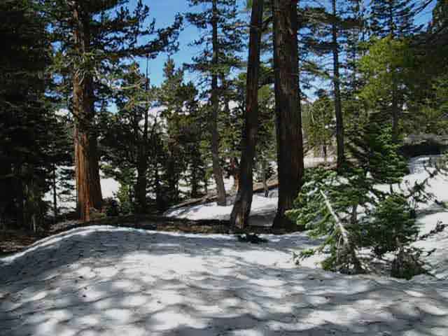
Over the Last Rise to Round Lake
Top of the Rise Looking Southwest towards Round Lake
Last Ridge South to Round Lake Climbing the low ridge South of the Boulder Garden pictured above we're making our final ascent to the top of the last rise, over the last ridge between us and Round Lake. Well, at least until we become familiar with the terrain. This is a great place to get to know. The trail up from the South Upper Truckee is not too long, but its course is packed with detail, and it is steep. The dense mixed forest, the variety of terrains, and the close-in nature of the terrain makes this a special place worth spending the time and energy to familiarize yourself with. Look to your Right descending to Round Lake. First, we will see a campsite. It's kind of hidden from the trail, but we can see it across a fallen tree between two low rises in the terrain. Next, after hiking down to Round Lake we see a trail branching off to the Right when we reach lake level. This trail leads around the North Shore of Round Lake to the check dam, past a series of nice campsites. These campsites are tucked into folds in the ridge running East and West above the North shore of Round Lake. |
North: Big Meadow Trail Junction South: More Round Lake
South Down to Round Lake
 |
Reaching the high point of the ridge around the North shore of Round Lake we have a short hike down to the Lake. That's a segment of the trail melting through the snow. |
Down to Round Lake
 |
||
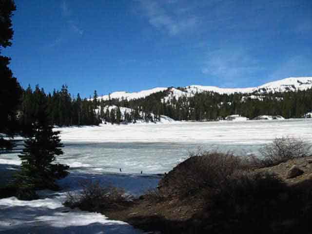
Round Lake's soft-frozen surface appears through the trees.
|
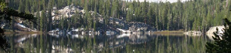
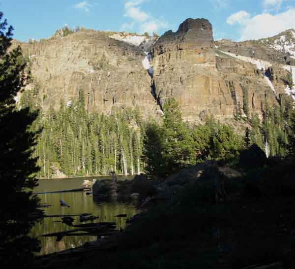
View Southwest Across Round Lake
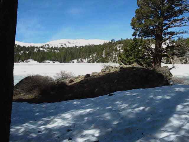
View South Across East Shore of Round Lake
 |
|||
View South across the East shore of Round Lake. This is the direction of the trail South to Meiss Meadow, and towards our exit from the Lake Tahoe Basin through the Carson Gap. We can see where the Tahoe Rim begins lowering to the Carson Gap, from Right to Left, along the ridgeline on the horizon. Though hard to distinguish, the furthest peak on the far Left of the ridgeline is actually Round Top, sitting outside of the Tahoe Basin. The peak to its Right is closer to us, being part of the Tahoe Rim, and we can make out the faint line of the ridge running to its Left in front of Round Top. We will exit the Tahoe Basin over the low point of that ridge. Forum Snow Videos
|
Backpacking Information
South Upper Truckee Road TrailheadMeiss Country Roadless AreatoApproaching Round LakeElevation Mileage Above that point there are new switchbacks up to the Burnt Flat not indicated on any of the maps, mine included, and I'm sure there are a few more minor alterations I failed to record on the map. This trail has radically changed over the years. The trail was rerouted between 2008 & 2010. The original trailhead was at the end of the dirt road to the Forest Service Summer homes, and the original route is as indicated on the maps. What do you think the new mileage is between the South Upper Truckee Trailhead and Round Lake? Hit the Forum with your figuresMileages Note I am recording miles measured at a high degree of magnification on the USGS 7.5 topo maps. I am following the trail routes marked on the maps except when the actual trail route varies from the marked route, which is quite often. Trail miles and map representations of trail are a moving target. The mileages on the trailhead signs, posted on the trail junction markers and posts, and noted on the various trail guides are a snapshot of distances at a particular point in time. Nature moves, Trails reroutes and repairs, and we hike. Local Options
|
North: Big Meadow Trail Junction South: More Round Lake
Arriving at Round Lake
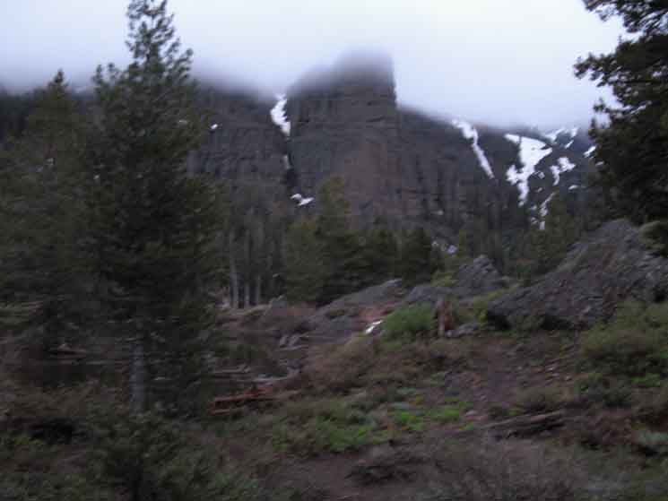
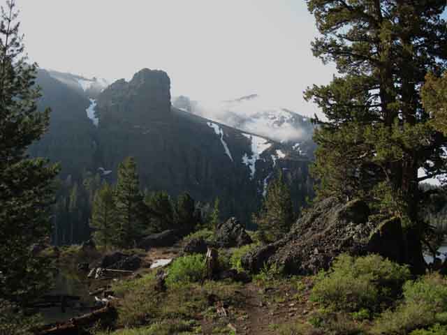
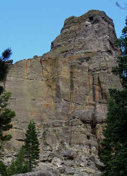
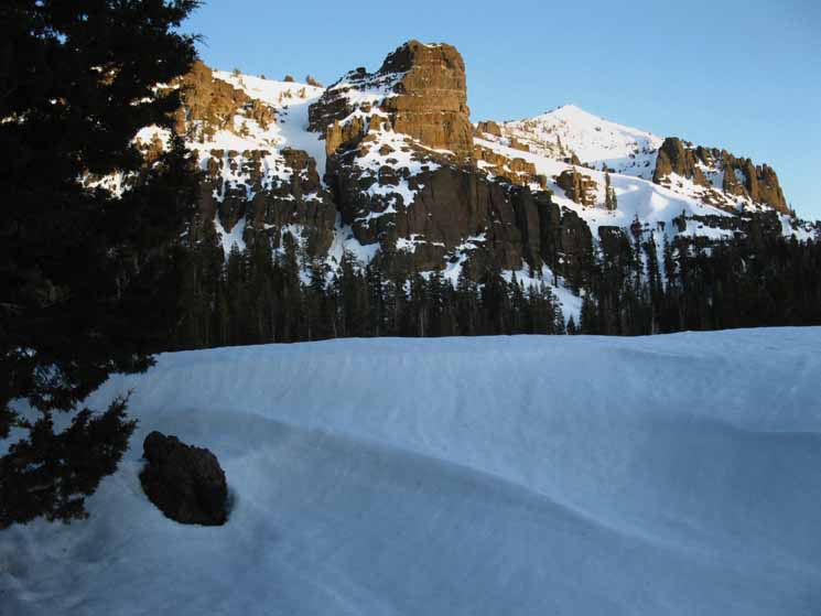
Veil of afternoon fog Settles on the Pinnacle. What I call the Round Lake Pinnacle rises off the East Shore of Round Lake. |
||
 |
||
Light Rains and heavy Mists. Looking at the great volcanic features composing the East side of Christmas Valley above Round Lake. This great volcanic feature is the source of the composite boulders.
|
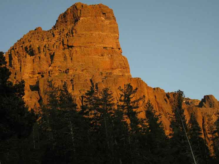
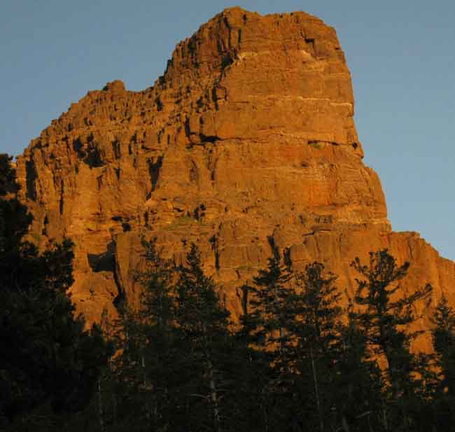
Round Lake Pinnacle
Round Lake Landmark
in the
last light of Day
Bathed in Twilight from campsite near check-dam. The soft glow of the sunset on the rock got me up and out of camp to shoot this, and the pictures below. Round Lake Pinnacle bathed in twilight glow: A sure Landmark for Round Lake from Echo Summit above, to the Tahoe Basin down in Meyers, up to Meiss Meadow. |
||
 |
||
Notable feature overlooking Round Lake, both for its beauty, its role as a four-season Landmark, as well as for its constant contributions to the vast field of massive composite boulders littering its base. Maybe that's why I always camp on the North, rather than East side, of Round Lake. This sucker is coming down! Granted, it is coming down in a Geological Time Frame, but it is coming down nonetheless.
|
Sphinx of Round Lake
 |
| Detail of the top of the Round Lake Pinnacle reveals its composite internal nature, as well as the diverse subtle coloring of it outer surfaces. Note the yellows and oranges of Lichen growth, the green of moss, rust, and even a patch of grass. |
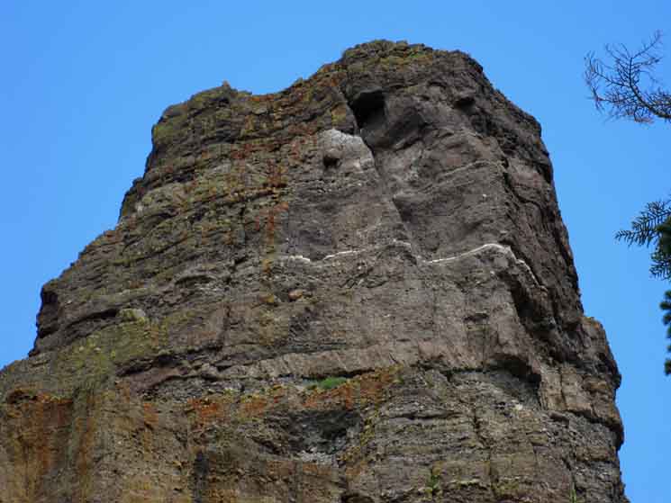 |
The instability of the structure is plainly visible in this shot. This explains all the boulders at its base. The diagonal seam along the Right side presages a major rockfall. |
Aspects of the Round Lake Pinnacle
| Round Lake Pinnacle towering above. | ||
 |
||
Composite Pinnacle with Composite Boulders it has shed litter its base. Many roll down towards the lake taking down swaths of forest on their way.
|
| Round Lake Pinnacle |
 |
Lake and Shadow foreground. |
Winter Sunset 2001
Film
| Winter Twilight brings early cold to the Shaded Basin Round Lake sits within. |
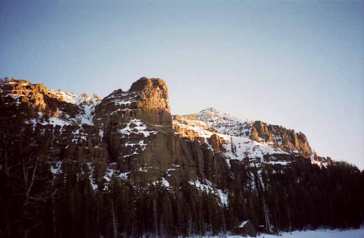 |
The same features that make Round Lake cool in the Summer makes it cold during Winter. Winter 2001. |
Winter Sunset 2010
Digital
 |
||
Another beautifully cold Winter Sunset at Round Lake. I used the snow berm above as wind shield for my camp.
|
Camp Al
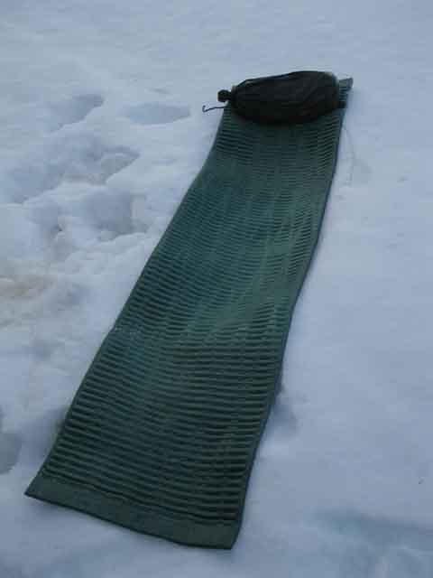 |
I use the tent as my pillow in case anything bad blows in during the night. Otherwise I throw down the pad. |
Cooking-Resting Site
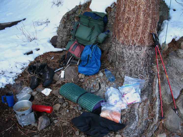 |
||
Nice melted spot provides kitchen and kick-back capabilities. No bear container to protect food during early March, but note the rock hanging off the line on the Right side of the image. Two groups of coyotes howled themselves together during the course of the night, meeting over on the South shore of Round Lake. They moved over to where the trail up from the South Upper Truckee Trailhead reaches the lake as the night progressed. I don't worry too much about coyotes, but I pull my food up high enough they can't jump for it, if they come sniffing around as I sleep.
|
North: Big Meadow Trail Junction South: More Round Lake
Big Meadow
Trail Junction |
The first few pictures at the top of this page depict the last half-mile hiking up to Round Lake from the Big Meadow trail junction. We are reaching Round Lake at the top of Christmas Valley. A blind rise brings us over the last ridge line to Round Lake, who's position is a welcome surprise as new visitors may not realize they are so close to the lake. From the Burnt Flat we got views North of the way we came. Here at Round Lake is the first time we're getting views South of where we are going. Hiking into the opening in the forest cradling Round Lake also gives us our first clear view of the Round Lake Pinnacle since approaching the trail head way down in Meyers, or when we located it from just South of Echo Summit. Regional Views of The Round Lake Pinnacle When we are coming South on Highway 89 towards the Portal Drive turnoff on the way to the Trailhead we can see this feature, as we could from Echo Summit. When we cross Echo Summit Eastbound on Highway 50 into the Lake Tahoe Basin in our car, and start dropping down the Western Wall of Christmas Valley via the Hawley Grade into the Tahoe Basin, pull over for a second into one of the convenient turnouts. If we glance to our East, or to the South, when we are hiking South from Echo Summit on the Pacific Crest Trail we are looking down into (or East across) Christmas Valley's climb upwards from Lake Tahoe level, up to Round Lake. We can easily identify the Round Lake landmark Pinnacle when we get views from the Tahoe Rim South of Echo Summit, if we know what we are looking for. Check out this view into Christmas Valley from the Tahoe Rim South of Echo Summit. Pictured is the top section of Christmas Valley between Round Lake and Meiss Meadow. Once we get to know its position, the Round Lake Pinnacle and its surrounding features offers Winter travelers passing North and South between Round Lake, Meiss Meadow, and Lake Tahoe an excellent navigational aid. Check this view of the Round Lake Pinnacle looking North from Meiss Meadow. This is what I look for in Winter to situate which of my three Northbound routes down to the South Upper Truckee Trailhead I'll take coming back into the Lake Tahoe Basin from Round Top and The Sisters. 7.5 Topo Hiking Map 30 min Topo Hiking Map Next page South |
Backpacking Trail Guide North |
 |
Backpacking Trail Guide South |
Backpacker ForumsHave a great Sierra Nevada route or trip to relate?Post 'em on
On the Forum you can browse trail locations and add your experiences, comments, questions (& pictures and videos if you Register...) about hiking South out of the Echo Summit Trail Head. General comments about the South Upper Truckee to Carson Gap section of the High Sierra trails, or this particular location: Section
|
North: Big Meadow Trail Junction South: More Round Lake
Trailhead
Contact
Alex Wierbinski

Backpacking Lake Tahoe to Mount Whitney
Your guide to the High Sierra Crest, including the Tahoe to Yosemite, Pacific Crest, and John Muir Trails
