High Sierra
Backpacking
Trail Guide
Forums
Sierra
Weather
WeatherNotes Northern
Sierra Weather
Gear
Northern High Sierra
Backpacking Weather Information
Languages
Trail Skills
Mountain
Safety
Food
Planning
Trail Arts
More
Information
Social
| ALL SIERRA WEATHER |
NORTHERN SIERRA WEATHER |
CENTRAL SIERRA WEATHER |
SOUTHERN SIERRA WEATHER |
LAKE TAHOE WEATHER MAP |
CARSON PASS WEATHER MAP |
GEAR | trail guide index | maps index |
Northern High Sierras Weather Information
| North Sierra Weather Information |
|
The Northern Sierra Weather Page is under construction. The list at right is the basic outline of weather resources covering the route from Meeks Bay to Sonora Pass. I will link the weather stations near the trail locations on a nifty USGS map when I get the trail guide constructed down this far. Soon! The Northern Sierra Weather for Backpackers covers the Northern Sierras between South Lake Tahoe to the Sonora Pass area. I consider Yosemite the Central Sierra. To your right find more specific local information about areas in the Northern Sierra Nevada. To your bottom right find broad weather information covering the North Sierra. |
CARSON PASS EBBETTS PASS SONORA PASS |
General Information and Introduction
| Basic Facts | General Northern High Sierra Weather Resources for the Backpacker |
The Sierra Crest is noted for having the capacity to produce four seasons of weather during a single Summer Day. Rain, snow, hail, fog, lightening, and a bit of sunshine can all happen in quick sequence. Spring and Fall can bring flashes of Winter weather, and Winter can turn downright Arctic occasionally. The High Sierra is noted for rapid changes in weather and temperature, and the sudden appearance of harsh weather trends all year round. You may experience anything from intense heat to bitter cold Summer snow storms. Or you may not. In any case, weather must be considered and preparations made to deal with these weather facts BEFORE entering the High Sierras. Long Distance Backpackers who were on the High Sierra Crest in early August of 2009 experienced just such a series of Summer Snow Storms. Temperatures dropped to the high teens and low twenties, snow and hail fell which partially obscured the trails, and all of those who entertained the misconception that the Sierras only have fine weather during the Summertime were bitterly disappointed. Luckily for the many backcountry travelers who were not properly prepared, those storms blew apart, rather than consolidated and deepened.
Weather considerations should inform and guide your gear selection. |
Weather Preparations
|
Four-Season Resources
Additional Winter Information |
REGIONAL SNOW ANALYSES: Western Coastal.NWS Winter Weather ForecastsNational Snow and Ice Data CenterOther
|
Check out the High Sierra Backpackers-All Backpackers Forum: TahoetoWhitney.Org
Backpacker ForumsHave a great Sierra Nevada route or trip to relate?Seen Weird Things in the Sky? Post it on Experiences, comments, questions, pictures, or more resources about the weather? Post them up in the Weather Forum:Forum: Sierra Weather / Area: Northern Sierra Weather |
Last page: Sierra Nevada Weather Index & Info Next page: Central Sierra Weather Index
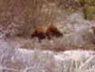
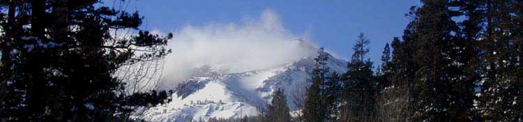
Below: Meiss Country Winter morning Below:Bear at the Silver King Creek, Carson-Iceberg

Backpacking Lake Tahoe to Mount Whitney
Your guide to the High Sierra Crest, including the Tahoe to Yosemite, Pacific Crest, and John Muir Trails