High Sierra
Backpacking
Trail Guide
Forums
Sierra
Weather
WeatherNotes Northern
Sierra Weather
Gear
Southern High Sierra
Backpacking Weather Information
Languages
Trail Skills
Mountain
Safety
Food
Planning
Trail Arts
More
Information
Social
| ALL Sierra Weather |
Northern Sierra Weather |
Central Sierra Weather |
Southern Sierra Weather |
MAP South From Tuolumne Meadows |
Muir Wilderness MAP |
Muir Ranch Map |
trail guide index |
maps index |
Southern High Sierras Weather Information
Southern Sierra Weather Information |
|
UNDER CONSTRUCTION Check out: Tahoe to Whitney
The Southern Sierra Weather Page is under construction. The list at right is the basic outline of the route from Reds Meadow to the Whitney Portal. I will link the weather stations near the trail locations on a nifty USGS map when I get the trail guide constructed down this far. So there's lots more to come. Soon! The Southern High Sierra Weather for Backpackers covers the Sierras between Reds Meadow to the Whitney Portal. To your right find more specific local information about areas in the Northern Sierra Nevada. To your bottom right find broad weather information covering the North Sierra. |
Purple Lake Silver DivideBear CreekSelden PassEvolution MeadowEvolution BasinMuir PassPiute PassBishop Pass Pallaside LakesMather Pass Pinchot Pass Woods Crossing Rae Lakes Bubs Creek Forester Pass Spiller Creek Wallace Creek Crabtree Meadow Trail Crest Whitney Peak Whitney Portal |
General Information and Introduction
| Basic Facts | Basic High Sierra Weather Resources for the Backpacker |
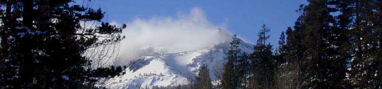
The Sierra Crest is noted for having the capacity to produce four seasons of weather during a single Summer Day. Rain, snow, hail, fog, lightening, and a bit of sunshine can all happen in quick sequence. This is especially true in the Southern Sierra, which has the highest average trail elevations in the Sierra Nevada. The Southern Sierra Crest is generally more isolated, being quite a ways from trailheads for long lengths of the crestline. Making the Southern Sierra even more isolated is the fact that many of the trailheads in the Southern Sierra are a long ways from main roads. The High Sierra is noted for rapid changes in weather and temperature, and the sudden appearance of harsh weather trends. You may experience anything from intense heat to bitterly cold Summer snow storms. Or you may not. In any case, weather must be considered and preparations made to deal with these weather facts BEFORE entering the High Sierras. Long Distance Backpackers who were on the High Sierra Crest in early August of 2009 experienced just such a series of Summer Snow Storms. Temperatures dropped to the high teens and low twenties, snow and hail fell which partially obscured the trails, and all of those who entertained the misconception that the Sierras only have fine weather during the Summertime were bitterly disappointed. Luckily for the many backcountry travelers who were not properly prepared, those storms blew apart, rather than consolidated and deepened.
Weather considerations should guide your gear selection. |
Weather Preparations for Backcountry TravelAll SeasonsThe Northern Sierra General Information
Satellite NWS Water Vapor Western US 28 KM
Radar The NWS Radar out of the San Joaquin Valley covers the Souther half of the Sierra. The NWS Pacific Southwest Radar covers all California, and can be clicked for local detail.
Forecasts
Real-Time Ground Reporting Stations Meso-West South California Map For more detailed information see the area links above. |
Four-Season Resources
| Additional Winter Information |
REGIONAL SNOW ANALYSES: Western Coastal.NWS Winter Weather ForecastsNational Snow and Ice Data CenterOther North Sierra Reporting StationsFeds: Natural Resources and Conservation Service. All California Snotel StationsState: California Department of Water Resources. All Snotel Stations: CDWR Home Page, select “Stations” tab.
|
Check out the High Sierra Backpackers-All Backpackers Forum: TahoetoWhitney.Org
Backpacker ForumsHave a great Sierra Nevada route or trip to relate?Post it on Experiences, comments, questions, pictures, or more resources about the weather? Post them up in the Weather Forum:Forum: Sierra Weather / Area: Southern Sierra Weather |
Last page: Central Sierra Weather Index Next page: Sierra Nevada Weather Index & Info
Contact
Alex Wierbinski

Backpacking Lake Tahoe to Mount Whitney
Your guide to the High Sierra Crest, including the Tahoe to Yosemite, Pacific Crest, and John Muir Trails