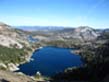
The Current Status of Highland Creek
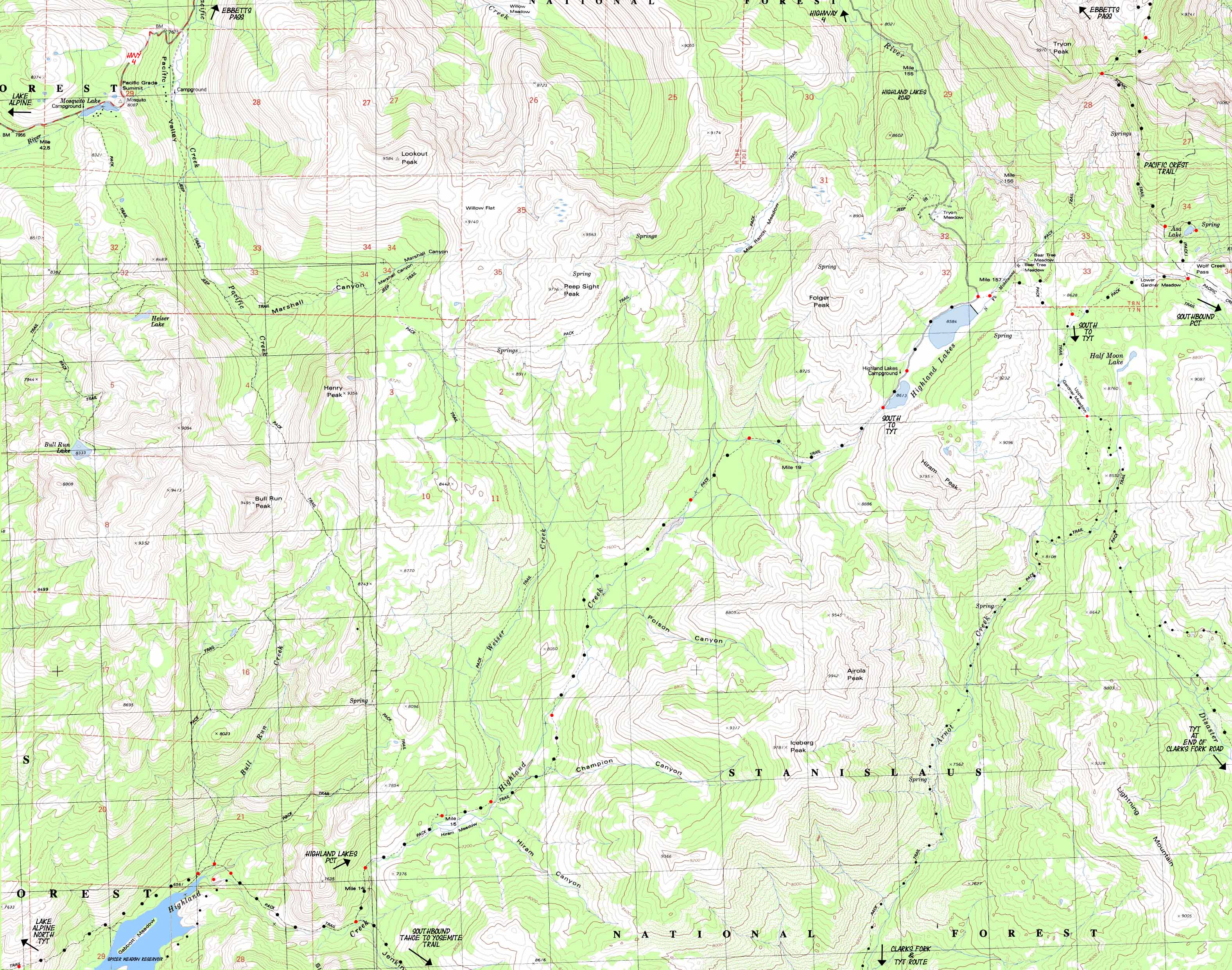
The USGS Topo Maps above are inaccurate. Spicer Meadow Reservoir now extends Northeast, covering Gabbot Meadow and extending to the three trail junctions pictured on the far Left, or Eastern side of the map above.
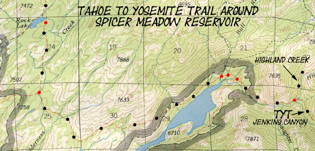
The trail South down to what is now the Northeast shore of Spicer on the map above has been moved higher up the side of the canyon as indicated on the map below... |
|
Click the red dots on the maps above to see the trail configuration as of October 2011, when the trails depicted above were modified into the new configuration of a single trail junction to the North from the upper end of Spicer Meadow Reservoir.
This small section of topo map of the present configuration of Spicer Meadow Reservoir above is from the National Forest Service 1987 Carson-Iceberg Wilderness Map. It depicts the old trail junction configuration.
See the
2009 National Forest Service Map without the Bull Run Trail that was removed, and with Spicer Meadow Reservior:
2000 Carson Iceberg Wilderness (pdf).
The map above represents the current configuration of the trail junctions and reservoir.
MAP NOTE
Those squares breaking the USGS topo maps up into a grid are the Universal Transverse Mercator / Military Grid Reference System, otherwise commonly known as UTM.
What's important for our general reference purpose is that each side of a square is 1000 meters, or a Kilometer.
From my point of view that is 1000 yards or .62 of a mile.
Diagonal: 1414.22 meters, if my trig is correct. |
|
Location
Jenkins Canyon Highland Creek Trail Junction, SW Corner of Local Loops |
Main Features: 11.38 miles South of Silver Valley Trail head at Lake Alpine we arrive at the Jenkins Canyon trail junction. Here the Tahoe to Yosemite Trail turns Southeast up Jenkins Canyon while the Highland Creek Trail continues another 6.46 miles up Highland Creek towards its Highland Lake Trailhead.
Highland Lakes also sports the Gardner Meadow Trailhead just Northeast of Lower Highland Lake, 1.15 miles from the Highland Lakes Trailhead we emerge from. From Gardner Meadow we have a 1.12 mile hike East towards the Pacific Crest Trail junction at Wolf Creek Pass. Long distance backpackers are using this short road section between the Highland Lakes and Gardner Meadow Trailheads to finish up connecting up the TYT to the PCT. The road access to Highland Lakes opens up Northern access to a wide range of nice backpacking loops around the Carson Iceberg Wilderness.
Highland Lakes Road Map
Hiking 1.93 Southeast out of Gardner Meadow we run into the Northern end of the the Arnot and Disaster Creek Trails. Trailheads for both of these trails are situated on Clarks Fork Road off of Highway 108. 6.31 miles South down Arnot Creek hikers encounter the Tahoe to Yosemite Trail heading North up Woods Gulch towards Jenkins Canyon. Turning North here to hike the 5.83 miles over Woods Gulch and Jenkins Canyon we reach Highland Creek. The Highland Creek Jenkins Canyon trail junction is 6.46 miles below Highland Lakes.
Hiking down Disaster Creek brings us to the Paradise Valley trail up to the PCT at Golden Canyon, where we can loop back to Gardner Meadow hiking North on the PCT via Wolf Creek Pass.
The map we are looking at above is not just the decision point for a potential alternative route on the long trails. This trail junction is also the Southwest corner of a series of great backpacking loops around the Carson Iceberg Wilerness beginning at Highland Lakes or the Clarks Fork Road. Now imagine if we had continued hiking past the Arnot-Disaster Creeks trail junction East of Gardner Meadow to the Pacific Crest Trail at Wolf Creek Pass. 5.71 miles South down the PCT we will encounter the the Golden Canyon trail junction. While the Golden Canyon trail heads East down to the remote East Fork of the Carson River, the Paradise Valley Trail tracks 3.16 miles Westbound down to Disaster Creek.
We can hike North up Disaster Creek back to our Gardner Meadow Trailhead, or turn South towards the Tahoe to Yosemite Trail along the Clarks Fork of the Stanislaus River, which we can follow back to Silver Valley at Lake Alpine.
Check out the maps, miles, elevations, and the trail guide pages to put together your own custom-crafted bakpacking loop through the Carson Iceberg Wilderness that suites you skills, fitness, and time constraints.
This terrain offers completely different experiences than the Yosemite backcountry. |
Location
Highland Creek Trail to Highland Lakes, Carson-Iceberg Wilderness |
Trail Stories. Trail Culture, Trail Crew: The Jenkins Canyon trail junction is where we have the option to break off of the Tahoe to Yosemite route and continue up the Highland Creek Trail towards Highland Lakes and our trail junction with the Pacific Crest Trail, just to the East of Highland Lakes at Wolf Creek Pass.
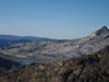
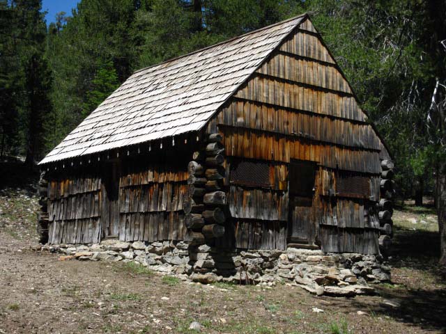
I have only encountered people three of four times between the East side of Spicer Meadow Reservoir and Highland Lakes during years of backpacking through this area. One of my favorite encounters was with a CCC (California Criminal Corps) crew stationed near Hiram Cabin, pictured below, near Hiram Meadow.
About half of this crew looked like they were living in hell. They were dirty, tired, dragging their feet, dull eyed, and not having a good time at all. The other half of the crew looked like they were in heaven. They were also dirty, but were light-footed, had sparkling eyes, and were looking like it was the first time their souls had been set free in nature.
Such was the composition of the CCC. Half got set free in nature, and the other half went running screaming out of nature.
As of July of 2009 the cabin's shingle roof needs to be weather and fire treated. It was completely dried out and bleached.
I like to take this route option because heading South from Wolf Pass on the Pacific Crest Trail ultimately brings me through one of my favorite places, the East Fork of the Carson River. From Wolf Pass we head South on the Pacific Crest Trail and will shortly begin backpacking along the Western flank of the mountain wall bounding the Western shore of East Carson River: The Sierra Crest. And a fine section of the Crest it is.
Instead of heading up through canyons towards the Sierra Crest on the Tahoe to Yosemite Trail we are looking down the heads of canyons from the Sierra Crest above the East Fork of the Carson River.
I can't think of many places I would rather be. Except working my way up the E. Carson, from the Carson Falls to the junction of the E. Carson Trail with the Pacific Crest Trail. |
|
Road Map
Ebbetts Pass, Lake Alpine,
and
Bear Valley
|
|
The map above is set up to show access to the Lake Alpine and Ebbetts Pass trailheads on Highway 4.
We can also adjust the road map a bit to the South to find where the paved Spicer Meadow Road breaks off the South side of Highway Four to the West of Bear Valley to access the Tahoe to Yosemite Trail.
The paved Spicer Meadow Road leads to a web of improved Forest Service Roads servicing Union Spicer Meadow Reservoirs. Forest Service Road 7N01 offers the closest hiking access to the Tahoe to Yosemite Route at its end at Elephant Rock Lake.
I guess that this would be a good place to begin and end a backpacking loop. But, I think Highland Lake is a better place to begin remote loops. Highland Lakes is situated between the TYT and PCT, rather than being offset from the TYT as is the Elephant Rock Lake access point.
It depends on what you want to see. The best trip for different folks are different. The Elephant Rock Lake entry point is perfect for access to Rock Lake, then around to Duck Lake, then back down the mountain to Elephant Rock Lake.
That is a beautiful piece of country with three beautiful lakes in close proximity on a nice litttle loop. |
Mapping, Mileage,
and
National Forest
Information |
Miles and Elevations
Lake Alpine to Saint Marys Pass
Ebbetts Pass to Sonora Pass
Guide
Highway 4 to Highway 108
Trail Guide Index
Maps
Highway 4 to Highway
108 Map Index
Page
Lake Alpine Backpacking
trail guide page
Backpacking permitting authority
Stanislaus National Forest Wilderness
Contacts
Stanislaus National Forest
National Forest website
Carson-Iceberg Wilderness
Physical Location
Between Highway 4 and Highway 108 |
Four Topo Maps compose this USGS Map
maps
NW Map Name: Pacific Valley, 1979, 7.5 minute USGS topographic map
SW Map Name: Spicer Meadow Reservoir, Calif, 1979, 7.5 minute USGS topographic map
SE Map Name: Ebbetts Pass, Calif, 1979, 7.5 minute USGS topographic map
SE Map Name: Dardanelles Cone, Calif 1979, 7.5 minute USGS Topographic
Compass Offset
Magnetic North is 16 1/2 degrees East of True North
scale
1:24 000
Contours
40 feet
The second map below the main map
USDA Forest Service Carson-Iceberg Wilderness Map.
Scale
1:63360
Countors
80 feet |
| |
| Elevations |
|
More Information |
Lake Alpine
7330 feet
Spicer Meadow Reservoir
6560 feet
Highland Lakes (towards PCT)
8613 feet
High point between Jenkins Canyon and Woods Gulch (TYT): 8142 Feet |
Trail Guide Section Index
Highway 4 to 108
Trail Guide page
Rock Lake to Jenkins Canyon
Map Index, TYT
Highway 4 to 108 |
Map Credit: Thanks, USGS ! |
U.S. Geological Survey, Department of the Interior
Download Free USGS Topo Maps
USGS MAP LOCATORI
love these guys... Move the Map to the Sierras. Select size of Maps you wish to locate. Click "Mark Point" on map to see the USGS map grid of the selected map scale.
USGS Topographic Maps
Map Information
Common Map Symbols |
|