The Trails
Guide
Maps
Miles/Ele
Permits
Resupply
Forum
Current Weather Conditions
Weather Notes
Northern High Sierras
Central High Sierras
Southern High Sierras
Gear
Gear List
Gettin Started
Layering
Discussion
Testing yourself and your gear
Gear Reviews
Backpacking
Lake Alpine to Rock Lake
Hiking
The Tahoe to Yosemite Trail between Lake Alpine and Saint Marys Pass
Languages
Languages
Trail Arts
The art of walking
Physical Preperation
Trail Skills
The trail
Off the trail
Scrambling
Maps
Navigation
Camp skills
Food
Resupply
Food
Other
Photo Catagories
Trail Stories
Trail Culture
News and Science
Links
Groups
Books
Terms and Conditions of Use
| Trail Guide INDEX Highway 4 to Highway 108 |
TYT North Lake Alpine |
TYT |
7.5 Topo Hiking Maps |
30 min Topo Map Carson Iceberg Wilderness |
Lake Alpine to Saint Marys Pass MILES AND ELEVATIONS |
TOPO MAPS INDEX Lake Alpine to Saint Marys Pass |
Resupply Resupply |
National Forest Stanislaus |
all maps index |
South
into the
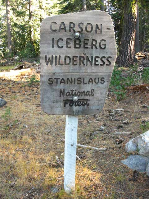
Carson Iceberg Wilderness
on the
Tahoe to Yosemite Trail
Trail Section This hike will give us a great look at the Western half of the Carson Iceberg Wilderness. Remember, the last 4.57 miles of this section are a significant climb up to and over 10,400 foot Saint Marys Pass on a pretty darn challenging Hard 1, Class 3, unmaintained route. I found a series of Wild Ducks marking key points in the route around Clarks Meadow high up off the North bank of the River and Meadow during 2010, the last time I hiked through here. We explore both the unmaintained route over Saint Marys Pass as well as a set of very interesting maintained trail alternatives to crossing the unmaintained section of the Tahoe to Yosemite Trail over Saint Marys Pass. We've got many route options across the Carson Iceberg Wilderness. We can bypass Saint Marys Pass by hiking up to the Pacific Crest Trail along one of four possible routes. The Pacific Crest Trail brings us South to Sonora Pass rather than Saint Marys Pass along the TYT. The Silver Valley trailhead is a portal into short and long local backpacking trips and loops remaining within the Carson Iceberg Wilderness. The guide pages below introduces us to the lay of the land and gives us the tools to explore the Carson Iceberg Wilderness all at once or a little piece at a time. Trail definitions used on this guide. IndexMaps, Miles, and Elevations
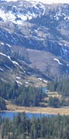
Carson Iceberg Wilderness 30 minute USGS topo map Lake Alpine to Rock Lake
|
||||||||||||||||||||||||||||||||||||||||||||||
The Silver Valley Trailhead1st Goal:
|
| Carson Iceberg Wilderness 30 minute USGS topo map |
Spicer Meadow Reservoir to Highland Lakes 15 minute USGS topo hiking map |
Mileage
Lake Alpine to Saint Marys Pass
TYT miles and elevations
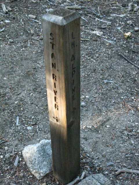
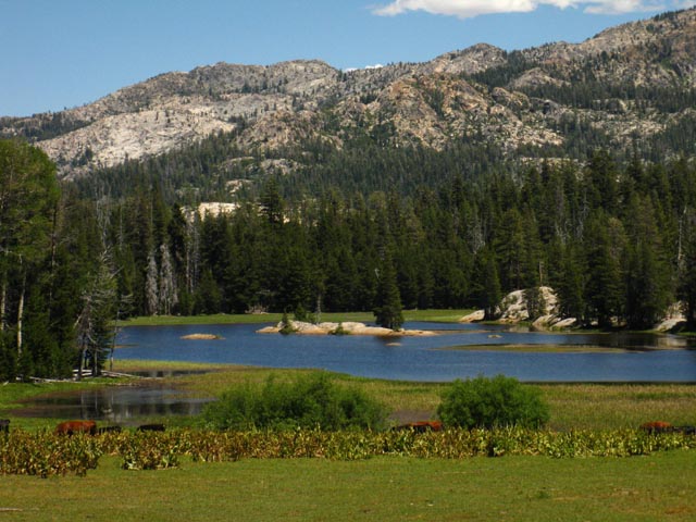
Good campsites are available at Duck Lake, the North Fork of the Stanislaus, and Rock Lake.
| comments | Forum |
The Situation If we are hiking the Tahoe to Yosemite Trail we have just resupplied and fed up at the Lake Alpine Lodge on Highway 4, had an ice cold beer, or two, and are now rested, resupplied, and ready to continue South on the TYT through the Silver Valley Trailhead on the East Shore of Lake Alpine. We deserved it after hiking 68 miles South from out starting trailhead out of Meeks Bay up in Desolation Wilderness, and especially after crossing the really fun, and really challenging unmaintained segment of trail hiking South through Summit City Creek on our way to Lake Alpine from Carson Pass. Or, we could be beginning a backpacking loop, a local in-and-out trip, or hiking a point to point trip out of the Silver Valley Trailhead to another trailhead. No matter. Good Hiking Ahead in the Carson Iceberg Wilderness for everyone, be we short, long, or in-betweeners! Duck Lake to Spicer Meadow Reservoir No loops for us. We're going long. We're hiking the TYT 34.57 miles across the length of the Western Carson Iceberg Wilderness through Saint Marys Pass to Highway 108. We have more than two ways to skin this cat.
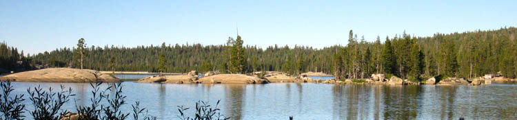
FULL Route Selection Carson Iceberg Wilderness Map Collection This makes every map a handy index to the underlying trail guide information. Use the arrows along the edges of the maps to click to the next maps up and down the trail. However we get there, our next resupply spot for long distance backpackers headed South is located on Highway 108 at Kennedy Meadows Pack Station. Northbound backpacker's next resupply opportunity on the trail is at the Echo Lake Chalet, 37.92 miles North of our position at Lake Alpine. Even better resupply options await the Northbound hiker on the Pacific Crest Trail just a short ways off the trail in beautiful South Lake Tahoe, a few miles East of Echo Summit on Highway 50. Lots of fun, rest, and relaxation in South Lake Tahoe! Long and Short Distance Long Distance Carson Iceberg Backpacking Options TYT PCT Hybrid Trail Routes This TYT-PCT hybrid pushes the length of this section of trail between Highways 4 and 108 up to 43.42 miles and adds thousands of feet of climbing. I prefer the terrain along the TYT on the Northern and Southern ends of the Carson Iceberg Wilderness, and the terrain along the PCT through the center of the Carson Iceberg Wilderness. This route modification can achieve three goals. First, it extends the length of our trip and expands the scope of our understanding of the terrain. Second, it brings us around the paved segment of the TYT past the packed car campgrounds along the Clarks Fork Road. Third, if offers a detour around the challenging unmaintained and untrailed segment over Saint Marys Pass at the Southern end of the Tahoe to Yosemite Trail. Detouring around this unique route would be a shame. These challenging segments of unmaintained/untrailed route are what make the Tahoe to Yosemite Trail so unique. It's good to have a detour around the upper Clarks Fork segment of the TYT if our fitness or skills are not up to Hard 1 trail difficulty requiring route finding demanding Class 3 skills. We will miss this unique segment of trail if we stay on the Southbound PCT. We can cut back down to the TYT on the South side of the Carson Iceberg through the short but sweet Boulder Creek trail down to the TYT just below where the challenging climb to Clarks Meadow and over Saint Marys Pass begins. In any case, there's lots of beautiful long distance hiking options that remain within the Carson Iceberg Wilderness. We can set up the route that suits our skills and fitness. This article will give you some insight into the long and medium distance loops we can hike in the Carson Iceberg Wilderness by mixing together sections of the Tahoe to Yosemite and Pacific Crest Trail routes via the four trails that connect them across the length of the wilderness. Short Backpacking loops and trips in the Carson Iceberg Wilderness Access Points Access to the PCT from the East via the East Fork of the Carson River is a hard, but very rewarding way in. Check out the Road Maps for more context on our potential access point trailheads around the Carson Iceberg, and the Sonora Pass Trailheads page for more ideas about local loops and short distance backpacking North into the Southern Carson Iceberg Wilderness. A Very Long Trail... We can plan local backpacking trips in the Carson Iceberg that can run from a few short miles up to the mid-teens and low-twenty mile distances up to 80 or 90 miles for a full loop of the Carson Iceberg Wilderness tying together most of the lengths of both the PCT and TYT. Check the Highway 4 to 108 Trail Guide Index for more information. Here we cab find access to the maps, mileage, elevation, and trail guide information that can help plan our own custom adventures through the Carson Iceberg Wilderness from the North. The Sonora Pass Trailheads page shows trail access North into the Carson Iceberg Wilderness from the Southern end of the wilderness. So Many Killer Routes and Trails Come back after you finish hiking the Tahoe to Whitney and pick them off to fill in more of the blank spaces on the map in your head. Carson Iceberg Wilderness Topo Map
|
Southbound
Tahoe to Yosemite Trail
The Highland Creek Trail at the Silver Valley Trailhead
| Southbound into the Carson Iceberg Wilderness from the East side of Lake Alpine. | ||||
 |
||||
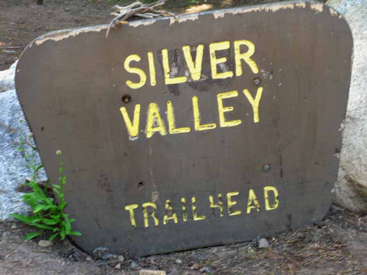
Silver Valley Trail Head, Tahoe to Yosemite Trail, East side of Lake Alpine.
This is mile 0 for the Tahoe to Yosemite miles figures across the Carson Iceberg Wilderness.
|
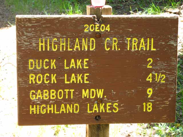
Highland Creek Trail As the old sign above indicates, this section of the Tahoe to Yosemite Trail is also known as the Highland Creek Trail. This trail leads directly up to Highland Lakes, near the Pacific Crest Trail at Wolf Creek Pass. Gabbott Meadow, listed on the sign below, no longer exists, having been drowned by the extension of the Spicer Meadow Reservoir during the late 1980s. Our contemporary destination is the set of campsites up on the end of the reservoir above the drowned location of Gabbot Meadow. 1979 USGS Topo Map with and without 2009 National Forest Service Map with The Tahoe to Yosemite Trail skirts around the flooded section of Highland Creek's canyon that once hosted Gabbott Meadow, but now is filled with reservoir water. Both the creek and the meadow are now deep under Spicer Meadow Reservoir's waters. The TYT now pushes further Northeast around the upper limit of Spicer Meadow Reservoir where Highland Creek feeds it, then turns Southeast for a short distance above the reservoir to bend itself around to enter the narrows of Highland Creek Canyon. (Correction: One trail now.) Lake Alpine to Spicer Meadow Reservoir A few feet South of where we enter Highland Creek Canyon the Tahoe to Yosemite Trail turns South (Right) at a well-marked trail junction up Jenkins Canyon. The Highland Creek Trail continues Southeast up towards Highland Lakes and the Pacific Crest Trail. We can carve many fine short and medium distance hiking trips out of the network of trails that connect the Tahoe to Yosemite route South of the Silver Valley Trailhead with the Pacific Crest Trail's route across the Carson Iceberg Wilderness.
|
| The old Highland Creek Trail sign at Silver Valley Trailhead. | ||
|
||
I did not see this sign last time through, 10-26-11. The Stanislaus National Forest is either repainting it, or they have decided to take it down. Gabbott Meadow is now submerged under the East end of the Spicer Meadow Reservoir. Gabbot Meadow is now replaced by the campsites on the far Northeast edge of Spicer Meadow Reservoir as the backpacker's destination 10 miles from this trailhead.
|
Silver Valley Trailhead
| The custom old Stanislaus National Forest information Board. |
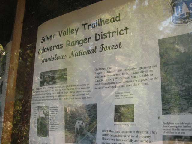 |
National Forest Information, Silver Valley Trailhead. Trees, nature, bears, water, and warnings of beauty with a "bite!" |
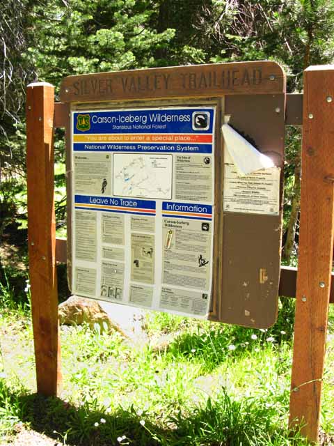
Silver Valley Trailhead
| The new style National Forest information display. | ||
 |
||
This is the standardized format that we now see at all National Forest trailheads.
|
A few Feet South
of the
Silver Valley Trailhead
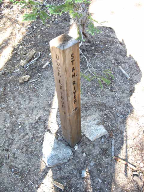
Emigrant Trail
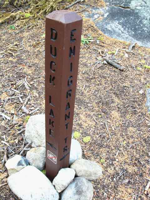 |
Just a few feet South of the Silver Valley Trailhead we encounter this junction with the "Emigrant Trail." Between seasonal trips I noticed this junction showed up. I think it was sometime around, maybe after, 2004. Yet another "Emigrant Trail." I was a little irritated at the time. Yet another new trail to explore. Jeeze, I was pushing hard to explore my "must hike list," and the damn list kept getting longer and longer with each new hike, rather than shorter... This trail is pointed 90 degrees off the route of our North-South TYT, to the Northeast, and it was not pointing into great granite or any especially remarkable terrain. So I put it on my "new information" list, and stopped worrying. It was not listed on any Federal maps until the new 2009 Forest Service Map of the Carson Iceberg Wilderness was published. The map indicates a route climbing moderately over 3 miles as the bird flies moving East roughly parallel with Highway 4 to and through Stanislaus Meadow up to the headwaters of the North fork of the Stanislaus River flowing out of Mosquito Lake. This information promoted this trail up to my "explore for suitability for future Winter Trips" list. I've entertained dreams of crossing the Sierra during Winter for quite some time. I've gotten to the crest from the East and the West many times, but have never put together full crossings. I've been eyeing the Sonora Pass Road for years, but circumstances have never come together properly. Then I caught some frostbite, which was manifesting a deeper weakness. These physical events slowed down my Winter plans as well as Summer excursions. |
A few hundred yards South
of the
Silver Valley Trailhead
| Entering the Carson Iceberg Wilderness. | ||
 |
||
About a quarter mile beyond the trailhead we enter the Carson Iceberg Wilderness. We notice that our Southbound trail route makes a big turn to our Left, to the Northeast. Looking carefully at the terrain we also notice that an old trail route continues straight through this bend to the Southeast. We come to the conclusion that this big Left-turn is designed to break up the old, straight route of trail down to the West shore of Duck Lake into a new segment of trail that makes two great switchbacks down to the West shore of Duck Lake. Lake Alpine Region Hiking Map We can still see indications of the old trail which once continued straight down the side of this low ridge to the West shore of Duck Lake.
|
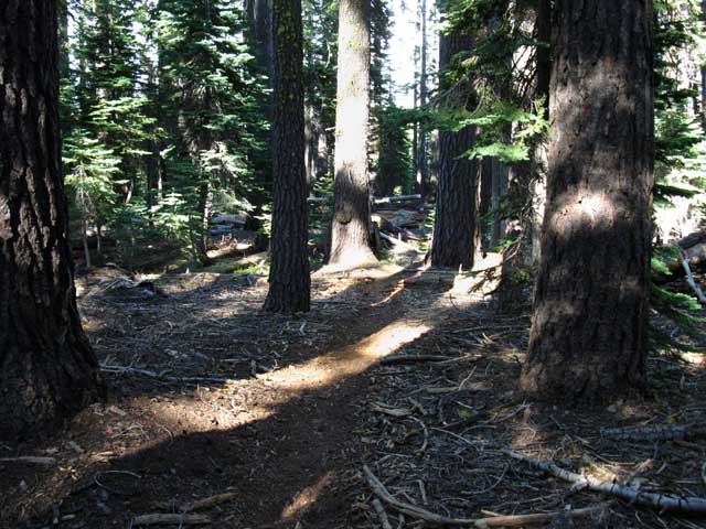
Ancient Forest
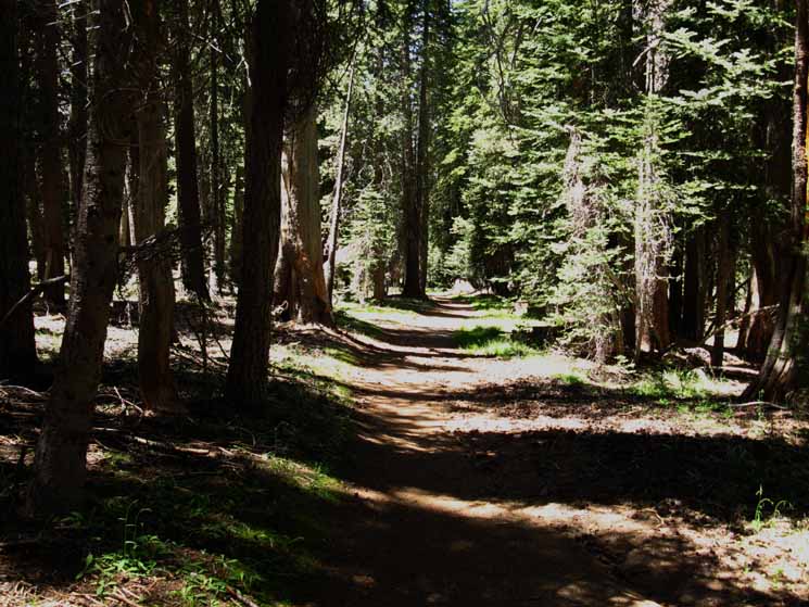 |
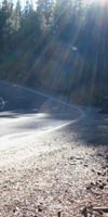
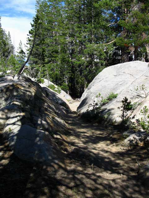
Bright morning light slashes across ancient forest and human trail between Silver Valley Trailhead and first Duck Lake junction. I'd say the width of the trail here is relative to the number of car campers at nearby campgrounds. |
The Duck Lake Loop
The Duck Lake Loop Presents Long Distance Backpackers with two routes South. Two Ways South on the Tahoe to Yosemite Trail Around the North Shore This furthest Duck Lake Loop trail junction is the point where the two wings of the Duck Lake Loop come together on the Southeast side of the lake. Doing the Loop Check the pictures and videos on the guide page below for more details. Duck Lake Loop for Local Backpackers Lake Alpine Area Backpacking Map The Duck Lake Loop .54 of a mile South of the Silver Valley Trailhead in the Carson Iceberg Wilderness we encounter the first of the Duck Lake Loop trail junctions. This is where we decide to go around the North Shore (straight) or the West Shore (Right) Distance to the junction on the West shore of Duck Lake past the wrecked ranch from the Silver Valley Trailhead: 1.08 miles. Distance to the far junction on the Southeast side of Duck Lake from the Silver Valley Trailhead taking the route around the North shore of Duck Lake: 1.28 miles. Distance between the Southwestern and Southeastern Duck Lake Loop trail junctions on the South side of Duck Lake: .58 mile. Total distance around the Duck Lake Loop: 2.94 miles total. Tahoe to Yosemite Trail hikers can take either route from the first Duck Lake Loop junction pictured below, as both routes bring us around Duck Lake to the same location on the Southeast side of Duck Lake. The real difference between the two is which side of Duck Lake we hike around on our way South. Though both trails join up at the Southeastern side of Duck Lake I far prefer staying to my right at the first trail junction to hike around the West, then the South sides of Duck Lake. Faint Shortcut Trail Visible The first Duck Lake Loop junction is a bit confusing because a faint trail cuts off from the trail prior to reaching the first Duck Lake Loop junction, breaking off to the Southbound backpacker's Right. Well, we go straight onto the faint trail where the regular trail turns Left, so that's a practical Right turn... This unmarked trail heads directly towards the West side of Duck Lake, bypassing the first Duck Lake Loop trail junction altogether. (Map) This little shortcut route meets up with the Western (Right) Loop trail coming down from the Duck Lake junction on its way to the West side of Duck Lake. Note how this shortcut route "straightens up" the trail down to the West side of Duck Lake by cutting off the trail loop to the Southeast. The reason this is not still the official trail route is that the straight line of the old trail route down the slope pulls runoff too directly down mountain, causing erosion damage. Your Choice I prefer the Western leg (Southbound-Right) of the Duck Lake loop because this route offers great pastoral scenes of Duck Lake while hiking around its Western Shore. The Western route also gives us access to the break spots in the granite formations near the trail along the Southern Shore. The Duck Lake Loop around the North shore (Southbound-Left from the first trail junction) of the lake bypasses the Western and Southern shores of Duck Lake and therefore misses the beautiful lake views the Southwestern leg of the loop offers, as well as the nice lunch & break spots along its South shore. If your trip is the Duck Lake Loop which way you hike down through the first trail junction matters little, as you will return by the other side of the loop. Campsites But, the best campsites at Duck Lake are on the Eastern side of the Lake. If you are hiking down to the East Shore campsites then taking veering left at the first Duck Lake junction is the shortest route to your East shore campsites. But this leg of the loop is not as scenic as the Western route around the lake. This is not a consideration as our loop will bring us around the whole lake anyway. I consider the East shore campsites superior to the South shore sites because the East shore sites are more distant from nearby meadows, and their terrain is set in rockier, harder, and therefore drier soil which does not support as many mosquitoes. The South shore sites are surrounded by verdant meadows which harbor huge mosquito populations until they dry out. Which route and which campsites you select as you hike South may be best decided by which of your available options is the drier choice, especially during the height of the Mosquito Population Bomb that explodes during the wetness of early Spring. It very well may be the direction of the wind selects your campsite. Never camp downwind of a wet meadow during mosquito season... Always camp upwind of a mosquito source. Nonetheless, the most scenic route around Duck Lake is around the Western and Southern shores of Duck Lake. Lake Alpine Area Backpacking Map |
The first Duck Lake Loop trail junction is .29 of a mile South of the Silver Valley Trailhead, and .57 of a mile South of the Backpacker's Camp. Lake Alpine to Saint Marys Pass |
||
 |
||
Southbound hikers on the Tahoe to Yosemite Trail or the Duck Lake Loop can hike either way from here. Lake Alpine Region Hiking Map This is the wrong image... would someone take a picture of this junction and send it to me? Lake Alpine to Saint Marys Pass
|
| The video below brings us around both sides of Duck Lake, and reviews the differences between our Right and Left options at the first Duck Lake Loop trail junction. |
Video
The Duck Lake Loop
| The Duck Lake Loop Video. The big view. | ||
Duck Lake Loop Video: 8:07. Lake Alpine Region Hiking Map
|
Right
-or-
Southwest from the Duck Lake Loop Junction
| Duck Lake Route I The Western Route Let's check out the trail route after taking the right fork from the Duck Lake trail junction. |
| View. The profile on the horizon through this small break in the forest cover is the huge burnt-red volcanic structure of The Dardanelles. Spicer Meadow Reservoir lay just below its North side, which is the side near us. The Tahoe to Yosemite Trail bends Southeast to pass through Jenkins Canyon on the far Left edge of The Dardanelles. That's where we're headed. |
 |
This view is from the trail West, or Right past the first Duck Lake Loop junction. We're pushing to the Southeast traversing down the ridge before turning South to pass around the West Shore of Duck Lake. |
After a downhill hike a little longer than a mile we exit the forest into the wide flat meadow apron extending around the Western shore of Duck Lake. At the far South side of the meadow we can see an old wrecked ranch house and barn. |
| Wrecked ranch house on Southwest corner of Duck Lake. | ||
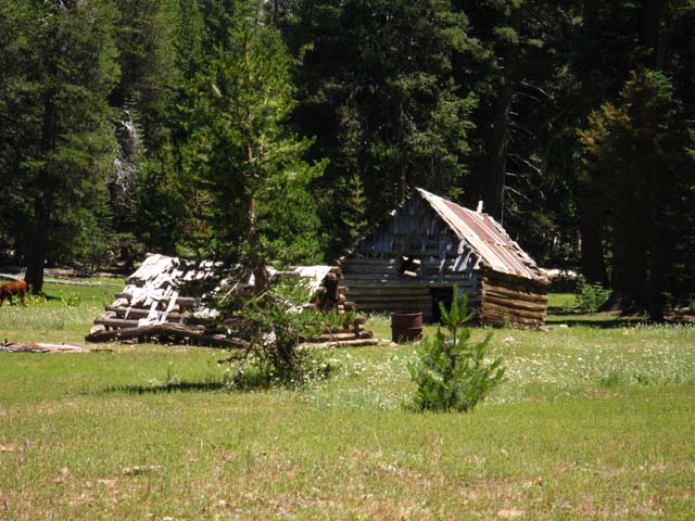 |
||
Note the cow ass poking into the left-middle of the frame. This is grazing Land.
|
| Duck Lake As we approach the wrecked cabin Duck Lake wheels into view to our East. |
| Note the cows in the middle foreground, at lake level. The meadow I am crossing is not even a few feet higher than lake level. |
 |
Duck Lake comes into view. Passing to the West of the lake looking Eastward. Note the extensive meadow-flats around the lake. This place is a swamp during early Spring, and surging with mosquitoes... This image was taken during a very hot July. Temps were running in the high 80s before 11am. I have encountered very hot hiking conditions along the Tahoe to Yosemite Trail, especially along the lower elevation sections of the trail during the past 12 years. Temps in the high 80s and low 90s, which demand that we carefully monitor our water intake, sweating, how we "feel," and the color of our pee, all to maintain optimal hydration. The weather in the Sierra has changed considerably over the past 12 years, with Summers getting much longer, hotter and drier. Consider heat safety, especially when hiking at lower elevations. |
Duck Lake
| Detail of the Rock, Water, Trees -and the cows- in the foreground from the West side of Duck Lake. |
 |
Duck Lake Detail. I'm looking at the granite boulders along the right (South) shore of the Lake for a nice break spot. There's campsites over there too. The cows are working the fresh greens along the boggy West shore of Duck Lake. |
| Rock Lake is South of Duck Lake on the Tahoe to Yosemite Trail. | ||
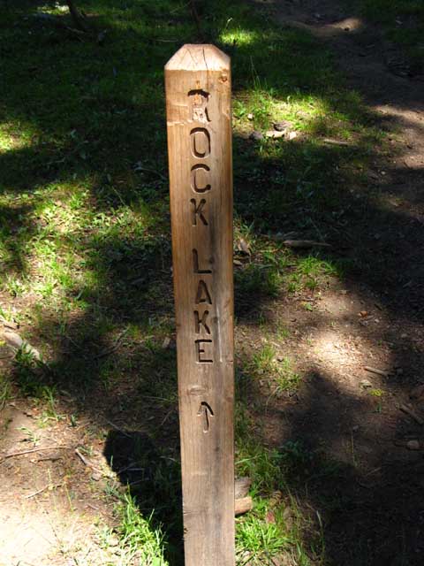 |
||
The Southwestern Duck Lake Tahoe Yosemite Trail junction past the wrecked ranch house. The Southbound TYT hiker will turn Left here towards Rock Lake. Lake Alpine Region Hiking Map
|
Here the Southbound Hiker on the Tahoe to Yosemite Trail takes a Left, turning East to follow the TYT South. Short and Looping Elephant Rock and Summit Lakes Continuing straight through this junction brings us through beautiful granite terrain down to Elephant Rock and road access at Summit Lake. The trail is very quiet and has some very faint segments down to Elephant Rock Lake. The trail was subtly ducked last time through.
Or, from Elephant Rock we can hike Northeast up to Rock Lake on the TYT and loop back to Silver Valley Trailhead by coming North on the TYT. A bit further down the trail past Elephant Rock Lake the Summit Lake trail runs up to the TYT 1.19 miles South of Rock Lake. Lake Alpine to Spicer Meadow Reservoir |
| The Southwest Corner of the Duck Lake Loop. Fully Sweated |
||
 |
||
A hot July day at the wrecked ranch trail junction on the Southwest side of Duck Lake. View looking North towards me before the trail junction. The trail behind me beyond the junction heads North up to the Silver Valley Trailhead. Southbound on the Tahoe to Yosemite towards Rock Lake is to the right side of the image. Heat Index
|
.58 of a mile past our Left Turn
at the
Wrecked Ranch House
our
TYT Route joins with the trail making up the North leg of the Duck Lake Loop
Duck Lake, West Shore From the trail junction South of the Wrecked Ranch House we Southbound hikers on the Tahoe to Yosemite Trail turn left (East by the Compass) to continue hiking South on the TYT towards Rock Lake. Though we turn East by the Compass at the ranch house junction, we are heading South on the Tahoe to Yosemite Trail. As we hike past the South shore of Duck Lake looking Left, or North across Duck Lake, we see various granite formations and mounds under the thin canopy of trees all decorating the scenic South shore of the lake. Nestled within the folds of this rocky terrain are a few great places to camp or take a break, though the low water quality at Duck Lake is an issue, especially late in Summer when the water is low. See the Duck Lake Notes below, about the camping and water quality issues at Duck Lake. |
| Beautiful Trail just South of the Wrecked Cabin Junction on the TYT... |
 |
Tahoe to Yosemite Trail zags through rock channel along the South shore of Duck Lake. |
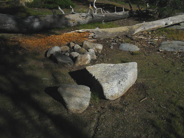
| A nice campsite nestled within the granite and forest along the South shore of Duck Lake. | ||
 |
||
There are a couple of fine little sites along the South side of Duck Lake. This one has a nice granite boulder table-chair combination along with a small fire ring.
|
Meadow South of Duck Lake
| Verdant green meadows mark the limits of Duck Lake's Spring overflow zone, surrounded by belts of dense, rich forest. Duck Lake is to our Left as we head South down the Tahoe to Yosemite Trail. |
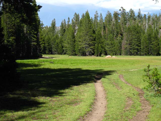 |
Meadow around the South shore of Duck Lake. This area fills with water overflowing out of Duck Lake during the Spring Thaw overflow. Grazing cows are likely what is keeping Lodgepole Pines from invading the expansive meadows around Duck Lake, and are certainly what degrades Ducks Lake water every Summer. |
Duck Lake Notes You can see Duck Lake is belted by flat meadow aprons on its Western and Southern shores which are frequented by grazing stock. These terrain factors mean three things to backpackers. First, the green apron of lush meadows around Duck Lake are big-time breeding grounds for mosquitoes. This is true of all Sierra Lakes surrounded with lush meadow aprons. Mosquitoes dominate the exposed terrain from the opening of the Spring Thaw until whenever its moisture is finally dried out of the meadows. The dryout time changes with the character of each year's seasons. The trajectory of each year's moisture cycle controls the mosquito population levels. This is the fundamental truth driving each season's mosquito profile from Spring into Summer, and determines when mosquito populations will decline each year. The basic rule is that wetter Winters bring wetter Spring Thaws, which bring larger mosquitoes populations and preserves them deeper into Summer. Drier Winters bring less mosquitoes through the Spring Thaw, reducing their overall numbers as well as reducing the time they can survive into Summer. It is important to stay as high and as dry as possible during the height of the High Sierra Mosquito Season. Wet meadows are to be avoided. Second, the grazing cows screw up the water quality in Duck Lake, big time. Backpacker's Forum Third, we can see no invading Lodgepole Pines in the meadows around Duck Lake, unlike High Sierra Meadows that are not under grazing leases. Grazing cows appear to keep High Sierra meadows intact by eating all the Lodgepole saplings trying to invade the meadow. Logical behavior preserves resources. Cows eating saplings preserves their meadow-feasts. This brings up an interesting conflict in the Sierra between purists and the practical. Should check dams be removed? Should all grazing leases be terminated? The purist would say yes to both, but the practical person would question removing the great water source check dams are providing during a drying era. The practical hiker would see grazing stock as a replacement for the natural grazers that Western development removed. I'm not defending over-grazing, water spoilage by grazing, or fish stocking. I'm saying that all of our activities must preserve or move towards restoring natural balances. Speaking practically, the water quality issues caused by grazing must be addressed by all backpackers.
Gear Note The water conditions in Duck Lake are real crappy due to the grazing cattle standing in it while pissing and crapping. You will find lakes like this up and down the areas that allow grazing. If you are running an MSR or Sweetwater style filter that is already hard to pump, "cow-lakes" such as Duck Lake will really challenge your patience by significantly increasing your filtering time. MSR and MSR Sweetwater utilize ceramic or latticework style filters, which I call "hard" filters. The other style are the paper filters, which I define as "soft" filters. The "hard" filters clog instantly trying to filter "cow-lake" water, and clog rapidly filtering the hard waters of the Sierra Nevada. The "soft" filters, such as the Pur Hiker, have little problem with the cow and hard waters we encounter in the Sierra. I've used the MSR and Sweetwater filters in clear and crappy water, resulting in the Pur Hiker being my device of choice for High Sierra use. I have not noticed any real difference in water quality or taste between the various filters, nor have I had any stomach issues with any of these filters. Final Water and Grazing Thought I like cowboys, horses, and cows. I don't like cow-lakes. There's got to be a way to maintain grazing leases while preserving water quality. I don't want cows or clean water, I want cows and clean water. |
| South to the North Fork of the Stanislaus River Entering the Fir and California White Pine forest approaching the last Duck Lake junction on the Southeast corner of Duck Lake. |
||
 |
||
Forest beyond meadow hiking South around the South shore of Duck Lake.
|
The Far point
of the
Duck Lake Loop
We come to the final Duck Lake trail junction off the Southeast corner of Duck Lake, no matter which leg of the loop we hiked to get here. This furthest Duck Lake trail junction on the Duck Lake Loop is 1.94 miles from the backpacker's camp just outside of, and a bit South of, the Silver Valley Trailhead. 1.66 miles separate the Silver Valley Trailhead and this Eastern Duck Lake Loop trail junction. This Southeastern junction is where the trails coming around from the North and South shores of Duck Lake connect up to complete the Duck Lake Loop. Lake Alpine to Spicer Meadow Reservoir In our case we will break out of the loop to continue hiking South on the Tahoe to Yosemite Trail. |
| Furthest Duck Lake Trail Junction Trail Junction at the East side of Duck Lake where the two wings of the Duck Lake Loop Trail meet at their furthest point from the Silver Valley Trailhead. Southbound hikers on the Tahoe to Yosemite Trail continue South towards the North Stanislaus River. |
||||
 |
||||
This junction marks the point that hikers on the Duck Lake Loop circle back towards the Silver Valley Trailhead. Southbound hikers on the Tahoe to Yosemite Trail continue South towards our next landmark, the North Fork of the Stanislaus River. We hike straight through this junction if we are coming South from the Wrecked Cabin trail junction. If we are coming South around the North side of Duck Lake we'll turn Left at this junction to continue South on the Tahoe to Yosemite Trail.
|
Video
Our Second Route Option
around
Duck Lake
Duck Lake Route II: This route brings us around the Northeast side of Duck Lake. |
Left-East
from the
First Duck Lake Loop Junction
past the
Silver Valley Trailhead
| Hiking Left from the first Duck Lake Junction to hike South on the Tahoe to Yosemite Trail around the North side of Duck Lake. | ||
This video shows the forest and rough trail down to the East side of Duck Lake. Duration: 2:10.
|
South Past
the far
Duck Lake Loop
trail junction
South past the far Duck Lake Loop trail junction on the Southeast side of the lake we are now hiking South on the Tahoe to Yosemite Trail, independent of which way we came around Duck Lake. Rock Lake is 2.73 miles South of the far Duck Lake Loop trail junction. Lake Alpine to Saint Marys Pass South of this last Duck Lake trail junction parts of the trail suffer from a lack of maintenance as of October 2011. This has been subsequently confirmed through 2014. Post up updates if you hike through here.
Many downed trees cross the trail, underbrush has grown over parts of the trail, and the light hiker traffic during the short Summer of 2011 did little to keep the trail open. From Duck Lake to the high point of the trail above Spicer Meadow Reservoir the trail crews and likely the Carson Iceberg Wilderness Ranger has put up bits of orange construction tape marking the lightest sections of trail. No big deal. The government is starving the National Park Service, and the NPS is starving the National Forests for bucks, and here on the ground trail conditions suffer. Get used to it. |
South
on the
Tahoe to Yosemite Trail
to the
North Fork of the Stanislaus River
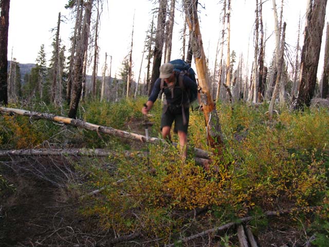
| Rough Tahoe to Yosemite Trail South of Duck Lake trail junction. A few downed trees to swing my fat ass across. | ||
 |
||
Note that only one of the three trees across the trail has been sliced and rolled. This image was taken in late October of 2011. These trees have been down for a while. The trail is present and easy to find to and past the North fork of the Stanislaus River. We enter an old burned are once we make part of the climb past the North Stanislaus where the trail becomes more diffuse and requires close attention to follow.
|
Video
Duck Lake
to the
North Fork of the Stanislaus River
| Let's check out the terrain and features... |
| Past Duck Lake South on the Tahoe to Yosemite Trail to the North Fork of the Stanislaus River. | ||
Duration: 3:39 minutes.
|
South of Duck Lake
we get a
View to the Southeast
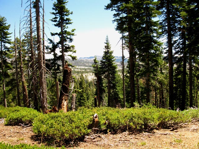
Looking Southeast into and across the fold in the granite terrain the North Fork of the Stanislaus River runs through. We can see bits of the Sierra Crestline running roughly parallel to our route in the furthest distance. |
||
 |
||
A rare break in the dense Forest Cover past Duck Lake reveals the surrounding terrain. We are dropping down towards the North Stanislaus River hidden under the forest running along its drainage below us. We're hiking to our South (right), and are about to bend South and down to the North Stanislaus. Lake Alpine to Spicer Meadow Reservoir
|
Black Ponds
in
Low Elevation Forests
are Rare
| Black Pond |
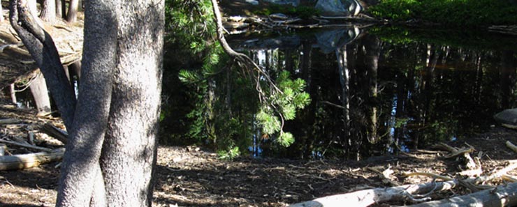 |
Black ponds, otherwise known as Vernal Ponds exist in many notable locations. The black pond off the PCT above Boulder Lake, the black ponds between Wilmer Lake and Stubblefield Canyon, and the black ponds stuck up in Seavy Pass come instantly into mind. Most sit in wind-sheltered locations, and sit as 24-hour mirrors of everything around them. Including the starry sky at night. This is a small black pond. But it is amazing that it is still looking so full during October, when this shot was taken. Wikipedia |
Granite rising towards the Sierra Crest above & East of the North Stanislaus River at this position on the TYT. We are hiking South dropping down to the North bank of the North Fork of the Stanislaus. |
 |
We are about 15 miles West of the Sierra Crest Line here. |
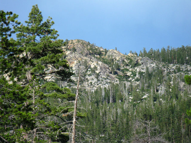
Terrain Notes Note how the last section of our hike over Mount Reba was through rich red volcanic terrains. North of Reba we were in Summit City's granite gorge. Red and White Baby! Hiking into the Carson Iceberg Wilderness South past the East side of Lake Alpine we have again entered granite terrain. Hell, Lake Alpine itself is an artificially filled-up granite basin, as the series of Utica, Union, and Spicer Meadow Reservoirs established in this series of fine granite basins. This stretch of granite terrain will not last long, as we can plainly see, for every now and then when we get long views South we get glimpses of the great ancient volcanic hulk of The Dardanelles sticking up through thin sections of forest cover, and visible when we cross highpoints along our trail route South. The great volcanic feature of The Dardanelles towers above the length of the whole South shore of Spicer Meadow Reservoir, while the forest and granite terrain we are now passing through extends South from Lake Alpine, all the way down to where the granite terrain twists around the North shore of Spicer Meadow Reservoir up Highland Creek. The granite ends when we turn South on the Tahoe to Yosemite Trail up Jenkins Canyon. From Lake Alpine past Duck and Rock Lakes, to Spicer Meadow Reservoir, and up Highland Creek if we cut off the TYT to the PCT, we will be traveling through granite terrain. But we reenter volcanic terrain when we cross over the Northeast shoulder of The Dardanelles hiking South on the TYT. We get back into granite when we get down to Clarks Fork Road. The vast majority of this section of the Tahoe to Yosemite Trail South to Saint Marys Pass from Jenkins Canyon we will be pass though small granite sections and observe the interface line between the volcanic and the granitic terrains as we continue South. If we continue on the Tahoe to Yosemite Trail route South out of Kennedy Meadows Pack Station we will walk the dividing line between golden granite and rusty red volcanic terrains as we climb up Summit Creek towards Brown Bear Pass. Brown Bear Pass itself marks the a unique line dividing volcanic from granite terrains. I guess what I'm saying is that we should not just pay careful attention to the terrain under foot and around us, which is very important. Once we hit Yosemite boundary the granites pretty much take over, until we exit Yosemite and enter the Volcanic Hot Zone around Mammoth. Again, the volcanic terrain will end once we hike South of Mono Creek, and we will mostly travel across granite with bits of ancient metamorphic and some really ancient pre-granitic terrain from Kings Canyon NP South to the Whitney Portal. Let's keep our eyes on the nature of the terrain. This terrain will enrich our spirit as it drains us physically. Terrain does all sorts of nifty things in the present, and it is timeless, in the sense that it stretches further into the past and the future than we can see. So we have a Geology and Terrain Forum to share observations of the unique and beautiful characteristics of our physical world.
|
North Fork
of the
Stanislaus River
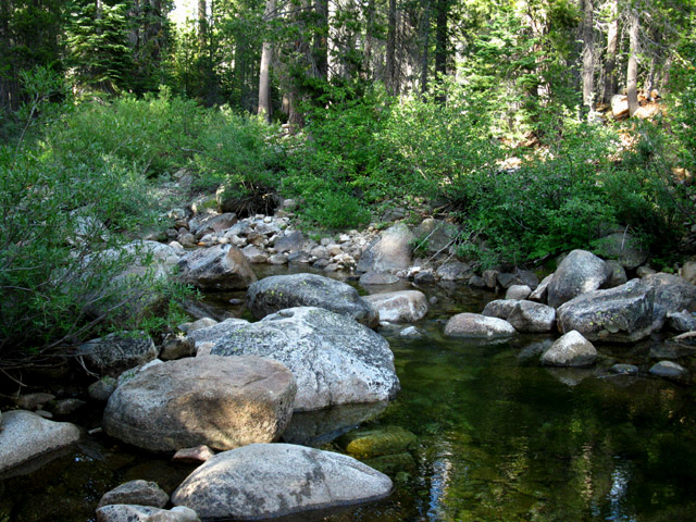
| Granite stepping stones across the North Fork of the Stanislaus River. | ||||
 |
||||
The North Fork of the Stanislaus is almost always a placidly flowing river. Except during the Spring Thaw, and I imagine it can get really charged up by heavy Summer Thunderstorm downpours, though I've never seen that happen here. It could!
|
| North Fork of the Stanislaus River: Video Above. |
| Downstream from the ford. |
 |
A bucolic landscape downstream along the North Stanislaus River, July during a hot Summer and low water. |
| Break Time, and the Campsite on the South Bank of the North Fork of the Stanislaus River. |
| Time to air out the feet, change into dry socks, water-up, and sit back for awhile along the South shore of the North Fork of the Stanislaus River. | ||
 |
||
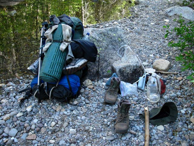
Break and water at the North fork of the Stanislaus River. The socks on the pack have been Sun-dried and Sun-bleached from my secure sock cleaning station on the top of my pack. Sock System Using this system I can keep two sets of socks clean and dry for up to five days before I have to pull out and use my third pair, and field wash the two working pairs. The two washed pairs are deployed on the top of my pack in the Sun and dry quickly. I then Sun bleach and dry the third pair on the pack before re-packing them in a waterproof zip-lock, ready to be redeployed the next time I have to wash the 2 working pairs. My sock system keeps my feet clean and dry hiking long days and lots of miles over weeks on the trail. In my opinion having clean dry feet are vital for long term, long distance, and high mileage trips. I remind those of you who are skeptical that anyone can be a pig on the trail. That's easy. But keeping your feet and ass clean prevents a lot of problems down the trail. Those of you who have been hiking down along this trail guide from Meeks Bay with me have likely concluded that I have a system for everything. True. And that does not include the fact that I have contingency plans for everything. And I am always recalculating all the changing factors along the trail, knowing that the system, the plan, and the contingency plans require constant modifications to keep them current.
|
Campsite on the South Bank of the North Fork of the Stanislaus River
| Big well-used campsite on the South side of the North Stanislaus River. |
 |
North Stanislaus River Campsite on Tahoe to Yosemite Trail. |
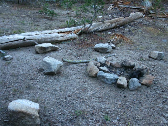
| Fire ring at North Stanislaus River Campsite, October 2011. | ||
 |
||
Fire ring and seats at North Stanislaus River Campsite, Carson Iceberg Wilderness.
|
Continuing South Past the North Stanislaus River Campsite WARNING The route of the TYT degrades into unmaintained status and even down to "route" condition South of the North Fork of the Stanislaus River. Read the Trail Status Reports from a range of backpackers on this route during the 2014 and 2015 seasons. Lake Alpine to Rock Lake Read the Comments |
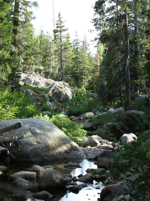
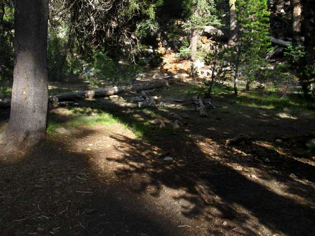
| Terrain looking South from the campsite on the South Side of the North Stanislaus River. |
 |
Meadow and forest looking South from N Stanislaus campsite hiking South. We can see the delicate nature of wild beauty from the North Stanislaus campsite. |
South on the Tahoe to Yosemite Trail from the North Stanislaus River
| North Stanislaus River campsite, duck marking Southbound TYT. |
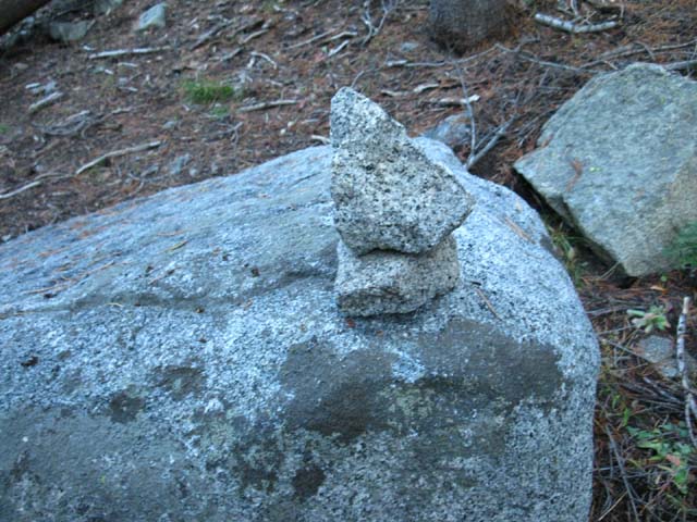 |
On the far South side of the campsite we have to look carefully to see ducks marking the Southbound TYT route up the ridge side. Look downstream, then pan Left until you see the above boulder and duck marking the trail South. Yeah, time to climb again. A steady grade of moderate difficulty brings us out of forest and into the |
Video
North Stanislaus to Rock Lake
Video: North Fork of the Stanislaus River to Rock Lake. THE BURNED ZONE |
||||
Duration: 6:30.
|
| Sunset while climbing South past N Stanislaus River. |
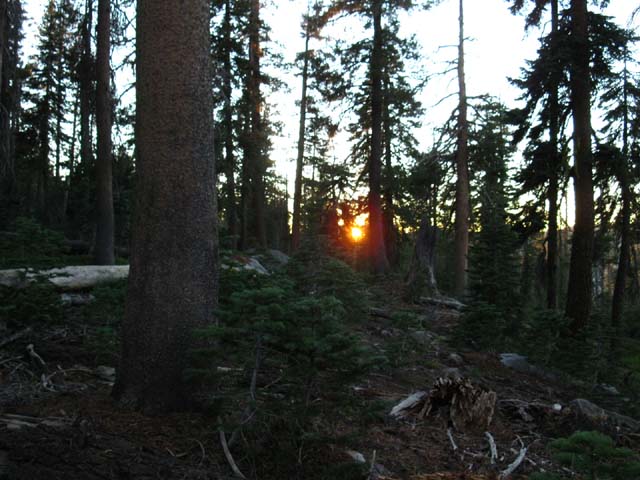 |
| A late start South out of the Silver Valley Trailhead had us racing daylight to Rock Lake. |
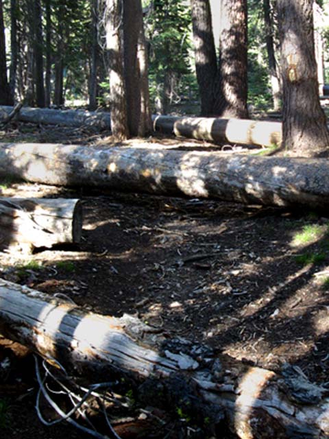
Obstacles along the Tahoe to Yosemite Trail
| Trail obstacles on the TYT between the North Stanislaus River and Rock Lake. | ||
 |
||
A variety of obstacles required our attention through here during late October 2011. Hiking South of the North Stanislaus River we notice the trail begins to degrade a bit before we cross out of verdant forest into a great burned zone. The trail fades further once we enter the burned zone. Fallen snags and the power of runoff over the exposed terrain have both covered and obscured alternating stretches of our trail South. These factors demand heightened attention to the ground at our feet and the logic of the surrounding terrain to maintain our proper course South to Rock Lake. Post up your experiences hiking here through the comments link.
|
Entering the Burned Forest
spanning from
The North Stanislaus River to Spicer Meadow Reservoir
| Sunset through a section of burned forest North of Rock Lake on the TYT. |
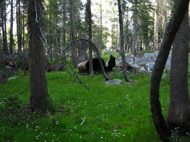
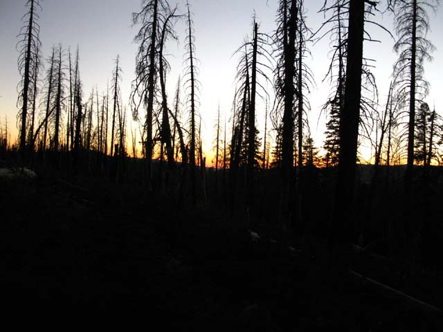 |
Burned and whole forest sections intermingle South of the North Stanislaus River. |
| Trail obstacles on the TYT in the Burnt Area North of Rock Lake and South of the North Fork of the Stanislaus River. | ||
 |
||
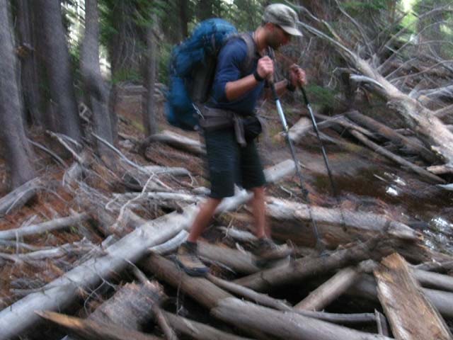
Ari Breaking through and over Obstacles Heavy brush and fallen snags keep the route interesting. All of the snags along the trail are going to eventually fall down, and at least 25% of them are going to fall across the trail.
|
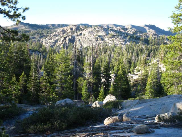
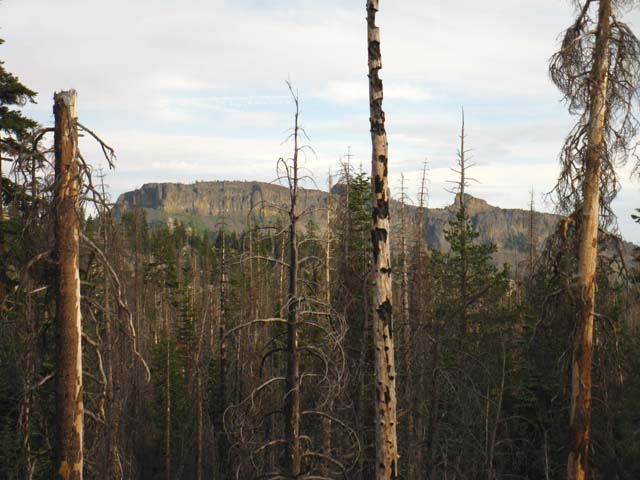
View South-Southeast
| A glimpse of the Southwest end of The Dardanelles caught from the highest part of the trail just North of Rock Lake. We now begin a gentle descent down to Rock Lake, down towards our right. | ||||
 |
||||
Note how green veins of live forest intermix with the old burned snags. Our Southbound TYT route continues South past Rock Lake towards the far Left end of The Dardanelles at the far Left side of the image. Climbing over the last ridge separating us from The Dardanelles reveals Spicer Meadow Reservoir sitting beneath the Northwest flank of the Dardanelles. These ridges are rolling off Bull Run Peak. We will hike Southeast (towards the Right in the image above) over the lower end of the ridge in the middle-distance above, then turn Northeast on the other side of that ridge to get around the North shore of Spicer Meadow Reservoir. Compare the maps below with the image above, and that will open understanding of the route of the trail across this segment of terrain. From Highland Canyon we of the Tahoe to Yosemite Trail turn Right off of the Highland Creek Trail to hike Southeast up Jenkins Canyon to pass over the Northeast shoulder of The Dardanelles. Our route over the shoulder is out of view on the far Left side of the Dardanelles formation in the image above.
|
Rock Lake Trail Junction
| Looking South at the Rock Lake Trail junction on the Tahoe to Yosemite Trail. | ||||
 |
||||
Rock Lake Trail Junction The trail to the Left continues Southbound on Tahoe to Yosemite Trail towards Spicer Meadow Reservoir. 1.46 miles South we encounter the Summit Lake trail junction, also branching off to the South, and also running down to the trail running up to Elephant Rock, and back up to Duck Lake. Thus we could turn a loop back to Silver Creek Trailhead from here, or continue South down to turn a bigger loop back through the Summit Lake trail junction. Or we can continue South towards Spicer Meadow Reservoir on our way to complete the Tahoe to Yosemite Trail.
|
North: Lake Alpine South: Rock Lake to Jenkins Canyon
Tahoe |
||
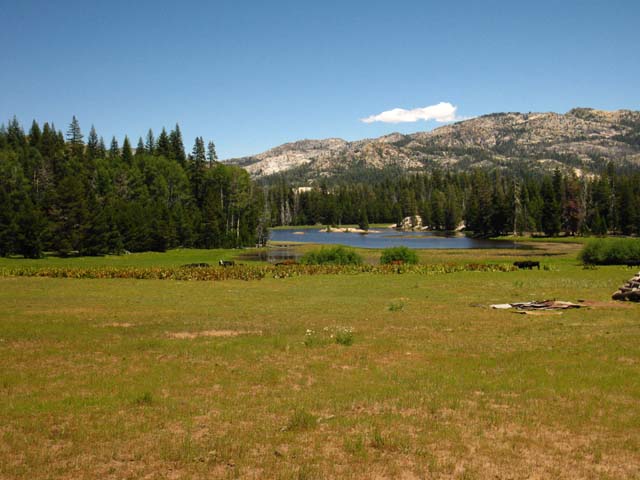
Lake Alpine to Saint Marys Pass From Lake Alpine we have hiked 4.74 miles South around Duck Lake and across the North Stanislaus River to Rock Lake. From here we can loop back to our Silver Valley Trailhead via Elephant Rock. Though the USGS map excludes the trail from Rock Lake to Elephant Rock and its namesake lake, there is one, and I traced its outline on the maps for this section. Or we can loop back to the Silver Valley Trailhead via the Summit Lake trail junction another 1.19 miles further South of Rock Lake along the Tahoe to Yosemite Trail. We've got local, as well as long distance backpacking options here. Our next waypoints on the Tahoe to Yosemite Trail route South are at the head of Spicer Meadow Reservoir, 5.37 miles South of Rock Lake. From the top end of the reservoir we have a short hike up to the Jenkins Canyon trail junction where the Tahoe to Yosemite Trail turns South out of the remoteness of Highland Creek's canyon. Highland Creek drains into the top of Spicer Meadow Reservoir, and besides this fine source of fresh water, there are a clutch of fine campsites at the top of the reservoir and up Highland Creek too.... 7.5 Topo Hiking Map 7.5 Topo Hiking Map 30 min Hiking Topo Map 30 min Hiking Topo Map
Next page South |
Backpacking Trail Guide North |
|
Backpacking Trail Guide South |
Backpacker ForumsHave a great Sierra Nevada trip or story to relate? A fine piece of gear? Or gear that failed?Post it on
|
North: Lake Alpine South: Rock Lake to Jenkins Canyon
Trailhead
Contact
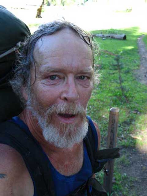
Alex Wierbinski

Backpacking Lake Tahoe to Mount Whitney
Your Guide to the High Sierra Crest, including the Tahoe to Yosemite, Pacific Crest, and John Muir Trails
