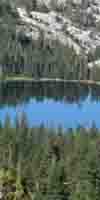
Merced Lake in Yosemite National Park. Lake Tahoe to Mount Whitney: Your Backpacking Guide to the High Sierras Yosemite chipmunk climbing tree.
Merced Lake Yosemite trail miles sign.
Merced Lake
Yosemite trail miles sign at Merced Lake.
Chipmunk


The Trails

Guide
Maps
Miles/Ele
Permits
Resupply
Forum


Current Weather Conditions

Weather Notes
Northern High Sierras
Central High Sierras
Southern High Sierras
 

Gear

Gear List
Gettin Started
Layering
Discussion
 
Testing yourself and your gear
 
Gear Reviews

top of page

Yosemite Valley to Lyell Canyon
(And/Or Tuolumne Meadows)

Miles and Elevations


Via
Merced River
&
Over
The Cathedral Range
Via
Vogelsang High Sierra Camp


Backpacking
Central Yosemite Backcountry


Backpacking
Miles and Elevations
on an
Alternative Route
to the
John Muir Trail
via
Voglesang Pass


Languages

Translate


Trail Arts

The art of walking
 
Physical Preperation


Trail Skills

The trail
Off the trail
Scrambling
Maps
Navigation
Camp skills
 

Food

Resupply
Food


Other

Photo Catagories
 
Trail Stories
 
Trail Culture
 
News and Science
 
Links
 
Groups
 
Books
 

top of page

MILES
NORTH

JMT

Tuolumne
Meadows

to
Yosemite
Valley

MILES
SOUTH

JMT-PCT

Tuolumne
Meadows

to
Reds
Meadow

MILES
INDEX

PCT-TYT

Yosemite
Valley

REGIONAL
MAPS

JMT-PCT &
ALT ROUTE

Tuolumne
Meadows

Central Yosemite
Wilderness

TRAIL
GUIDE
INDEX

Yosemite
Valley

to
Lyell
Canyon

MAPS
INDEX

Tuolumne
Meadows

to
Reds
Meadow

ALL
MAPS

INDEX

TRAIL
GUIDE

INDEX

PERMITS
Yosemite

SIERRA
WEATHER

Central
Yosemite Wilderness

Miles & Elevations

Yosemite Valley
to
Lyell Canyon
via
Vogelsang
High Sierra Camp


An
ALTERNATIVE ROUTE


Happy Isles Trailhead
departing the
John Muir Trail
Hiking Up
Merced River
to rejoin the
JMT
in
Tuolumne Meadows
or
Lyell Canyon

via
Vogelsang High Sierra Camp


Golden Triangle II
Yosemite Valley to Reds Meadow via Lyell Canyon
TRAIL GUIDE INDEX


This route is suggested as the complimentary Southern wing of our hike down the John Muir Trail from Tuolumne Meadows into Yosemite Valley. Now we're hiking back up to the Sierra Crestline by a different route.

We're taking this visit down to Yosemite Valley as a detour off the main line of our Tahoe to Whitney hike, so we are returning to the JMT & PCT on the Sierra Crest by a different route. This route measured-out below will put us into Lyell Canyon a bit over five miles South of Tuolumne Meadows. TM is where we deflected off our Southbound line down the Sierra Crest to take a hike down to check-out Yosemite Valley.

Folks hiking the classic route of the John Muir Trail from Yosemite Valley to Tuolumne Meadows should check out the Tahoe to Whitney guide information, though this section of the JMT is covered "backwards," from the perspective of hiking down from Tuolumne Meadows into Yosemite Valley.

Golden Triangle I
Tuolumne Meadows to Yosemite Valley
TRAIL GUIDE INDEX


Miles & Elevations
JMT
backwards
Tuolumne Meadows into Yosemite Valley

We could hike almost directly to Tuolumne Meadows from Vogelsang High Sierra Camp by hiking North through Tuolumne Pass & almost directly down to TM.

We are taking the route via Evelyn Lake into Lyell Canyon from Vogelsang HSC, as our trip plans are taking us South out of Yosemite into the Ansel Adams Wilderness. along the combined route of the Southbound JMT-PCT.

25.94 miles
Yosemite Valley
to JMT in Lyell Canyon

Location  Elevation Mileage  
Happy Isles Trailhead
Yosemite Valley
Mileage Sign Post

Store, Grill, & P.O.
4035 0  
  +xx .71  
Merced River Footbridge
Unicorn Creek
4400 .71  
+xx .14  
Lower Mist trail
Trail Junction

Mileage Sign Post
4590 .88  
+xx .73  
Clarks Point-Middle Mist Trail
Trail Junction

Mileage Sign Post
5940 1.61  
+xx .93  
Glacier Point
Trail Junction

Mileage Sign Post
6000 2.54  
+xx .20  
Nevada Falls Bridge 5930 2.74  
+xx .14  
Upper Mist Trail
Trail Junction

Mileage Sign Post
5970 2.88  
  +xx .58  
Trail Junction
West End
Little Yosemite Valley
6120 3.46  
+xx .46  

Merced River Trail &
John Muir Trail
LITTLE YOSEMITE VALLEY
TRAIL JUNCTION

Little Yosemite Valley Backpackers Camp
Trail Junction
Mileage Sign Post

6140 3.92  

Below
Eastbound Up Merced River


North
see
JMT to Tuolumne Meadows

+/- 00 2.06  
East End Little Yosemite Valley 6160 5.98  
+xx .41  
Enter Lost Valley 6320 6.39  
+xx .69  
Enter Bunnell Cascade 6360 7.08  
+xx .66  
Tiny Unnamed Valley
below Bunnell Point

At the First Bridge
At the Second Bridge

6560
+/00
6560

7.74
.06
7.80

 
+xx .37  
Bottom of Switchbacks 6720 8.17  
+xx .32  
Top of Switchbacks 7040 8.49  
+xx .29  
High Point
7130 8.78  
+xx .62  
Bridge below Echo Valley 6960 9.4  
+xx .75  
Echo Valley Bridge & Trail Junction
Mileage Sign Post
Trail Junction
7000 10.15  
+xx .36  
East End Echo Valley
7020 10.51  
+/- 00 .90  
West Shore Merced Lake

7230 11.41  
+/- 00 .69  
Merced Lake High Sierra Camp
Northeast Shore
Mileage Sign Post
7230 12.1  
00 --  
Merced Lake Backpackers Camp
7230 12.1  
00 --  
Merced Lake
Yosemite Miles Signs
Mileage Sign Post
7230 12.1  
00 .87  
Merced Lake Ranger Station
Mileage Sign Post
Trail Junction
7250 12.97  
+xx 1.06  
Fletcher-Lewis Creeks Junction
Mileage Sign Post
Trail Junction
8160 14.03  
+xx .15  
Lewis Creek Footbridge 8120 14.18  
+xx 1.65  
Babcock Lake Trail Junction
Mileage Sign Post
Trail Junction
8880 15.83  
+xx 1.84
Emerick Lake Trail Junction
Mileage Sign Post
Trail Junction
9400 17.67  
+xx .08  
Boothe Lake-Tuolumne Pass
Trail Junction
Mileage Sign Post
9400 17.75  
+xx 2.10  
Vogelsang High Sierra Camp
Mileage Sign Post
Trail Junction
10120 19.85  
+xx .64  
Cathedral Range Crestline 10400 20.49  
+xx .78  
Creek out of Evelyn Lake 10334 21.27  
+xx 2.11  
Ireland Lake Trail Junction
(Route Highpoint Just above,
@ 10560 feet)
10410 23.38  
+xx 2.56  
John Muir Trail in Lyell Canyon
Trail Junction
Mileage Sign Post
8084 25.94  
JMT NORTH
Yosemite Valley
to
Tuolumne Meadows
Miles and Elevations
JMT SOUTH
Tuolumne Meadow
to
Reds Meadow
Miles and Elevations
Miles
and
Elevations
INDEX

Lake Tahoe to Mount Whitney
top of page

Miles North: Tuolumne Meadows to Yosemite Valley               Miles South: Tuolumne Meadows to Reds Meadow

Notes

Setting up the outlines of the South Sierra section of
Tahoe to Whitney.

Stay tuned for construction progress.


Miles and Elevations
Discussion and Notes
Desolation Trail

ahoe on H

This is the Draft Edition


Backpacker Forums

Have a great Sierra Nevada trip or story to relate? A fine piece of gear? Or gear that failed?

Post it on
TahoetoWhitney.Org

Above we come to the Front Page of the High Backpacking Trails and Topics Forums. Below we break the forums down into categories:

High Sierra Trails High Sierra Topics

The Trails Forum acts as your place to put up input, comments, relate your experiences, or ask questions about each segment and spot along the length of our combined TYT-PCT-JMT trails.

The Forum is your place to supplement the trail guide.

Anyone can post text comments in the existing forums, but only members can post up new topics, along with images, maps, and formatting.

Become a Member

If you have experiences, comments, questions, or pictures and videos of the John Muir and Pacific Crest Trails Vermilion Valley to Muir Ranch, post up here as an unknown hiker or as a member:

UNDER CONSTRUCTION

Forum Section
Yosemite Valley to Lyell Canyon
Forum Segment
Vogelsang HSC to Lyell Canyon

Miles North: Tuolumne Meadows to Yosemite Valley                           Miles South: Tuolumne Meadows to Reds Meadow

Trailhead

Contact
Alex Wierbinski

top of page

Backpacking Lake Tahoe to Mount Whitney

Your guide to the High Sierra Crest, including the Tahoe to Yosemite, Pacific Crest, and John Muir Trails

© Lake Tahoe to Mount Whitney: Crown Jewel of the Pacific Crest Trail