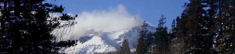
Looking back at Leavitt Peak during a Winter Circle to Sonora Pass, up to and over Leavitt, then back down to Highway 395.
High Sierra
Backpacking
Trail Guide
Forums
Sierra
Weather
WeatherNotes Northern
Sierra Weather
Gear
High Sierra
Backpacking Navigation
Introduction
to
Time, Space, Earth and Sky for the Long Distance High Sierra Backpacker
Languages
Trail Skills
Mountain
Safety
Food
Planning
Trail Arts
More
Information
Social
| HOME PAGE |
GEAR PAGE |
NAVIGATION FORUM |
Field MAPS INDEX |
SCRAMBLING | OFF THE TRAIL | Mountain Safety News & Topics |
TRAIL SKILLS |
| On This Page Land & Sky Navigation Topics INDEX |
| Intro & Orientation Goals |
Astronomical |
Reading Nature's Clock and Compass |
On This Page
Earth & Space
Information Resources
INDEX
| Maps |
| Map Info |
Map Tools |
| Sky Maps |
Astro Simu- -lators |
Astro Data Services |
| Year's Night Skies |
Our Galaxy |
Deep Space |
| Space Time Temps |
History 'O Time |
More Time |
| Map Info |
Map Tools |
Sky Maps |
Astro Simu- -lators |
Astro Data Services |
Year's Night Skies |
Our Galaxy |
Deep Space |
Space Time Temps |
History 'O Time |
More Time |
Maps, Navigation, Introduction The Physical Interface of Abstraction A simpler goal is to be able to find our location on our map with ease. In either case we are still dealing with the same abstractions. These would be your map and you, in a weird sort of way. We are the real pointer of Nature's compass and the hands of its clock. Our goal here is to become aware of the theoretical basis and physical expressions of our position within these relationships. Wow The coordinate-contour system our maps are based on is precise. It is an almost perfect mathematical and visual representation describing the real physical world around us. I say "almost" perfectly because we still have not figured out how to display a 3-D spherical world accurately on a 2-D flat paper map. Inter-dimensional distortions occur. But it's pretty darn good! Despite the precision of our tools they all have the same limitation: our ability to utilize them. We need basic navigation and route-finding skills to use our tools properly and to their potential. Here & Now The Ancients were correct, but not for the reasons they cited. Everything is measured from the perspective of the viewer. The Nature of Time, Space, and Quantum Mechanics all demonstrate that Reality is democracy at its finest. The observer-dependent nature of many aspects of our physical reality itself validates that the perception and perspective of each viewer centers the biggest parts of experienced or experiencable reality. Thus, Reality is a Multiplex of both physical and human factors, created by experience...Truth, then, is Reality's uncreated First Foundation and Future Fuel, if not ever part of the "shared" architecture of a multi-perspective reality. We're going to use Nature as both our compass and clock on our adventures, leaving behind all our human-centric time and space measuring tools, and get back to the fundamentals of land navigation, being excellent observation, sharp analysis, and quality decision-making. The Laboratory The Big Picture We'll use each vista to line-up our map with our compass, locate the line of our upcoming trail route in the terrain, identify the local mountains, and ascertain the locations of hidden valleys, lakes, and tributaries obscured by the range itself. Our personal observations will be the moments where compass and map information are brought together, ideally, in our head, as understanding of the logic and location of our upcoming trail through the very complex terrain surrounding it. That's why we're here, right? Deeper Now we will begin to probe the unmaintained routes, and explore exciting terrain on scrambles from campsites along the maintained routes. Then we can move on to cross-country routes. It's nice to be able to navigate our way into, explore, and get back out of the unknown in one piece.
Getting off maintained trails we'll find the line of our route blocked by great sections of fallen snags, runoff gullies, dense thickets, box canyons, dead-end ridgelines ending in sheer cliffs, and a wide range of natural obstacles all constantly conspiring to deflect us off our "best line" through the terrain. We will be constantly forced to break our bearing line. I define "Navigation" as the ability to find and set a theoretical line between two points on map and terrain. "Route-Finding" is the practical act of finding the actual line of travel necessary to connect the theoretical bearing line between those points we identified using our "Navigation" skills. The best "Navigation" tools and skills still leave us dependent upon our "Route-Finding" skills when the trail disappears. Only our sharp observations and good decision-making allow us to find a line through the terrain. Navigation skills can be replicated by an electronic device. Route-Finding skills cannot.
Terrain and Trail Both trails and terrain have frameworks of logic behind them. Local terrain logic is a product of many forces at play, generally starting with the ancient shape of the terrain. Next is how the weather treats it during Winter, how it drains during Spring, and how the trees and animals are running through it. Expanding Scope and Scale You are opening (By, "very exciting," I mean Dangerous. Know that Backpacking is Dangerous.) Once we get familiar with dealing with maps, compass, terrain logic, and unknown situations with grace and style we will kick it up a notch. My goal is for you to evolve your observation and navigation skills sufficiently to break through the seasonal barrier into Winter travel.
Ever-Widening Scope Taking the time to step off the main trails and study, physically and navigationally study a remote piece of Sierra Terrain, say a remote hanging canyon full of lakes, or a junction of mighty canyons only accessible after a grueling cross-country backpacking trip, will bring rewards unknown to hikers on maintained trails. Ironically, it takes lots of hikes down the maintained trails to even find these super-places. Thus the need for a "super-you." The next time we hike that route we will execute an informative and exciting local scramble from our campsite to suss out what we saw on our last trip through. That's why I'm carrying an extra day's food along each section of trail; to probe unknown terrain and find delights otherwise outta-sight! Observations reveal, maps quantify, feet confirm.
DEFINE I keep telling myself that. My experiences indicate status is a state of mind. Are we in a state of understanding? Do we have an understanding of the relationship between our position, the map and compass, or not? Does this bother us? This brings up the next element of successful navigation: confidence. Are we reasonably confident we can bring ourselves back into understanding? Do we have the skills and fitness? Do we have a plan to "re-align" our tools and our understanding when they get mis-aligned? Pressing a button on an electronic device is not a plan... Finding out the answers to these questions is not best done by precipitiously throwing yourself out onto the razor's edge of wilderness, which you can do, but preferably as the product of an evolution of skills, fitness, and experience.
Into the Unknown I always take mental notes, and often written notes making the transition. Well, I take notes now. I never took notes or pictures when I first started getting lost. Pictures and notes only came after I figured out I was "exploring unknown terrain." Each involves a degree of physical and psychological "pain," possibly enduring pain and stress. The difference between the pain of exploring unknown territory and being lost differs considerably, depending on the nature of your character. It looks to me like some folks psychologically thrive on delving into the unknown, while others are physically overwhelmed by the very concept of being lost. I always like to make sure the degree of caution and worry I am experiencing are effective, that they are, as designed, warning me of risk, and are directly reflecting the depth of the threats I face, and not my personal fear. The bottom line is that we've all got to be able to remember that we were all designed to operate effectively in all of Nature's environments, while being able to identify the limits of our capabilities and endurance. How I look at our "capabilities" as humans is that you can, as one of "us..." "Every one of us has within us the ability to quickly and effectively observe, analyze, make good decisions, communicate these, while engaging all aspects of our natural environment while walking, climbing, crawling, or running across every natural terrain existing on this planet. We do so while fully loaded, through all types of weather conditions while communicating in complex groups while chasing or being chased. And having a blast doing it. We are quite amazing in our original natural habitat."
It's not the map, not the compass, nor the GPS that are the keys to navigation. Though all of our tools are vital for successful navigation, the nature of our experience is going to boil down to the fact that it's the personal synthesis of all our physical observations and analytical skills of the navigator that gives life, meaning, and direction to all of our maps, compass and GPS readings, and all of our "outside" tools. That would be you, you tool you. You carry within you all the fundamental powers and capabilities reflecting the definiton, structure, and physical expression of the spirit of life and consciousness in the physical world, in all its sacred and profane expressions. We humans have been the recipients of the bounty of our environment, in that we've collected up a unique set of physical and reflective skills as we've evolved and travelled through the relationship of all living things to each other and our environment, since life began on this planet. These capabilities we carry preceed life on this planet, being a product of the fundamental rules, structures, goals, and means of life everywhere, as they translate through our unique sets of circumstances.
The Ultimate Tool That, my friends, is the scope of simple backpacking navigation. We pull the assets out of ourselves and our environment necessary to line it all up. Orientation Big Picture We will build the perspective of competent navigators of Time and Space. Time and space make a lot more sense when we see that we are actually hiking through the workings of the clock moving around us, that we ourselves are the mother of all its reference points. We are literally the moving pointer of Nature's Compass and the shifting hands of Nature's Clock. My advice is clear: Center Thyself, Tool. I want you to be able to find the North Star and know that the angle of the North Star above the horizon is our latitude, that our compass is significantly offset from True North, and that the rise and setting positions of the ancient patterns of stars and our Sun upon their shifting tracks define our seasons. The set of links below pursue these goals.
What this "Navigation Thing" is really about is being capable of accurate observation, crisp analysis, and great decision-making when we look up at the Sky, down at the Ground, and looking at our planet spinning all around. We gonna do the Hokey-Pokey! Our Hokey-Pokey ties Earth, Time, and Space together along the line of our perception through It. Maybe it's really the Time Warp: And the void would be calling... With a bit of a mind flip... You're into a time slip... And nothing can ever be the same again. It's astounding... I don't know. I just keep freeking dancing. Our final goal of finding, understanding, developing, and mastering these navigation and route finding skills is mastering backcountry skills to be the master of our own destiny. Maybe it's time to pay a visit to ("Hey, You alive? Still breathing? Congratulations! You Passed the Test!) If so, we will carefully begin to enter and navigate snow obscured terrain. Once we master basic Summertime orientation and route finding and we can begin to carefully translate our capacities and skills into snow-season High Sierra backpacking. Careful assessment required:
Our small slice of perfect clarity creates almost perfect ignorance of the rest of the pie. Not Cool. The brightness of the light around the fire blinds us to the vast majority of our environment outside our quite limited cone of light. We observe much more if we forgo the fire, and allow our expectations to accept darkness and let our eyes adjust to low light. Very Cool. GPS creates a similar dichotomy. The precision of GPS location information creates a fragile sense of clarity. Pin-point accuracy means little without context, without personal engagement with, and an understanding of the broader logic of the terrain every position we occupy exists within. That's classic "cone of stupid." Not Cool. We can draw knowledge of our position from "out there," by physically lining-up our maps and compass by sight with Nature itself to our position. We ourselves are the most important tool we have, as the process of us personally engaging the Natural environment with compass and map draws out untapped resources, perspectives, and unknown skills within each of us. Very Cool. GPS tends to build reliance on digitized forms of social "point-source" information. Most GPS users cannot personally verify GPS information. The real loss backpacker's suffer is not based on the fragility and shallowness of GPS knowledge. The true loss we experience is by intellectually engaging with an artificial "point-source" device on the trail rather than broadly engaging Nature. I find it annoying when hikers engage an electronic device when we are actually hiking through the very workings of Nature's clock and compass reflected by all aspects of the Natural World around us. We respond by looking away, down into a machine, and pushing a button.
With greater precision and less meaning as we go. These observations of ours have identified many of the "timers" of life itself. Our observations of the patterns of weather and the seasons have identified the forces timing the cycles of fertility of all living things. Despite the fact that one of our oldest jobs as humans is to watch and time It, most of us have lost the skills and forgotten the logic and meaning behind It. These relationships can now be easily and quickly calculated and described mathematically on a digital device, then presented on digital device-based maps. Those calculations do not express the meaning of the processes they describe. The precision, coldness, and isolation of those calculations pushes me further from the reality around me, rather than closer.
Talk about putting a hood over our head! Restoration The experiences needed to generate these skills also naturally lends themselves to generating NO GPS Because of all of the above , I use no GPS, nor will any of the guide or following information incorporate or genuflect to GPS technology. My simple rational has two basis. First, many experiences I have had with GPS hikers over-relying on GPS to their great detriment. I hope their inevitable, and highly resisted, even unanticipated, transitions from dependence on GPS to dependence on personal route-finding went well! Hell, I'll know the way out, even if I can't make it. Humanity's natural observational and analytical skills make each of us the "needle" in Nature's compass and the "hands" on Nature's clock. It is our very presence that gives birth to the relative notions of time and space. I'm going out to "kiss and make up" with Nature for humanity's crimes, on Nature's own terms. Technical tools push It further away, and tightens the straps of the straight-jacket of socialized context and consumption we have put Nature into. It seems to me that many "miracles and mysteries" of life and existence, such as, "what is life?," "what is consciousness," and the physical question of, "how is the physical reality put together," all become technically irrelevant when we practically answer these questions in the very process of precisely determining our position and vector in time and space in Nature using Its own natural reference points and tools. That would be us. We are currently Nature's most powerful reference point and tool, and we are disconnected from Nature and badly out of balance with Nature and each other. Each of us can do our part to restore balance. The meaning of life can clarify during these very real reference moments in time and space that we've created for ourselves. They are out there. You gotta find and focus them. It seems a real shame to short-circut, even trivialize, this ancient process and these "timeless" relationships with digital distractions. They do not get me where I need to go. Step away from the button.
High Sierra Backpacke All Astronomy & Astrophysics News Forums
|
Astronomical |
||||
The Rotations
|
| DAILY Sun and Moon TIMING Information for One Day |
ANNUAL Sun and Moon TIMING Information for One Year |
DAILY
Sun or Moon
TIMING
&
COMPASS POINTS
Sun-Moon
Altitude/Azimuth Table Calculator
All Naval
Astronomical
Data Services
Check this resource for deriving
ANY DAILY
Sun Rise, Noon, and Set Times and their Compass Points
from any location
on
EARTH:
Once we've ascertained our position of observation we enter our location into the Sun-Moon Altitude/Azimuth Table Calculator, and write down the time and compass points for Sunrise, Sunset, and Transit of the Sun from that location in our hiking journal.
We can do this for
for the first and last days of our trip, and add a mid-point roughly halfway along the length of our route, and roughly halfway across the time span of our trip.
It's best
we examine the Solar data for the length of our trip to determine the rate of change for Sunrise and Sunset times and their compass points over the duration of our long trips, though this differential, the rate of change, will not be a significant factor for short backpacking trips.
Note the Time and Date site clearly presents the daily rate of change of Sunrise and Set, but not from Sierra locations.
The rate of change they cite will be correct, but the actual times for rise, transit, and set will be a little off.
Sunrise and Sunset times and their compass points will change more or less per day depending on the season, but transit times (High Noon) remains relatively constant over the duration of most of our short and even our long backpacking trips.
What we've done above is specify three times a day we can observationally determine our exact time and compass orientation over the duration of our trip.
Once we identify the Rise, Noon, and Set positions of the Sun on land and across the Sky we can draw an imaginary curving line through these points, and begin telling time by the Sun's position along the arc.
GOAL
This demands we develop the skills to personally figure out and roughly track basic directions and time between our thrice daily "reference moments," without a compass or clock. Our minds and bodies are sufficient for the task.
With our reference information we will be able to observe the Sun to figure out exactly what time it is and where the cardinal compass points are from the beginning to the end of our hiking day. We are going to fundamentally orient ourselves.
Note
I have a feeling that the Motions of the Sun Simulator can be used to derive our Sunrise, Set, and Noon positions and timing, but this needs to be verified:
| Motions of the Sun Simulator | More astronomical links |
Night Skies
The relationship between time, space, and us does not end when the Sun goes down. It deepens.
We are not just going to get some beautiful views of the night sky, but we are going to expand our daily navigational perspective into an important, informative, and very entertaining part of our seasonal and annual context:
The Night Sky.
The info blocks below have links to astronomical and terrestrial information necessary to put the day and night skies into context with our specific position on Earth. Why?
To better enjoy and understand the view, of course!
After putting our terrestrial position in context with our Sun during the day we will explore our relationship with our Solar System, our Galaxy, and push out to the known limits of the surrounding Universe at night.
The deeper we go into the mountains the further we can see into time and space.
Credit for Simulators
Go Big Red
| Good Celestial and Terrestrial Map Stuff Navigation Information |
| Explain Terrestrial Maps Navigation Information |
| USGS Download ALL USGS MAPS FREE |
USGS Map Standards |
USGS Universal Transverse Mercator Grid System (UTM) |
| The Maps | The Standards | The System |
| Map Tools NAVIGATION Tutorials (excellent map tools too) |
| Best Navigation Resources | |||
Map Tools
|
|
|
Map Tools
Map Tools
Navigation Text |
| Systems | Concept | Information | Information |
| Good Celestial Map Stuff Navigation Information |
| Explain Celestial Maps Look Up! |
| How they Work | Star Charts | ||
| Measuring the Sky Full Observational Astronomy Guide TEXT |
RA Sky & Telescope, |
RA and Declination Cool adjustable chart |
Digital Copy
|
| Home and Field Use |
| Observations Adjustable Web-Based STAR CHART |
Print Current Paper Star Chart |
| top of page |
| Land-Space-Sky Simulators |
| Visualize Celestial Relationships |
|||
| Latitude-Longitude Adjustable Earth Chart |
Seasonal Explorer Seasonal Angle of Earth to Sun adjustable chart |
Rotating Sky Animations |
Sun Motion Simulator |
| Planetary Configurations Simulator |
Planetary Orbit Simulator Amazing! Play with it! |
| Good Space Stuff USNO Celestial References |
| Determine Sunrise, Noon, & Sunset Compass Points & Times |
|
| All Naval Astronomical Data Services |
Major Planet Positions Data |
| Sunrise, Sunset, and Bearings | top of page |
| A Year's Night Skies |
| The Universe Surrounding Us | |||
Constellation Guide
Constellations |
Constellation
Constellation Charts |
Adjustable
|
Classic |
| Seasonal Observations |
| Four Seasons of Fun |
|||
KING
Digital Telescope
FOR ORION NOTE |
Seasonal Observer Winter Observations
Summer Observations
Backpacker All Sky
Sitting in Camp |
Find Coordinates for setting the
Downloadable
RA |
All Naval
Tahoe to Whitney
Astronomy
Tahoe-Whitney
|
| top of page |
| OUR GALAXY |
| Our Island in the Sky |
|||
Our Galaxy
Our Galaxy |
Our Galaxy Image
Our Galaxy & Everything Else |
Our Galaxy Image Best Low Tech Image |
Center of Our Galaxy
The Black Hole |
| DEEP SPACE |
| To Our Limits of Perception & Knowledge | |||
Next Galaxy Over
|
Local Group
Local Group |
Local Supercluster Graphical |
The Big Picture
|
| top of page |
| Good Time, Space and Temperature Stuff Temporal Information |
Time Standards UTC-GMT |
Being the Point |
AKA |
| All US Naval Observatory Master Clock Animations |
National Institute of Standards & Technology OFFICIAL US TIME |
Time Zones
GMT It is Perfect A Precision System Thus the navigational need for highly accurate clocks. Self-Centered World The World, English Centered Since the Rise of Fertility The Real Center Everything is doing it Everywhere My Lucky Rock Let's keep an eye on it with the best observing tools we have.
All Naval |
| top of page |
| HISTORY OF TIME Thus Greenwich remains the center of global time, even though the center of global empire has shifted West... |
| Time Over Time | |||
| History of Timekeeping NRICH |
History of Timekeeping NIST |
Global Longitude Time System WIKI |
Celestial Navigation WIKI |
| Time and Navigation Smithsonian History |
Royal Observatory | The Time Ball | Greenwich Mean Time Adjustable World Time Zones |
TIME OFFSETS THE DST RULES Between March 10 to November 3, 2019, 2019 2018 2018 "DST" |
| Human Time | |||
| PST USNO Pacific Standard Time (PST=GMT-8) |
PDT Time and Date.Com Pacific Daylight Time (PDT=GMT-7) |
USNO PST-PDT Clock |
At 2 am on March 11, 2018, clocks in the Sierra Nevada Range will be set Forward one hour to PDT. "Spring Forward, Fall Back" At 2 am on November 4, 2018, clocks in the Sierra Nevada Range will be set Back one hour to PST. |
| top of page |
|
More Time We are looking for info about the rate of change of the compass points and timing of Sun rise and set, and therefore the rate of change of the of day's length. |
| Astronomical Data Sources | |||
All Naval
|
USNO Sunrise-Sunset Data
USNO HOW to Determine the FACTS Sun-Moon Altitude/Azimuth Print out charts for daily, monthly, and annual times and locations of Sun Rise and Set. |
Sunrise and Sunset
|
2017
|
| top of page |
| Helpful Distance & Angular Conversions |
| FYI | |||
|
Sexagesimal- Decimal. |
General |
||
| Comments | top of Page |
| top of page |
Time Now, the question is what to do with all the astronomical information linked to above. That depends on your goal. I never bring a watch, GPS, or other electronic gear into the wilderness besides camera and flashlight. I want to have an active, engaged relationship with time across space. The compass points and times of Sunrise, Noon, and Sunset are the opening observations of each trip's trail journal. I take note of the lengths of day and night, the progress of the Moon's Phases, and any notable planets, stars, or astronomical phenomena. We'll pull out our digital star chart and sky wheel to determine the configuration and progress of the night sky, then print us out a paper star chart for our trip.
My goal is to establish the position of the Sun as my basic trail clock and part-time compass during daylight. To do this I will have to record the astronomical information I mentioned above from the links above to use on the trail. That information is the header of my journal. Call it my "Land Navigation Almanac." Though the Sun will be a clock all day long, it will only act as a compass at Sunrise, Noon, and Sunset, when local astronomical transitions reveal both an exact compass bearing and the precise time. This means that we can begin, find the middle, and end our days knowing exactly what time it is without a clock. These "time" observations give us a precise perspective on how we are situated in the terrain in relation to the compass without a compass. Our astronomical reference data gives us the exact time and compass points of Sunrise and set. This becomes a part of our observational aresnal, as a part of our perspective begins to include orientation as part of observation. This knowledge will allow you to see more when you look around. With a little practice you will begin to see time, and feel how your perpetual motion alters your relationship with it's "mother of all reference points" here, our Sun.
Between Sunrise and Sunset is 12 Noon. Anywhere we stand on our planet there is an imaginary line encircling our planet that pass North and South over our heads crossing through and aligned with both the North and South Poles know as our personal meridian. It follows us wherever we go. In every case this meridian is a line drawn above our exact position traveling North and South around the sphere of our planet encircling our planet while crossing through both its North and South poles. That line represents our True Noon, no matter what anyone's watch says. Noon is defined astronomically as the time when the Sun is at its highest point crossing our specific North-South meridian-line viewed from our specific location. The highest point of the Sun from any position we occupy is when it passes across our imaginary North-South meridian, defining our local Noon. But we also know the real, "local" time. The Sun and Moon Information linked to above gives us the local "clock" time for Sun transits across our meridian every day at any location around the world. Independent of the "standardization" of time at that location, it is Noon when the Sun transits where you are standing. But, I believe it's always good to know what "Noon" means for the rest of the standardized world too. Nothing will synchronize you, society, and Nature for you, if you don't do it yourself. Quick Orientations To locate our distance from Greenwich we note the exact time (on our GMT clock) when the Sun transits Noon, note the number of hours differing from our Local Noon to GMT time, which is the number of hours we are East or West of Greenwich, depending on if our GMT time is later (West) or earlier than GMT. Since each hour of time represents the Earth spinning 15 degrees, we can multiple the number of hours we are ahead or behind Greenwich Time by 15 to find the number of our degrees of longitude East or West of Greenwich. The different times from which the same act is observed represents the distance between them. Time equals distance on a spinning planet. This method is limited by the accuracy of our ability to precisely measure the precise transit time of local Noon. Unless we have a sextant. Measuring the elevation of Polaris, the North Star, above the horizon gives us our Latitude to within a half-degree. Time Systems We can determine the exact "civilization" time-zone time for when the Sun is directly above our position ("Noon") from the astronomical charts linked to above. These are different! Recording the exact times and position of the Sun at Sunrise, Sunset, and High Noon in our journal gives us the ability to precisely determine time and direction from astronomical sources. With this information we can easily measure time after Sunrise, before or after Noon, which is very helpful to determine how many hiking hours we have on the trail before sunset. Measuring Time Another Way of looking at a day: Second, it so happens that the size of a human fist at arms length equals 15 degrees. This means that each and every one of us, little chick and big dude alike, can hold out our fist out at the end of our arm (looking at the back of our hand's width, not including the thumb) to physically measure time. It's proportional, and each of us is so scaled. We need to be able to directly locate one of three positions to tell time: We can estimate the altitude of the horizon to establish "estimated" locations of the Sunrise and Sunset points along their bearing-lines even when we can't actually see the horizons. The reassuring element is that being able to easily find Noon's transit line and altitude keeps our readings of Nature's "clock" fairly accurate even when both horizons are obscured. The A simple, daily metaphysical junction point in motion. After our Sunrise, Noon, and Sunset positions are "pointed out," with some fine moves thrown in reflecting the local Nature of Reality, I finish up by drawing the day's imaginary mental line, an arc really, from the point of Sunrise on the horizon over to where the Sun crosses the meridian at Noon, and down to its end point. Now We are going to finalize our perception of the line the Sun follows along its arc between these points to calibrate our fist-measuring system to determine time today. We will duplicate this process at Noon to re-calibrate our position within our know and our projected Sunrise and Sunset points, within our changing local context. We will add or subtract the number of hours each fist measures from the known timing of our reference point, and that tells us what time it is. You will find great accuracy with a little practice. That's why I suggest setting up the mental and physical frameworks of our clock every morning. Telling accurate time without a watch will become second nature with use. The distance between our rise and set points grows larger as the daily arc rises towards the North, and it shrinks as the arc falls South. The position of the arc and the length of days is determined by where the tilt of the Earth's axis is pointing as the Earth orbits around the Sun. Night Skies Too Night time-keeping requires a different approach to establishing our time references than the orderly Time Dance we use to begin each day. Because we almost randomly locate the first star every evening we must be ready to quickly establish both a reference point from which to measure its continuing motion and the time of observation. Thus the need for "Timespot One." Timespot One is the moment and position from which each night's first time observation is established. This is my favorite Timespot One position. (hint:Summit City) Star Watch Thus if I know it is 7:10 pm at astronomical sunset, I begin to keep mental track of the time to the appearance of the first star in the East. When I spot the first star I measure its distance from the horizon using the "fist equals fifteen degrees" method, then add the estimated elapsed time since astronomical sunset to determine the current time. It's hard to measure the transition to night skies on the Western horizon, as the Western sunset washes out the sky, delaying early appearance of stars in the Western skies, unless we've got a bright planet hanging out there. It that case our night timing will be pretty good, if we retain proper context. Our nighttime observations of the relative positions of terrestrial reference points against moving celestial objects requires our observations be from a consistent observation point, which I have always christened as, "Timespot One." It's just crazy. A drawback of our time system drawing on natural time and space reference points is that they can be elusive or obscured. We can rely on our references being occasionally obscured by fog, clouds, and storms. We can be sitting in the bottom of a deep valley with no observable horizons. That's why we bring a compass... More words on the Nigh Skies. The Trail Journal Now we have to make this astronomical information useable on the trail. Since I want to bring vital information into and out of the wilderness, I've developed a note taking system for the trail. I want to bring some Natural History information into the wilderness as well as astronomical information. So I made myself a custom 15 page nature guide. It has information gleaned from the Sierra Club Naturalist's handbook, mostly tree and plant identification. I actually photocopied entries out of various guide books, pasted them onto sheets of paper, then photocopy these sheets into my homemade guide. My Trail Journal-Plant Guide Therefore 7 single pages stapled together should suffice for a five-day segment of trail, depending on how literary we are feeling, and how much we see and feel. Trail Journal I label the top of the first blank page with the name of the trip, the season, the date, and basic notes about the present and predicted weather along with any particular concerns about the trip, what kind of gear setup I am bringing. I then carefully and legibly note the precise compass points and times of sunrise and sunset on the first day of the trip, derived from the US Naval Observatory links provided above. We will also note the "conventional" PDT clock time, and the elevation of the Sun at Local Noon in our journal. Local Noon is when the sun is at its highest daily position crossing the North-South line on our compass from our position. That is exactly Noon, no matter what anyone's clock reads. Moon phases are also helpful, as the phase of the Moon determines the character of the night. I fold my nature guide/trail journal into quarters and keep it in a waterproof zip-lock plastic bag within easy reach inside my buttpack next to my camera. The buttpack's pouch rides facing forward, above and covering my backpack's belt strap buckle. The strap and buckle of the buttpack are perfectly positioned above the backpack's belt strap. This allows me to do lots of things while hiking, especially get instant access to my trail journal/plant guide, so I can instantly reference or record experiences. I can quickly take pictures and/or notes as I hike down the trail. Using these figures I can now figure out the exact times and compass points during Sunrise and Sunset, determine both the time of local Noon and translate that local time into Pacific Daylight Time, and easily use the fist measurement system to determine the exact time of day between Sunrise and Sunset and measure the number of hours until to sunset. Understanding the physical nature of time allows me to estimate how many miles I can get in during the length of a day, and especially how many hours I have until the sinking Sun forces me to make camp. All of this can be done by recording some basic information, bringing a compass, and having a fist at the end of one of your arms. As I don't bring a phone, I also record the telephone numbers of my Sister, who is monitoring my backpacking trip's entrance and exit dates, as well as any local friends I am going to call and visit during or after the trip. The North Star is less than 2 degrees off of true North. This means that the North Star is much more accurate than your compass, which is typically off by 15.5 degrees at our latitude. (Call my local latitude 38 degrees North.) The reason for this is that the location of the Magnetic North Pole is offset to the East of True North from our location in North America. High Sierra Backpacker Magazine All Astronomy & Astrophysics News Geomagnetism
Magnetic North (North on your compass) is offset from the True North Pole by an angle that depends on your latitude and longitude. The angular and mileage difference between Magnetic North to True North is indicated on every good map you use. The height of the North Star above the horizon is almost exactly equal to your Latitude. It is within a half-degree. Thus we can measure the accuracy of our compass at night by its offset from the North Star.
High Sierra Backpacker Magazine Geo Electro-Magnitism: 3D mapping of the Crust and Mantle
High Sierra Backpacker Magazine
|
Maps, Navigation, and the Real World Instructional Materials Lets get some more resources for you to check out. Though our needs mostly revolve around maintaining understanding of our position as we travel down maintained trails, we might want to know how to exactly define a specific location on a map.
I have put up an excellent series of navigation and map reading videos |
Last page: Astro Links Next page: Trail Skills
High Sierra |
The whole point of this page is to get a good degree of context between the backpacker and their terrestrial and celestial environments. The Earth around us appears stationary. But it is not. Not only are we, the backpackers, moving across the terrain, but the terrain itself is moving in context of the Sun and our surrounding Solar System, which is in turn gives us a revolving view of our surrounding Galaxy and Universe. These motions create the chronological and spatial dimensions we measure to ascertain our location, direction, and pace. We can do all of this, navigating through time and space, with little theoretical or technical knowledge of time and space. No problem. Humans have been accurate reflections of the reality around us long before we wrote down or even understood our observations. We followed, named, and measured time and space across the night skies long before we could read or write. The abstraction of this knowledge and experience into the written word allows us to enjoy it even more, restore it to those who have lost it, and pass it down to succeeding generations who might otherwise be ignorant of the personal relationship between the backpacker, our physical terrestrial surrounding, and movement around our Sun and Galactic Center as we wander across the Universe. But, not to worry, it's there with or without us.
Next page The Latest Astro-Physical News, 2018
|
Backpacker ForumsHave informative backpacking navigation information to share? Post it on Members can post up their experiences, comments, questions or information in the various elements of the navigation forum. Unknown hikers can post up comments in the Navigation Forum. Members can post up new articles and topics. Backpacking Navigation Forum |
Trailhead
Contact
Alex Wierbinski

Backpacking Lake Tahoe to Mount Whitney
Your guide to the High Sierra Crest, including the Tahoe to Yosemite, Pacific Crest, and John Muir Trails
