High Sierra
Backpacking
Trail Guide
Forums
Sierra
Weather
WeatherNotes Northern
Sierra Weather
Gear
Backpacking
Showers Lake
Hiking the combined Tahoe to Yosemite, Tahoe Rim, and Pacific Crest Trails from Echo Summit to Carson Pass via Showers Lake crossing Meiss Country Roadless Area
Languages
Trail Skills
Mountain
Safety
Food
Planning
Trail Arts
More
Information
Social
| Trail Guide INDEX |
NORTH Showers Junction to Schneiders Junction |
SOUTH Showers Lake to Meiss Cabin |
Topo Hiking Map Echo Summit to Carson Pass |
Maps Index |
MILES and ELEVATIONS |
Miles and Elevations INDEX |
Local Weather All Sierra Weather |
Tahoe to Whitney on YouTube |
HAS
The Best Campsites
between
Echo Summit and Carson Pass
Showers Lake Videos Showers Lake in the Showers Lake under |
SHOWERS LAKE
from
THE NORTH
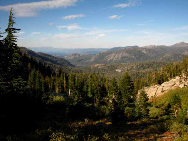
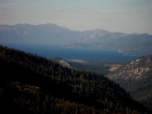
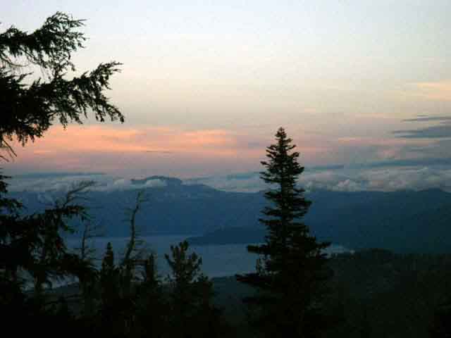
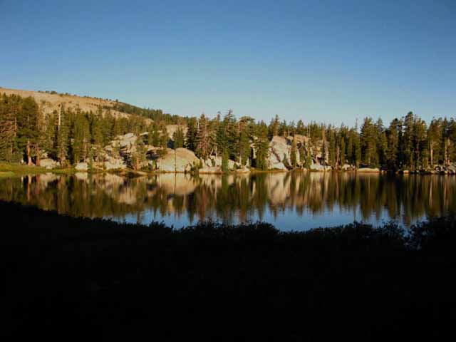
View looking North at the Southern end of the Lake Tahoe Basin with Christmas Valley and the South Upper Truckee Drainage at our feet, taken from just North of Showers Lake. Views hiking South to Showers Lake from Echo Summit had been generally obscured by steep mountains and dense forests. Our views up until now were fleeting seconds as we momentarily emerged from the dense forests and peeked around the complex terrain filling the Southwest corner of the Tahoe Basin. Approaching the shelf Showers Lake sits on begins opening up wider views of the South Upper Truckee Watershed draining Christmas Valley into Lake Tahoe. |
||
 |
||
Freel Peak is the biggest mountain on the far Right edge of the picture. We can see the haze of the faint blue of Lake Tahoe visible below the Carson Range in the furthest distance. That's the East Shore of Lake Tahoe. Though Christmas Valley is a narrow U-shaped valley on the South end of the Tahoe Basin, the views we get from Showers Lake looking down through Christmas Valley to Lake Tahoe feel, and are very expansive compared to the relatively claustrophobic character and general lack of views along our hike from Echo Summit to Showers Lake. Approaching Showers Lake we begin to get good overviews of the terrain wrapping around the South end of the Tahoe Basin that were mostly shrouded by forest and rock until we approach Showers Lake.
|
||
|
||
| Southern End of Lake Tahoe. | ||
 |
||
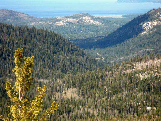
The open terrain around Showers Lake begins to grace us with some expansive views to the North of South Lake Tahoe. The best views are to our East and Northeast, across the Carson Range and into the high desert beyond. Finally getting an expansive view imparts a greater understanding of the context of the terrain we could not completely figure out until we could get a series of overviews. This process of questing for information and understanding our context in obscured conditions is part of becoming an excellent backpacker. Your view of the terrain does not just seek out the beauty, but also sees beauty in the logic of the terrain and its drainiges in a cascading set of contexts. Internally the terrain establishes the physical stress, our heart rate, breathing and energy consumption. This level of exertion establishes the mental reality we will view the world through. Externally the terrain affects the weather, which affects the distribution of life, which affects the rate of erosion and change. Every piece of this grand puzzle fits into every other piece to create the operating reality we deal with. This reality and its operations, characters, and logic are available to properly tuned human perception. To the practical observer the logic of the terrain will reveal the most likely route, the likely approach, and give us hints about the nature and difficulty of our upcoming experiences. Our observations allow us to calculate the degree of physical investment we will have to put into crossing the terrain, and how to most effectively disperse that investment. Premium Overlook in Meiss Country Roadless Area Showers Lake is also ideal for medium and short distance backpackers. It almost splits the distance between Echo Summit and Carson Pass, making it an excellent mid-point for a quick local backpacking trip across the Meiss Country Roadless Ares. Sweet Overlooks At Least Stop for Lunch If you are just passing through and want to see the overlook view, the first overlook extends out to the North next to where the trail South from Echo Summit enters the flat apron around the North Shore of Showers Lake. If we are hiking Northbound through Showers Lake the overlook is the trail we see off to our right just as we are hiking to the end of the campsites on North end of Showers Lake. |
Christmas Valley
and
Shadow
Christmas Valley
and
South Lake Tahoe
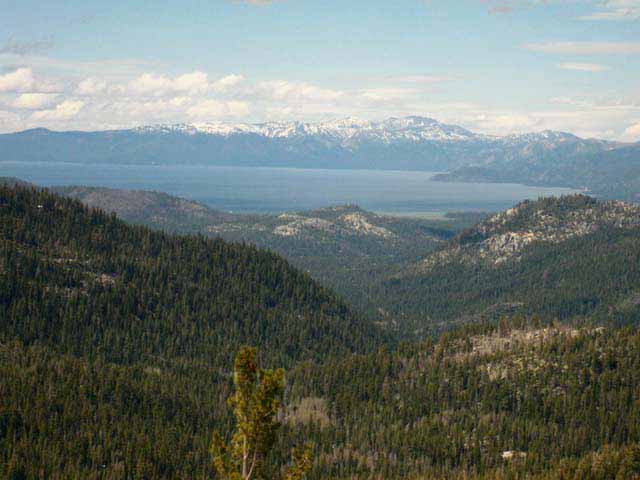 |
Pulling our perspective back a bit we can put Christmas Valley into context in the South end of Lake Tahoe. The road maps below the full Desolation Wilderness Hiking Map also gives us some context. Road Maps of South Tahoe Basin Carson Range wrapping around the East Shore still decorated with Spring snow during June of 2010. Snow was historically common in June, but the last two decades have seen Spring move earlier into Winter, Winter grow shorter and weaker, with dry Fall conditions pushing into December. Above we see thinning snow still clinging to the upper elevations of the Carson Range on June 7th. The fact is that the grand weather patterns over the whole North Pacific Ocean have radically changed during the past twenty-five years. We have already become a drier, wetter climate. Our four-season weather pattern born out of the Northwest seems to be moving towards a two-season pattern spawned in the tropical oceans to our Southwest. This long, slow change in weather patterns over the course of my life has deep, powerful implications for man and Nature. Though these changes seem "slow," happening over the course of a single human lifetime, this pace of change of weather patterns is unprecedented over geological time spans. |
Information
Meiss Country Roadless AreaEcho Summit
|
| Hiking Map South Meiss Country Roadless Area |
Trails West to Highway 50 Echo Summit to Round Top & The Sisters |
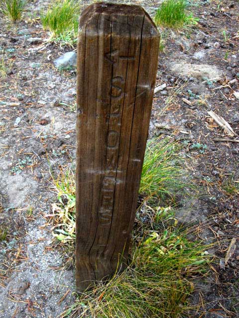
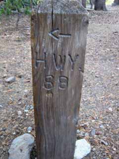
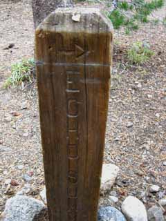
Though I found the signpost pictured above at the spot the Northern junction was marked on the map, there was no trail junction, and no trail around the South Shore of Showers Lake.
My notes on this trail junction say, "Signpost, but no Junction." (Yup, I keep a "trail notebook," one of those tiny 4.5x3.5 inch "Penway Composition Books," in addition to my journal.) Experiences, memories, notes, images, and videos are almost required to keep any kind of meaningful record of High Sierra terrain.
Hiking Southbound past the Northern sign post turns us down a gully alongside a beautiful granite berm-feature that gives us an idea of the great scrambling terrain surrounding Showers Lake.
It appears that as the main trail has been routed through Showers Lake old route of the TYT-PCT bypassing Showers Lake has been abandoned. Likely in the name of reducing erosion damage. Trail designers figured they might as well run the trail through the already damaged North Shore apron of Showers Lake and let the damage around the South Shore caused by the trail heal.
Therefore it also makes sense that there is a trail post at the map point South of Showers Lake marking another junction to a trail that no longer officially exists.
The second, Southern trail junction post at Showers Lake is now located at the campsites on the North side of Showers Lake, rather than South of Showers Lake, as marked on the 1992 USGS map.
Check out the Map, and Click the Colored Dots for related trail guide page.
The Showers Lake Trail Junction
North
of
Showers lake
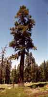
| Twisted old Lodgepole Pine. |
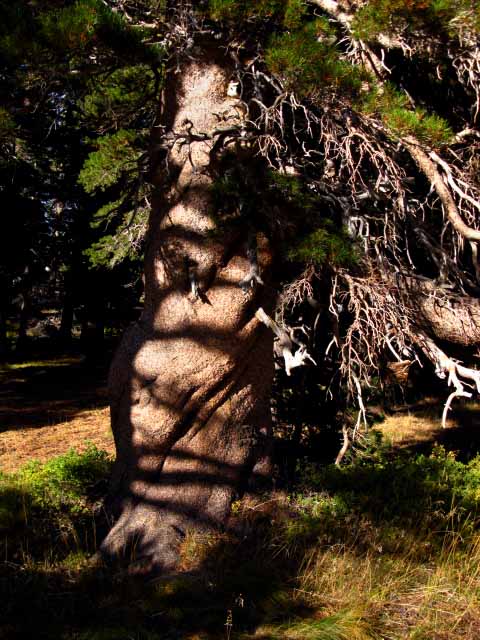 |
Knarly twisted lodgepole about to fall into mulch, much to the benefit of its brethren's future growth. Trees work both individually and as a group to convert rock and meadow into nice forest-floor to provide for their future health and expansion. The lives and actions of each tree supports its own, and its fellow tree's welfare through coordination, cooperation, and fierce competition. "Forest" is almost too-static of a term to describe the group movements of individuals who are acting more like a "herd of trees" than a staid "forest." I see trees and their forests as being a whole lot more rowdy than that, but on a time scale that escapes most folk's attention spans. |
Showers Lake Trail Post
North End
| The junction post on the North side of Showers. See the map for the location of this post. |
 |
Trail post, but no trail junction. Rather than a loop off the main trail to Showers Lake the whole trail loops around its North Shore. |
Showers Lake Check Dam
| Showers Lake's Genesis | ||
 |
||
Showers Lake exists because of this Check Dam. More on |
Showers Lake We can see something a bit strange about this junction. It is that the main trail has been rerouted, deflected through its one-time loop around the North shore of Showers Lake. We are hiking down the gully to approach the campsites on the Northeastern apron of Showers Lake. A short ways down the gully the trail turns Right to climb to the Northeast corner of Showers Lake just below the check dam. Looking at the post above we can sense what's strange is that the old main route proceeded straight, wrapping around the South Shore of Showers Lake where the North end of the Showers Lake loop turns down the gully. Well, visiting Showers Lake is good to meet folks and see the sights, so a good thing overall, but it's a little detour around the most direct line across the terrain, which is what most PCT hikers are looking for. Well, instead taking the option of pushing straight through this little detour, and following what remains of the old route straight around the West-Southwest shore of Showers Lake, we'll cop a Left at this junction to visit Showers Lake. Both the old 30 minute and much newer but still "old" 15 minute maps still depict the trail's old configuration around Showers Lake.
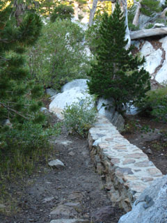
Hiking down this gully we have a great rock wall of beautiful forest shaded granite rising to our Right, until we find ourselves threading our way to our East through a break in its expansive wall following our trail turning Right out of the gully for the brief climb up to Showers Lake. This rock is part of the great rock formation that wraps around the Northwest Shore of Showers Lake that is so nice to scramble around on. Showers Lake is a very pleasant and pretty piece of rock/terrain, water and forest to camp and take delightful walks/scrambles to explore the surrounding terrain from our Showers Lake campsite. Turning Right out of the gully around the bottom of this cool rock we quickly scramble up to the compressed apron around the Northeast shore of Showers Lake that serves as its main campsite area. We can see the soils under the forest around the Northeast Shore of Showers Lake have been compressed by many years of backpackers camping here. There are also a couple of sites across the lake off its Southwestern Shore. PCT-TYT-TRT HINTS
Best View of the Meiss Country Roadless Area But, though this fantastic viewpoint is not on the trail, it is close. This fine overlook is a few feet off the route of the PCT-TYT-TRT along the North end of the rerouting the of trail route around the North shore of Showers Lake. At the far North end of the flat apron of campsites around Shower Lake's Northeast shore is a well trod trail to the Northeast (Southbound hiker's Left) that pushes through some brush for a few short feet until it splits into two trails, each leading out to the end of two great rocky ridge-fingers jutting out from our mountainside flat over the end of the sheer and complex Upper Christmas Valley drainage. From these overview positions we get a good sense of the nature of the terrain around us, such as this shelf under the top of the Tahoe Rim mountains holding Showers Lake, as well as Meiss Meadow. |
Camp Notes
|
|||||||||||||||||||||
| Meeks Bay to Echo Summit MILES AND ELEVATIONS |
Echo Summit to Carson Pass MILES AND ELEVATIONS |
Total distance from Meeks Bay
TYT
37.51 miles
Lots of Local Backpackers
This is a popular spot for local backpackers from Tahoe, Reno and Carson City in Nevada, and local residents living in the West Flank Sierra Foothills.
I always meet lots of locals here.
Weather NotesSunset Temp before Sunset No weather, no mosquitoes: Sunrise: Temp at Sunrise: |
Echo Summit
NWS
|
Regional NWS NWS |
| All High Sierra Weather Resources |
|
|
|
|
|
Road Conditions |
|
Big View |
Big View |
* "or so" note:
I record the Sunrise/Sunset times and their respective compass points, the time of the rise, transit, and setting of the Sun, (transit is when the Sun crosses the imaginary North-South line in the sky) and the Moon Phases for the day my backpacking trip begins as the header of my journal. These are the bookends of day into night.
I also note their rate of daily change.
The sunrise and sunset times shift in conjunction with their shifting rise and set compass points.
This means that trips over a week in duration require I include another set of readings for the date of the mid-point or end of the trip.
When I'm collecting the data from the US Naval Observatory I poke around a bit, to determine if the rate of change is great or small.
This allows us to accurately use of the Sun as both a compass and a clock for the duration of my trip. Unless it's cloudy.
Time and space are deeply related for backpackers, as well as physicists.
The times of Sunset and Sunrise given above reflect the time on the start day of a September 2009 Tahoe to Yosemite backpacking trip. In fact, each day the Sunset and Sunrise times precede slightly, so my accuracy diminishes.
The daily rate of change during September is a loss of up to two minutes a day for both Sunrise and for Sunset.
In other words, the day is shortening by up to four minutes a day in September.
| Celestial Navigation Information |
Astronomical Information |
Good Neighbor
| Texas Steve camping at Showers Lake. |
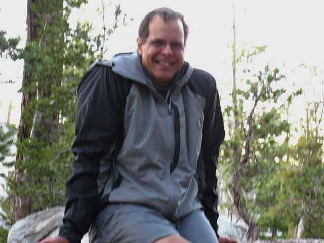 |
| Steve is backpacking the Tahoe Rim trail by sections. |
Early Morning Brightness
| First Light illuminating Little Round Top and about to hit Showers Lake on a Lazy morning at camp. |
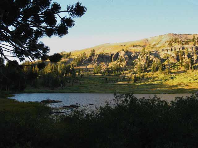 |
Descending East shoulder of Little Round Top-Sierra Crest-Tahoe Rim I kicked it late at camp, and did not depart until the Sun hit the lake. One way of measuring effectiveness and efficiency on the trail is the length of our hiking day. How long it takes us to develop the capacity to comfortably hike from Sunrise to Sunset is a measure of fitness. Another is how many days in a row can be hiked from Sunrise to set before needing a day off. And finally, what speed can be maintained over those full days. These are interdependent variables. Each greatly affects the others. Carefully consider how you mix them, and carefully monitor the results. |
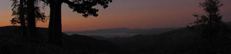
Evening Light Fades
Darkness Spreads
and
Clouds Glow
 |
| Light, shadow, and clouds Sweet Lake Tahoe Sunset from Showers Lake. |
Showers Lake
Images
by
Peter Skaff
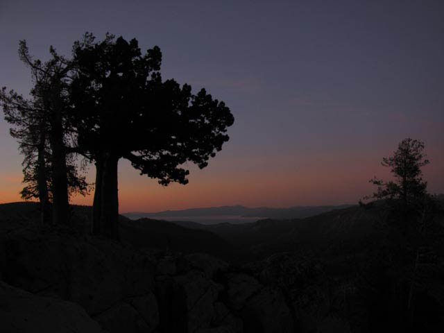
| Sunset over Lake Tahoe from Showers Lake, September 2009. |
 |
by Peter Skaff. Also See Peter's |
North: Showers Junction to Schneiders Junction South: Showers to Meiss Cabin
| Sunrise at Showers Lake, September 2009. |
 |
| by Peter Skaff |
Video
Showers Lake
in the
Morning
| Departing Showers Lake, Backpacking South | |
Departing Showers Lake hiking South on Day 5 from Meeks Bay to Tuolumne Meadows after a nice night at Showers Lake.
|
Video
Showers Lake
under
Ice and Surrounded by Snow
June 6, 2010
This video shows part of a Spring snow trip to Showers Lake from the South Upper Truckee trailhead. May and June brought heavy Spring snowstorms, leaving a heavy snow cover in early June. REMEMBER THAT. Many PCT and long distance High Sierra Backpackers are beginning to believe that Summer backpacking conditions begin in May!! They do not. Though recent trends have brought a snow free Sierra in June and even May, this is highly unusual, and makes anyone in the Sierra during May and June subject to "unexpected" Spring snowstorms. The same danger is true during October and November. October and November have been getting warmer and the onset of Fall and Winter storms has been delayed by the same climate mechanism that is triggering early Spring Thaws. Hikers in Fall are subject to powerful, unexpected early season Winter storms blowing in, as are early Spring backpackers subject to unexpected Spring storms. Early and late season backpackers must be ready for the worse weather that the time of the year they are hiking can possibly blow in, despite the recent changes in Fall and Spring weather. I believe that many more backpackers are subjecting themselves to increasingly dangerous situations in late Fall and early Spring precisely because the climatic tilt towards "good" weather during these critical periods of weather transitions have drawn out many hikers not properly experienced or geared to deal with the potential weather that can blow in during early Spring and late Fall. To have the best backpacking trips possible we must always consider the worse-case scenarios possible. Otherwise "things" can get way out of hand. SPRING CONDITIONS at SHOWERS LAKE |
||
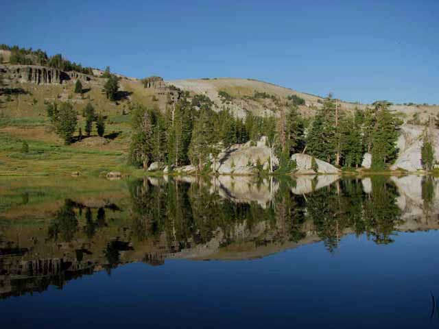
Though we approached Showers Lake from the Northeast coming up from Meyers, this video well depicts Spring conditions in the Meiss Roadless Area.
|
Spring Bear Tracks
departing hibernation spot near Showers Lake, June 7, 2010
| Departing Showers Lake the next day, I noticed a lone set of tracks descending from a stand of trees around some big rock that had melted out. | ||
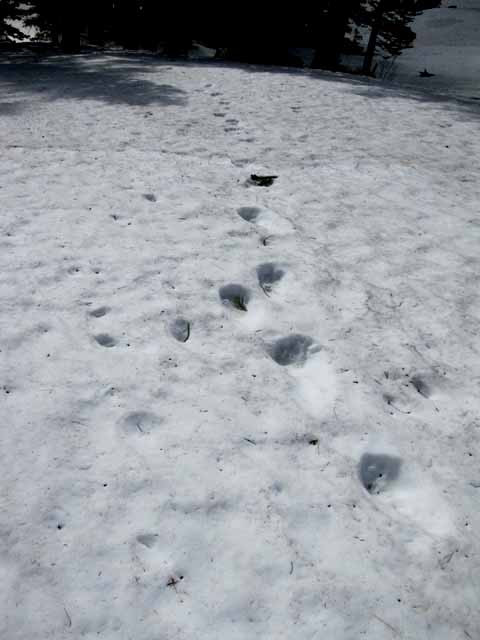 |
||
Further inspection (I circled this stand of rock and timber) revealed, as I suspected, that only one set of big tracks were coming in or out of this location. The tracks were pointed directly down the mountain towards the houses about 7 miles away along South Upper Truckee Road. Though the tracks indicated a lethargic and hesitant bear, there was no deviation from the straight line of the bear tracks towards "civilization." At the South Upper Truckee Road a quick and tasty meal could easily be had out of these luxury house's unprotected garbage cans. If I was a bear, that's where I'd go too! I found it sad that the bear tracks did not point towards any of the three nearby lakes that hold fish and attract all sorts of critters, nor towards Meiss Meadow, which was right then experiencing the snow collapsing on the Meadow. Though the Bear's natural larder of meadow, forest, and lake looked full, bear was headed down to the houses. This means that my sadness will be shared by the homeowners in Christmas Valley, where bears have been tearing up shit outside the homes and even entering them (and really tearing shit up!) seeking easy pickings. In early 2011 two old yuppie dudes who live in Christmas Valley informed me that a bear had failed to hibernate, instead staying awake and feeing from the houses in Christmas Valley all Winter long. To me this just means two things: They are going to eventually kill that bear, and that homeowner garbage in the Lake Tahoe Basin must be bear proof by law if common sense won't work.... A bear in your kitchen can ruin your day. And your kitchen. Then then they shoot the bear. Despite all of these instant and grim thoughts these bear tracks inspired while standing here on this snow-covered mountainside, seeing these bear tracks still gave me a good feeling of satisfaction to locate a bear's Winter den right after Bear had departed. That good feeling was that there is some natural security, even in this crazy world dominated by the Urban Jungles we have created, a Natural Security that can independently preserver through the roughest of climates. Until the poor country bear stumbles into our endlessly expanding Urban Jungle, and we kill it. Go Bears! |
Showers Lake
Campsite in the Morning
About ready to hike South
Sun breaking through the trees over Showers Lake campsites on the flat apron around the North Shore of the lake. Besides composing the majority of campsites here, the big flat makes the whole North side of Showers Lake one big campsite. There's also sites on the other shore of Showers Lake. |
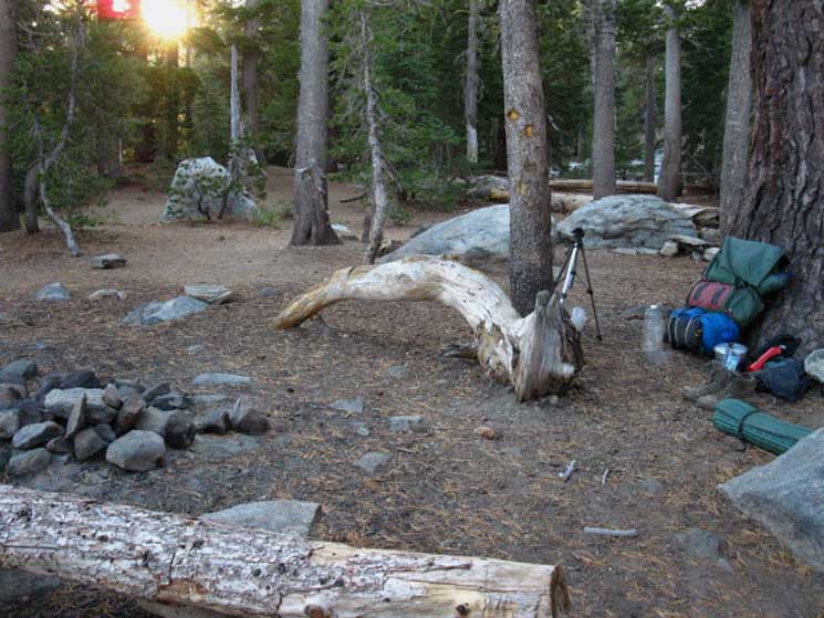 |
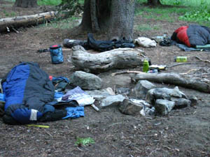
About Ready to Hit the Trail. The sleeping pad is my seat, the pack is the seat back. I'm ready to get up, stash the stove, pot and fuel, strap all the externals onto the outside of the pack (tripod, 2 extra food bags ((and the Garcia inside)), sleeping pad, and gallon water-storage bottle) and hit the trail. Note the lack of people in the background. Though Showers is very popular during Summer, it gets quiet in mid-September. Very nice. This is one of about 5 campsites on the Northeast Shore of Showers Lake, but the well-trodden flat around the North apron of Shower Lake makes any spot adequate to throw the pack down. Even if the place is full you will be able to find a nice flat to crash on. |
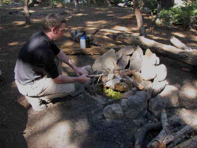
Campfires
on the
Trail
Pete and Jason Member Wisdom |
||||||
 |
||||||
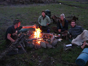
Jason and Pete's Peter's fire tip Alex fire tip You know you have the right stuff when the cube you observe is dried to almost the density and weight of Balsa Wood. Along with dried moss picked dead and dry from trees, cubes and moss are two of nature's pyrotechnic fire starter materials. Having a bit of both stored in a plastic bag in your pack is good policy. OnFires, Tents, and Company (My Fire Policy) Alex note My reasoning behind forgoing fires is simple. Fires create a sphere of light that limits vision to within that sphere of light. We are blind outside of the sphere of light. Foregoing fires allows eyes to adjust to the falling darkness. The capacity of vision, of sight, and the things to be seen are amazing. After adjusting to natural darkness, artificial light will seem like an insult to your senses. Pick the right campsite, and remain quiet, and the natural equivalent of the "changing of the guard," takes place as day critters bed down and the night life comes out. This transition cannot be viewed from within the sphere of light. This guide will be peppered with stories about nighttime in the High Sierras, and some of them should be yours. I apply the same minimalist principal to tents as light. If we cannot see past the light of the fire, we have less to no chance to observe from within a tent. If no weather or mosquitoes are threatening I do not put up a tent. I have been known to tent up after a few nights exposed under the fullness of a bright moon, just for sufficient darkness to sleep. Many consider fires and tents as indispensable parts of the camping experience. I do not. They are safety and social components in the backpacker's "toolbox." But when I travel through, camp, or just sit quietly in a remote wilderness area, I want my mind tuned to, and reflecting the natural environment, and not the people around me. When an individual travels lightly and quietly, the things that walk, crawl, swim and fly do not easily notice our presence. This Summer I had a bobcat walk through the edge of my camp near the headwaters of the E fork of the Carson River. The bobcat was totally unaware of my presence. This has happened with bears, birds, coyotes, and people. Groups will never have this happen, unless they are being targeted for food. The noise and bustle of a group would have warned off the bobcat long before anyone observed her. Maybe I enjoy company more after not seeing anyone, or saying anything, for three days to five days. The longest I have gone without seeing anyone in the High Sierras is five days. This happens mostly in Winter, late Fall, and early Spring, when traffic in the Sierras goes way down as the depth of the snow rises. This is not to say I condemn fires or company. I do not. I enjoyed two fires between Lake Tahoe and Mount Whitney during the Summer of 2009. The first, when I shared a campsite with a USGS Small Mammal counting team in the Emigrant Wilderness near Latopie Lake. They were a great crew, and I still thank them for the shots! Great Folks Everywhere
Although I find that fires, tents, and people are distractions to the real point of backpacking deep into the High Sierras, I always have the ability to make a fire, put up a secure tent, and share a fine conversation, or a friendly campsite, meal, beverage, and a fire, with my fellow backcountry travelers. What do you think about tents, fires, and group travel? POST UP IN THE CAMP SKILLS FORUM Backpacking Trail Tip Hit up the Backpacker's Forum with your General wisdom TahoetoWhitney.OrgFORUM |
Showers Lake
in the
Bright Morning Light
View Northwest Hiking South away from Showers Lake | Sunrise over Showers Lake Starting day 5 South towards Tuolumne Meadows from Meeks Bay The Tahoe to Yosemite Trail |
 |
A crisp and clear sunrise over Showers Lake. Nifty rock formation on the West shore of Showers Lake good for scrambling around. The trail down the ravine approaching the North Shore of Showers Lake lays on the other side of that great granite rock. Does that not invite you to scramble over its nooks and crannies? That's the big rock formation we noted when we emerged from the forests hiking South from the Schneiders Cow Camp trail junction to Showers Lake. |
Signage
AT
Showers Lake
| These sign posts sit within the North end of the campsite area at Showers lake, and are more for decoration than information. |
Highly Restricted
Catch and Release
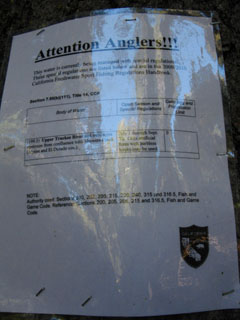
SHOWERS LAKE
Trout Fishing
REGULATIONS
| Text of Notice Below. | Text of Notice Below. | |||||
 |
 |
|||||
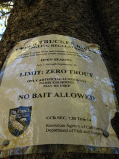
(TEXT) This water is currently being managed with special regulations. These Special regulations are listed below and are in the...California Freshwater Sports Fishing Regulations Handbook. 7.50(b)(111), Title 14, CCR Upper Truckee River and tributaries... July 1 through Sept 30, Only artificial lures with barbless hooks may be used. Daily Bag and Possession Limit: 0. California Department Fish & Game |
(TEXT) The Upper Truckee River and tributaries upstream from their confluence with Showers Creek (Alpine and El Dorado Counties) Open Season: July 1 through September 30 LIMITS; ZERO TROUT ONLY ARTIFICAL LURES WITH NO BAIT ALLOWED California Department Fish & Game |
|||||
| Translation Catch and Release. |
Translation Catch and Release. |
Fishing Showers LakeAs we hike South from Lake Tahoe to Mount Whitney we will travel across a wide variety of vast drainages containing what seems to be endless webs of rivers, creeks, and lakes. We will also travel across a wide range of fisheries. Some locations and fisheries are highly restricted, such as the Lahotan Trout in East Carson and related drainages in the Eastern Sierra Nevada. Other fisheries are problematic remnants of earlier plantings that need to be fished out, to have the planted fish removed. Many of the fisheries in the Sierra Nevada Mountains are unique. Due to their isolation from others of their species, many Sierra trout have evolved unique sub species. Mountain Trout of the High Sierra. Everything up here's special... Other areas are actively planted with trout, and you have excellent fishing. I say you because I don't fish. I stalk fish with a camera... What I'm going to do for fishing spots is put a link up to the particular National Forest's Fishing Information for that fishing spot. For Showers Lake that's the Meiss Country Roadless Area in the Lake Tahoe Basin Management Unit. I also have transcribed copies of the Fish and Game fishing regulations for Showers Lake that were posted there in 2009. These are the fishing regulations for Showers Lake, and I doubt they will ever loosen up. I'd bet they are more likely to tighten up as water conditions tighten up in the Sierra.
Unfortunately, this link currently leads to no real fishing information. (Since updated to current fishing information) I have hopes it will... Thus I have posted images and transcribed the text of the fishing restrictions posted at Showers Lake, above. For more and the latest fishing restrictions information call the Lake Tahoe Basin Management Unit at |
North: Showers Junction to Schneiders Junction South: Showers to Meiss Cabin
Showers Lake
|
||
Showers Lake was too great of a reward for my slacker 7.8 mile day. Showers Lake offers the best campsites between Echo Summit and Carson Pass. Actually, Showers Lake offers the best campsites on the Pacific Crest Trail between Lake Aloha (and the string of Lakes South to the Desolation Wilderness boundary, about eight miles North of Echo Summit, to Tamarack Lake, a couple of miles South of Blue Lakes, a span of roughly 28 miles. These are not the only campsites, but the best sites. Local Campsites
|
| 7.5 min Topo Hiking Map Echo Summit to Carson Pass |
30 min Topo Hiking Map Echo Summit to Round Top Lake |
Next page South
Showers to Meiss Cabin
Backpacking Trail Guide North Schneiders Junction |
 |
Backpacking Trail Guide South |
Backpacker ForumsGeneral Sierra Nevada hiking thoughts to relate? We cover High Sierra Trails and all Backpacking Topics. Post 'em on On the Backpacking Trails and Topics Forums we can browse trail locations and you can add your experiences, comments, questions (or pictures and videos) about hiking to Showers Lake.
Or any of the trails in Meiss Country and between Tahoe and Whitney. Browse around the guide and forum. Below we link to the Echo Summit to Carson Pass Forum and the Showers Lake page: Section
|
North: Showers Junction to Schneiders Junction South: Showers to Meiss Cabin
Trailhead
Contact
Alex Wierbinski

Backpacking Lake Tahoe to Mount Whitney
Your guide to the High Sierra Crest, including the Tahoe to Yosemite, Pacific Crest, and John Muir Trails
