The Trails
Guide
Maps
Miles/Ele
Permits
Resupply
Forum
Current Weather Conditions
Weather Notes
Northern High Sierras
Central High Sierras
Southern High Sierras
Gear
Gear List
Gettin Started
Layering
Discussion
Testing yourself and your gear
Gear Reviews
Backpacking
Mokelumne Wilderness Boundary
to
Raymond Lake Trail Junction
Hiking the Pacific Crest Trail between Carson Pass and Ebbetts Pass
Languages
Languages
Trail Arts
The art of walking
Physical Preperation
Trail Skills
The trail
Off the trail
Scrambling
Maps
Navigation
Camp skills
Food
Resupply
Food
Other
Photo Catagories
Trail Stories
Trail Culture
News and Science
Links
Groups
Books
Terms and Conditions of Use
Trail Guide Index |
North PCT Blue Lakes Road |
South PCT Raymond Lake to Ebbetts Pass |
7.5 Topo Map Upper Sunset Lakes to Ebbetts Pass |
30 min Topo Map Carson Pass to Ebbetts Pass |
Topo Map Index Carson Pass to Ebbetts Pass |
Carson Pass |
MILES AND ELEVATIONS INDEX |
National forest Humboldt Toiyabe NF |
Tahoe to Whitney on You Tube |
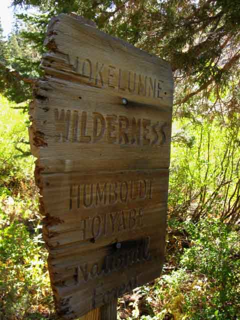
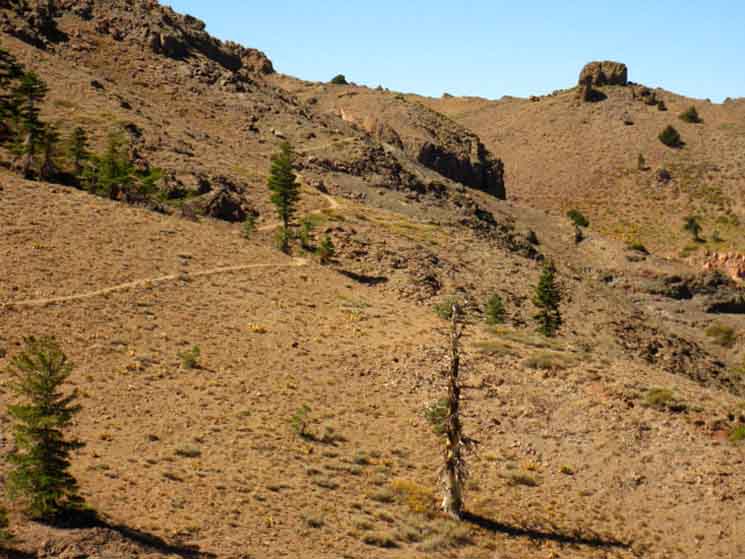
Mokelumne Wilderness Boundary
2 tenths of a mile South of the Wet Meadows Lake trail junction we yet again cross into the Mokelumne Wilderness. The boundary of the Mokelumne Wilderness between Carson Pass and Ebbetts Pass is crazily convoluted.
Blue Lakes Road to Raymond Peak Map It appears that the boundary was drawn to protect private mineral and water rights. The USGS map linked to above does not depict the crazy boundary as does the National Forest topo map of the Mokelumne Wilderness. I count six times in and out of the Wilderness between Forestdale Divide and Ebbetts Pass. Paper Maps Online has the National Forest Mokelumne Wilderness Map above online showing this complex wilderness boundary. Our USGS trail maps are more detailed, and give a better overall context of the trail at larger scale, but the National Forest Wilderness Maps depict the wilderness boundaries that some of the USGS maps neglect. Raymond and Reynolds Peaks No big deal. We've got a hat with a wide brim and lots and lots of sunscreen. The Raymond Lake junction at our high point across the flank of Raymond Peak is 3.38 miles South of this Wilderness Boundary. Another
|
| Roads and Weather | ||||||||||||||||
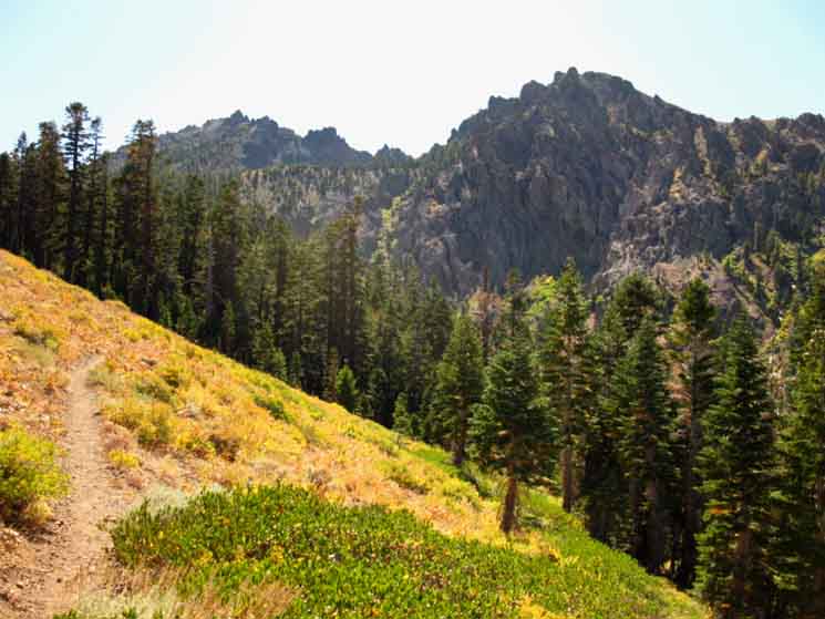
After Crossing back into the Mokelumne Wilderness, once again, we shortly come to a fine campsite along the creek coming off Raymond Peak. Will we need a tent? Only the Weather Reports will tell!
|
||||||||||||||||
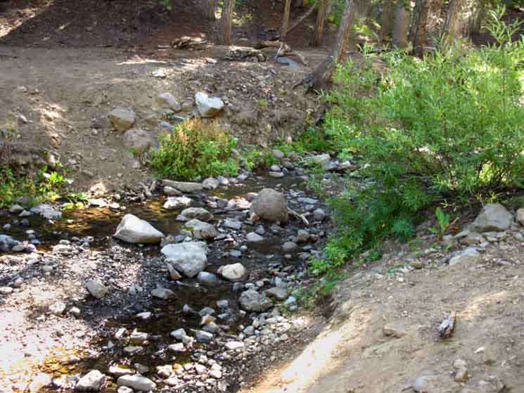
Spring Fed Creek
on
NW Base of Raymond Peak
has a
Nice Campsite
.38 of a mile South of the Mokelumne Wilderness Boundary We will cross the creek running off of the Northwestern flank of Raymond Peak. I have seen this creek flowing in mid-September even during dry years. It seems very reliable. This creek is one of the tributary branches of Pleasant Valley Creek. It has tasted great every time I've been here. Spring Fed Creek
|
| The spring fed creek running down the Northern flank of Raymond Peak, with nice campsite visible on the far shore. | ||
 |
||
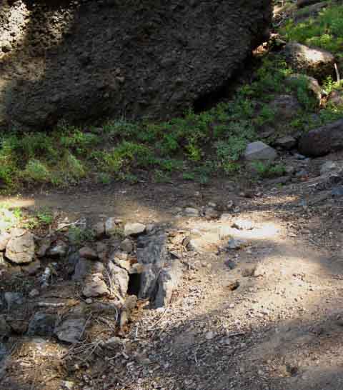
This is the creek in late September during a very dry year... still flowing.
|
Things really begin to dry out after crossing the creek on the North base of Raymond Peak. There's a fine campsite on the South side of this creek. I find this spot a fine place to snack, replenish water, and take a break prior to traversing the dry and exposed trails across Raymond and Reynolds Peaks on the way down to Ebbetts Pass. |
Campsite on the North base of Raymond Peak
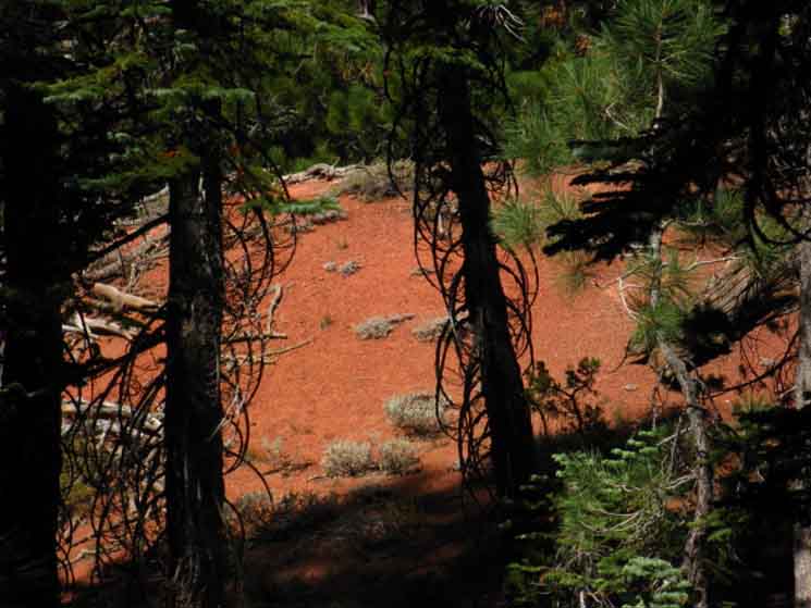
Earth Tones
| Climbing towards the Northern flank of Raymond Peak brings exposed sections of brightly colored minerals into view. | ||
 |
||
Continuing South climbing a moderate angle out of the forest we note beautiful colors painting the volcanic terrain, the amazing textures of the eroded minerals, and finally, the ghostly and fantastic shapes eroded into the hard lava formations.
Harsh, bright, bits of shade, all full of delight. This is a hillside made for hard black ants and tough beetles. |
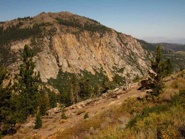
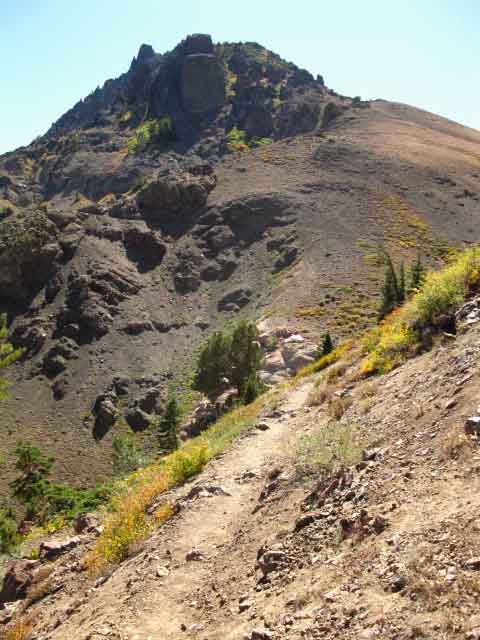
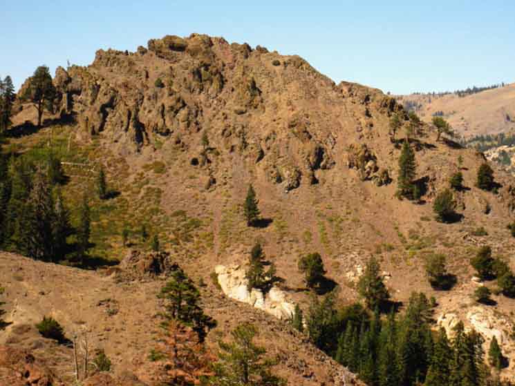
Thornburg Peak
Peak 8636, also known as Thornburg Peak, and its magnificent Southeastern Granite Face come into view as we emerge from the tree cover on Raymond Peak's Northern flank.
The Northern Flank
|
VIDEO
Wet Meadows Reservoir
and the
Mokelumne Wilderness Boundary
onto the
Exposed Flanks
of
Raymond and Reynolds Peaks
Duration: 4:16 |
Raymond Peak
| Hiking South up the Northern flank of Raymond Peak, which we can see partially hidden behind the thinning trees. |
 |
I always feel the tension rising as I climb South from the campsite. We can feel that we are in a transitional state, departing from an ancient establishment of forest and shade into an equally ancient exposed length of trail. We could see those barren qualities of the Raymond-Reynolds-The Cylinder massif from The Nipple. Now the forest is thinning into brush, and the brush is thinning beyond... |
Grand View of Peak 8636
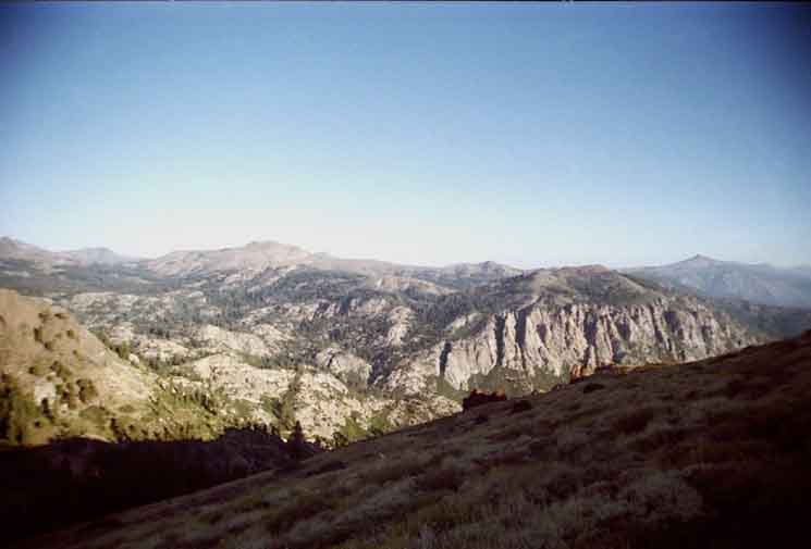
Markleeville Peak is the highest peak along the the middle-Left of the horizon. To the Left of Markleeville Peak Elephant Back sitting above Carson Pass is visible in the furthest distance.
Thornburg Peak
Emerging from the forest cover onto the Northeastern flank of Raymond Peak dramatically reveals the harsh Southern Flank of Peak 8636, Thornburg Peak, at the top of the Northwestern wall of Pleasant Valley. Coming out of forest cover into this view is a beautifully breathtaking few steps along the Southbound Pacific Crest Trail. |
||
 |
||
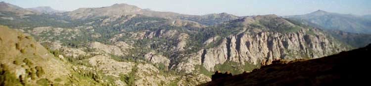
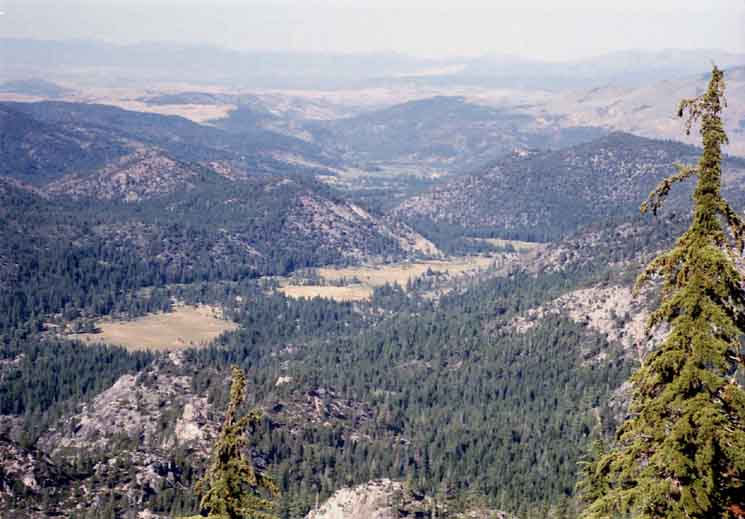
I expanded the Blue Lakes to Raymond Peak map to the Northeast to cover the beautiful terrain of Thornburg Peak topping the massive rock wall rising from the Northwest side of upper Pleasant Valley. This extension of the map gives us a good idea of the lay of the land to the East, especially if we use the 30 minute Carson to Ebbetts Pass map to get an even broader context. Regional Water Logic We're going to hike along, and eventually down into the upper section of the East Fork of the Carson River as we approach Sonora Peak on the South end of the Carson Iceberg Wilderness. I've spent a lot of time down there along the upper sections of the East Fork of the Carson River, coming in from the East out of Walker, as well as hiking North and South along this Pacific Crest Trail route. It is a very beautiful place. The upper section of the East Fork of the Carson River has cut through the surrounding volcanic terrain revealing a great gash of sublime granite emerging from its ancient burial from under a blanket of ancient volcanic flows. Remember that we were hiking along the top of the drainage of the West fork of the Carson River since hiking South out of Carson Pass. Forestdale Creek, the Lost Lakes and Charity Valley Creek all drained into the West Carson River. The string of lakes we encountered on the South side of Blue Lakes Road all drain East into the East Fork of the Carson River, as will everything on the East Sierra flank down to the top of its headwaters bowl, who's furthest extent is the North flank of Sonora Peak four miles North of Sonora Pass. That's one long drainage. The East fork of the Carson River drains 42.58 miles of our trail between the Blue Lakes Road down to its headwaters to the North of Sonora Pass. We're looking at the Northern extent of the East Carson's drainage from our position in the pictures above and below. From our position in these pictures we have 35.13 miles of trail South before we climb out of the East Carson River drainage through its headwaters bowl. We won't be in the East Carson drainage the whole time. We'll share the drainage of the North Mokelumne River with hikers on the Tahoe to Yosemite Trail for a couple of miles, but we're much higher up the drainage than TYT hikers. Hiking South over Tyron Peak brings use into the drainage of the North fork of the Mokelumne River down to Wolf Creek Pass, South of which we enter the drainage of Wolf Creek, which is a tributary of the East Carson. From Tyron Peak we can see Highland Lakes, the Eastern of which is the source of the North fork of the Mokelumne River. The Tahoe to Yosemite Trail crosses the North Fork of the Mokelumne River about 20 miles Southwest of where our PCT route briefly crosses its Western flowing drainage.
Carson Pass to Ebbetts Pass Wikipedia Map |
Peak 8636
High Contrast View Entering the exposed Northern flank of Raymond Peak reveals the raw beauty of the Cliffs falling off the South side of Peak 8636. It is amazing how different times of year and different times of day reveal completely different aspects of the same piece of terrain. |
 |
The shot above is nothing special, but it reveals the high stark contrast of the Sun on the Sierra terrain during late Fall. Note that the location of the boulder in the foreground puts the two pictures above on a similar line of observation. The big difference between the two pictures is the time of day and the time of year they were taken. The changes over a day and over the course of a year make extensive exposure to any location along the trail vital to get to know the areas we hike through. Thus our long trips down the Sierra Crest are giving us a broad context we will break down into more specific experience during different times of day and year on many subsequent trips. Blue Lakes Road to Raymond Peak Map |
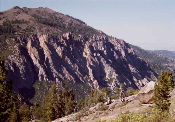
Detail on 8636
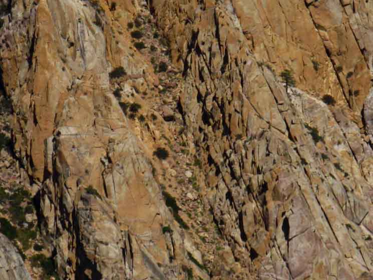 |
The harshness of this precipitous face is mitigated by the subtlety of the colors painting it, and the intricate detail and logic of its shapes. New aspects of its various attributes are revealed by the changing aspects of the Sun through its yearly cycle. |
Stunning view Northeast over Pleasant Valley
into
Carson Valley
from
Raymond Peak's
Northeastern Flank
| The Carson Valley in the far distance. |
 |
We're looking Northeast out of the Sierra Nevada Range at the Carson Valley beyond its Eastern flank sitting in the haze in the distance, and the Pinenut Range beyond. |
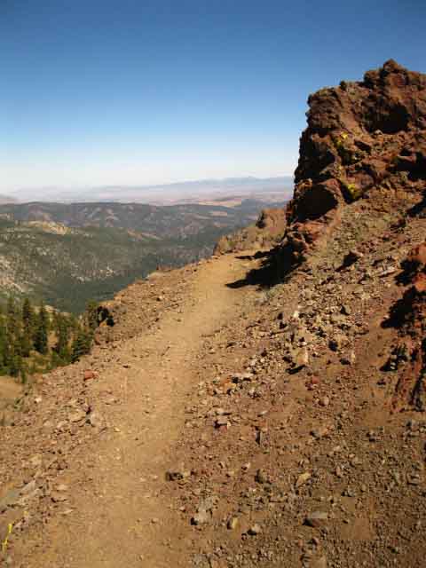
Trail ViewsLet's pull our long perspective in a bit closer to take a look at our Pacific Crest Trail route as it follows the folds on Raymond Peak's Northeast flank. We're North of the trail junction to Raymond Lake. Northeastern Flank
|
Looking at the Trail South
Trail near and far. The trail on Raymond Peak tracks across an unconsolidated eroded volcanic material. The type of terrain on Raymond Peak's Northeastern Flank is hard to maintain. |
||
 |
||
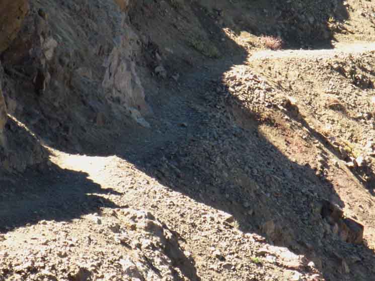
Fall rainstorms building up to every Winter's heavy Snows followed by Spring's runoff significantly degrades this type of trail across unconsolidated terrain, and specifically this segment of trail across Raymond Peak. The trail here degrades rapidly. The image above is looking South down the trail at remnants of hard volcanic rock projecting out of Raymond Peak's eroding bulk. Raymond Peak is composed of a high percentage of unconsolidated volcanic remnants. This stuff is moving. See the crease of our trail up ahead across the upcoming face?
|
Problem TrailThe section of trail from where we begin traversing the Northeastern flank of Raymond Peak to the trail junction to Raymond Lake is subject to cyclic degradation. The nature of the trail across sections of steep unconsolidated soils is such that a freshly dug out section of trail can degrade to the angle of repose in three years. Three years of Spring and Fall rains combined with three Spring runoffs can be sufficient to wear away segments of this trail. Well, it can if we get any rain at all! The drying out of the weather, the elongating of the Summer and shrinkage of the Winter has slowed time down in the High Sierra. Less water equals less growth. Less water equals less erosion. The two major forces of change, of the measurement of time, have significantly slowed over the last thirty years. (2014 writing) The timing of this section of trail's degradation is tied to the intensity of the seasons it experiences. The less rain and snow activity, the less erosion, and the rate of trail degradation slows. The more rain and snow we get the quicker these unstable sections of trail wear away. A very similar process is at work on the terrain and trail traversing the South flank of Sonora Peak to our South. That segment of trail wears away on the same timing mechanism as this segment of trail across Raymond Peak. |
Looking North, back Up the Trail
Looking North, back the way we came... Parts of the trail bed are starting to tilt towards the angle of repose. We can see how the drainages off the flank are attempting to cut the trail into ribbons. |
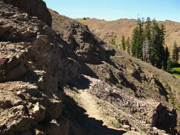 |
It's not too bad, but we need to watch our steps. I've seen this segment of trail flattened to the angle of the mountainside, down to its particular angle of repose. It's hairy and scary at that stage. It's not too bad at the level of degradation pictured above, but we don't want to step on a rolling rock, slip, or trip along crucial segments of this part of the trail. |
Looking North Up the Trail
| This section of trail fell off the side of Raymond Peak. |
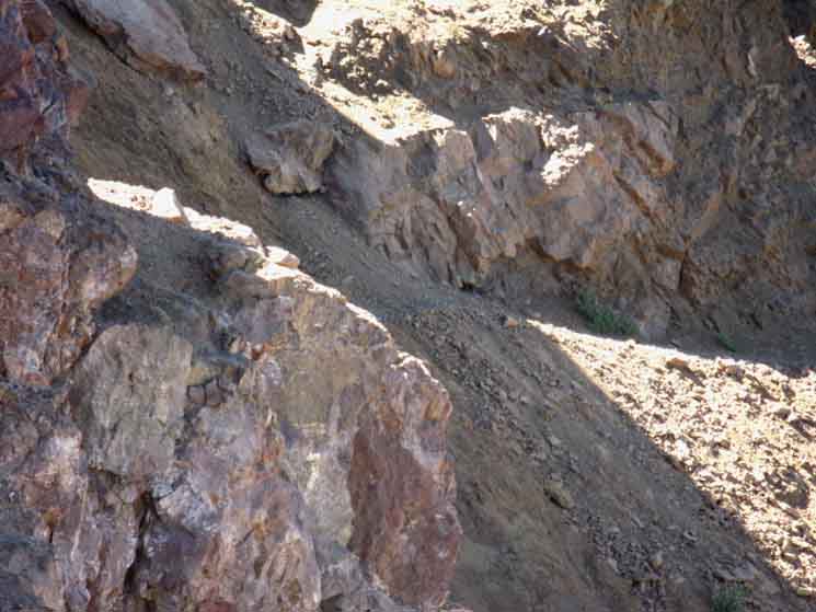 |
Serious Trail Degradation I was nervous crossing this degraded section of trail across the Eastern flank of Raymond Peak. It will not kill us to fall off, most likely, but it could be very hurtful, and a real drag to climb back and recover from. We've got to make the correct moves across these degraded segments of trail. That's about all there is to it. |
Looking North Up the Trail
Have you been across this section of the Pacific Crest Trail on the East Flank of Raymond Peak since I shot the pictures above? If so, post up your observations in our Also check out our Forum Page for the |
Pleasant Valley
View Northeast from Raymond Peak
Below we see the meadow in Pleasant Valley running out from under the great rock wall topped by Thornburg Peak. Thornburg Peak and its great wall are located just out of the Left edge of the image. Carson Valley is denoted by the yellow meadows mired in deepening haze beyond this rare section of rolling East Sierra foothills. There's not many of those. The East Sierra is noted for its sheer and abrupt escarpment. Beyond the Carson Valley the Pine Nut Range is vaguely silhouetted through the deep haze on the horizon. |
||
 |
||
We can roughly see where the little town of Markleeville is located in the image above. It's near the edge of the far, faint, greenish meadow in the upper middle distance. It's actually out of sight, blocked off from our view by the intervening terrain. Let's get a more particular context. In the foreground of the image we can see the expansive meadow filling the bottom of Pleasant Valley, running out from under Thornburg Peak's awesome wall. In the near distance just beyond this upper meadow we can see a lower meadow past where Pleasant Valley Creek makes a jog to pass between the ends of two ridges. That's almost dead-center in the image. Carson Pass to Ebbetts Pass Markleeville is located almost in the center of the image on the far Right edge of the lower meadow in the distance beyond Pleasant Valley in the foreground. The road to the famous Grover Hot Springs State Park is along the far edge of that lower meadow, and Highway 89's bridge over the East Carson River is down there too. Markleeville's small scattering of buildings are not visible, but that's where it's located. The Blue Lakes map below gives us a detailed depiction of the great granite face rising above the North side of Pleasant Valley while the Carson Pass to Ebbetts Pass map below that shows the course of Pleasant Valley Creek down to its confluence with the East Carson River at Markleeville.
Carson Pass to Ebbetts Pass |
Looking North Up the Trail
Terrain on the North side of the Raymond Lake Trail Junction
| Looking South at the Pacific Crest winding its way up and around the flanks of Raymond Peak. | ||
 |
||
See the faint line of the trail traversing it's way up and around the flanks of Raymond Peak? We can see the Northern spur of the trail branching off from the Right of the image. I don't know why. This trail comes back to the main trail near our current position. It drops. It climbs back. Well, it crosses the drainages lower down, where water is available later in the season. But we just crossed the spring-fed creek at the Northern base of Raymond Peak, so water should not be an issue. I have no idea why this spur trail exists. But it does. Anyway, there is a spur trail of no understandable necessity along this section of trail. There it is, above. The North end of the spur trail also identifies our position on the maps.
|
Looking North Up the Trail
| We are offered little cover hiking across Raymond Peak's flanks. |
 |
Our hat becomes an important piece of gear through here. I'm not exactly sure about what we are looking at. Oh, we are looking North up at the PCT, but we are looking South-Southwest by the compass, possibly towards one of the spires sitting around the circumference of "The Cylinder," poking up between the saddles of Raymond Peak's Northern spur. Raymond Peak to Ebbetts Pass
Map |
Looking North Up the Trail - West by the Compass
 |
| Fast Trail The trail around Raymond Peak is well graded and the switchbacks are reasonable, excepting the degraded sections of trail we are about to cross to our South, below. |
Looking North Up the Trail
 |
||
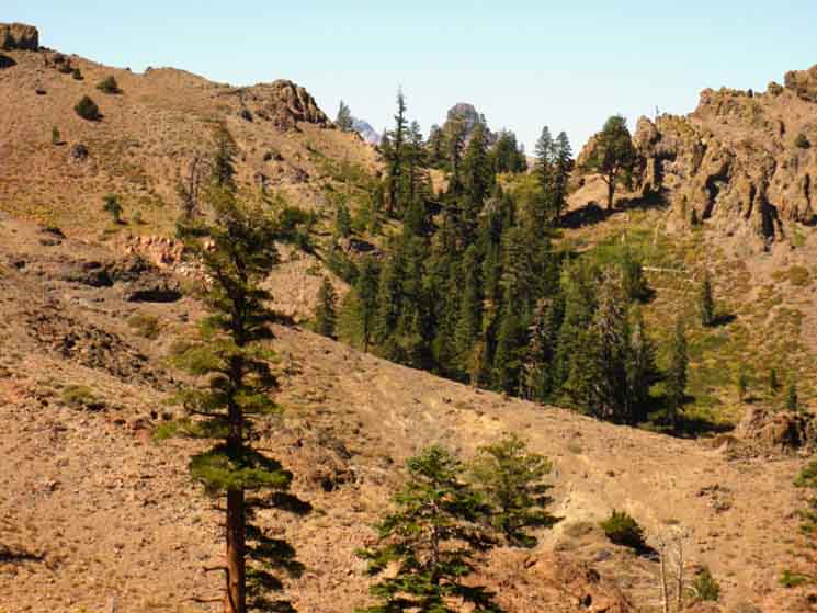
Turning around to look North we see how a Finger of Forest follows an active drainage up a ravine on the flank of Raymond Peak as we make the last switchbacks South up to the Raymond Lake trail junction. Well, not too active of a drainage. The forest looks thick in the second picture above, but the shot above shows that this cover is pretty thin. No water has been flowing here since Spring, and not much flowed then.
|
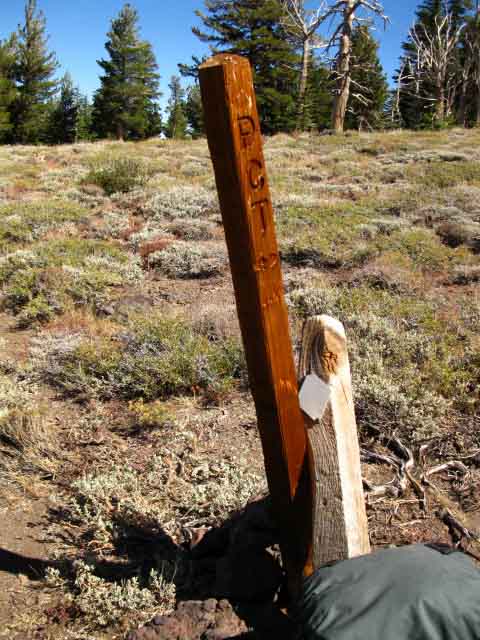
The Raymond Lake trail junction
Raymond Lake trail junctionElevation 17 miles South of Carson Pass. 9.78 miles North of Ebbetts Pass .97 of a mile to the end of the Raymond Lake Trail at Raymond Lake. I've never hiked up to Raymond Lake. Anyone have any pictures? I will hike up there and get some shots next time through... |
| Raymond Lake Trail Junction. | ||
 |
||
Raymond Lake Trail Junction. Though not exactly flat, we can see that we're on the top of a rounded flat wedged along the flank of Raymond Peak.
|
North: Blue Lakes Road South: Raymond Lake to Ebbetts Pass
Mokelumne Wilderness Boundary |
Notes on Trail Conditions A significant part of the trail along the Eastern flank of Raymond Peak is cut through unconsolidated volcanic debris that have been eroding off the hard lava formations of Raymond Peak for thousands of years. As we have seen on our way down the Pacific Crest and Tahoe to Yosemite Trail routes South from Echo Summit, there are amazing interface zones (Christmas Valley, Brown Bear Pass)between volcanic hard lava formations, lahars, and Sierra Granite. Quite incredible scenes. An epic tale frozen in time and space melting before our eyes. Just what are we backpacking through? The volcanic terrain was produced by massive eruptions of ancient volcanoes, about 10,000 years ago, that coincided with the end of the ice age that cut the granites into their present titanic forms. I can only imagine the spectacle of volcanoes erupting from under and around the Eastern Sierra Glaciers. It must have been a titanic mess. For the contemporary backpacker this type of unconsolidated volcanic terrain translates into sections of terrain that move every year. As with any unconsolidated eroded material, rain, snow, and Spring runoff cut right through it every year. When fully saturated this type of material actually flows down the mountainsides. This type of unconsolidated volcanic material is not uncommon on the flanks of volcanic peaks along the Northern Sierra Trails. The Southern flank of Sonora Peak is much the same as the Eastern flank of Raymond Peak. The annual movement of this unconsolidated volcanic material is a real challenge for trail crews. I figure that a trail freshly cut across this type of material on a steep mountainside can last about three years, depending on weather, before the trail is again almost tilted off to the angle of repose. How long these trails last depends on the intensity of the Spring runoff, how much rain falls before the snows begin, and the intensity of Winter avalanche activity. Some sections of trail are in exposed locations that are hard to maintain, while other sections are more stable. The Trail Crews are generally up to date on trail maintenance, but it is not uncommon to have to cross sections of deteriorated trail across the flanks of unconsolidated volcanic peaks every few years. Be very careful! Contribute! If you have hiked through this section recently, you should Register and post a stand-alone Trail Report update about trail conditions in the Carson Pass to Ebbetts Pass section of the Backpacker's Forum. Or not. If you have hiked short trips around Raymond Peak on the Pacific Crest Trail and other locations midway between Carson Pass and Ebbetts Pass sharing your experiences will give us all more information about this interesting piece of terrain. I am generally running fast when I pass through this section of the Pacific Crest Trail. So I'm especially curious to hear from people who have made one of these lakes between Raymond Peak and Blue Lakes a destination, and have kicked it here for a few days exploring the area more thoroughly than I. Update Topo Maps 7.5 min topo hiking Map 30 min topo hiking Map Note: |
Backpacking Trail Guide North |
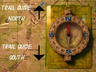 |
Backpacking Trail Guide South |
Backpacker ForumsHave you hiked these mountains before? Do you have a great Sierra Nevada route or trip to relate?Post it on
|
North: Blue Lakes Road South: Raymond Lake to Ebbetts Pass
Trailhead
Contact
Alex Wierbinski

Backpacking Lake Tahoe to Mount Whitney
Your guide to the High Sierra Crest, including the Tahoe to Yosemite, Pacific Crest, and John Muir Trails
