High Sierra
Backpacking
Trail Guide
Forums
Sierra
Weather
WeatherNotes Northern
Sierra Weather
Gear
Trail
Segment
Island Pass to Thousand Island Lake
Combined
JMT & PCT
Trail
Section
Tuolumne Meadows to Reds Meadow
BACKPACKING
ANSEL ADAMS WILDERNESS
INYO NATIONAL FOREST
Hiking
The
John Muir Trail
South
to
Reds Meadow
Languages
Trail Skills
Mountain
Safety
Food
Planning
Trail Arts
More
Information
Social
| Trail Guide INDEX JMT-PCT Tuolumne Meadows to Reds Meadow |
Trail Guide NORTH JMT-PCT Donohue Pass to Island Pass |
Trail Guide SOUTH WEST JMT 1000 Is Lake to Reds Meadow |
Trail Guide SOUTH EAST PCT East Route to Agnew Meadow |
7.5 Topo Map Donohue Pass to Reds Meadows MAP |
30 min |
Tuolumne Meadows to Reds Meadow MILES and ELES |
TOPO MAP INDEX Tuolumne Meadows to Reds Meadow |
Resupply South |
Forest & Parks Permits Toiyabe & Yosemite & Inyo |
Island Pass
to
Thousand Island Lake
John Muir Trail
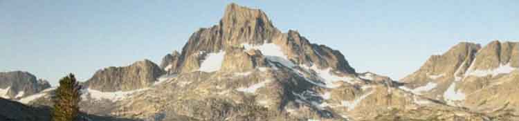
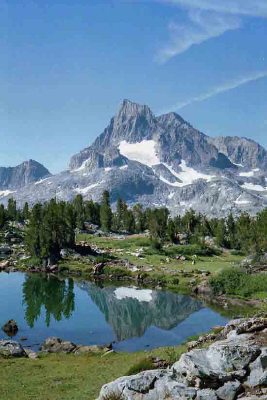
At Thousand Island Lake we find three routes down to the trailheads at Agnew Meadows and Reds Meadow. The PCT runs down the barren East Flank of the Canyon, the River Trail follows the soft, forest shaded route down the center of the canyon, while the John Muir Trail finds its way through the glacially sculpted granite carved into the Western Wall of the Canyon under the crowing Ritter Range rising above. I prefer the latter, which is also the longest and hardest of our three hiking options from Thousand Island Lake to the Shuttle to Mammoth Lakes.
Here's the different trails, and their different miles from Thousand Island Lake to their respective trailheads.
SOUTH
Maps
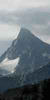
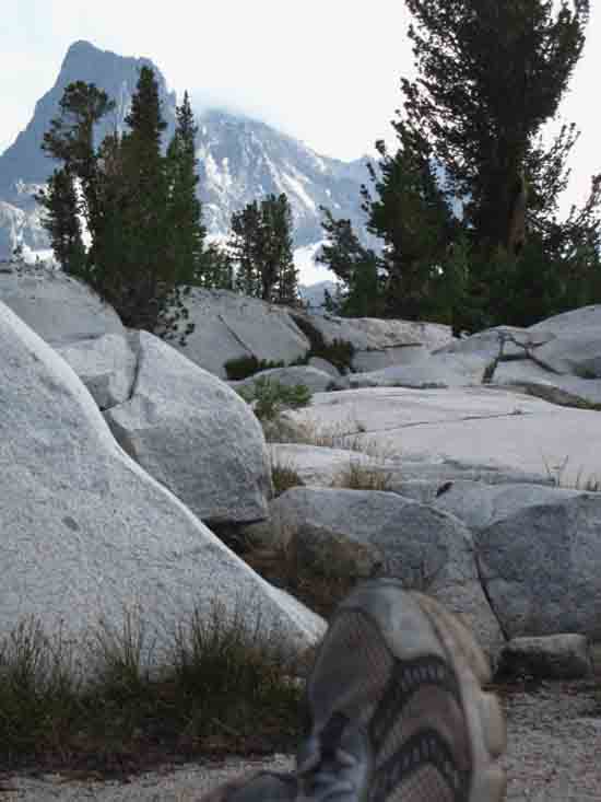
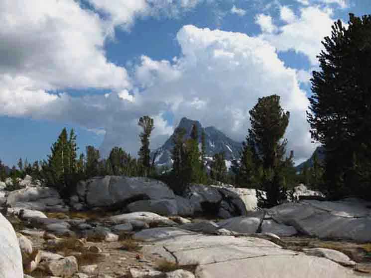
The reason this short section of the trail deserves its own page is that it begins with a great flat shelf of terrain surrounding Island Pass that wraps around the North and Western Shores of Thousand Island Lake accessing the scrambing approaches to the backsides of Banner and Ritter Peaks.
Backpacker Resources
Lakg the Tahoe to Yosemite Trail. |
|||||||||||||||||||||||||||||||||||||||||||||
Island Pass
| Island Pass along the John Muir Trail
Island Pass
Maps & Miles
30 min Map
Island Pass
SOUTH
OF 17.36 miles 4.76 miles
Island Pass
Down the John Muir Trail
1.72 miles 2.24 miles 2.59 miles 3.81 miles
16.89 miles
|
Looking North
across
Island Pass
 |
||
We just crossed Island Pass.
|
Southbound The Layout South Three Routes Local Color Soak it Up
Campsites on Island Pass East This site has a flat granite floor with fine sand, a sandy annex for sleeping, beautiful granite boulders wrapping around the site providing perfect seating, cooking, and leaning facilities, with excellent sun and wind protection. That's my favorite camp to the East of Island Pass
Maps & Miles
|
Trail to East Camp
 |
||
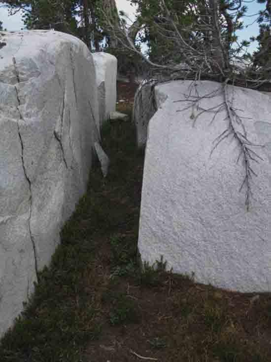
After breaking off to the East from a jog in the JMT just South of Island Pass, we make our way a couple of hundred yards East to the East end on a little lake to our North. We find our last steps to our custom campsite by passing through the rock channel above, down to my custom little camp Southeast of Island Pass, with our view of the lake to our North from our campsite below.
|
View North from Campsite
 |
||
View to the Northwest from my favorite Island Pass campsite off to the Southeast of Island Pass.
|
View Southwest
Banner and Ritter
from
Island Pass Campsite
 |
||
Note my position of recline, enjoying the view to our Southwest from my favorite Island Pass campsite, the one to the Southeast of Island Pass.
|
Campsite Views
of
Ritter-Banner
 |
||
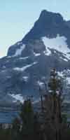
View from my campsite at one of my nearby kick-back spots, being that formation of rock & tree in the center, where I can sit, drink coffee, and observe. Now, to get a better look at our surrounding terrain, we're going to take a little "scouting" hike as directly as we can towards the Ritter-Banner Massif, finding the best path to our Southwest from our camp to reach to top of the low rise we see ahead.
|
Lake Southwest of our Campsite
 |
||
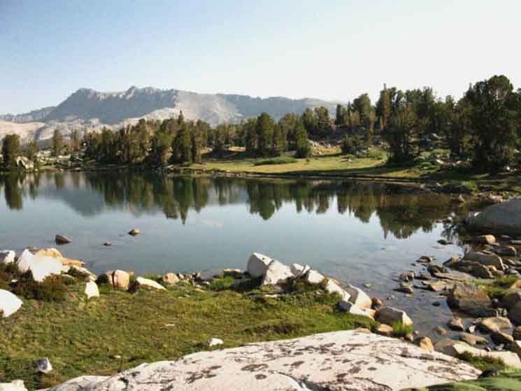
Hiking Southwest from our campsite to the top of the rise beyond it we come to a small lake clearly reflecting the beauty of Ritter and Banner. This location is just a few hundred yards off the John Muir Trail to the Southeast of Island Pass. Wandering around up here is very rewarding! These campsites are located on the kinda-flat plateau, being an eleveated shelf of terrain starting on the South side of Island Pass and wrapping around the north & West shores of Thousand Island Lake. Hiking a bit further South will bring us onto the descent down to Thousand Island Lake.
|
| Campsites West of the John Muir Trail South of Island Pass Hiking to the campsites Southeast of Island Pass involved hiking a couple of hundred yards to find the very faint use trail leading East at the jog in the trail. We can see a couple of the lakes to the Southwest of Island Pass Maps & Miles
|
| Transitions
Alternative Routes The John Muir and Pacific Crest Trails run all the way South from Tuolumne Meadows to Mount Whitney. Except this one upcoming segement of trail, which we are now encountering as we come to the trail junction on the end of Thousand Island Lake. The PCT forks off to our East to continue South through the volcanic terrain characterizing the East Flank of the Canyon, the JMT continues South throught he convoluted granites of the West Flank of the Canyon, while the River Route splits the difference in the center of the canyon betweem the two, accompanying the Middle Fork of the San Jouquin under nice forest cover on soft, river-bottom soils. That makes a difference if your feet are hurting. Which trail do we take? Which one have you not seen before? If none, I'd take the John Muir Trail because of its superior beauty. After taking the JMT a couple of times I explored the other two routes. We're also considering differences between these trails, not only in mileage, but in every aspect of "trail reality," from the nature of the surfaces (hard, soft, and medium), the surrounding terrain & cover (fully exposed to forest-covered), and the differing character of different types of hikers we encounter on each trail (JMT, PCT, & local hikers). Other considerations to add to these calculations are distance & time, how we are feeling, and where we are resupplying. Writing this guide has caused me to both use the package service out of Reds Meadow, while also taking the Shuttle to Mammoth for resupply, to check out both worlds. This way I keep up with how Reds is working and how things are going in Mammoth Lakes.
River Route
PCT
JMT It's a nice position to be in.
|
Trail
v
|
Trail
v
|
from
Island Pass
to
Thousand Island Lake
| M along the John Muir Trail
SIDE ROUTEs 8.76 ft
Island Pass
Maps & Miles
30 min Map
Island Pass
SOUTH (NOT DONE) OF XX.36 miles XX.76 miles
Island Pass
Down the John Muir Trail
X.72 miles X.24 miles X.59 miles X.81 miles
16.89 miles
|
Trail
v
|
Trail
Trail
v
|
Trail
v
|
Trail
v
|
Trail
v
|
Trail
| Trail Junction to Waugh, Gem, Silver & June Lakes along the John Muir Trail
SIDE ROUTE
Island Pass
Maps & Miles
30 min Map
Island Pass
SOUTH (NOT DONE) OF XX.36 miles XX.76 miles
Island Pass
Down the John Muir Trail
X.72 miles X.24 miles X.59 miles X.81 miles
16.89 miles
|
Trail
v
|
Trail
v
|
Trail
v
|
Trail
v
|
Trail
v
|
Trail
v
|
A Campsite
South Flank of Donohue Pass
Maps & Miles
|
Central & South Yosemite Hiking Map
Ansel Adams Wilderness
Miles and Elevations
|
|
| Upper Trail Junction along the John Muir Trail Maps & Miles
|
Lower Cathedral Lake
Trail Junction
SPUR TRAIL
SOUTHWEST:
Spur Trail
to
Lower Cathedral Lake
v
|
Central & South Yosemite Hiking Map
v
|
v
|
R PeakF Lake Loop Junction 1.86 miles from the Raymond Lake junction South to Raymond Canyon. 3.68 miles from the Raymond Lake junction South to Pennsylvania Creek. |
F Lake Loop JunctionElevation: 75 Mileage: .91 miles from E Summit |
| N Lake's |
| Next
Crossing Down!
WE make our way South, either down along one of the Rims or the Shores of the Middle Fork of the San Joaquin River, then down our respective Canyon Wall to Reds or Agnew Meadows, depending on where our plans called for us to spend the evening. |
North: South:
Backpacking |
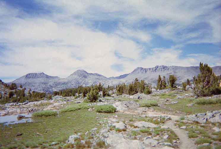
The Golden Triangle Yosemite is a large National Park that I break down into North, Central, and South regions for the convience of the Long Distance Backpacker. We hike into the most Northwestern region of Yosemite through Bond or Dorothy Lake Passes on the Tahoe to Yosemite and Pacific Crest Trails, respectively. To our East-Northeast are the Hoover Wilderness Trailheads, to our South-Southwest lays the Grand Canyon of the Tuolumne River. We arrive at roughly the center of the Sierra Nevada arriving at Tuolumne Meadows. Here the end of the Tahoe to Yosemite Trail is supplanted by the John Muir Trail heading South along the Sierra Crest from Tuolumne Meadows. Since I consider everything South of Tuolumne Meadow to be the South Sierra, our explorations of the center of Yosemite will be quite limited. Unless we take an alternative route that will run us down to Yosemite Valley and back up to the JMT 5.6 miles South of Tuolumne Meadows in Lyell Canyon.
THIS PAGE IS UNDER CONSTRUCTION: STAY TUNED FOR MUCH MORE! COME ON BACK NOW, 'YA HEAR?
7.5 Map:
30 min Map
|
Backpacking Trail Guide PCT-TYT North Glen Aulin |
 |
Backpacking Trail Guide JMT South Tn |
Backpacker ForumsHave a great trip or story to relate about Yosemite or in the Sierra Nevada? Post it on Above we come to the Front Page of the High Backpacking Trails and Topics Forums. Below we break the forums down into categories:
The Trails Forum acts as your place to put up input, comments, relate your experiences, or ask questions about each segment and spot along the length of our combined TYT-PCT-JMT trails. The Forum is your place to supplement the trail guide. Anyone can post text comments in the existing forums, but only members can post up new topics, along with images, maps, and formatting. If you have experiences, comments, questions, or pictures and videos of the Pacific Crest Trail between Sonora Pass and Tuolumne Meadows, post up here as an unknown hiker or as a member: Forum Section
|
Trailhead
Contact
Alex Wierbinski

Backpacking Lake Tahoe to Mount Whitney
Your Guide to the High Sierra Crest, including the Tahoe to Yosemite, Pacific Crest, and John Muir Trails
