
The Trails
Guide
Maps
Miles/Ele
Permits
Resupply
Forum
Current Weather Conditions
Weather Notes
Northern High Sierras
Central High Sierras
Southern High Sierras
Gear
Gear List
Gettin Started
Layering
Discussion
Testing yourself and your gear
Gear Reviews
Hiking
Stubblefield Canyon to Seavy Pass via Kerrick Canyon
Backpacking
NORTH YOSEMITE BACKCOUNTRY
Yosemite National Park
Hiking
The Pacific Crest and Tahoe to Yosemite Trails from Sonora Pass to Tuolumne Meadows
Languages
Languages
Trail Arts
The art of walking
Physical Preperation
Trail Skills
The trail
Off the trail
Scrambling
Maps
Navigation
Camp skills
Food
Resupply
Food
Other
Photo Catagories
Trail Stories
Trail Culture
News and Science
Links
Groups
Books
Terms and Conditions of Use
| Trail Guide INDEX Highway 108 to Highway 120 |
North TYT GUIDE Tilden Lake North PCT GUIDE Wilmer Lake |
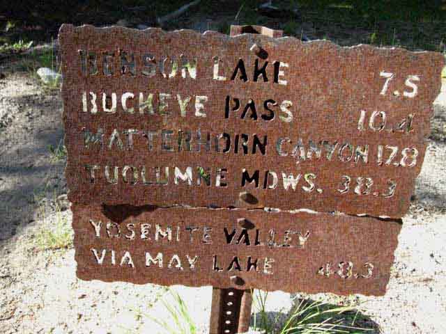
South TYT-PCT GUIDE Seavy Pass to Smedberg Lake via Bensen Lake |
7.5 Topo MAP Stubblefield Canyon to Bensen Lake |
30 min MAP Sonora Pass to Bensen Lake |
Sonora Pass |
TOPO MAP INDEX SONORA PASS |
Resupply North South |
National Forest-Park PERMITS Toiyabe & Stanislaus & Yosemite NP |
all maps index |
Yosemite National Park
Stubblefield Canyon
|
||||||||||||||||||||||||||||||||||||||||||||||
| Sonora Pass Region Hiking Map USGS 30 minute Topo Hiking Map |
Sonora Pass to Bensen Lake North Yosemite 30 min Backpacking Map |
| Jack Main Canyon to Tilden & Wilmer Lakes Map 15 min North Yosemite Topo Hiking Map |
Stubblefield Canyon to Bensen Lake 15 minute USGS Topo Hiking Map |
Physical Terrain
South of the Stubblefield Canyon ford we almost immediately begin the steep climb up to the gap at the top of the ridge dividing Stubblefield from Kerrick Canyons. Our next ford South is of Rancheria Creek, located just past where we drop into the bottom of Kerrick Canyon.
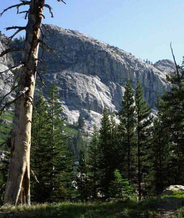
The upcoming climb South to the top of the ridge is short and steep: Our trail climbs 960 feet over 1.22 miles from the Stubblefield ford South to the gap at the top of the ridge dividing Stubblefield from Kerrick Canyons. We get great views of Stubblefield and Thompson Canyons behind us as we climb South above forest cover out of Stubblefield Canyon, perfectly complimenting the great views we got descending South to the Stubblefield ford and campsites.
A steep 1.36 mile descent South from the gap through the top of the ridge brings us down 760 feet to the Kerrick Canyon ford of Rancheria Creek, putting the total distance between the ford at Stubblefield Canyon and the Kerrick Canyon ford at 2.58 miles steeply ascending or descending a total of 1720 feet.
It's steep on both sides of the gap at the top of the ridge.
Hiking South from the Kerrick ford of Rancheria Creek we begin the grinding 3.8 mile steady climb of 920 feet up Kerrick Canyon along Rancheria Creek to where we meet the trail "Y" I call the Seavy Pass trail junction at the bend in Kerrick Canyon. The Seavy Pass trail junction is located where the North-South alignment of upper Kerrick Canyon bends into the East-West orientation of the middle canyon.
Coming into Range of the Twin Lakes Trailhead
The trail from the North-Northeast coming down Rancheria Creek through upper Kerrick Canyon starts out of the trailhead above Twin Lakes in the Hoover Wilderness. Twin Lakes is a bit to the Southwest of the town of Bridgeport at the base of the East flank of the Sierra. The trail at Twin Lakes opens up a relatively easy access point onto the PCT-TYT route and into this fantastic Bensen Lake Backpacking Loop around the North Yosemite Backcountry.
Don't get me wrong: It's a short but fierce climb up the steep East flank of the Sierra over the Sierra Crest out of Twin Lakes. It's a "Hard-1" trail for sure, but our other options to hike here are very far to our North and South, being in the thirty to forty mile ranges, respectively, consisting of "Hard-1" and "Hard-2" trails. The trail to the Seavy Pass trail junction via Twin Lakes is relatively easy.
The brief brutality of the climb over the Sierra Crest out of Twin Lakes is of much shorter duration than the long hard hikes in from Highway 108 to the North and Highway 120 to the South.
Bensen Lake Loop
out of
Twin Lakes
Arriving at the Seavy Pass trail junction and turning Right puts us Southbound hikers on the PCT-TYT onto part of the Bensen Lake Loop. Local backpackers hiking this loop enter and exit through the Twin Lakes Trailhead near Bridgeport on Highway 395, as mentioned above. The 30 minute USGS backpacking map below Left lays out the Bensen Lake Loop around the North Yosemite Backcountry.
Out of the East
Climbing up and over the East flank of the Sierra from Twin Lakes via Peeler Lake or over Buckeye Pass are both fierce but short climbs. Hikers along both routes up are well rewarded with a sweet hike down the Western flank of the Sierra after hiking into the top of beautiful Kerrick Canyon.
Hikers on the Bensen Lake Loop follow upper Kerrick Canyon down to the Seavy Pass trail junction with the TYT-PCT where we all turn South for the short but steep climb up a majestic curving stone staircase to the Northern gap into the Seavy Pass Bowl.
Hikers on the Bensen Lake Loop join our combined Tahoe to Yosemite & Pacific Crest Trail routes at the Seavy Pass trail junction for the segment of trail South to Matterhorn Canyon via Bensen Lake.
| Bensen Lake Loop Hiking Map | Bridgeport on a Road Map |
The Bensen Hole
After making the deep descent down to Bensen Lake from Seavy Pass and and the even steeper climb out to Bensen Pass you will understand why I call this segment of trail the "Bensen Hole." Hiking to Bensen Lake is like climbing down into and back out of a steep, deep granite hole.
Climbing South over Bensen Pass from Bensen Lake we descend into the great hanging canyon Wilson Creek flows through down into Matterhorn Canyon.
Once we hit the floor of Matterhorn Canyon hikers on the Bensen Lake Loop continue North up through the top of Matterhorn Canyon for their return hike to Twin Lakes. Hikers on the Bensen Lake Loop hike straight through the trail junction where we Southbound PCT-TYT hikers turn East for the climb out of Matterhorn Canyon to Miller Lake on our way to Tuolumne Meadows.
South
TYT-PCT
from the
Seavy Pass Trail Junction
We Southbound hikers on the PCT-TYT turn Right, Southwest by the compass, at the Seavy Pass trail junction in Kerrick Canyon. The Seavy Pass trail junction is located where the East-West alignment of Kerrick Canyon bends Northeast. This is the point where our Southbound hike along the unified PCT-TYT turns South and climbs out of Kerrick Canyon towards Seavy Pass.
From the Seavy Pass trail junction in Kerrick Canyon we have a steep three-quarters of a mile hike up to our entrance into the magnificent Seavy Pass Bowl through an alluring gap in the canyon wall, where this guide page ends.
What is It?
The area I call the "Seavy Pass Bowl" is a high altitude basin set atop the massive granite ridge dividing Kerrick Canyon cradling Rancheria Creek from the drainage of Piute Creek through Bensen Lake.
The trail over the next 1.22 of a mile winding through the Seavy Pass Bowl between its Northern and Southern gaps is nothing short of delightful. We are hiking a winding trail up and down and around granite obstacles and around blue and black vernal ponds all surrounded by majestically romantic granite peaks and walls, while passing through strips of dark forest punctuated by tiny bright meadows. Deer frolic. Butterflies flit. It's idylic.
This 1.22 of a mile trail segment from the gap to the North of Seavy Pass to the gap laying to the South of Seavy Pass brings us winding through a museum of granite sculpture set within and around a series of moody blue ponds always reflecting and magnifying the changing character of beauty here through the days and the seasons.
Passing through the South gap out of the Seavy Pass Bowl we Southbound hikers begin our steep descent to Bensen Lake. Seavy Pass itself is a low "high point" situated between these the two gaps guarding this very special space.
South to Bensen Lake
The next page brings us South through the Seavy Pass Bowl and down the steep, deep, and swift descent to Bensen Lake beyond the South gap. First we'll make the steep descent down to the shortcut trail to Bensen Lake, and then we'll hike past the shortcut to the regular Bensen Lake trail junction along the PCT. Southbound hikers have these two options to visit Bensen Lake: the shortcut trail we encounter towards the bottom of our hike down the mountain, or the regular trail junction at the bottom of our descent.
Seavy Pass Bowl
The Heart of Ancient and Modern Mythology
If our cities represent the spirit of Mordor, as Tolkien indicated, then entering the Seavy Pass Bowl is akin to hiking into Lothlorien, or having a nice talk with Tom Bombadil. The Seavy Pass Bowl is a concentration of natural beauty that is an antidote to the distilled social desires fueling the physical and spiritual engines of our Modern Mordor.
No mythology patrols the Seavy Pass Bowl, only the ancient spirit of life itself. We're finally put enough physical distance between ourselves and the brutal physical reality of the modern city that our senses can uncoil and resensitize themselves to subtle inputs, rather than recoil from the urban soundscape and hide from the insults of its post-industrial sights and smells.
Even more importantly, our many days on the trail hiking to Seavy Pass from Lake Tahoe have
broken us out of our modern urban "interpretive framework," being the social power of cities to impose comprehensive physical and psychological interpretations of reality on the human mind. We are far enough out in time and space that our perceptive and interpretive powers can finally escape their urban captivity. And so too has Nature.
It's not just our minds and bodies that are unchained by extended exposure to big natural spaces, but the spirit of life itself emerges out of vast natural spaces with force virtually impossible from smaller, more constricted natural spaces, and impossible out of the unnatural physical configurations of our Modern Mordor.
Only living things carry spirit into our vast cities. In Nature all things carry it.
We've hiked enough days and miles on the trail to break through our self-created social and physical limits, our own expectations, to at least see our physical and perceptive potentials grow back into the natural environment that created them.
Mission Accomplished.
I am not religious. The opposite in fact. But I am not blind. This is not superstition or religion, this is hard experience, what I call fact. Life does not live within our scientific or spiritual limits, and many of our spiritual and scientific interpretations are dead wrong.
They are sadly broken frameworks for the Unframe-able.
I do not throw out the "baby with the bad bath water." Both our spiritual and scientific interpretations are focused upon the same object of study, life moving through the physical reality. I say simplify things down to their most fundamental basics, and take a clear look yourself. Make yourself capable of extended physical and social isolation in the vast expanses of Nature.
Reset your physical and perceptive tools in a big natural environment, and take a fresh look at this thing around us, what it is, and what really drives it.
Then you tell me what you see.
Here's What I See
It's still out there, though damaged and weakened by our "ignorance," to put it politely.
We are each small parts of a great key, that when configured properly opens life's potentialities. Backpacking, being long isolation in nature, resembles a classic configuration process shared by many cultures.
The apex of this process is the spirit setting up housekeeping in your reflective capacity and wearing your ass out until you drive it out, and return to man.
It will wear your spirit like a hat while it drives your heart like a sled dog.
When not properly configured our reflective capacity reduces the web of life, rather than expanding it by our reflection of its power, beauty, and glory.
The former is Evil, the latter Good.
Trail SegmentsMiles and Elevations
Stubblefield Ford 960 feet over 2.58 miles |
Kerrick Ford 920 feet over 3.8 miles |
Seavy Pass trail junction 240 feet over .74 mile |
Seavy Pass Bowl 1.22 mile |
Totals Stubblefield Ford to the North Gap into Seavy Pass Bowl Stubblefield Ford through Seavy Pass Bowl to the South Gap 2120 feet |
Backpacker's Index
Map and Miles| Stubblefield Canyon to Bensen Lake 15 minute North Yosemite Hiking Map |
Miles and Elevations |
Regional Maps
Sonora Pass Region Hiking Map
USGS 30 minute Topo Hiking Map
| Sonora Pass to Bensen Lake North Yosemite 30 min Backpacking Map |
Bensen Lake to Virginia Canyon North Yosemite 30 min Backpacking Map |
Backpacker Resources and Hiker Information
| Backpacking Trails and Topics Forums |
Backpacking Trail Information Stubblefield Canyon to Seavy Pass Index |
||||||||||||||||||||||
Southward Bound
Video: Stubblefield Canyon South to Top of Ridge above Kerrick Canyon
South Bank Stubblefield Canyon Campsite
Great Views South: Granite on the East flank of Stubblefield Canyon NORTH: Stubblefield and Thompson Canyons West: Macomb Ridge
Backpacker: Griffin
Spring 2012 Blow: Down Trees
Video: Through the Gap down to Kerrick Canyon Ford
|
North Yosemite Backcountry Weather
Below find the closest Ground Stations, Point and Regional Forecasts near Stubblefield Canyon. Satellite and Radar Imagery provides Long Range and Regional overviews. Check out the Ground Reporting Stations for real-time current snow and temp data.
All Weather |
Approaching Kerrick Canyon Floor
Northernmost Campsite in Kerrick Canyon
Campsite Upstream from Kerrick Canyon Ford
Video: Kerrick Canyon Ford of Rancheria Creek to Seavy Pass
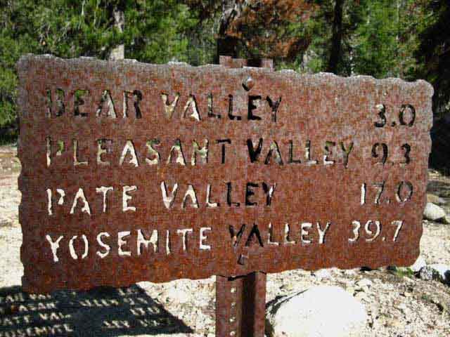
Trail Junction: Bear, Pleasant, and Pate Valleys to the Southwest
Hiking South UP Kerrick Canyon
Creek Dry Late in Season
Nature of the Trail: Up and Down, BACK UP
Matt, Will, and Spence: Twin Lakes to Lake Eleanor
Up to the Seavy-Buckeye Pass Trail Junction |
||||||||||||||||||||
| > Forum < | ||||||||||||||||||||||
All backpackers can post text comments about this segment of trail from Stubblefield Canyon to Seavy Pass through the comments links on this, and all the trail guide pages. Links on each page go to the Forum for that specific segment of our trail.
Registered Members can post post more information besides text comments, including images, maps and videos in their own stand-alone posts on the Trails Forum supplementing the trail guide's coverage of the trail from Stubblefield Canyon to Seavy Pass.
WATER NOTE
South from the Kerrick Canyon Ford to where the trail touches Rancheria Creek below the Seavy Pass-Buckeye Pass trail junction there are numerous little creeks running during Spring and early Summer. There are two places along this section of trail where Rancheria Creek is easily accessible from the trail.
During Dry years there is one year-round creek barely running across this 3.8 mile section between the Kerrick Ford and where the trail comes down to Rancheria Creek. I carry enough water from Kerrick Canyon to get me to Rancheria Creek where the our trail comes down to creek level before climbing to the Seavy-Buckeye Pass trail junction.
The Trail South Beckons
 |
German Backpacker Euros love Sierra Nevada Backpacking ! A Northbound German backpacker on the North bank of the Stubblefield Ford, pointing our way South while enjoying all aspects of the North Yosemite Backcountry. August 25 2012. This ain' t the Alps, Hans ! Note that he is inviting us to cross the creek and continue our tough hike South to Tuolumne Meadows, from where he has hiked North. The main horse ford behind "Hans" along the trail route is always deep, but the streams feeding the ford divide above the ford, transforming one deep ford into two shallower fords. I meet lots of cool Germs in the High Sierra every year. They seem to be delightful folks, overall. They are quieter and more serious that the average "American," whatever the hell that is. We are about to cross the creeks off to the Left behind Hans and climb South to altitudes where we can see the two canyons bringing their creeks down to this conjunction point. About the ford itself, see the previous trail guide page for more information on the Stubblefield Canyon Ford. We're going to visit Teech! |
Video
Hiking South to Gap on Ridgetop between Stubblefield Canyon and Kerrick Canyon
Up 960 feet over 1.22 miles South from Stubblefield Canyon Ford to the Gap in the ridge overlooking Kerrick Canyon in 12 minutes and 38 seconds. In the mid 2000's I was hiking up this ridge when two CCC kids caught me climbing just below the gap over to Kerrick Canyon. We all took a break together in the gap, where they related they were the advance team hiking out to Stubblefield Canyon to get it ready for the rest of the CCC trail crew and horsepackers who were on their way to establish a trail crew camp.
|
Stubblefield Canyon South Bank Campsite
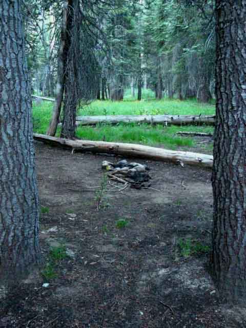 |
Crossing the Creek Southbound we find this tidy site, off to our Right. The North bank campsite on the other side of the creek is in a forested flat surrounded by massive low granite formations. This sharp-looking South shore campsite, above, in located along the messy interface of forest and meadow. July '09. The campsites on the North bank are more distant from surrounding meadows, therefore more distant from the sources of mosquitoes, and therefore a superior location to camp until the meadows dry out and the mosquito populations recede. Stubblefield Canyon to Bensen Lake |
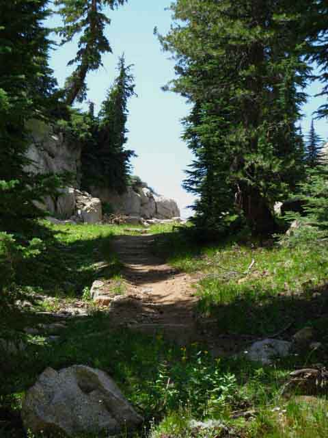
Trail South to Kerrick Canyon
 |
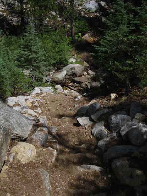
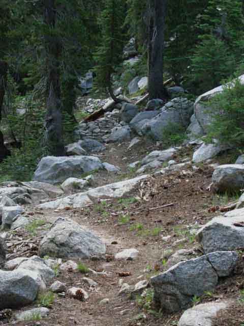
The trail South begins gently, but soon takes a turn up. |
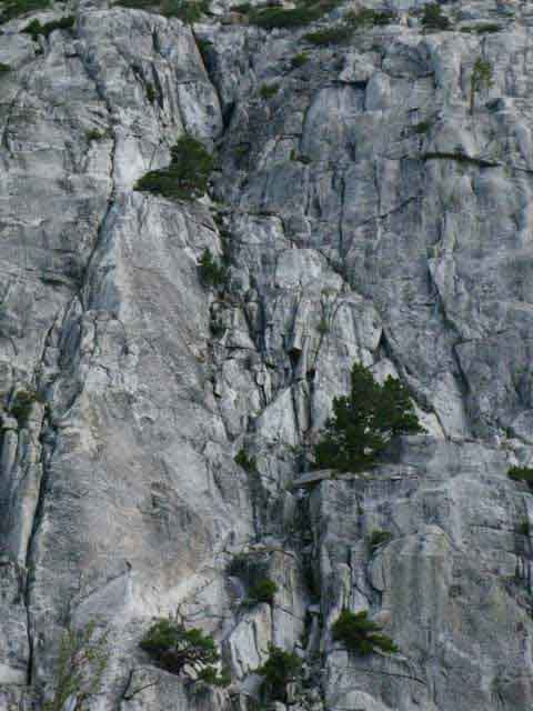
View South of Great Granite Formation on East Wall of Stubblefield Canyon
 |
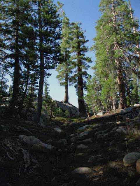
Fantastic shifting shades of gray in rising morning light. Climbing above forest level reveals details of this great granite vault, known as Stubblefield Canyon, that we are climbing out of. To our South the contrasts of sunrise bring out fantastic details on this breathtaking formation making up part of the East flank of Stubblefield Canyon. Fantastic solitary trees dot unlikely shelves and even cracks up and down the face, a testament both to the persistence of the trees and the resistance of the rock over vast swaths of time. Those nooks and crannies holding fully grown Jefferies and California White Pines have been worked and held by thousands of generations of trees far into the misty shadows of time. |
Morning Shadow on the Trail South
 |
Switchbacking up the lower section of our climb South. Early Mornings offer good climbing conditions before the Sun heats the air and fries the skin. North Yosemite Stubblefield Canyon to Bensen Lake |
View North up Stubblefield and Thompson Canyons
 |
Stubblefield and Thompson Canyons from the South canyon wall of Stubblefield Canyon. Stubblefield Canyon is on the far side of the granite formation, Thompson on the near. The canyons are split by the granite formation emerging out of the shadows of morning at our feet. Stubblefield Canyon to Bensen Lake |
North Detail
 |
Detail of great granite ridge dividing Stubblefield from Thompson Canyons just above (to the NE of) where the canyons merge at the Stubblefield Canyon ford and campsites. Thompson Canyon lay below our position on this side of the granite formation in the center of the image, while Stubblefield Canyon runs up its far side. In the distant-Left we see Stubblefield Canyon running up Macomb Ridge to the Sierra Nevada Crestline. |
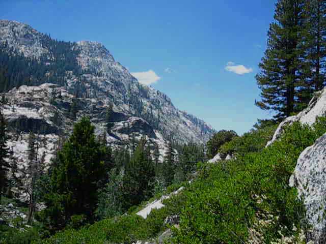
Western View: Macomb Ridge makes up the West flank of Stubblefield Canyon
 |
Looking Back to our Southwest In the image above we can roughly observe most of the terrain the route of the Pacific Crest and Tahoe to Yosemite Trails cross from the gap along the top of Macomb Ridge down to the Stubblefield Canyon campsites and fords located on the lower Right corner of the image. The trail roughly follows the line of forest traversing down the mountain from the forested gap on the Left end of Macomb Ridge down to the lower-Right corner of the image where the Stubblefield ford and campsites are located. Stubblefield Canyon to Bensen Lake |
Encounter with Griffin
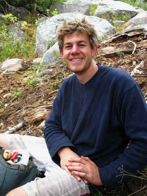 |
Tuesday, September 29, 2009 I was physically hiking a brisk pace up the very difficult climb South out of Stubblefield Canyon, but I was psychologically deep within myself when this kid, Griffin, popped out of nowhere, scaring the shit out of me. The Grif was the only hiker I saw between Jack Main Canyon and Bensen Lake. It was nice to meet him. Griffin was a student taking some time to hike some long trails. He was hiking North from Tuolumne Meadows to Kennedy Meadows, if I remember correctly. I am missing some notes from this 2009 Tahoe to Yosemite Trip, and cannot find Griffin's information, nor for the German hiker at the top of this page. If you guys see this post up! |
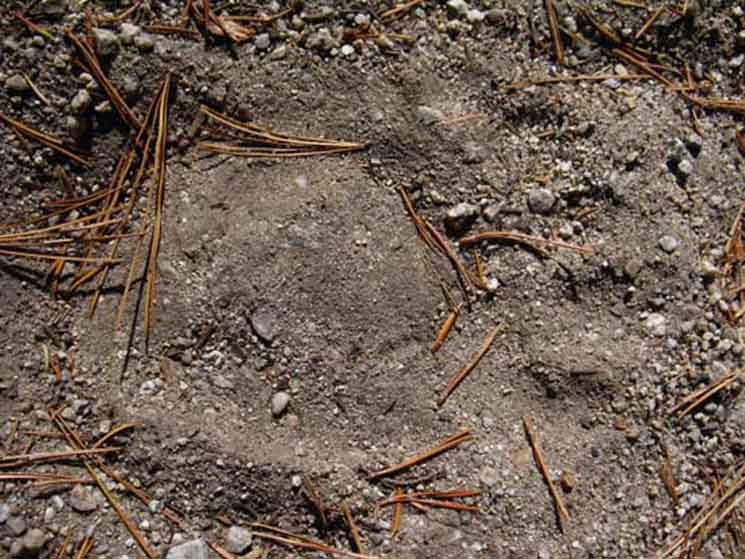
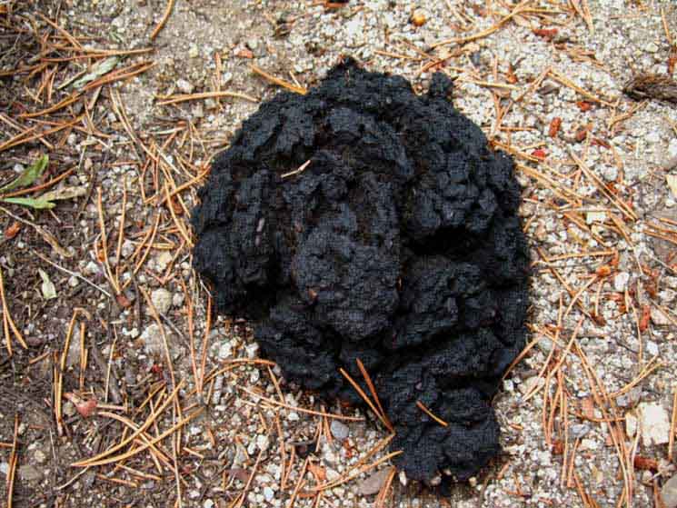
Bears hit the Trails during Fall
 |
||
Above: A rather large and fairly fresh paw print on the trail. Below: Bear leaves a gift on the trail. |
||
 |
||
Bear Sign Tuesday, September 29, 2009 Fall In the North Yosemite Backcountry I've noticed the bears steer clear of the main trails during Summertime. But come late Fall, when hiker traffic on the trails decreases, the bears begin using the trails, as evidenced above. I encountered this dried out specimen with other, fresher examples. A few minutes hiking past the above scat, I alarmed a medium-sized adult bear who was snoozing in a thicket of brush. The bear departed faster than I could deploy my camera, leaving only the picture in my mind. A few years earlier, also during late Fall, a bear and I walked right up to each other while hiking different directions into a blind corner on this same section of trail between Stubblefield and Kerrick Canyons, but over on the South flank while hiking down to the Kerrick Ford. We both stopped, looking at each other in a mutual state of shocked surprise. Then the bear ran up the ridge, and I continued down the trail to the Kerrick Ford. Those were a long couple of seconds! You never know what's on the other side of a blind corner! Stubblefield Canyon to Bensen Lake I've bumped into a few bears on this section of trail between Stubblefield Canyon and Bensen Lake during late Fall over the years, but none on the trail during Summertime. There are some acclimated bears out here that stage night raids on camps, but most of the bears out here are "natural" bears, meaning they sleep at night rather than staying up to raid humans.
Camp and Trail Skills Bear Note Bears are amazing at navigating terrain. |
Lost Horseshoe
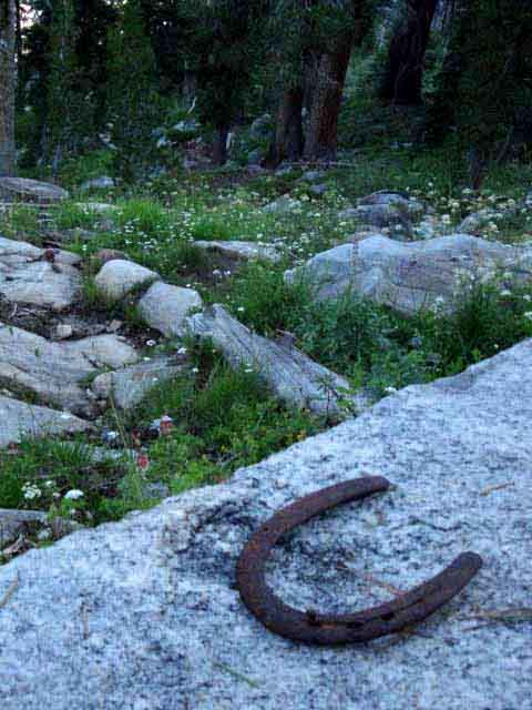 |
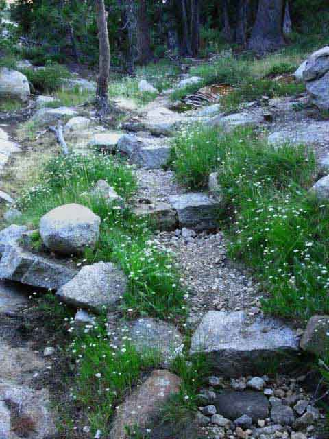
This horseshoe was not lucky for the horse. It's a ways to any stable in any direction. Our trail winds around short meadows bursting with flowers and verdant grasses wedged into the mountainside between dark fingers of forest and bright granite outcroppings. |
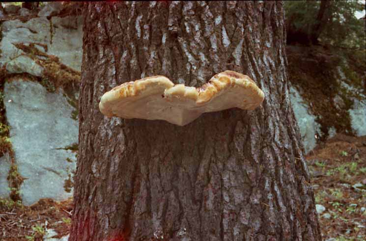
Huge Fungus
 |
||
This great fungus was growing on a tree on the Eastern flank of Stubblefield Canyon late in the Summer of 2000.
|
Great Fall of 2011 Blowdown
 |
||
During November 30 of 2011 a great wind blew, which blew down trees from the North Yosemite Backcountry to the Silver Divide. Expect Great Blows Winds in the Sierra are a blessing during Spring and early Summer, when their currents can be deployed to keep the mosquitoes at bay. High winds are experienced during Spring and Summer Storms, but the greatest winds are generally reserved for Wintertime. As this 2011 blow and blowdown happened after the trail crews had departed, it caused a tremendous amount of extra work for trail crews up and down the Sierra when the mountains cleared of snow in 2012. Trails were seriously blocked.
Devil's Windstorm Excellent Analysis BACKPACKER'S FORUM Well, an inspection hike from Kennedy Meadows to Rae Lakes during the Summer of 2012 showed that damages spanned from the North Yosemite Backcountry South to the Silver Divide. |
Hibernating Snake
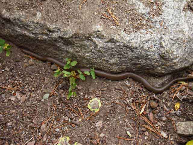 |
Tuesday September 29 2009 Hibernating Snake I did not notice this snake wedged into the base of a stone step along the trail until I was walking over him, at which point I jumped. THE MIND: "Freeking Snake!" The snake did not move, either when I step-jumped across him, nor when I came back down to check him out. That's pretty strange for snakes, which really don't like to be around people. Upon closer inspection I saw that the snake had pulled both its head and tail into itself, essentially sealing itself up for the Winter. This sucker was done for the season. Expect Temp Drops The temps that day dropped from 49 to 35 degrees, and a mixture of snow, sleet and cold rain fell. That evening the temps fell into the high teens, bringing a 22 degree sunrise. That snake knew what it was doing. |
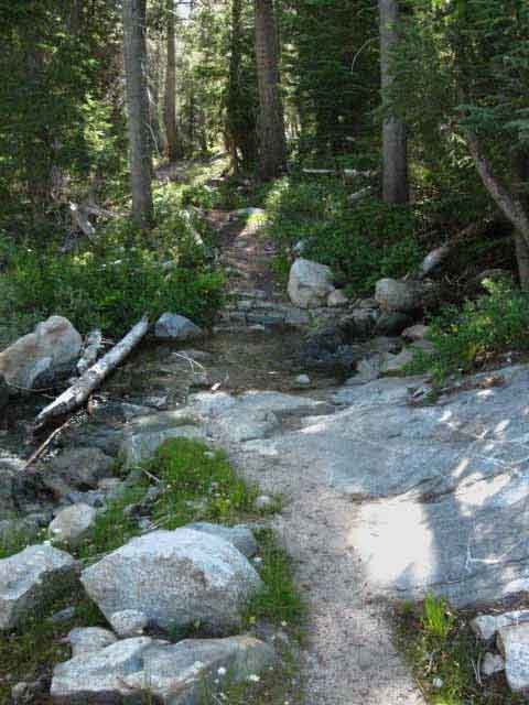
Trail Buildup over Creek
 |
Creek below gap to Kerrick Canyon from Stubblefield Canyon. The trail is built up, and during Spring and early Summer the creek flows through and over the build up. Check out 6 minutes into the video above to see the creek flowing over the built up trail during Summertime. The image above was shot during late September when the creek was barely flowing. To our Left is a lake wedged in a small basin atop the ridge that feeds this creek. I've been meaning to hike up to the lake and spend a night up there to check it out, but the last few years have been quite hectic! Post up if you've found your way up there to check out the lake! Stubblefield Canyon to Bensen Lake |
Moving to our Right to the Gap over the Ridge
 |
Approaching the gap through the top of Macomb ridge hiking South from Stubblefield to Kerrick Canyons. Above we are glancing East to see the crest of Macomb Ridge as we make our way South to where the trail turns East through the gap. |
The Gap over to Kerrick Canyon
 |
Final steps up South flank of Macomb Ridge to the gap into Kerrick Canyon. |
ENTERING KERRICK CANYON
Our First Steps into Kerrick Canyon
Gap to Kerrick Canyon
 |
||
Crossing through the gap from Stubblefield Canyon into Kerrick Canyon.
|
Video
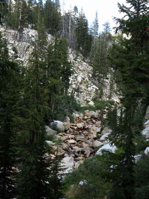
Through the Gap down to the Kerrick Canyon Ford of Rancheria Creek
A short and steep scenic hike down to the base of Kerrick Canyon, where we ford Rancheria Creek to begin our hike up Kerrick Canyon to the splendors of Seavy Pass. |
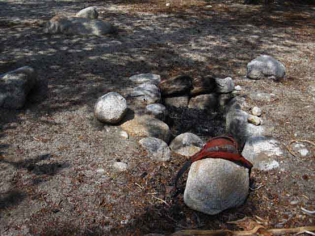
Wham!
Things Happen
Things Always Happen
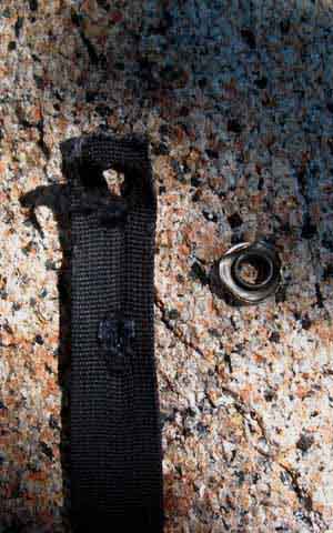
| This is why we carefully check our gear before every trip, and take note of what is falling apart. | ||||
 |
||||
Broken backpack strap at the top of the ridge between Stubblefield and Kerrick Canyon. I anticipated this failure, so I was ready with a replacement when the strap finally cut loose. |
||||
 |
||||
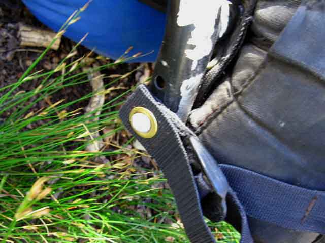
New backpack strap deployed. Let's Roll!
|
||||
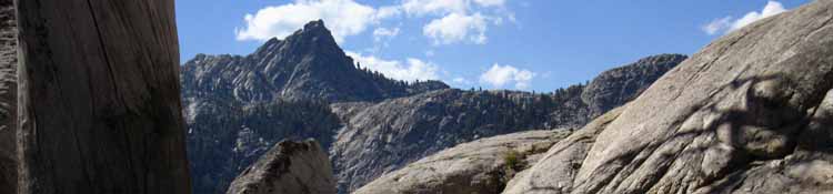
Views South from the Meadowed Shelf below the Gap
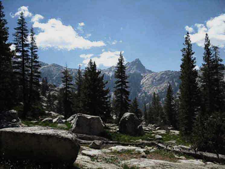 |
||
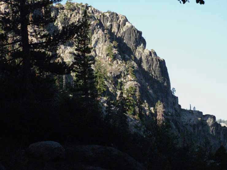
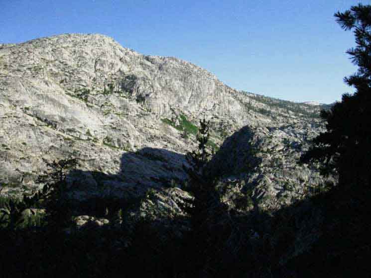
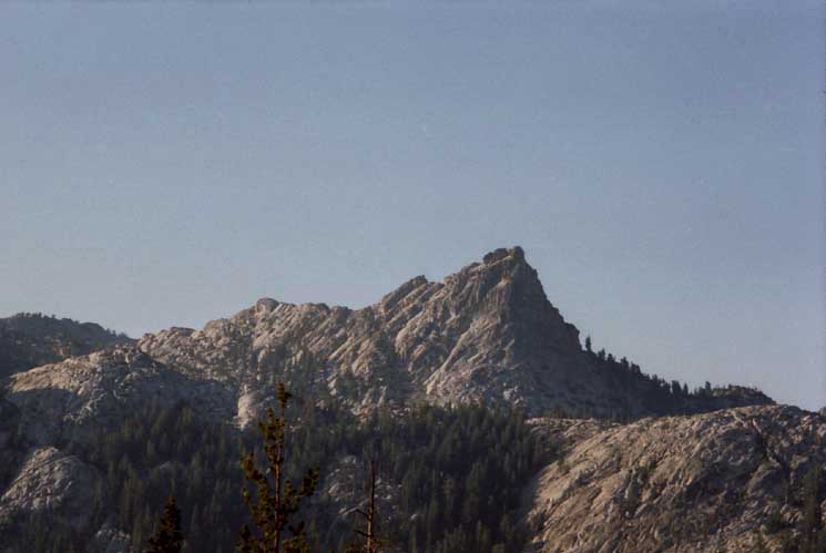
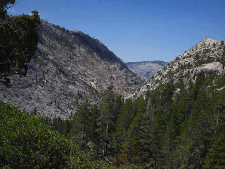
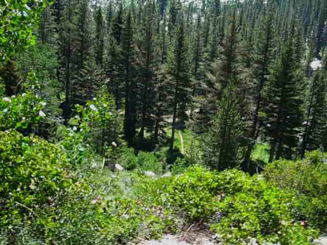
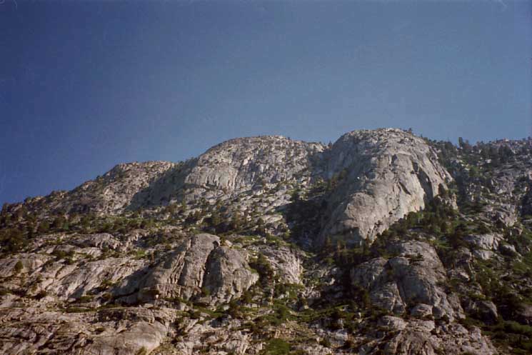
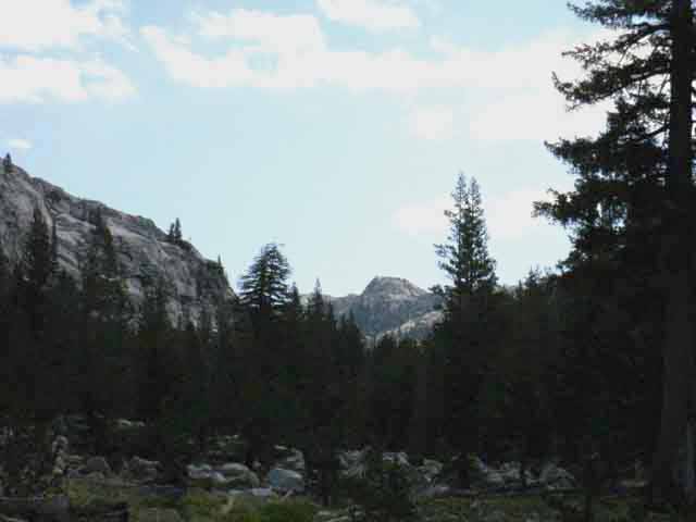
We climb a steep trail down to a flattish open shelf below the gap over the ridge from Stubblefield Canyon. We have been rotating around this pointy peak since we first observed it crossing into Stubblefield Canyon over Macomb Ridge and as we descended the flank of Macomb Ridge down to the Stubblefield ford. This is the peak behind the lake marked as 9154 along the trail from the Kerrick Canyon ford South to Pleasant Valley. This crest of this triangular peak sits at 9800 feet of elevation. Now we've our clearest and last views of this landmark peak before we drop into Kerrick Canyon.
The maps above do not include the trail down to Pleasant Valley. The USGS 15 minute Piute Mountain and the 30 minute Bridgeport maps do show Peak 9154 and the trail down to the Tuolumne River via Pleasant Valley. Download these maps from the USGS Store for free and view them and measure route distances in the Adobe Reader.
|
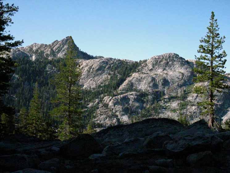
 |
A striking peak well capping striking terrain. The trail South to Pleasant Valley from the Kerrick Canyon ford climbs up the far wall of Kerrick Canyon we are viewing to a lake on a flat on the top of that far ridge. The trail climbs very steeply through the steep forests clinging to the cliffs behind the tree in the foreground. |
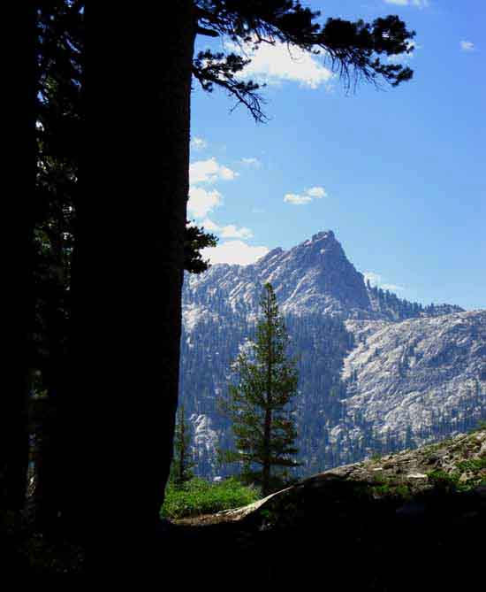
 |
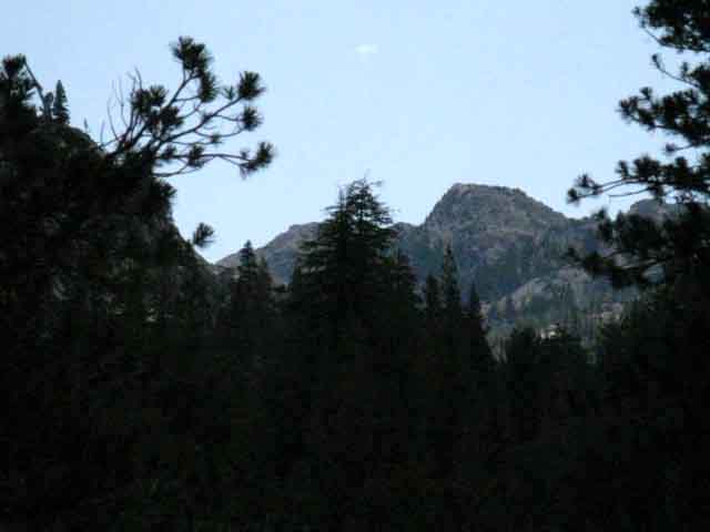
The Great Landmark Pointy Peak towering above both Kerrick and Stubblefield Canyons becomes clearly visible from the gap between the canyons. A lake sits at its base on a ridgetop flat. The trail from Kerrick Canyon to Pleasant Valley (and on down to Hetch Hetchy) climbs the ridge through the forests in the middle-bottom of the image on its way down to the Pleasant Valley trail junction. |
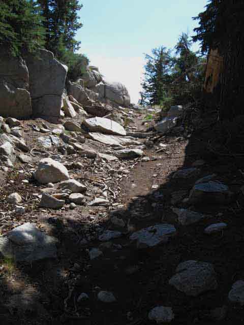
| Below the flattish open area we again descend sharply. |
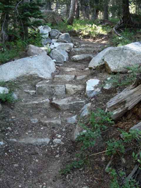
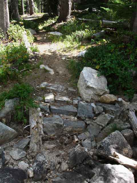
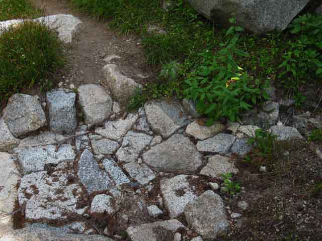
| Fine Trail Work down steep sections of our Descent into Kerrick Canyon | |
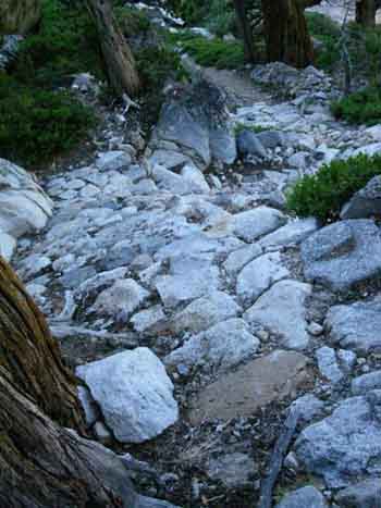 |
 |
Massive build-up on the Left, precision steps on Right. As we descend our changing perspective opens new views. |
|
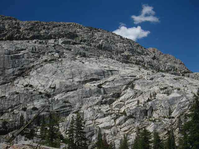
South Flank of Kerrick Canyon
View to East-Southeast
 |
South flank of Kerrick Canyon looking upstream and up the canyon through morning glare. Stubblefield Canyon to Bensen Lake |
South Flank of Kerrick Canyon
View Southeast
 |
Detail of South flank of Kerrick Canyon looking up the canyon. The crestline up to Piute Mountain is visible in the upper Left of the image while Piute Mountain itself is clipped off. |
View Southwest
Down and Out
End of Kerrick Canyon
 |
||
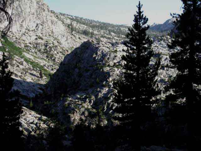
Looking South down Kerrick Canyon through the end of Kerrick Canyon. Beyond the end of Kerrick Canyon Rancheria Creek merges with the stream flowing down Stubblefield Canyon for the run down to end up filling Hetch Hetchy in the Grand Canyon of the Tuolumne River. This is where San Francisco's water comes from.
|
Continuing our descent soon brings the bottom of the canyon into view. |
 |
||
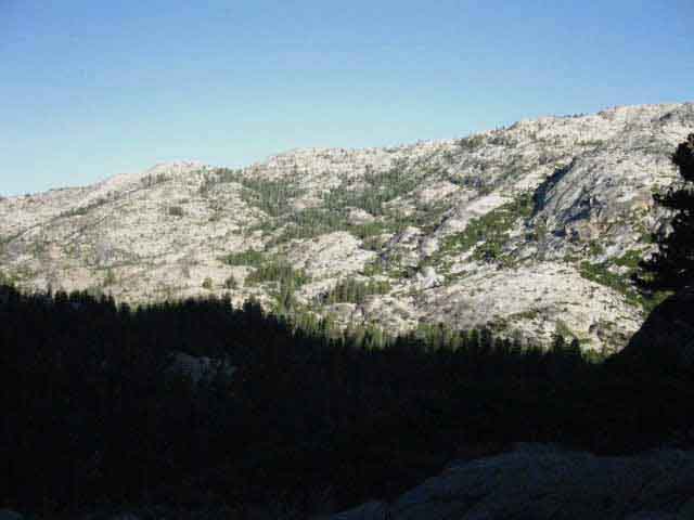
The peak to the Southwest of Piute Mountain capping the South wall of Kerrick Canyon. We've more switchbacks between us and the bottom of Kerrick Canyon. This view is Southeast across Kerrick Canyon.
|
Long View Looking almost directly East at our trail route up Kerrick Canyon
 |
View up Kerrick Canyon as we hike South down to its bottom. Our PCT-TYT trail continues up Kerrick Canyon past the base of the mountain in the far distant center of the image. That is Peak 9489. We see the crestline of Piute Mountain in the upper Right of the image. We are going to hike up Kerrick Canyon less than four miles from our current position to just beyond Peak 9489 where we turn Right to the Southwest to climb South out of Kerrick Canyon into the basin holding Seavy Pass. |
Forested Flat with Campsites and Ford Below
Piute Mountain in Distance
 |
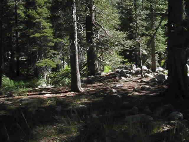
INTO KERRICK CANYON Near the bottom of Kerrick Canyon, turning down the final switchbacks to the floor of Kerrick Canyon. Piute Mountain in the upper-right, Peak 9489 in the distant middle-Left of the image above. We are still above the top of the forest filling the bottom of Kerrick Canyon as we drop down to the Kerrick Canyon ford and campsites sitting under that forest. |
Our Trail on the Floor of Kerrick Canyon
 |
TRAIL BELOW ROUTE ALTERATION Below us on the floor of Kerrick Canyon we can see our trail moving toward Rancheria Creek before it turns Left, upstream towards the Kerrick Canyon fording point. Where the trail turns upstream Southbound hikers will see a shaded flat off to our Right. This is a nice campsite, as pictured in the second image below. Hikers moving Northbound should know that this nice campsite is here, right at the base of your climb over the ridge out of Kerrick Canyon to the fine camping over in Stubblefield Canyon. Stubblefield Canyon to Bensen Lake |
View Southwest down the End of Kerrick Canyon
 |
View Southwest down and out the end of Kerrick Canyon before we drop below the forest. |
North Kerrick Canyon Campsite
 |
KERRICK CANYON CAMPSITE There is another campsite to our South just yards upstream from the Kerrick Canyon Ford, but it is more exposed to sun and wind than the above camp. In 2012 the campfire ring here was gone, and the flats had not been slept in for some time, but the utility of the site is its location and disposition, not its level of use. |
Trail Y Approaching
Kerrick Canyon Ford
 |
Trail turning towards the North shore of the Kerrick Canyon ford. Note the faint trail breaking off to the Left. |
Following the faint trail to our Left
Kerrick Canyon Ford Campsite
 |
||
We find the remnants of an old trail crew camp as signified by this altered National Park Service keyway firepit. It is located about a hundred yards upstream from the Rancheria Creek fording point in Kerrick Canyon. This site is nice, but is pretty darn hot and not well shaded. The site North up the trail at the end of this river-side flat has better shade. Here's the way it works here: The big site with the keyway firepit upstream of the ford is the best for big groups and horsepackers, while the little shaded site downstream under the climb South to Stubblefield Canyon is better for solo backpackers.
Keyway fire pits are created by professional trail crews as the center of their camp. The keyway is dug out in alignment with the prevailing wind and lined with stones. The keyway acts to guide the prevailing wind through the fire which results in a much more efficient and powerful fire. We can see in the image above that subsequent backpackers have "bricked in" the ends of the keyway to create a much lower efficiency fire ring. |
Hiking Straight to the North Shore of the Kerrick Canyon Ford
 |
Moderate-low flow across Kerrick Canyon backpacker Ford, Saturday August 1 2009. North Yosemite Sonora Pass to Bensen Lake |
Rancheria Creek
not
flowing through the Ford
during
Late August
 |
Rancheria Creek in Kerrick Canyon The slowly changing weather patterns across the Northeast Pacific Ocean have been shrinking Winter and Spring while radically expanding Summer and Fall bit by bit for the past 40 years. The current drought seems to be nothing more than the establishment and deepening of this new drier weather pattern that has been growing for decades. |
Video
Kerrick Canyon Ford of Rancheria Creek to Seavy Pass
4.54 miles in 12:39 minutes. Take a look at the trail and terrain following Rancheria Creek up Kerrick Canyon.
|
Trail Junction
South Shore of Rancheria Creek
at the
Kerrick Canyon Ford
South
Tahoe to Yosemite and Pacific Crest Trails
South to Bensen Lake along the combined TYT-PCT routes
 |
||
The Combined PCT-TYT trail South. I note and discuss the differences between the miles figures on Tahoe to Whitney versus those found on trail signs and other sources in the Miles Forum. Tahoe to Whitney Miles I have it at 19.1 miles to the trail junction to Miller Lake in Matterhorn Canyon.
North Yosemite
|
Tahoe to Yosemite and Pacific Crest Trails
North
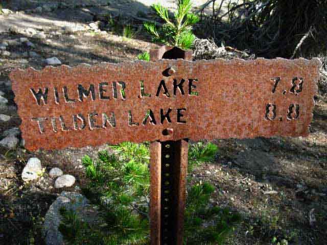 |
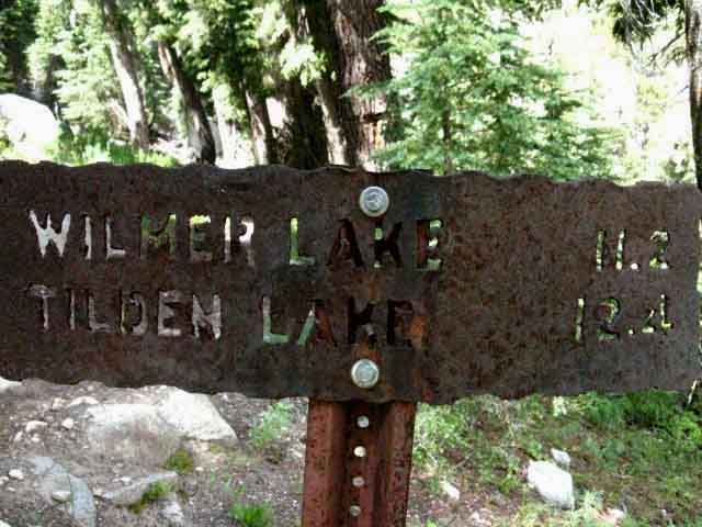
North, Back the way we came on the PCT-TYT. The Northbound trail around Tilden Lake is Tahoe to Yosemite Trail route, while the Pacific Crest Trail swings around Wilmer Lake. Both routes rejoin in Jack Main Canyon to continue North together out of the North Yosemite Backcountry. Tahoe to Whitney Miles I have the distance to the shore of Tilden Lake at 8.51 miles. |
Southwest
into the
Grand Canyon of the Tuolumne River
 |
||
Southeast to the Tuolumne River Hiking South on the segment of the PCT-TYT between Jack Main Canyon to Cold Canyon along the Western flank of the Sierra Nevada we are hiking across a series of great canyons, the "Five Canyons" of the North Yosemite Backcountry. We passed trails down to Hetch Hetchy at the trail junction in Tilden Canyon. Further to the North our hike down Jack Main Canyon would have eventually brought us down to Hetch Hetchy if we had not turned East with the Southbound PCT at Wilmer Lake. Hiking to our South down the PCT-TYT we will encounter the next trail junctions leading down to the Tuolumne River at two closely-spaced trail junctions North of Smedberg Lake. These are the junctions to the trail down Rogers Canyon into the Grand Canyon of the Tuolumne via Pate Valley. The last trail down to the Tuolumne River past the Rodgers Canyon trails is our run down Cold Canyon along our unified PCT-TYT to the Tuolumne River at Glen Aulin High Sierra Camp.
Trails connecting our PCT-TYT route across the North Yosemite Backcountry to the Tuolumne River run down Jack Main Canyon, Tilden Canyon, out of Kerrick Canyon via Rancheria Mountain, Rodgers Canyon and Cold Canyon. There is no access South to the Tuolumne River via Bensen Lake, Matterhorn Canyon or Virginia Canyon. North Yosemite Backpackers interested in these trails up and down the Five Canyons of the North Yosemite Backcountry can study and plan their trips using the USGS 30 minute maps of the Bridgeport and Yosemite areas. You can download these, and every other USGS map covering the High Sierra and the US of A from the USGS map store: |
Hiking South
through
Kerrick Canyon
Continuing South
along the
Pacific Crest and Tahoe to Yosemite Trails
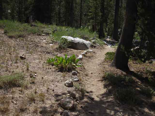
Kerrick Canyon Ford to Seavy Pass Our hike South now turns up Kerrick Canyon upstream along Rancheria Creek. Though we will officially climb 1160 feet to cross the 9120 foot high Seavy Pass 4.54 miles to the South of our position at the Kerrick ford, we actually climb more than the numbers indicate. Though the average angle of the trail up Kerrick Canyon is the most difficult degree of a moderate difficulty hike, many short sections of this trail push up to the easiest degree of difficult. Two sections of the trail above the Kerrick Canyon ford cross great open meadows, other sections wind through granite filled forest. On the way up Kerrick Canyon grand views of the North wall of Kerrick Canyon open up through breaks in forest cover, while the wild flow of Rancheria Creek below provides a fine sound track for our hike. There is a fine improved campsite on a flat below the trail between our trail and Rancheria Creek. This site is located in heavy forest to the North of the all-season creek which roughly divides this section of trail between Kerrick ford and the Seavy Pass trail junction |
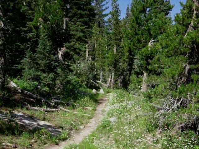
 |
South up Kerrick Canyon after crossing Kerrick Ford hiking South from the trail junction. A brief climb brings us up onto a gently inclined shelf of terrain holding meadow and forest. |
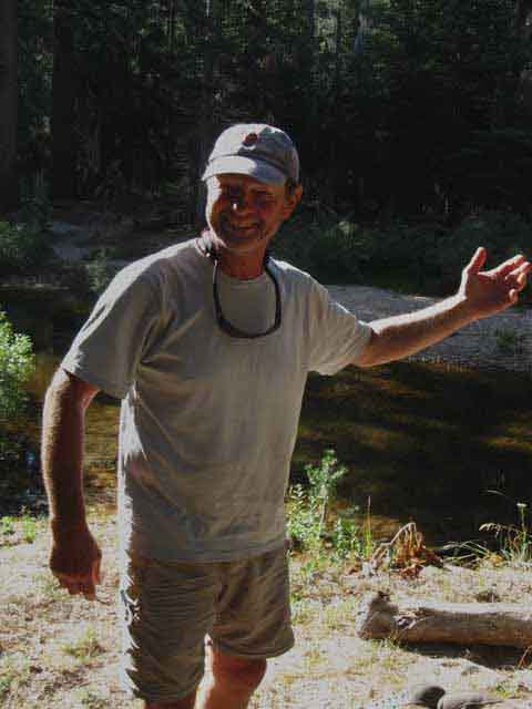
Nathan and Dave
2010 PCT SECTION HIKERS
 |
Nathan from Connecticut and Dave Bewby from Florida. Wednesday July 28 2010. Dave was hiking the PCT by sections. I had met him briefly at the Hotel 6 in Mammoth Lakes the previous year, but we were unable to strike up much of a conversation as Dave had picked up a case of Giardia, and was suffering terribly. After recovering Dave continued his quest to section hike the PCT as we see him in Kerrick Canyon during 2010. High Sierra Backpacker's Topics Forum |
Great Snag Tottering in an almost Timeless Landscape
 |
North wall of Kerrick Canyon in the North Yosemite Backcountry. Snag. Meadow. Forest. Rock. Stunning. High Sierra Backpacking Topics Forum Stubblefield Canyon to Bensen Lake Granite walls along North flank of Kerrick Canyon towering over meadow and forest. I've seen a few climbing teams out here over the years. Groups of climbers who backpack out, set up camp, and climb a whole bunch of these walls before returning to civilization. The easiest way here for climbing parties is through Twin Lakes. Climbers can either carry their heavy climbing gear out or have a horsepacker deliver it. |
Meadow Narrows into Forest Trail
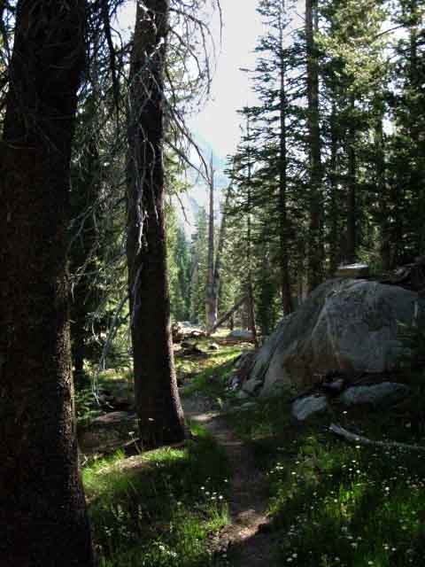 |
Pressed into Dark bits of forest meandering through gardens of granite boulders with green grasses and bright flowers. This beautiful terrain makes as much joy ooze out of my pores as sweat. Stubblefield Canyon to Bensen Lake |
Brightness
 |
A bit of Brightness. |
Creek 2009
 |
Creek across our PCT - TYT route through Kerrick Canyon. Sat Aug 1 2009 with low flow. We are hiking through dense forests that obscure our view, but every now and then we can see great rock formations towering overhead when we come to a clearing or gap in the canopy. Then we see the full extent of the granite towering overhead. This place has more layers than an onion. Stubblefield Canyon to Bensen Lake |
Same Creek
in late
2012
 |
First stream in Kerrick Canyon hiking South of the ford. August 25 2012 with no flow. The wages of greed is drought. |
Dry
 |
| Though this stream runs out early during dry Summers, the next one to the North on the trail is generally flowing. |
Great Dome on North Flank of Kerrick Canyon
 |
Detail of domes rising off North flank of Kerrick Canyon. |
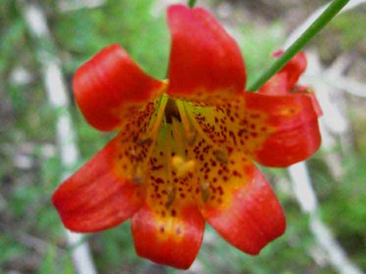
Leopard Lily
 |
||
LEOPARD LILLY Beauty is peeking through everything. From the forest and forest floor granite boulders that tumbled off the majestic canyon walls, which often strain our necks to see the top of, to the brilliant flowers growing along the fringes of meadow and forest at our feet, beauty is everywhere here. The roar of Rancheria Creek during Spring, and the wind through trees and off rock provide the sound track.
|
View North-Northwest Hiking South through Kerrick Canyon
 |
||
Northern flank of Kerrick Canyon. Looking back to the Northwest towards where we came across the ridge from Stubblefield Canyon, which is out of sight just a bit further Left along the descending ridgeline.
|
Detail of Above
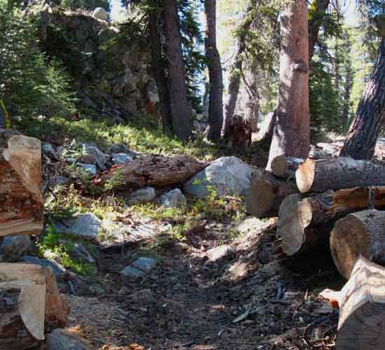
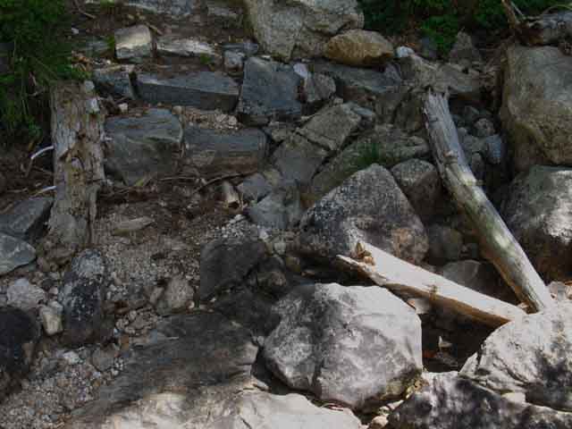
A set of Downed Trees along the Trail
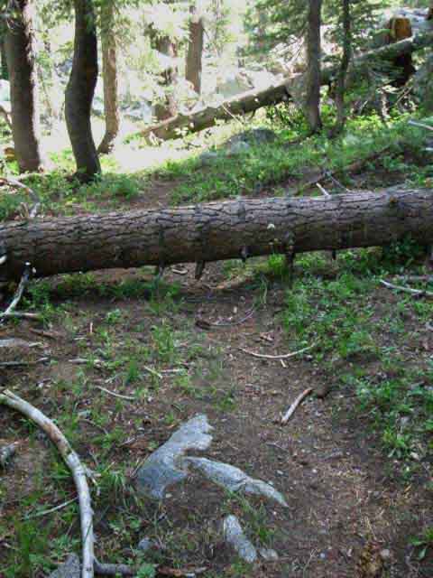 |
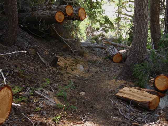
It is rare to see trees blocking trails in Yosemite after trail crews have done their Spring sweeps. But things happen. A powerful windstorm during early Spring of 2012 brought down large numbers of trees from Jack Main Canyon to the Silver Divide. The lesson for backpackers is that the requirements of your backpacking trip can change radically due to the occurrence of unique or rare natural events. An endless series of trees downed across our path require that we spend considerably more time and energy for a given distance. This is also true for unmaintained trails and routes, where we will have to spend much energy dealing with obstacles normally cleared from the maintained trails by professional trail crews. Some years great winds blow, other years great snows fall. Every year brings changes to the trail. |
Sphinx of Kerrick Canyon
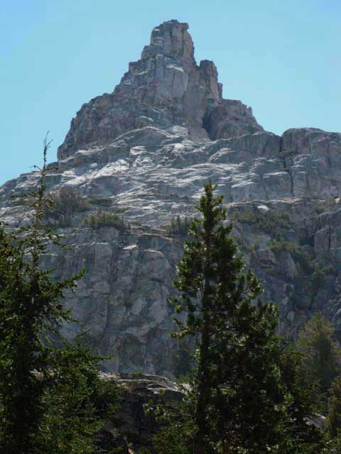 |
The Sphinx of Kerrick Canyon, sitting atop the Southern flank of the canyon, which we are seeing through breaks in forest cover. |
All Season Creek
 |
This is the year round creek identified on the map between the Kerrick Canyon ford to our South and the Seavy Pass junction to our North. This creek is a bit to the North of the first creek we crossed, which is typically dry during late Summer of a dry year. I have found this Northern creek flowing, if very low, through the Summer. Stubblefield Canyon to Bensen Lake |
Water Late in the Season
 |
| August 25 2012. |
Kerrick Canyon Campsite
 |
||
Rancheria Creek backdrops excellent flat and nice campsite about halfway between Kerrick Canyon ford to our North and the Buckeye-Seavy Pass trail junction to our South. Keep your eyes on Rancheria Creek after we pass South of the second stream to see this nice little camping flat.
|
The Great Blow of 2011
 |
Trail Crew up and down the Sierra Nevada faced a considerable amount of unexpected work when the great blow brought down timber across trails up and down the Sierra. |
Trail South
 |
Tahoe to Yosemite and Pacific Crest Trail Southbound up Kerrick Canyon, Yosemite. Kerrick Canyon narrows as we continue hiking upstream towards the point where the canyon turns North toward Buckeye Pass and our trail South through Seavy Pass. Bensen Lake to Virginia Canyon |
Trail Work
 |
I am a fan of stonework. This little piece of work will stabilize this runoff channel for years, maybe decades or centuries if our current drought (2014) deepens and gets legs. Trail work protecting the trail and terrain against the ravages of a fierce Spring Runoff my soon become vestiges of a changed weather pattern. |
View East-Northeast
 |
||
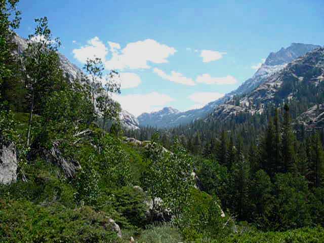
LOOKING UP KERRICK CANYON We get a glimpse of a long view to the East-Northeast where we can make out where Kerrick Canyon's bend to the Northeast is sharpening into a turn almost directly to the North. Local Hiking Loop Option Rancheria Creek within Kerrick Canyon turns directly North just past where our Pacific Crest-Tahoe Yosemite route turns South at the Seavy Pass-Buckeye trail junction. That position would be on the far side of the peak in the distance, which I have identified as Peak 9489 on our map. Kerrick Canyon turns almost directly North (Left from the perspective above) just past Peak 9489. Following Kerrick Canyon past the Seavy Pass trail junction to the Northeast brings us up to where we either slip through Buckeye Pass or around Peeler Lake over the Sierra Crest and over onto the East flank of the Sierra Nevada hiking to the Hoover Wilderness trailhead at Twin Lakes. Hiking up Rancheria Creek above the Seavy Pass junction trail difficulty eases as the trail up Rancheria Creek to pass through Buckeye Pass (or around Peeler Lake) rises gently towards the Sierra Crest through fine creekside meadows.
The Bensen Lake Loop From Twin Lake the Bensen Lake Loop climbs into the top of Kerrick Canon and hikes down to hook up with the Southbound PCT-TYT at the Seavy Pass trail junction. Hikers on the Bensen Lake Loop hike all the way up Matterhorn Canyon North past where we Southbound hikers on the PCT-TYT turn South to Miller Lake.
Download the USGS 15 minute Piute Mountain and Matterhorn Peak maps from the USGS store to take a good look at the heart of the Bensen Lake Loop: |
Peak 9489
 |
||
Detail of Peak 9489 along Southeast flank of Kerrick Canyon where the Kerrick Canyon bends North. I split Kerrick Canyon into upper and lower sections. Upper Kerrick Canyon is where the canyon turns North and runs North-South above the point where our PCT-TYT turns South through Seavy Pass. Lower Kerrick Canyon is below the trail junction to Seavy Pass where Kerrick Canyon is running East-West. Upper Kerrick Canyon is above the Seavy Pass trail junction where Kerrick Canyon and Rancheria Creek run North-South.
|
Rock Wall in Kerrick Canyon
 |
North Wall of Kerrick Canyon As we hike East up the narrowing channel of Lower Kerrick Canyon through dense terrain filled with forest and rock, openings in the canopy give us breathtaking views of the canyon walls towering over us. This bit of fine granite is rising behind the North bank of Rancheria Creek. |
Climbing Up and Around Narrow Run of Rancheria Creek
 |
Climbing up and away from Rancheria Creek. The trail constantly climbs up onto the South wall of the canyon to avoid sheer sections where Rancheria Creek cuts deep into it's rocky bed, as well as climbing to avoid flatter areas which are soggy during the Spring thaw. Here we climb a quick couple of hundred feet of switchbacks to get around a section of Rancheria Creek cut deeply into the terrain below steep banks. |
View Northeast
 |
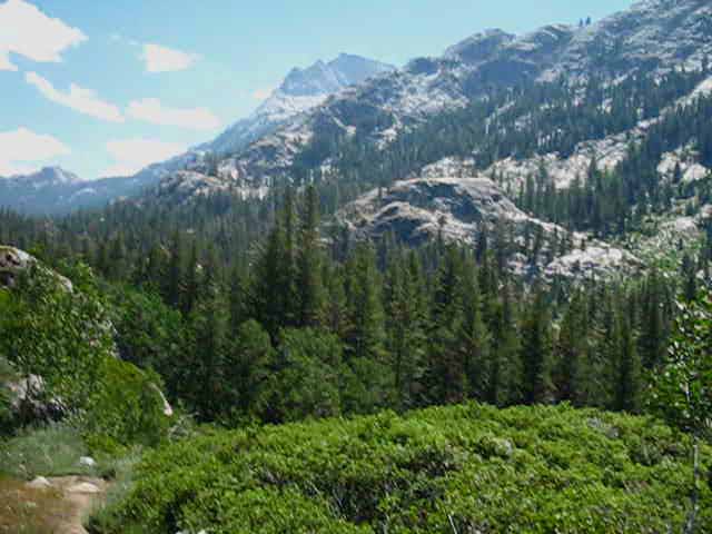
As our trail climbs up above this rough section of Rancheria Creek our improved perspective reveals the great basin opening up on North side of Kerrick Canyon. This fantastic sheet of expansive granite opens up to our Northeast as we approach both the trail junction to Seavy Pass and the point where Kerrick Canyon turns North. Stubblefield Canyon to Bensen Lake This basin sits below the East flank of Price Peak on the map above. We can see the washed-out image of Price Peak in the distance sticking up over the Right side of this great shadowed mass of granite. |
Interlocked Stability
in an
Unstable World
 |
Trail Crew Practical Art. An amazing rock wash. This is how you prevent a problem area of the trail from growing and washing away during the Spring Thaw, and the surrounding trail from becoming a creek. Note how the rocks are chipped and wedged into a powerful interlocking structure to maintain form under natural, human, and equestrian loading. This is one of a series of fine rock works done along this section of trail during the last decade, including the evolution of the staircase hiking to Seavy Pass out of Kerrick Canyon. These kids are good! |
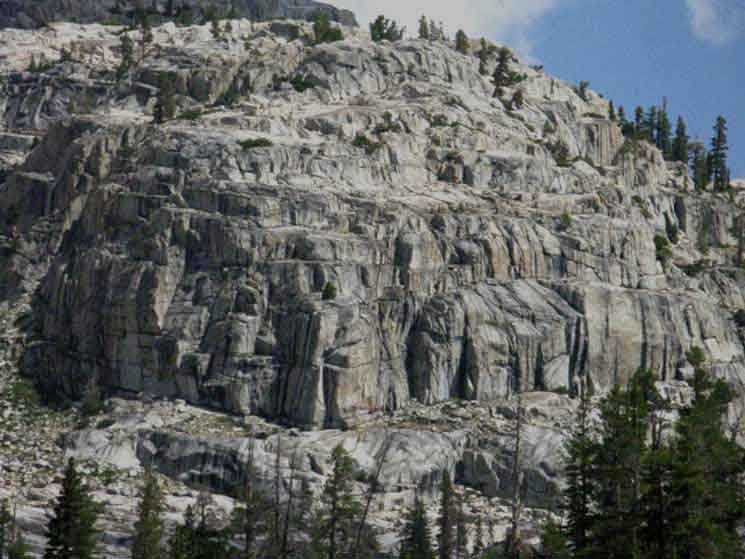
The Greatest Quarry on Earth?
 |
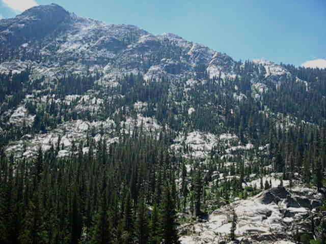
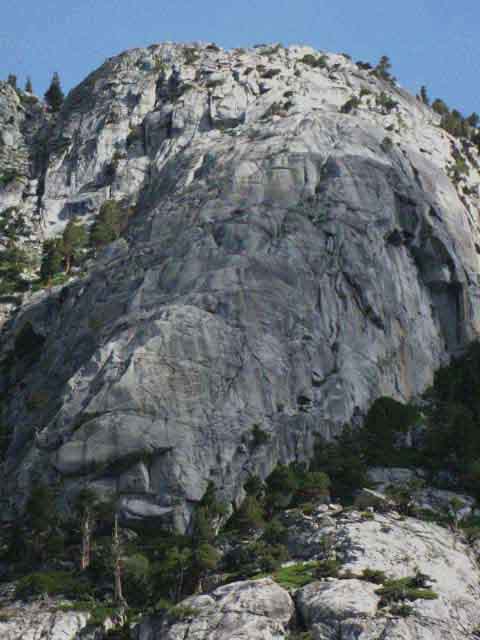
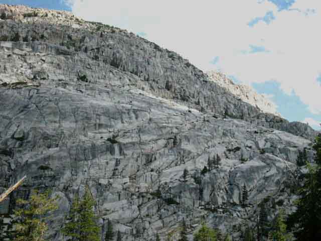
The North face of Kerrick Canyon begins tapering off to reveal a great basin opening up to the North. This basin is cut North up into the vast block of granite that makes up the North wall of Kerrick Canyon. This piece of granite to the North of us as we've hiked up Kerrick Canyon is vast. Here on it's East end we can begin to get a look at its vast scale. Looking at the descending Right side of this granite wall we can make out the shape of Price Peak rising over the near shoulder in the far distance, a" bump" in the distance above the descending flank in the foreground. It is difficult to differentiate the near from far granite in the image above, but that's Price Peak rising in the distance above the descending flank of the near granite. Now we are going to experience the confusion of the terrain here. |
FAN-FREEKING-TASTIC BASIN
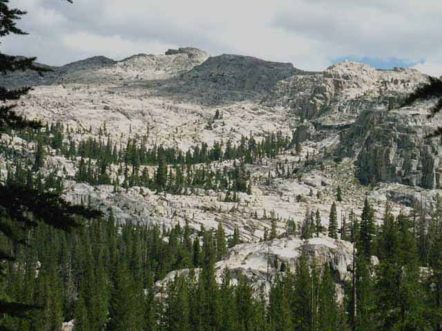 |
||
Looking North from middle Kerrick Canyon A great basin opens up, rising up to the North above the North shore of Rancheria Creek under the East flank of Price Peak as we hike South up Kerrick Canyon drawing near the Seavy Pass trail junction. We look Left, to our North and see this great basin as we emerge out of forest cover approaching the Seavy Pass trail junction. Rancheria Creek in Kerrick Canyon both bend almost directly to the North just past the Seavy Pass trail junction. This section of Kerrick Canyon running North to South makes up what I call "upper" Kerrick Canyon. This "middle" section of Kerrick Canyon runs East-West while the upper section runs North-South. "Upper" Kerrick Canyon's North-South alignment runs up to the Sierra Crest on the far side of the granite ridgeline along the Right side of the image above. Upper Kerrick Canyon is on the other side of that ridge. This great basin
runs North for a short distance out of middle Kerrick Canyon running parallel with the North-South line of upper Kerrick Canyon. Upper Kerrick Canyon runs up to the Sierra Crestline while this basin terminates into a ridge capped by a local peak halfway up to the crest. I mean when is a basin big enough to be a world in itself "minor?" The answer is where: In the North Yosemite Backcountry. This place is big. Words fall short of measuring the scale of the North Yosemite Backcountry. It exceedes the senses while filling the spirit. The small details of the vast blocks of granite terrain here are magnificant, far outpacing the greatest works of man. The big stuff here is the material of reality itself defining the spacial boundaries framing life over time. Not just in the details of the local terrain, but in its overall effect in determining the behavior of regional weather. In other words, the Sierra Crest is an Engine of Life, a place where the fundamental natural forces feeding life are brought together and distributed. The physical structure of the Sierra creates a vortex of energy that feeds life over a huge span of territory preceeding the Sierra Crest as surely as the terrain in its shadow is starved. Us, in the picture above we're hiking out of the Right frame to the East following the Southbound PCT-TYT East by the compass up middle Kerrick Canyon past this basin to the Seavy Pass junction. WTF? I love spots of the terrain like this! The reason why Kerrick Canyon and Rancheria Creek look like they run East where they turn Norh is that the top of the glacier-cut granite making up Kerrick Canyon actually continues to run East. The glacier actually cut the top of the canyon East-West. Though the top of the canyon continues East the bottom of the canyon rises to the East, blocking the bottom of the potential drainage. The top of the canyon continues East, but the drainage cut onto the bottom of the canyon turns North, bringing Rancheria Creek through its unlikely route from upper to lower Kerrick Canyon. The trail and the terrain split North and South on the East end of this granite block at the Seavy Pass trail junction. The terrain to our North, the great block of granite and the basin cut into its Eastern side under Price Peak are solid, ice carved but unbroken vast blocks of grante. Not so to our East. where this great block of granite looks like a plate of glass withwas brokennot a great bl Kerrick Canyon turns North once we get East past the basin shown above through a serpentine narrow channel climbing up to the Sierra Crest through a set of expansive meadows in upper Kerrick Canyon. We Southbound hikers on the PCT-TYT turn South climbing out of Kerrick Canyon to Seavy Pass. What looks like a route continuing East from here is a fold in the line of mountains where Kerrick Canyon bends North, an optical illusion produced by the fantastic complexity of the terrain.
|
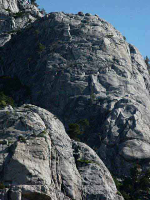
Great Granite on North Side of Kerrick Canyon
 |
Southeastern Corner of the Price Peak Massif This would be the Southeastern shoulder and flank of the great block of granite topped by Price Peak, rising to our Northwest. To the East, the Right of the image above, we will see a great granite basin opening up Northward in the distance, laying below the East flank of Price Peak. To the East of this great granite basin Kerrick Canyon turns North up to the Sierra Crest. As we climb higher up Kerrick Canyon the terrain seems to be closing in, especially as we begin to follow the trail descending to Rancheria Creek. |
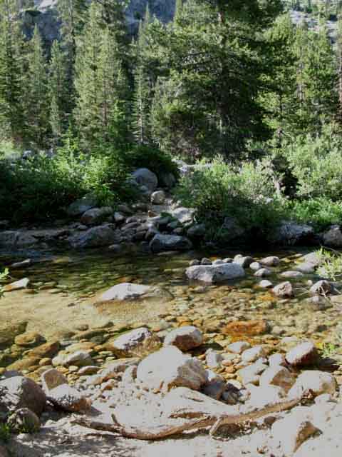
Rancheria Creek
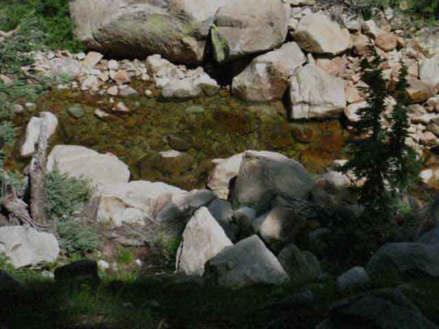 |
Dropping back down towards Rancheria Creek. We've been high up on the South wall of Kerrick Canyon far above the turmoil of Rancheria Creek, but now we're making a descent back to creek level. |
Looking Up Rancheria Creek
 |
Getting down to creek level we can see a bit upriver. We are descending down to Rancheria Creek where we will be able to access water if necessary. |
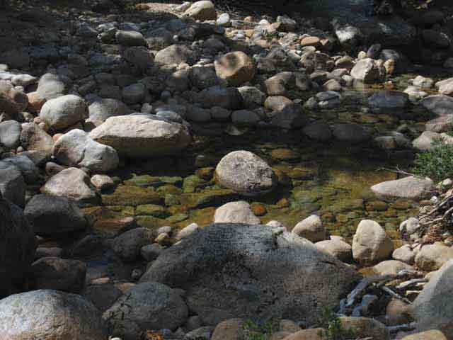
Rancheria Creek
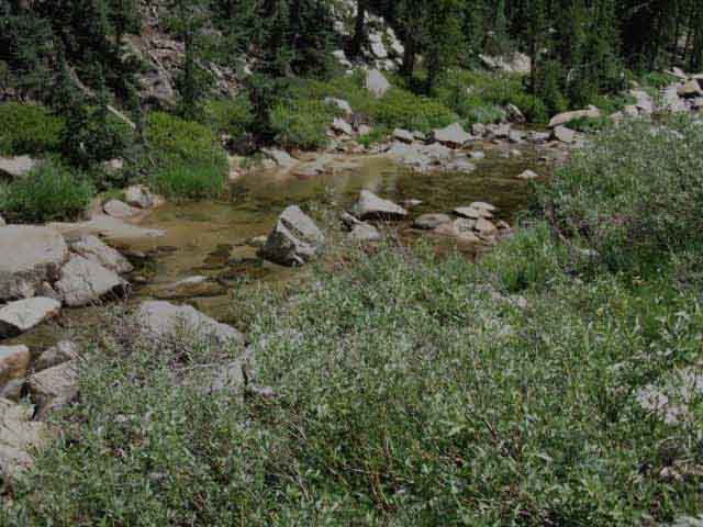 |
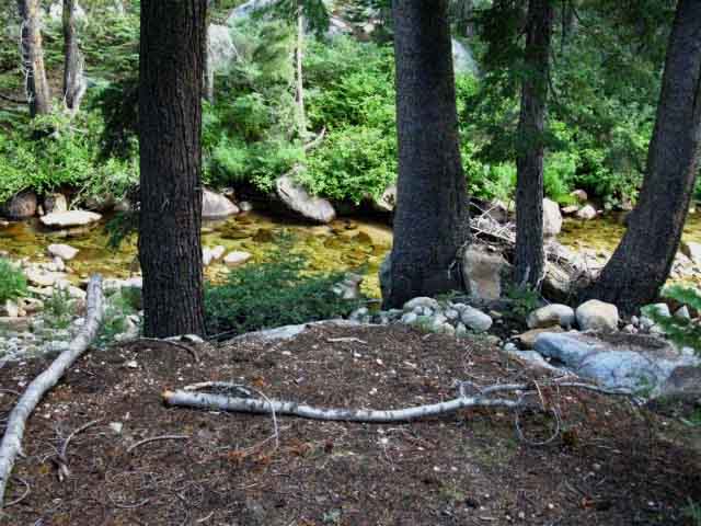
Trail and Rancheria Creek touch in Kerrick Canyon before we make the climb up to the Seavy Pass trail junction. Stubblefield Canyon to Bensen Lake |
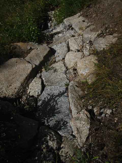
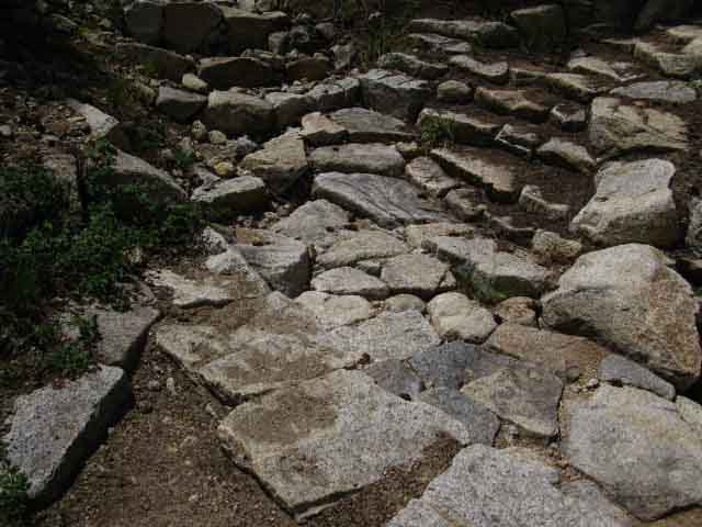
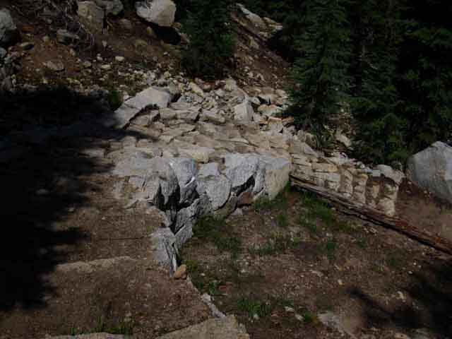
Trail Crew Rock Work at Trail Low Point
 |
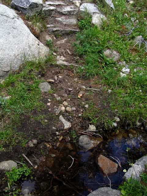
This is the low point of the trail. Rancheria Creek is accessible to our Left. Now the trail South climbs up to the Seavy Pass trail junction, where we will turn South (Right) to finish the climb up to Seavy Pass. Note the excellent trail work at, and surrounding this low point location, which is a natural focus point of destructive Spring Thaw runoff flows coming off the steep flanks of the canyon above flowing into Rancheria Creek. 8760 feet of elevation at low point of trail in Kerrick Canyon, above. 9320 feet at Seavy Pass. |
Wash Out and Trail
get
Equal Attention
 |
Fantastic Pacific Crest Trail wash out along Rancheria Creek. The washout comes down from the Left of the image, channeling runoff across armored trail to Rancheria Creek. The Northbound PCT-TYT branches off to the Right. Note how trail crew spent lots of attention on the seasonal drainage. This has been a problem section during the Spring Thaw for years due to the steep terrain above. Yosemite Trail Crew responded by engineering how the runoff is collected and guided as it comes off the mountain across the trail. They fit the rocks so the pressure of the water will lock them more firmly together under greater pressure, controlling that pressure and preserving the trail. These guys and gals are GOOD! |
Climbing towards Seavy-Bensen Pass Trail Junction
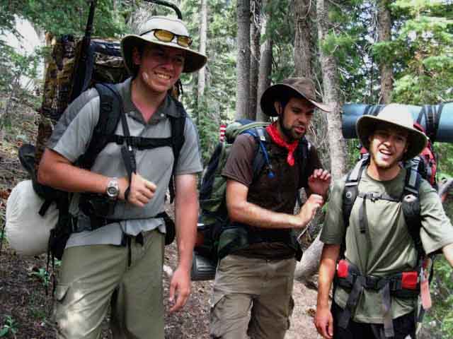 |
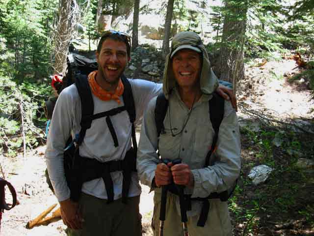
GOOD DUDES Matt, Will, and Spence. I always like meeting dude packs. Lots of good dudes putting it into the mountains, from all over California, the Western US, and the World. I'm not negating the presence of female hiking teams across the North Sierra, the ladies are out there, but it's more common to see groups of women South of Tuolumne Meadows. Female representation along the John Muir Trail is a much larger percentage of hikers than we see North of Tuolumne Meadows. Except when the main body of each year's Pacific Crest Trail hikers come through. I generally see a good representation of women hiking solo, in pairs, and teams in each year's crop of PCT hikers. The dudes above assured me I was rapidly approaching the Seavy Pass trail Junction. Matt, Will, and Spence's trip: Twin Lakes to Lake Eleanor. A Trans-Sierra Trek. 8 or 9 days, no resupply. Met 'em just below the "elbow" in Kerrick Canyon, where the upper canyon bends from North-South to an East-West line where the PCT-TYT turns South through Seavy Pass. Saturday August 1 2009. Matt was packing heat, as their trip was passing into Emigrant Wilderness, where guns and hunting are legal, as they are not in Yosemite. We can see his rifle slung on his pack. What looks like the upright on the Left side of his pack is actually the barrel of his rifle. I don't hunt or fish, though I love tracking and observing terrestrial and water critters. I'll tell you what I know if you treat the critters with respect as you track, observe, hunt and eat them. No problem. Life eats itself to Survive. Just don't eat everything... On the other hand... |
Seavy Pass Trail Junction
Tahoe to Yosemite
and
Pacific Crest Trails
South
South to Bensen Lake
along the
Combined TYT-PCT routes
 |
||
Seavy Pass trail junction South through the Seavy Pass Bowl to Bensen Lake. Tahoe to Whitney Miles I have it at 35.24 miles South to the Store and Post Office in Tuolumne Meadows.
|
Northeast
up
Kerrick Canyon towards Twin Lakes Trailhead
in the
Hoover Wilderness
Entering the Route of the Bensen Lake Loop
 |
||
NORTHEAST Peeler Lake to Twin Lakes This puts us 12.9 miles from Twin Lakes via Peeler Lake. Buckeye Pass to Twin Lakes Twin Lakes is located a few miles East of Bridgeport off of Highway 395. This road map below can be adjusted down to the Southeast a bit to locate Bridgeport Reservoir, Bridgeport along Highway 395, and the road from Bridgeport to Twin Lakes: North Sierra Mountain Pass Trailheads Road Map Twin Lakes is a unique "backdoor" into the middle of the North Yosemite Backcountry. Twin Lakes feels like a remote place indeed, rustic, old, and long used. The Twin Lakes Trailhead is the beginning and end of the Bensen Lake Loop around this North Yosemite Backcountry, a fine loop indeed. This map covers the Bensen Lake Loop out of Twin Lakes in the Hoover Wilderness: Bensen Lake to Virginia Canyon Twin Lakes and the cabins, car campgrounds, and Summertime activities out there are a long-standing tradition for many families, hunters, and fishermen. Locals from up North in Antelope Valley down to Lee Vining will gather at Twin Lakes to party on Fourth of July. Twin Lakes is a "local" resort and place where locals bring their families out for picnics, fishing, and car camping. I've only hiked in through Twin Lakes a couple of times, and I am always amazed by its rustic, country-style resort-like atmosphere. We can see the signs of long-term heavy use on the very well-trod trails up to Peeler Lake and Buckeye Pass. The soils and campsites around Peeler Lake show the signs of long compaction by generations of local hikers, hunters, fishermen, and backpackers. For us long distance backpackers Buckeye Pass and the trail around Peeler Lake are our two trail options to get over the Sierra Crest into the top of Kerrick Canyon out of Twin Lakes. Twin Lakes Option
Into the Wild We can even point ourselves down one of the amazing canyons down to the Grand Canyon of the Tuolumne River and on down to the trailhead at Hetch Hetchy Reservoir. We just met Matt, Will, and Spence who are hiking from Twin Lakes to Lake Eleanor. |
North
down
Kerrick Canyon
on the
Combined
Pacific Crest and Tahoe to Yosemite Trail
 |
NORTH Northbound Hikers The TYT turns West from where it touches Tilden Lake to rejoin the PCT a bit higher up Jack Main Canyon from Wilmer Lake. The PCT and TYT share the rest of the hike up to the top of Jack Main Canyon where they again split up. After the PCT and TYT break up at the top of Jack Main Canyon they will take distinctly different routes North along the Eastern and Western flanks of the High Sierra, respectively, until they next unify far to our North entering the Lake Tahoe Basin. Tahoe to Whitney Miles TYT Why? |
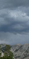
September Skies
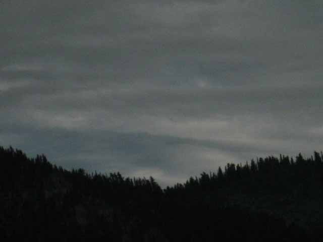 |
Shifting cold and warm breezes bring bits of snow, ice, and cold rain. My journal of Tuesday, September 28, 2009 notes, "49 degrees all day, until 4pm, clearing skies, drop to 35 degrees, 8-15 mph winds." Don't think that low temps only happen during Fall and Winter. Summertime daily lows can hit the low 20s for extended periods of time. |
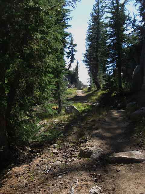
Trail up to the Seavy Pass Bowl
 |
Spiral Staircase Over the past decade (2003-13) I've noticed a logic, or underlying pattern that guides the evolution of trail construction. If I am correct, we are going to see changes. The lessening of the snowpack over the past few decades has lessened the ravages of Winter and the Spring Thaw on the trails. As Spring water flows decrease so too will the general force of erosion working on the Sierra. And so too will the growth rate of the forests slow, if not retreat. It is as if time is slowing down in the Sierra. The rate of snow and rain determines the power of plant growth and erosion which together are the main factors that determine the rate of physical change in the Sierra. The intensity of the Winter and Spring seasons determines the level of flora and fauna. We can see that trees are a major force in levering apart vast blocks of granite, and transforming this broken rock into soil. With lessening water all of these forces of nature diminish. The amount of Winter and Spring moisture fueling the rate of change in the Sierra is steadily diminishing year by year over at least three decades now. The throttling back of the forces of change in the Sierra will eventually diminish traditional trail construction and repair needs. The diminishing snow and rain is diminishing erosion. The lack of water is retarding tree and plant growth. The damages of massive snowpacks and the fury of their Spring Thaw will be replaced as the major source of trail crew work by the rise of fires and blights as the main factors driving trail maintenance. I strongly suggest hikers see the Sierra now, before the current changes in the character of the seasons completely change the ancient character of the Sierra itself. All living things are struggling to find balance in the new conditions brought on the wings of the emerging new seasonal weather patterns. |
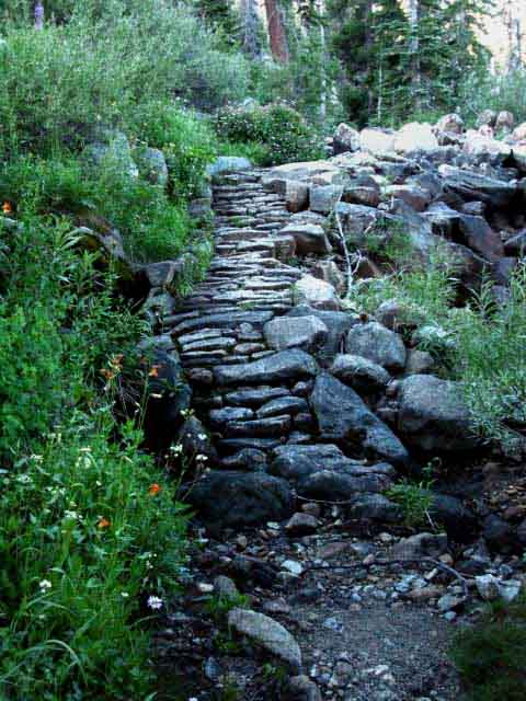
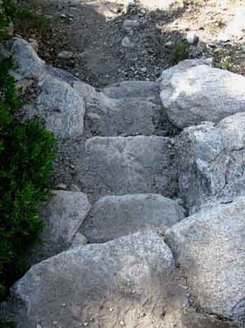
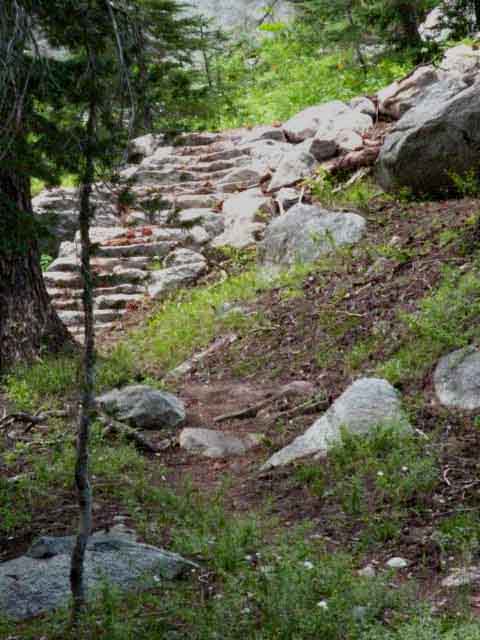
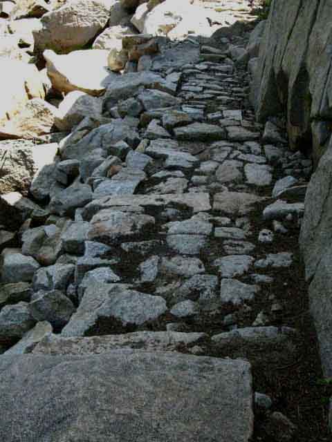
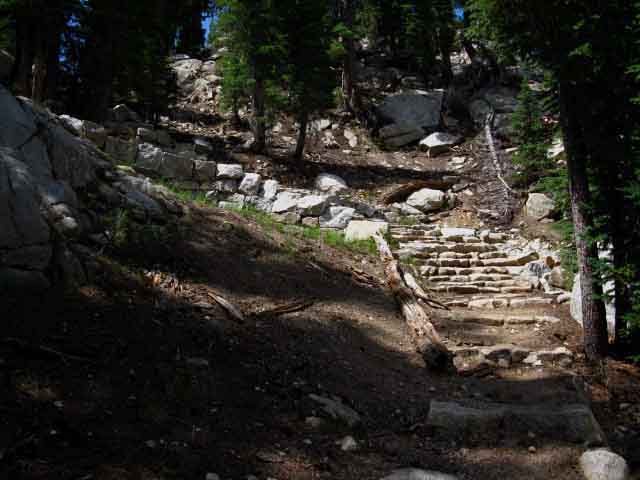
Stairway to Heaven
errr
...Seavy Pass
 |
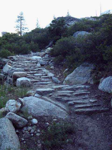
Yosemite Trail Crew Work Looking down the Staircase below the North end of the Seavy Pass Bowl. Looking down the staircase leading us up to the gap to enter the North end of the Seavy Pass Bowl. The combined Pacific Crest and Tahoe to Yosemite Trails. Though short, this section of trail hiking South out of Kerrick Canyon is decorated with a few steep switchbacks and this nifty staircase. Stubblefield Canyon to Bensen Lake |
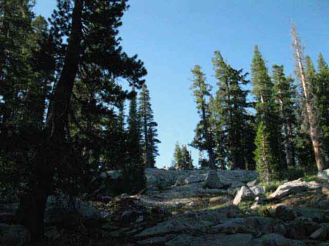
Hiking South
approaching
North Gap into Seavy Pass Bowl
 |
||
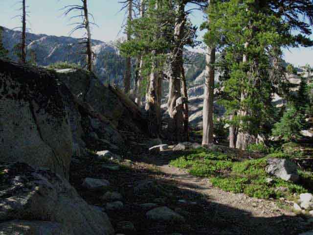
Hiking South on the Pacific Crest Trail approaching Seavy Pass. At the top of the last switchback the trail untwists into a forest lined walk through a beautiful rock channel, a gap in the granite leading us into a unique granite bowl filled with ponds, meadows, and granite rock gardens cut into the mountain top. What I call We are passing from one wondrous scene to the next in quite rapid succession. The key to really enjoying it is fitness. If we are in shape our full attention can be paid to the environment. If we are hurting we will be distracted at the level of our discomfort. Make sure we give ourselves a good chance to fully enjoy this magnificent terrain by being as physically prepped as possible before we hit the trail. This is not the place to be struggling...
|
To The Gap
 |
Though we are hiking through this gap into the bowl beyond, this is not the high point. Seavy Pass is the high point in the bowl beyond this gap, where we wind through an ancient maze of the jumbled granite terrain between the North and Central ponds. Stubblefield Canyon to Bensen Lake North Yosemite Note the length of the trail across the upcoming Seavy Pass Bowl is slightly longer than one of the UTM 1000 meter grid squares. MAP NOTE What's important for our general reference purpose is that each side of a square is 1000 meters, or a Kilometer. From my point of view that is 1000 yards, 3000 feet, or .62 of a mile. That puts the Diagonal Distance across a grid square at 1414.22 meters, if my trig is correct. From my point of view that's 4640 feet, which is .89 of a mile. Call it nine-tenths of a mile for field reference. |
Gap into the Seavy Pass Bowl
 |
Tahoe to Yosemite Trail looking South at the gap into Seavy Pass Bowl in the North Yosemite Backcountry. |
Into
the
Enchanting Terrain
of the
Seavy Pass Bowl
 |
Wow Getting a view directly Southwest across the length of the North Pond as we enter Seavy Pass Bowl, backpacking North Yosemite. As this bowl does not drain real well the trail is moving East following this bowl's rocky perimeter to avoid nasty marshy conditions across the center of the bowl. Well, nasty to try to maintain a trail through when drowning in the Spring Thaw. Thus the trail follows a delightful path around and through a granite and forest maze off to our Left, from the perspective above. As we move across-around the bowl we will mark our Southbound direction by Piute Peak sitting above our Southern exit from the Seavy Pass Bowl. It's the peak in the upper Left in the image above behind the tree. Stubblefield Canyon to Bensen Lake |
NEXT PAGE SOUTH:
Through the Seavy Pass Bowl
&
Down to Bensen Lake
&
Up to Smedberg Lake
BELOW
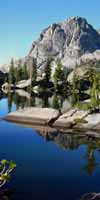
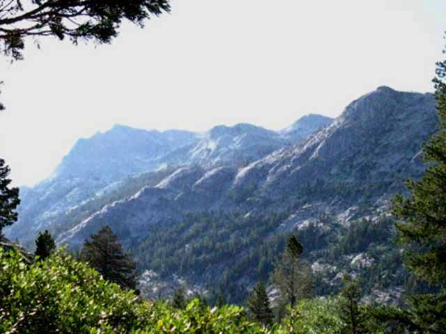
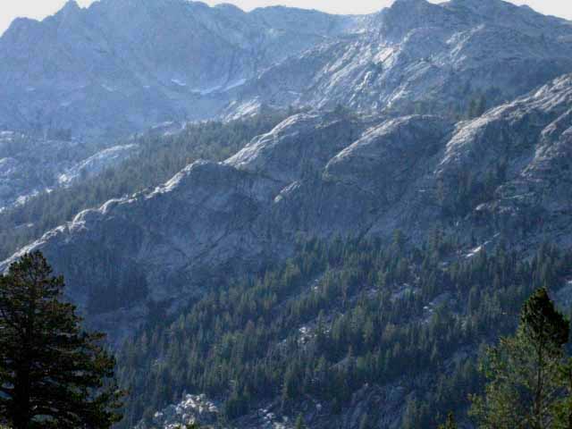
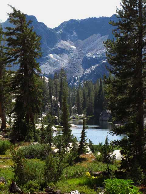
Piute Peak on Southeast Corner of the Seavy Pass Bowl
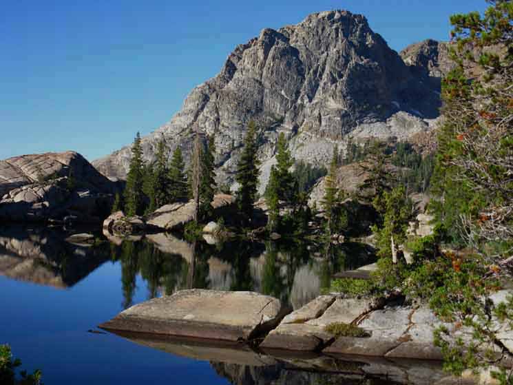
I call the peak above "Piute Peak" because it is the striking Peak on the South end of Piute Mountain's mighty ridgeline. Is it not stunning on a calm morning? NEXT Seavy Pass to Bensen Pass The next segment of our trail starts by hiking through the Seavy Pass Bowl. Each step we take we think the beauties in the Seavy Pass Bowl cannot get any better, we find we are wrong with the next step. We find the delightfully fine terrain above awaiting us on the far South side of the Seavy Pass Bowl, as seen above, after investigating the beauties of the rock, forests, ponds and meadows all jumbled together in this special place. Passing out of the Seavy Pass Bowl by hiking around the South Pond pictured above we descend the steep hike down to Bensen Lake, and then face the much steeper hike up and out of the "Bensen Hole" to Bensen Pass via Smedberg Lake. The climb from Bensen Lake to Bensen Pass is quite a climb. If you want to make any of your climbs early in the cool air of the morning, this is the one. Context We're going to take this fantastic view of the mountains South of Bensen Lake as an opportunity to pull out our map (if it's not already in hand) to line it up with Volunteer and Double Peaks rising South of Bensen Lake. This allows us to ascertain the line of approach our trail uses to climb up to, then get around Volunteer Peak and up to Smedberg Lake. This is very complex terrain so I take every chance I can get to put it into the best context I can construct. Smedberg Lake is beautiful! Our upcoming views of Volunteer Peak will give us an pretty good idea about the difficulty of the lower and middle parts of our hike South from Bensen Lake. The middle section from the top of the meadow to the Rodgers Lake trail junction is the hardest segment. There's one problem with tomorrow's hike to/past Bensen and Smedberg Lakes. They are too close together for such beautiful lakes! Their beauty has caused me to stay at both lakes along the same hike, despite the fact that the West shoe of Smedberg Lake is only 4.5 miles from the Bensen Lake trail junction, plus the .4 of a mile from the junction to the lake. You have the choice of camping at one lake, none, or both lakes. For me the decision simply revolves around how much time I gave myself for this section of trail between Highways 108 and 120. I've employed all three approaches over the years, but I far prefer the "both" option. |
vv TRAIL GUIDE
|
North: Wilmer Lake South: Seavy Pass to Smedberg Lake via Bensen Lake
Hiking |
Seavy Pass Hiking from Stubblefield Canyon to Seavy Pass we cross the halfway point of our backpacking trip across the High Emigrant Wilderness and the North Yosemite Backcountry between Highway 108 and Highway 120. This is a striking and strenuous segment of trail, this last bit from Stubblefield Canyon to Seavy Pass. Striking for the mostly ascending trail itself, for the grand views from the top of the ridge between Stubblefield and Kerrick Canyons, and for the amazing granite walls of Kerrick Canyon. But we are only a quarter of the way across the roughly 33 mile length of our trail across the famous Five Canyons of the North Yosemite Backcountry stretching from Macomb Ridge to Cold Canyon. We Southbound hikers still quite a high altitude roller coaster ride ahead! On the next page of the trail guide South we'll cross the Seavy Pass Bowl and make the great plunge down to Bensen Lake down at the bottom of the "Bensen Lake Hole." Climbing South out of Bensen Lake's 7600 feet of elevation up to Bensen Pass's 10160 feet brings us up 2560 feet over 6.7 miles. We climb this distance over a set of distinct steep climbs divided by nice meadow flats. The steep segments of this trail are the steepest segments of trail between Tahoe to Whitney. The hike up to Bensen Pass from Bensen Lake is the hardest segment of trail along the whole Tahoe to Whitney in my opinion. I'm willing to hear your nomination for the hardest segments of trail between Lake Tahoe and Mount Whitney. Post Up! Add your input, perspective, and experiences through the comment or forum links, depending on how much information you have to share. That means you'd have to register as a member of Tahoe to Whitney. Questions from Unknown Hikers always welcome. 7.5 Topo Hiking Map 30 min Topo Hiking Map |
Backpacking Trail Guide PCT & TYT North North TYT Tilden Lake North PCT Wilmer Lake |
 |
Backpacking Trail Guide PCT & TYT South |
Backpacker ForumsHave a great Sierra Nevada trip or story to relate? A fine piece of gear? Or gear that failed? Post it on Forums cover all High Sierra backpacking trails and topics. Anyone can post up comments in the forums. Only members can post up their own pages in the forums. Unregistered hikers can post up text comments about their experiences or ask questions in already existing forum posts. For this part of the trail from Stubblefield Canyon to Seavy Pass, the forum Section is where members can post up information and the trail Segment is where everyone can post up basic comments about this bit of trail. Forum
|
Trailhead
Contact
Alex Wierbinski

Backpacking Lake Tahoe to Mount Whitney
Your Guide to the High Sierra Crest, including the Tahoe to Yosemite, Pacific Crest, and John Muir Trails
