The Trails
Guide
Maps
Miles/Ele
Permits
Resupply
Forum
Current Weather Conditions
Weather Notes
Northern High Sierras
Central High Sierras
Southern High Sierras
Gear
Gear List
Gettin Started
Layering
Discussion
Testing yourself and your gear
Gear Reviews
Backpacking
Kennedy Canyon Trail Junction
to
West West Walker River Bridge
Toiyabe National Forest
Hiking
The Pacific Crest Trail from Sonora Pass to Tuolumne Meadows
Languages
Languages
Trail Arts
The art of walking
Physical Preperation
Trail Skills
The trail
Off the trail
Scrambling
Maps
Navigation
Camp skills
Food
Resupply
Food
Other
Photo Catagories
Trail Stories
Trail Culture
News and Science
Links
Groups
Books
Terms and Conditions of Use
| Trail Guide INDEX Highway 108 to Highway 120 |
GUIDE |
GUIDE |
West to South to |
Southwest MAP Emigrant Meadow South PCT MAP Kennedy Canyon |
30 min MAP Sonora Pass to Bensen Lake |
Sonora Pass to Tuolumne Meadows MILES AND ELEVATIONS |
TOPO MAP INDEX SONORA PASS |
Resupply North Kennedy Meadows South Tuolumne Meadows |
National Forest & PARK PERMITS Toiyabe & Stanislaus & Yosemite |
all maps index |
Kennedy Canyon
into the
Toiyabe National Forest
KENNEDY CANYON TRAIL JUNCTION Our Situation
Backpacker's
Local Maps and Miles |
|||||||||||||||||||||||||||||||||||||||||||||||||||||||||||||||||||||||||
| Kennedy Canyon to Dorothy Lake Pass PCT USGS 15 min hiking map |
Sonora Pass to Tuolumne Meadows PCT Miles and Elevations |
| Sonora Pass Region Hiking Map USGS 30 min backpacking map |
Sonora Pass to Bensen Lake PCT USGS 30 minute backpacking map |
INDEX
Backpacking Trail Information Kennedy Canyon Index |
|||||||||||||||||||||||||
|
Leavitt Meadow Trailhead Backpacking Loops
Trail Junction Video
Campsite at top of Kennedy Canyon
Map Note Ford and Trail
Campsite @ Ford
Trail Junction
Walker Meadow Rock
Video
Trail Junction |
Emigrant Wilderness
all All
Comprehensive
|
||||||||||||||||||||||||
| > Forum < | |||||||||||||||||||||||||
This trail guide is made to be a source of information for, and subsequently updated by backpackers using it through the comments and forum links on each trail guide page. Anyone can post comments, but only registered Members can post up stand alone articles and trip notes about this segment of the trail. Commentators cannot post images, but members can post images, maps and even embed videos in the Trails Forum for the Sonora Pass to Tuolumne Meadows Pass section of the Trail Guide. Post up your cool stuff. Show us more! Learn-Teach-Share Add updates, questions, comments, and additional information about this part of the trail through the comments links. Check out this supplemental information through the forum links. Check out the Tahoe to Whitney .org Backpacking Trails and Topics forums
|
|||||||||||||||||||||||||
|
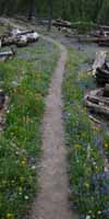
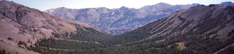
South on the PCT This next segment of our Pacific Crest Trail route opens up backpacker access to a unique and somewhat remote section of the the Eastern Flank of the Sierra stretching Southeast from Leavitt Meadow on Highway 108 up the West and West West Walker Rivers. These trails up the West and West West Walker Rivers give us remote access to Eastern Sierra Flank entry points into the Northeastern Emigrant, the Northwest Yosemite Backcountry, and the North end of the Hoover Wilderness. The trail in the West Walker River Canyon runs Southeast along the highest base of the Eastern Sierra Flank out of its headwaters to a position above the Hoover Wilderness Trailheads at Twin Lakes, or access into the Heart of the North Yosemite Backcountry through Kerrick Canyon. We are going to use this page below to examine those local trip options. We are going to look at how this area fits in as part of local backpacking trips around the Emigrant Wilderness and the North Yosemite Backcountry, as well as being an excellent segment along our long distance backpacking trip from Tahoe to Whitney.
To our North and South the Emigrant Wilderness runs up the West Flank to the Sierra Crestline, while here the Hoover Wilderness is set back from the East flank of the Sierra and its Crestline by this "pocket" of the Toiyabe National Forest wedged between the Hoover Wilderness and the Sierra Crest. The whole run of the West and West Walker Rivers is wedged into a slice of the Toiyabe National Forest between the Hoover Wilderness to their East and first the Emigrant, then the North Yosemite Wilderness to their West, from North to South. The Emigrant and Yosemite Wilderness Areas cover everything West of the Crest along the courses of the Walker Rivers. SOUTHBOUND Local Backpacking Options Local Backpacking Options PCT Option
Top |
PCT-TYT Relationship Southbound PCT Turns East Though we hike in the West Walker River Watershed from our first steps East into Kennedy Canyon until we step across Dorothy Lake Pass, we will never actually see the West Walker River itself. The best we do is observe the sheer volcanic ridge making up its Eastern wall. The Trail Down Kennedy Canyon There is a good camp site at the top of the canyon near the top of the treeline and multiple camps at the ford about halfway down Kennedy Canyon. There is a hard to find campsite near the bottom of the canyon. Once we turn South out of the bottom of Kennedy Canyon our trail is routed along the top fringe of the forest as high as possible above the edge of the jumble of intertwined forests and meadows below. We descend 1080 feet over the 4.66 miles hiking "South" from the Kennedy Canyon trail junction to the West West Walker Bridge and its associated campsites. There are nice campsites around the West West Walker Bridge.
PCT PCT hikers continue South through the Marine Base following dirt roads up to their highest access to Wolf Creek, where we work our way up faint trail to Wolf Creek Lake under the East Flank of Sonora Peak. We resume the PCT in the East Carson Gap where we drop into the watershed of the East Carson River. The Northeastern corner of this map below shows the Northern return to the PCT of the "PCT detour." That route is also my exit point for Winter backpacking trips up the East Carson River. Sonora Pass to Kennedy Canyon To the South along the Eastern edge of this same map above we can trace out the course of the West Walker River and much of its relationship to the PCT, the Hoover, Emigrant, and Yosemite Wilderness Areas around it. These maps above and below put our long-distance PCT route into context with our local road and trailhead access so we can understand these cool places and figure out ways to explore more of them. |
PCT to TYT West
Note that we can also turn West from the Kennedy Canyon trail junction down Kennedy Creek on the Western flank of the Sierra to the Tahoe to Yosemite Trail junction 2.67 miles above Kennedy Meadows Pack Station.
Kennedy Meadows Pack Station Trailhead up to Kennedy Canyon trail junction Sonora Pass Trailhead to Kennedy Canyon trail junction |
That puts the distance from Kennedy Meadows Pack Station to Sonora Pass Trailhead at 19.03 miles, and we've barely scratched the surface of the Emigrant Wilderness' Backpacking potential.
First
Four-Way Crestline Trail Junction
This Kennedy Canyon trail junction is the first of two four-way trail junctions on the Sierra Crestline South of Sonora Pass where we can move North and South along the Sierra Crest or turn down either the East or West flanks of the Sierra.
The next four-way trail junction South is the Grizzly Peak trail junction along the Tahoe to Yosemite Trail. These two junctions open up a can of worms of hiking trails, trips, and backpacking loops around Emigrant Wilderness and the adjacent section of the Toiyabe National Forest.
I say push further South down the Sierra Crestline into Emigrant Wilderness before turning our loop back, if we are not hiking South to Tuolumne Meadows.
The Middle Route
Us long distance hikers on the PCT down to Tuolumne Meadows have to consider the alternative route of hiking South over Big Sam along the Tungsten Road to the TYT route at Grizzly Peak from this Kennedy Canyon trail junction. The route South from Grizzly Peak to Jack Main Canyon along the TYT is a viable alternative to the PCT route described down the page below.
The Tungsten Road to Grizzly Peak alternative route is depicted on the Big Sam guide page.
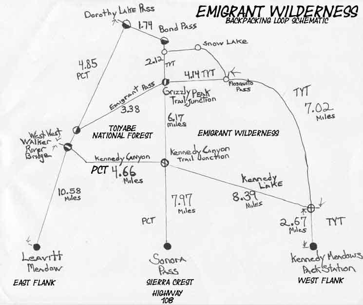
| ROAD MAP | Emigrant Wilderness Trail Schematic |
Index
STANDARD ROUTE
Continuing South on the PCT
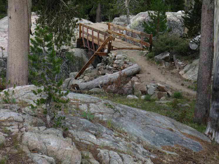
Reaching the bridge over the West West Walker River marks the end of our 4.66 mile down-mountain hike from the Kennedy Canyon trail junction and the beginning of our 4.85 mile hike up 880 feet of elevation to enter Yosemite National Park through Dorothy Lake Pass. Here at the West West Walker Bridge we encounter two of the three routes that each could potentially bring us Northeast out of the forest to the Leavitt Meadow Trailhead on Highway 108.
Trail to Emigrant Pass
The next trail junction along the PCT South from the West West Walker bridge is .19 of a mile up the West West Walker River. Here our PCT veers Left off this old trail up to Emigrant Pass. If we continued straight through this trail Y for another 1.5 miles continuing up the trail towards Emigrant Pass we encounter the Western Cinko Lake trail junction.
The West West Walker River and its trail continues upriver climbing another 1.69 miles beyond the Western Cinko Lake trail junction up through its unique "channel" carved in the terrain. The original channel was carved by ice through granite, but the current configuration was not achieved until the huge volcanic cap was applied. We get fantastic perspectives on this interace as we climb through it. Towards the top of our climb the trail moderates into the broad Sierra Meadow constituting Emigrant Pass draped across the Sierra Crest in the shadow of Grizzly Peak.
Back to the
PCT
The West West Walker Bridge
The PCT veers Left at this first trail junction .19 above the West West Walker Bridge to climb Southeast over the ridge dividing the West West Walker from the main watershed of the West Walker River.
Once we Southbound PCT-route hikers climb out of the West West Walker's "channel" into the greater West Walker drainage we hike through a series of compact meadowed flats and arms of forest strung-out along a narrow seam of shattered granite. The terrain exhibits the characteristics of a great sheet of granite riven with cracks, like a shattered windshield of a car.
Lines of moisture running along the cracks in this shattered landscape draws the lines of seasonal streams feeding meadows which draws trees, creating unique patterns of growth along this section of the East flank of the Sierra.
The terrain running off the East flank of the Sierra below the line of volcanic terrain wrapping around Emigrant Basin appears to consist of a vast sheet of granite that has has been ground into undulations and cracked into distinct pieces that control how water runs through it.
EAST
Cinko Lake
Trail Junction
1.81 miles South of the Y-junction turning out of the West West Walker River the PCT hiker encounters the
Eastern Cinko Lake trail junction.
The length of this trail West to Cinko Lake from this Eastern Cinko Lake trail junction on the PCT is 1.52 miles to the Western Cinko Lake trail junction. As mentioned above, the Western Cinko Lake trail junction is located along the trail to from the West West Walker Bridge to Emigrant Pass, with Cinko Lake located about 2/3rds of the way up the trail to the pass.
This map below lays out the relationship between the PCT and the East and West Cinko Lake junctions, and how the PCT at the West Walker Bridge links up with the TYT passing under Grizzly Peak via the trail up to Emigrant Pass.
Sonora Pass to Bensen Lake PCT
USGS 30 minute backpacking map
Romantic Terrain
I find this to be very "romantic" terrain, in the sense that the route through the forest, rock, and tiny meadows here always strikes me as being "new" and old, in that I feel like we're hiking in the footsteps of the first trickle of Western explorers probing into the unknown.
For me this is a hike into known and loved beauties, but I can imagine that for these first Western travelers these "unknown beauties" must have stirred serious apprehensions thinly coating a sea of fears we can still feel today, with some imagination.
This place tore up the first wagons and the folks who tried to get them over the Crest.
Remember, our PCT route is swinging Southeast around the East flank of the Sierra Crest here. The old Emigrant Trail up to Emigrant Pass that we veered off of .19 of a mile South of the West West Walker Bridge pushes up and over the Sierra Crest into the High Emigrant Basin.
The Emigrant Trail
continues for 2.15 miles past where we veered off it climbing Southwest following the West West Walker River up its granite-carved channel up the Eastern Sierra flank and through Emigrant Pass' very low gap in the Sierra Crestline.
This original emigrant trail brings us along the same route that the first misguided wagon expeditions of Western Emigrants attempting this very difficult route used to push over the crest and into the fantastic beauties of the Emigrant Basin along this section of the Sierra Crest and West flank of the Sierra.
History indicates that they didn't enjoy it as much as we do.
I've put together a couple of articles covering the specific History of the Sonora Pass-Mono Road, and a general History of the Sierra Nevada. The first below is a chronological account of early Sierra travelers and the local history of the Sonora Pass Road.
The second review is a basic account of early California history focused on the Sierra Nevada. The Sierra Nevada Mountains have a long history with humans and an even longer history without.
| History of Sonora Pass-Mono Road | Early Sierra Nevada History |
Emigrant Pass Trail
Those of us who decided to follow the old Emigrant Trail straight though the trail Y up the remaining 2.15 miles to Emigrant Pass in the Emigrant Basin are climbing up into a fantastic interface where flowing lava (and/or massive waves of flowing volcanic debris) reached the furthest possible extent of their successive flows where they froze dead in their tracks, while lava was dripping over the granite below.
That is really-really cool sight along the Emigrant Trail.
The trail up to Emigrant Pass climbs into, follows, then climbs above a fine interface between underlying granite pushing out from under the furthest extent of the ancient volcanic flows that buried them, and buried much of the Sierra Crest above us.
These massive volcanic flows drowned, candy-stripped, and ultimately surrounded the fantastic granites of half the Emigrant Basin in an ocean of ancient lava lapping granite shores. Brown Bear Pass well defines one of these interfaces in the High Emigrant Basin.
Our position hiking up to Emigrant Pass along the upper West West Walker River (assuming we turned off the Southbound PCT) is akin to climbing up the outside of a giant granite birthday cake, up into the interface where this "volcanic frosting" oozed and dripped down the East side of this granite "cake," and then we hike off the granite and up onto the frosting-covered top of the cake itself...
Again, this is really cool.
The PCT is routed to the East-Southeast around the Sierra Crestline across the Emigrant Wilderness, so we PCT hikers are kept at arms-length from from this stunning interface, out on great sheets of granite beyond the scope of these ancient volcanic flows. The Emigrant Trail gives us a way in.
The Emigrant Trail climbing to the Southwest up from the West West Walker Bridge to Grizzly Peak via Emigrant Pass closely explores this volcanic-grantie terrain interface.
The Grizzly Peak Trail Junction
is a
Hub of Trails
From the Northeast From the Northeast From the North From the Northwest |
This puts the distance from Leavitt Meadow Trailhead to Kennedy Meadows Pack Station through the Grizzly Peak trail junction at 27.79 miles, and makes it 27.74 miles from Leavitt Meadow Trailhead to Sonora Pass through the Grizzly Peak trail junction.
Though these are both very beautiful backpacking trips, I prefer the Leavitt Meadows to Kennedy Meadows route, if I'm hiking a local trailhead to trailhead trip, rather than hiking through. Each route has areas it covers and areas it misses.
Again, the schematic map is handy for figuring out our basic route possibilities.
Emigrant Wilderness Trail Schematic
The Grizzly Peak trail junction is the second four-way trail junction along the Sierra Crestline South of Sonora Pass where we can turn medium distance backpacking loops from our Highway 108 Trailheads back towards any of the Highway 108 Trailheads.
At each of these four-way junctions we can turn Northeast towards
Leavitt Meadow, North towards Sonora Pass, or Northwest down the West flank towards Kennedy Meadows.
At each of them we can hike South towards Yosemite on our way to Tuolumne Meadows.
Sonora Pass Region Hiking Map
USGS 30 min backpacking map
Back to the PCT...
Our Southbound PCT route is bringing us up and around to the Southeast under the Eastern flank of the Sierra Crest to line us up with our approach to cross over the Sierra Crestline onto the Western flank through Dorothy Lake Pass. Our PCT route finds the easiest course through this complex terrain. I rate this segment of the PCT climbing from the West West Walker Bridge to Dorothy Lake Pass as an Intermediate 1 or Hard 3 trail.
Key Junctions
The Kennedy Canyon trail junction is the Northern four-way trail junction on the Sierra Crestline in the Emigrant Wilderness giving access North, South, East, and West from the Crest. Grizzly Peak is the next four-way junction to the South offering access to all four directions from the Crest. These two key trail junctions make a wide range of Emigrant Wilderness loop and trailhead to trailhead backpacking trips possible. It gets better...
Dorothy Lake and Bond Passes
The close proximity of Bond and Dorothy Lake Passes to each other at the top of Jack Main Canyon gives us our furthest-South turnaround point for backpacking loops South from Highway 108 trailheads that more-or-less remain within the Emigrant Wilderness. Our turnaround loops into the corner of Yosemite National Park.
The layout of the trails and terrain puts this bit of Yosemite and the West Walker River Watershed of the Toiyabe solidly into our backpacking loops around the high elevation elements of the Emigrant Wilderness.
The three lines of trails South from Highway 108 on the Sierra Crest, being the PCT along its Eastern flank, the TYT along its Western flank, with the Tungsten Road running down the Crestline can all be tied together by the Kennedy Canyon and Grizzly Peak trail junctions, and all can use Bond and Dorothy Lake Passes as their furthest-South turnaround point.
This trail configuration with two four way trail junctions along the crest, and two mountain passes linking the TYT and PCT routes gives us a huge number of Emigrant Wilderness backpacking loop options as well as fantastic alternative routes to the classic PCT and TYT. We really can explore the high altitude elements of Emigrant Wilderness on long or short backpacking trips.
Once we figure out the basic context of the trails and terrain in the Emigrant Wilderness many cross-country routes and scrambling opportunities become visible, adding another dimension to the wonders of this place.
Emigrant Wilderness Trail Schematic
The Lay of the Land
The East Sierra Flank Bends Eastward
Those of us continuing South on the PCT from the West West Walker Bridge will begin getting glimpses of Tower Peak rising over the Sierra Crest to our Southeast as soon as we hike out of the West West Walker's drainage. Tower Peak to our Southeast and the great dry burnt-red volcanic ridge to our East are two landmarks triangulating our position as we move across the terrain towards the course of Cascade Creek and up to Dorothy Lake Pass.
That's the Hoover Wilderness...
The crestline of the great burnt red volcanic ridge to our East is the Western boundary of the Hoover Wilderness. Up here on its North end the Hoover Wilderness is separated from the Sierra Crestline by a pocket of the Toiyabe National Forest marking out the North-South line of the West Walker River Watershed.
On its East flank, on the other side of that burnt-red ridge a set of short and steep canyons fans out radiating from North to East.
The Northern canyon running off the East side of that ridge holds the Little Walker River flowing North into the West Walker near Sonora Junction. A series of canyons radiate off the Eastern flank South of the Little Walker, all draining East between ancient volcanic ridges into Bridgeport Valley. These ridges and the canyons between them are a bit longer that the typically abrupt, short descent of the East flank of the Sierra. This is because these volcanic ridges to our East push out a "bulge" in the mostly straight line of the East Sierra flank from Northwest to Southeast.
The road map shows how Highway 395 offsets its route to the East around this "bulge." The Wilderness Map shows the cutout of the Toiyabe between the Northern Hoover Wilderness and the Sierra Crestline.
| ROAD MAP | Hoover Wilderness Roads and Borders PDF Toiyabe National Forest |
Bridgeport Valley lays at the Eastern foot of this set of canyons, the town of Bridgeport sits at the bottom of the valley, and the Bridgeport Reservoir lays to the Northeast behind the town.
Hot springs are scattered about along the Eastern edge of Bridgeport Valley.
Highway 395 turns and runs far to the East below Sonora Junction to bend around this "protrusion" off the East Sierra's otherwise virtually straight line Northwest and Southeast. What's up with that?
It twists like a snake... moving over time and space
I believe that the "extra" Eastern extent of the Eastern flank pushing East is here because the Sierra Crestline itself bends its line to the Southeast from Big Sam to Grizzly Peak to Tower Peak. This bending of the Sierra Crestline further to the East appears to have focused the geological forces necessary to push a set of stunning ridges further Eastward than the abrupt sections of the East Sierra flank to our North and South.
The "inside" bend of these turns in the Sierra Crestline appear to focus immense geological forces.
At Matterhorn Peak the Sierra Crestline bends back to the Southeast around the fantastic five ridges running off the West flank through the North Yosemite Backcountry. These two bends in the line of the Sierra offsets the line of the Sierra Crest to the East.
I have found that unique geographic features proliferate on the "inside" corners of bends in the Sierra Crestline. Complex sets of canyons are typical on the inside of these bends. Here on the Eastern flank to the West of Bridgeport these complex Eastern Sierra flank ridges and canyons are protected within the Hoover Wilderness.
The Western boundary of the North end of the Hoover Wilderness is pushed off, offset from the Sierra Crestline by this pocket of Toiyabe National Forest we are hiking through.
The Hoover Boundary tracks South along the top of the great red volcanic ridge rising to our East above the East bank of the upper West Walker River. The boundary line runs South down to where it intersects with the Sierra Crestline above the Headwaters of the West Walker River just a bit South of Tower Peak.
From that point the Hoover Wilderness covers the East Flank of the Sierra Crest down to and a short ways North of Highway 120, the Tioga Road.
Hoover Wilderness Roads and Borders PDF
Toiyabe National Forest
To our West the boundary of the Emigrant Wilderness runs South along the Sierra Crestline above us to where the Yosemite Wilderness begins administering the Western flank of the Sierra. The route of the PCT through the West Walker Watershed lay between the Hoover wilderness area to our East and the Emigrant to our West.
South of the Headwaters of the West Walker River, just a bit Northwest of Twin Lakes, the Hoover's Western boundary bends South along a spur ridge off the Sierra Crest to intersect with the Yosemite boundary running more or less North and South along the Sierra Crestline. From this point the Hoover and Yosemite Wilderness split the Sierra Crest East and West, respectively, down to Highway 120.
This makes the Hoover Wilderness Trailheads from Twin Lakes and points South, including Green Creek, Virginia Lakes a series of excellent backdoor access points into the remote beauties of the North Yosemite Backcountry over on the West flank of the Sierra.
Hoover Wilderness Permit Information
Toiyabe National Forest
Strangely enough, the West Walker River Watershed was excluded from the Hoover Wilderness.
The watershed of the West Walker composes a pocket of Toiyabe National Forest Land wedged between the Emigrant Wilderness to its West, the Hoover to its East, and the Yosemite Wilderness to its South.
Hoover Wilderness Roads and Borders PDF
Toiyabe National Forest
The Dancing Snake
The bottom line is that great geological forces working over millions of years have set the stage we hike across, determining both the simplicity and complexity of the terrain we experience. It raises up great mountain ranges, makes them dance about, and then It tears them down.
These grand forces have crafted some unique beauties stashed inside these two bends along the Sierra Crestline between the Emigrant, Hoover, and Yosemite Wilderness. To better understand these forces and the life within them I employ a range of resources.
Back to Cascade Creek on the PCT
Dry terrain characterizes our hike along the West West Walker (despite the river), but the situation subtly shifts as we cross over the ridge to drop into the West Walker Drainage. Crossing over to the Southeast side of the ridge we enter a "seam" in the granite terrain leading us into and through a series of forested glens containing black ponds and lush bits of meadow, which almost seem out of place in this otherwise arid environment.
These "seams" of life and green seem to be the remnants of great glacially ground channels into, and lines cracked into and across the granite before the glaciers retreated.
These glacially carved and cracked seams cutting through the granite focus the flow of water and life by channeling Spring runoff and natural springs feeding the lines of meadows and ponds stringing themselves out along this, and along the pattern cracked, ground, and cut into the terrain by ancient ice. I say pattern because lines of green crisscross this otherwise dry and rocky plate of granite.
The contradictions between the beauty of the stark granite, the dry forests wrapping up around it, and the verdant bits of lushness growing along spring-fed cracks and seams are all expressions of the ancient mechanisms generating starkly contrasting forms of beauty across this harsh terrain.
There's nothing like wildflowers blooming on a barren rocky face.
The Sierra is simultaneously brutal, beautiful, and delicate. It shelters flowers, frogs, fish, ladybugs, and butterflies while at the same time possessing the capability to to finish off man, plant, or beast in the blink of an eye. It presents the extremities of bitter and sweet creating beauty balanced across the the razor's edge both dividing and generating life from death.
It's great when we stay balanced on the razor's edge, but it will cut us hard if we fall into its bad side. Stay balanced, my friends!
Once we pass the Eastern Cinko Lake trail junction we pass by a compact green lush meadow, a drier green meadow, and two silent black ponds before we begin to come out of this relatively cool series of semi-shaded forests and the series of lush meadows along this "green seam" approaching Cascade Creek.
We hike into exposed granite terrain approaching Cascade Creek, and this exposure increases when we turn South to follow Cascade Creek up. Though Cascade Creek provides year-round water, it quickly climbs above the range of most trees to use it. We are moving above the lodgepole into the whitebark zone. Rock is supplanting soil, trees are thinning, and the view is opening up again.
Our rate of climb increases steadily along Cascade Creek hiking past the series of fairly exposed small high elevation lakes leading us up to Dorothy Lake Pass. This would be a Hard 3 or Intermediate 1 rated trail.
The lakes are surrounded by thin-forested green aprons, but the trail is fully exposed.
We're getting out our sunscreen and tipping our hat to stay deep under the brim. The terrain is exposed and the surrounding rock is highly reflective up this last bit of the East flank of the Sierra from Cascade Creek over Dorothy Lake Pass.
The Way Back
Hiking South through the West Walker River Watershed on long distance backpacking trips long ago convinced me that this section of the Toiyabe National Forest merits further exploration, not to mention the adjacent Emigrant Wilderness along the Sierra Crestline to our West.
The time required for a series of backpacking trips to soak it all in, especially the upper West Walker and the Chain of Lakes is time well spent.
This is not unusual.
We constantly get glimpses of the "tip of the iceberg," of beautiful terrain hiking along the PCT (and the TYT!) that demands we return for trips to properly explore hidden beauties.
Once we hike through this segment of the Toiyabe on the PCT we will come back and hike the Western Emigrant Wilderness from Kennedy Meadows Pack Station to Jack Main Canyon when we hike the Tahoe to Yosemite Trail.
After completing the TYT and PCT, we'll have the Emigrant Wilderness pretty well "bracketed," and will next consider packing 5 to 7 days of food to connect these two classic routes into a grand backpacking loop around Emigrant Wilderness.
The goal of this "third stage" of exploration is to fill in the gaps in our knowledge on and between the classic trail routes of the PCT and TYT across Emigrant Wilderness and more deeply explore the web of amazing trails and incredible variety of terrain encompassing the High Emigrant Basin and its adjacent terrain on both the East and West flanks of the Sierra.
All on one, or even a series of backpacking loops, after hiking the PCT and TYT routes a couple of times.
This is why I feel that you should hike the Tahoe to Whitney as soon as your skills and fitness allows, not to mention time and money. Hike it first along the PCT or TYT route. Once you hike the T-W you will have your own "index" of High Sierra beauty that will guide your subsequent trips for years to come.
But,
you really have to hike the Tahoe to Whitney Trails at least twice to absorb the main route options, such as the very divergent characters of the PCT and TYT routes across the North Sierra, and to explore various side routes off the main PCT/JMT routes across the South Sierra as well.
The next time we hike through we will hike the "other" route than the one we came through the first time, the TYT if we first hiked through on the PCT, and visa-versa.
This approach allows us to uncover more of the beauties of the Sierra Nevada Crest and its upper flanks between Lake Tahoe and Mount Whitney every year. It will outlast us.
I've averaged a T-W hike at least every 3 years since 1998. I spend the two years between long hikes exploring what I found on the long trail.
Index
Next Section
The North Yosemite Backcountry
South of Dorothy Lake Pass we begin the next segment of our hiking trip South: Yosemite. Entering the very Northwestern corner of the Yosemite Backcountry into the top of Jack Main Canyon marks the beginning of the final leg of our backpacking trip down to Tuolumne Meadows for hikers on the TYT, and the end of the North Sierra for those of us continuing South along the John Muir and Pacific Crest Trails.
The TYT joins our PCT route at the top of Jack Main Canyon. Tuolumne Meadows is our next, and most excellent resupply spot for those of us that will be continuing South on the John Muir Trail to Mount Whitney from Tuolumne Meadows.
Tuolumne Meadows is a blast for long distance backpackers.
This next 56.23 mile long segment of trail from Dorothy Lake Pass to Tuolumne Meadows is very difficult. I rate it as an overall average of Hard 2, the second most difficult trail difficulty rating, with a good many bits of Hard 1 trail. This is a very physically demanding segment of trail. The distance between resupply points, let's just round it up to 75 miles for simplicity, dictates a high daily mileage to complete in a reasonable number of days.
Five days demands 15 miles per day. Five days food weights about 15 lbs. 15 miles per day over this difficult terrain is strenuous. Less days demands more miles per day, more days means a heavier pack due to the extra food.
Your goal is to bring your daily mileage capacity to the point where you can maintain 15 miles per day over very difficult terrain for five consecutive days with a heavy pack. I discuss the factors that feed into properly planning successful long distance High Sierra backpacking trips at the start of the Tahoe to Yosemite Trail.
When we reach the Yosemite boundary at Dorothy Lake Pass it's time to count our calories, to take the measure of our internal endurance and strength, and to check our gear. If everything is in order we are ready for the remaining hike to Tuolumne Meadows. If not, we might want to bend back to a Highway 108 trailhead.
Or we can take the great plunge down Jack Main Canyon to Hetch Hetchy... That's a fun hike!
The Big Picture
THINKING AHEAD
First, to Yosemite Valley
THE GOLDEN TRIANGLE ROUTE
Personally, Once I reach Tuolumne Meadows I've started following the John Muir Trail down to Yosemite Valley before continuing South on the JMT. I call this side-route addition to the Tahoe to Whitney hike the "Golden Triangle." We hike the Golden Triangle after a nice rest and resupply at Tuolumne Meadows, of course.
Route of the Golden Triangle
The first leg of the Golden Triangle follows the JMT backwards from Tuolumne Meadows down to Yosemite Valley. The second leg out of Yosemite Valley climbs the JMT to Little Yosemite Valley then follows the Merced River up to Merced Lake, rather than the JMT up to Tuolumne Meadows. The third leg crosses Voglesang Pass to drop down into Lyell Canyon where we pick up the route of the Southbound JMT South of Tuolumne Meadows.
The first leg of the Golden Triangle is hiking the John Muir Trail backwards down to the Valley from Tuolumne Meadows. This is a fine, though short hike, which can give us the time to explore a bit. Scramble around Cathedral Lakes, visit Sunrise High Sierra Camp, and even climb Half Dome.
You'd have to do some fine juggling and precise trip planning to reserve your Half Dome permit in advance for the exact day you plan on hiking through along this extended version of the Tahoe to Whitney Hike, but it's not impossible...
Half Dome Option
Half Dome is the one exception to the rule that, "If you name it on your wilderness permit, all subsequent Forests and Parks must honor it."
Nope. Not Half Dome. A special permit is required for all who wish to use the cables, even those with valid through-permits naming Half Dome. That's a no-go. We have other options. We can stop by the Tuolumne Meadows Permit Station to see if we can pick up our Half Dome Permit as one of the 40% of daily permits that are held for the public at the permit stations. Our last option would be to pick up our Half Dome permit in the Valley to climb it on the way hiking back out of Yosemite Valley.
Back to the JMT
After visiting Yosemite Valley we are faced with finding a different route to return to continue the JMT in Lyell Canyon South of Tuolumne Meadows. I don't want to hike the same JMT route back up to Tuolumne Meadows as we hiked down. No problem. The layout of the terrain makes this easy. The return leg of the Golden Triangle will bring us through and over new territory across the heart of Yosemite National Park.
From Yosemite Valley we climb back up the John Muir Trail along the Merced River the same way we hiked in, but from Little Yosemite we continue up the Merced River to Merced Lake. From Merced Lake we'll climb over Voglesang Pass, and then past Evelyn Lake to rejoin the JMT in Lyell Canyon.
We'll rejoin the Southbound JMT a few miles South of Tuolumne Meadows in Lyell Canyon. We also have the option of hiking straight North from Voglesang High Sierra Camp through Tuolumne Pass to Tuolumne Meadows, and "closing" the top of our Golden Triangle Route back to Tuolumne Meadows.
Tuolumne Meadows Hiking Map
15 minute topo hiking map
I have not yet seen any need to visit Tuolumne Meadows twice on one Tahoe to Whitney hike. Especially as our next resupply spot to the South at Reds Meadow Pack Station is close by.
The trail North though Tuolumne Pass back to Tuolumne Meadows makes the Golden Triangle an even better stand-alone backpacking loop around the heart of Yosemite National Park.
I really like this route.
The Yosemite Valley
I always thought I was not missing much except the crowding in Yosemite Valley when I continued hiking South from the TYT at Tuolumne Meadows onto the JMT down Lyell Canyon. I was wrong. The crowds and culture of Yosemite Valley have always been a unique part of the "Sierra Experience," at least since Muir popularized it in the late 19th century.
At some point in time I decided to break off the Sierra Crest and hike down the JMT to check out Yosemite Valley as part of the Tahoe to Whitney Hike. I have not regretted it since.
I was skeptical about the crowding on the trails hiking in and out of the Valley, which can be bad. After hiking down and out of the Valley and talking to lots of Yosemite Backpackers I became convinced that there's a lot of good kids and folks on trails everywhere, looking for ways into, and deeper into the mountains and their own meaning. There are great folks down there, despite their being stuck within the sometimes vast crowds and the feeling of being in a "fishbowl" in the Valley.
Maybe "ant farm" is a better metaphor.
I have had hellish hikes attempting to descend the last bits of the John Muir Trail through vast crowds of tourists blindly trudging up the steep trail to their destination: the first footbridge up the JMT from Happy Isles. It's really pretty, and draws thousands of Japanese tourists every day during the high tourist season, as well as a wide variety of Americans and Euros too... They walk right into me, even after I've stopped on the trail and verbally hailed them. A significant percentage of the tourists on the Valley Floor are a danger to themselves and others if they attempt the surrounding trails.
Every year heart attacks, heavy Spring Thaw river flows, and just walking off cliffs along the edge of steep trails claims more than a few lives of tourists who get in over their head when they put a foot on a trail.
Strangely, I have come to see the urban crowds on the Valley Floor as "normal" since our population has grown so large. Else wise I will get fully stressed out and "pop."
At least these folks are putting some kind of a value on nature beyond destroying and consuming its resources. Unless we consider beauty itself a "resource."
It is both encouraging and disturbing to have an industry dedicated to making the beauty of nature accessible to mass tourism as something to be consumed. The problem is that this vast influx of humans, and their approach to nature transforms natural experience into something else, changing engagement with nature into a different kind of social experience between humans, just played out against a more natural background.
I find this type of tourist "interface" between man and nature both strange and interesting.
I consider the optimal experience one where the context of engagement with nature far outweighs social engagement with my fellow man. Natural reality, not man's social reality must be the predominant environment for what I consider optimal backpacking experience. That's why I hike solo, and tend to favor remote areas. Yosemite falls on both sides of this line... and so do I.
It's Everything
Including the Quiet and the Loud
The Yosemite Backcountry can sometimes be devoid of folks during Winter, Spring and Fall. On the other hand, even the most remote parts of Yosemite's North Backcountry entertains a continuous stream of PCT hikers for a couple of weeks, and heavy traffic for a couple of months as the main body of PCT hikers pass through, followed by a diminishing stream of slower through hikers and relaxed PCT section hikers.
The trailhead of the John Muir Trail out of Happy Isles can be as busy as a city street in downtown San Francisco during lunchtime on Chinese New Year. The peak tourist season in Yosemite Valley is Crazy Busy!
Then I hiked down the JMT from Tuolumne Meadows to Yosemite Valley during the Federal Shutdown of October 2013. Yosemite was almost devoid of people.
I've come to accept both its solitude and the "urban" aspects of Yosemite. They are conditions our actions created and we must live within the wide parameters of the sad reality we've created.
The Old "In and Out"
I find that penetrating the natural, and my physical, spiritual, and psychological boundaries on the way back into "civilization" almost as entertaining and informative as breaking through on the way out. The bottom line is that it takes the average person between three and five days on the trail to make what I call the physical and perceptive "transition" between social and natural realities. This means it takes up to five days of marginal contact with fellow hikers and full contact with nature before the mind and body are "sensitized" to subtle natural inputs.
Settle Down...
Hikers seeking to speed-up this unique process up should not get frustrated seeing folks in the backcountry, but rather they must put themselves into parts of the backcountry where the likelihood of seeing folks is low. Busy places like Yosemite and Desolation Wilderness should be avoided.
As we hike closer to Tuolumne Meadows we run into more and more folks. From Tuolumne Meadows we descend into even greater densities of backpackers approaching Half Dome and then through the crowds capable of hiking up to Nevada Falls until we actually hike into traffic jams of hikers around Happy Isles into traffic jams of cars on the floor of Yosemite Valley.
This provides us with a gradual transition into busier and busier environments into the mellow insanity on the Yosemite Valley Floor.
We'll take a nice look at Yosemite Valley, contrasting its urban carrying capacity and usage against the Natural Wonders that make Yosemite Valley a small city during peak Summertime periods.
Looking for What? Here?
The real issue is expectations. I don't have expectations of getting away from people in Yosemite. At least not during Summer on the main trails, and especially when we approach Tuolumne Meadows and then dip down to visit Yosemite Valley. Those would be unreasonable expectations. If we want to find isolation, we should stay away from Yosemite in the Summertime.
The true arena of isolation in the Sierra Nevada is during Winter. I've regularly had five day spans of silence during Winter hikes. The best I hope for during these overpopulated times is up to three days of quiet during Summer hiking, when we venture off the main trails onto extended unmaintained routes.
Even that may be an unreasonable expectation today with our vast and rapidly swelling population.
Yosemite National Park is not unaware of this conflict between mass population, pristine wilderness, hiker density, and the quality of experience. They have responded not only with quotas and limits, but have generated interesting research to quantify crowding.
| Visitor Use and Impacts Monitoring Wilderness Encounters |
Yosemite History and Statistics |
Local Loopers
Local backpackers hiking South out of the Highway 108 trailheads of Sonora Pass, Kennedy Meadows, or Leavitt Meadow can turn North back towards Highway 108 by threading through Bond and Dorothy Lake Passes across the top of Jack Main Canyon.
We can turn Northwest to end our trip at Kennedy Meadows Pack Station via the Northbound Tahoe to Yosemite Trail.
Or we can turn Northeast to hike out through Leavitt Meadow. We can hike straight North from Bond Pass to Sonora Pass on the Tungsten Road and a bit of the PCT.
These are all good ways to begin and end Emigrant Wilderness backpacking loops if we are not pushing South into Yosemite.
Leavitt Meadow Trailhead to Kennedy Meadows Pack Station through Bond Pass: 33.12 miles
Outward Bound: Leavitt Meadow Trailhead to the PCT South to Bond Pass.
Return Leg: TYT Northwest from Bond Pass to Kennedy Meadows.
Or visa-versa...
| Sonora Pass to Kennedy Meadows Pack Station through Bond Pass 38.57 miles |
The miles for the route above depicts a hike straight South from Sonora Pass to Bond Pass. Arriving at Bond Pass we turn North on the PCT to the WW Walker Bridge. This puts us in position to cross back over to the West flank of the Sierra Crest through Kennedy Canyon over to Kennedy Lake to Kennedy Meadows.
This route is almost a "figure-8," but mostly explores the Eastern Emigrant Wilderness and "Western" Toiyabe National Forest.
The beginning of the route above hikes South from Sonora Pass to Bond Pass actually following the Sierra Crestline from Sonora Pass to Bond Pass across Emigrant Wilderness, which neither the PCT or TYT does.
Sonora Pass to Bond Pass via Big Sam and Grizzly Peak: 13.78 miles
PCT to Tungsten Road to TYT to Bond Pass
|
Once we hike South to Bond Pass along the PCT we have the option of hiking almost directly North from Bond Pass on the TYT back to Grizzly Peak, then to the PCT at this Kennedy Canyon trail junction via Big Sam.
From the Kennedy Canyon trail junction we have trail options to all four directions. Independent of where we started our trip we can end it through Kennedy Meadows Pack Station to the Northwest, Sonora Pass to the North, or Leavitt Meadow to the Northeast from either the Kennedy Canyon or Grizzly Peak trail junctions.
Check out this crude Emigrant Backpacking Loops Schematic, and some more thinking about backpacking loops and trip possibilities across Emigrant Wilderness. This place is great for a wide variety of very interesting interconnected trails.
The East flank-West flank-and-Crestline coverage of these three parallel trails South from Highway 108 (the PCT down the East flank, the TYT down the West flank, and the Tungsten Road along the Sierra Crest) gives us fantastic access to explore the amazing Emigrant Basin along the Sierra Crestline and the mind-blowing range of terrain surrounding it across its Eastern and Western flanks.
This place is truly a treasure chest of fantastic backpacking trails through beautiful terrain.
Written descriptions, pictures, videos, maps, miles and elevations information about backpacking the 9.51 miles along the PCT from the Kennedy Canyon trail junction at the top of Kennedy Canyon into the North Yosemite Backcountry through Dorothy Lake Pass follow on the trail guide page below.
Your Job
Study the maps, plan your loop, begin some preparatory training, study the weather, get your gear and food together, and go knock out a thirty or forty mile backpacking loop around the Emigrant Wilderness.
Wring the urban-industrial bullshit out of your body and soul, and hike the living power of nature back in.
The Other Way:
Hiking West down Kennedy Lake trail junction to the TYT trail North of Relief Reservoir above Kennedy Meadows Pack Station.
Note Though this trail guide travels North to South, the videos on this particular page run South to North through the sections of trail they depict. |
East Down Kennedy Canyon
then
South Up the West Walker River Watershed of the East Sierra
The Halfway Point
 |
||||
The West West Walker River Bridge The West West Walker Bridge is roughly the halfway point between Kennedy Canyon trail junction and Dorothy Lake Pass along the PCT. It is also our access point onto and off of the PCT via the trails funneling out to the Leavitt Meadow Trailhead along Highway 108 on the East flank of the Sierra. Low Point along the Trail Kennedy Canyon trail junction The Long Perspective At the Kennedy Canyon trail junction Leavitt Peak sits between the Northbound PCT hiker and Highway 108 access to our next resupply at Kennedy Meadows Pack Station. It is essentially a steady 10 mile climb South up 2400 feet to the high point of the PCT across Leavitt Peak from the low point of the West West Walker Bridge. As we are backpacking South on the PCT our position at the West West Walker bridge puts us at the end of this steady 9.97 mile descent. Nonetheless, everyone hiking North and South along the PCT from the West West Walker Bridge climbs. Maps Providing A Regional Context
Sonora Pass to Tuolumne Meadows
|
Trail Guide South
Our Exact Position
Standing on the flat Spot
The Pacific Crest Trail
between
Kennedy Canyon down the East Flank
and
Kennedy Lake's Canyon down the West Flank
and
Leavitt Peak rises to our North down the Sierra Crest
and
Big Sam towers to our South down the Sierra Crest
from the
Kennedy Canyon Trail Junction
| A KEY FOUR-WAY TRAIL JUNCTION | ||||||||||
|
||||||||||
 |
The Kennedy Canyon trail junction at the top of Kennedy Canyon along the Pacific Crest Trail. Canyons descend East and West of the Kennedy Canyon trail junction. The PCT route descends East down Kennedy Canyon while a faint trail West past Kennedy Lake and down Kennedy Creek brings us to the TYT. Mountains ascend North and South of the Kennedy Canyon trail junction.
|
GPS Note I don't use GPS. I exclusively use map, compass, observation, analysis, and hopefully good decision making to locate myself in the terrain. If you want GPS coordinates for positions on the maps you will have to identify the map, download the map from USGS, then take the coordinates of the desired position through the Adobe geo features available when you open the map. Just put the cursor there, and readout the coordinates... The maps used on this guide are all identified on the page below the map, the USGS store provides free downloads of all USGS maps used on this trail guide, and the free Adobe Reader opens the maps and displays coordinates. Cut and paste the sections of the maps that cover your trip into custom maps that you can print out, with the proper printer. I am working on a project that links the guide information to Google Earth. This links all the contextual info from the guide, being maps, miles, videos, and written descriptions to a view of the position in Google Earth. Besides being a powerful way to coordinate and visually organize terrain information, Google Earth also offers terrain coordinates. The guide information linked to google earth's graphical display powerfully presents the terrain within the informational web of the guide. It provides unparalleled context. I've contacted Google about the legal issues, but contacting Google is like talking to a corpse, no, more like a zombie. They seem to be "the living dead." It's like their software's running, but there's nobody home... Stay tuned! Or inform me as to the legal ramifications of publishing (selling?) sets of custom Google Earth "place marks" interlinked with the maps, miles, and trail guide information.
The guide text provides maps, miles, images, and text to create a common sense context while Google Earth provides a graphic geological overview and easy to derive coordinates. |
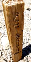
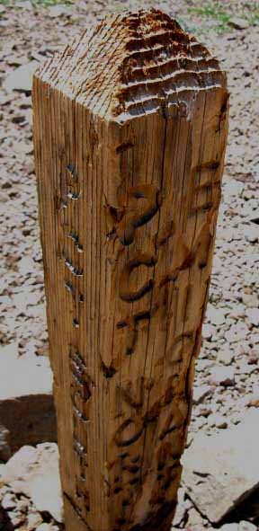
July 2012 Update The Kennedy Canyon trail junction sign post looks like a sacrificial victim on a rock alter. Not a great help at this confusing four-way trail junction that only identifies three of our four hiking route options. Trails to ALL Compass Points Hiking in from the North Southbound PCT Don't Be Fooled OK, no problem. Our compass will tell us the proper way: Turn East! Hiking South by the Compass The Tungsten Road brings us 6.17 miles South from this Kennedy Canyon trail junction to its junction with the Tahoe to Yosemite Trail at Grizzly Peak. Both the TYT and Tungsten Road routes continue South together from Grizzly Peak. Our Western trail option is kind of hidden. Hiking West Here we find indications of a faint trail tracking West down to and past Kennedy Lake to intersect with the TYT a couple of miles above Kennedy Meadows Pack Station. It's a total of 8.39 miles from this Kennedy Canyon trail junction West down the Tahoe to Yosemite Trail above Kennedy Meadows. If Bloom can ride his horse through here, most folks can hike it... The TYT-Kennedy Lake trail junction is 2.67 miles South of the gate at the Kennedy Meadows Pack Station. The 1985 series of USGS maps omits the trail above Kennedy Lake, the 1990 maps include it, but swing it around to connect with the Tungsten Road on the South side of Kennedy Creek, which it does. The new maps omit the faint tail of trail swinging Northwest up to the Kennedy Canyon trail junction, which it also does. |
Trail Post Down How about someone sending me an image of the new junction? Snap a photo when you walk by and send it to:
Emigrant Wilderness Trail Schematic
Kennedy Canyon to Dorothy Lake Pass
Sonora Pass to Tuolumne Meadows
|
Four-Way Trail Junction
On the Sierra Crest
KENNEDY CANYON TRAIL JUNCTION
THE SOUTHBOUND PCT East down Kennedy Canyon The Southbound Pacific Crest Trail takes a 90 degree Left turn East down Kennedy Canyon hiking off Leavitt Peak into the first of a web of creeks and rivers that all eventually feed the West Walker River drainage flowing North out of the High Sierras through Leavitt Meadow. Though the creek we are following flows East down Kennedy Canyon, it is not Kennedy Creek. Kennedy Creek flows West through the canyon down the West flank of the Sierra through Kennedy Lake, to the West of the Kennedy Canyon trail junction. We can fix that. |
Backpacking Route Options:
A Study of the Leavitt Meadow Trailhead
Short and Long Trip Hiking Options A lifetime of backpacking options Hiking down Kennedy Canyon we are hiking into the West Walker River Watershed of the Toiyabe National Forest. Our short hike past the West West Walker and its tributaries along the PCT show us that it's a good place to come back in and explore on its own merits. We're going to explore these options below. Leavitt Meadow Trailhead Leavitt Meadows is a trailhead along Highway 108 on the Eastern flank of the Sierra below Sonora Pass where we can access the West Walker River running South up its canyon wedged under the East flank of the Sierra Crest below Emigrant Basin.
The watershed of the West Walker River is virtually surrounded by famous wilderness areas. The Sierra Crestline runs above its Western edge marking the Eastern boundary of the Emigrant Wilderness. The West Walker River Watershed along the base of the East flank is part of the Toiyabe National Forest, but excluded from the Hoover Wilderness. The West Walker River is carved out from between the Emigrant, Hoover, and Yosemite Wilderness Areas and excluded from these surrounding wilderness areas. Leavitt Meadow Trailhead
We get indications of the unique character of the terrain in the watershed of the West Walker River as we descend Kennedy Canyon and climb out through Dorothy Lake Pass along the PCT. This small sample of the local terrain in the Toiyabe National Forest along the East flank of the Sierra we experience hiking by on the PCT will draw us back for more. We can craft great loops around Emigrant Wilderness or longer trips to destinations in Yosemite out of the Leavitt Meadow Trailhead.
|
Change in Environment Exposed Terrain to the North Exposed Terrain to the North Objective Hazards of Exposed Crossings
Terrain Transition The great volcanic ridge arms on both sides of Kennedy Canyon are directing us East down onto the great granite slab of terrain below, which we hike around its Western edge for most of the climb to Dorothy Lake Pass. Bottom of Kennedy Canyon I always get the feeling there is treasure out there... don't ask me why... well, I've seen things down there. Instead of treasure hunting, (scrambling East) we turn South with the trail to hike around the Western edge of the Walker Meadows to the West West Walker River bridge.
Exiting Kennedy Canyon At the bottom of Kennedy Canyon we turn South hiking along the top edge of this deep, dark, and strange forest, South to where the West West Walker is bridged.
|
What is this Strange Area? Entering this area through Leavitt Meadow Trailhead allows us to take short trips in to explore this complex little bit of terrain here at the bottom of Kennedy Canyon, longer trips pointing up the West Walker River itself, or long backpacking loops that circle back to the Leavitt Meadow Trailhead through the highest elevation elements of the Emigrant Wilderness and a bit of the Northwest corner of Yosemite National Park. Looking at the maps we can see that there are three potential routes from the West West Walker Bridge Northeast down to where the Walker and West Walker trails and these rivers merge before running down and out to Highway 108 through Leavitt Meadow and its trailhead. I want to hike out there and just sit there in the middle of it all and quietly observe. It's on the hiking list. Or in this case the "sitting" list.
The Basic Backpacking Approaches Expanded Route Options The section from Muir Ranch to the Portal is right up there in difficulty, but not for the average difficulty of the trails but for the length of the section between resupply points. I'd say Highway 108 to Tuolumne trail section has a harder average trail difficulty. Our hiking options from our Leavitt Meadow Trailhead are like a series of semi-circles of increasing diameter measured from our trailhead. Our backpacking loop options increase the further we hike from our start point to quickly become hard to count. Proper planning is essential for every backpacking trip. The good thing is that there are nice easy close-in loops for beginners, long hard loops for more experienced and fit backpackers, and trips between these long and short extremes that can be custom designed for your purposes and capabilities. Fishing? Photography? Observations? Drawing? Fitness? Hunting? Or just plain old "Backpacking Experience?" Emigrant Wilderness Trail Schematic Here's an example of a great backpacking loop out of Leavitt Meadow Trailhead. Lay of the Land The three routes to the West Walker Bridge from Leavitt Meadow Trailhead
West West Walker River Chain of Lakes West Walker River Each of these three routes is surrounded by sweet sections of uniquely sculpted granite formations filled-in with dark forests growing around bright meadows. The West Walker River cuts a nice canyon along the base of the East Sierra Crestline. It's a dark and mysterious environment which I find both refreshing and intriguing. Three Routes off of the PCT
|
West West Walker Bridge
We can figure out the miles from Leavitt Meadow Trailhead to Sonora Pass or Kennedy Meadows Pack Station with the figures above. Me? I'd hike deeper (South) into the Toiyabe and Emigrant before turning around... Southbound PCT Emigrant Pass Trail The main trail continues straight to the Southwest through this Y-junction following the West West Walker River up past its headwaters bowl through Emigrant Pass onto the Western flank of the Sierra under Grizzly Peak. ((We can follow the trail Southwest up through Emigrant Pass from the West West Walker and turn Northwest at Grizzly Peak trail junction to check out Brown Bear Pass on our way hiking down the Western Sierra flank along the Northbound Tahoe to Yosemite Trail, if we want to explore this particular line of the granite-volcanic interface across Emigrant Wilderness.
|
Old School The least amount of scouting would have revealed that the route up Kennedy Canyon over to Kennedy Lake would have been much more inviting than the routes over Emigrant and Brown Bear Passes. My thought that the first wagons down here crossed over the Sierra via the current location of the Kennedy Canyon trail junction is reinforced by the historical records that report the Bidwell-Bartleson and the first early parties crossing the Sierra Crest in this area reported crossing 8 miles South of Sonora Pass, which is almost exactly the location of the Kennedy Canyon trail junction at 7.97 miles South of Sonora Pass. I've always thought that bringing wagons up the West West Walker river was crazy, and doubly so without extensive scouting. Running a well-equipped and supplied team of horsemen and mules across the Sierra Nevada behind a competent scouting party would be achievable. But wagons? No frigging way. Not surprisingly, the shadow of disaster hung over all the first wagon teams that attempted the Sierra. "Success" was survival. Hike through here, check out the West Walker River up to Fremont Lake from Leavitt Meadow (crazy, with WAGONS!), and then compare the route up the West West Walker River against the route up Kennedy Canyon, and tell me which route you think you could get a wagon over, if you would be crazy enough to try either... I'd trade the wagons for mules, load my crap on mule-back, and walk my stock line over the Sierra.
Below I put together a history of early trans-Sierra travelers: History of Sonora Pass-Mono Road The West Walker Watershed The terrain to our East is quite different. Our PCT route through the West Walker Watershed walks between these two diverse terrains. A great burnt red volcanic ridge rises to our East marking the furthest Eastern reach of the West Walker River Watershed. We are hiking South between these divergent terrains with Granite terrain rising to our West up to the Sierra Crestline, where it runs itself under the great cap of volcanic material covering the Sierra crestline across the top of the Emigrant Wilderness. The Sierra Crestline to our West and the precipitous volcanic ridge to our East mark out the extent of the West Walker Watershed our PCT route crosses. Our route on the PCT up to Lake Harriet finds its way around the noses of the greater granite mounds and ridges tumbling East off the Sierra Crestline, more or less following glacial channels cut into the rock wrapping around their noses.
|
Route Options Eastern Sierra Loops From the West West Walker Bridge trail junction these routes are the Southbound PCT up to Dorothy Lake Pass, the Northbound PCT up to the Kennedy Canyon trail junction, and the old trail up to Emigrant Pass. All are located at various points along the Sierra Crest well bracketing Emigrant Wilderness. The Cinko Lake trail connects the trail up the West West Walker River to Emigrant Pass with the Pacific Crest Trail below Cascade Creek. Kennedy Canyon to Dorothy Lake Pass PCT Each of these successive trail junctions open up greater backpacking loops into the Emigrant Wilderness and puts us in position to bend our route back around to the North to end trips through the Kennedy Meadows and Sonora Pass trailheads, as well as back out through Leavitt Meadow.
The drawback of the trail South up and down from Leavitt Meadow Trailhead is the deep sandy conditions of the lower segment of trail. The sandy trail is the product of broken down soils caused by backpacker and horsepacker traffic. I've met an old cowboy dude out of Leavitt Meadows Pack Station working to keep the trail in good shape. The pack stations must do trail work to remediate damage done by their stock. This old boy is one piece of work. Ask him what time it is, and stand back... "Govt. Time? You want damn gobberment time?" "Are you crazy?," "Time is local." and "It gets dark at different times at different places." And so on... this old cowboy is a crack-up, and even more interestingly, he is completely correct. Time is local, and "government time" is not accurate enough for backcountry work. Astronomical Time is key for establishing time and direction. I deal with these topics superficially in the Astronomical Information section of the Navigation Chapter. The bottom line is that Sunrise, Noon, and Sunset are time and space reference points that set our internal compass and clocks. Also check out the Skills Links and the Forums below for more information.
Specific Backpacking Loops and Trips Why, trans-Sierra hikes, of course! Hikes across the Sierra from the East to West, replicating the situation faced by earlier explorers on foot. Well, we do have the great advantage of trails and maps. And great gear, and high tech food, and so on... Trans-Sierra Backpacking The Interface Route The Way In This area of the crest is a great sloped-flat along the crestline with a volcanic "floor" that has both volcanic and granite terrain rising out of, and around it. Looking around we find volcanic mountains centered on Big Sam, wrapping around the North and Eastern edges of the basin and granite mountains wrapping around its Western and Southwestern perimeter. This transition makes hiking up the Emigrant Trail a very pretty and interesting trail bringing us into the outright intriguing High Emigrant Basin. It gets better. Grizzly Peak to Brown Bear Pass Emigrant Meadow is ringed by massive volcanic mountains to the North and fine granite peaks around its Western and Southern perimeter. The low point of Brown Bear Pass to the Northwest above Emigrant Meadow is where we hike through the red and white interface line between the red rock to the North and the subtle golden-red-to white spectrum of colored and color-streaked granites to the South. The Jaws of Beauty This striking red-white volcanic-granite interface continues down the Western flank to our Northwest through Brown Bear Pass splitting the whole canyon down to Relief Reservoir. The South wall of the canyon are a spectrum of granite colors from golden to white, while the North flank of this great canyon is the uniform burnt volcanic red shared by the vast amount of volcanic material eroding off the North flank of the canyon. Summit Creek runs down the center of the canyon between its red and white canyon walls. The South flank of the canyon is the North flank of the massive chunk of granite called Granite Dome, while the whole Northeastern wall of this bifurcated canyon is the vast volcanic ridge dividing Summit Creek on its South flank from Kennedy Creek and Lake at the base of its North flank, capped along the ridgecrest by the pointy spire topping-off Relief Peak. This route West across the Sierra Crest out of the Leavitt Meadow Trailhead and up from the West West Walker River Bridge over to Relief Reservoir and Kennedy Meadows via Grizzly Peak along the TYT is amazing. It follows an amazing interface between granite and volcanic terrain up the East flank, across Emigrant Basin over the Sierra Crestline, and on down the West flank to Kennedy Meadows Pack Station. This is a very good example of "once you see it you can't unsee it." The "Interface Trail"
Leavitt Meadow to Hetch Hetchy Leavitt Meadow Trailhead to Hetch Hetchy: 44.83 miles Let's substitute the 17.48 miles South along the PCT from Sonora Pass to Dorothy Lake Pass:
The 16.91 miles from Kennedy Meadows to the top of Jack Main Canyon on the TYT added to the 27.66 miles from the South junction in the top of Jack Main Canyon to Hetch Hetchy equals 44.57 miles.
This is a sweet route that I've hiked a couple of times and would be delighted to hike again at any point in time! I have worked on scouting it out for Winter travel, but that's been put on hold. I caught some frostbite in early 2011 that has been problematic for Winter travel since, and for Summer travel when I found its cause in 2012. |
South of West West Walker Bridge Dark Shadow and Bright Light We hike South, taking a Southbound Right turn through the Cascade Creek trail junction. If we turn Left, Northeast, we'd be dropping down to the West Walker River in its canyon. We
turn South with the PCT following the diminishing forest cover climbing along Cascade Creek up to Lake Harriet. The last 1.18 miles South from Lake Harriet to the Sierra Crestline climbs up a couple of hundred feet of elevation across fully exposed terrain bringing us past Stella Lake. Stella Lake is just below the low channel over the low neck of the Sierra Crest called Dorothy Lake Pass. Both Lake Harriet and Stella Lake have fine campsites, as does Dorothy Lake just below the South side of its namesake pass. Crossing the Sierra Crest into Yosemite We can follow Falls Creek for 29.4 miles South from Dorothy Lake Pass down the West flank of the Sierra to the Road at Hetch Hetchy. Though the West Walker River rapidly exits the East Sierra, it still has a nice run to its end. The West Walker River and Highway 395 run North through the narrow canyon North of Sonora Junction to empty into Antelope Valley. Here Highway 395 cuts around the West edge of the valley while the West Walker River runs across Antelope Valley to its end at Topaz Lake on the far North end of Antelope Valley.
|
Segment Recap Though we can bend routes through the West West Walker River Bridge from our other Highway 108 trailheads, only the trail out of Leavitt Meadow Trailhead explores the three possible routes across the complex terrain leading us up to the PCT at the West West Walker Bridge. Bond Pass Perspective The Way Back Sonora Pass Region Hiking Map Grizzly Peak Trail Junction To our Northwest the TYT follows the stunning "Red and White" canyon holding Summit Creek down the West flank to Kennedy Meadows Pack Station via Relief Reservoir. To our Northeast the trail through Emigrant Pass brings us down to the PCT at the West West Walker Bridge. To our North the mass of Big Sam sits between us and the Kennedy Canyon Trail Junction. Layers of Complexity and Beauty Local Delights It Wants More! It is time well spent.
|
FURTHER YET For example, I once turned Southwest from Grizzly Peak and made up my own route hiking cross country down to Pinecrest Lake, located just off Highway 108 near the Summit Ranger District station near Strawberry. That was a real adventure. The Emigrant Basin is full of scrambles. Granite Dome to the Southwest of Summit Creek is a veritable paradise of granite scrambling as is the terrain all around the Emigrant Basin. |
Variable Loops Which one we turn around through depends upon our particular constraints of time, money, or stamina we each face, as each of these turnaround junctions is further out from our Highway 108 trailheads and further expands our backpacking loop. |
Options from Kennedy Canyon Trail Junction Hiking to Grizzly Peak from any direction allows us to bend our route North back through the Kennedy Canyon trail junction, from where we can turn to end our local backpacking trip through any of the Highway 108 trailheads. Check out the maps and schematic to chart our long distance and loop trip options.
Emigrant Wilderness Trail Schematic
|
Joy of Emigrant Wilderness The high altitude terrain along the Sierra Crestline South of Sonora Pass makes the Emigrant Wilderness and the adjacent section of the Toiyabe National Forest a frkn treasure chest of on and off trail four-season wilderness experiences. Hiking through Emigrant Wilderness on the Tahoe to Yosemite and Pacific Crest Trails gives us some good looks at slices of the Emigrant Wilderness and the nearby Toiyabe NF. We're going to have to come back for backpacking trips to turn these thin slices of trail knowledge into big fat backpacking loops delving much more deeply into the local terrain. I've hiked into Sonora Pass from the East and the North during Winter. This place is full of great experiences. You just gotta get yourself out here. Check out the trail junction in Grizzly Meadow and consider that position as a key junction for local backpacking trips potentially exploring all points of the Emigrant Wilderness, and its adjacent Toiyabe National Forest and Yosemite National Park areas. For a "bird's eye" description of the Kennedy Canyon trail junction in the context of its surrounding terrain, let's take a look down at it through this brief video (below the schematic) from the top of the South flank of the mountain to the North of the Kennedy Canyon trail junction, the Leavitt Peak Massif. Kennedy Canyon to Dorothy Lake Pass
|
Emigrant Wilderness
Backpacking Loop Schematic
Time to get your Loop On?!
Map Correction: WW Walker River Bridge to Emigrant Pass: 3.84 miles.
NEW SCHEMATIC
BACKPACKING MAP
OF
EMIGRANT WILDERNESS

Big Version
Video
Kennedy Canyon Trail Junction
Options
View from Tungsten Road/Pacific Crest Trail junction while standing on Southeast flank of Leavitt Peak. A "Birds Eye" view of the Kennedy Canyon trail junction and its hiking trail options. 1:13 minutes Sonora Pass Region Hiking Map
|
Video
Hiking the length of Kennedy Canyon
Video The 2.46 mile length of Kennedy Canyon from the bottom of the canyon on the East flank of the Sierra up to the Kennedy Canyon trail junction located on the low saddle between the Eastern and Western flanks of the Sierra Nevada. 14:01
|
Looking East down Kennedy Canyon
 |
||
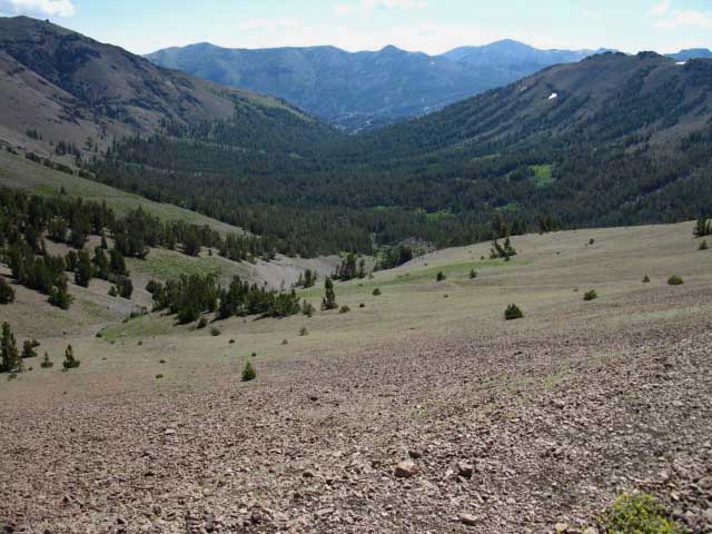
Kennedy Canyon The West West Walker River is at the base of Kennedy Canyon, though we will not see the river until we reach the bridge over it, after turning South out of the bottom of Kennedy Canyon. The Pacific Crest Trail bends to the Right, to the South, at the bottom of the canyon. Looking down to the base of the canyon we can make out a mound rising from Walker Meadow between the mouth of Kennedy Canyon and the high ridgeline beyond. We can see this feature more clearly from the Southeast ridge arm up on Leavitt Peak. That's a complex and beautiful bit of granite, rivers, meadow and forest terrain down there... I've been meaning to see if I could get myself lost scrambling down there between the bottom of Kennedy Canyon, the Chain of Lakes, and Walker Meadows. Of course I'd find myself again, after exploring some new territory. It's on the list... I'll bet there are some ripping fine campsites between Chain of Lakes and the bottom of Kennedy Canyon. I can't write about it with authority, as my last trips through there we in the early and mid 1990s! But they were great trips that I still remember with fondness. We can also see the faint brown line cut into the terrain by the Pacific Crest Trail's route into Kennedy Canyon across the green grasses of the hillside descending from the middle-Left of the image above.
|
Kennedy Canyon
 |
||
The Eastern boundary of the Hoover Wilderness runs along the crest of the distant volcanic ridge. The Little Walker River drains the far flank of the volcanic ridge across the bottom of Kennedy Canyon. The Little Walker contributes to the West Walker River's flow just South of Sonora Junction. The West Walker River flows North along the base of the East Sierra flank into Antelope Valley and Lake Topaz in the North end of Antelope Valley. Sonora Pass Region Road Map Southeast of the Little Walker River the series of creeks and canyons draining the East flank of the Sierra down to Conway Summit all drain East through Bridgeport Valley into Bridgeport Reservoir.
|
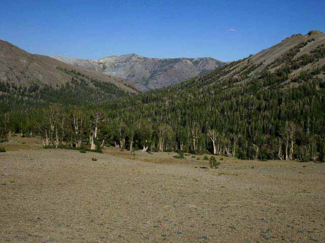
Down to the Edge of Forest at the Top of Kennedy Canyon
 |
||
Into the Top of Kennedy Canyon This is the last point Southbound backpackers get long views East down Kennedy Canyon. A few feet further South down the PCT brings us under dense forest cover, terminating the long views. No problem. We have been hiking for miles across exposed high altitude terrain, and the shade is welcome. We are located at the top, the West end of the forested section dropping into Kennedy Canyon below the Kennedy Canyon trail junction hiking South. Northbound PCT hikers will be exiting the forest for the first time since turning Northwest at the Cascade Creek trail junction below Harriet Lake. Northbound hikers will be crossing 13.37 miles of high altitude exposed volcanic terrain from this point until they drop into the forests along the East Carson River North of Sonora Pass. Southbound PCT hikers will travel under forest until the trees thin reaching Cascade Creek as we climb towards Lake Harriet.
|
North and South Views from the top of Kennedy Canyon
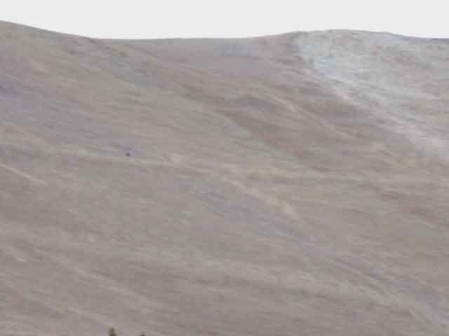
Looking Northwest at the PCT climbing the mass of Leavitt Peak's Southeast flank
 |
||
Southeast Flank of Leavitt Peak See that black dot just above and left of the center of the image? That's him. I had seen him hiking North past Lake Harriet the previous day, and camped with him and two nice ladies hiking to Tuolumne Meadows along the PCT at the Kennedy Canyon ford campsite the previous evening. Check out the view of Kennedy Canyon and that section of the Pacific Crest Trail's route up the Southern flank of Leavitt Peak shown in the image above, but also the view looking down on this section of the PCT from up there, from the Southeastern end of the South flank of the Leavitt Peak Massif. From down here we can barely see the hiker, let alone the trail. From up there we can make out the route of the trail up the Southern flank of Leavitt Peak, and are also overlooking all of our upcoming hiking options to the South out of the Kennedy Canyon trail junction.
Sonora Pass to Tuolumne Meadows Miles and Elevations |
Looking East (South on the PCT) down Kennedy Canyon
 |
||
Northbound Hikers to the top of Kennedy Canyon Northbound PCT hikers begin climbing from the 8600 foot low point South of the the bottom of Kennedy Canyon at the West West Walker River Bridge. From the West West Walker Bridge Northbound hikers have a 9.97 mile hike up to the 11000 foot highpoint through the gap above Latopie Lake crossing over the Leavitt Peak Massif.
2400 feet over 9.97 miles Above we see Joe and Meredith hiking North on the PCT route out of Kennedy Canyon's dense lodgepole forest into the open terrain approaching the Kennedy Canyon trail junction. Let's hike down and see the campsite at the top of Kennedy Canyon they used the previous evening. |
Campsite at the Top of Kennedy Canyon with Happy Campers
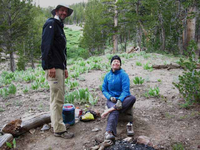 |
||||
Campsite at the top of Kennedy Canyon Joe and Meredith getting ready to hit the trail from their fine campsite at the top of Kennedy Canyon. Meredith gave me some ibuprofen. Funny story. I had counted out the required amount, but brought the wrong pill bottle... Thanks Meredith! Meredith was hiking through some leg problems that I would not even hike on. Let's all hope she has recovered, because Joe and Meredith are great folks to meet on the trail. Meeting good people on the trail is an important part of my hikes, and I hope you all are all still getting out there. Know that I'm always fighting to get out. Meeting good folk in our massive urban crap-centers is not easy. The wilderness is an excellent "people filter" which blocks out many of the spiritual, ethical, and social lightweights that we manufacture and import in massive numbers into our massive cities, AKA "consumers." At least we are still manufacturing something... The wilderness remakes or breaks the urban idiot in each of us. I'll see you all out there!
|
Campsite at the Top of Kennedy Canyon
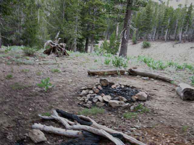 |
Upper campsite Kennedy Canyon Pacific Crest Trail. It seems particularly empty without the character and spirit of Joe and Meredith lighting it up better than any fire. |
Kennedy Canyon
South into the Forest
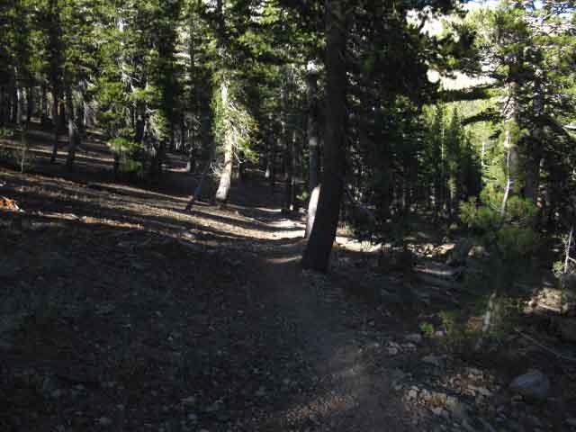 |
||||
Look at those surging young lodgepoles! Into the Forest. Finally! Sweet shade for the first extended period since climbing out of the forests into the headwaters bowl of the East Carson River on the North side of Sonora Peak. We have been fully exposed for too many miles across Sonora and Leavitt Peaks with very small exceptions, until now. Sweet Shade! Soft Trails! The impact of Sun and terrain diminished. We will remain within shady forest for 8.33 miles until the forest begins to break-up and thin out approaching the tree line climbing up Cascade Creek to Lake Harriet. Above Lake Harriet we enter a short treeless zone until we climb down into the thin forest cover around Dorothy Lake. Below Dorothy Lake Jack Main Canyon's series of alternating forest, meadows, and granite terrain below Grace Meadow keep any one environment from predominating.
|
Map Note The Maps Neither does the USGS 30 minute Bridgeport map of 1985 show the ford. Both of these maps are incorrect. I have corrected them as best I can on the guide maps. Both of these USGS maps cited above depict the Pacific Crest Trail following the North shore of the creek all the way through Kennedy Canyon to a fording point over the creek in Walker Meadows below Kennedy Canyon. The Reality I have always considered Kennedy Canyon to have two fords, though I am mistaken. What I considered the upper ford is the heavy Spring wash in the upper reaches of the canyon. This is a part-time ford, as it only is running when the early Spring Thaw is running through it. There is one year-round ford in Kennedy Canyon, located a little less than halfway down the canyon. The ford spot has two real nice campsites on the Northwest shore of the ford. Nonetheless, early season backpackers will find at least two fords confronting them. The upper wash will be flowing like the Dickens during the Spring Thaw, and you will find many of the dry tributaries of late Summer are surging creeks during early Spring. Route The PCT route continues South along the North bank of the creek, then crosses over to the South bank of the creek in Kennedy Canyon below the ford point, remaining as high up on the canyon wall as possible where our trail turns South out of the bottom of Kennedy Canyon. The reason for this route change is pretty easy to suss out. The old route plunged down into the meadow. Have you ever tried to maintain a trail through a meadow? Better to swing the trail as high up above the low ground as possible. Kennedy Canyon to Dorothy Lake Pass These differences between map and trail tell us that there is likely a route down to the forest and meadow at the bottom of Kennedy Canyon along the North bank of the creek below the ford. The old maps show us a trail that is likely no longer maintained, meaning that it has likely devolved to the status of a route. This route fords the creek below the mouth of Kennedy Canyon. This lower fording point assures its flow will be stronger, as its downstream location collects more water, but the creek is possibly wider down in the flat meadow area where it's not running within narrower banks as it is up in Kennedy Canyon, making this old ford potentially both more and less suitable as a ford at the same time! This old ford should be no problem during Summer, but could be problematic during Spring. On the List I've come up via Chain of Lakes a couple of times, had great trips, saw beautiful things, but the last trip I've taken below the West West Walker Bridge was in the early/mid 1990s! If you've scrambled around in there recently, post up your impressions and experiences below. I'd like to see some pictures!
|
View
Southwest
out the
Top of Kennedy Canyon
Southwestern View across upper Kennedy Canyon |
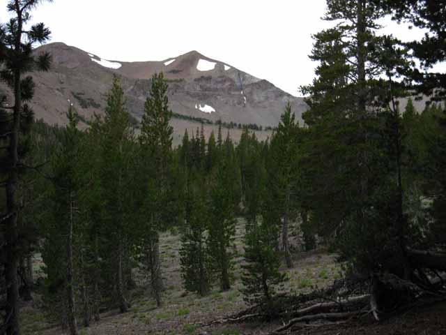
This view looks Southwest out the top of Kennedy Canyon We are taking our last look Southwest up and out the top of Kennedy Canyon before hiking deeper into the trees and the terrain which will end our views West out of the top of the canyon. We are looking across the Sierra Crest at the peaks above the Tungsten Road on its way to climb Big Sam. I am pointing at this exact same position from the very different perspective of being up on Leavitt Peak in the static image on the cover of this video above. We can see Peak 10827 on the upper Left edge of the image along the great volcanic ridge arm that makes up the South wall of the canyon-Sierra Crestline above the headwaters of Westward flowing Kennedy Creek. Kennedy Creek flows down the Western flank under a line of peaks capped by Relief Peak. Interestingly, the ridge those peaks sits on also runs down this flank, the East flank of the Sierra to our Left in the image above, making up the South wall of Kennedy Canyon down the East flank of the Sierra above us, as it also makes up the South wall of the canyon down the West flank above Kennedy Creek. Kennedy Canyon to Bond Pass High Emigrant Basin I started thinking about it as a basin after entering it from many directions, mostly from the North. Up the East flank through Emigrant Pass, the West flank through Brown Bear Pass, and over Big Sam. These various perspectives informed me of a long, rectangular flat along the very top of the Western flank of the Sierra between Big Sam to the North and Bond Pass to the South. It is as if there is a ledge along the Sierra Crestline. I would use the term "Emigrant Basin" in conversation with backpackers, horsepackers, and the hunters and fishermen they pack around the Emigrant Wilderness referring to this area. I consider the High Emigrant Basin to be a flattish rectangle running North-South along the Sierra Western Crestline encompassing the three high altitude meadows between Big Sam and Bond Pass situated at between 9200 to 9600 feet of elevation. These would be Emigrant, Grizzly, and Summit Meadows. Once we drop off the South end of Big Sam to Bond Pass the high point of the Sierra Crestline is Grizzly Peak, which is a weird volcanic (metamorphic?) anomaly sticking up like the proverbial "sore thumb" over an otherwise flat, nondescript "low" run of terrain along the Sierra Crestline. By "low" I mean an average elevation of 10,000 feet along the Sierra Crestline, and maybe an average elevation of 9700 feet for the route of the Tungsten Road across Emigrant Basin. Here's a view of Emigrant Meadow and Grizzly Peak in the Emigrant Basin from Brown Bear Pass. Here's a view of Emigrant Basin from Big Sam. Big Sam is out of sight to our Left (North) in the first image linked to above, while Grizzly Meadow is out of sight wrapped around the base of Grizzly Peak. I measure the width of the Emigrant Basin by the width of the chain of meadows along the Sierra Crestline between Big Sam/Brown Bear passes South down to Bond Pass. Though I prefer backpacking the "top" end of the Emigrant Wilderness, through Emigrant Basin and its associated trails, the Emigrant is beautiful from top to bottom. My imperative to hike both "long" and "deep" is knocked a bit off kilter by the draw of the beauty in Emigrant Basin. It distorts my route-planning to include more and more of Emigrant every time I hike through, drawing me to cross it by every route possible each time through until the Emigrant has actually drawn me into planning long distance loops remaining almost entirely within the Emigrant Wilderness. The Emigrant Wilderness is catnip for backpackers. Back to the top of Kennedy Canyon Again, check the image fronting this video above to get a contrasting perspective of this same position, looking down on it from Leavitt Peak rather than up at it from Kennedy Canyon. That low flat divides the Eastern and Western flanks of the Sierra. Beyond that flat we are looking Southwest towards Big Sam, which is obscured behind the tree on Right side of the image. We can make out its rounded shape through the tree. Again, see the video above to precisely identify and locate Big Sam's position. The Tungsten Road The Tungsten Road bends onto a track carved right into the face of the mountain flank facing us below those two peaks above on its traverse over to first circle around the canyon to the East of Big Sam, then climb the switchbacking route up Big Sam's Northeast face and around its rounded 10825 foot peak crossing into the "High Emigrant Basin." This Tungsten Road route over Big Sam intersects with the Tahoe to Yosemite Trail at the trail junction under Grizzly Peak. Big Sam to Grizzly Peak
USGS 30 min backpacking map Miles and Elevations for Both Routes South
|
Down Kennedy Canyon
The Great Wash
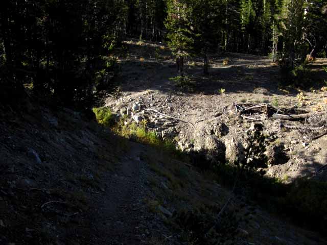 |
||
Not a Ford Great Wash above the campsite at the Kennedy Canyon ford. I note the violence of this feature every time I pass through. This runoff gash reflects the "hidden in plain sight"violent character of Kennedy Canyon during a surging Spring Thaw. Before we dropped into Kennedy Canyon we should have noticed the great slashes in the forest decorating the Southern Wall of the canyon. These slashes are avalanche paths indicating the violent nature of Wintertime action in Kennedy Canyon. The USGS map even shows the avalanche tracks through the forest. The great wash pictured above showcases the now drought-forgotten power of the Spring runoff, while further down the canyon we can see how the canyon itself is deeply cut out by, and to accommodate the wide swings in the volume and power of the Spring runoff over the centuries. The weather pattern that supported the current configuration of life and terrain has slipped out of its ancient pattern into a new and very different pattern. This change in the sky is being followed by changes in how water and plants cut the terrain. I always considered this wash one of two fords in Kennedy Canyon, but it only runs during the Spring Thaw. There are two fords in Kennedy Canyon early in the Spring thaw, the one pictured above being the upper ford during the height of the Spring Thaw. Later in Spring and through Summer we find the ford half-way down Kennedy Canyon to be the only year-round ford. Kennedy Canyon to Dorothy Lake Pass
|
Southbound Pacific Crest Trail
Soft, shaded, downhill. Lined with rocks. I'm in frkn love.
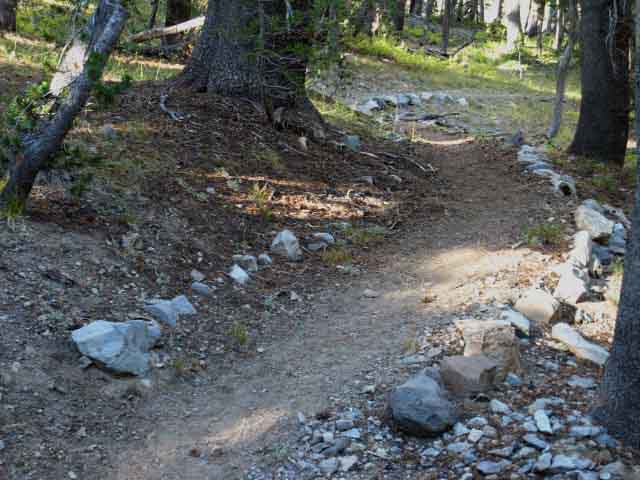 |
Trail Up Kennedy Canyon A nice soft trail that helps dissipate the impact stresses of downhill hiking. For me, as a dedicated North to South hiker, Kennedy Canyon down to the WW Walker Bridge is where I can really lay down a blazing pace, if I am so inclined, the body feels up for impacts, and/or the situation requires it. This will also be true for the long 10 mile 1520 foot descent down Jack Main Canyon after we cross into Yosemite. Both of these long, soft downhill sections can help bring our hiking plan back up to date! As we noted above, we have a run dropping 2400 feet over 10 miles from our high point crossing Leavitt Peak down to our low point at the West West Walker Bridge. We can cross these two ten mile segments of trail quite rapidly. |
Big Campsite
at the
Kennedy Canyon Ford
 |
||
Kennedy Canyon Ford Campsite 2009: Looks like my pack exploded all over the campsite at the ford in Kennedy Canyon. The creek flows by in the background. Massive fire ring. Good sleeping flats. Two distinct campsites on North bank.
|
July 2012
Much Busier at the Kennedy Creek Ford Campsite
 |
||||
Hiking Team Women are great hikers, if they give themselves a chance. I've repeatedly seen women perform at super high levels of strength and endurance. I don't believe that women have as much strength and endurance as men, but they have the capacity to suffer extended stress and pain at least as well as men. Women have inherently high levels of pain endurance. There are two distinct campsites on the North side of the ford. The large site pictured above sits on the Right side of the trail. A few feet further North past this site brings us to a smaller site on the Left side, the South side of the trail.
|
Walk in the Park
FALL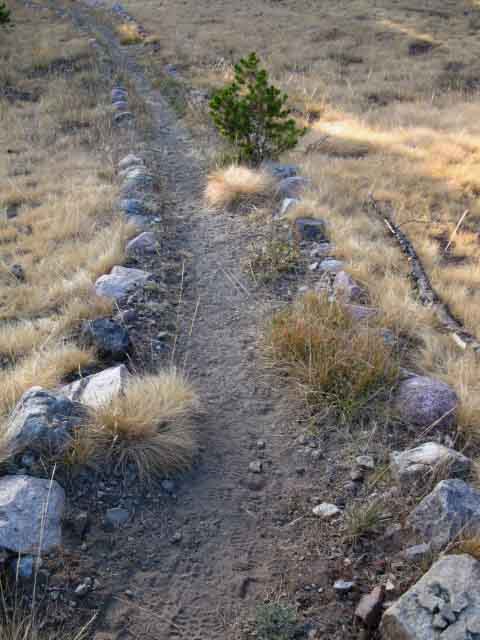 |
View East up Kennedy Canyon Kennedy Canyon Trail in Fall. Note the fresh footprints. We are close behind a couple of backpackers. Note the steady angle through Kennedy Canyon. |
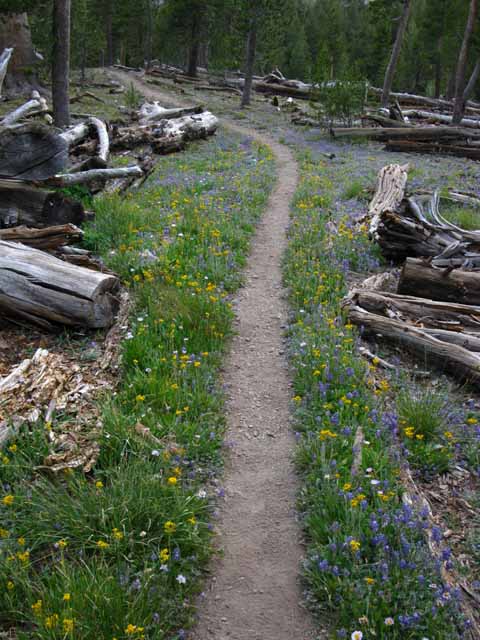 |
View East up Kennedy Canyon Vibrant early Summer Flowers and soothing green lining the Pacific Crest Trail through a section of old blown down lodgepoles looking Northbound up Kennedy Canyon. |
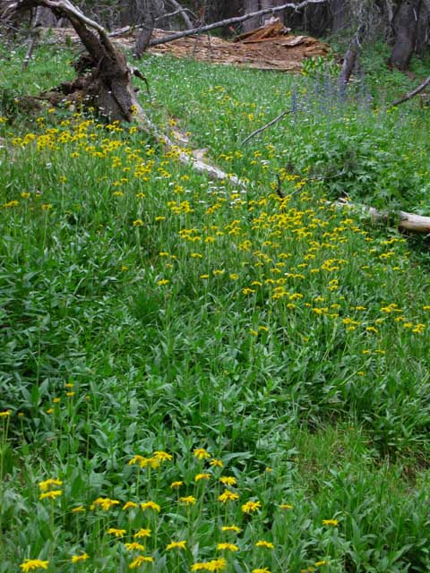 |
||
Lovely Lushness Dense Daises overwhelming fallen timber under a lush bit of meadow along the trail down Kennedy Canyon. Why We Work Folks can't enjoy sublime beauty when they hurt. Pain Pleasure Balance Pain is as real as beauty, and both are centered and balanced, or unbalanced within each of us by our expectations of what life is, and especially life on the trail. The expectations we hold hiking the trail of life determines a great bit of how we look at it, which is the framework that determines what we see and feel. The Instrument of Safety Safety First! Perception was the first human "safety device!" It turns out the dangers of perception are as great as its advantages. Break on Through to the Other Side Our training and our approach to the trail are breaking and reshaping our social concepts of physical pain and psychological expectations to something quite new yet very old. We are crossing over from life as a set of self-centered social expectations to life as physical engagement Shared with Nature. How we socially conceive of time, space, and our own character, the very context and values of our social identity and values can be tested, broken, and restructured in the natural context. Moving our mind and body back and forth over the interface between the Social and Natural realities echoes the birth of our fundamental perceptions of time, space, and self-reflective life itself. The birth of self-reflection gave us our first look at this living machine of life. Mankind used this consciousness to build a series of gods that are little more than mirrors of our own violent desires, rather than the profound forces of life they are. Well, I say go look for yourself. Feet Back on Earth... But first we've got to absorb and get beyond the psychological strains and physical pains to open our inherent abilities to engage and deeply reflect the deep beauties which live and consolidate in large natural spaces. These spirits of life move through forests, soils, living things, and the water and sky around living things. The Natural Spirit of Life does not travel through roads, bridges, buildings nor the massive footprints of our vast cities. Only social spirit moves through those things. Some folks in the cities reflect the natural spirit of life, but cities themselves block and choke out the spirit of life. This gives our physical training a purpose. Our goal is to maintain and keep our "instrument," our physical body and its basic perceptive apparatus, sharp, clear, and ready for deep reflection of, and fit for engagement with nature. We need to build an instrument to create the drumbeat of life with the cadence of our steps through nature over a month or more. See It Yourself I suggest that It be left on Its own terms, and not be limited by ours. It is beyond species, let alone individuality, gender, race and culture. It is the source of all these things. It is all things, but It is most focused in the dancing vortex of time, space, matter, and energy sitting at the center of all things. That's what It is and where It is: At the center of everything existing. You and Me and the Rocks and the Trees... The rest, being what to do with this great power, is up to us.
|
Shattered Lodgepole Pine
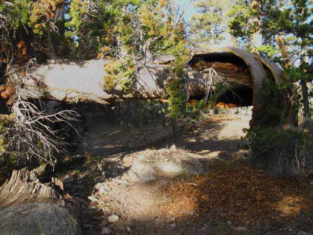 |
||
Life and Death on the Trail Trail crew has since cut away the top section that fell across the trail. The lodgepoles seem to grow internally like a unicorn horn, in a spiral motion and shape. The Pine and Fir forests are nifty. The Brethren Thus the Sierra Pine and Fir forests move across terrain on a magic carpet of their own dead. These tidal movements are only clearly seen over decades and centuries, in the movies of our reflective mind. This lodgepole above is adding to the biomass of the soil its brethren will grow and benefit from. Everything we see in the Sierra is a "snapshot," a very thin slice of reality "frozen" at a particular point in a very long stream of time, while in fact the weather, the geological uplift and erosion, and the life cycles of the plant and animal life across it are participating in a much greater and longer process than our superficial "snapshot" observations indicate or reveal. The problem is not the forests, but that we can't know what we are if we don't know what it is, what this process is, and what it is doing before we unalterably change it. A good long walk through it offers fundamental context measuring the vast gulf between our long term external natural and short term internal "social" realities. Kennedy Canyon to Dorothy Lake Pass
|
Creek and Trail
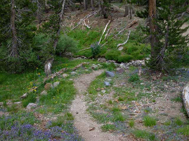 |
Park like scene at tributary in lower Kennedy Canyon. Veins of vibrant green follow the stream tracks. Though far from any contrived scene, we find beauty that far exceeds that crafted by the hand of man. |
Dry
Spring is a Local Thing
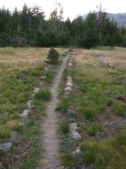 |
||
View West-Northwest by the compass up Kennedy Canyon A subtle line between green and brown grasses marks this moment's location of the moving local balance between between moist and dry. The last bits of Summer's greening moisture is finally evaporating out of soil and plant, this final stage of drying slowly driving the crisp golden colors of Fall down Kennedy Canyon.
|
Lush
Kennedy Canyon
Thick with Young Lodgepoles, Dense Groundcover, Soft Trail
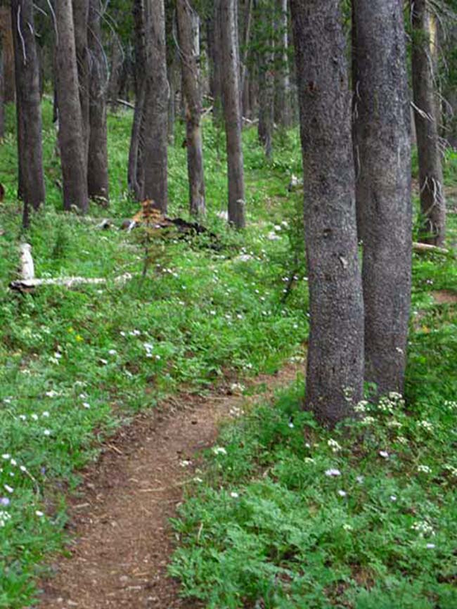 |
||||||||
Quiet Green Zone This area of profound and profuse lodgepole growth is the other side of the coin of great swaths of lodgepoles being blown down by blights and avalanches during Winter. The Sierra Nevada Hiker's Seasons Recent history shows us that the High Sierra Hiker's Seasons are not determined by dates on the calendar. The wise High Sierra Hiker is guided by and geared for the potential as well as current conditions on the ground and in the sky, the prevailing trends, and certainly not guided by dates on a calendar. Trail and weather conditions often do not correlate with dates on the calendar. Let the conditions on the ground, not dates on the calendar guide our trip expectations and gear selection. The trends are clear. Over the last 15 years Summertime has expanded significantly, Fall pushes to the doorstep of Winter and kicks it down, and Spring begins earlier and earlier each year, if there is a Winter to thaw. Summer backpacking has started earlier and pushed later over the last 20+ years. These "new" weather patterns pushing good conditions both earlier in Spring and later into Fall have drawn more folks into the Sierra earlier in Spring and later in Fall, when the odds of extreme weather increases. So, we can't just be ready for the weather that will "most likely" happen, but the weather that can happen. These conditions can increase dangers. More backpackers are out in fine late Fall conditions now have greater chances of "getting caught out," by an unexpected Winter storm blowing in early. More hikers starting out in early Spring Thaw conditions are now more vulnerable to catching late Winter storms. Especially if we are hiking deep into Fall and earlier into Spring with the "end of Winter" in the High Sierra. Tahoe to Whitney Weather Resources Forewarned is Forearmed. We link to local High Sierra real-time ground reporting stations along and near the trail routes, to local forecasts, to the local radar, and to the hemispheric satellites and weather maps that provide us with the current information from on-the-spot ground-level conditions to "over the horizon" views into our weather future.
OPC more weather above Wet and Dry Crazy Seasons Reciprocally, at the end of the Summer of 2012 these dry conditions initiated a very early transition to Fall. Dry Fall conditions almost persisted into the first day of Winter. The Winter of 2013 brought little but disappointment. This is exactly the opposite as 2011, when a super-heavy Spring snowfall added to an already super-heavy Winter snowpack to keep snow on the North facing high trails through October. Heavy snow persisted above moderate elevations on North-facing mountain flanks through the whole Summer. One year the trails were clogged with snow, the next there was no snow to be seen. The Winter of 2014 demonstrates that we have brought unmitigated disastrous weather down upon ourselves. The global circulation of heat is completely different than it was 20 years ago. The seasons of my childhood are long gone. Our standards persist as conditions change All of these factors have tended towards much earlier beginnings of Summer hiking conditions and their persistence deep into Fall. Winter hiking conditions have reciprocally deteriorated, bringing much less snow over much shorter Winters. I traveled across West Texas during 2006, as part of a complete 8500 mile circumnavigation of the nation of Mexico. I talked to a bunch of West Texas Ranchers. They were completely freaked out by the changes in the seasons, the different wind directions, and the change in the "feel" of the air. They were experiencing biblical plagues like locusts, floods and mini-droughts before this latest drought expanded. The citiodiots? Er, I mean consumers of the Empire? Er, I mean city-folk. Well, Not so much... The problem is that at least 70% of people who live in the USA have no idea about, or any connection at all with the local annual weather patterns where they live. None. They have much deeper relationships with their smartphones and software than with nature. That's the sad center of our problem. Highly Variable Opening and Closing Dates of Trails , Water, Mosquitoes and Fire One consequence of the radical change between the Winters of 2011 and 2012 was felt in the radical difference in each year's mosquito cycle. The heavy snowpack of 2011 did not just block the High Sierra Nevada trails deep into August. It fed high mosquito conditions all Summer long. This wetness also sustained mosquitoes through Summer into Fall. Mosquito populations remained vibrant through the whole moist Summer of 2011, and only diminished with Fall's dropping temps, rather than running out of water in mid August, as is typical during "average" years. 2011 was frkn amazing. This changed radically the next year. The exceptionally dry Winter of 2012 was followed by a mild Spring. This lack of moisture brought weak Springtime mosquito populations which declined into oblivion during early Summer. From one extreme to another in successive years. These changes are indicative of a destabilized system. The normal "drop dead" date when most Sierra mosquitoes are dried out of existence happened two weeks earlier during the Summer of 2013 than the "average" dry-out "drop dead" day, which averages out to August 15. Near Term Implications The problem is that trees don't run as fast as temperature changes. Thus we have the spectacle of great ancient forests growing in zones that will not support them into the future. Rather than a gradual transition between eco-zones we are seeing the forests burn. This bio-transition has already begun and is in motion. Our inaction in the face of these changes over the last 40 years has already assured this progression will transform the Sierra during the next 40 years. Maintaining growth into the face of ecological and economic failure is much worse than foolishness, it is evil. Evil Who does that sound like? The Great Threat One without the other is doomed. The solution is simple. We've just got to stop doing evil. Evil to our environment comes from the evil we've done to our Constitution. To put the problem even more simply, we must restrain our greedy and their greedy corrupted ways. It's simple: Backpacker Observations The lesson of these radical changes in the seasons from year-to-year for high-altitude long-distance backpackers is quite simple. Each and every season has its own character and its own timing. We must be aware of the character and timing of each season, and the particular hazards and advantages each brings. Each season generates its own very specific range of gear requirements. It is our responsibility to select the proper gear for the current range of Sierra conditions, and know how to use this gear under less than optimal circumstances. Every year's Spring is unique, with the timing of when the heavy Spring runoff begins in earnest to the time when the snows finally clear from the high elevation passes being different. Unexpected deep snow significantly slows backpacker hiking speeds. Creeks and rivers raging with the Spring thaw are often too dangerous to cross. Remember, river fording and lightening kills the most backpackers. Having great weather information is vital. Each year's Fall is different as well. When conditions shift from Summer to Fall determines when our gear kit must shift to heavier insulation to accommodate the changing conditions. Some years carry Indian Summers into December. Other years put down two feet of snow in October, though that is becoming rarer each year. Backpackers not informed or prepared for these potential conditions can be killed. Observing life responding to each year's unique evolution though its unique seasons is one of the standard and fundamental pleasures and practicalities of life, and vitally necessary for properly planning and gearing for all backpacking trips. Knowing what nature is doing around us is good, if disturbing. Backpacker Assumptions The calendar has often told me it's time for Summer Backpacking Gear when conditions on the ground and in the sky tell me my Spring/Fall Gear Setup is still very necessary. Our job as backpackers is to observe and interpret the requirements of each season and every situation, and meet them successfully. This requires some careful observation, considered reflection, and effective action. Check out the Trail Skills page. *** Aesthetics Zones like this run deeper than perception, creating food and habitat for chains of plant and animal life who's mutual consumption balances these islands of life over thousands of years. It is delightful to observe the subtle range of experience these little green zones of fragrant cool and quiet offer. Yet observing the range of beauty within these little concentrations of life through seasons over years deepens into terror as these spaces are threatened by abrupt Winters, very early Springs, and the growing potential of an impending Endless Summer. I strongly suggest those inclined to experience this natural wonders of the High Sierra to do it now. It is changing rapidly, and its ancient natural character is being rapidly lost due to the influences of man. Kennedy Canyon to Dorothy Lake Pass
|
Yes, this is still the Pacific Crest Trail
 |
||
Pacific Crest Trail Emblems Pacific Crest Trail emblems are our constant companions all the way down our trail from Desolation Wilderness to the Crabtree trail junction East of Mount Whitney. Pacific Crest Trail emblems are generally posted at the beginning and end of geographic features such as we see here at the ends of Kennedy Canyon, in the directions the PCT enters and exits trail junctions, across various confusing points along the trail, and at sometimes seemingly random points along the trail. Here's a few examples of different styles of PCT emblems:
|
Finally
The Northbound Trail Turns West to hike up Kennedy Canyon
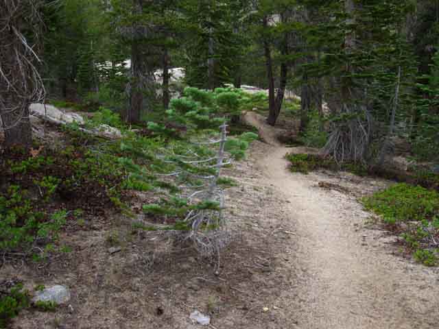 |
||||||
The Ninety Degree Bend in the Bottom of Kennedy Canyon Northbound Hiking up Kennedy Canyon means we are not too far from the campsites at the ford, but it's not too long to sunset either... the daily race between impending sunset and our declining pace progresses to the end of another day. Good thing twilight provides 45 minutes of diminishing light after sunset. Entering the bottom of Kennedy Canyon steepens the steady climb that we began hiking North from the West West Walker River Bridge. Great, save the best for the last part of an already long, hard, and very rewarding day of hiking and exploring. Northbound PCT Plans From Latopie Lake we can quickly hike the 3.07 miles South to Sonora Pass to arrive with the beginning of the daily traffic over the Sierra Crest. Our goal is to catch the earliest ride down to Kennedy Meadows Pack Station while still camping at the best campsite to the North of Sonora Pass, which is at Latopie Lake. The Efficient PCT Hiker Resupply Personally, I suggest long distance backpackers extend their rest and resupply time at Kennedy Meadows to soak in the local color and properly rest and recharge themselves. I understand that each PCT hiker has their own resupply stop needs, standards, and strategies. Long distance backpacking rewards those who know and stay within their personal limits, and eventually wears down and breaks those who do not. "Slowing down," as in taking the time for a serious rest and recharge at the various resupply spots may well be the step necessary to reach the next level of hiking performance, and avoid crashing hard further down the trail. It's the old "slow down to speed up" trick, and it works well on long distance trails.
Northbound Up Kennedy Canyon Oh, and we have a campsite down here in the lower canyon too. After making the turn West up Kennedy Canyon we will see a campsite down by the creek about a quarter mile up from the bend. Keep your eyes open, or you will miss it! It's a nice little campsite on a shelf above the creek, but below the South bank where it cuts deep into the canyon. We also have to find the trail down to it, which is just beyond (above) where we first see the site. Northbound PCT Recap I rate this climb as a Hard 2. Southbound The Southbound hiker's descent down Kennedy Canyon moderates where the trail bends to point itself almost directly South out of the bottom of the East-West direction of the canyon. We are passing around the Southern limit of Walker Meadows approaching the West West Walker Bridge, following the trail bending East around the interface between the rising granite formations to our Southwest and interlaced meadows and forests around the perimeter of the West West Walker River. Reaching the bridge marks the end of our descending through forest along meadow. South of the bridge we climb into forested granite terrain. Hiking South from the West West Walker Bridge the Pacific Crest Trail begins its 4.85 mile climb up 880 feet of elevation towards our entrance into Yosemite National Park through Dorothy Lake Pass. Great things lay to our North and South from the West West Walker Bridge, and we have to climb to them in either direction along the PCT.
|
Video
West West Walker Bridge to the Bottom of Kennedy Canyon
2.22 miles from the West West Walker River Bridge North to the bottom of Kennedy Canyon. 11:18
|
View North-Northwest from the bottom of Kennedy Canyon
Looking Across the bottom of Kennedy Canyon
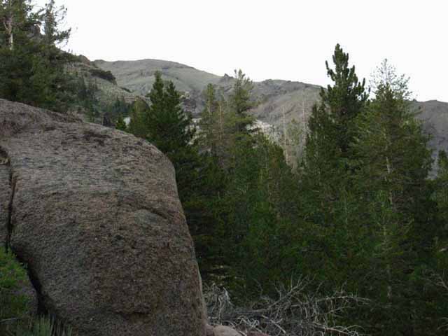 |
||
Looking into and across the Bottom of Kennedy Canyon The Northbound Pacific Crest Trail begins bending West, to our Left, once we get around the upcoming shoulder of the canyon, visible above the volcanic boulder at the bottom Left of the image above. But now we know that there is granite under the volcanic material making up the South wall of Kennedy Canyon because we have seen it sticking out from under its East end. This little wedge of granite grows into fantastic granite running down the East flank of the Sierra as we continue South. Kennedy Canyon to Dorothy Lake Pass
|
| Hiking Southbound on the Pacific Crest Trail |
Fine Granite Formations at the Base of Kennedy Canyon
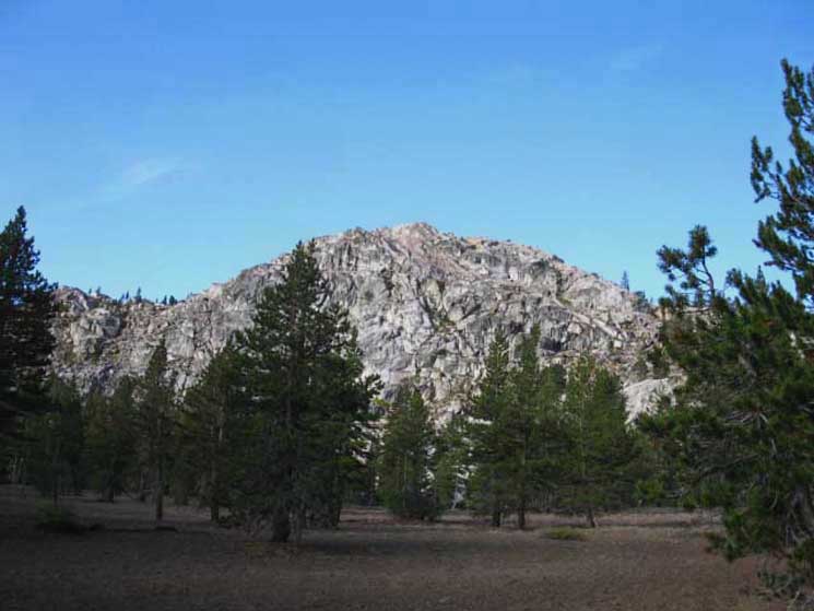 |
||||
I like this granite mound. I feel good every time I see it. Great Granite Feature in Walker Meadows, observed looking Northeast from just a bit South after hiking out the bottom of Kennedy Canyon. I've always found this feature striking. It also speaks to the complexity of the terrain dividing the West West from the West Walker River. The Chain of Lakes and its dense forests and bright meadows are wedged within this special little zone of terrain that we are looking into from the bottom of Kennedy Canyon. Chain of Lakes is beyond that ridge, and the West Walker River Valley beyond Chain of Lakes to our East. The terrain Northeast from the West Walker Bridge to Fremont Lake between the West and West Walker Rivers is a pretty little puzzle. The Leavitt Meadow trailhead is about 7 miles to the Northeast along our line of sight above. We could actually point ourselves in that direction with the goal of scrambling over to the trail on the North end of the Chain of Lakes. I would not do this until hiking in from Leavitt Meadow Trailhead to Chain of Lakes at least once. Put up your thoughts and experiences about this sweet area in the forum for the The 30 minute Sonora Pass to Bensen Lake map shows the way in from the Leavitt Meadow Trailhead, which is 10.58 miles from the West West Walker Bridge. Sonora Pass to Bensen Lake
|
West West Walker River Doe
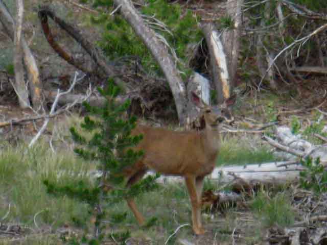 |
||
Full Observational Power Searching for Me We encounter a doe browsing the interface between lodgepole forest and Walker Meadows. She hears me but can't quite bend her ear to my specific position. I motionlessly watched her use her ears and eyes to scan the terrain. Hey Girl. I spotted her grazing far below the trail so I quietly de-packed, pulled off the tripod and set up the camera to get the long shot. Shussssh! She began to hear bits of my muffled activity and stopped her grazing to begin searching for the source of the sounds: me.
|
There I am
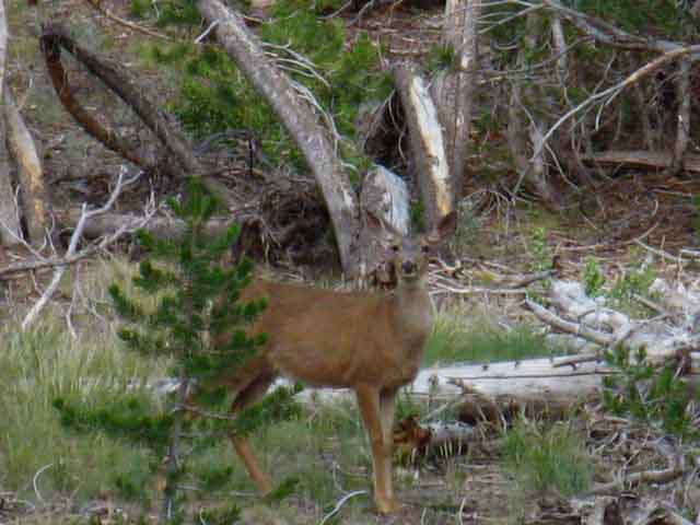 |
Ah-ha! The sound of my camera shooting finally focused her attention in on me. The source of the noise is a pesky human... me. She looks attentive rather than worried. That's because I'm a heck of a lot better sight to a doe than a mountain lion. The lions are not restricted to killing bucks as we humans are, and our girl here knows the difference between the types of critters that hunt her. Hey, stick around girl! I'll likely do some stupid human tricks for your enjoyment. Here's one: Does a human falling in the forest make a sound if no one can hear it? Only if you can hear the deer laughing. |
Trail North of Dry Creek
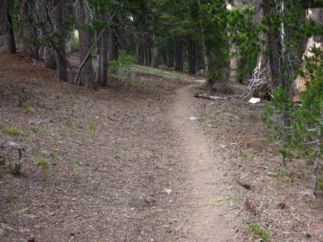 |
||
Trail Climbing Gently North to base of Kennedy Canyon Looking North: The trail stays up on the Western edge of the canyon. The PCT is routed away from and above the West West Walker River and its flat meadows, off to the Right in this North-looking image above. This is the "new" route of the PCT, as indicated by it's exclusion from the 1985 Bridgeport 30 minute map, and its inclusion on the 1990 15 minute Tower Peak map. We can see that many heavy Spring Thaws over time have contributed to the layout of the terrain down at the base of Kennedy Canyon, and putting a trail in the path of that pattern of flooding just creates work.
|
Dry Creek
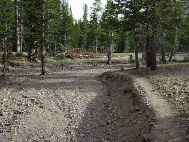 |
||||
View to the Southeast. Dry Creek just a bit North of West West Walker River Bridge and South of the Eastern end of Kennedy Canyon. Dry Creek marks the point we hit the level of the surrounding meadow-flats after dropping out of the bottom of Kennedy Canyon and turning South. It should be called Dry Wash, as I've never seen water in it, and it looks like its only active during Spring Thaw. It's a wash, not a creek. It's Dry Creek!
|
Lightening Damage?
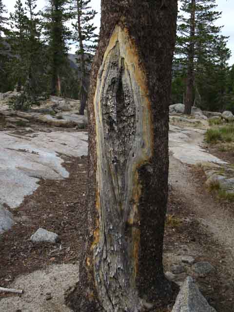 |
||
Damaged lodgepole pine just North of the West West Walker Bridge. I stopped for a minute to check it out. I could not tell if it was lightening that did this, but I suspect it was. Bam! Struck and lived to tell about it. Lucky tree, or unlucky tree? I would have stayed longer to study and ponder this, but I was racing the sun. The sun was going down and I was hiking upward, hiking North towards Kennedy Canyon on the particular trip I shot this image. This guide is written while walking within the parameters of the long trail, which has little mercy for screw-ups or trail guide writers. Food for "X" amount of days requires "Y" miles must be hiked per day, even when hell and high water make me feel I'm hiking between the devil and the deep blue skies. I tarried as long as I dared for the requirements I faced.
|
Southbound
Approaching the West Fork of the West Walker River & its Bridge
View from the North
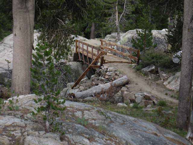 |
||||
Looking Southeast at the West West Walker River footbridge. There is a nice flat meadow with a couple of fire rings on this side of the bridge below the great boulder in the foreground.
|
West Fork of the West Walker River & Bridge
Detail
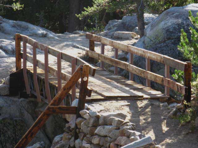 |
West-West Walker River Bridge. Cross the bridge, take a Left, and scout around for nice sites... Take a Right to follow the PCT South. East to the West Walker River past Lost Lakes If we continue East past the Chain of Lakes trail junction at Upper Long Lake we descend into the canyon of the West Walker River further to the South. We enter the West Walker Canyon at the base of the burnt red volcanic ridge who's crestline marks the boundary with the Hoover Wilderness. Our trail East from the West West Walker River Bridge ends where it intersects with the West Walker River at Lower Piute Meadow. From Lower Piute Meadow we can follow the West Walker River North down to the Leavitt Meadow Trailhead on Highway 108 or South to its headwaters bowl. |
Video
The West West Walker River and Bridge
A quick look at this four-way trail junction
Take a look at the West West Walker River, its Bridge, and its associated campsites. A few feet South of the bridge we come to a four-way trail junction. 3:26 minutes The real question here is, "What is opened up from here?" West West Walker River Bridge Trail Junction
West West Walker Bridge to Hetch Hetchy Road 34.25 miles Sonora Pass to Tuolumne Meadows
Local and Regional Backpacking Maps
The West Walker River This route roughly parallels the course of our PCT route, but over to our East, below the great volcanic ridge marking out the boundary with the Hoover Wilderness to our East and South. If we did hike up the West Walker River we'd find a ranger cabin where we enter Upper Piute Meadow along the upper West Walker River that has been manned by volunteers each Summer. Well, it was. One year long ago I met the volunteer dude who lived out there for a Summer. He loved it up there. He said they tried to put a volunteer up there every Summer. Call the Bridgeport Ranger Station of the Toiyabe National Forest for more current information. The West Walker River Watershed As the West Walker River moves up into its headwaters bowl between the Sierra Crest and the Volcanic Ridge, to our West along the Sierra Crest the boundary with Yosemite takes over from the Emigrant Wilderness. Again, check out the Hoover Wilderness pdf map below Right to understand this unusual configuration of the West Walker River Watershed in the Toiyabe National Forest Land wedged-in under these three wilderness areas on the East Sierra flank. Toiyabe National Forest
Upper West Walker River and Headwaters The top of the red volcanic ridge making up the Eastern wall of the West Walker River Canyon is the Western boundary of the Hoover Wilderness up here. At the Southeast end of this ridge is where the trail from the headwaters of the West Walker River climbs Northeast into the top of Buckeye Canyon. The trail up the West Walker River from Leavitt Meadow Trailhead climbs out of the Walker River Headwaters Northeast into the top of Buckeye Canyon and down the East flank along Buckeye Creek. The trail ends at the end of the canyon while Buckeye Creek continues across Bridgeport Valley into Bridgeport Reservoir. The headwaters of the West Walker River is surrounded by a complex zone of peaks and gaps scrunched-up along the Sierra Crestline that makes an Eastward extension of the Sierra Crestline. It's a nifty "finger" of the West drainage pushing East. East Side Access to the West Walker River I've come West up into this zone out of Twin Lakes via Peeler Lake, which is just a bit Southeast of these peaks around the headwaters of the West Walker River. A Nice Side-Trip in the Shadow of the Sierra Crestline Trails Above the Cascade Creek trail junction the West Walker River does not offer access to the Sierra Crest trails. The Bensen Lake Loop Twin Lakes is where the famous "Bensen Lake Loop" begins. This loop brings us over the Sierra Crest down Kerrick Canyon to the PCT-TYT route. We follow the trail South to Matterhorn Canyon from Bensen Lake to return to Twin Lakes out the top of Matterhorn Canyon through Matterhorn Pass, then Rock Island Pass. The Bensen Lake to Virginia Canyon 30 minute map lays out the Bensen Lake Loop: Bensen Lake to Virginia Canyon This is one majestic backpacking loop. It is the Northern Sierra version of the "North-South Lakes Loop" down on the JMT in the South Sierra. For us hiking on the PCT through this sliver of the West Walker Watershed (or hiking loops around the Emigrant via Leavitt Meadow Trailhead), the boundary for the Hoover Wilderness runs North and South along the crest of the great red volcanic ridge to our East. The slot cut into the middle of that ridge is a great local landmark. This area, meaning the Leavitt Meadow Trailhead and the subsequent trails through the West Walker River Watershed are great ways into the Emigrant Wilderness and open up some real nice local backpacking loops.
|
Looking North
at the
little meadow hosting a flurry of nice big and little Campsites
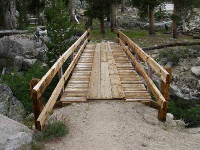 |
View North across the West West Walker footbridge. Campsites are scattered in the grassy flat on the North side of the bridge. We can see the benches and fire ring of the big one in the upper-Right of the image above. |
View from the North
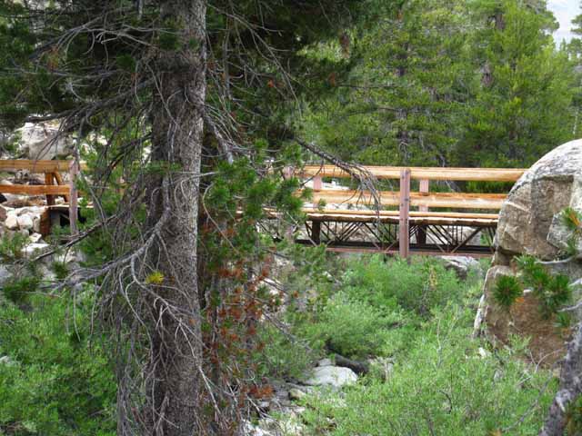 |
Northbound PCT hiker view approaching the upcoming West Walker River Bridge, or the Southbound hiker looking back. |
West-West Walker River Bridge LEAVITT MEADOW TRAILHEAD ACCESS Leavitt Meadow Trailhead
Local Hikers and PCT Bail-Out Just a few feet South beyond the bridge we encounter a trail junction tying together four important trails. This is an important trail junction for local hikers hiking starting South out of Leavitt Meadow Trailhead as well as those backpackers ending their hikes through the Leavitt Meadow Trailhead. The PCT Bail-Out Route The bailout route exits to Highway 108 through Leavitt Meadow Trailhead, reenters the dirt road through the US Marine Base located a 3.64 miles East down Hwy 108 from Leavitt Meadow Trailhead. We rejoin the Pacific Crest Trail by following the road across the Marine Base to the dirt road climbing the ridge behind the Marine base West to where the road ends at the base of the valley Wolf Creek flows East below the East flank of Sonora Peak. Sonora Pass Region Hiking Map Important Local Trail Junction Hiking East through this junction opens up the options of either hiking down to Leavitt Meadow Trailhead through the junction just to our East at the nearby Long Lakes via the Chain of Lakes trail or continuing East to the trail along the West Walker River. Both of these options bring us to Leavitt Meadow Trailhead, but the Chain of Lakes route is shorter. Long Lakes and Chain of Lakes I say temporary lakes as they are slowly being sedimented in, and lodgepoles are slowly marching into the sedimented aprons around these lakes, gradually transforming meadow into forest floor. Look around. We can see this process going on across the diminishing meadow terrain we have hiked around the edge of since hiking South from the bottom of Kennedy Canyon to the West West Walker Bridge. Forests and Soil are on the Move here. Nice Leavitt Meadow Loop Possibilities Hikers on short backpacking loop trips up from Leavitt Meadow can turn around at this bridge to return to Leavitt Meadow along one of the other two routes we did not hike in on. Note that the 30 minute (large scale) map shows the old route up to the base of Kennedy Canyon from the West West Walker Bridge is on the East side of the West Walker. Though this is not the current route of the PCT, which I marked on the far Western side of the canyon, it can still be useful. We have a huge amount of backpacking loop options here. Check out the Schematic Diagram and backpacking map below to help figure out the scope of backpacking loops we can hike out of Leavitt Meadow Trailhead.
Neither of these maps above show the "official" trail linking the PCT with the trail up to Emigrant Pass via Cinko Lake, but this map does: Kennedy Canyon to Dorothy Lake Pass TYT We can hike 20+mile backpacking loops to the West West Walker Bridge and back, push it out another six miles to circle around Cinko Lake, or expand our loop to incorporate as much or as little of the High Emigrant Wilderness as we can bite off. I've met all sorts of backpackers out here enjoying these grand loops. Fishermen. Couples. Families. Solo Dudes like me. All having the times of their lives. Join Us!! Post up your explorations here among the meadows, rivers, lakelets, and amazing granite formations wedged in-between the bottom of Kennedy Canyon South to the West West Walker Bridge, East to the Walker River and North down to Fremont Lake. This rectangle of terrain is a fantastic place to explore on scrambles, once we get an understanding of the overall lay of the surrounding terrain.
top of page The Southbound PCT We're climbing again, this time into a close-in densely forested channel that the West West Walker flows through on its way down to Walker Meadows from the interlaced fingers of granite and volcanic terrain along the Sierra Crestline above. We encounter our next trail junction one-fifth of a mile South of the West West Walker River Bridge trail junction. Out of the West West Walker River Hummm... that the Grizzly Peak junction opens up a bunch of very exciting backpacking loops and trips... Grizzly Peak Trail Junction We can hike to the Northwest, down to Kennedy Meadows Pack Station along the Northbound Tahoe to Yosemite Trail. We can hike to the Southeast, also along the TYT to the PCT at the top of Jack Main Canyon to return to our current position at the WW Walker Bridge by hiking North on the PCT through Dorothy Lake Pass. Another great route is hiking North from Emigrant Pass over Big Sam and Leavitt Peak to Sonora Pass through the Kennedy Canyon trail junction. The Emigrant is overlaid with a web of well-interconnected trails. Putting together the correct combination of these trails will create the perfect trip for you, your fitness, and skill levels. Ain' t the Emigrant Grand?
Beyond the Trail Junction My whole point here is that local backpackers can use the series of key trail junctions, the Kennedy Canyon, Grizzly Peak, and Bond-Dorothy Passes to craft varying lengths of backpacking loop trips either bringing us back to our original trailhead or to one of the other trailheads along Highway 108. By a variety of routes. I have no problem designing 70 mile loops around the high altitude sections of Emigrant Wilderness and that very special sliver of the adjacent Toiyabe National Forest holding the West Walker River watershed aloof from, and wedged in-between its three surrounding Wilderness Areas. We can tie them together with our feet. In the map below and the fourth image below we can see that our Southbound PCT above the West West Walker Bridge is now briefly unified with the trail South to Emigrant Pass. These trails will split up .19 of a mile South of our position here at the trail junction at the West-West Walker River Bridge.
|
Location
of the
West West Walker Bridge along the Pacific Crest Trail Route
Click the Map
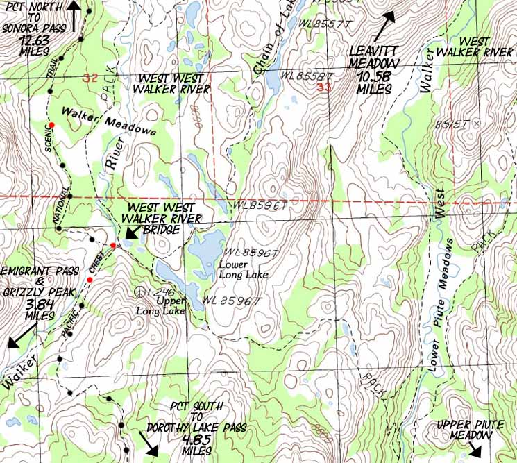
|
||||
Detailed Hiking Map of the West West Walker River Bridge Distances measured North and South from West West Walker River Bridge. NORTH The first is the Westernmost route North along the East bank of the West West Walker from the bridge, which shortly veers Northeast to intersect with our second trail Northeast, the trail past the Chain of Lakes. Our Easternmost trail to Leavitt Meadow is the trail running the length of the West Walker River, into which the other two trails merge before entering Leavitt Meadow. Turning at the Upper Long Lake trail junction to hike Northeast past the sweet Chain of Lakes points us more directly towards the Leavitt Meadow Trailhead than hiking East to the West Walker River Trail. The problem with the three trails Northeast to Leavitt Meadow is that they are all intriguing trails surrounded by beauty. A constant frustration of mine is not being able to see it all. I urge myself to patience, and put my mind towards figuring out my next moves to expand my understanding of the terrain, which expands "the list." "The List" represents where my trail knowledge ends and trip planning begins. For local hikes one of these three trails is a good way out to the West West Walker Bridge from Leavitt Meadow Trailhead, the other two offer good ways to loop back to Leavitt Meadow to end local backpacking loops of less than 30 miles out to the West West Walker Bridge or up to Cinko Lake. Our local short-distance backpacking loop options out of Leavitt Meadow are laid out on the maps linked to below.
Emigrant Wilderness Backpacking Loops I neglected to include the Cinko Lake trail linking the PCT with the West West Walker River on the Schematic, it is omitted from the Sonora Pass Region Maps, but "marked in" on the Sonora Pass to Bensen Lake map. SOUTH All the Rivers and their associated trails along the West and the West West Walker Rivers run Northeast out of the mountains through Leavitt Meadow on the Eastern flank of the Sierra along Highway 108. Except our PCT route North and South. Get Your Maps On Another link to the USGS if the above fails. They do that... Map Planning You're welcome to print out the maps on the Tahoe to Whitney Guide for your own use. At some point in time I'll be offering a map service. Using the Forum to Plan Trips and Collect Information These pages will become part of your permanent reference materials and be a foundation for building further trips. You can add after-trip information to correct and sharpen your trip planning. You can reopen your personal backpacking planning pages by going to "My Account" and clicking on the "Track" tab. This will list out all the pages you've constructed. To construct a page register, click "create content," and select "Personal Backpacker Notes" to create private pages only available to you through your account. If you want to publish stories, notes, updates, or opinions across the home page to add information to the various backpacking trails and topics forums you must select another type of content. These "Personal Notes" are a great way for you to keep track of the miles and elevations of your trips, and just how you planned out your campsites, food, and gear for future reference. Your account as a member of Tahoe to Whitney can be a helpful tool for collecting the information off this trail guide to plan out your backpacking trips. And remember, the Backpacking Trails and Topics Forums are currently in a primitive form. The forum site is moving slowly towards a redesign that will transform it into the most informative and easy to use backpacking forums on the whole darn internet! In the meantime it is a great feature for collecting and storing backpacking information gleaned off this trail guide and backpacking forums, and id a good place to collect up and centralize information drawn from a number of sources. Remember:
|
West West Walker Bridge Trail Junction
Four Way Trail Junction
on the
Southeast side of the West West Walker Bridge
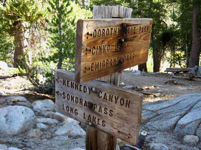 |
||
West West Walker Bridge Trail Junction The upper sign pointing towards us points the way South on the PCT up the mountain towards where the PCT trail up to Dorothy Lake Pass splits off the trial up to Emigrant Pass. The interesting thing is that both these trails can bring us South to the top of Jack Main Canyon, not just the PCT... The two upper destinations on the lower sign point North towards Kennedy Canyon on the PCT route to Highway 108 at Sonora Pass. The bottom destination on the lower sign points East to Long Lakes. That trail continues East past Long Lakes where it passes East by the junction Northeast up to the Chain of Lakes, continuing East to descend into Lower Piute Meadows along the West Walker River in its sweet canyon. At Lower Piute Meadow we pick up the trail running the length of the West Walker River, from its trailhead on Highway 108 at Leavitt Meadow up to the top of its headwaters bowl. The best map I have up of the length of the West Walker River is the Sonora Pass Region Hiking Map
|
The Pacific Crest Trail
The West West Walker Bridge to the Eastern Cinko Lake Trail Junction
Cinko Lake Loop Kennedy Canyon to Dorothy Lake Pass A Northbound Video This is a distance of 2 miles, mostly descending as we hike North. There's another Upper Cinko Lake trail junction, the Western junction along the trail up to Emigrant Pass. Cinko Lake lays along a trail connecting the PCT to its East with the trail to Emigrant Pass to its West.
Sonora Pass to Bensen Lake
9:28 |
Trail Junction on the Southeast side of the West West Walker River Bridge
Detail
Hiking the PCT South into Yosemite via Dorothy Lake Pass
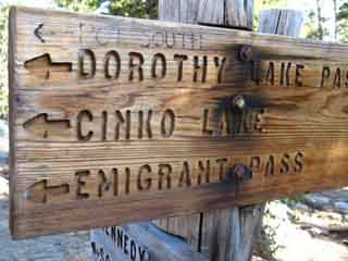 |
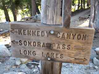 |
||
Southbound PCT Alternatively, continuing Southwest past this next PCT junction up the West West Walker brings us to the nearby Cinko Lake trail junction. We can cut over to the PCT via Cinko Lake as well. Continuing Southwest past the Cinko Lake trail junction brings us up through the headwaters of the West West Walker River to Emigrant Pass, which sits next to Grizzly Peak, where we intersect with the route of the TYT coming across the High Emigrant Basin from Kennedy Meadows Pack Station. |
Northbound PCT Northeast If we continue East past the Long Lakes we intersect with the trail running North and South along West Walker River beyond. Situate Thy Self:
|
Four routes out of a three-way Junction I figure that the old route down the East bank of the West West Walker river from the bridge is still a route if not a maintained trail. It stretches North along the West West Walker from the bridge until it bends Northeast to intersect with the Chain of Lakes Trail.
|
Sign Pointing East and West near the West West Walker River bridge
 |
||||
Local Landmarks The noting of meadows points out an interesting feature of this area: The West-West-Walker, the Chain of Lakes, and the West Walker all run parallel and very close to each other, separated by distinctively beautiful steep and narrow granite ridges. Each channel between these close-spaced formations is full of river, rock, forest, and meadow terrain that is real sweet. There is a unique little zone between these meadows that warrants further exploration.
The map linked to above can be magnified in your browser for close inspection. The red dots along the main trail routes marked on the maps bring you to the specific trail guide entry for that location. Each map is linked to the next map continuing to the North and South along the main trail routes, and to the East and West as necessary to depict the connections between the main Pacific Crest and Tahoe to Yosemite Trail routes. Explore the maps and the guide pages, then get out and explore this special section of the Toiyabe National Forest and its associated trails through the Emigrant Wilderness. It will enrich your life.
|
The Other Trail South from West Walker Bridge The West West Walker Bridge is the center of a triangle of trails up to Cinko Lake. Note on the map that Cinko Lake is situated between the trail running up the West West Walker to Emigrant Pass and the Pacific Crest Trail to Cascade Creek. This trail configuration makes Cinko Lake a premium turnaround point for backpacking loops out of Leavitt Meadow.
|
Hiking .19 miles South
on the
Pacific Crest Trail from the WW Walker Bridge
we encounter the next
trail junction
 |
||||
The PCT Bends Southeast The sign is also pointing Southwest towards Cinko Lake & Emigrant Pass, to our Southbound Right, continuing up the West West Walker River. The Southbound Pacific Crest Trail veers left here, to the Southeast, towards Dorothy Lake Pass. Here Southbound hikers on the PCT route begin climbing out of the granite channel cut into the terrain the West West Walker flows down to cross over and around the noses of a couple of granite Sierra ridge arms descending off the crest into the watershed of the West Walker River on our way over to Cascade Creek. Along the way we pass by the Eastern end of the Cinko Lake trail. We can loop through Cinko Lake to return to this point. Past the Eastern Cinko Lake junction we approach Cascade Creek, who's course we will follow up to Dorothy Lake Pass's entrance into the Yosemite Backcountry. Turning onto Cascade Creek the forest cover begins to thin as we climb into exposed terrain for the final climb over Dorothy Lake Pass. Alternative Route South towards Tuolumne Meadows Continuing straight up to Emigrant Pass from the West West Walker Bridge puts us in position to turn South to Bond Pass from Emigrant Pass along the Tahoe to Yosemite Trail. This route option allows us to rejoin the Southbound PCT route to Tuolumne Meadows at the top of Jack Main Canyon. Route Selection My criterion for route selection is balanced between what I have not hiked before against my desire to repeatedly hike trails to better understand their character and detail. I figure it takes at least three trips down a particular trail to get somewhat familiar with it. My approach generally works out like this: I hike the PCT route through an area. Then I hike the TYT route through the same area. Many times. Then I come back and hike big loops tying these two routes together. Then I figure out my favorite spots, and make trips to spear them all. The Next Step Our best access to the Sierra Crest during Winter is either through one of the open trans-Sierra highways or coming in the Eastern flank off of Highway 395.
|
The Southbound backpacker begins the climb to Dorothy Lake Pass here, where the Pacific Crest Trail breaks off from the West West Walker River.
Northbound Though the WW Walker is descending as it flows to the Northeast, the Northbound PCT only stays level for a short distance before it begins climbing gently to position itself above the meadows, then steepens its climb a bit to situate itself for the turn up into Kennedy Canyon. Once to the top of Kennedy Canyon the climb North over the Leavitt Massif begins in earnest. At the 11000 foot high point across Leavitt Peak we've climbed 2400 feet over 9.97 miles from the low point of the trail at the West West Walker River Bridge. PCT NORTH |
Kennedy Canyon Trail Junction |
|||||
Toiyabe National Forest This 9.51 segment of the Pacific Crest Trail from Kennedy Canyon trail junction South through Dorothy Lake Pass is not just a fun and beautiful bit of trail, but it brings us across a full range of local and long distance backpacking loop opportunities out of the Leavitt Meadow Trailhead located on the East flank of the Sierra. The way I look at it is that there are multiple long-distance "Tahoe to Whitney" routes, at least three main ones, across the Emigrant Wilderness and adjacent section of the Toiyabe National Forest from Highway 108 down to our potential Dorothy Lake and Bond Pass entrances into the Northwestern corner of the North Yosemite Backcountry. In either case it will take a number of hikes to properly explore this area.
30 min Map Guide South
|
Scroll up page to view PCT North to Kennedy Canyon
This Trail Guide Hikes North to South If you are hiking South to North then you may want to inspect these pages from the bottom up. I'm experimenting with linking to the bottom of each Northbound Page to simplify use for Northbound hikers. What do you think? |
Backpacking Trail Guide PCT TYT |
|
Backpacking Trail Guide PCT West West Walker River |
Backpacker ForumsHave a great Sierra Nevada trip or story to relate? A fine piece of gear? Or gear that failed?Post it onTahoetoWhitney.Org Become a MemberIf you have experiences, comments, questions, or pictures and videos of the Pacific Crest Trail between Sonora Pass and Tuolumne Meadows, post up here.All backpackers can comment. Forum Section
|
The Tahoe to Whitney Trail Guide and Forum have been built, funded, and supported by my individual efforts, with a little help from my friends and family. If you feel these efforts are valuable to you, you are invited to support them here: |
Trailhead
Contact
Alex Wierbinski

Backpacking Lake Tahoe to Mount Whitney
Your Guide to the High Sierra Crest, including the Tahoe to Yosemite, Pacific Crest, and John Muir Trails
