
The Trails
Guide
Maps
Miles/Ele
Permits
Resupply
Forum
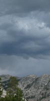
Current Weather Conditions
Weather Notes
Northern High Sierras
Central High Sierras
Southern High Sierras
Gear
Gear List
Gettin Started
Layering
Discussion
Testing yourself and your gear
Gear Reviews
Backpacking
from the
Lower
Jack Main Canyon
at the
Tilden Canyon Trail Junction
down
to
Hetch Hetchy Trailhead
Backpacking
the
NORTH
YOSEMITE BACKCOUNTRY
Hiking
A SIDE ROUTE
off the
PCT-TYT
Alternative Route
Linking the PCT & TYT to Hetch Hetchy and the Grand Canyon of the Tuolumne River
via
Jack Main Canyon
Languages
Languages
Trail Arts
The art of walking
Physical Preperation
Trail Skills
The trail
Off the trail
Scrambling
Maps
Navigation
Camp skills
Food
Resupply
Food
Other
Photo Catagories
Trail Stories
Trail Culture
News and Science
Links
Groups
Books
Terms and Conditions of Use
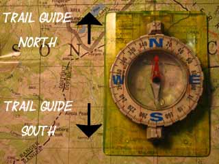
| Trail Guide INDEX Highway 108 to Highway 120 |
NORTH |
SOUTH |
7.5 Topo MAP Lower Jack Main Canyon |
30 min MAP Sonora Pass to Bensen Lake |
Sonora Pass to Tuolumne Meadows MILES AND ELES |
TOPO MAP INDEX SONORA PASS to Tuolumne Meadows |
Resupply South |
National Forest PERMITS Toiyabe & Stanislaus & Yosemite |
All maps index | |
| Grand Canyon of the Tuolumne River (Click the Maps) |
||||||||||
Backpacking
Yosemite National Park
NEW
DRAFT TRAIL GUIDE PAGE
Points
To & From |
|||||||||||||||||||||||||||||||||||||||||||||||
|
Hetch Hetchy Trailhead
Mileages
Trailhead Distances |
Trailhead Distances from Hetch Hetchy Trailhead up to Rancheria Falls & Beyond |
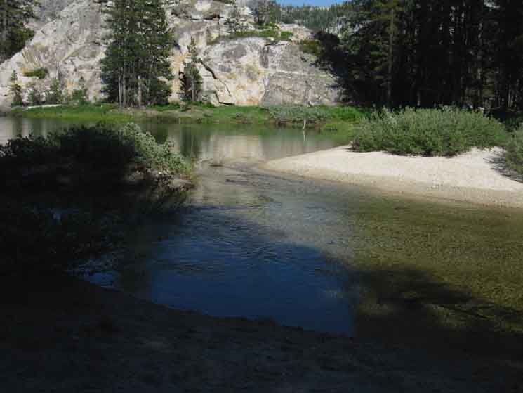
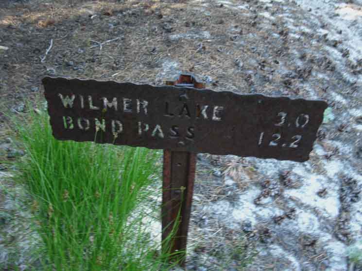
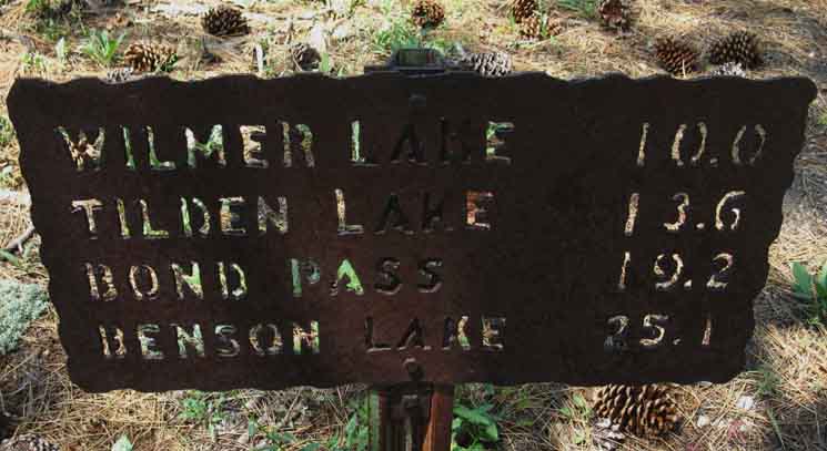
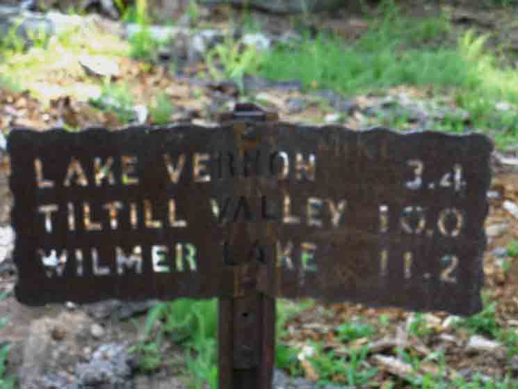
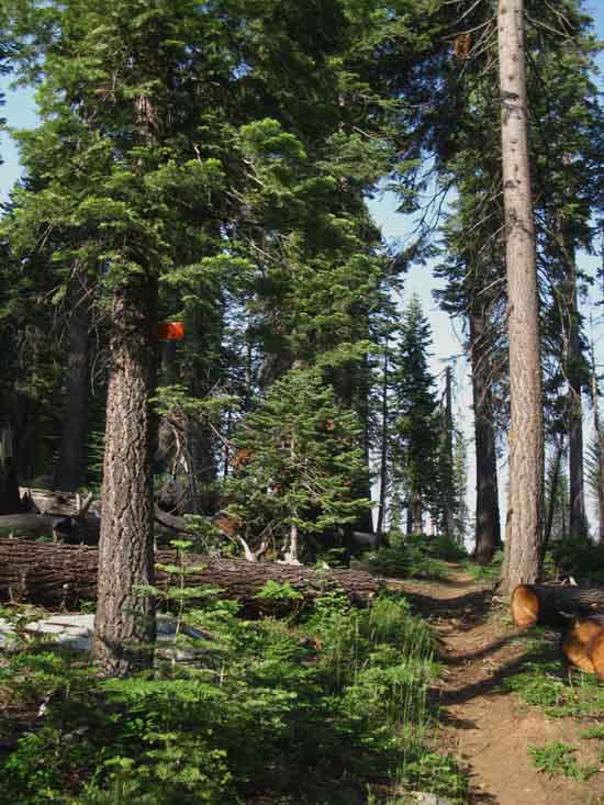
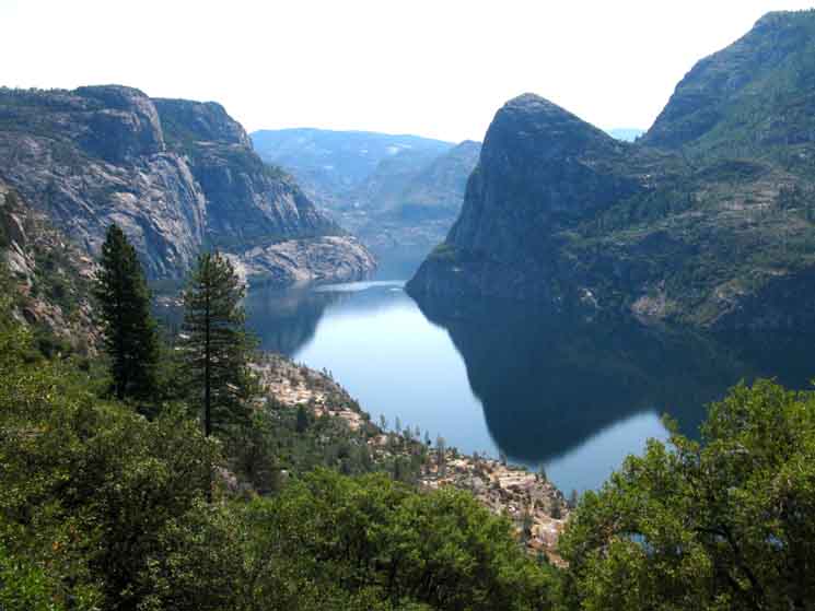
Lower Our position is at the trail junction three miles South of the Pacific Crest Trail junction & its fording point of Falls Creek at Wilmer Lake. We are 14.9 miles above Hetch Hetchy in Jack Main Canyon. The table above describes our distances from the major trailheads on the Highway 108 corridor to our North. Wilmer Lake is 46.27 miles North of Tuolumne Meadows along the TYT-PCT. This Tilden Canyon trail junction offers three choices: North to the PCT at Wilmer Lake, South to the trailhead at Hetch Hetchy, or East to Tilden Canyon to a position roughly 2 miles South of the PCT-TYT trail junction in Tilden Canyon. The PCT-TYT junction in Tilden Canyon is 17 miles above Hetch Hetchy. These mileage figures indicate we have a number of potential loop hikes possible out of the Hetch Hetchy Trailhead, as well as many potential routes hiking from the Highway 108 corridor to Hetch Hetchy. Hetch Hetchy Hiking Maps One Piece Oh, I almost forgot the Twin Lakes Trailhead in the Hoover Wilderness on the East Flank of the Sierra. We have the option of hiking in from Twin Lakes to Hetch Hetchy by slashing diagonally across the North Yosemite Backcountry from Northeast to Southwest. The map below shows how to access Kerrick and Rodgers Canyons hiking out of Twin Lakes. Click the arrows pointing to the adjacent maps to follow those trails down to Hetch Hetchy, North to Highway 108, or South to Tuolumne Meadows. |
Jack Main Canyon Hiking Maps
Upper
Jack Main Canyon
HIKING MAP
| Lower Jack Main Canyon HIKING MAP |
PCT-TYT Miles and Elevations |
The
Grand Canyon of the Tuolumne River
HIKING MAP
| Though this trailads. |
Backpacking Trail Information Index |
||||||||||||||||||||||
|
North Yosemite Backcountry Weather and Road Information These are the closest ground stations, point and regional forecasts to Jack Main Canyon Check out the ground reporting stations for real-time snow and temp data.
All
All
|
|
||||||||||||||||||||
| > Forum< | ||||||||||||||||||||||
POST UP
All backpackers can post text comments about the section covered by this guide page below through the comments links on this, and all the trail guide pages.
Registered Members can post post more information besides text, including images, maps and videos in their own posts on the Trails Forum that supplements this trail guide page's coverage of the trail from Wilmer Lake to Stubblefield Canyon.
East to Tilden Canyon
 |
Trail junction in Lower Jack Main Canyon to Tilden Canyon. |
East to Tilden Canyon
 |
||
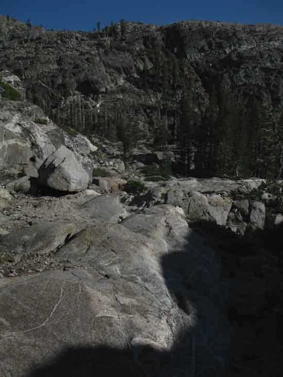
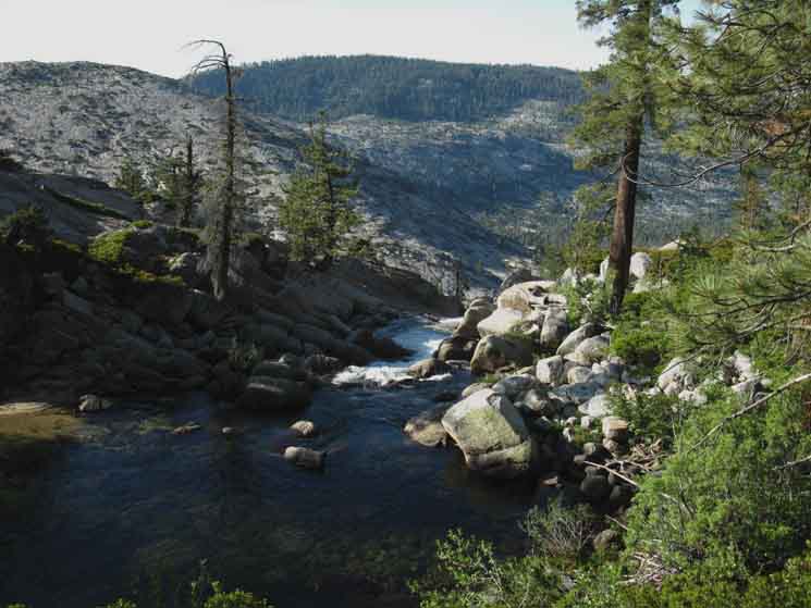
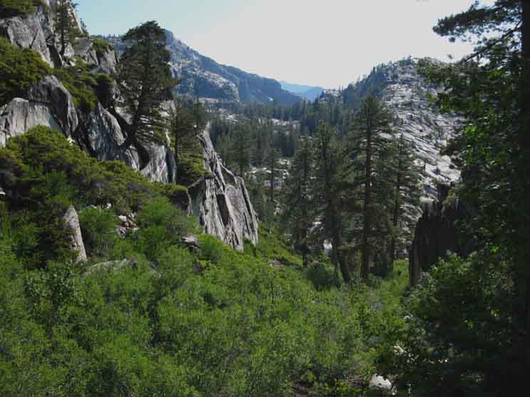
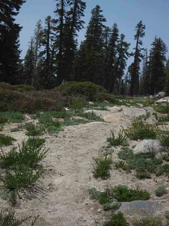
Lower Falls Creek Ford to Tilden Canyon. The Other End of the Trail Above We last saw Falls Creek on the previous guide page, at the end of the long meadow-kinda flat section upriver, where it bend around the rock formation with the gap we hiked through. Now it's back after circling all the way around the rock feature. At this point Jack Main Canyon bends more to the Southwest while another arm of the canyon runs on a line pointed thirty degrees further South. Do check out the map of this very complex terrain. The two cuts of the canyon split on Andrews Peak.
|
North Up Jack Main Canyon
 |
Up Jack Main Canyon. Distance up Jack Main Canyon from trail junction to Tilden Canyon. |
Lower Jack Main Canyon
 |
||
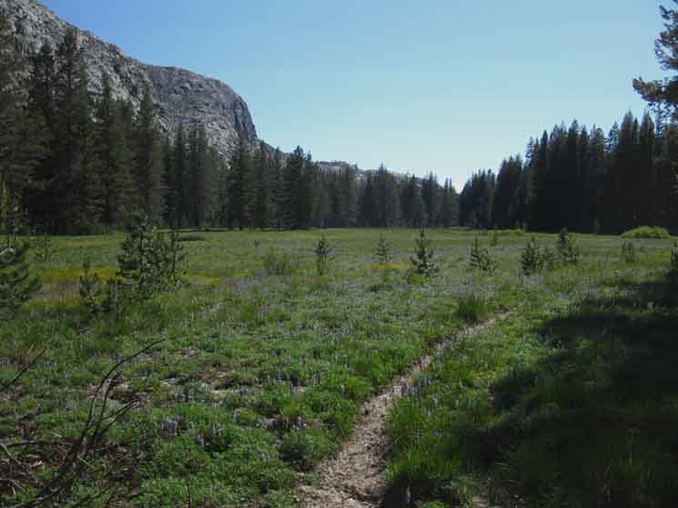
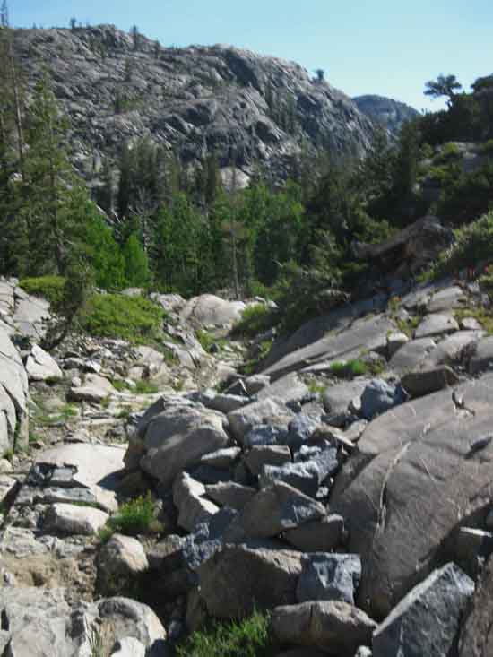
Hiking South from the Tilden Canyon trail junction runs us down another nearly flat gently descending run of wide open meadow canyon bottom, until we come to the next bend in the course of Falls Creek, which forces us to climb and cut off the knob of granite creating the bend, from which we get good views up-canyon and reasonable views down. Andrews Peak is rising on our Left. Checking out the detailed topo map shows us that Andrews Peak acts as a corner, being the pivot point dividing the line of glacier that cut Jack Main Canyon below its North Flank from the line cut through the Branigan Lakes. A close look at the terrain shows a series of slashes creating canyons and ridges, then canyons are cut into the tops of the ridges.
|
Soggy Trail
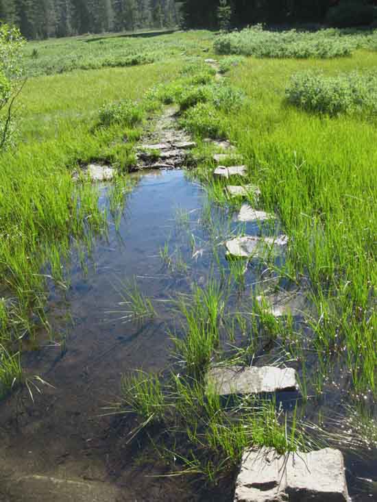 |
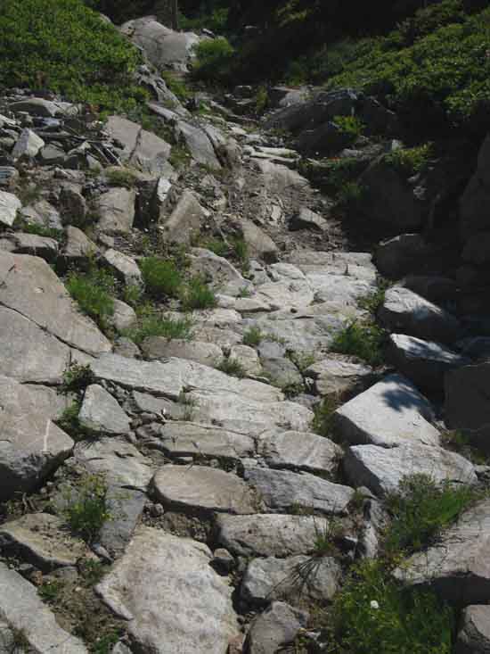
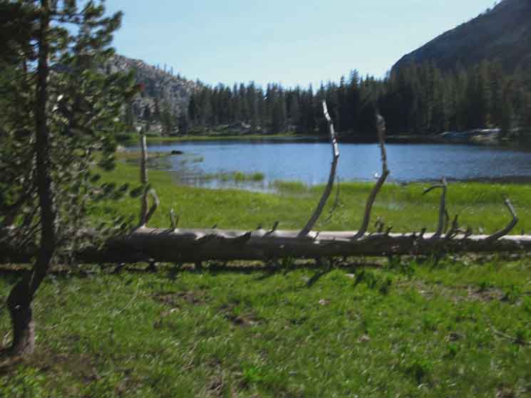
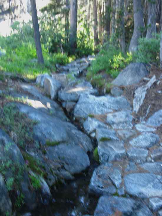
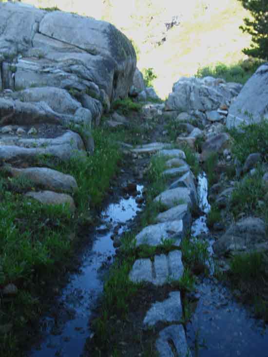
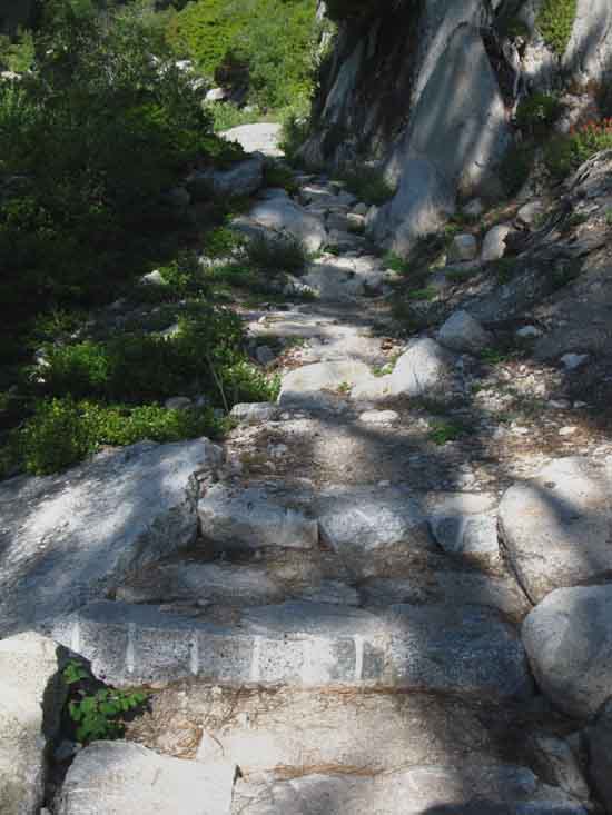
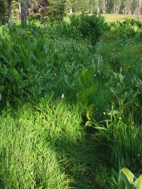
Saturated meadow trail through Lower Jack Main Canyon. Here we see yet another sign that the whole length of Jack Main Canyon is cut through solid granite, meaning the floor of the canyon is one big, long sheet of granite. Thousands of years of sediment deposition have covered this granite base, which still serves to capture all the water that drains into it. |
Trail Build Up
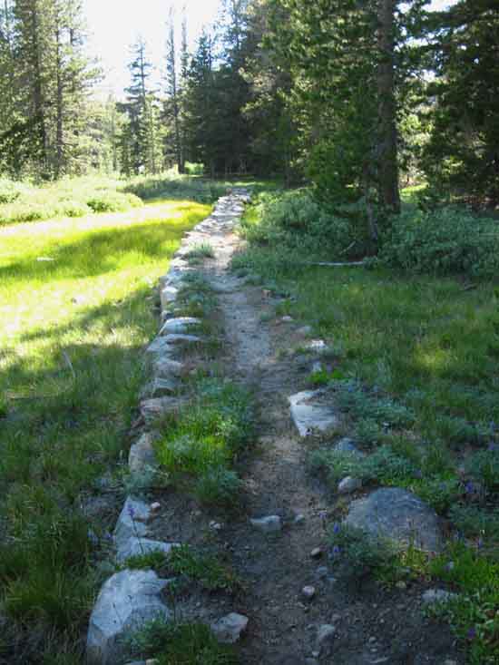 |
||
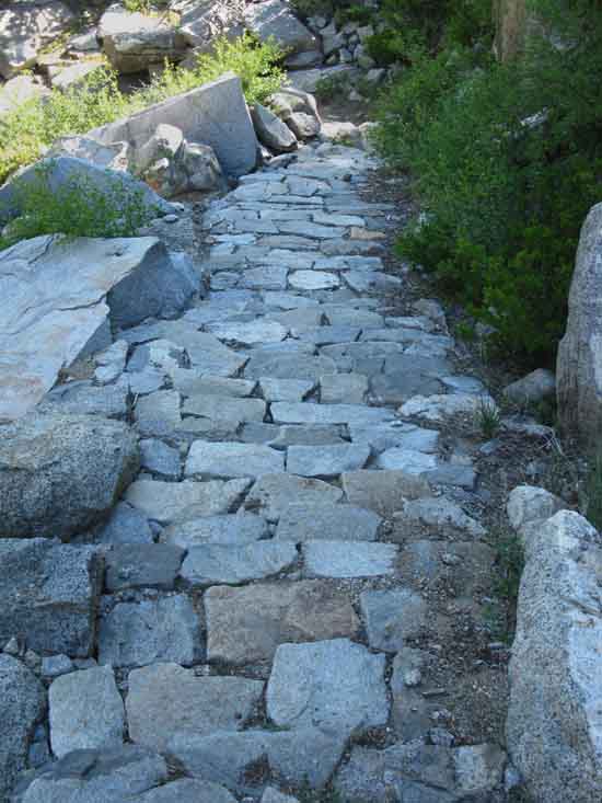
Improved, raised meadow trail through Lower Jack Main Canyon. Typical treatment for saturated or fragile soils.
|
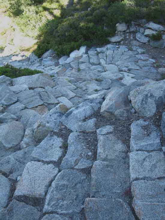
Rock Block Trail
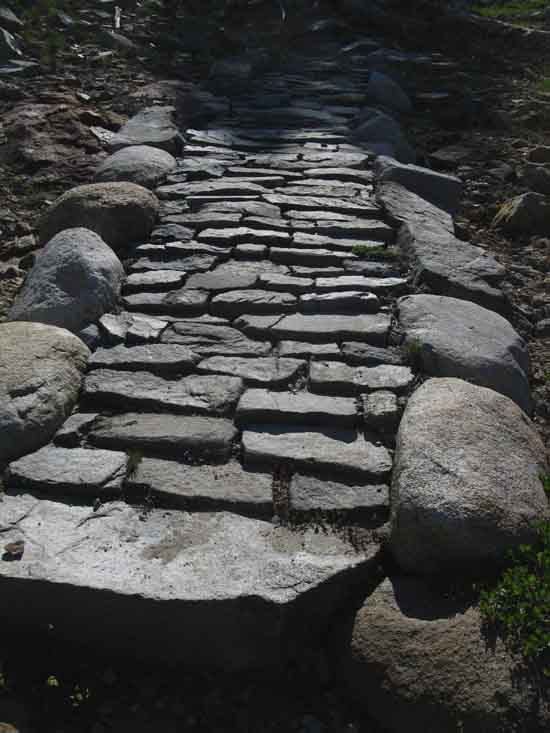 |
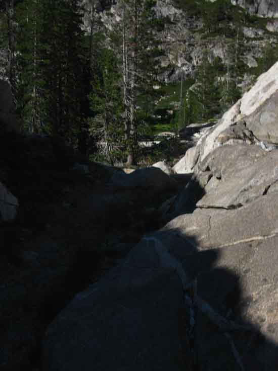
Climbing to cut off bend in Falls Creek below the run of meadow. |
Trail
 |
||
Climbing around bend in Falls Creek running down Jack Main Canyon with Southwest shoulder of Andrews Peak in distance.
|
Up Canyon View:
Complexity
 |
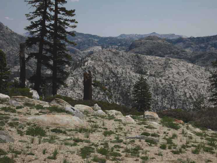
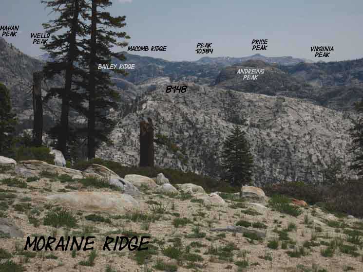
Let's Unravel This Feature rising on the center-Right is the dome along Bailey Ridge behind Avonelle Lake. Macomb Ridge is visible in the furthest distant middle of the image, while Peak 8273 above Mahan Lake is the prominent feature rising in the center-Left of the image. We came down between Peak 8273 and the Knob rising on Bailey Ridge above Avonell Lake. Turning around to continue down-canyon we review the features along it's East Wall. |
Down Jack Main Canyon
 |
||
Descending back down to the floor of Jack Main Canyon after cutting off the bend in Falls Creek climbing over this feature below Andrews Peak.
|
Falls Creek
 |
We see the placid waters of Falls Creek off to our Left as we turn away descending to our West. |
Trail Down
 |
||
Trail down Jack main Canyon below Andrews Peak..
|
Trail Down
 |
Fine Yosemite Trail Crew Work running down Jack Main Canyon below Andrews Peak. |
Falls Creek
 |
||
Down to Falls Creek in the bottom of Lower Jack Main Canyon. Descending we note Falls Creek flowing by to our Left, to our East.
|
Falls Creek
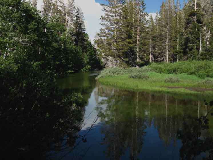 |
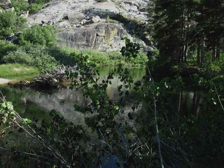
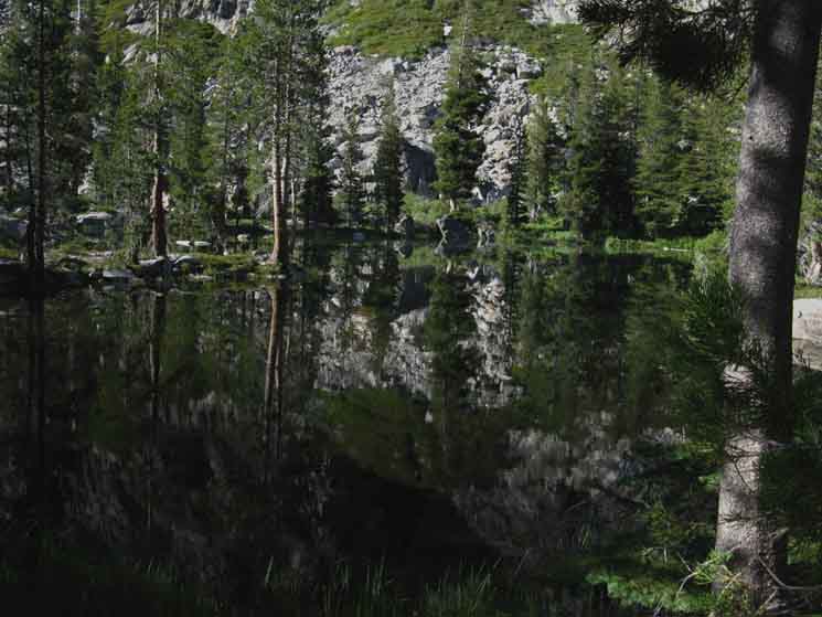
Hiking around a bend in Falls Creek looking down Falls Creek. Ahead we have Falls Creek and a big blue pond with a narrow strip of land holding our trail between. |
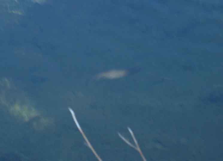
Falls Creek Fish
 |
||
About a fifteen inch trout swimming upstream.
|
Trail
Between Lake and Creek
 |
||
Falls Creek is to our Left, the East, and an expansive little blue pond to our West, on our Southbound Right. We are hiking along a narrow strip of organic terrain separating Falls Creek from this big blue pond. At the end of the strip we cut across/along a granite island floating in the bottom of Jack Main Canyon where Falls Creek continues down-canyon between the soft banks of sediments it transported down here. Our trail turns onto the hard rock.
|
View South
Hard Rock Trail
 |
Cutting across this low feature to the North is setting our trail up to swing around the North Shore of Lake 7643, where we are going to camp tonight. Hiking North we look almost directly South at Wall of Jack Main Canyon below Andrews Peak. The North-South line of Upper Jack Main Canyon has gradually bent itself more and more into a Western course. The line of Jack Main Canyon is almost East and West down here in the bottom of the Canyon. Thus we are looking almost directly South when we look Left at what was the "Eastern" wall of Upper Jack Main Canyon. Hiking North over a granite feature from Falls Creek towards Lake 7643 we turn to look South at the wall of Jack Main Canyon running off the Southwest Flank of Andrews Peak. |
View North
Rock Trail
 |
||
Making our way North, Falls Creek behind us and descending to the next blue pond off to our Right and Lake 7643 to our Left.
|
Pond
 |
||
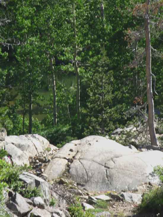
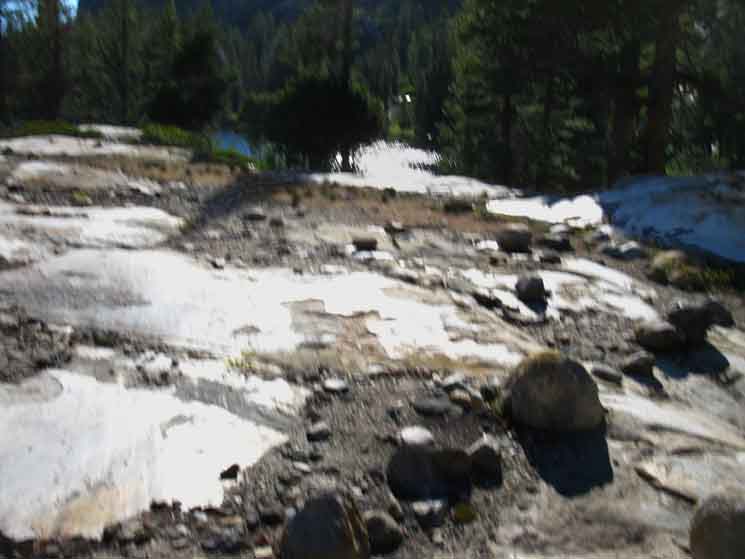
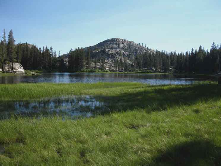
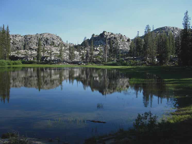
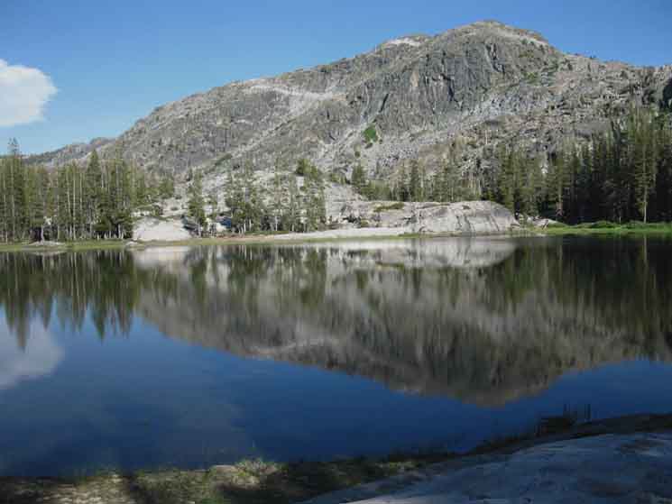
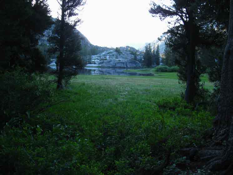
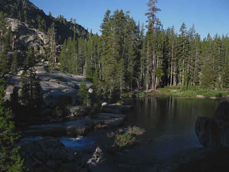
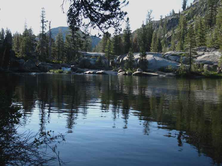
But first we pass a small black pond to our Southbound Right. We are hiking a grand S-turn bending with our route following the most stable terrain through and around a series of meadows, bits of forest, and a series of interesting "lake-ponds" all situated in the serpentine course of the delightfully irregular sculpted granite features encountered in this glacially carved river bottom. I mean carved by a river of ice. Everything subsequently has had to fit into and through the shape of the canyon left by the long departed ice. The "Ponds" Not really ponds and not really lakes. Polakes? The basis of this identity crisis is that the vast majority of the bottom of this canyon, beneath the deposited sediments and the lakes, meadows and forests sitting on the sediments, is a solid rock floor. Virtually nothing soaks in. Very little water "soaks into" Jack Main Canyon because there is nothing but solid rock below all the sediments. EVERYTHING flows down Jack Main Canyon. These lakes are fed and maintained by this "rock bathtub" character of the canyon that lets no water soak in, but forces all water to flow down Jack Main Canyon. Thus we find this series of blue water "pond-lakes" with no inlet nor outlet. Water is flowing down-canyon through the soils, passing through meadows and lakes on its subterranean course down Jack Main Canyon.
|
Trail
Rotating Around Lake 7643
 |
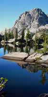
To our Left we can see the expansive surface of the next pond-lake, designated as "Water Level," WL 7643 on our map glistening beyond its merged reflections with the glacially polished rock surface. Though it's a pond, 7643 is very lake-like. I attribute that to much higher than normal flows of water through the soils of Jack Main Canyon, charging up all the ponds in Lower Jack Main Canyon. It seems to me these soils are piled on top of long lengths of uninterrupted solid granite that makes up the unseen buried floor of Jack Main Canyon. We can't see it, except for the increased capture and retention of water down the whole length of Jack Main Canyon. |
Across
Lake 7643
Our Route
Down Canyon
 |
||
SOUTHWEST Our trail continuing South passes between the dome on the Left and the rising North wall of Jack Main Canyon on the Right. Our View in the series of images below rotates counter-clockwise from the Southwest looking down canyon in the image above to our view looking almost directly East, up-canyon as we hike South beyond Lake 7643, below.
|
View Southwest
Downriver Across
Lake 7643
 |
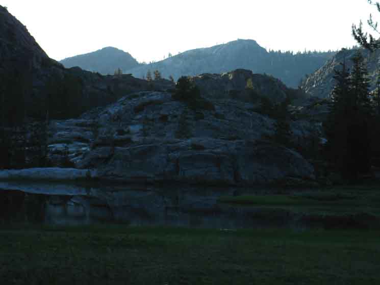
Downriver View Lake 7634 sits on the floor of Jack Main Canyon a bit North of the Northern foot of Andrews Peak's North-facing flank. That flank makes up the South wall of Jack Main Canyon rising above us. Our view above is from the North Shore of Lake 7643 looking Southwest at the low dome feature sitting just off the base of the Western-most foot of Andrews Peak. Andrews Peak is off to the Left making up the South wall of Jack Main Canyon, and wrapping around the South shore of Lake 7643. Our trail continuing down-canyon passes through the saddle to the Right of the dome. Below we are looking almost directly South. |
Lake 7643
View South
Across
Jack Main Canyon
 |
||
Granite features stretching out to the Northwest from the base of Andrews Peak wrapping around the Southwestern shore of Lake 7643 in Jack Main Canyon. This perspective is are looking almost directly South, a little West of South, while our route down the remainder of Jack Main Canyon tracks Southwest, to the Right of the dome on the far Right of the image, which is the same as the image above. We are almost down to the very bottom of Jack main Canyon, which is narrowing down to an arrowhead shape between steep granite walls. The tip of the arrow is where Falls Creek bends 90 degrees South to run down to Lake Vernon, which is sitting in it's own valley seemingly cut into the top of the ridge to our South. We climb a moderately steep gorge to get ourselves out the bottom of Jack Main Canyon up onto the top of Moraine Ridge.
|
Lake 7643
View a Bit East of South
Across
Jack Main Canyon
 |
Rock ramp down to the lake. The Northwestern foot of Andrews Peak descending to the lake. |
Andrews Peak
Up-Canyon View
View Southeast
Across Lake 7643
 |
Upriver View Our lake is just below the Westernmost extent of Andrews Peak. |
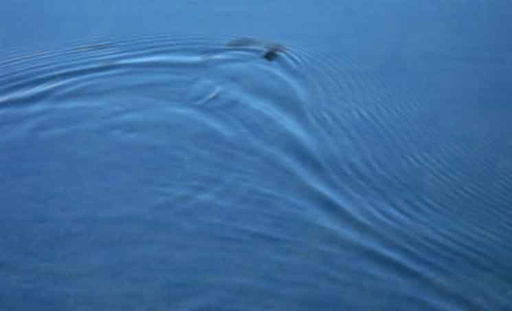
Snake in the Lake
 |
||
Snake in the Lake!
|
Andrews Peak Twilight
Upriver View
Across Lake 7643
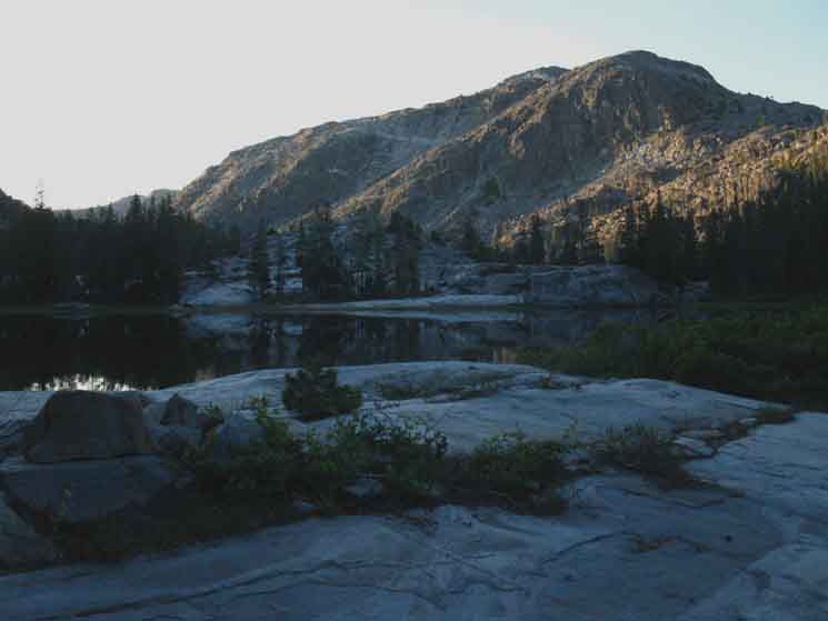 |
Andrews Peak trimmed with the last light of the dying sunset. |
View South
Across
Jack Main Canyon
towards
Andrews Lake
Across Lake 7643
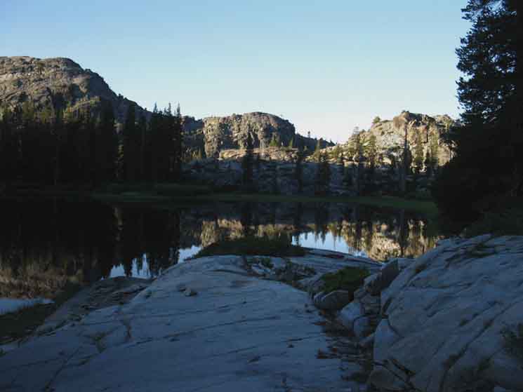 |
First light into Lower Jack Main Canyon looking Southeast across Lake 7643. Andrews Lake is just on the other side pf the Ridge Arm above, which is descending off the Northwest-most shoulder of Andrews Peak. |
View East Up Jack Main Canyon
Across Lake 7643
 |
||
First Light looking East up Jack Main Canyon across Lake 7643. We have hiked down to the South Shore of the lake and have turned to take a look up-canyon, above. Our route down canyon came around the Right (South) edge of the ridge arm we see in the distance, then crossed the granite between the ridge and far side of the lake from Right to Left to wrap around the Left (North) Shore of Lake 7643 to our current position.
|
A Closer Look
View East
Up
Jack Main Canyon
Across Lake 7643
 |
View We're looking across the foot of the great Southern Shoulder descending off Mahan Peak. We see Peak 8768 rising above Avonelle Lake on the Left, and the next peak South along the Bailey Ridge ridgeline towards the location of Tiltill Mountain to the Right of Peak 8768. The trail down the next canyon to our East, the trail from Tilden Lake to Tiltill Valley climbs under the opposite flank just below the top of Peak 8768, then runs up a groove in the terrain just under the crest of the peak to its Right. That point is where hikers on the trail from Tilden to Tiltill stop climbing and begin their great descent into Tiltill Valley and past Rancheria Falls to Hetch Hetchy. But, that's over there, and we're here in Jack Main Canyon. Check out the Lower Jack Main Canyon map to locate the peak on the Left, above, in its dominant position above the NW shore of Avonelle Lake. The peak in the distant Left is this stretch of Bailey Ridge that we observed closely as we hiked under it, and beyond. Note the light playing on the flank of Andrews Peak on the far Right of the image. The gap between Andrews Flank and Bailey Ridge beyond is where the canyon holding the string of Branigan Lakes is located. That string of lakes and its canyon drop into the canyon holding Lake Vernon further down the West flank. |
Lake 7643
View Southwest
Continuing
Down
Jack Main Canyon
|
Continuing South we're going to hike down-canyon over the low rise between the low dome on the Left side of the image above, and the canyon wall rising to the North, which is rising out of the Right edge of the image. Falls Creek is bending around from Left to Right around to the backside of that dome, while our trail down Jack Main Canyon will climb over the low saddle between the dome and the canyon wall. |
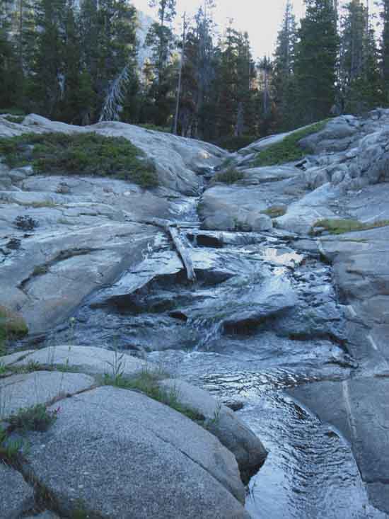
Tributary
 |
||
Descending the far side of the saddle we find this cool tributary stream running in a granite slot. The tributary is coming off and draining the West flank of the saddle our trail crossed hiking downstream from Lake 7643.
|
View
West-Southwest
at
The Top
of
Moraine Ridge
beyond the
Bottom
of
Jack Main Canyon
 |
||
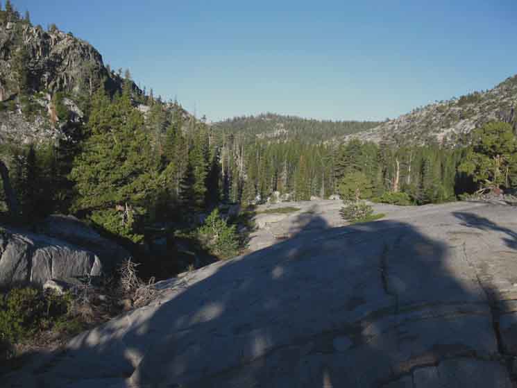
The End of Jack Main Canyon The converging ridge arms point to the bottom of Jack Main Canyon. Our route out of the bottom of Jack Main Canyon up to the top of Moraine Ridge passes just to the right of the forested point of Peak 8213 at the very top of Moraine Ridge. Our trail runs up to that point just along the Right edge of the line of granite formations we see showing through the forest from the bottom of Jack Main Canyon up to the summit of Moraine Ridge. That's where we are going.
|
Falls Creek below Lake 7643
View South
 |
View almost directly South. The cascade along Falls Creek just past Lake 7643 getting its first light. Andrews Lake is on the other side of Falls Creek wedged into the low ridgeline beyond the treetops. |
Trail Down-Canyon
 |
Staining on granite wall as our trail stays on the North side of Jack Main Canyon as we make our way down to the longer, but final segment where Falls Creek fattens up to run itself through a wide segment before narrowing down and plunging out the lower end of Jack Main Canyon. |
Last Fat Segment
of
Falls Creek
Up-Canyon View
 |
||
Our trail brings us down to the final segment of a "fat" run of Falls Creek, where we turn around to take a last look up the canyon at Andrews Peak.
|
Campsite in the Bottom
of
Jack Main Canyon
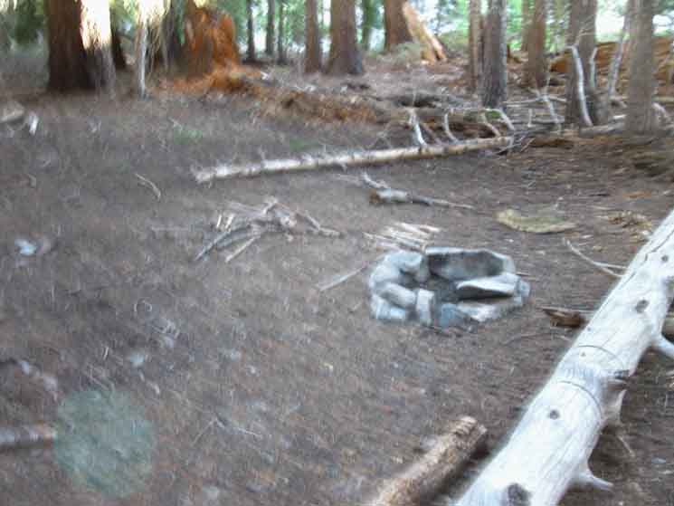 |
Campsite in the bottom of Jack Main Canyon. |
Armored Trail
 |
||
Temperate climate zone in the bottom of Jack Main Canyon. The terrain must be terribly saturated during late Spring into early Summer, demanding this segment of armored trail. Our last three-quarters of a mile across the bottom of Jack Main Canyon undulates along the Northwest canyon wall, as it has down the length of the canyon.
|
Wet Trail
 |
Wet trail rising with a nice dry granite fin. |
Last Descent
 |
very finely crafted steep and deep S-turn brings us to the end of Falls Creek's run down Jack Main Canyon, and ours too. |
End of the Trail
for
Falls Creek
in
Jack Main Canyon
 |
||
Ahead we see Falls Creek turning out the bottom of Jack Main Canyon.
|
Falls Creek
departs
Jack Main Canyon
 |
Falls Creek takes a Ninety-degree turn South flowing out the bottom of Jack Main Canyon. Falls Creek flows into the wide valley seemingly cut into a ridgetop holding Vernon Lake. |
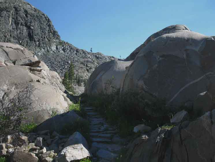
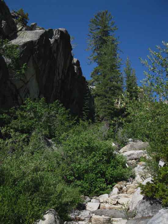
NOW WE CLIMB
Moraine Ridge
 |
Now our trail climbs out of the bottom of Jack Main Canyon up to the top of Moraine Ridge. |
Trail
up onto
Moraine Ridge
 |
Climbing Moraine Ridge from the bottom of Jack Main Canyon we enter the narrow slot or shallow groove carved into the North flank of Moraine Ridge. |
Moraine Ridge
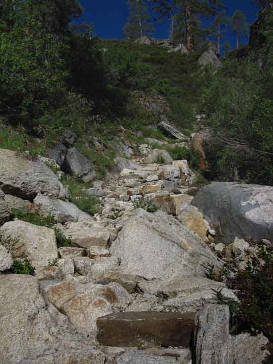 |
Climbing Moraine Ridge out of Lower Jack Main Canyon. The North Flank of Moraine Ridge. |
Looking
Northeast
into
The Bottom of Jack Main Canyon
 |
||
Looking into the bottom of Jack Main Canyon while climbing onto Moraine Ridge.
|
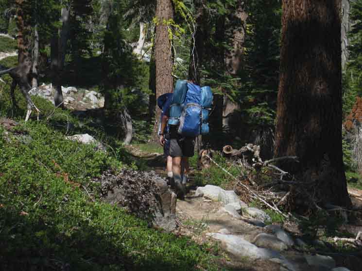
North Carolina Hikers
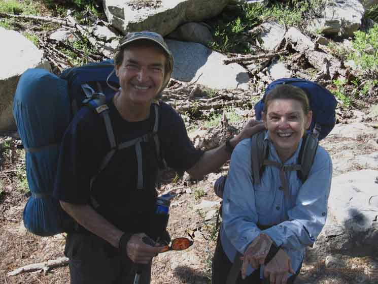 |
John and Renee out of North Carolina, June 30 2016. Also See |
Trail
 |
||
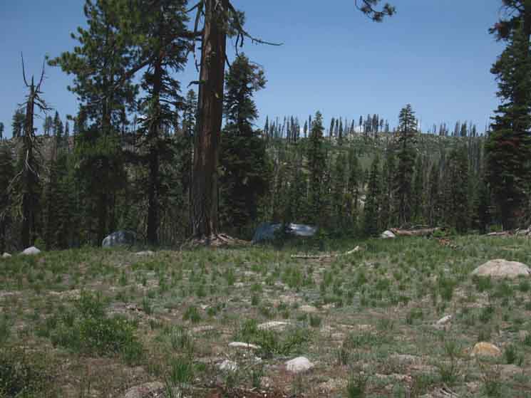
John and Renee climbing Moraine Ridge in Yosemite. We find an interesting juxtaposition of increasing heat and decreasing water dotted with islands of lusher life where water is available. Lodgepole Pines have given way to California White Pine and Fir.
|
Mariposa Lily
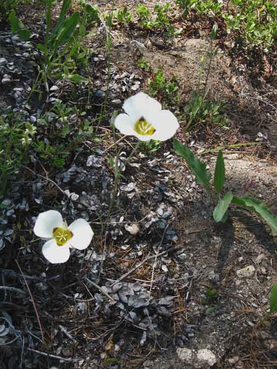 |
Mariposa Lilly |
Puddles of Pleasure
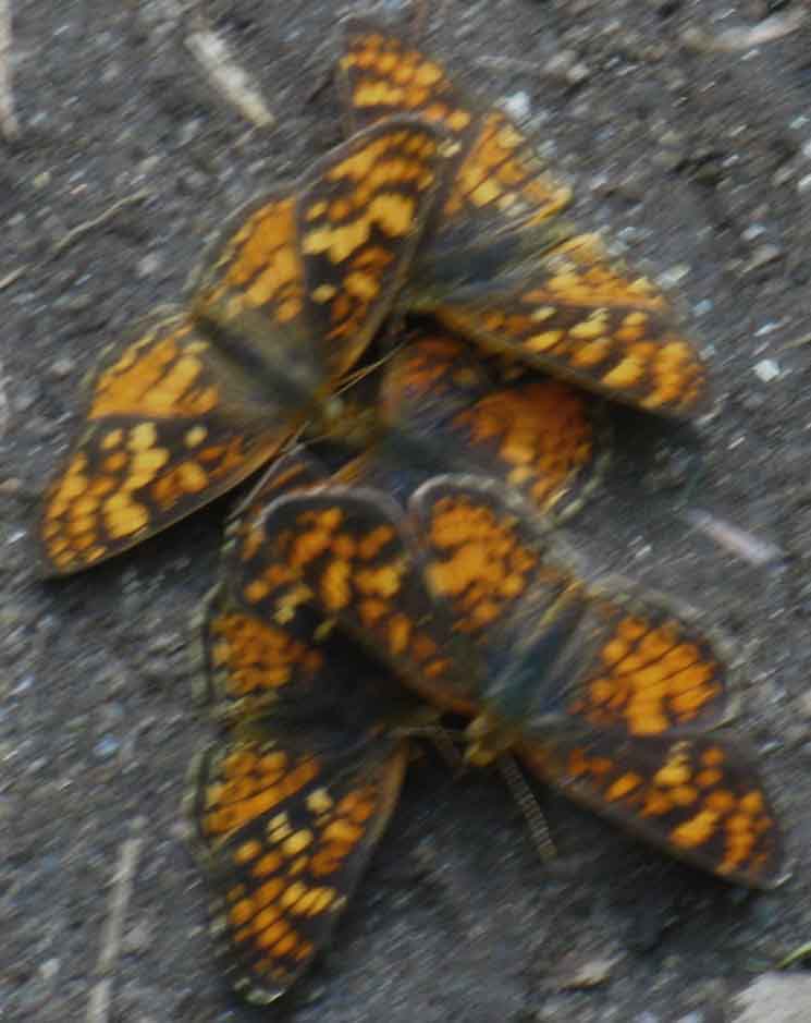
Butterflies on Moraine Ridge
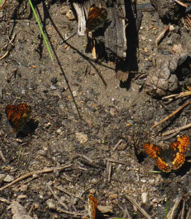 |
Butterflies form a compass on Moraine Ridge. |
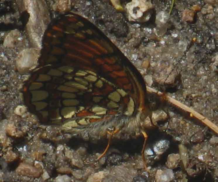
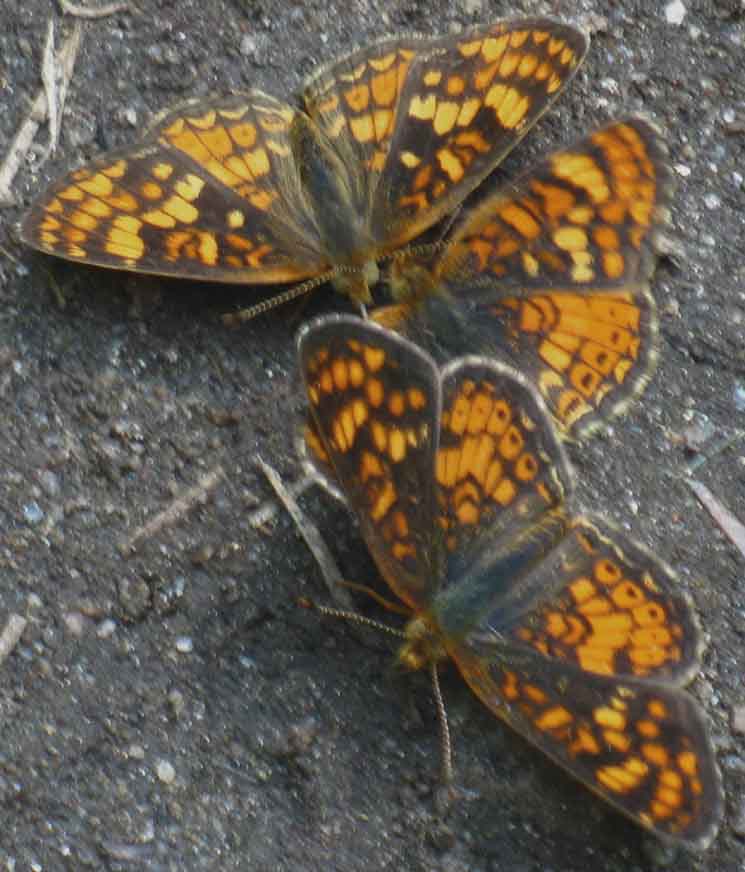
Butterfly
 |
||
Moraine Ridge butterfly.
|
Butterflies
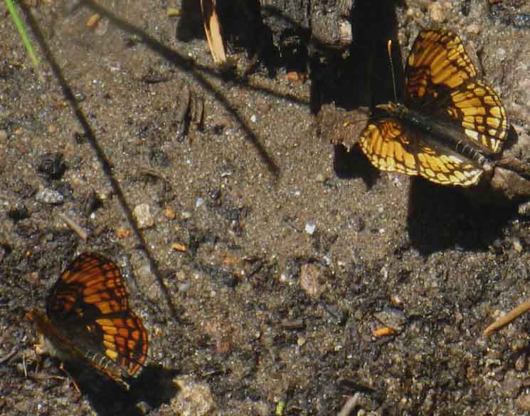 |
Moraine Ridge Butterflies. |
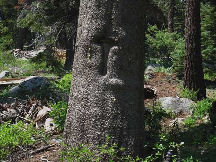
Cavalry T Trail Blaze
 |
||
Cavalry T trail blaze atop Moraine Ridge.
|
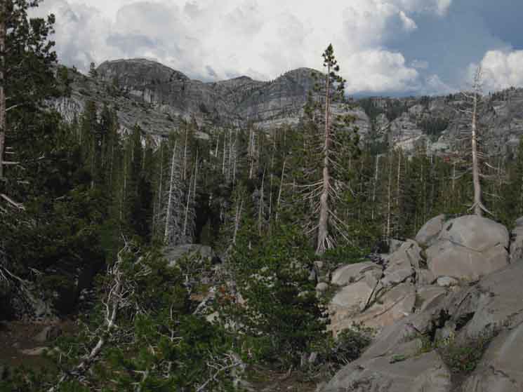
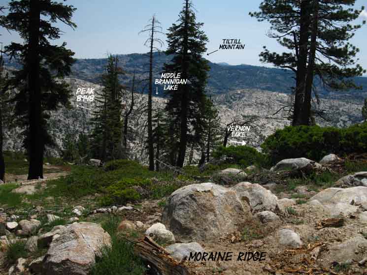
Looking Up Jack Main Canyon
 |
Getting up to the top of Moraine Ridge our view up Jack Main Canyon and the North Yosemite Backcountry beyond opens up. Let's figure out what we are seeing. |
View
Almost Directly
EAST
Up
Jack Main Canyon
 |
||
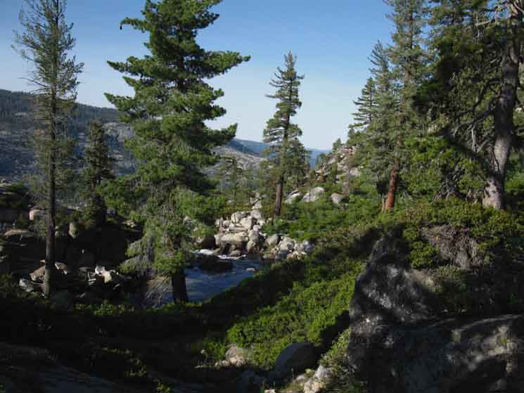
Price Peak has the route of the TYT-PCT running through the portion of Kerrick Canyon wrapping around its Southern Flank. The stretch of Kerrick Canyon running Rancheria Creek down from its Sierra Crest source to the East of Price Peak offers fantastic access into the North Yosemite Backcountry and onto the TYT-PCT route through Twin Lakes.
|
View
Northeast
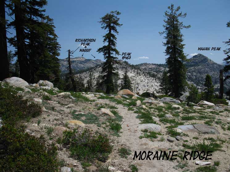 |
I figure our line of sight through Peak 8467 above is about 38 degrees East of North. |
View
East by South
 |
||
Our view above is looking just a bit South of East off the North end of Moraine Ridge, what I figure is running a line along the bearing of 97 degrees towards the summit of Tiltill Peak, which is blocked by the tree.
|
Trail
Last Steps to the Top
 |
Last steps to the top of Moraine Ridge. |
Ant World
 |
Many ants on Moraine Ridge. |
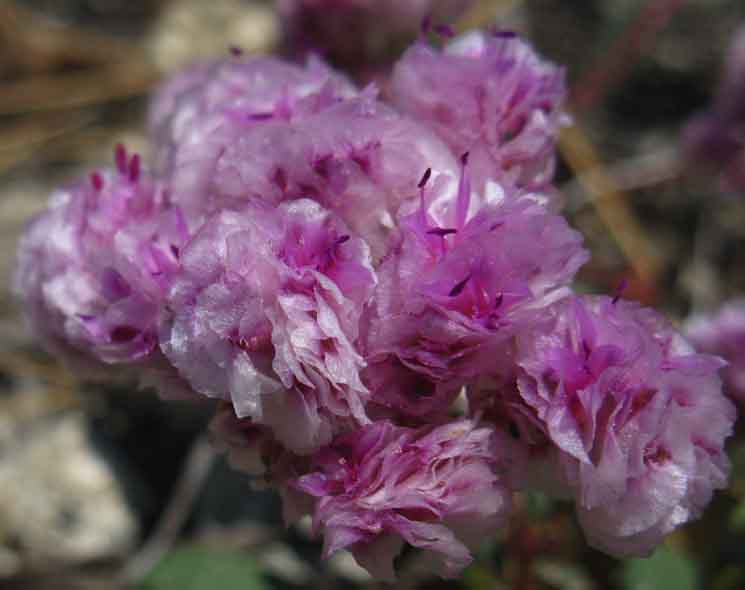
Pussypaw
 |
||
Pussypaw near the top of Moraine Ridge in Yosemite.
|
Descending Now
 |
We've crossed the high point along the crest of Moraine Ridge, now descending for the rest of our hike down to Hetch Hetchy. |
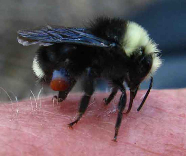
Me & the Bee
 |
||
Bumble Bee and Me, atop Moraine Ridge while backpacking out of Jack Main Canyon. This dude persistently pursued me, insisting I let him harvest some salt. I was at first resistant to his persistence, then relented in the face of the overwhelming need this persistence revealed. The Bumbler was putting his health at risk "bugging" me, which indicated his health was at greater risk not bugging me. Salt must be at a real premium. Bumbler was an expert, using his rasp-like tongue to quickly scrape off and roll up a a wad of salt crystals off the surface of my skin. Bumbler, or his buddies, had a serious need for salt, stat!
It gets better even better! While checking out the Bumbler I spied another little guy running by. With eight legs! Trying to run by...
|
Trail
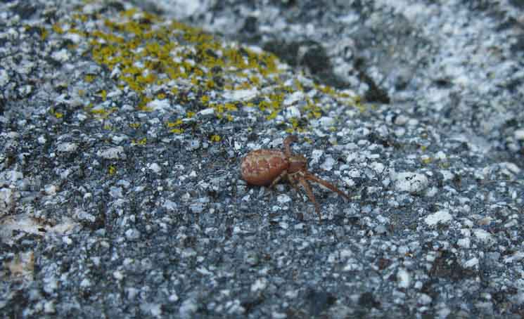 |
Little red spider trying to run away as fast as he can. I can feel him thinking, "Aw shit, I hope he didn't see me," as he scurried on, convinced I had indeed seen him, and making haste. I had, and I was coming in to say, "Howdy, Spider." |
Howdy, Spider!
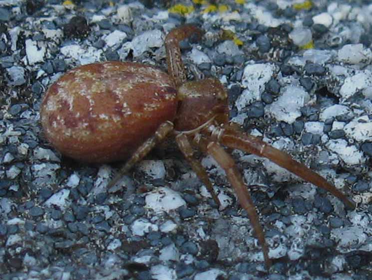 |
||
Hey little dude, Note the eye he's keeping on us...
|
Run Away
Little Spider
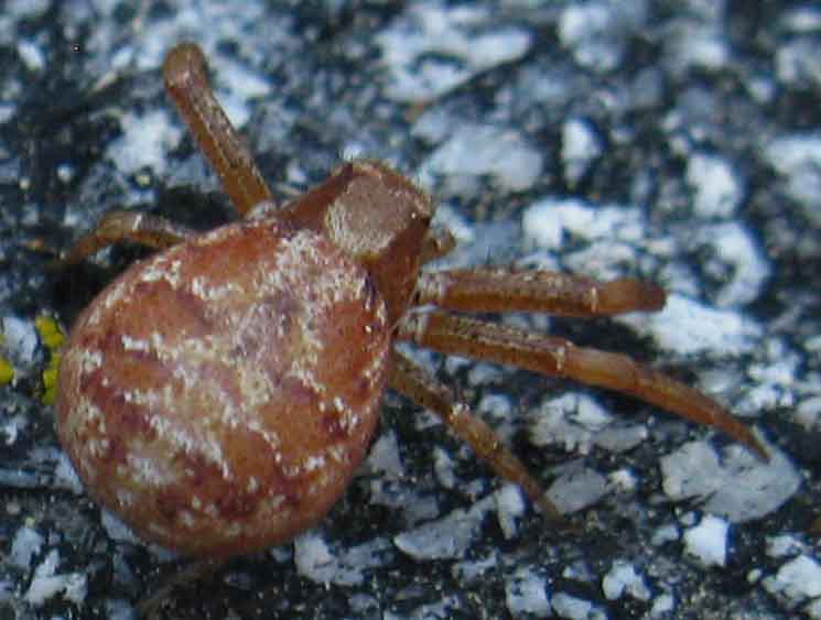 |
Little red spider running up the rock, thinking Alex does suck. Note the eyes on the back of his head on us. Have any idea what to call this little guy besides, "Little Red, Spider Variety?" Post it up in the |
Northeast
UP
Moraine Ridge
to
Jack Main Canyon
 |
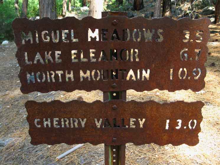
Trail sign up Moraine Ridge into Lower Jack Main Canyon. |
Southwest
Down
Moraine Ridge
to
Hetch Hetchy
 |
||
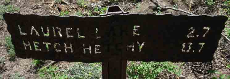
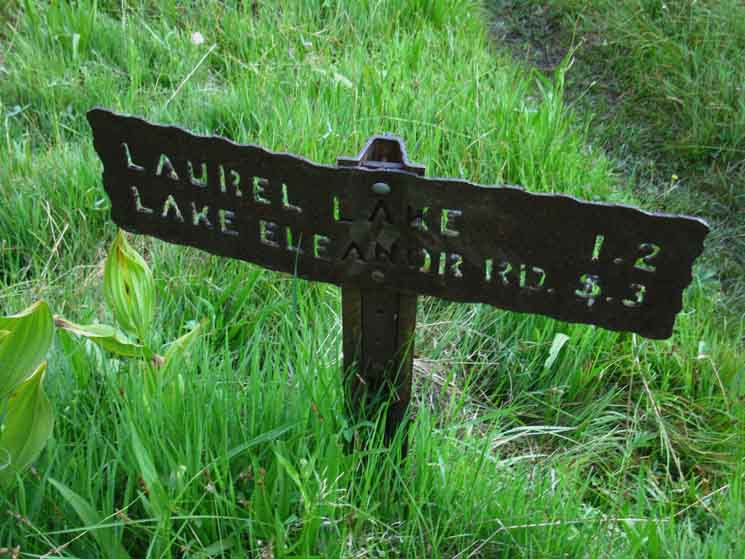
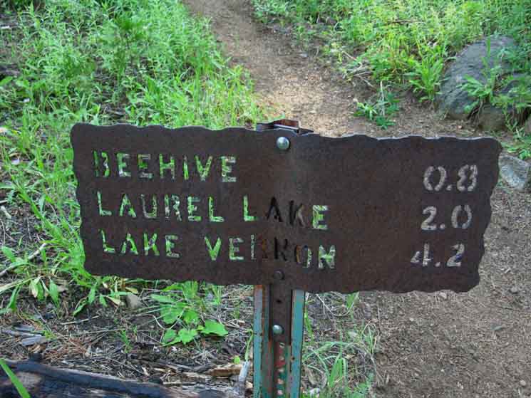
Trail sign down Moraine Ridge into the Grand Canyon of the Tuolumne River and Hetch Hetchy Reservoir. We figure it's 1.5 miles to the Spring and Campsites at the Beehive trail junction to Laurel Lake.
|
Northeast
Down
to
Vernon Lake
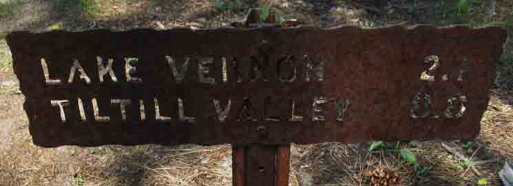 |
Trail to Northeast off Moraine Ridge down to Vernon Lake, with the trail continuing Southeast around the South Flank of Gibson Peak to get into Tiltill Valley. |
Temperate Trail
 |
||
A bit of lush terrain hiking Southwest down Moraine Ridge approaching the Beehive trail junction. The lushness is indicative of the effect of this little "pocket," this low depression in the topography that feeds this temperate zone, the upcoming meadow at the beehive trail junction out to Laurel Lake, and the improved spring located there. The spring at the Beehive is sufficient to reliably supply hikers and the campsites there.
|
Trail
 |
Butterflies puddle on Moraine Ridge. |
Trail
 |
||
v
|
Endless Butterflies Video
Endless Butterflies along a segment of temperate trail approaching the spring at the Beehive. Endless Butterflies Check out the |
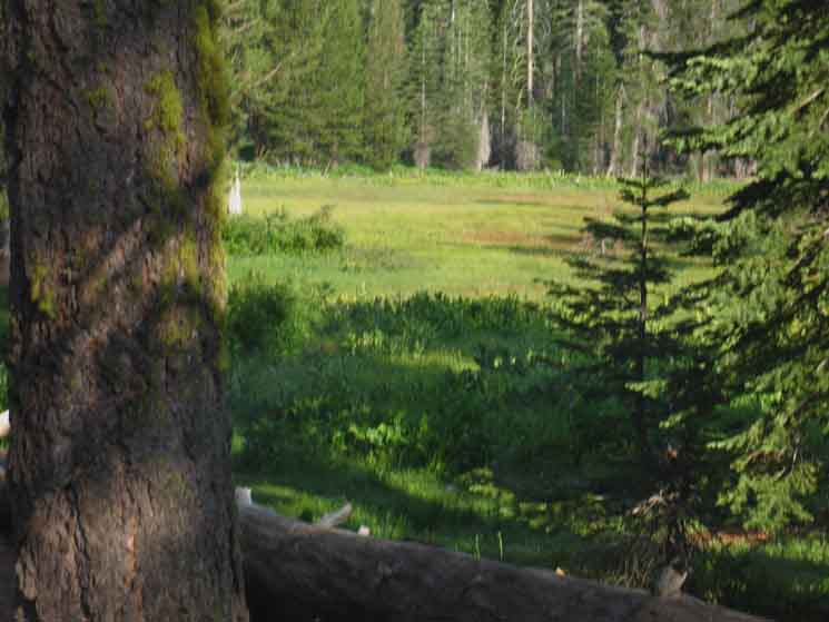
Meadow
at
Beehive Trail Junction
to
Laurel Lake
 |
||
Hiking Southwest and down into the East edge of the meadow at the Beehive where we hike straight past the trail out to Laurel Lake.
|
Beehive Trail Junction Campsite
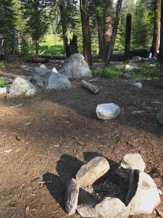 |
Campsites at the trail junction for Laurel Lake at the Beehive on Moraine Ridge. |
Beehive Trail Junction
Up
Moraine Ridge
 |
||||
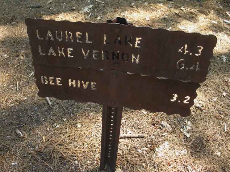
Up Moraine Ridge. We figure it's 1.5 miles up Moraine Ridge to where the trail junction to Lake Vernon. That junction marks the beginning of the descent to Lake Vernon off Moraine Ridge. The distance to Tiltill Valley is via Lake Vernon. Wilmer Lake is where the trail up Jack Main Canyon meets the Pacific Crest Trail's route across the North Yosemite Backcountry.
|
Beehive Trail Junction
Laurel Lake
 |
||
The trail from the Beehive to Laurel Lake
|
Water
 |
||
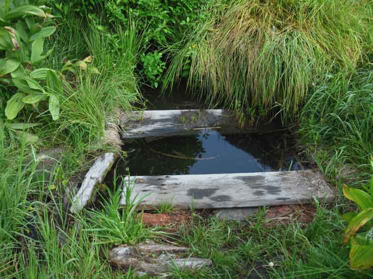
Trail to the spring. Trail to the fresh water spring at the Beehive trail junction and campsites.
|
Trail
 |
||
Freshwater spring near the Beehive trail junction and campsites.
|
Trail
to
Hetch Hetchy
 |
||
Hiking to Hetch Hetchy from the Beehive.
|
Trail Beginning
Descent
to
Hetch Hetchy
 |
Beginning to descend we find ourselves in fine fern under forest of Pine and Fir. |
Lake Eleanor Road
Trail Junction
UP
Moraine Ridge
 |
||
Trail to Beehive up Moraine Ridge from this trail to Lake Eleanor Road. The sign above pointing us back up Moraine Ridge indicates we have descended less than a mile from the Beehive.
|
Lake Eleanor Road
Trail Junction
DOWN
Moraine Ridge
 |
||
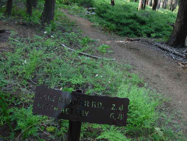
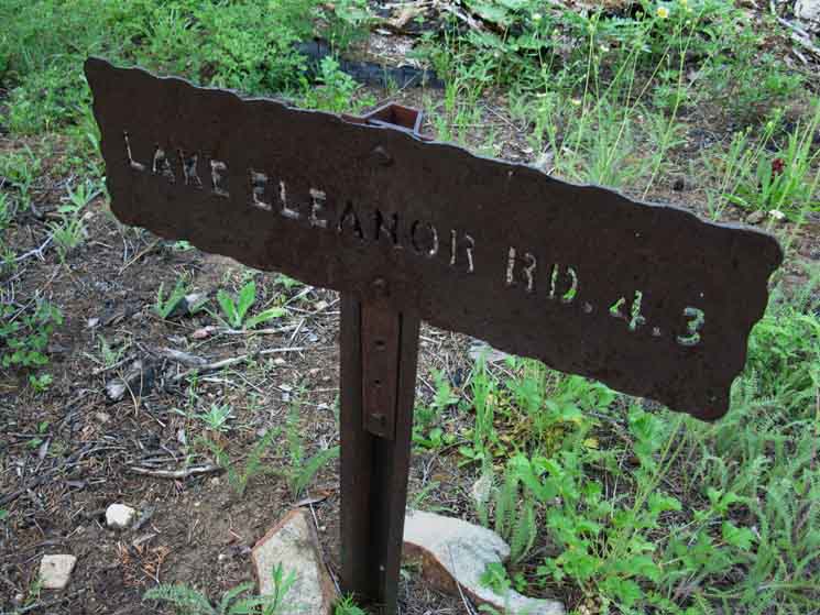
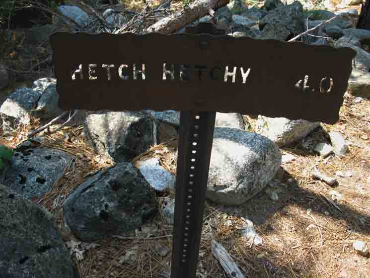
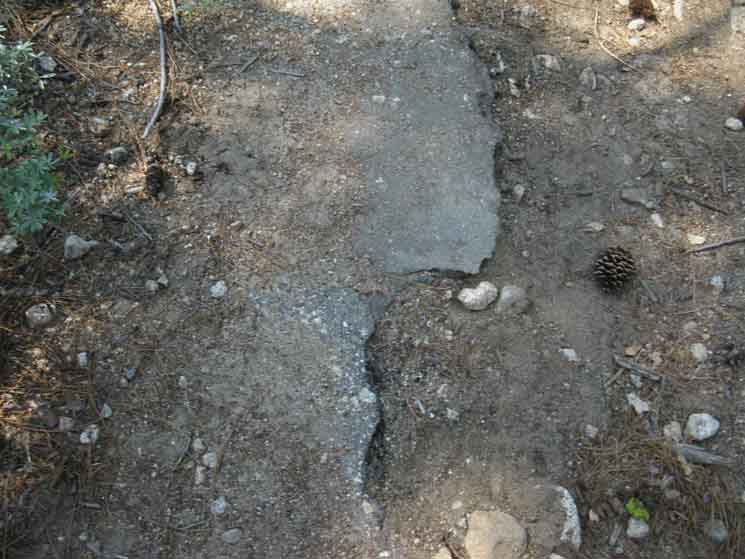
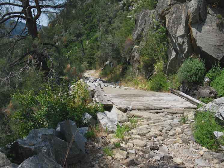
Lake Eleanor Road 2.4 miles The sign above measures our distance down Moraine Ridge to Hetch Hetchy and to the next trail junction along our way, which is the junction with Lake Eleanor Road. Once we get down to our next trail junction, the junction with the "Lake Eleanor Road" we will notice that we are entering what was once a paved road surface for the remainder of our trail down switchbacks to the surface level of Hetch Hetchy. We can see it was paved both by the size and grading, but mostly through the remnant random chunks of asphalt scattered about, and what's still remaining along some of the edges of this old road.
|
Lake Eleanor Road
Trail Junction
Southwest
to
Lake Eleanor Road
 |
This trail breaks off our main route running down Moraine Ridge to work its way Southwest down-mountain it's intersection with the Lake Eleanor Road. The Lake Eleanor road The trail to Lake Eleanor Road from the Beehive via Lake Eleanor connects with this trail on its way out to the Lake Eleanor Road. |
Trail
 |
Gunsight burned tree below the Beehive. |
Trail
 |
Beginning our descent into the Grand Canyon of the Tuolumne River. |
Trail
 |
||
Descending between the top two Eleanor Lake Road trail junctions.
|
Trail
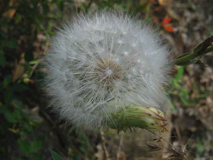 |
Unidentified Dandelion. |
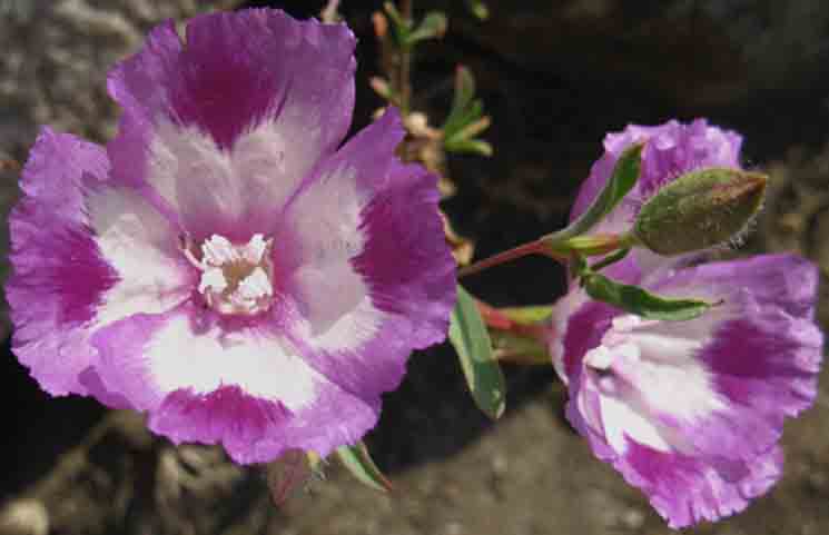
Trail
 |
||
Williamson's Clarkia on Moraine Ridge above Hetch Hetchy.
|
Trail
 |
Trail Coming down Moraine Ridge above Hetch Hetchy. |
Trail
 |
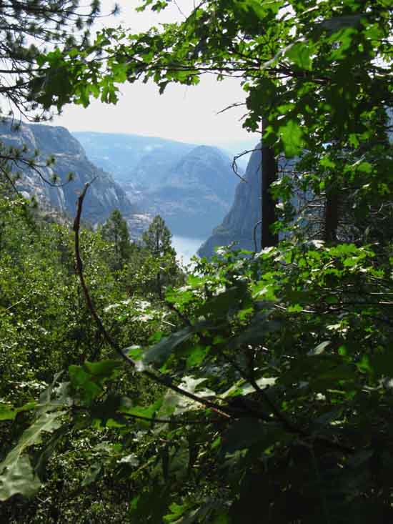
We get a nice view into the uppermost reaches of Hetch Hetchy reaching way up the Grand Canyon of the Tuolumne River. |
Lake Eleanor Road
Trail Junction
 |
Lake Eleanor Road trail junction above Hetch Hetchy. |
Lake Eleanor Road
Trail Junction
Climbing Moraine Ridge
 |
||
Lake Eleanor Road trail junction trail up Moraine Ridge.
|
Lake Eleanor Road
Trail Junction
Descending to Hetch Hetchy
 |
Trail down to Hetchy from the Lake Eleanor Road trail junction on Moraine Ridge. Here we sit atop road-width switchbacks down to Hetch Hetchy. |
Before the Wilderness
 |
||
Pavement remnants at Lake Eleanor Road above above Hetch Hetchy.
|
Kolana Rock
 |
Kolana Rock from Moraine Ridge as we descent to Hetch Hetchy below the Lake Eleanor Road trail junction. |
Rancheria Falls
 |
Looking up Hetch Hetchy at Le Conte Point rising above the canyon where Rancheria Creek runs through its Falls and down into Hetch Hetchy. Rancheria Mountain is the name of that vast ridge rising in the background. |
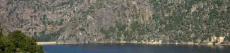
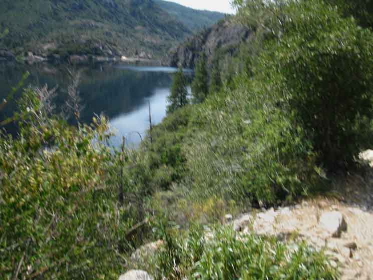
Hetch Hetchy
and
O'Shaughnessy Dam
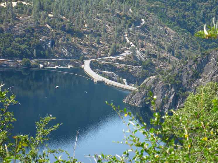 |
||
Hetch Hetchy up against O'Shaughnessy Dam.
|
Trail
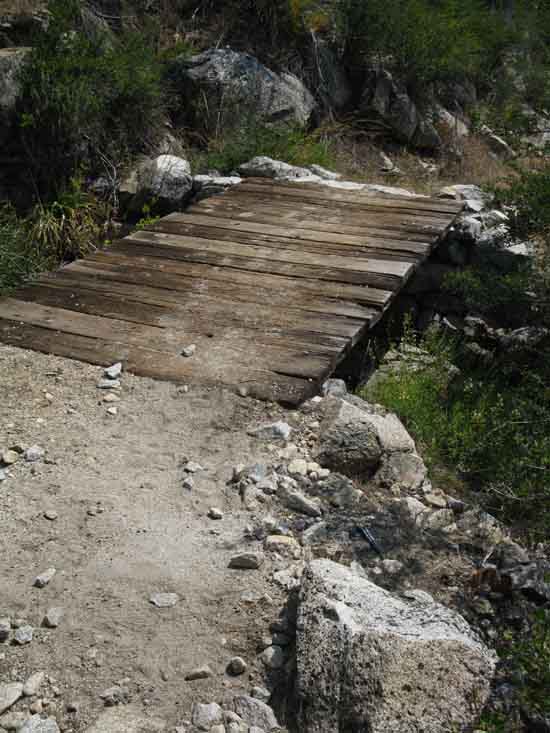 |
Trail work. |
Rancheria Creek
into
Hetch Hetchy
 |
Le Conte Point towering over Rancheria Falls beyond Kolana Point, Rancheria Mountain Climbing in the furthest background. |
Road-Trail
 |
||
Road sized trail switchbacking down to Hetch Hetchy below the trail junction with Lake Eleanor Road.
|
TRAILHEAD MILES
NORTH
VIA
MORAINE RIDGE
INTO
JACK MAIN CANYON
|
*Note the route from Kennedy Meadows to Hetch Hetchy via
Tilden Lake and Tilden Canyon
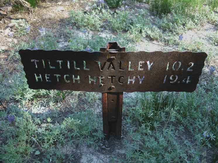
Hetch Hetchy Trailhead OUTBOUND HIKERS O'Shaughnessy Dam |
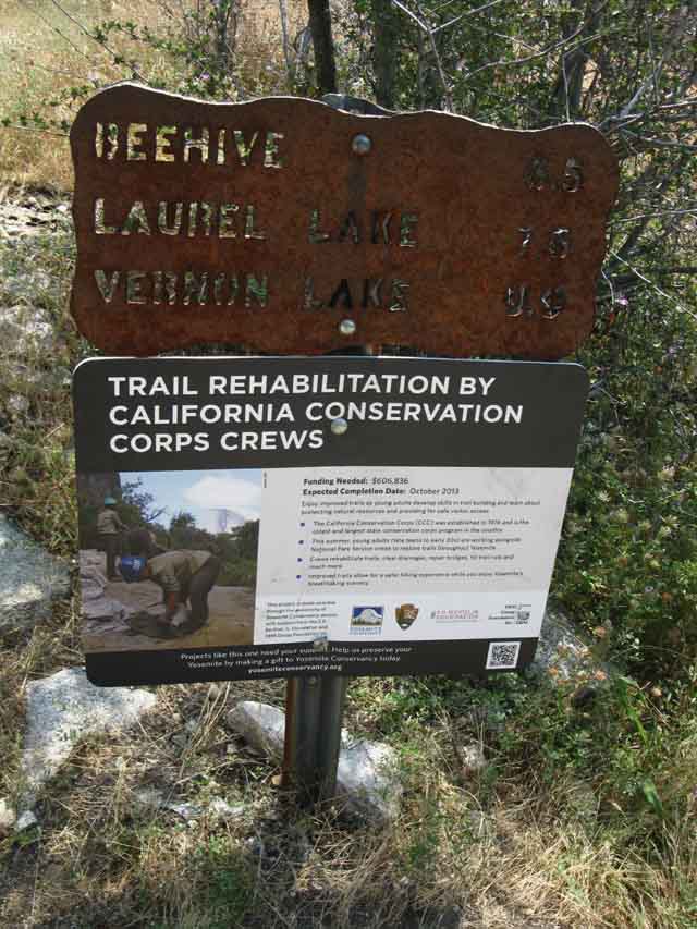 |
Trail junction beginning the monster climb onto and over Moraine Ridge into the bottom of Jack Main Canyon. Beehive 6.5 miles Laurel Lake 7.6 miles Vernon Lake 9.9 miles |
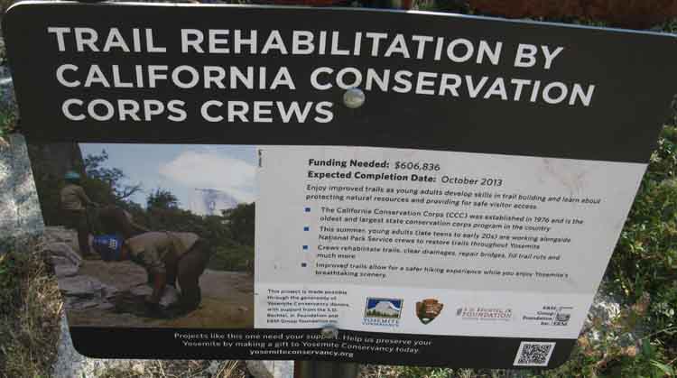
California Conservation Corps
 |
||
California Conservation Corps trail rehabilitation sign. Here's how: California Conservation Corps Sign Enjoy improved trails as young adults develop skills in trail building and learn about protecting natural resources and providing for safe visitor access. * The California Conservation Corps (CCC) was established in 1976 and is the oldest and largest state conservation corps program in the country * This summer, young adults (late teens to early 20s) are working alongside *Crews rehabilitate trails, clear drainages, repair bridges, fill trail ruts and * Improved trails allow for a safer hiking experience while you enjoy Yosemite's
|
HETCH HETCHY
TRAILHEAD
MILES NORTH
(On the Trail Pictured Below)
VIA
Rancheria Falls and Tiltill Valley
up to the
PCT-TYT
TRAIL JUNCTION
in
TILDEN CANYON
|
Hetch Hetchy Trailhead O'Shaughnessy Dam OUTBOUND HIKERS 6.5 miles to Rancheria Falls |
along the
North Shore of Hetch Hetchy
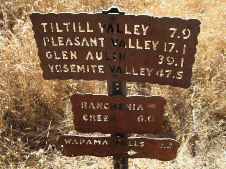 |
HIKING Our trip hiking South-Southwest off the PCT-TYT through Tilden Canyon to Tiltill Valley and Rancheria Falls on our way here to Hetch Hetchy is about over. Those hikers entering the Yosemite Wilderness through this Hetch Hetchy Trailhead have two options. From Pleasant Valley we can climb Rodgers Canyon to the PCT near Smedberg Lake or descend to Pate Valley on the floor of the Grand Canyon of the Tuolumne above the waters of Hetch Hetchy. The miles to Glen Aulin and on to Yosemite Valley are measured down that route from Hetch Hetchy to Pate Valley. Up onto Moraine Ridge I've got to note the steel trail sign in Tiltill Valley reads out the distance to Hetch Hetchy at 9.2 miles, while the sign above reads it out at 7.9 miles. Outward Bound We can ascend from here to three different points along the combined routes of the TYT-PCT across the North Yosemite Backcountry. These are through Tilden Canyon Creek, into Kerrick Canyon at its PCT-TYT fording point, or up through Rodgers Canyon. Taking the route to Rodgers Canyon brings us through Pleasant Valley, where we can either continue up to the PCT-TYT or drop down to Pate Valley on the floor of the Grand Canyon of the Tuolumne above the top of Hetch Hetchy Reservoir. See the Grand Canyon of the Tuolumne map for a good overview of all these North Yosemite backpacking trips. |
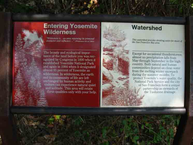
Exiting the Wilderness
 |
||
Wilderness boundary sign and notice at Hetch Hetchy Trailhead.
|
Bottom of Hetch Hetchy
 |
||
Hetch Hetchy Trailhead hiking to O'Shaughnessy Dam.
|
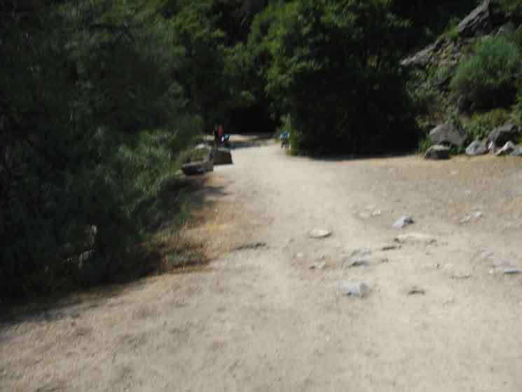
Road to Hetch Hetchy Tunnel
 |
||
Road to O'Shaughnessy Dam.
|
Hetch Hetchy Tunnel
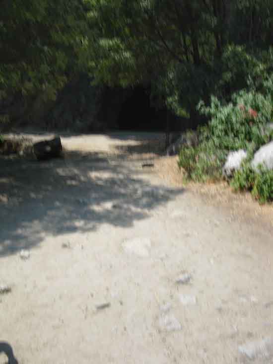 |
The Hetch Hetchy Tunnel. |
OUT
Across
O'Shaughnessy Dam
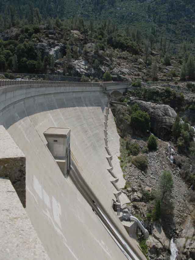 |
Face of O'Shaughnessy Dam. |
Hetch Hetchy
&
O'Shaughnessy Dam
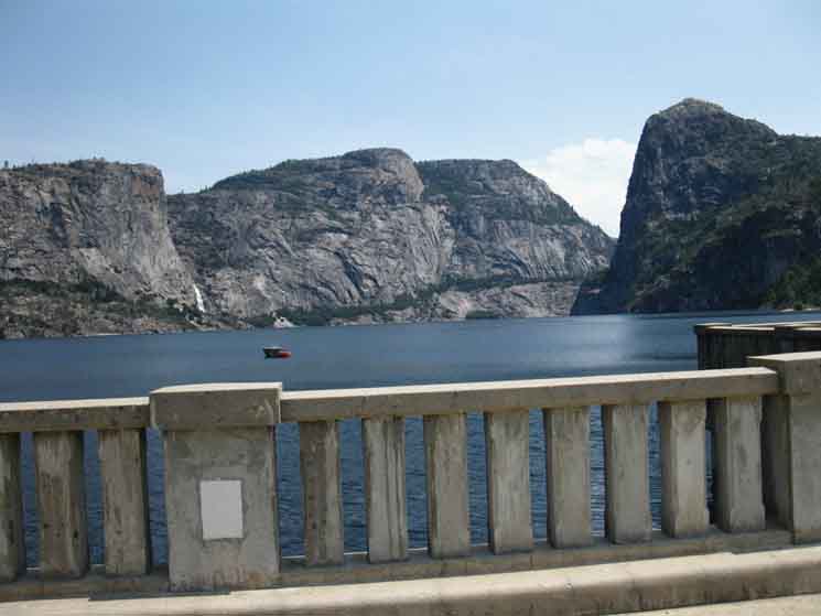 |
| View of Wapama Falls and Kolana Rock across Hetch Hetchy from O'Shaughnessy Dam. |
Wapama Falls
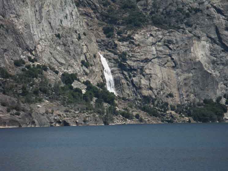 |
Wapama Falls from O'Shaughnessy Dam. |
Associated
Trail Guide Pages
|
Hetch Hetchy Roadmap
Road Maps specifying locations of the endpoint of our backpacking trip to Hetch Hetchy in relation to Mather, Highway 120, Crane Flat and Tuolumne Meadows. |
North: South:
The |
|||||||||||
The Destination of this Voyage The I have listed the selection of guide pages North and South In that case, let's rest, resupply, and get ready at 2016 Visit Associated Trail Guide Pages
HEY ! THIS PAGE IS UNDER CONSTRUCTION: STAY TUNED FOR MUCH MORE! COME ON BACK NOW, 'YA HEAR?
7.5 Map 7.5 Topo
MAP
Grand Canyon
|
Backpacking Trail Guide NORTH |
 |
Backpacking Trail Guide SOUTH |
Backpacker ForumsHave a great trip or story to relate about Yosemite or in the Sierra Nevada? Post it on Above we come to the Front Page of the High Backpacking Trails and Topics Forums. Below we break the forums down into categories:
The Trails Forum acts as your place to put up input, comments, relate your experiences, or ask questions about each segment and spot along the length of our combined TYT-PCT-JMT trails. The Forum is your place to supplement the trail guide. Anyone can post text comments in the existing forums, but only members can post up new topics, along with images, maps, and formatting. If you have experiences, comments, questions, or pictures and videos of the Pacific Crest Trail between Sonora Pass and Tuolumne Meadows, post up here as an unknown hiker or as a member: Forum Section
|
Trailhead
Contact
Alex Wierbinski

Backpacking Lake Tahoe to Mount Whitney
Your Guide to the High Sierra Crest, including the Tahoe to Yosemite, Pacific Crest, and John Muir Trails
