The Trails
Guide
Maps
Miles/Ele
Permits
Resupply
Forum
Current Weather Conditions
Weather Notes
Northern High Sierras
Central High Sierras
Southern High Sierras
Gear
Gear List
Gettin Started
Layering
Discussion
Testing yourself and your gear
Gear Reviews
Hiking
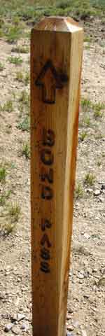
Brown Bear Pass to Bond Pass
Backpacking
Emigrant Wilderness
Backpacking
The Tahoe to Yosemite Trail
from
Kennedy Meadows to Tuolumne Meadows
Languages
Languages
Trail Arts
The art of walking
Physical Preperation
Trail Skills
The trail
Off the trail
Scrambling
Maps
Navigation
Camp skills
Food
Resupply
Food
Other
Photo Catagories
Trail Stories
Trail Culture
News and Science
Links
Groups
Books
Terms and Conditions of Use
| Trail Guide INDEX Highway 108 to Highway 120 |
North |
South |
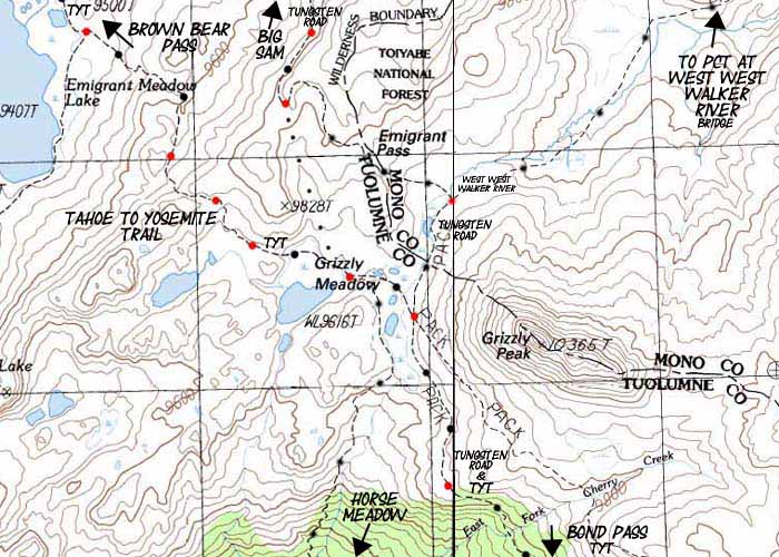
7.5 Topo Map Brown Bear Pass to Jack Main Canyon |
30 min Map Sonora Pass to Bensen Lake |
Kennedy Meadows to Tuolumne Meadows MILES AND ELEVATIONS |
TOPO MAP INDEX Kennedy Meadows to Tuolumne |
Resupply South |
National Forests Toiyabe & Stanislaus |
all maps index |
High Emigrant Basin
Emigrant Meadow, Grizzly Meadow, and Summit Meadow
Viewing
Grizzly, Tower, and Forsyth Peaks
 |
|||
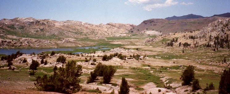
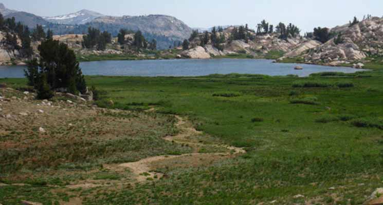
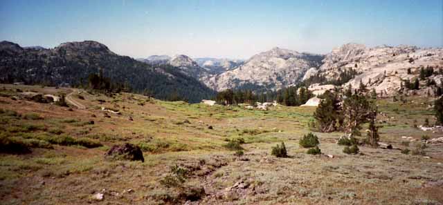
View Southeast from Brown Bear Pass 9760 10.92 miles Above
Emigrant Meadow
Tower Peak
Forsyth Peak & Saurian Crest
Walking the Line
Together Again
High Emigrant Basin
Duration Brown Bear Pass 10.92 miles Tahoe to Yosemite Trail
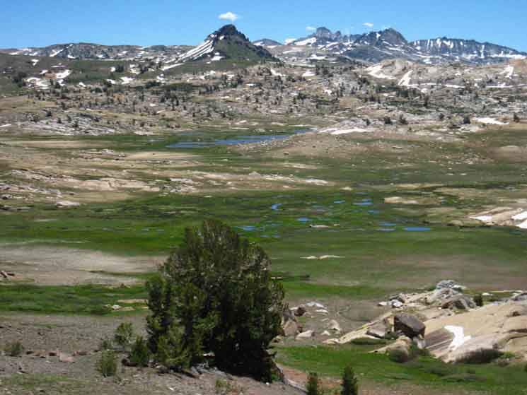
In the image above we see the moderate tones of a dry year dimming the usual verdant greens of early Summer. By High Emigrant Basin I mean the great mountaintop flat holding Emigrant, Grizzly and Summit Meadows as well as the lakes and mountain peaks sprinkled around this series of high elevation flats. June 26 2013: Above |
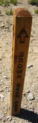
Brown Bear Pass
MAPS |
| 15 Minute MAP Brown Bear Pass to Bond Pass |
30 Minute MAP Sonora-Brown Bear Passes to Bensen Lake |
30 Minute MAP
TYT-PCT across Highway 108
| Kennedy Meadows to Bond Pass TYT Miles and Elevations |
Bond Pass to Tuolumne Meadows PCT Miles and Elevations |
Route Options
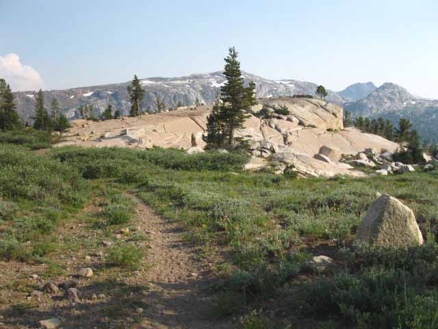
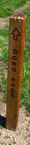
This next segment of the Southbound Tahoe to Yosemite Trail has us hiking directly Southeast across a series of high elevations meadows. We cross Emigrant, Grizzly, and Summit Meadows on our way to Bond Pass. Bond Pass is our Easternmost exit from Emigrant Wilderness into the Northwest Yosemite Backcountry.
Eating Cake
We descend from our position in Brown Bear Pass to cross Emigrant Meadow, as seen in the image above. From the East side of Emigrant Meadow at Emigrant Meadow Lake climbing a moderate 200 foot ascent over the low ridge separating Emigrant from Grizzly Meadow brings us into Grizzly Meadow and the trail junctions radiating to all compass points situated under Grizzly Peak.
Hiking South on the Tahoe to Yosemite Trail from Grizzly Peak we find we've picked up the remnants of the old tire ruts, and sometimes wider track of the Tungsten Road. We hike South from Grizzly Peak ascending gently until we enter the rocky chute beginning our slightly longer descent down to Summit Meadow. Bond Pass is a short climb Southeast out of Summit Meadow. This next section between Brown Bear and Bond Passes is a piece of cake.
All Horizons
This short section of trail crosses the highest section of Emigrant Wilderness. The series of trail junctions we encounter along this segment of trail opens up lots of local hiking opportunities. Trails in every direction branch off to all compass points of the Emigrant Wilderness from the trail junctions under Grizzly Peak. We can hike North, South, East, or West from Grizzly Peak.
Trails down the Western flank into the North and East forks of Cherry Creek branch off before, at, and after we reach Grizzly Peak.
Top Trail Junction
Grizzly Peak
Trails to all Four Compass Points
This is the "roof of the world" here in this part of the world, and this hub of trails under Grizzly Peak offers us access to all compass points.
North
North we have the Tungesten Road over Big Sam leading to the PCT at the top of Kennedy Canyon. The PCT trail junction at the top of Kennedy Canyon is another four compass point trail junction located on the Sierra Crestline. Our route options to the North hiking over Big Sam are legion. See the trail diagram below.
Northwest
The route of the TYT that we hiked Southeast from Kennedy Meadows Pack Station to Grizzly Peak can also take us Northwest back to Kennedy Meadows.
East
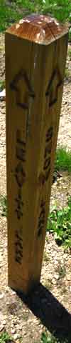
To the East we have the trail over the low gap of Emigrant Pass down the East Flank via the headwaters of the West West Walker River, then to the West Walker River leading North to Leavitt Meadow Trailhead. Both of these scenic Sierra rivers are wedged into a tab of the Toiyabe National Forest between the Emigrant, Hoover, and Yosemite Wilderness Areas.
South
South we have the unified Tahoe to Yosemite Trail & Tungsten Road continuing South into Summit Meadow; the TYT continues into the Northwest corner of Yosemite from Summit Meadow, presumably on our way to Tuolumne Meadows. The Tungsten Road swings two trails to the Southwest out of Summit Meadow.
A branch of the Tungsten Road tracks Southwest from the North edge of Summit Meadow into the top of Horse Meadow's canyon, while another fork continues Southwest with the TYT into the middle of Summit Meadow, where a trail junction points the Tungsten Road over to one of its ends, this one at the Montezuma Mine at Snow Lake. The branch of the Tungsten Road from the North end of Summit Meadow proceeds down through Horse Meadow to terminate at the old mine located just below the bottom of Horse Meadow.
| Tungsten Road Information | Tungsten Road forum |
Southern Options
We have many alternative routes to our South. First, we can hike down the length of Jack Main Canyon to Hetch Hetchy once we hike into the Northwestern corner of Yosemite, if we don't want to hike all the way down to Tuolumne Meadows.
We also have the option of using Bond and Dorothy Lake Passes as a turnaround point for long backpacking loops remaining within, more or less, Emigrant Wilderness. Instead of continuing South into Yosemite we exit out of the "other" pass.
If we entered Yosemite through Bond Pass we would turn North on the PCT to exit through Dorothy Lake Pass. Visa-versa for those hiking Southbound in through Dorothy Lake Pass. They would turn North on the TYT over Bond Pass into Emigrant Wilderness.
Or we can turn Southwest from the Grizzly Peak trail junction.
Southwest
Southwest we have two options from Grizzly Peak. First, we have the unmarked trail down into the top of Horse Meadow. At the bottom of Horse Meadow we find the trail running Northwest to Maxwell, Blackbird, and Emigrant Lakes on the way over Mosquito Pass & back to the TYT above Lunch Meadow.
This option is expanded out another level by looping around Snow Lake via Summit Meadow before turning back to the Northwest to reconnect with the TYT. Note that our trails to the Southwest all pick up the length of trail tying Summit Meadow to Lunch Meadow running parallel to the line of the TYT, but just a bit lower down the Western Flank of the Sierra.
High Emigrant Basin Hiking Map
The North Fork of Cherry Creek through Emigrant Lake and the East Fork through Horse Meadow offer us access to the lower elevation trailheads down the Western Flank around the Southern perimeter of Emigrant Wilderness. Specifically, the trailheads at Cherry Lake and those at Pinecrest Lake, and higher up along the Highway 108 corridor.
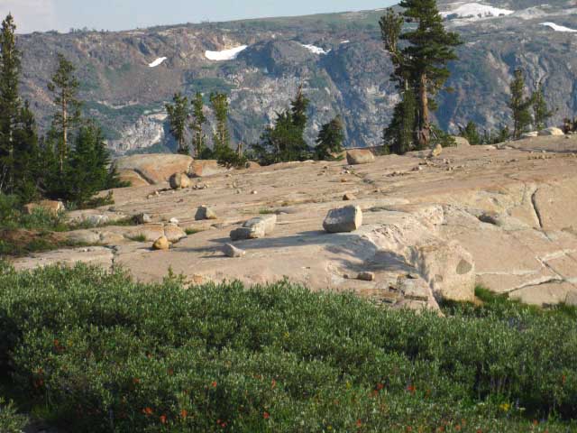
Though this guide sticks to the trails along the Sierra Crest, the trails down the Forks of the Cherry Creeks are worth exploring. The Cherry Creeks run the length of this great sheet of granite draining the crestline through Emigrant Basin down the Western flank to Cherry Lake. It is this magnificent sheet of vast granite running from Emigrant Basin along the Sierra Crest all the way down to Cherry Lake that composes the majority of Emigrant Wilderness.
Hiking down either branch of Cherry Creek we will find access to the Buck Meadow Creek trail running West to Pinecrest Lake, and other more accessible trailheads along the Highway 108 corridor, than the remote trailheads we find way down the Western flank around Cherry Lake.
Since our Tahoe to Whitney maps concentrate on hiking and exploring the Sierra Crest, the National Forest Wilderness Map of Emigrant Wilderness is a good map for backpackers exploring their options for starting or ending their backpacking trips through lower elevation trailheads at Pinecrest or Cherry Lakes.
Emigrant Wilderness Area
Dept AG USFS hiking map PDF
| All Emigrant Wilderness Map Resources: Digital & Paper |
TW Trail Guide Emigrant Wilderness Hiking Map Collection |
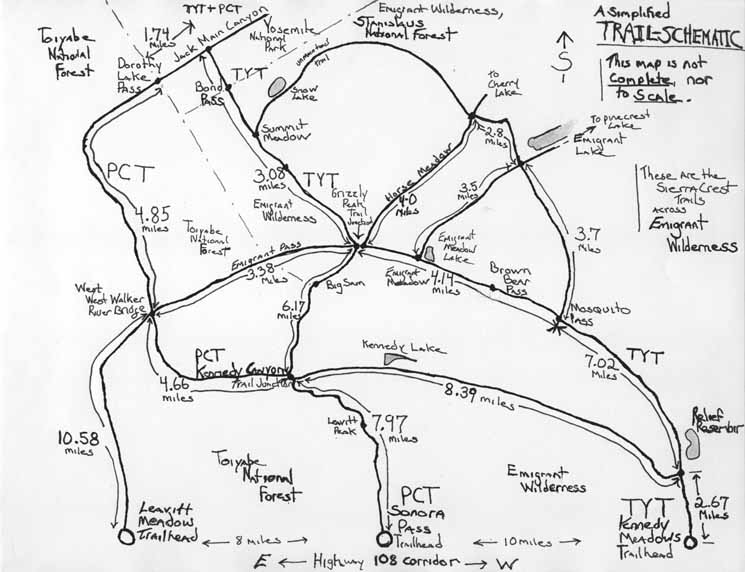
Blow-up this Schematic Trail Map of High Emigrant Wilderness
below for a better view:
Emigrant Wilderness
Schematic Trail Map

BIG VERSION
Inside the Matrix Alternative Endings Brown Bear Pass to Bond Pass
30 Minute MAP
By High Emigrant Basin I mean the great mountaintop flat holding High Emigrant Meadow, Grizzly Meadow, and Summit Meadow, as well as the lakes sprinkled around within the reach of this "ledge." Forum All backpackers can post text comments about the section covered by this guide page below through the comments links on this, and all the trail guide pages. Registered Members can post up text, images, maps and videos in the Trails Forum supplementing and updating this page's coverage of the High Emigrant Basin. Check out the Tahoe to Whitney .org Backpacking Trails and Topics forums
|
|||||||||||||||||||||||||||||||||||
Video
Brown Bear Pass to Grizzly Peak
16:56 After laying out the routes, the maps, and the mileages a modern digital trail guide can just step back and show the video.
High Sierra Backpacking Videos
|
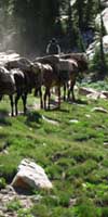
Riding North into Brown Bear Pass
 |
||
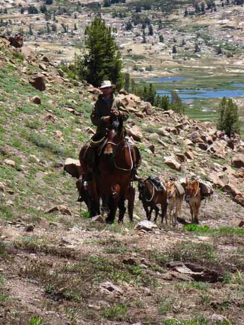
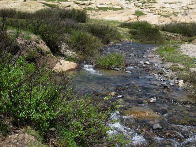
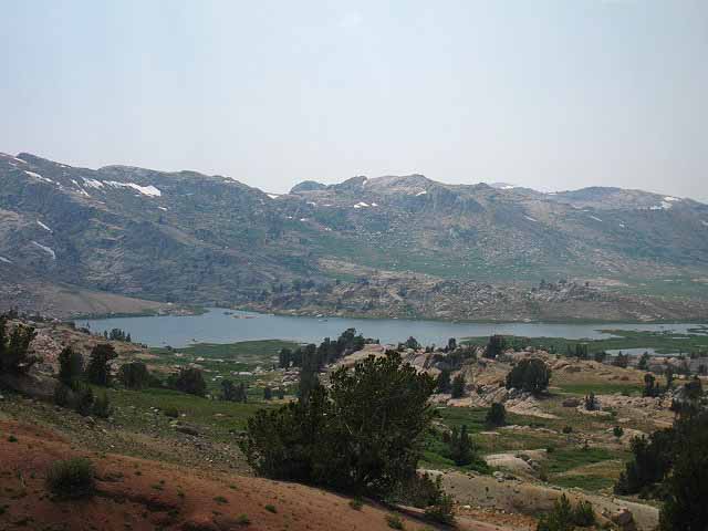
Colin, a horsepacker out of Kennedy Meadows Pack Station, riding North into Brown Bear Pass. We can see the distinctive pools along the Northeastern-tilted shore of Emigrant Meadow Lake in the background. These pools become more distinctive as Summertime shrinks the main body of the lake further away from the pools.
|
Over Brown Bear Pass
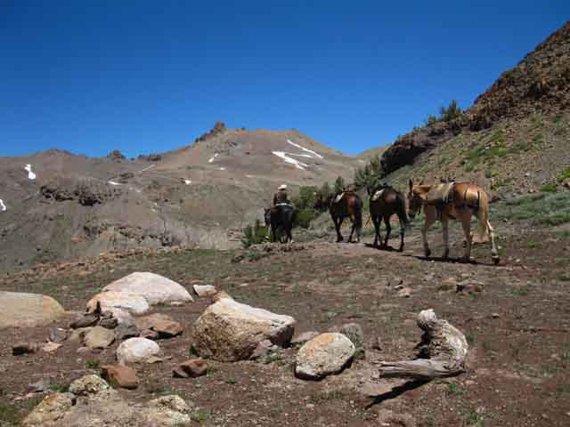 |
Brown Bear Pass Kennedy Meadows horsepackers North over Brown Bear Pass. |
View Southeast from Brown Bear Pass
Emigrant Meadow Lake Pools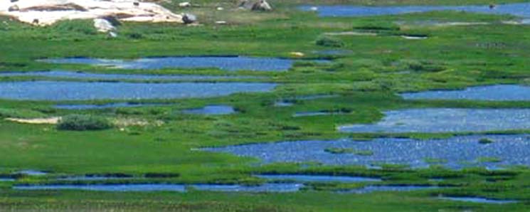 |
||
Emigrant Meadow Lake Northeast "shore" of Emigrant Meadow Lake is a series of deceptively beautiful pools. These beautiful blue pools also fuel the brutality of the winged menace which rises as dense clouds of mosquitoes from Emigrant Meadow's deep saturation every Spring. Don't be deterred, be prepared.
|
View Southeast
across the whole
High Emigrant Basin
 |
||||
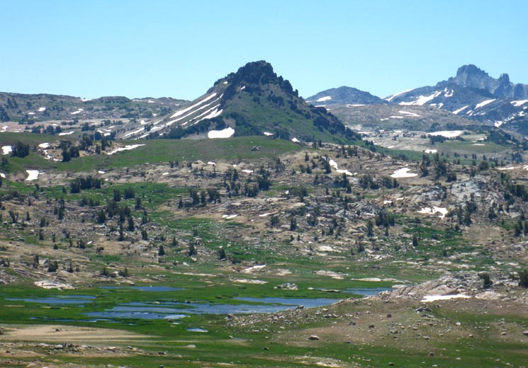
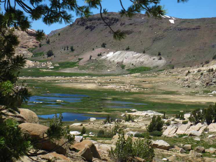
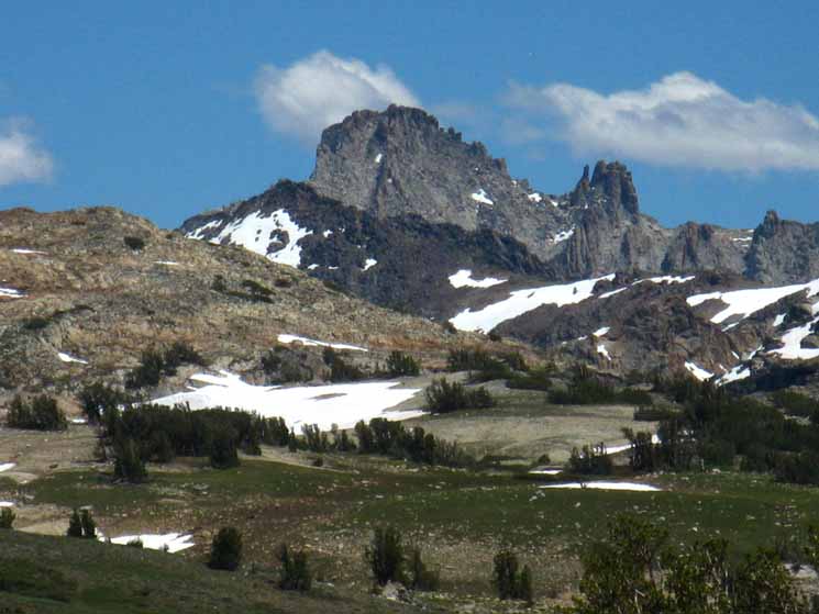
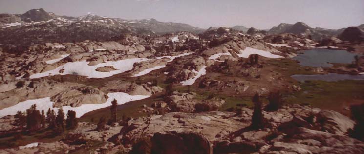
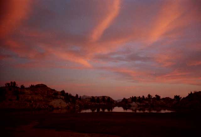
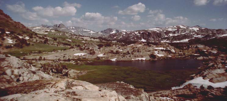
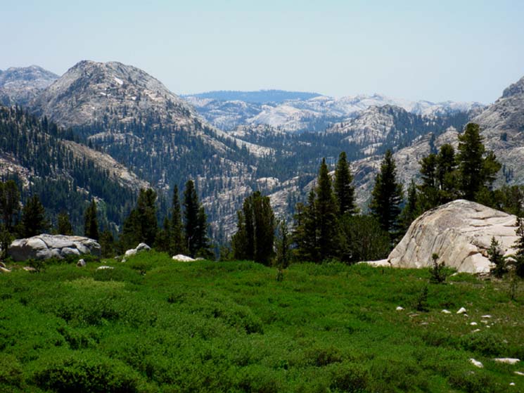
View Southeast from Brown Bear Pass Grizzly Peak is centered in the middle distance beyond the ponds of Emigrant Meadow Lake. The monster of Tower Peak reaches towards the sky on the far-right distant horizon. This image well describes our upcoming hike across the High Emigrant and Grizzly Meadows just beyond. We can see all the high points along our trail Southeast across Emigrant and into Jack Main Canyon from here. Our Line through the Terrain Our Southeastern route along the Tahoe to Yosemite Trail draws almost a straight line from Grizzly Peak towards Tower Peak. Though our trail stops well short of Tower Peak, it is a good landmark to identify our upcoming route. Notice that there are two light-colored low rises between Grizzly Peak and Tower Peak. Examine the image carefully and you will see them. The first low rise divides Grizzly Meadow around the base of Grizzly Peak from Summit Meadow, and the second low rise is dropping down to Bond Pass separating Summit Meadow from Jack Main Canyon in Yosemite. Note in the foreground of the image above there is a 200 foot high ridge between Emigrant Meadow Lake and Grizzly Peak that we have to cross on our way to Grizzly Meadow. Grizzly Meadow sits hidden between the base of Grizzly Peak and the ridge. Follow the Right-side of Grizzly Peak down to see a bit of Grizzly Meadow peeking from behind the intervening ridge. That green grass is the Southeastern edge of Grizzly Meadow. At the base of Grizzly Peak we have three nearby trail junctions. On the Left side, below the North flank of Grizzly Peak the trail to the Northeast through Emigrant Pass crosses over the the East Sierra Flank and drops down to the PCT at West West Walker River Bridge, and eventually out of the mountains through Leavitt Meadow.
The Mountains at your Feet What this hub of trails under Grizzly Peak means is that backpacking trips starting from any of the Highway 108 trailheads can pivot towards any of the other Highway 108 trailheads here. Backpacking trips starting from the East flank of the Sierra out of Leavitt Meadow or Leavitt Lake, trips starting South from Sonora Pass, or trips like ours starting out of Kennedy Meadows can each pivot here to exit at any of the other Highway 108 trailheads. This four-compass point trail junction along the Sierra Crest opens up a series of 30 to 50 mile trailhead to trailhead trips exploring the High sections of the Emigrant Wilderness. God I love this place. This hub of trails in Grizzly Meadow also seems to be a link between heaven & planet Earth, where physical and spiritual beauty collide. And, Emigrant Basin is literally the tip of the iceberg of mountains and lakes rising out of the surrounding beauty of the Emigrant Wilderness. Lots to do and see here. In addition to amazing backpacking trips, if you like scrambling and making cross country routes this place will be heaven for you. |
Tower Peak Story This is a story within a story. I did this trip before I took pictures. (My early photographic philosophy was, "Wanna see it? Walk it yourself." Literally. That's what I told folks about the Sierra: "go hike it." When I took a snow trip up here during the early '90s I encountered Marines exiting the snow-covered Sierra down its Eastern flank from Wolf Creek Lake through Wolf Creek down to the Marine Base in Pickle Meadow. I had Stinky Marine encounters on the way down. I'm always good for an "Uh-Rah" when Marines drive by. One group hit the brakes, slid their big-ass gray AMC station wagon sideways, and all popped out all at once to check me out. I had just done five days across the snow covered Winter Sierra, and they were curious as hell about where I came from, what the conditions were, what I had seen, and how it felt. They insisted on giving me a ride out. I told them I stunk, and that they had no room. They roared! Stink? We'll show you stink, boy... they stuffed my pack into the back, then we all squished in. Then the real argument began...Our argument driving out of the mountains was about who smelled worse. I won. Five days is five days. Ride-Walk-Ride Had to get out above base and walk across base. Giving backpackers rides through mountains is frowned upon by Marine Commanders, and certainly not across base. Waited a ways up Hwy 108 from the gate for Lt. The Lt was the officer in charge driving his guys out of the mountains, and had to drive up to the training area just above the West end of Pickle Meadow along Highway 108. Lt drove past his training area to bring me up to my car stashed at Sonora Pass on his way to giving climbing class for Marines at the training area. Sonora Pass was a long way past his destination, which gave him chance to tell me his Tower Peak Story. He and his crew of mountain trainer sergeants climbed it. Great story. The trainers get an annual budget for outside training. I mean training outside the Marines. The problem was time. The guide bailed because they could not beat the sun off the mountain. The marines went on, topped Tower, and were forced to camp on its flank on the way down without overnight gear. That's why they were pissed at the guide. The Marines were going to succeed, and the guide's mis-selection of approach route merely changed what it would take them to reach their goal. The Marines have an "all-in" kind of mentality, so when the mission became difficult they accepted the new terms of success, which meant suffering through a night on the mountain. The guide did not. The Marine Lt. described how they searched out and finally found a ledge sufficient for sleep as darkness fell descending off the summit, played out their climbing ropes to make an insulated sleeping surface, then zipped up all their gear and slept nut to butt to preserve heat and not fall off the ledge. They exited safely the next day. The Lt. drove me up to my car at Sonora Pass as he related his trip. I hope him and all his boys are OK. Have encountered corpsmen up here too, great guys all. Well, most. The Navy has lots of folk across a wide variety of perspectives. Ha Ha, guess that shows I'm Navy... Experiences like this finally got me to begin carrying a camera. Yet the best "camera" in the High Sierra is not just an almost meaningless "snapshot," but is your personal physical and psychological experience itself, and how the experience itself evolved both aspects of you. Media is icing on the cake of life. Media can reflect aspects of, but never be, nor replace the experience of life itself. |
 |
||||
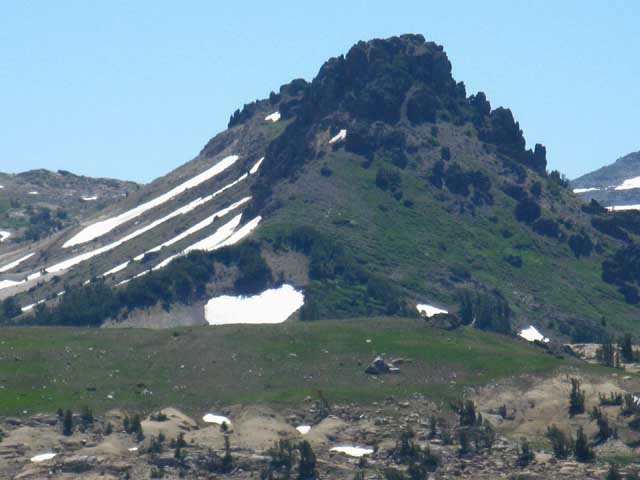
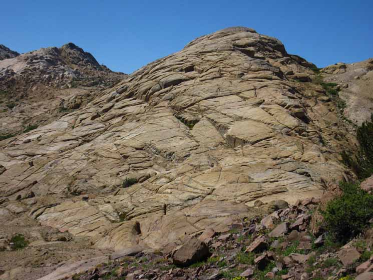
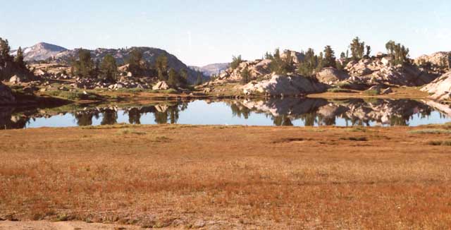
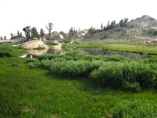
Grizzly Peak Grizzly Peak beyond the top of the low ridge dividing Emigrant Meadow in the foreground from Grizzly Meadow in the background. Grizzly Meadow wraps around around the Western base of Grizzly Peak. We are looking at the Western flank of Grizzly Peak from Brown Bear Pass. Emigrant Meadow Lake is out of sight in the low foreground on the near side of this low ridge while Grizzly Meadow is hidden on the other side.
|
Northwest View
Brown Bear Pass
with
Relief Peak dominating background
 |
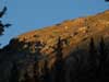
Brown Bear Pass Brown Bear Pass's South Flank viewed looking Northwest from High Emigrant Meadow. The faint line of our trail is visible traversing across the red rock up to the high point of the seam between Granite and Volcanic terrain marking the exact spot of Brown Bear Pass. Relief Peak dominates the background, capping the top of the volcanic ridgeline making up the North wall of the canyon leading down to Relief Reservoir, along the line of Summit Creek below the far flank of Brown Bear Pass. |
South Flank of Brown Bear Pass
View to the West-Southwest
 |
||
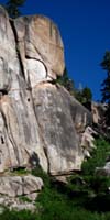
Granite Formations on Southwest Flank of Brown Bear Pass Turning around after hiking South through Brown Bear Pass, glancing back Westward across the entrance to the pass. The trail North bends Right into Brown Bear Pass. This is the highpoint of the granite terrain that makes up the South wall of the canyon down to Relief Reservoir. On this side of Brown Bear Pass Emigrant Meadow sits on the interface between the volcanic terrain to the North and the granite to the South.
|
Detail of Sweet Granite Terrain on South Flank of Brown Bear Pass
 |
| Granite rock on the South side of Brown Bear Pass. |
 |
The narrow trail through the gap of Brown Bear Pass focuses deer traffic as well as human. Many Deer. |
Granite Mounds on North Flank of Brown Bear Pass
Northern Boundary of Emigrant Meadow
 |
||
Westernmost reach of Emigrant Meadow below South Flank of Brown Bear Pass.
|
Mountains around Southwestern Perimeter of High Emigrant Meadow
View Southwest |
||
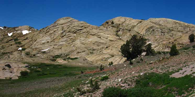
Peaks a bit further Southwest of Brown Bear Pass ringing Emigrant Meadow are shattered, while the peaks in the second image above are heavily jointed but smooth granite. The qualities of the granite on the Southwest edge of Emigrant Meadow are much rougher than the smooth un jointed pink granite along the South Flank of Brown Bear Pass.
|
Forsyth Peak
View Southeast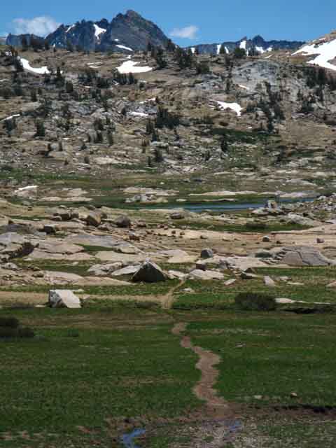 |
Forsyth Peak over Emigrant Meadow. Forsyth Peak sits at the top of Jack Main Canyon in the Northeastern corner of Yosemite National Park just a bit South of Dorothy Lake Pass. We can see the line of the Saurian Crest beyond. |
Grizzly and Forsyth Peaks
 |
||
Grizzly Peak over Grizzly Meadow on the other side of the low ridge.
|
East End of Emigrant Meadow
The Headwaters of the North Fork of Cherry Creek wrapping around Emigrant Meadow Lake
 |
||
View East approaching North fork of Cherry Creek. Beyond N Cherry Creek is the trail junction of the trail South to Middle Emigrant, Blackbird, and Emigrant Lakes, among many others. Beyond the location of the trail junction on the East end of Emigrant Meadow we can see the low rise between us and Grizzly Meadow. We must climb over this to access Grizzly Meadow, where we will pick up the old Tungsten Road for much of the rest of the hike to Yosemite. But first we've got to get over this little upcoming ridge in Emigrant Meadow. Grizzly Meadow is wrapped around the Western base of Grizzly Peak. Grizzly Peak is the near mountaintop peeking over the ridge. Note the much more distant Forsyth Peak poking over the ridgeline to the Right of Grizzly Peak. And, there were almost no mosquitoes when this image was shot in late August. Nice.
|
North Fork of Cherry Creek
 |
||
North Cherry Creek ford in Emigrant Meadow.
|
North Fork of Cherry Creek
 |
View upstream of a good spot to ford North Cherry Creek, Emigrant Meadow and Wilderness. The easiest place to cross in a bit upstream from the horse ford along the trail route. |
Low Rise in Emigrant Meadow
 |
Hiking South over the low rise in the middle of Emigrant Meadow. I read it as 40 feet on the topo map. |
Emigrant Meadow Lake
View Southeast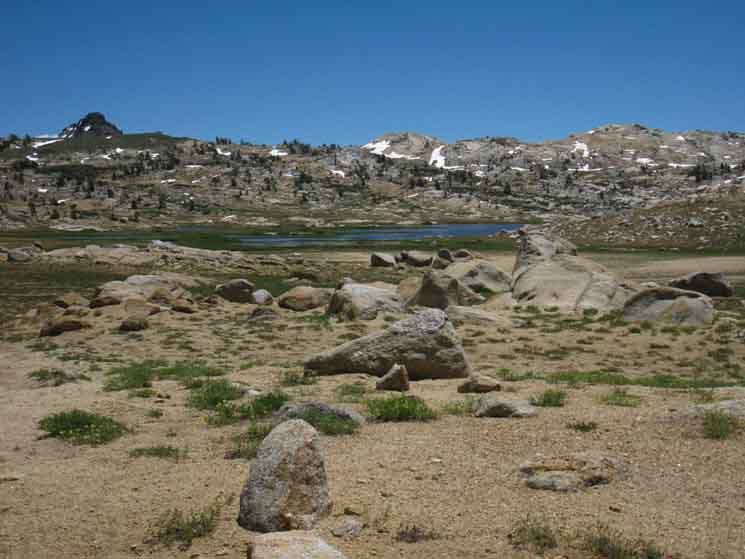 |
||
On the South side of this low rise Emigrant Meadow Lake comes back into view. Note the crest of Grizzly Peak poking over the upcoming low rise we will cross passing from Emigrant over to Grizzly Meadow. I figure that ridge at 200 feet.
|
Eastern Edge of Emigrant Meadow
 |
||||
| Trail leading us South to the Emigrant Meadow Lake trail junction located off the far Northeastern corner of the lake. I get water out of North Cherry Creek if I need it here, after making the climb through Brown Bear Pass. The pools along North Cherry Creek make retrieving water much easier than getting water out of Emigrant Meadow Lake. That's because negotiating the extensive shallow, mushy, mosquito-filled green apron around this lake only brings us to frustrating positions where the shallowness of the lake makes retrieving water challenging. I use North Cherry Creek as my water source if I need water here. Beyond the lake we can see Grizzly Peak peeking over the low ridge. The low ridge is composed of both glacial and volcanic debris. It looks like a terminal moraine of an ancient glacier was forming-up along the limit line of an ancient volcanic flow over underlying granite terrain. This glacial action created this hybrid glacial-volcanic moraine-ridge we see before us today. Backpacking TopicsGEOLOGY
Backpacking Trails EMIGRANT BASIN
|
High Emigrant Meadow Trail
Hiking East across Emigrant Meadow
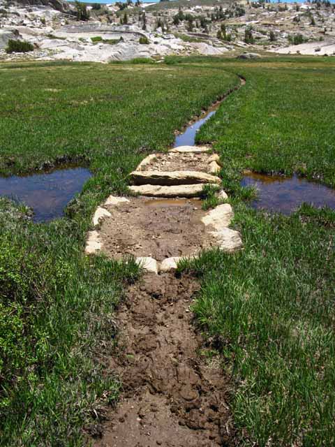 |
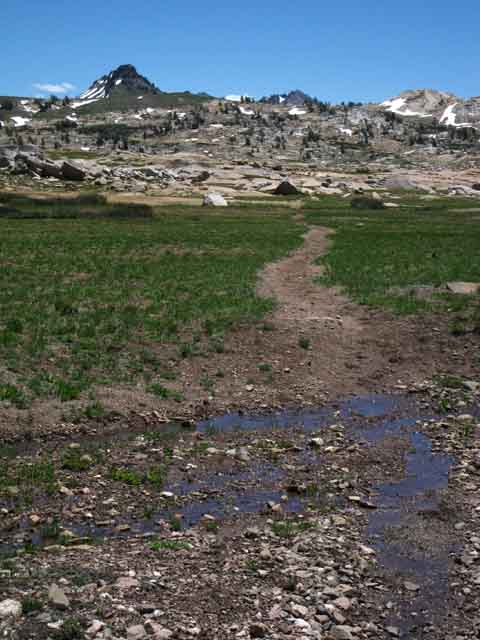
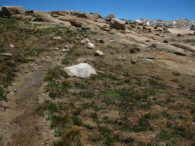
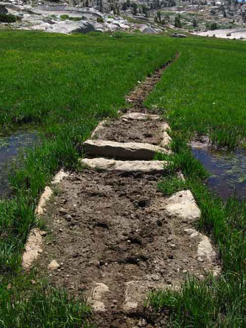
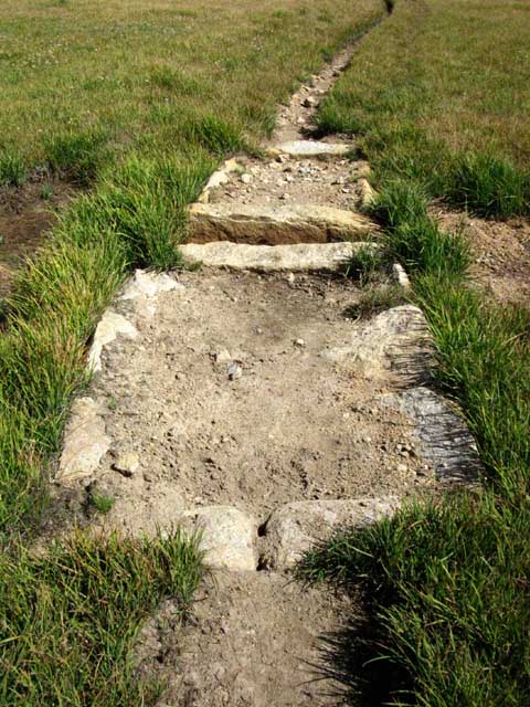
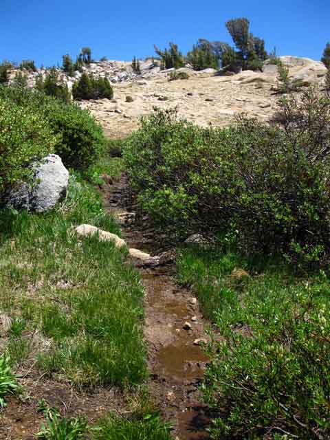
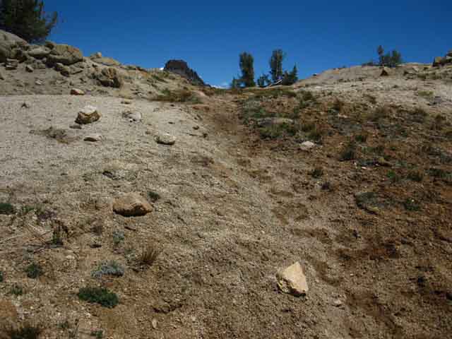
Trail just emerging from Spring's Quagmire on June 26 of 2013, a very dry year. Trail across Emigrant Meadow at tail end of Spring conditions during what should be the middle of Spring. |
Trail dries out Later in the Season
 |
||
Built up trail across lush wet meadow of High Emigrant Basin. Still moist and the whole basin is just full of mosquitoes on July 27 2010. All About High Sierra Mosquitoes Emigrant Meadow Still green approaching Fall
Trail across Emigrant Meadow drying out as season progresses. The surrounding mountains are totally dried out while Emigrant Meadow is still holding water, still holding green grass, and still holding a few mosquitoes. Not many, but a few. August 23 2012.
|
Emigrant Meadow Lake
View South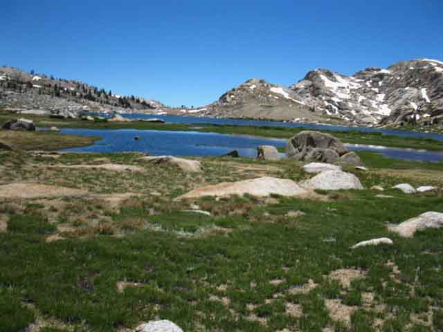 |
Hiking East around the North shore of Emigrant Meadow Lake we look South across its surface at the entrance to the canyon leading South. The upcoming junction marks the top of the trail running down through that canyon. |
Emigrant Meadow Lake Trail Junction
 |
||||
Trail junction on Northeast shore of This is a Tee-Junction, with a trail tracking Southwest down to Emigrant Lake branching off the North-South line of our Southbound hike down the Tahoe to Yosemite Trail. Blackbird Lake is just a bit East of Emigrant Lake, where we would find Mosquito Pass leading North. back to the TYT just a bit above Lunch Meadow, and a bit below Brown Bear Pass, which is behind us from our current position.
The large-scale map below has the best overall view of the trail running down to Emigrant Lake from our current position in Emigrant Meadow. From Emigrant Lake we could hike North over Mosquito Pass, as mentioned above. 30 Minute MAP We have a lot of route options here. Each of them reveals new and amazing aspects of the Emigrant Wilderness.
Viewpoints View down Canyon from Emigrant Meadow Lake to Emigrant Lake, on the page below. Mosquito Pass junction above Lunch Meadow along the
|
Emigrant Meadow Lake Trail Junction Post
 |
||||
Grizzly Meadow is along our Southbound Tahoe to Yosemite Trail route to the Southeast, while the trail breaking off to the Southwest tracks around the flatness of Emigrant Meadow Lake to Middle Emigrant Lake in its breathtaking canyon, past Blackbird Lake down to Emigrant Lake. Hiking to Blackbird Lake opens up the possibility of loops back to the Tahoe to Yosemite Trail South of here through either Horse or Summit Meadows. Hiking South to Emigrant Lake also allows us to hike a loop back to the Tahoe to Yosemite Trail North of here. Hiking a short distance past the trail junction at Blackbird Lake brings us to Emigrant Lake, encased in its granite vault, and the trail North over Mosquito Pass to the trail junction with the Tahoe to Yosemite Trail on the South side of Lunch Meadow. 30 Minute MAP Turning Right and hiking South through this junction opens up a fine set of potential loop routes back to the Tahoe to Yosemite Trail both North and South of our present position alongside Emigrant Meadow Lake.
|
Emigrant Meadow Lake trail junction View of our Route from Above Continuing Southeast through this trail junction keeps us on the Southbound Tahoe to Yosemite Trail towards Grizzly Meadow on our way to exit the backdoor of Emigrant Wilderness into the very Northwestern corner of Yosemite Wilderness through Bond Pass. Our long trip South requires we hike straight through this junction. That's too bad, as we can see from the overview below. Below Emigrant Meadow and Middle Emigrant Lakes l viewed looking Southwest descending the Southwest flank of Big Sam: Our Emigrant Meadow Lake trail junction is located on the edge of the grassy apron on the bottom-Left edge of the image below. Bird's Eye View of East End of Emigrant Meadow Middle Emigrant Lake is the second lake back. Emigrant Meadow Lake, which we were just approaching, sits in the foreground of the image. The trail Southwest to Blackbird and Emigrant Lakes is through the the throat of this magnificent granite canyon behind Middle Emigrant Lake that deepens to the Southwest, bending out of sight to our Right beyond Middle Emigrant Lake. That canyon and the granite terrain the trail down there is breathtaking.
Additionally, this terrain invites scrambling, once you've figured out the basic lay of the land and location of the trails. There are amazing thing to be found here. Our North to South route along the Tahoe to Yosemite Trail from Brown Bear Pass to Grizzly Peak passes from Right to Left across the base of the image above, along the North Shore of Emigrant Meadow Lake, the one closest to us, in the foreground of the image. The trail junction down to Middle Emigrant Lake from the Tahoe to Yosemite Trail is located in the lower Left of the image. That's the bird's eye view of Emigrant Meadow from Big Sam. Go walk it yourself! From Emigrant Lake over Mosquito Pass If we do turn South from Emigrant Meadow Lake off the Tahoe to Yosemite Trail to hike down to Middle Emigrant, Blackbird, and Emigrant Lakes we can we swing back to Kennedy Meadows Pack Station either the short way or the long way. We can either turn Northwest to hike over Mosquito Pass back to the TYT on the North end of Lunch Meadow, or we can turn Southeast towards Maxwell Lake, crafting a crazy big 90 mile loop, say out of Kennedy Meadows, that will turn Northward back towards KM from Summit Meadow, which is situated just a couple of miles South of Grizzly Peak. Check the maps to plan your own custom route around the high altitude areas of Emigrant Wilderness. Continuing South along the Tahoe to Yosemite Trail Though Grizzly Meadow is the same altitude as Emigrant Meadow Lake we have to hike over what I measure out as a 240 foot high pile of debris left by what appears to be an admixture of retreating glacier and volcanic debris, to get over to Grizzly Meadow from the trail junction at Emigrant Meadow Lake. Straightaway after passing the Emigrant Meadow Lake trail junction we climb over this low ridge. Climbing over this ridgelet we find some nice flowers, a battered ladybug, frogs, and a few of the deer who I figure are the ones who left the tracks we saw coming through Brown Bear Pass into the High Emigrant Basin. At least that's what I figure. |
 |
| Sweet shining flowers between Middle Emigrant Lake and Grizzly Meadow Sept 3 2010. |
Emigrant Meadow Flower
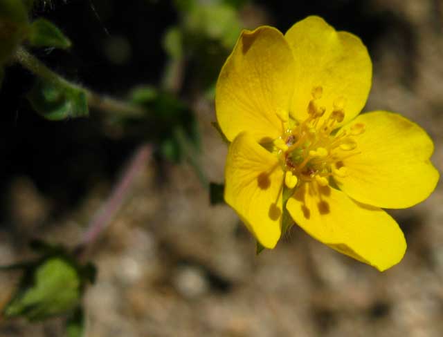 |
I could spend a lifetime enjoying each flower I meet on the trail. |
 |
||
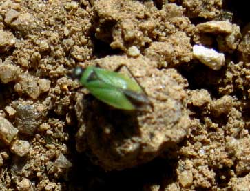
Little Green flying bug at 9400 feet in the High Sierra at the Emigrant Meadow Lake trail junction along the Tahoe to Yosemite Trail. This little sucker ran me hard. The beetles do that, and I figure this dude is some kind of beetle relative. After running me around a bit this little dude took off and flew away. Neither his running or flying could escape my pursuit as a predator, but he sure made taking his picture hard! This entry: Questions, comments, information.
|
Looking Northwest
across
Emigrant Meadow Lake
at
Brown Bear Pass & Relief Peak
 |
||||||
Brown Bear Pass is visible across North Shore of Emigrant Meadow Lake on the West edge of Emigrant Meadow as the abrupt interface between volcanic and granite terrain. Brown Bear Pass is exactly located by the line between volcanic and granite terrain. As with the image below, we are viewing the Northwestern end of Emigrant Meadow across the Northwest shore of Emigrant Meadow Lake, looking at Brown Bear Pass in the middle distance, and the distinctive dual peaks of Relief Peak beyond. Though this is a view of the route of the Tahoe to Yosemite Trail, it is not a view from the TYT. This shot above was taken while hiking South to the Tahoe to Yosemite Trail after hiking South from the PCT over Big Sam (guide) from Sonora Pass (guide) on the Tungsten Road. 30 Minute MAP The Tungsten Road route coming South over Big Sam from Leavitt Lake intersects with the PCT on the Southeastern corner of the Leavitt Massif and breaks from the PCT as soon as it descends to the top of Kennedy Canyon. After crossing over Big Sam it intersects with the TYT under the North flank of Grizzly Peak. A PCT-TYT
Emigrant Wilderness Backpacking Maps
Additional Emigrant Basin Information
|
Emigrant Meadow Lake Campsites
 |
||||||
View of Emigrant Meadow Lake earlier in the Summer season, full up with thaw and mosquitoes. This is substantially the same view as the image above, but instead of hiking the Tahoe to Yosemite Trail we are on the trail passing South over Big Sam from the PCT at Kennedy Canyon to Grizzly Peak. I'm hiking down to the Tahoe to Yosemite Trail at Grizzly Peak from Sonora Pass. Our position on this trail is climbing lengthwise down the length of the ridge dividing Emigrant from Grizzly Meadows, and we've almost reached its high point. 15 Minute MAP Check the route coming in from the North on the map above. This route is an excellent Alternative Route into Emigrant Meadow from the North than either the PCT or TYT, if you've already become familiar with those two trails. We can better see the best campsites around Emigrant Meadow Lake from this position. The best camps for Emigrant Meadow Lake are located on and around the elevated granite formation between us and the lake. We can also see this formation in the second image above. The route of the TYT passes between the far side of that granite feature and the lake. The campsites on that granite formation offer tree and rock shelter from both the Sun and Wind while putting some small distance between ourselves and billions of Emigrant Meadow mosquitoes living in those green grasses wrapping around Emigrant Meadow Lake. The sites closer to the lake are more exposed to the elements and the relentless mosquitoes. Brown Bear Pass is located out of view a small bit further to the Right, the Northwest, along the ridgeline we see ringing Emigrant Meadow in the background. Break-Lunch-Camping I have a favorite campsite accessible from either our route South on the TYT or from the trail South over Big Sam from the PCT. From our position on the Tungsten Road pictured in the two images above, we will very shortly reach the high point of this low ridge, where the trail makes a loop entering Emigrant Pass. Tomorrow, after spending a night here, we will continue hiking the Tahoe to Yosemite Trail route South through Bond Pass into Yosemite, regardless if we came to our East Grizzly Peak Lake campsite from Sonora Pass or via Kennedy Meadows. For local loop hikers out of Kennedy Meadows Pack Station the Northbound trail over Big Sam offers a loop back to Kennedy Meadows via Kennedy Lake, or to exit from the Wilderness at Sonora Pass or through Leavitt Meadow.
Trisecting the Emigrant Wilderness The Tungsten Road is the link between the PCT along the Crestline in the North Emigrant and the TYT along the Southern Crestline of the Emigrant Wilderness. In other words, the only line of trail maintaining the Sierra Crest across Emigrant Wilderness uses the PCT in the North, Tungsten Road along the Central, and the TYT across the South end of the Sierra Crest across the Emigrant Wilderness.
The trails tying the Western-biased route of the TYT to the Eastern flank route of the PCT, and the Sierra Crestline route of the Tungsten Road together open up a vast variety of approaches to both entering and exploring the high altitude elements of Emigrant Wilderness with a backpack. High Emigrant Wilderness Backpacker Schematic Map 30 Minute MAP
|
Up over the berm dividing Emigrant from Grizzly Meadows
Up the Ridge
 |
Hiking over the ridge between Emigrant Meadow and Grizzly Meadow. |
 |
||
Our elevation climbing over the ridge between Emigrant and Grizzly Meadows gives us a look Northwest across the spotty North shore of Emigrant Meadow Lake in Emigrant Meadow. The trail we hiked from Brown Bear Pass is visible along the far Right side of the picture. The junction for the trail leading Southwest, down to Middle Emigrant Lake, sits on the Left edge of the granite formation we see on the bottom-edge of Emigrant Meadow below our position. In the distance beyond Emigrant Meadow and its Lake we can see the stark line dividing the granite terrain wrapping around the South end of the meadow from the volcanic terrain wrapping around its North flank. The interface line between granite and volcanic material we can see through the tree branches marks the exact location of Brown Bear Pass.
|
Critters of the Climb up the little Ridge
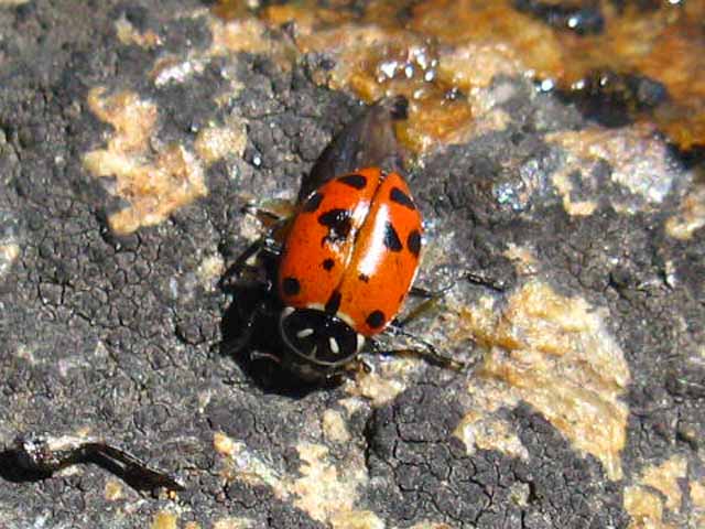 |
||
This battered little ladybug was all business. I was glad the sun was warming it. I could feel the ephemeral nature of living things as the sweet but directed nature of this bug marched it to its doom. Though its own life is less than a season of our year*, it was marching to a very old rhythm that I had the sense to stay out of the way of. Though I wanted to put down a finger so we could explore each other, I felt this player would perceive me as intrusive, and take a bite. Though those big black and yellow bumble bees don't sting, the ladybugs bite! And, this looked like one cranky old ladybug. * I figure the average lifespan of a ladybug in Emigrant Meadow
|
High Sierran Frog
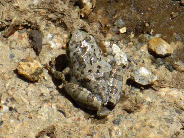 |
||
This guy was fairly trapped. Conditions were drying out, but for a feeble trickle this frog controlled. He really did not, nay could not, wander too far from the life giving water. This guy was prepped and camouflaged for the winged threat from the air, the rapacious birds. He hopped like lightening struck, and his landing points were as easy to find as a drunk Irishman's pot of gold at the end of the rainbow. So I just stuck around until he came out on his own. Hell, he owned this section of water. After a while frog figured out that I was not gunning for him, and came out. Once I saw him, he could not escape meeting me. This one took a little time. Hey Frog. comments-information-identification
|
Grizzly Peak over the Ridge
 |
Hiking up the final bit of our trail to the top of the Northwest flank of the low ridge between Emigrant and Grizzly Meadow. It is a bit sandy, but the trail during the trip above was still well consolidated from a nice two day rainstorm that ended the day before. This hardened up all the trail sections between Kennedy Meadows and Tuolumne Meadows that typically break down into sandy trails as Summer progresses. We can see that the trail has only taken the foot prints of two hikers since the storm smoothed out and consolidated the trail. Sometimes the weather acts like an eraser, quickly sweeping the trail of all transitory marks. Other times the weather acts on the trail as time acts on beauty, slowly sapping all tracks of their vitality. Our understanding of what the trail is telling us depends on our knowledge of recent temps and winds, and the accuracy of our observations of how a particular section of the trail absorbs the effects of time, winds, and frosts. Ahead, we can see the high point between the two meadows, between Emigrant Meadow and Grizzly Meadow. But we've still got to drop down and wind around a bit before we finally drop into Grizzly Meadow. Before we arrive at Grizzly Meadow we still have to reach the top of this low rise, and at the top we can see a bit of shade promising a break spot that will delay our descent into Grizzly Meadow a bit longer. |
Grizzly Peak
 |
Grizzly Peak again rises into view as we climb to the top of the trail over the ridge dividing Emigrant Meadow from Grizzly Meadow. Grizzly Peak appears again as we approach the crest, revealing more of itself in sharper detail as we get closer, much more than our first distant views crossing Brown Bear Pass. Crossing over this low rise we come into an area of open meadow descending from the top of the ridge to our Right, South, down into a small alpine lake. To our Left the meadowland ascends following the crest of the ridge. Once we reach the top of this low ridge and we begin descending to our Right, to the Southeast, we begin to get expansive vistas to the Southeast of great granite ridges descending down from this bowl, this great basin wedged along the Western flank of the High Sierra crestline across the top of the Emigrant Wilderness. It is hard to make out in the third image below, but we are looking at three ridges laying between our position and Tower Peak, not two. These are the peaks marking out the line of the Sierra Crest lacross Emigrant Wilderness and the very Northwestern corner of Yosemite National Park. Look Closely. The Pacific Crest Trail goes around this section the Sierra Crestline from the top of Kennedy Canyon to Dorothy Lake Pass. The Tahoe to Yosemite Trail tracks the Sierra Crestline from Grizzly Peak to Bond Pass, but it misses the section of the Sierra Crestline North of Grizzly Peak, running from Big Sam to Kennedy Canyon to Sonora Pass. The Pacific Crest and Tahoe to Yosemite Trails each cover, and each deflects around different parts of the Sierra Crestline on their divergent routes across Emigrant Wilderness. Hiking the Sierra Crestline across the length of Emigrant Wilderness requires using three trails. Takeaways Not Much Shade |
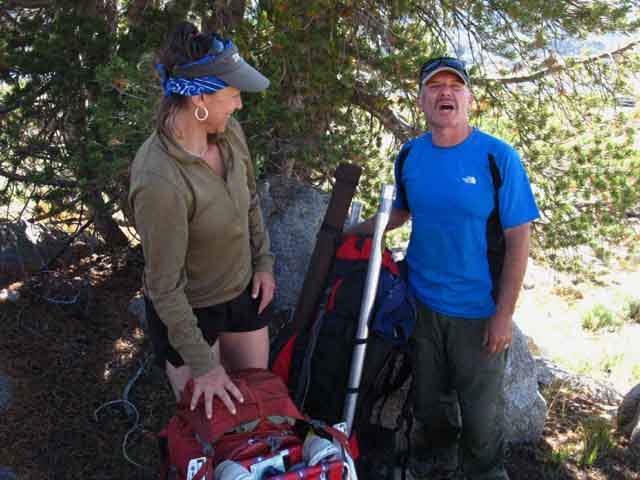
Cathy and Dale
 |
||
Great Minds Think Alike Hiking up the the trees pictured above I came to a couple of real nice folks taking a break from the searing sun. I thought it was a great break spot, so I asked if I could join them. This is Cathy and Dale from Point Reyes Station. Real nice folks. They were out for an extended hike around the High Emigrant Wilderness.
|
Cathy and Dale
Digging
the
High Emigrant Basin
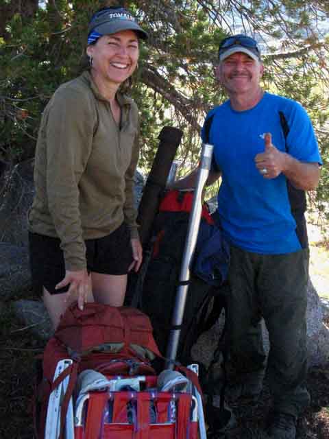 |
8 days of lots of fishing and no mosquitoes. I was a bit worried about the rainstorm providing the fuel for a little resurgence of the mosquito population, but I was hiking quickly South of the zone the heart of the storm drenched, so I would soon be out of the "danger zone." Feed nature some water and heat, and it will brew up different things in different places. In the great grassy meadows of the Sierra it will brew up some mosquitoes. |
View Southeast
From the top of the Low Ridge between Emigrant Meadow and Grizzly Meadow
 |
||
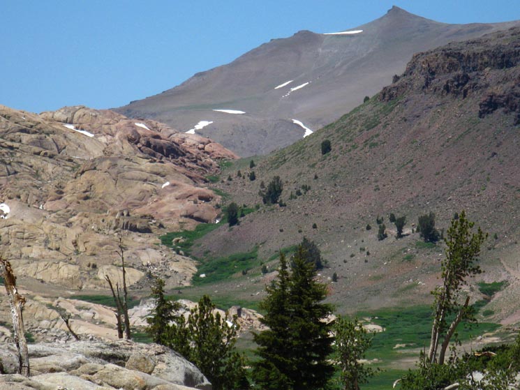
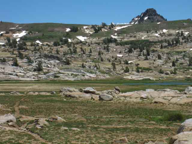
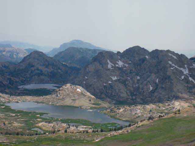
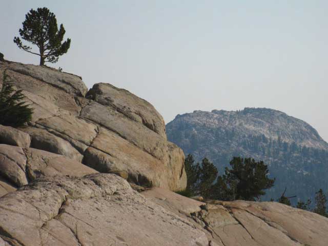
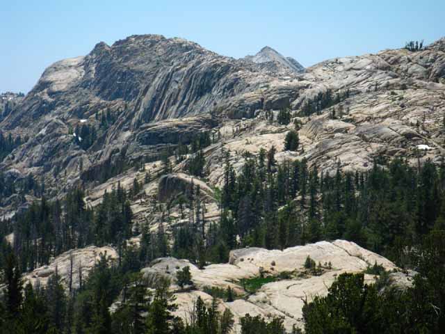
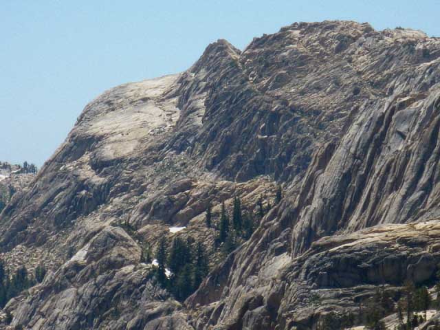
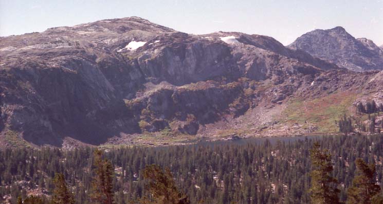
Tower Peak This image is looking across the Sierra Crestline at the intersection of the Toiyabe National Forest, the Emigrant Wilderness, and the far Northwestern corner of Yosemite National Park. Tower Peak centers this view across the Southeastern corner of High Emigrant Wilderness. The boundary line marking the border running down the West Flank of the Sierra between the Emigrant and Yosemite Wilderness area runs Left and Right (Northeast and Southwest) along the crest of the white granite ridge above. Crossing the low point the Right side of that ridge is descending towards brings us through Bond Pass into South Yosemite from Emigrant Wilderness. The East-West boundary along the Sierra Crestline between Yosemite on the West flank and the Hoover Wilderness/Toiyabe National Forest on the East flank runs an imaginary line through the top of white granite peak on the far Left of the image above, running Southeast through Tower Peak. Everything on this side of the white granite peak and ridge is in the Emigrant Wilderness. Everything on the far-Right side of the White Peak is in Yosemite, while everything on the far Left side of the line running from the white peak to Tower Peak is in the Toiyabe's Forests or its Hoover Wilderness. The Hoover Wilderness of the Toiyabe National Forest lays on the distant East (Left) flank beyond Tower Peak, while terrain on the near East flank of the crestline lays within the Toiyabe National Forest. Nearby In other words, we have two lakes with suitable campsites on the East side of the low ridge dividing Emigrant from Grizzly Meadows, before we reach the Grizzly Peak trail junctions. Check out the map. The view along this same line of observation, but looking Southeast from Brown Bear Pass, gives a better look at the Saurian Crest wedged in there. Can you see it up in there? Tower Peak Tahoe to Yosemite Trail hikers first see Tower Peak crossing South over Brown Bear Pass. Southbound PCT hikers will get glimpses of various aspects of Tower Peak from Sonora Peak until they drop into Jack Main Canyon. After that the next major peak that we will actually rotate around will be Volunteer and "Double" Peaks. TYT hikers will get another, one last close look at Tower Peak as we hike around Tilden Lake. That's because Tower Peak is the mountain capping the top of Tilden Lake's canyon. PCT hikers will not see the rotating view of Tower Peak as we on the TYT will as we circle the Southwest shore of Tilden Lake. Instead, the PCT hiker's route takes them around Wilmer Lake, nestled under the granite arms of Bailey Ridge's Western flank. We TYT hikers will miss Wilmer Lake by hiking the TYT route, by crossing over Bailey Ridge higher up Jack Main Canyon. PCT hikers will miss Tilden Lake walking around Wilmer Lake because they cross Bailey Ridge further down Jack Main Canyon. The maps linked to below well define our route options between the TYT and PCT in relation to Tower Peak. Jack Main Canyon 7.5 Hiking Map Jack Main Canyon 30 Hiking Map
|
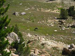
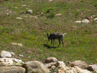
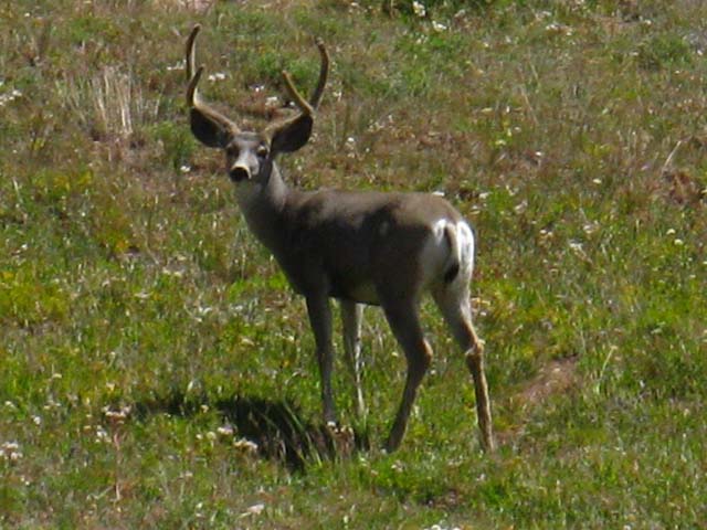
Buck Grazing Meadow on the Top of the Rise Between Emigrant and Grizzly Meadows
 |
 |
||
| Spot a Buck. | Creep in slow and quiet. | ||
 |
|||
Quietly set up the camera, make a few gentle clicks to get his attention so he would not freak out and run off, and take his portrait. Call it Young Buck I continued South and Young Buck continued to graze. All was well on Sept 3, 2010.
|
|||
The Westernmost Lake between Emigrant Meadow Lake and Grizzly Meadow
View of this "horned" lake from the Rock formations from above
 |
||||
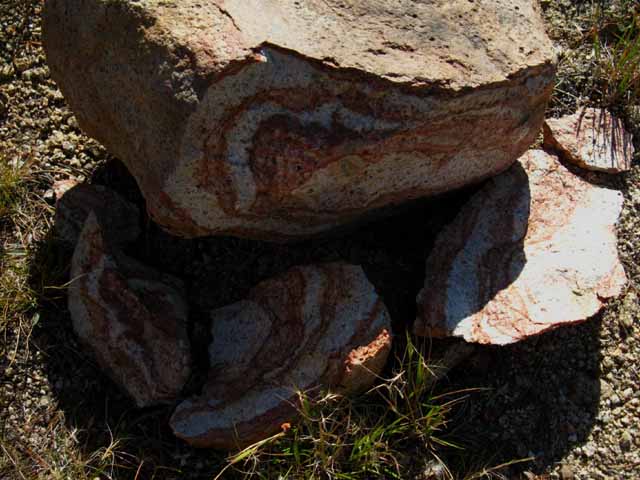
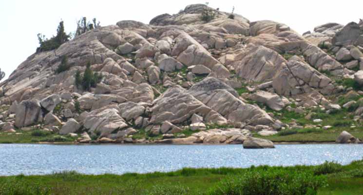
Looking South down the South end of the low ridge dividing Emigrant Meadow from Grizzly Meadow. This image was shot from off the trail, in the late 1990s while scrambling granite formations. Running around the inviting granite terrain of the High Emigrant Basin is a lot of fun. It's just too good to resist running right off the trail! We have scrambled up to the top of the nifty granite formations North of the Tahoe to Yosemite Trail route to get a better look at the surrounding terrain early during the Spring of 1998. Note the distinctive "horns" decorating the West Grizzly Peak Lake on Right side of image to locate this position on the MAP. The shot below was also taken while scrambling around off the trail, but standing in the dried out horn of the lake pictured above. Below we are standing where the North side of the Lake, the feature that looks like the Lake's "horns," which is normally full of water, had dried out by the date I hiked through on Friday August 28, 2012. A dry year. I miss the beauty of the water, but not the mosquitoes... Drought Conditions in the Sierra This is the Westernmost lake between Emigrant Meadow and Grizzly Meadow. I refer to this lake as the Western Grizzly Peak Lake, or the horned lake. A short distance East of here (South on the trail) we find the little lake sitting under the West flank of Grizzly Peak in Grizzly Meadow. Below, we found this interesting "pastry roll rock" which looks like layers of different dough rolled up and sliced.
Serving up hot slices of rolled pastry rock. Who's your favorite baker now? Mother Nature, of course. Below the West Grizzly Lake is viewed on Tuesday the 28th of July from ground level hiking by on the Tahoe to Yosemite Trail. Note the rock formations beyond the lake. We will pass through a really neat channel in this little rock ridge on our way over to the East Grizzly Peak Lake. The rock channel is leading to the next lake, the lake under Grizzly Peak is located to our Left, out of the frame of the image below.
|
 |
||||
| Above: The West Grizzly Peak Lake is located just to the West of Grizzly Meadow and East of Emigrant Meadow on the TYT. How it looked during July of 2010.
Above: USGS topo hiking map of Emigrant and Grizzly Meadows with their respective lakes strung out along our Tahoe to Yosemite Trail route. Above we can see that the lake with the "horn" is the second lake West of Grizzly Peak, located on the ridge, while the lake under the "Grizzly Meadow" label on the map is the first lake to the West of Grizzly Peak. The scattering of little ponds (below) to the West and NW of the Grizzly Peak trail junction indicate the perpetual marshiness of those areas.
|
 |
Above: Lake at the Western foot of Grizzly Peak in Grizzly Meadow. The sky feels like we are looking up from the bottom of the sea through ocean waves. Ocean waves of fluorescent pink. We are, depending on how we see ourselves. |
 |
Above: Nice and Dry, late in the year 2000. The East lake in Grizzly Meadow wearing Fall colors. |
Sunset from E Grizzly Peak Lake
 |
||
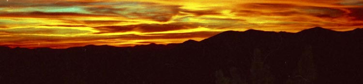
Grizzly Meadow Sunset. When the sky began to burn I was first happy I was present, then glad I brought a camera. This image was captured on film in 2000. I digitized and printed it. The colors are as captured by the camera, not created by software, and they are very close to what I saw.
|
Lake West of Grizzly Peak
 |
||||
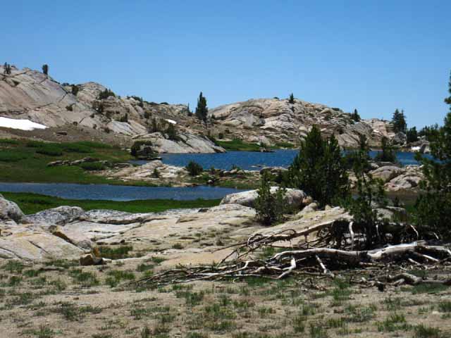
View looking South across Grizzly Meadow Lake and the Tahoe to Yosemite Trail. The TYT passes Right to Left in the Southbound direction between our position and the lake, but closer to the lake. My custom little campsite sits under the stand of whitebark pines on the elevated shoulder of the low rise in the middle far-Left of the image. July 30 2009. We see this position more clearly from a position up the draw behind us. The trees act as a windbreak and late afternoon sunscreen. A nice rock and downed tree offer backrest, and a soft flat provides a place to sleep. The most entertaining residents live in these trees during very early Spring, when the local inhabitants of Grizzly Meadow use this stand of trees as a nursery for baby chicks and chipmunks. More on that below. Hawks cavort above, chipmunks run around below, insects pursue their ceaseless toil while the frogs jump, and we take a moment to lean against our rock under our tree to take it all in. Nice.
|
What happens when you stop to film in Grizzly Meadow when it's FULL of Mosquitoes
Grizzly Peak-Meadow Lake at the foot of Grizzly Peak in Grizzly Meadow
 |
||
Finally, a reasonable view of Grizzly Meadow! Grizzly Peak rises out of frame to the Left. The trail junctions pictured below sit in rapid sequence between the sheet of flat granite on the Northeast, or upper left side of the lake, and the base of Grizzly Peak. It appears that the Grizzly Meadow Lake, in the lower Right foreground, almost merges into the green apron of grasses bounding it's North Shore. Look carefully at the green apron along the lake's North shore. Note the subtle distinction between the dark blue of East Grizzly Peak Lake and the dark green of the grass apron along the North side of the Lake. When our eyes adjust we clearly see the straight line of the Tahoe to Yosemite Trail across Grizzly Meadow pointing the way to the trail junction sitting under the hulking mass of Grizzly Peak. The snow patch on the lower right side of the image connects to the snow patch in the picture above to give us an approximate idea of the proximity of the E and W Grizzly Lakes. They are right next to each other separated by a low rise. This old picture was shot during the late Spring of 1998.
|
Scrambling and Camping in the High Emigrant Basin Great! Except the enduring mosquitoes. Notice that this basin is wet, and it is wet deep into the Summer hiking season. |
 |
Grizzly Meadow in foreground, East Grizzly Lake in middle, and Rock in background. There are miles and miles of granite like the above here for our scrambling pleasure. |
 |
||
Full mosquito protection with the mosquitoes all up in it, Grizzly Meadow. I am wearing my service-issued Navy Pea coat. That was my "mountain jacket" for a number of years.
|
Two reasons why I deal with the mosquitoes in Grizzly Meadow
 |
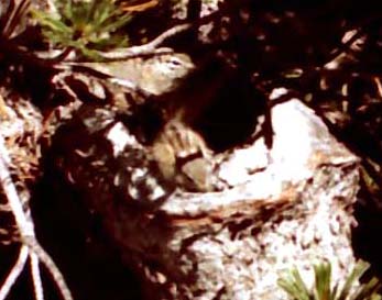
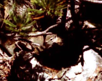
Whitebark in Grizzly Meadow is home to bunches of baby birds, squirrels and chipmunks every Spring. At the very center of this picture there are two eyes looking back at you. See this image enlarged below Right. Below Left is the baby birds. |
Grizzly Meadow Springtime Campmates
Baby Birds and Chipmunks
Look carefully at each of the images below. Each contains baby chicks or baby chipmunks.
 |
 |
||
A Closer look reveals my campmates, tiny chicks.
|
The gang of baby chipmunks and baby birds got along like one big happy family in their protective Whitebark Pine Home. |
Grizzly Meadow The mosquitoes in Grizzly Meadow are deadly from early Spring when the melting snows first reveal soil through the beginning of Summer into Fall. They will eat you alive if you are not properly protected. The cuteness of the baby birds and chipmunks born into Grizzly Meadow every Spring is to die for. They are so cute and so friendly. Exactly the opposite of the mosquitoes at exactly the same time. Springtime brings an explosion of life to Grizzly Meadow. Birds, bugs, all the small mammals, as well as the mosquitoes are all participating in a mutual feeding and f^^king frenzy. High Emigrant Meadow is a powerful Engine of Life Once the little critters see you are not trying to eat them they chill out instantly. I don't and won't feed them, despite their friendly cuteness. I don't want to distract them from the other more important elements of their environment, some of which feed them, and others trying to feed upon them. They must learn and know both quickly. The food thing's not so hard during early Spring. The not being food thing is not so clear. They really have no clue. They will. Paying attention to me may distract them from observing the hawks, coyotes and many other creatures hunting them. I have found that they learn about danger by seeing their siblings picked off. If they don't see their brother picked-off, they will not know the danger. Once they see death strike out at them, they become cautious. Before that point they are completely adorable. I'm not a fan of "cuteness," but this is the real deal. My choice of their home tree as campsite gives them a degree of protection against attack from land and air, which improves their chance of survival. at least while I'm there. Coyote and hawk skirt my presence. Despite my little bit of help, they gotta cut it on their own. Many do. Follow Ups My Very Early Spring trips are inevitably followed by Spring trips. Amazing changes in the resident's numbers and behavior occurs in a very brief time span. Rather than 5 trusting, happy little creatures, there are now only 2 baby chipmunks living in the tree. The remaining kids are sharp, observant, and suspicious. I can't say about the baby chicks, as they've flown the coop, so to speak. Well, they've changed how they use the tree. After the chicks take off I can't determine which baby birds flying around the campsite tree grew up here. On the other hand, the young chipmunks appear to use the cover of their home tree longer than baby chicks before they disperse into the greater meadow. Hiking through a month later into Summer shows that nobody is living at the tree. All the baby chipmunks and chicks are long gone. The unbounded joy of brand-new baby chipmunks is also gone, along with three of their company, but I rest assured this joy was replaced by an awareness of their situational threats. Anyone who watches squirrels and chipmunks knows that their joy is not gone, but sits in a place they can instantly deploy it, once they believe no danger is present. |
&
Sky Dances of Winged Poetic Beauty
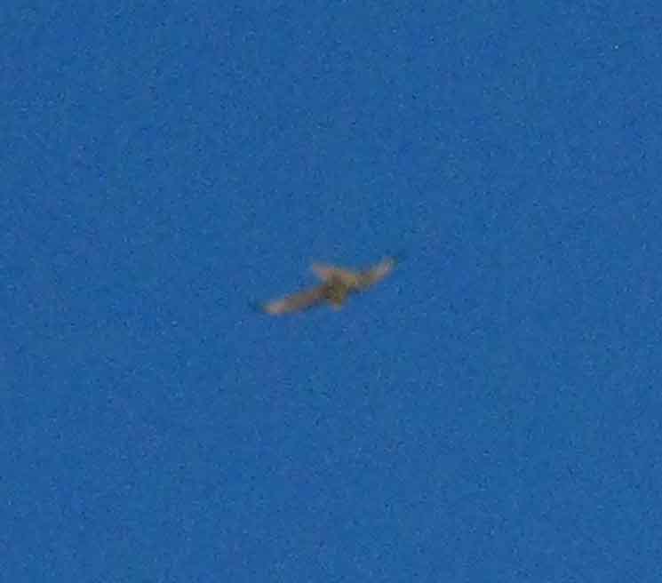 |
Sitting in my campsite (above) puts me on an elevated shoulder above the level of Grizzly Meadow. On the morning of July 12 of 2016 I was sitting in my campsite on this shoulder, on the Eastern side of the narrow gap between the height of a small stand of whitebark pines in front of me and the rising stack of granite formations behind, which I was leaning against the base of, when the hawk pictured above flew through the gap between tree and rock at a high rate of speed. Just above my eye level at about 12 feet of elevation through the gap, maybe 25 over the level of the surrounding meadow. These moves approaching the meadow by stealth before engaging in a high-speed hunting run across the meadow were to maximize the element of surprise for Hawk's run across this particular Western-most branch of Grizzly Meadow. Subsequent (and previous) observations indicated Hawk has "strafing lines" across all these high elevation meadows. Hawk is the master of the sky of all these meadows. We were both shocked each to see the other on this high speed flyby, and my presence disturbed Hawk's lightening food patrol across this portion of Grizzly Meadow. Which was fascinating. Hawk had to describe a couple of big circles in the winds high above to make second and third runs across my meadow before being satisfied about both me, and the food status of the meadow. Hawk came right back to check me out. I have observed generations of Hawk here. A Nice Scramble I was sitting at one of these overlooks approaching Sunset when I spied a hawk coming up out of the Southwest, up the Horse Meadow Canyon towards my position, which I began observing. Behind be, I noted another hawk flying towards my position out of the North-Northeast. I was about to be offered a delightful look into the personal life of this particular hawk couple of the High Emigrant Wilderness. The Art of Love The male would use amazing displays of strength and power to force a "flyby," where he would aim to use his superior skills in open air to "herd" her, and then pick her off. But at the last second during her high-speed evasions she would deploy full "air brakes," tuck under his final attack, and peck him on his way by. Amazing. She would pull every move that gave advantage to a lighter, quicker stopping and turning body against a larger body that could not stop or turn as quickly as she. Their aggressive greeting transformed into team flying of the highest caliber. Their aggression turned into a ballet of mutual moves that only the other would understand and respond to, each as individuals in unison. After about 15 minutes of meeting, greeting, and flying dynamically around the very top of the Western Flank of the Sierra, they took a last leisurely circle of the crest, then flew a line together down towards Blackbird Lake as the reds of twilight deepened. |
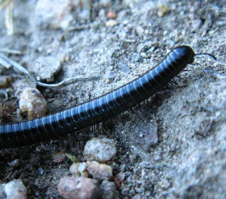 |
|||
Centipede at Grizzly Lake, Emigrant Wilderness, insect, Stanislaus National Forest. Living Things: High Sierra Insect Forum This millipede I actually got up to let her pass on by. This is a product of my "Living Things Policy."
Living Things: High Sierra Insect Forum This millipede |
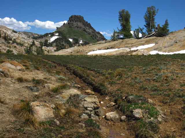
Marshy Area in Grizzly Meadow
 |
Marshy area East of Grizzly Meadow lake, looking South at where the trail junction to down to Horse Meadow is situated. The unmarked trail down to Horse Meadow breaks off from the TYT route around the far side of the rising knoll. In the video below the marshy area is dried out, cut by the trickling flow of the small creek draining Grizzly Meadow into the lake. During Spring the lake overflows into the surrounding meadow fed by drainage from the upper section of Grizzly Meadow. The meadow drains down to the lake through the terrain during early Spring, meaning that this area gets really soggy during early Spring. |
High Sierran Frog near Grizzly Lake in Grizzly Meadow
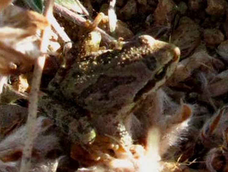 |
Sierra Tree Frog in Grizzly Meadow around Grizzly Lake, Emigrant Wilderness, Tahoe to Yosemite Trail. Forum: High Sierra Frogs |
Horse Meadow Trail between Grizzly Peak Lake and the Emigrant Pass-Bond Pass Trail Junction
CCC trail crew moving through the unmarked trail down to Horse Meadow a few yards North of the TYT route reaching the Tungsten Road running through the Grizzly Peak trail junction. Trail Culture Trail Crew Forums The CCC crew was moving to Horse Meadow to set up their camp down there, to move their trail operations to a new area.
View hiking into the South end of Horse Meadow, looking up towards our position. 1:20 High Sierra Backpacking Videos
|
Video
Grizzly Peak to Bond Pass
Tahoe to Yosemite Trail
hiking to the
Pacific Crest Trail
in
Jack Main Canyon
21:09 Hiker's Forums
|
7-2010 #7097 &7098
Hub of Trails
in
Emigrant Basin
at the
Base of Grizzly Peak
Scrolling Up on this Page:
Northwest
TYT
towards
Kennedy Meadows Pack Station through Brown Bear Pass via Northbound TYT
| North Trail Guide to the PCT: TUNGSTEN ROAD Trail Guide Grizzly Meadow to Kennedy Canyon |
Northeast Trail Guide to the PCT: EAST FLANK Trail Guide West Walker River Bridge |
Scrolling Down on this Page:
South
TYT
over
Bond Pass on the Southbound TYT
into
Yosemite merging with the PCT at the top of Jack Main Canon
The map below ties all these routes together.
30 Minute MAP
TYT-PCT across Highway 108
|
||||
Trails from Grizzly Meadow radiate out in all directions. Maps above:
30 Minute MAP Download these maps for free from the
|
Down this Page
Tahoe to Yosemite Trail South to Bond Pass
Along with the Tungsten Road reaching down to Summit Meadow
TYT
Trail Junctions |
Northeast to PCT |
South TYT |
Northwest TYT |
|||||||
Grizzly Peak This is the central trail junction in Emigrant Basin (definition) for all hikers into the Emigrant Wilderness from trailheads around the compass.
Trail Options Leavitt Meadow is a trailhead sitting at the base of the Eastern Sierra along Highway 108.
N The Kennedy Canyon trail junction is 4.66 miles North of the West West Walker Bridge along the PCT.
NW
TYT
SW
Local Turnaround Point? |
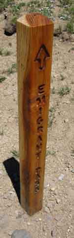 Emigrant Pass |
|
 Bond Pass |
|
||||||
1> The unmarked trail leading Southwest down into the top of Horse Canyon located about a hundred Yards North on TYT from this Grizzly Peak trail junction. 2> The actual trail junction forking off to the NE through Emigrant Pass into the headwaters of West West Walker, and down past Cinko Lake to the PCT at the West West Walker River's Bridge.
The Tungsten Road Complete Tungsten Road Trail Map The last time I was in a four-wheeler climbing up the road into the Leavitt Lakes basin (Maybe late 1990s, Tyler and Chris?) the road was pretty screwed-up down low. Huge berms and ridges were cut through the roadbed (reports-comments-questions?). It took some good driving in the four-wheeler, but I've gotten my old Izuzu 2-wheeler up there and back many times. Regardless, Joan has not been happy with the condition of the Tungsten Road (see TR page) in 2016 and recent years. It will not improve much, Judging by the massive thaw we are going to see at the end of the 2016-17 Winter. My Winter route typically follows Highway 108 up to Sonora Pass, then the Winter route to the Crest, on to Leavitt Peak, and out via Leavitt Lake's nifty basin nestled under the encircling Sierra Crestline. That's how I like my Leavitt Lake served up: Ice Cold and Frozen Solid. Anyway, beyond the end of the open access portion of the Tungsten Road out to Leavitt Lake the Tungsten Road continues its short and steep climb from Leavitt Lake to the Sierra Crestline as an Emigrant Wilderness trail. The Tungsten Road intersects with the Pacific Crest Trail on the Southeastern-most end of the Leavitt Peak Massif. Thankfully, because this configuration creates a lot of routes. I expect this from the TYT, which makes regular sweeps down off the Sierra Crest and back up the Western Sierra Flank to the Crest, as its route does across Emigrant Wilderness. But the Pacific Crest Trail diverts off the Sierra Crest from the top of Kennedy Canyon to Dorothy Lake Pass. There's almost never a higher "through" trail than the PCT up and down the Sierra Crest. Except here. Here the Tungsten Road is the high trail along the Sierra Crest, not the Pacific Crest Trail. I also say "thankfully," because this omission of the majority of the Emigrant Basin from the traffic of the Pacific Crest Trail has preserved it as an oasis of solitude and expansive scrambling off the beaten trail. South into Yosemite A branch of the Tungsten Road turns down into the top of Horse Meadow's canyon from the North edge of Summit Meadow. This branch of the Tungsten Road serviced the old Cherry Creek Mine below the bottom of Horse Meadow. The other branch of the Tungsten Road turns Southwest off the TYT from the junction in the middle of Summit Meadow. This branch serviced the Montezuma Mine at Snow Lake. The Southbound TYT branches Left through both of these TR Y-junctions. Hiking South through Summit Meadow gives us good views of the upcoming brief, moderate-difficult climb to Bond Pass. Trail Scale: Difficulty Ratings We'll hike past the Horse Meadow and Snow Lake junctions on our way to Bond Pass on the TYT.
|
||||||||||
| High Emigrant Wilderness Schematic Trail Map | ||||||||||
 |
||||||||||
The map above is by no means comprehensive or to scale. It's purpose is to impart an idea of the web of Emigrant Wilderness Backpacking Trails laid along and across its portion of the Sierra Crest. Our goal is to provide clarity about the wide variety of classic and alternative hiking routes across Emigrant Wilderness for long distance backpackers. Don't feel left out! This map can be your key for putting together very interesting local backpacking loops around the Emigrant Basin and its surrounding terrain for hikers wishing to remain within Emigrant Wilderness. What remains unmapped are all the amazing exploration/scrambling opportunities. Those you must find by searching along these routes, then fill in the details yourself.
30 Minute MAP
|
||||||||||
Where the Hell are We? The TOPO MAP always helps... Trail Junction below the West Flank of Grizzly Peak This trail junction, really a line of three closely-spaced junctions under the shadow of Grizzly Peak collectively compose the hub of a circle of trails radiating out from the base of Grizzly Peak in the center of High Emigrant Basin of the Emigrant Wilderness, for your hiking and scrambling pleasure. We're going to hike the TYT South into the North Yosemite Backcountry on our way to Tuolumne Meadows. That's not our only option. From this hub of trails we have the Tungsten Road leading North to the PCT at the Kennedy Canyon junction on our way to the Sonora Pass trailhead. We can also access the PCT along the East Flank of the Sierra from here, and the Leavitt Meadow Trailhead via the PCT at the West West Walker Bridge by hiking through Emigrant Pass to our Northeast. To our Northwest our TYT route to Kennedy Meadows marks where the TYT hits road access to Highway 108. To the Southwest the unmarked trail leads into the top of Horse Meadow Canyon. From the bottom of Horse Meadow we find interesting trails leading North back to the TYT in Lunch Meadow and South back to the TYT in Summit Meadow via a nifty unmaintained trail. All of these Northern destinations lead us to trailheads located at various points along the Highway 108 corridor. Sonora Pass is on the Sierra Crestline while Kennedy Meadows and Leavitt Meadows are located on the West and East flanks, respectively. Our long-distance backpacking options to the North from our position here under Grizzly Peak are the many route options pointing us North towards these Highway 108 Trailheads. To the South we follow the Sierra Crest to Tuolumne Meadows, or maybe down into the Grand Canyon of the Tuolumne River. This Grizzly Peak trail junction can be part of a unique long distance backpacking route across Emigrant Wilderness, or part of a custom backpacking loop around the Emigrant Basin. Me, I'm heading South to Tuolumne Meadows in Yosemite via Bond Pass. |
Big Sam
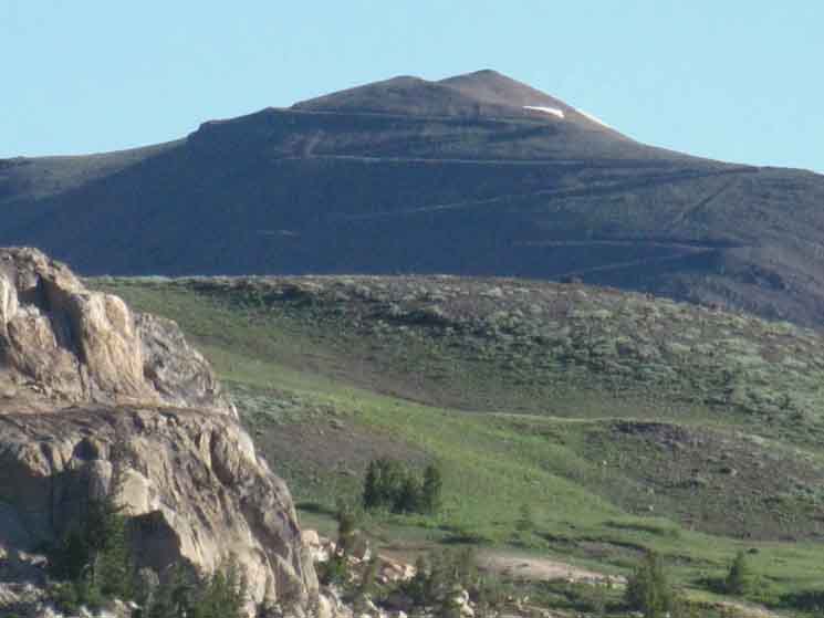 |
View North of Tungsten Road switchbacking out of the North end of the Emigrant Basin over the Southwestern Flank of Big Sam.
|
Hiking South on the Tahoe to Yosemite Trail to Bond Pass
The Tungsten Road South from Grizzly Peak and Meadow
 |
||
The Tungsten Road approaches a favorite slab. I like this slab. Another Line Across Emigrant We know that Snow Lake lays at the base of the ridgline dividing Emigrant from Yosemite in the distance. The saddle we can see descending to the Right of the pink slab and to the Left of the horn of rock in the middle-distance is where the unmaintained route from Snow Lake crosses over to Bigelow Lake. From Bigelow Lake we descend to Twin Lakes and down to the East Fork of Cherry Creek coming out the bottom of Horse Meadow. Hiking that line of trail North brings us down to the bottom of Horse Meadow's Canyon, where we can hike North to Emigrant Lake via Maxwell and Blackbird Lakes.
Third Time's a Charm Well, we have yet another, a fourth long distance backpacking route across Emigrant Wilderness to go along with these three. The Fourth Route We can see all this beyond the pretty pink slab. Part of it in the terrain, the other in our mind's eye. |
View Southeast
 |
||||
The boundary between Yosemite and Emigrant Wilderness follows the top of the ridge in the distance. Snow Lake sits at the base of this ridge.
|
View Southwest off the Slab
 |
Rock near and far. Tip of the horn of rock above the unmaintained trail linking Snow to Bigelow Lakes, laying beyond our nifty pink slab. As we hike South we note the amazing view down the descending canyon to our West opens up. |
Maxwell Lake to the West between the folds of the Surrounding Mountains
 |
||||
Far below to the Southwest I spy Maxwell Lake buried in forest above the bottom end of Horse Meadow, and its massive canyon. Maxwell Lake sits in a ledge carved into the ridge dividing the North and East forks of Cherry Creek. That's one of the beauties of the vast granite ridges running West off the Sierra Crest across Emigrant and the North Yosemite Backcountry: These ridges are soooo vast that they have vast canyons and gorges cut into their flanks and crowns, as well as the major rivers flowing through the major canyons between them. Never underestimate the magnitude and complexity of these "subordinate" flank and crown canyons. They can be as worlds unto themselves. We can hike down to Maxwell Lake through the upcoming Horse Meadow trail junction on the North edge of Summit Meadow. That option runs us down Horse Meadow's canyon from top to bottom. Or we can take the long way, hiking to Maxwell Lake via Snow Lake over the unmaintained trail through the Saddle and down to East Cherry Creek. From East Cherry Creek we make the short hike North across the very bottom of Horse Meadow's canyon for the climb up to Maxwell Lake.
|
Southeast view of Valley holding Horse Meadow and Maxwell Lake
Hiking South from Grizzly Peak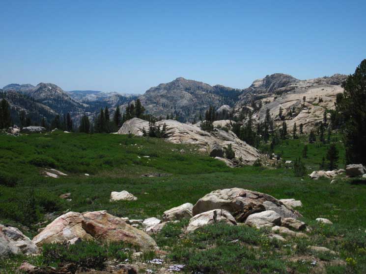 |
||||||||||||
Three Peaks Horse Meadow is to our Southbound Right, the Southwest, wedged in off the lip of its upper canyon, which we see in the near middle-distance of this image above. The terrain descending into Horse Meadow's canyon is especially noticeable where we can see the forest is descending into the top of the canyon. The unmarked trail into the top of the canyon from Grizzly Meadow started behind us, to the North, from just West of the Grizzly Peak trail junction. Its route descends into the top of the canyon through the cut we can in the middle-Right of the image above. That route descends steeply down to where it intersects with the more substantial route of the Tungsten Road entering the top of Horse Meadow's Canyon from the North edge of Summit Meadow. That branch of the Tungsten Road is wrapping around the head of Horse Meadow's Canyon below us, coming down from the next trail junction to our North, located on the North edge of Summit Meadow. This upcoming junction on the North edge of Summit Meadow is where the Tungsten Road splits off into two branches. One is the main route running down into the top of the Horse Meadow's Canyon, while the other branch of the Tungsten Road crosses Summit Meadow on its way to its end at the Montezuma Mine on the Northeast shore of Snow Lake. 15 Minute MAP I don't suggest extensive cross-country travel around here until you've mentally "mapped out," and have begun to establish an understanding of the context of the terrain. This is only properly achieved through close observation of all the perspectives we can get of the canyons and the ridges dividing them by hiking the standard trail routes. We should maximize our understanding of the trail routes by probing key points through "scrambling studies," which we will supplement with extensive map study both on and off the trail. Once we begin to get a grasp of the logic holding this terrain together, and a grip on the physical requirements for effectively engaging and studying it, we will eventually realize what really holds it all together. This perceived abstract knowledge combined with observations of both the visible and invisible real-time pulses of Life that coordinate here over eons and seasons here will blow away the limits to our physical access to, and our philosophical understanding of, this amazingly complex terrain.
Second, the Philosophical Basis
Human Effect on this Changing World This place will open you up, and open up to you, when approached properly. |
Terrain along North Flank
of the
Horse Meadow Valley
 |
||
Peak 9631 above Horse Meadow. We're looking Southwest as we hike South, to our Right as in the image above, taking a closer look at the vast ridge running to the Southwest above Horse Meadow's Valley. This is the line of ridge dividing Horse Meadow's Canyon from Emigrant Lake's Canyon at the base of its Northern Flank. We are hiking South approaching the beginning of the rocky descent, the chute, that the Tahoe to Yosemite Trail & Tungsten Road drop down into the North end of Summit Meadow.
|
Detail
 |
A yet closer look at this piece of spectacular terrain. A vast sheet of granite cut and polished by a vast sheet of glacial ice, then weathered for ten thousand years.. |
Valley Southwest of Tahoe to Yosemite Trail from North of Summit Meadow
 |
||
What's Down There We would then reacquire the Tahoe to Yosemite Trail in Summit Meadow... Gunsight Orientation The great rock rising in the middle Left of the image is the Sachee Monument . Maxwell Lake sits at the base of its Northwestern flank, its Right side from our perspective here. Huckleberry Lake lays down the canyon along the East Fork of Cherry Creek running through the bottom of the steep and deep granite canyon below the Southeast flank of the Sachse Monument, its Left flank from the perspective above. That's what we're looking at down there, from here just above the lip of the canyon running down into Horse Meadow. We are almost at the very top of the watershed of the East Cherry Creek on the route of the Tahoe to Yosemite Trail. And, there is a lot of fine terrain down there.
|
Long View of Valley Southwest of Tahoe to Yosemite Trail between Grizzly and Summit Meadows
 |
||
The same view to the Southwest from the Sierra Crest crossing Emigrant Wilderness later in the Fall, with golds overwhelming the greens across the high meadow. This shot was likely taken in the 1990s.
|
 |
||||
Snow Lake below the Saddle to Bigelow Lake Note the low gap above the Right shore of Snow Lake. An unmaintained trail route passes through that gap over to Bigelow and Black Bear Lakes. The horn of rock rises on the Right side of the low gap, out of sight in the image above. After the Southbound Tahoe to Yosemite Trail passes the pretty pink slab we hike down what is the remnant of the Tungsten Road roadbed dug through very rocky terrain. The old roadbed is strewn with granite boulders that we pick our path through as we drop down to cross the East fork of Cherry Creek high up near its source. Sidenote: I call the climb up the flank to the Saddle, "Hummingbird Hill," because of the thousands of hummingbirds up there during late Spring and Early Summer. We can see the subtle splashes of green and yellow-brown signifying the dense thickets of brush running up the flank to just below the saddle. That configuration apparently creates a heavenly environment for hummingbirds, who turn that whole flank into a virtual hummingbird city. They will be cool and chill if you approach and hike through with friendly respect. If you make nice sounds and clicks (above) that convince them to calm down enough to prevent them from backing off, they will all come and check you out as you move through the dense brush chirping like a hummingbird, which is a real trip.
|
Butterfly in the forest fringing the South side of Summit Meadow
 |
Butterfly on edge of Summit Meadow near Snow Lake. Living Things Forum> Butterflies> This Butterfly. I believe that this is a Field Crescent |
Summit Meadow Butterfly
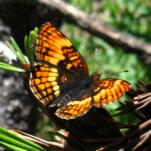 |
Butterfly in the interface between forest and meadow on the North side of Summit Meadow. |
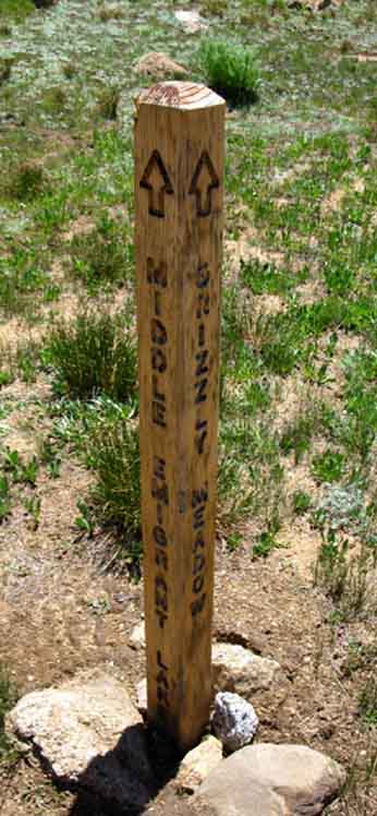
Trail Junction to Horse Meadow
on the
North Side of Summit Meadow
 |
 |
|||||
| West to Horse Meadow and South to Bond Pass from this trail junction on North side of Summit Meadow. | North to Emigrant Meadow and Brown Bear Pass back the way we come on the Tahoe to Yosemite Trail. | |||||
30 Minute MAP
View hiking into the South end of Horse Meadow, looking up towards our position.
|
||||||
 |
View South of Tungsten Road across Summit Meadow.
|
TYT-Tungsten Road Junction
in
Summit Meadow
 |
View South of Tungsten Road tracking straight to Snow Lake where the Tahoe to Yosemite Trail branches of to our Southbound Left, Southeast for the climb over Bond Pass into Yosemite.
|
 |
||
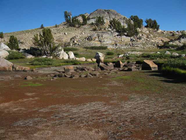
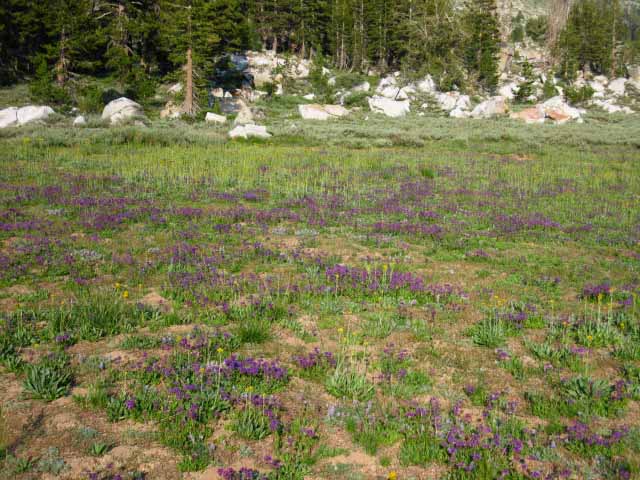
Summit Meadow in Emigrant Wilderness.
|
Summit Meadow
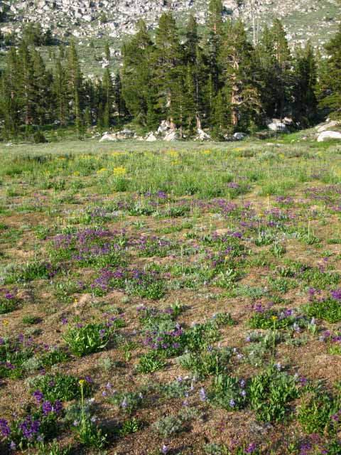 |
| Summit Meadow and surrounding terrain. |
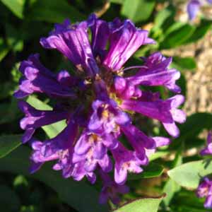 |
Source of purple dappling across Summit Meadow. |
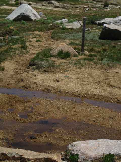
Summit Meadow Snow Measurement
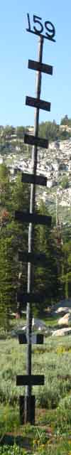 |
Summit Meadow snow sensor. |
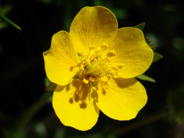
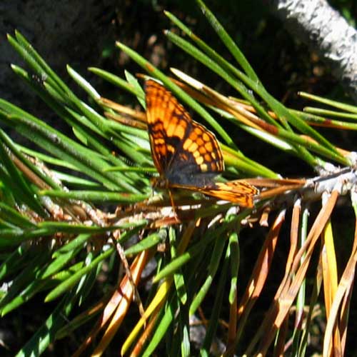
Moth and Buckwheat
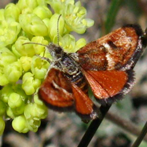 |
Butterfly, burnt orange, Emigrant Wilderness, High Sierra. Can you identify this butterfly? |
Summit Meadow Moth
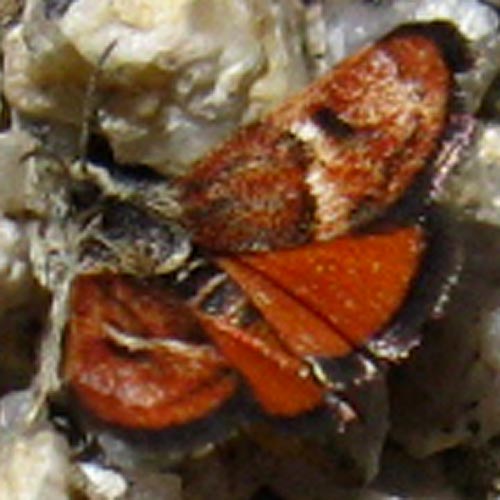 |
Another one, but this one is on the ground. |
Vibrant Summit Meadow Pussypaw
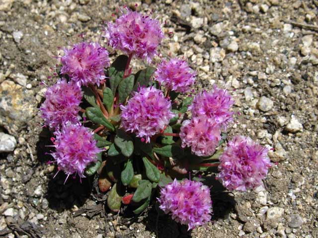 |
| Pussypaws. |
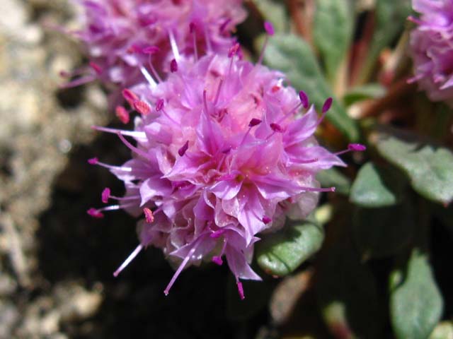
Vibrant Summit Meadow Pussy paw, Detail
 |
||||
Sweet, delicate look of one tough high altitude flower. Add Your Own: comments-questions-information
|
Summit Meadow Trail Junction to Snow Lake
 |
 |
|||||||
| Trail junction Southwest to Snow and Bigelow Lakes, North to Leavitt Lake via Big Sam. | Summit Meadow trail junction South on TYT to Bond Pass. |
|||||||
|
||||||||
Tungsten Road Turns Though Summit Meadow long ago ate up any traces of the Tungsten Road, this junction is where the Tungsten Road turns towards the site of the Montezuma Mine on the Northeast side of Snow Lake. |
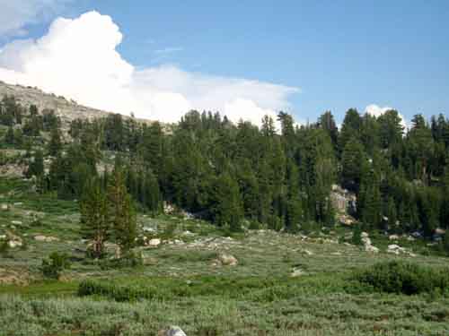 |
| Bond Pass South of Summit Meadow. |
Trail up North Side of Bond Pass
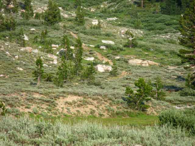 |
||
Tahoe to Yosemite Trail climbing South up to Bond Pass.
|
Unique Rocks on the North side of the Ridge
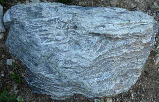 |
| Super cool rock. |
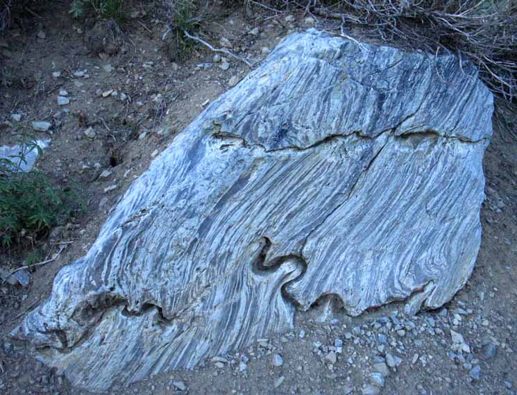 |
| Interesting rock hiking up to Bond pass in the Emigrant Wilderness. |
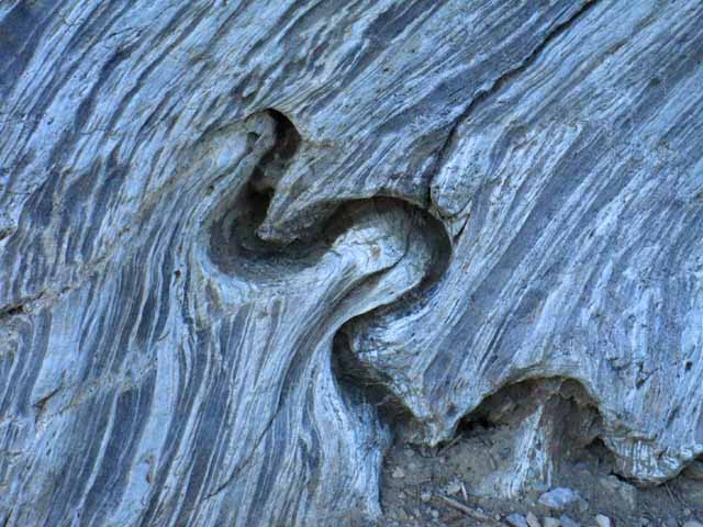 |
||
Detail of unique erosion feature.
|
Summit Meadow in Morning Mists
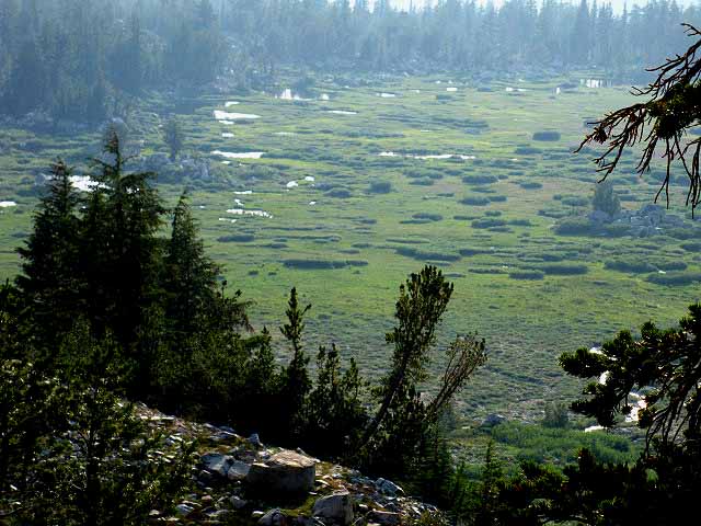 |
South edge of Summit Meadow viewed while climbing South to Bond Pass. |
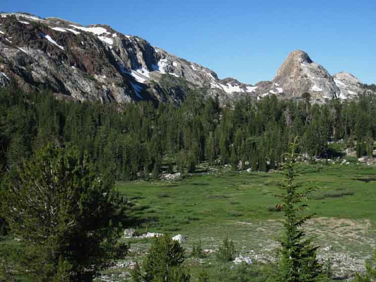 |
Looking across South edge of Summit Meadow at Saddle and Horn over to Bigelow Lake. Snow Lake is hidden in a low depression beyond the rim of rising forest, and below the distant saddle. We are looking at the "Saddle and Horn" marking the position of the unmaintained trail from Snow Lake to Bigelow Lake. |
Spanish Paintbrush up to Bond Pass
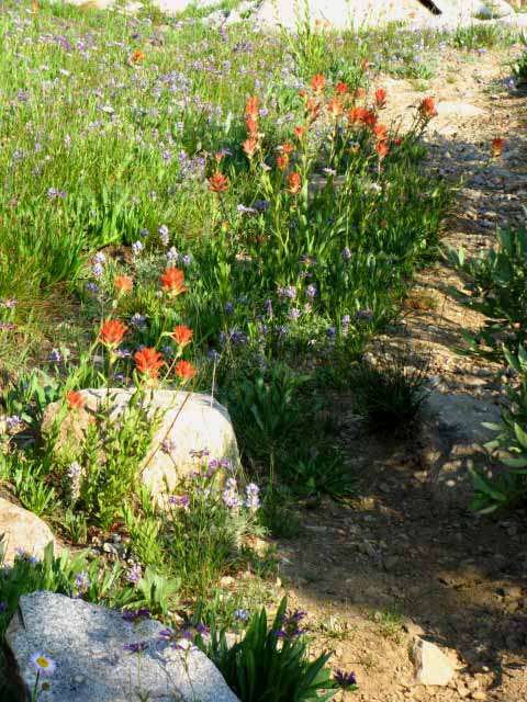 |
Flowers lining the trail South up to Bond Pass. |
Bond Pass
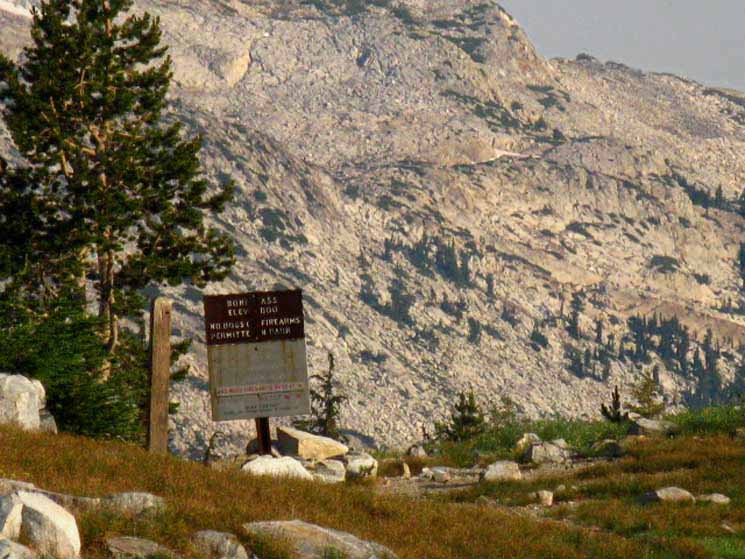 |
||
Bond Pass. 30 Minute MAP
|
Yosemite National Park Boundary Sign
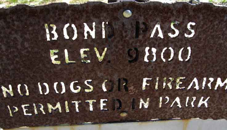 |
| Bond Pass Yosemite National Park trail sign. |
Stanislaus National Forest Bond Pass Marker
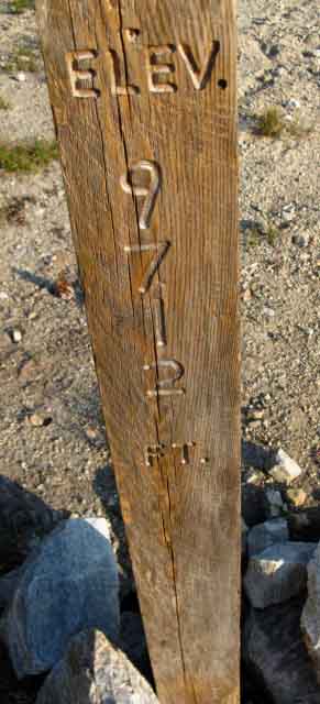 |
Bond Pass elevation post by Stanislaus National Forest. |
Hey. Me at Bond Pass
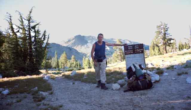 |
Bond Pass between Yosemite National Park and Emigrant Wilderness. |
Yosemite Sign at Bond Pass
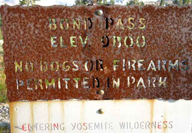 |
||
Our first encounter with the heavy metal signs carved by cutting torches that define Yosemite trail signage. These signs became the established standard for Yosemite in the early 1950s as a solution for bears removing conventional trail signage. See "trails and roads" in Yosemite: the Park and its Resources (1987) by Linda W. Greene, specifically page 771 about the steel cut trail signs installation. Also see "Cranky Bears" in the Forum.
Miles Discussion at the top of Jack Main Canyon.
|
Yosemite Sign at Bond Pass Detail
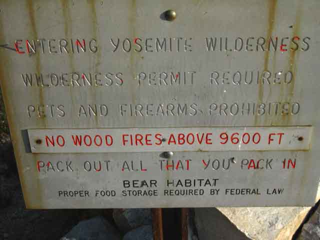 |
Note the elevation restriction for fires marked at 9000 feet in Emigrant Wilderness has shifted to 9600 feet in Yosemite National Park. see the Stanislaus Wilderness Rules |
Welcome to Yosemite, Says the Buck
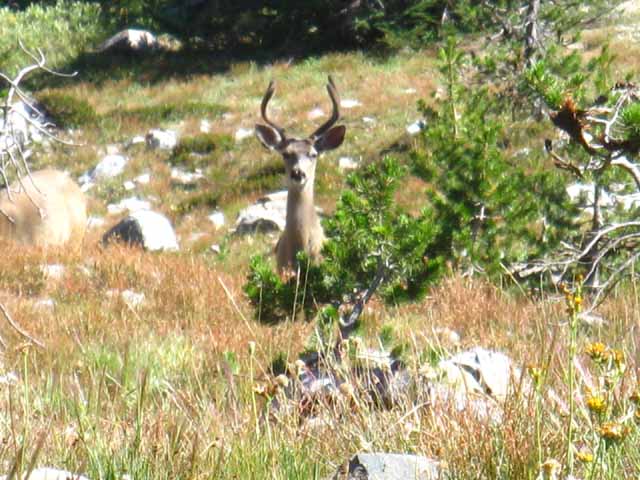 |
| Buck on the South side of Bond Pass. |
Say the Bucks
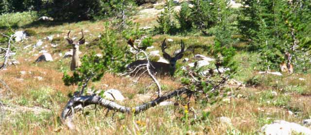 |
| Two. |
Looking Across Jack Main Canyon
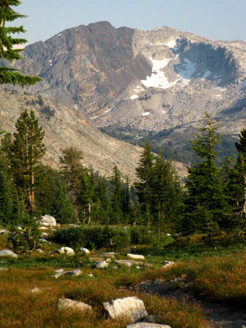 |
||
Forsyth Peak wraps around and provides an amazing backdrop for the lakes on both the East and West flanks of the Sierra. That's Jack Main Canyon down there, with the PCT route running through it.
|
Looking South Down Jack Main Canyon at Yosemite National Park
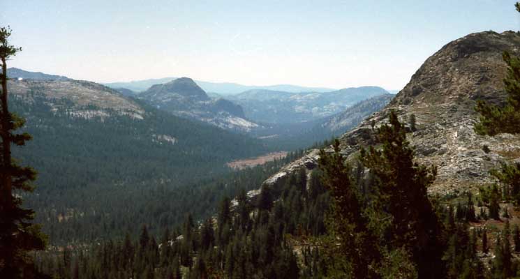 |
||
A glimpse down Jack Main Canyon at Gracie Meadow and Chittenden Peak guarding the Tahoe to Yosemite Trail option past Tilden Lake.
|
Back under Forest Cover down to the Pacific Crest Trail
 |
Forest on South side of Bond Pass. Big California White Pine with a Juniper tucked in alongside. |
Whitebark Pine
 |
| Whitebark Pine budding. |
California White Pine
 |
| California White Pine bark. |
Trail Cutoff South into Jack Main Canyon
 |
||
Trail junction TYT Southbound to Jack Main Canyon. The main trail brings further up the canyon closer to Dorothy Lake, while the shortcut bring us further down Jack Main Canyon. This is the Western end of the trails triangle connecting the Tahoe to Yosemite Trail to the Pacific Crest Trail at the top of Jack Main Canyon.
|
Down the Southbound Tahoe to Yosemite Trail Shortcut into Jack Main Canyon
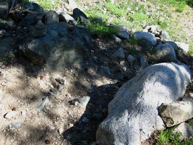 |
||
Trail to Southbound TYT junction with PCT in Jack Main Canyon. Continuing straight through this junction, rather than turning down on the trail shown above, brings us to the North Bond Pass junction in Jack Main Canyon. The North Bond Pass junction is just a bit further up Jack Main Canyon from the South junction pictured below, which is at the end of the trail depicted above.
|
Jack Main Canyon
Jack Main Canyon Trail Junction between TYT and PCT
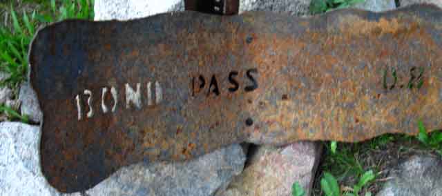 |
| Tahoe to Yosemite Trail through Bond Pass to junction with the PCT in Jack Main Canyon. |
North Pacific Crest Trail to Dorothy Lake
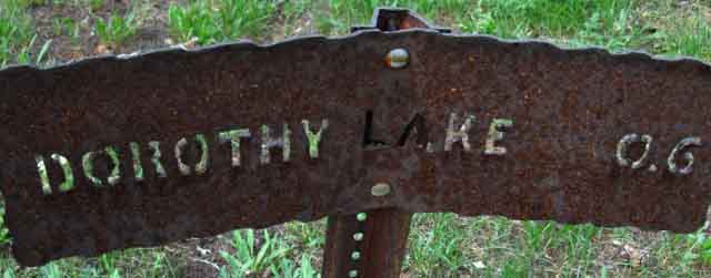 |
| PCT North to Dorothy Lake Pass. |
South down Jack Main Canyon on the combined TYT-PCT
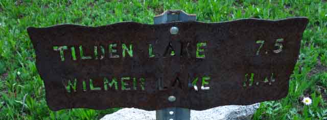 |
||
South on the TYT to Tilden and Wilmer Lakes down Jack Main Canyon.
|
All Right Now we're in the Northwestern-most corner Well, just below it... |
North TYT: Relief Reservoir to Brown Bear Pass
North PCT: Kennedy Canyon to Bond Pass
South PCT-TYT: Tilden and Wilmer Lake Junctions
Emigrant Wilderness |
||
Tahoe to Yosemite Trail
MAPS
Here we pick up the route of the PCT: PCT Miles and Elevations to Tuolumne Meadows South on the PCT and TYT: |
Scroll up page to view TYT North from Bond Pass to Brown Bear Pass
Backpacking Trail Guide TYT North Relief Reservoir |
|
Backpacking Trail Guide TYT South |
Backpacker ForumsHave a great Sierra Nevada trip or story to relate? A fine piece of gear? Or gear that failed?Post it onTahoetoWhitney.Org Become a MemberIf you have experiences, comments, questions, or pictures and videos of the Tahoe to Yosemite Trail between Kennedy Meadows to Tuolumne Meadows, Post up here:Forum Section
|
Trail Guide Pages
North TYT
Relief Reservoir to Brown Bear Pass
North PCT
Kennedy Canyon to Bond Pass
South TYT-PCT
TYT to Tilden and PCT to Wilmer Lakes
Trailhead
Contact
Alex Wierbinski
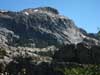
Backpacking Lake Tahoe to Mount Whitney
Your Guide to the High Sierra Crest, including the Tahoe to Yosemite, Pacific Crest, and John Muir Trails