2019
Fall to Winter
2018
Issues and Situation
Spring of 2019
2018
Issues and Situation
Spring of 2018
WINTER of 2018
Approaching the Winter of 2018
2017
Issues and Situation
Summer
Heat & Fire with Snow on the Crest
Winter
Biggest Snowpack in History?
Longest Persistant Summer Snow?
2016
Issues and Situation
Slightly Below Average Winter Snowpack
April 17 2015
-- Freak Weather, Freak Weather around the World --
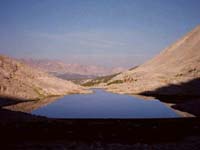
We just experienced a drought Winter during the biggest El Nino in human memory, and it barely left an average snowpack on the Sierra.
2015
Issues and Situation
March 25 2015
-- Screaming Drought, Freak Weather, Freak Weather around the World --
Earliest opening of Sierra Crest Trails in human and geological history is forming up.
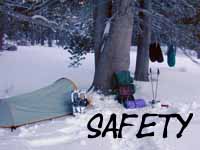
Having a "fire escape plan" for this year's High Sierra backpacking will be a wise forethought this year.
March 2015
We Need a New Environmentalism
"It is later than you think."
The Situation has gone too far to maintain the status-quo lies...
THE AGE OF CHEATERS
Impending Ecological Disaster of Historical Proportions
Current weather conditions, any reasonable observations, and new research indicates we on the West Coast of the US are facing expanding drought and fire conditions unprecedented in the human and natural historical records. Extreme weather is tormenting the whole country, and the whole world.
I am curious about what we are going to do with the vast population our "leaders" have so wisely stuffed/snuck into the Southwest-West Coast of the US, when we run out of water?
You have any ideas?
I know why it happened.
THE AGE OF CHEATERS
Environmentally, our greedy motivations created a program of endless irresponsible growth that has severely damaged the web of life in California, the US, and around the world.
Specifically, the rapid swelling of our population matched with spreading our irresponsible industrial growth program around the world ("globalism"-moving our dirty manufacturing to China) has transformed seasonal weather patterns in the North Pacific and around the whole world.
In our part of the world our trans-Pacific policy, our bad behavior, has dispelled the North Pacific weather pattern that traditionally fed the Sierra snow pack every Winter.
The weather pattern feeding the Sierra snow pack is gone. Our traditional Winter weather pattern out of the Northwest has slowly faded away over the last 40 years to be replaced by weaker Winter weather patterns out of the West and Southwest Pacific.
This is a serious problem.
California will not support its current very irresponsible level of population without the weather supporting the annual Sierra Snow Pack each Winter. Period.
I know how it happened.
Our corporate program of endless growth powered by endless greedy self-interest perpetuated through institutionalized political bribery and widespread cheating, of people putting themselves above our laws, has succeeded in sweeping away the political and social values necessary to maintain our democracy, our security, and our environment against greed and self-interest.
That's a mouthful.
We lost the battle between our mutual democratic rights and social liberties against the profits of the greedy and powerful, and the self-gratifications of power-seekers. We lost the battle between democratic ethics and the base desire to get rich, to dominate, to consume, and use that collected power to rule over other folks.
Some folks have stolen and cheated themselves to a "better life."
We are in the situation we are in because the cheaters have won, making greed and the lust for power the ascendant motivations tying the players in our polity together.
That's quite unexceptional...
We replaced our exceptional political values with greed, redefining the meaning of "exceptional" along the way.
The Desires of Consumerism have replaced the Ethics of Citizenship as our nation's qualification for citizenship, with greed becoming the operational, "value system," motivating and justifying the crimes of our political, economic, and social, "leaders," and their millions of, "followers."
The fates of man and nature are doomed as long as greed rules our hearts, minds, and politics. If we cannot clean up this central quagmire of corruption to make our democratic values operational we will not preserve the last remnants of our traditional ecology.
The greed-based political policies of endless irresponsible growth have stripped our country's social, human, and natural resources naked, pushing more wealth and political power to the smallest number of people at the very top of our society than any time in all of human history.
"Mission Accomplished," or "That's not Right?"
Personally, I am very angry about the corruptions and greed that have powered and allowed this massive irresponsible growth and associated transfer of wealth and power to continue.
This "feeding frenzy" of greed will not end well environmentally, economically, or socially.
A recognizable set of corrupt behaviors have fueled a shift in power and wealth over the past forty years that have ravaged the social, political, and environmental infrastructures in the State of California, across our whole country, and around the world.
Allow me to clarify and contrast some basic principals of being an American against these behaviors.
END
THE AGE OF CHEATERS
Shared greed and corruption are not American Constitutional Principals, and they do not produce ethical bonds or practices between politicians and their bribers. They produce conspiracies between political criminals.
Bribery is not democracy.
Money is not free speech.
Breaking our laws and borders and putting yourself above the rule of our laws is not the basis of citizenship.
Imposing yourself and your values on others is not an American Right.
Cheating is wrong, no matter how well it serves your self-interest, or makes your "dreams" come true.
The dreams of cheaters are a nightmare for everyone else.
A NATION
OF
CHEATERS
Many claim the above behaviors are "American" rights!
Barry Bonds, Lance Armstrong, Mexicans, Bush, Obama, and their political parties come instantly to mind when considering those who's cheating has put themselves above our laws, rules, and political values as a matter of professional practice.
We have become a nation of cheaters, ruled by cheaters, fueled by cheaters, and this cheating must end to save our environment, let alone our democracy, and our country!
None of these corrupt practices are compatible with citizens running a self-regulating American democracy. They are compatible with American Corporate Fascism ruling over fat greedy "consumers."
Our current practices are antithetical to our Constitutional values or to creating or maintaining healthy social or natural environments to raise children in, let alone to maintain our democratic republic.
Unless you want fatter, stupider, greedier children...
How can your children not be cheaters, when raised in a society based on cheating?
We have in fact already lost our democratic republic and our Constitutional rights. We are now consumers in a corporate state, not citizens in a democratic republic. We live in, and serve a system of greed. And as a result we are losing the last remnants of our traditional weather patterns around the world.
"Si Se Puede?"
Really? You want to cheat to join an empire that's that you helped set on fire? Really?
Strange times, when the rats are jumping onto the burning ship of state...haha
Nonetheless, we can stop the cheaters at the top and at the bottom of society who've joined forces to rob our country of its political, economic, and environmental wealth.
GREED IS NOT GOOD.
Unless you are supporting the American legacy of irresponsible growth via cheating powered by greed that has driven the destruction of our democracy and our environment in the first place.
CORPORATE FASCISM
There are a lot of American Fascists and foreigners who put their own material wealth, their own self-interest, and imposing their own values on others before their duty to defend our shared political principals, practices, and process.
They ARE NOT Americans. It's that simple.
That would be the dark side of American history and the American personality. This genocidal force of mass greed must be subjugated to, and restrained by our "Higher Angels," our eternal mutual democratic values as specifically defined in our Constitution. It's that simple.
The Mantra of Death
Personally, I reject the mantra of endless greed, endless growth, and endless profits that our corporate fascist leaders have deluded and drained America with, and I reject those who pursue greed. I choose the Constitutional values of our democratic republic as the basis of our social and political relationship, not shared greed. I choose balance over growth.
I reject the Corporate Growth Machine of Death.
We the people are empowered to regulate wealth, political power, markets, and immigration,
not they regulating and abusing us citizens, as is happening today.
BACK to the FUTURE
If we want to save the last bits of our environmental and political legacies we've got to get back to our own honest standards, and cast these greedy cheaters and their corrupt practices aside.
If we don't stop the greed and corruption, if we don't stop the cheaters who have corrupted our government and driven this irresponsible growth and destruction, nature will. Nature is.
FASTER than SCIENCE
Nature is now undergoing powerful changes in direct response to our irresponsible growth of the last forty years that are moving more rapidly than science can track, to stop our corrupt practices in their tracks!
On a Biblical Scale.
Watch and Learn.
Karma is a bitch when you are bad, and we have been very bad, by our own Constitutional and ethical standards, let alone by any spiritual or secular interpretations of ethical behavior.
Nature is coming for us, and IT is not happy.
The need for a New "American" Environmentalism that actually recognizes the sources of these damages and addresses their true causes is profound.
We must
" un-do it."
Status-Quo
of
EVIL
The political status-quo of bribery, corruption, and cheating fueled by greed is insufficient for the scale of the ecological, economic, and political crisis we face.
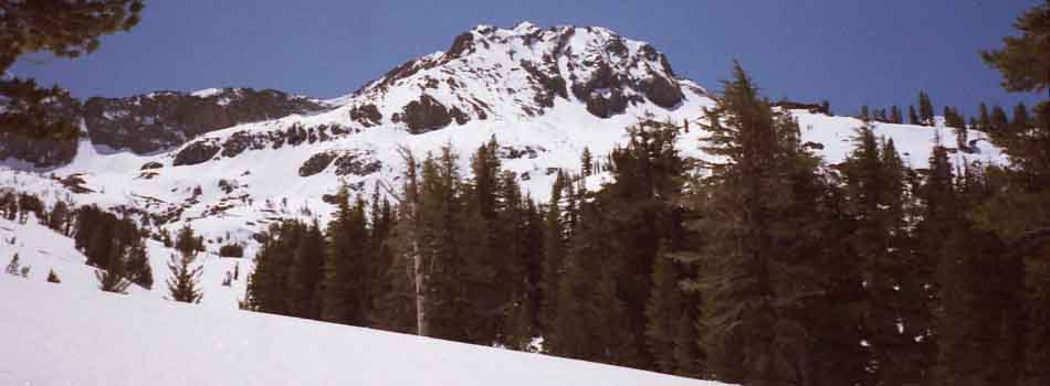
Our favorite backpacking spots in the Sierra are being both slowly and quickly changed by the double-edged sword of massive population growth driving one blade of this sword, and the changing character of the seasons driving the other blade.
The remaining forests of California have suffered gradually under drying conditions sufficiently long to now assure their rapid transformation through fire. Drier species will fill the burned areas, rapidly transforming the character of the Sierra.
The disastrous trajectory we are on will not be altered unless we as a people take up a new vision of renewed political relationships, curb the greedy, and pull in the reins on endless growth that feeds their evil scam.
THE
WAY FORWARD
Wealth and power determines outcomes in government, not democracy. Thus effective environmentalism requires political bribery be outlawed, or at least be driven out of the center of politics. It demands a real democratic playing field be reinstated.
Restoring democracy is the only way to disempower our growth-based corporate-bribed political "leadership." Alternatives to their failed growth policies are doomed to fail within the current political processes dominated by corporate bribery and corruption.
The status-quo killed our goose, and continues to cook it.
The political corruptions of our past that brought us to our current disastrous situation and the cheaters who did it must be politically neutralized and harshly punished to preserve any future for our country, our planet, let along the fragile nature of the Sierra Nevada's unique sub-alpine environment.
We must "un-rig" politics to save the environment, and ourselves.
NO cheaters!
Edited
Dec 2, 2019
January 2015
ZERO RAINFALL
The critical issue is the serious persisting drought conditions. Nature is cooking us up a disastrous Spring and Summer for life on the West Coast.
Again, conditions are looking like they could again develop into historical early openings of the High Sierra roads and trails. I figure the Sierra will be burning by July, so watch the fire reports...
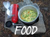
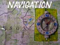
My personal situation is embroiled deep in injury recovery and editing up the completed North Sierra parts of the Tahoe to Whitney Guide.
I've got to bring the finished Lake Tahoe to Tuolumne Meadows part of the guide from draft to finished form.
So I'm turned mostly inward, even as our modern Rome burns ever so slowly around us.
I believe the seasonal reports from recent years are informative as to the hot and dry trajectory our future weather holds in store for us.
2015 High Sierra Snow Backpackers & Skiers:
You're Screwed --&-- No Snow in the Sierra |